BlockBefore
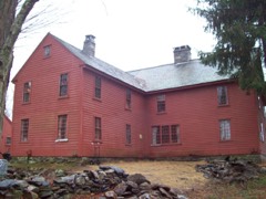
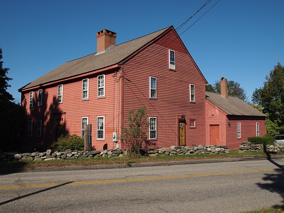
Photograph of Edward Cogswell House
Photograph by Thundersnow, CC BY-SA 3.0. Via Wikimedia Commons.

Edward Cogswell House

Listed on the National Register of Historic Places in 1993.

From the record

“The Edward Cogswell House, also known as the Bliss House, is a historic house at 1429 Hopeville Road in Griswold, Connecticut. Its oldest portion dates to around 1740, making it one of Griswold's few 18th-century buildings.”

Wikipedia article Edward Cogswell House, CC BY-SA 4.0.

One of 197 National Register listings published here for New London County · listed in 1993 · category: Building.

Sources: the Wikipedia article · the case file at the National Archives · the National Register database, National Park Service
The listing

  • What is counted as historic. The nomination lists 2 buildingss as contributing to the listing.
  • Listed as. Cogswell, Edward, House - the National Register files a house under its owner's surname.
  • Address. 1429 Hopeville Rd., Griswold, 06351
  • When was it listed? December 1993
  • Category. building
  • Town. Griswold town
  • Architectural style. American colonial architecture
  • National Register reference number. 93001378 - the number the National Park Service assigned this property when it was listed, and the key its nomination file is catalogued under at the National Archives.

The ground it stands on

13,789 words

The chapter on Griswold Town in History of New London County, Connecticut, with Biographical Sketches of Many of Its Pioneers and Prominent Men, published 1882 names Griswold. This is what it says, exactly as the scans read.

The town of Griswold lies in the northeastern part of the county, and is bounded as follows : on the north by Windham County, on the east by Yoltintown, on the south by North Stonington and Preston, and on the west by Preston and Lisbon. The surface of the town is hilly, and the soil generally consists of a gravelly loam.

Passage source: History of New London County, Connecticut, with Biographical Sketches of Many of Its Pioneers and Prominent Men, published 1882.

The Soholfield establishment was subsequently purchased by Mr. Wilson, whose enterprise assisted largely in the growth and prosperity of the village. He was a man of solid sense and dignified deportment, highly valued as a citizen. By a change of boundaries and new acts of incorporation he became an inhabitant of three different towns, and at distinct periods was a selectman of Norwich, of Preston, ;ind of Griswold without changing his abode.

Passage source: History of New London County, Connecticut, with Biographical Sketches of Many of Its Pioneers and Prominent Men, published 1882.

Machine-read from a century-old scan, so expect the errors a machine makes: misspelled names, dropped words, stray characters.

Read the whole chapter on Griswold Town - 13,789 words on its settlement, mills, schools and churches.

Fires near this property

113 since 1992

Regional context, not property-specific evidence. The federal wildfire occurrence database lists 113 fires within 5 miles of Edward Cogswell House between 1992 and 2020, burning about 116 acres in total. None started naturally. 7 were recorded as arson. Distance is straight-line from the map coordinates, so a fire counted here may appear on a neighbouring settlement's page as well.

Reported cause Fires
Missing data/not specified/undetermined62
Debris and open burning26
Recreation and ceremony8
Arson/incendiarism7
Misuse of fire by a minor4
Smoking2
Equipment and vehicle use2
Fireworks1
Railroad operations and maintenance1

The most recent of them, most recent first, with the day each was reported and the service that recorded it.

DateCause SizeReported by Name on the report
6 September 2015Missing data/not specified/undeterminedunder an acreConnecticut Division of Forestrynot named
23 September 2020Missing data/not specified/undeterminedunder an acreConnecticut Division of ForestryI395 NB
22 September 2020Missing data/not specified/undetermined1.0 acresConnecticut Division of Forestry333 EDMOND ROAD
6 August 2020Missing data/not specified/undeterminedunder an acreConnecticut Division of Forestry999 VOLUNTOWN ROAD
23 August 2020Missing data/not specified/undeterminedunder an acreConnecticut Division of Forestry101 FORGE HILL ROAD
28 July 2016Missing data/not specified/undeterminedunder an acreConnecticut Division of Forestry1531 GLASGO RD, GRISWOLD CT
26 July 2020Missing data/not specified/undeterminedunder an acreConnecticut Division of Forestry22 HILLVIEW HEIGHTS
21 July 2016Missing data/not specified/undeterminedunder an acreConnecticut Division of ForestryI395SB EXIT 22, GRISWOLD CT

Every fire recorded in New London County

Mines and quarries near this property

10 of 21 shown

Regional context, not property-specific evidence. The federal mineral resources record lists 21 workings within 5 miles of Edward Cogswell House: 16 past producers, 4 producers, 1 unknown. 4 still produce. What was taken out: Sand and Gravel, Construction, Stone, Dimension. Distance is straight-line from the map coordinates, so a quarry counted here may appear on a neighbouring settlement's page as well.

Where SiteCommodity StatusRecorded
QuarryStone, DimensionPast Producer
Arpin PitSand and Gravel, ConstructionPast ProducerSedimentary
Arpin PitSand and Gravel, ConstructionProducer
B and O PitSand and Gravel, ConstructionPast ProducerSedimentary
B and O Sand and GravelSand and Gravel, ConstructionProducer
Bronson PitSand and Gravel, ConstructionPast ProducerSedimentary
Bronson PitSand and Gravel, ConstructionPast Producer
Campbells PitSand and Gravel, ConstructionPast ProducerSedimentary
Campbells PitSand and Gravel, ConstructionPast Producer
Geer PitSand and Gravel, ConstructionPast ProducerSedimentary

Every working recorded in New London County

Map coverage status

No historic map-sheet match is published for this property yet. That does not mean no map exists. This record needs a coordinate-quality review before it can be joined to a sheet boundary. Browse the county's mapped places while that work is pending.

Listed places nearby

6 within 8 miles

Other National Register properties close enough to walk or drive between, ordered by distance from this one. Both positions come from the same geocoding pass that matched these properties to their map sheets.

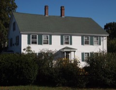
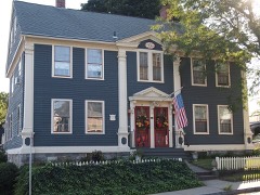
Photograph PropertyDistance Listed
Avery House1.7 miles1986
Kinne Cemetery2.1 miles2001
Timothy Lester Farmstead3.1 miles1998
Brewster Homestead3.7 miles2000
John Wilson House4.3 miles1985
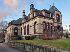
Slater Library and Fanning Annex4.5 miles2002

Sources for this property

National Archives recordThe nomination case file for reference 93001378 in Record Group 79.
Wikipedia articleCommunity-written account of this property, licensed CC BY-SA.
New London CountyAll 197 listed properties in this county.

Provenance

  • Listing record. National Park Service National Register of Historic Places, listed-properties dataset, current to 2026-05-22.
  • Map join. Address geocoded through the United States Census geocoder, then tested against the published boundary of every sheet in the USGS Historical Topographic Map Collection.
  • How this page is made. Listing fields come from federal records; map-sheet coverage is a labelled coordinate-to-boundary calculation, not a source-field claim.
  • Wildfire. Short, Karen C. 2022. Spatial wildfire occurrence data for the United States, 1992-2020 [FPA_FOD_20221014]. 6th Edition. Fort Collins, CO: Forest Service Research Data Archive. https://doi.org/10.2737/RDS-2013-0009.6 Collected with United States Government funding and usable without additional permissions or fees.
  • Mines and quarries. USGS Mineral Resources Data System (MRDS) https://mrdata.usgs.gov/mrds/ A work of the United States government, no copyright under 17 U.S.C. 105.