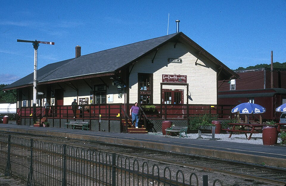
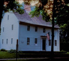
Listed on the National Register of Historic Places in 1994.
From the record
“The Essex Freight Station is a railroad station located in the Centerbrook village of Essex, Connecticut. Built in 1915, it is a well-preserved example of period railroad-related architecture.”
Wikipedia article Essex Freight Station, CC BY-SA 4.0.
One of 124 National Register listings published here for Middlesex County · listed in 1994 · category: Building.
National Register reference number.94000337- the number the National Park Service assigned this property when it was listed, and the key its nomination file is catalogued under at the National Archives.
Robert's Hill is situated about one-third of a mile north of the Congregational church in Centerbrook. In its side, and on the old Eli Denison place, there is a quarry of steatite or soapstone, which was also sometimes called cottonstone. This lies about one half a mile northward from the railroad station, on the road to Meadow Woods, and near the present residence of Richard Denison. The existence of this bed of stone was known to the Indians. They used the material in making pots and mortars, some of which have been found in their graves, and about the fields in the vicinity. Soon after the Revolution, the owners of a furnace in Killingworth used the material in making an oven for baking steel. It is said to possess durable qualities, and to be capable of taking a very high polish. Efforts were made as early as 1815 to bring it into use in manufacturing, but it was found to be too hard for practical purposes, and nothing further than preliminary experimenting was done. A quarry of granite lying near it is now being worked.
Very few of the citizens were appraised of their coming until a few minutes before they landed, and many of them knew nothing of it until the flames from the burn ing vessels, which lit up the country for miles around, awoke them from their slumbers. Fear and consternation seized the people. Aged women and little children hurried off to Centerbrook, taking such valuables as they could gather, expecting that their homes were to be burned and fearing that the men would be put to death or taken prisoners. Their fears, however, proved groundless, for there was no attempt to molest the people. A few houses were searched by the picket guards for arms and ammunition, while the main body of troops proceeded to burn the vessels at the diff'erent yards and those anchored in the lower and upper coves, firing every vessel they could find, with a few exceptions for particular reasons. A vessel belonging to Mr. Judea Pratt of New City, was saved through the mystic ties of free masonry. Lieutenant Coutts had ordered the vessel to be burned, but Mr. Pratt met him and gave a masonic sign of recognition, and after a few minutes conversation, it is said, the troops were withdrawn and the vessel saved. Jeremiah Glover, who had a sloop lying in the lower cove, begged the British to spare it, and they finally consented to do so on condition that he should pilot them down the river and back to their ships.
Regional context, not property-specific
evidence. The
federal wildfire occurrence database
lists 189 fires within 5 miles of Essex Freight Station
between 1992 and 2020, burning about 219 acres in total. None started naturally. 2 were recorded as arson.
Distance is straight-line from the map coordinates, so a fire counted
here may appear on a neighbouring settlement's page as well.
Reported cause
Fires
Missing data/not specified/undetermined
94
Debris and open burning
36
Recreation and ceremony
28
Smoking
10
Misuse of fire by a minor
8
Power generation/transmission/distribution
6
Railroad operations and maintenance
4
Arson/incendiarism
2
Equipment and vehicle use
1
The most recent of
them, most recent first, with the day each was reported and the service
that recorded it.
Regional context, not property-specific
evidence. The federal mineral resources record lists
13 workings within 5 miles of Essex Freight Station: 13 past producers.
None of them still produces. What was taken out: Granite, Stone, Dimension, Stone, Sand and Gravel, Construction. Distance is straight-line from the
map coordinates, so a quarry counted here may appear on a neighbouring
settlement's page as well.
No historic map-sheet match is published
for this property yet. That does not mean no map exists. This record needs
a coordinate-quality review before it can be joined to a sheet boundary.
Browse the county's mapped places while that work is
pending.
Listed places nearby
6 within 8 miles
Other National Register properties close
enough to walk or drive between, ordered by distance from this one. Both
positions come from the same geocoding pass that matched these properties
to their map sheets.
Listing record. National Park Service National Register of Historic Places, listed-properties dataset, current to 2026-05-22.
Map join. Address geocoded through the United States Census geocoder, then tested against the published boundary of every sheet in the USGS Historical Topographic Map Collection.
How this page is made. Listing fields come from federal records; map-sheet coverage is a labelled coordinate-to-boundary calculation, not a source-field claim.
Wildfire. Short, Karen C. 2022. Spatial wildfire occurrence data for the United States, 1992-2020 [FPA_FOD_20221014]. 6th Edition. Fort Collins, CO: Forest Service Research Data Archive. https://doi.org/10.2737/RDS-2013-0009.6 Collected with United States Government funding and usable without additional permissions or fees.
Mines and quarries. USGS Mineral Resources Data System (MRDS) https://mrdata.usgs.gov/mrds/ A work of the United States government, no copyright under 17 U.S.C. 105.
 Block