 Block
From the record
One of 451 National Register listings published here for Hartford County · listed in 1994 · category: Building.
Sources: the case file at the National Archives · the National Register database, National Park Service
Listed on the National Register of Historic Places in 1994.
One of 451 National Register listings published here for Hartford County · listed in 1994 · category: Building.
Sources: the case file at the National Archives · the National Register database, National Park Service
The chapter on Windsor Locks Town in The Memorial History of Hartford County, Connecticut, 1633-1884;, published 1886 names Windsor Locks. This is what it says, exactly as the scans read.
About 1836 Charles Haskell Dexter began in a small way the manufacture of wrapping-paper in a basement room of the grist-mill, his water-power being supplied by Kettle Brook. He was born Sept. 19, 1810, the only son of Seth Dexter, whose father (Seth Dexter) purchased, in company with Jabez Haskell, the tract of land which comprises most of the present village of Windsor Locks, and settled here in 1769. A decided bent towards mechanic and manufacturing industries seems to have been a family trait, and in the case of Charles H. Dexter was a specially marked characteristic. His first adventure in paper-making began in connection with the Haskell and Dexter gristmill, utilizing the waste water-power of that mill. This enterprise was attended with little or no profit except the knowledge which comes of experience, but it laid the foundation for better results. About ten years later, in 1847, Mr. Dexter built a new mill on the ground now covered by the C. H. Dexter & Sons' paper-works, in which, under more favorable conditions and Ijy virtne of improved methods of liis own devising, the business became highly profitable, and the products of the mill came to rank among the best goods in the market. In 1855 he became jjresident of the Connecticut River Company, and in the fifteen years of his administration made a fairly remunerative ])roperty of that which had been almost \alueless to tlie stockholders. To his enterprising and judicious management the company owes its large increase of water-power in the canal, and the village its consequent growth of manufacturing industries. Mr. Dexter never sought or held any civil or political office. But there were no matters affecting the welfare of the community which did not awaken his lively interest, and he was foremost in all measures of public improvement. The impress of his mind and hand was to be seen on all the material interests of the town. But his best work was in those things which concern the higher well-being of every community, - the school, the home, the church. He was a central figure in all the best activities of this community for thirty years. And his life, taken in all its bearings, was by far the most influential that Windsor Locks has known. Mr. Dexter Avas a man of remarkably fine presence and winning address, with a commanding form, slightly bowed in his later years by rheumatic suffering. He was of quick and clear apprehension, systematic in business, hopeful and earnest in whatever he undertook, responding freely and gladly to calls for help, whether in money or personal service. He died the 29th of August, 1869, in his lifty-ninth year.
Passage source: The Memorial History of Hartford County, Connecticut, 1633-1884;, published 1886.
Machine-read from a century-old scan, so expect the errors a machine makes: misspelled names, dropped words, stray characters.
Read the whole chapter on Windsor Locks Town - 3,613 words on its settlement, mills, schools and churches.
Regional context, not property-specific evidence. The federal wildfire occurrence database lists 26 fires within 5 miles of David Pinney House and Barn (Boundary Increase) between 2002 and 2020, burning about 19 acres in total. None started naturally. None was recorded as arson. Distance is straight-line from the map coordinates, so a fire counted here may appear on a neighbouring settlement's page as well.
| Reported cause | Fires |
|---|---|
| Missing data/not specified/undetermined | 21 |
| Debris and open burning | 2 |
| Recreation and ceremony | 2 |
| Smoking | 1 |
The most recent of them, most recent first, with the day each was reported and the service that recorded it.
| Date | Cause | Size | Reported by | Name on the report |
|---|---|---|---|---|
| 2 August 2002 | Missing data/not specified/undetermined | 2.0 acres | Connecticut Division of Forestry | not named |
| 9 July 2010 | Missing data/not specified/undetermined | 1.0 acres | Connecticut Division of Forestry | not named |
| 22 July 2020 | Recreation and ceremony | under an acre | Connecticut Division of Forestry | KINGS ISLAND |
| 10 July 2019 | Missing data/not specified/undetermined | under an acre | Connecticut Division of Forestry | not named |
| 23 June 2020 | Missing data/not specified/undetermined | under an acre | Connecticut Division of Forestry | 229 SOUTH WATER STREET |
| 2 June 2011 | Debris and open burning | 1.0 acres | Connecticut Division of Forestry | WINDSOR LOCKS |
| 7 May 2003 | Recreation and ceremony | 2.0 acres | Connecticut Division of Forestry | not named |
| 4 May 2015 | Missing data/not specified/undetermined | under an acre | Connecticut Division of Forestry | not named |
Regional context, not property-specific evidence. The federal mineral resources record lists 6 workings within 5 miles of David Pinney House and Barn (Boundary Increase): 4 past producers, 2 producers. 2 still produce. What was taken out: Stone, Dimension, Flagstone, Stone, Crushed/Broken. Distance is straight-line from the map coordinates, so a quarry counted here may appear on a neighbouring settlement's page as well.
| Where | Site | Commodity | Status | Recorded |
|---|---|---|---|---|
| Brownstone Quarry | Flagstone | Past Producer | ||
| Brownstone Quarry | Flagstone | Past Producer | ||
| East Granby Traprock Quarry | Stone, Dimension | Past Producer | ||
| Quarry Road Pit | Stone, Crushed/Broken | Producer | ||
| Quarry Road Pit | Stone, Crushed/Broken | Producer | ||
| Sandstone Rock Quarry No. Ci-006 | Stone, Dimension | Past Producer | Sandstone |
Regional context, not property-specific evidence. The National Weather Service names Windsor Locks, the town this property stands in, in 5 storm reports between 1995 and 2020: 3 thunderstorm wind, 1 hail, 1 flash flood. No death or injury is recorded in these reports. Each account below is quoted exactly as the forecast office filed it, from the NOAA Storm Events Database, and each date opens the federal record of that event.
| When | Event | Place named | Harm | What the report says |
|---|---|---|---|---|
| July 2020 | Thunderstorm Wind | Windsor Locks | $300 | In Windsor Locks, cable wires were down on West Street. |
| August 2018 | Flash Flood | Windsor Locks | - | At 9:35 PM EST, Center Street in Windsor Locks was closed due to flooding between Spring Street and Elm Street. |
| July 2017 | Hail | Windsor Locks | - | At 1236 Pm EST, an amateur radio operator reported one inch diameter hail in Windsor Locks. |
| June 2007 | Thunderstorm Wind | Windsor Locks | - | Numerous trees downed in Manchester and Broad Brook. One tree crushed a car in Broad Brook. |
| April 1995 | Thunderstorm Wind | Windsor Locks | - | The National Weather Service at Bradley International Airport reported a peak wind gusts to 60 mph. |
No historic map-sheet match is published for this property yet. That does not mean no map exists. This record needs a coordinate-quality review before it can be joined to a sheet boundary. Browse the county's mapped places while that work is pending.
Other National Register properties close enough to walk or drive between, ordered by distance from this one. Both positions come from the same geocoding pass that matched these properties to their map sheets.
| Photograph | Property | Distance | Listed |
|---|---|---|---|
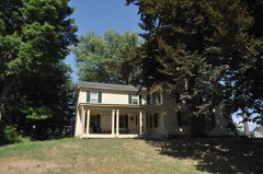 | David Pinney House and Barn | 0.2 miles | 1977 |
 | Windsor Locks Passenger Station | 0.9 miles | 1975 |
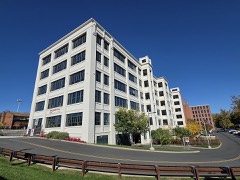 | J.R. Montgomery Company Industrial Complex | 0.9 miles | 2017 |
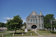 | Memorial Hall | 1.1 miles | 1987 |
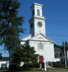 | St. John's Episcopal Church | 1.3 miles | 1982 |
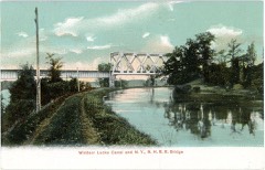 | Enfield Canal | 1.9 miles | 1976 |
| National Archives record | The nomination case file for reference 94000846 in Record Group 79. |
| Hartford County | All 451 listed properties in this county. |