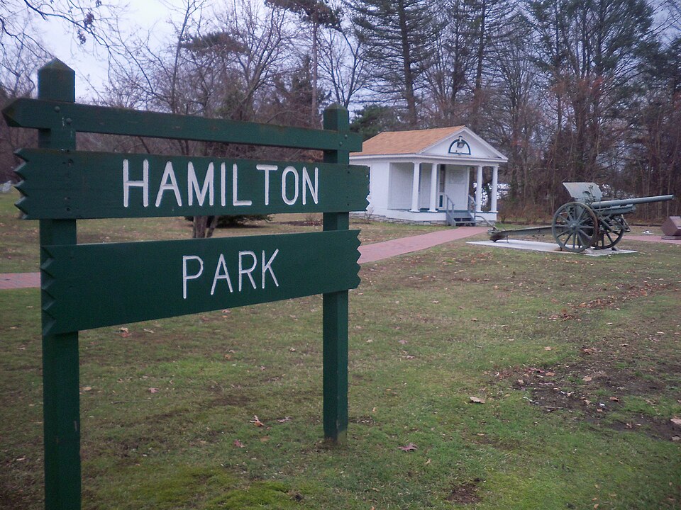
Listed on the National Register of Historic Places in 1996.
From the record
“Hamilton Park is the oldest city park in Waterbury, Connecticut. Founded in 1898 as a gift from the locally prominent Hamilton family, it offers both passive and active recreation, with ballfields and other amenities.”
Wikipedia article Hamilton Park (Waterbury, Connecticut), CC BY-SA 4.0.
One of 272 National Register listings published here for New Haven County · listed in 1996 · category: District.
National Register reference number.96000846- the number the National Park Service assigned this property when it was listed, and the key its nomination file is catalogued under at the National Archives.
Fires near this property
427 since 1992
Regional context, not property-specific
evidence. The
federal wildfire occurrence database
lists 427 fires within 5 miles of Hamilton Park
between 1992 and 2020, burning about 1,105 acres in total. None started naturally. 145 were recorded as arson.
Distance is straight-line from the map coordinates, so a fire counted
here may appear on a neighbouring settlement's page as well.
Reported cause
Fires
Missing data/not specified/undetermined
152
Arson/incendiarism
145
Misuse of fire by a minor
48
Recreation and ceremony
39
Debris and open burning
19
Smoking
9
Railroad operations and maintenance
8
Equipment and vehicle use
6
Power generation/transmission/distribution
1
The most recent of
them, most recent first, with the day each was reported and the service
that recorded it.
Regional context, not property-specific
evidence. The federal mineral resources record lists
15 workings within 5 miles of Hamilton Park: 7 producers, 6 past producers, 1 plant, 1 unknown.
8 still produce. What was taken out: Sand and Gravel, Construction, Iodine, Sand and Gravel, Construction, Stone, Crushed/Broken, Stone, Crushed/Broken. Distance is straight-line from the
map coordinates, so a quarry counted here may appear on a neighbouring
settlement's page as well.
Regional context, not property-specific
evidence. The National Weather Service names
Waterbury, the town this property stands in, in 50 storm reports between 1996 and 2025: 24 thunderstorm wind, 9 hail, 8 flash flood, 6 lightning.
The reports record 3 injuries. Each account below is quoted exactly as the forecast office
filed it, from the NOAA Storm Events Database, and each date
opens the federal record of that event.
Lightning struck a large tree in the back yard of 92 Grassy Hill Road around 4:30 am EST. It traveled through the ground, blasted a hole through the basement wall, and displaced wooden panels in the interior portions of the house. The sound was so loud that it damaged the hearing of a woman living in the house.
Numerous trees and wires were reported down throughout Waterbury, damaging at least one car, and several fences. In addition there was some minor roof damage reported in the area around Dallas and Monroe Avenues and Newbury and Gates Streets.
Heavy rain caused a vehicle to hydroplane on Piedmont Street, causing it to lose control and crash into two parked cars. The driver was taken to Saint Mary's Hospital to treat head injuries.
In Waterbury, 4 to 5 inches of rainfall fell over a 3 hour period. Many cars were stranded in high water approximately 3 ft. deep on Wolcott St. and at the Route 8 underpass on Watertown Ave. Portions of Freight St. was under 4 ft. of water and the intersection of Woodtick Rd. at Upson Rd. was closed due to flooding. Large chunks of pavement were torn up on Wall St. and the House of Joy and Praise sustained water damage in the basement from ravaging runoff from a hill nearby. A section of Long Hill Rd. near Wolcott St. was also closed from damage to the street from flooding.
Torrential rainfall from slow-moving thunderstorms caused flash flooding across almost all of Northern New Haven County during the late afternoon and early evening of June 2nd. Up to 8 inches of rainfall occurred in less than 6 hours time in Waterbury. This caused numerous roads to be washed out and many water rescues to take place. The extent of the flooding prompted the Waterbury Mayor to declare a state of emergency. The hardest hit areas in Waterbury were Bristol Street, Highland Avenue, Watertown Avenue, South Main Street, and Charles Street. A rain gage measured 7.40 inches of rainfall in Waterbury.
An intense severe thunderstorm produced golfball size hail and very strong wind gusts, which downed several trees, some of which fell on cars and blocked roads.
Trees and wires were downed in Waterbury and Cheshire between 12:30 EST and 12:40 EST. In Cheshire, power lines fell on a house. Three miles northeast of Waterbury, a tree was downed on a truck.
No historic map-sheet match is published
for this property yet. That does not mean no map exists. This record needs
a coordinate-quality review before it can be joined to a sheet boundary.
Browse the county's mapped places while that work is
pending.
Listed places nearby
6 within 8 miles
Other National Register properties close
enough to walk or drive between, ordered by distance from this one. Both
positions come from the same geocoding pass that matched these properties
to their map sheets.
Listing record. National Park Service National Register of Historic Places, listed-properties dataset, current to 2026-05-22.
Map join. Address geocoded through the United States Census geocoder, then tested against the published boundary of every sheet in the USGS Historical Topographic Map Collection.
How this page is made. Listing fields come from federal records; map-sheet coverage is a labelled coordinate-to-boundary calculation, not a source-field claim.
Wildfire. Short, Karen C. 2022. Spatial wildfire occurrence data for the United States, 1992-2020 [FPA_FOD_20221014]. 6th Edition. Fort Collins, CO: Forest Service Research Data Archive. https://doi.org/10.2737/RDS-2013-0009.6 Collected with United States Government funding and usable without additional permissions or fees.
Mines and quarries. USGS Mineral Resources Data System (MRDS) https://mrdata.usgs.gov/mrds/ A work of the United States government, no copyright under 17 U.S.C. 105.
Storms. NOAA National Centers for Environmental Information, Storm Events Database https://www.ncei.noaa.gov/stormevents/ A work of the United States government, no copyright under 17 U.S.C. 105. Narratives are quoted verbatim from the National Weather Service report and are not edited or summarised.
 Block