 Block
From the record
One of 136 National Register listings published here for Kent County · listed in 2019 · category: District.
Sources: the National Register database, National Park Service
Listed on the National Register of Historic Places in 2019.
One of 136 National Register listings published here for Kent County · listed in 2019 · category: District.
Sources: the National Register database, National Park Service
Regional context, not property-specific evidence. The federal wildfire occurrence database lists 1 fire within 5 miles of Downtown Harrington Historic District in 2012, burning about 2 acres in total. None started naturally. None was recorded as arson. Distance is straight-line from the map coordinates, so a fire counted here may appear on a neighbouring settlement's page as well.
| Reported cause | Fires |
|---|---|
| Debris and open burning | 1 |
The most recent of them, most recent first, with the day each was reported and the service that recorded it.
| Date | Cause | Size | Reported by | Name on the report |
|---|---|---|---|---|
| 4 April 2012 | Debris and open burning | 2.5 acres | Delaware Forest Service | not named |
Regional context, not property-specific evidence. The federal mineral resources record lists 6 workings within 5 miles of Downtown Harrington Historic District: 4 past producers, 2 producers. 2 still produce. What was taken out: Sand and Gravel, Construction. Distance is straight-line from the map coordinates, so a quarry counted here may appear on a neighbouring settlement's page as well.
| Where | Site | Commodity | Status | Recorded |
|---|---|---|---|---|
| Barber Sand & Gravel Pit | Sand and Gravel, Construction | Producer | ||
| Barber Sand and Gravel Pit and Mill | Sand and Gravel, Construction | Past Producer | Sedimentary | |
| Stayton Pit | Sand and Gravel, Construction | Producer | ||
| Staytons Pit | Sand and Gravel, Construction | Past Producer | Sedimentary | |
| William M. Killen Sand Pit | Sand and Gravel, Construction | Past Producer | Sedimentary | |
| William M. Killen Sand Pit | Sand and Gravel, Construction | Past Producer |
Regional context, not property-specific evidence. The National Weather Service names Harrington, the town this property stands in, in 34 storm reports between 1993 and 2026: 17 thunderstorm wind, 12 heavy rain, 2 flash flood, 1 tornado. No death or injury is recorded in these reports. Each account below is quoted exactly as the forecast office filed it, from the NOAA Storm Events Database, and each date opens the federal record of that event.
| When | Event | Place named | Harm | What the report says |
|---|---|---|---|---|
| July 1994 | Tornado (F1) | Harrington | $400,000 | Two sites along Route 13 had some wind damage. One was about 2 miles south of Felton where a warehouse lost its loading doors and sustained damage to some other doors. An empty trailer was blown off a rig which was driving south on Route 13. The second site was just west of Route 13 north of Felton where a mobile home was moved from its foundation (no tie-down) a damaged. Winds were estimated between 55 and 70 mph. |
| April 1993 | Thunderstorm Wind | Harrington | $50,000 | Downburst winds from a severe thunderstorm did considerable but spotty damage in the Harrington area. At the racetrack, about 0.5 mile south of Harrington, a 40-foot section of fiberglass fence was destroyed, three sets of aluminum bleachers were blown down while others were damaged. One mile east of Harrington, a screened porch on the back of a house and a wooden shed were destroyed. Several other houses had minor damage, a street light and TV antenna were damaged. |
| June 2010 | Thunderstorm Wind | Harrington | $10,000 | A severe thunderstorm tore down a tree onto a home in Harrington. No injuries were reported. The same severe thunderstorm tore down a few other large tree limbs and wires in and around Harrington. |
| March 2026 | Thunderstorm Wind | Harrington | - | Multiple trees uprooted with some snapped. Irrigation systems damage. Time estimated from radar. |
| May 2022 | Thunderstorm Wind | Harrington | - | Kent County received a couple of calls for downed trees and wires in the Harrington area. Time estimated from radar. |
| May 2022 | Thunderstorm Wind | Harrington | - | A tree was downed on wires on Clark St. Time estimated from radar. |
| July 2022 | Thunderstorm Wind | Harrington | - | Trees down on Liberty Street in Harrington, DE. Time estimated from radar. |
| August 2021 | Flash Flood | Harrington | - | East Liberty Street in Harrington was closed between Delaware Avenue and US Route 13 due to flooding. A water rescue took place on East Liberty Street. Another water rescue occurred on West Street. |
| August 2021 | Thunderstorm Wind | Harrington | - | A couple of trees and large limbs were blown down. Time estimated from radar. |
| August 2020 | Flash Flood | Harrington | - | A water rescue took place near the intersection of East Liberty Street and Howard Dill Avenue in Harrington. |
| February 2020 | Thunderstorm Wind | Harrington | - | Power lines downed in the area. Time estimated from radar. |
| February 2020 | Thunderstorm Wind | Harrington | - | The roof of a trailer was blown off. Time estimated from radar. |
| August 2019 | Hail | Harrington | - | Quarter size hail was reported in Harrington. |
| March 2017 | Thunderstorm Wind | Harrington | - | Trees downed in Harrington onto a road. |
| July 2017 | Heavy Rain | Harrington | - | Just under five inches of rain fell at this DEOS. |
| September 2016 | Heavy Rain | Harrington | - | Four and a half inches of rain fell. |
| September 2016 | Heavy Rain | Harrington | - | Four and a half inches of rain fell. |
| September 2016 | Heavy Rain | Harrington | - | Three and a half inches of rain fell. |
| September 2016 | Heavy Rain | Harrington | - | Four and a half inches of rain fell. |
| September 2016 | Heavy Rain | Harrington | - | Four and a half inches of rain fell. |
| September 2016 | Heavy Rain | Harrington | - | Just over 2 inches of rain was measured. |
| September 2016 | Heavy Rain | Harrington | - | Four and two thirds inches of rain fell. |
| September 2016 | Heavy Rain | Harrington | - | Just over five inches of rain fell. |
| September 2016 | Heavy Rain | Harrington | - | Four and two thirds inches of rain fell. |
| September 2016 | Heavy Rain | Harrington | - | Almost six inches of rain fell. |
| September 2016 | Heavy Rain | Harrington | - | Just over four and a half inches of rain fell. |
| July 2011 | Thunderstorm Wind | Harrington | - | A severe thunderstorm knocked down tree limbs and a couple of trees near Harringron. |
| June 2010 | Thunderstorm Wind | Harrington | - | A severe thunderstorm knocked down trees in southwestern Kent County in Harrington and Farmington. |
| August 2009 | Thunderstorm Wind | Harrington | - | The gust front from a severe thunderstorm tore down a couple of large tree limbs and wires in Harrington. |
| July 2008 | Thunderstorm Wind | Harrington | - | A severe thunderstorm knocked down large tree limbs and wires in the Harrington area. |
| May 2008 | Thunderstorm Wind | Harrington | - | A fairly fast moving cluster of thunderstorms, well ahead of a cold front, rolled across Delaware during the afternoon of the 31st. Some of the thunderstorms turned severe with locally strong winds. As a result, trees and wires were knocked down near Harrington at about 3:20 PM EDT. In addition, hail to about one-half inch in diameter was reported. |
| July 2006 | Thunderstorm Wind | Harrington | - | no account filed |
| July 2001 | Thunderstorm Wind | Harrington | - | no account filed |
| May 1998 | Lightning | Harrington | - | no account filed |
No historic map-sheet match is published for this property yet. That does not mean no map exists. This record needs a coordinate-quality review before it can be joined to a sheet boundary. Browse the county's mapped places while that work is pending.
Other National Register properties close enough to walk or drive between, ordered by distance from this one. Both positions come from the same geocoding pass that matched these properties to their map sheets.
| Photograph | Property | Distance | Listed |
|---|---|---|---|
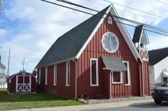 | St. Stephen's P.E. Church | under 500 feet | 2014 |
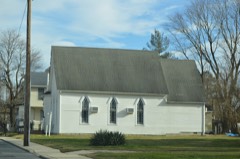 | St. Paul A.M.E. Church | 0.3 miles | 2016 |
| Vincelette Futuro House | 3.5 miles | 2023 | |
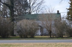 | Tharp House | 3.6 miles | 1973 |
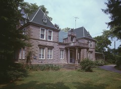 | Vogl House | 3.9 miles | 1976 |
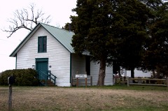 | Griffith's Chapel | 4.3 miles | 1983 |
| National Archives record | The nomination case file for reference 100004082 in Record Group 79. |
| Kent County | All 136 listed properties in this county. |