 Block
From the record
136 National Register listings published here, 2 of them National Historic Landmarks.
Sources: the National Register database, National Park Service
143 topographic sheets cover 356 settlements here, and 136 properties are on the National Register of Historic Places.
136 National Register listings published here, 2 of them National Historic Landmarks.
Sources: the National Register database, National Park Service
Every property in this county listed on the National Register of Historic Places, with the year it was listed and the federal nomination document.
| Photograph | Property | Type | Listed | Reference |
|---|---|---|---|---|
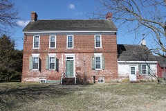 | Allee House | building | 1971 | 71000220 |
| George Arnold House | building | 1983 | 83001360 | |
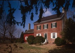 | Aspendale | building | 1970 | 70000170 |
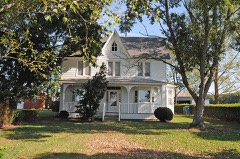 | Thomas Attix House | building | 1983 | 83001361 |
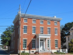 | Bank House | building | 1978 | 78000890 |
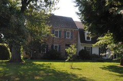 | Bannister Hall and Baynard House | district | 1973 | 73000503 |
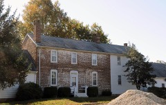 | Barratt Hall | building | 1973 | 73000492 |
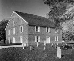 | Barratt's Chapel | building | 1972 | 72000281 |
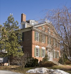 | Belmont Hall | building | 1971 | 71000223 |
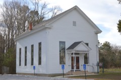 | Bethel Methodist Protestant Church | building | 1998 | 98001093 |
| J. F. Betz House | building | 1983 | 83001362 | |
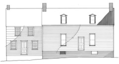 | Benjamin Blackiston House | building | 1983 | 83001363 |
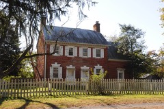 | Bonwell House | building | 1973 | 73000493 |
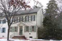 | Bradford-Loockerman House | building | 1972 | 72000277 |
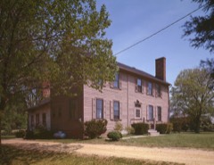 | Brecknock | building | 1974 | 74000596 |
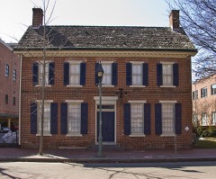 | John Bullen House | building | 1975 | 75000542 |
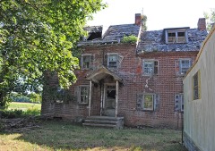 | W. D. Burrows House | building | 1983 | 83001364 |
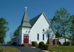 | Byrd's AME Church | building | 1982 | 82001023 |
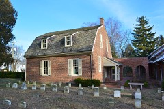 | Camden Friends Meetinghouse | building | 1973 | 73000485 |
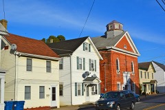 | Camden Historic District | district | 1974 | 74000595 |
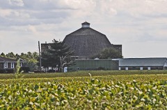 | Cherbourg Round Barn | building | 1978 | 78000888 |
| Cheyney Clow's Rebellion, Scene of | site | 1974 | 74000598 | |
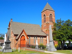 | Christ Church | building | 1973 | 73000502 |
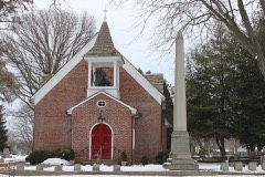 | Christ Church | building | 1972 | 72001500 |
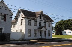 | Clark-Pratt House | building | 1983 | 83001365 |
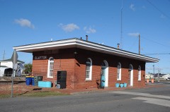 | Clayton Railroad Station | building | 1986 | 86003066 |
| Coombe Historic District | district | 1982 | 82002313 | |
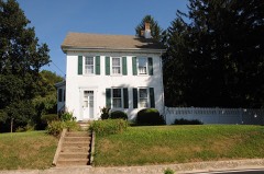 | Cooper House | building | 1973 | 73000495 |
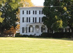 | Thomas B. Coursey House | building | 1990 | 90001069 |
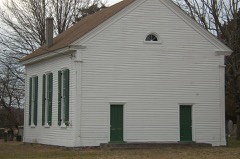 | Cow Marsh Old School Baptist Church | building | 1976 | 76000571 |
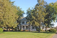 | David J. Cummins House | building | 1983 | 83003504 |
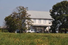 | Timothy Cummins House | building | 1983 | 83003505 |
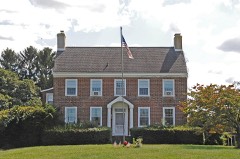 | Thomas Davis House | building | 1983 | 83001366 |
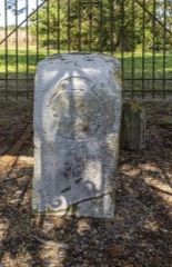 | Delaware Boundary Markers | district | 1975 | 75002101 |
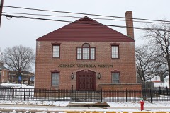 | Delaware State Museum Buildings | building | 1972 | 72000278 |
| T. H. Denny House | building | 1983 | 83001367 | |
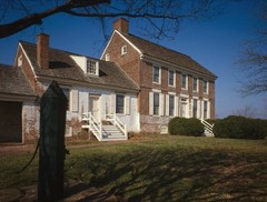 | John Dickinson House | building | 1966 | 66000258 |
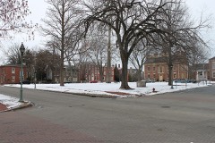 | Dover Green Historic District | district | 1977 | 77000383 |
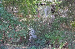 | N. C. Downs House | building | 1983 | 83001368 |
| Downtown Harrington Historic District | district | 2019 | 100004082 | |
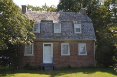 | Duck Creek Village | district | 1972 | 72000282 |
| Durham-Shores House | building | 2001 | 01001005 | |
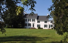 | Eden Hill | building | 1973 | 73000487 |
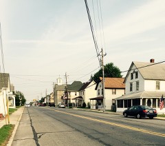 | Felton Historic District | district | 1988 | 87002433 |
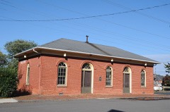 | Felton Railroad Station | building | 1981 | 81000191 |
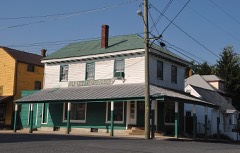 | Fennimore Store | building | 1982 | 82002314 |
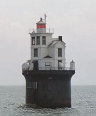 | Fourteen Foot Bank Light | structure | 1989 | 89000286 |
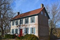 | Frederica Historic District | district | 1977 | 77000385 |
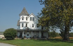 | George Farmhouse | building | 1982 | 82001862 |
| Golden Mine | building | 1978 | 78000891 | |
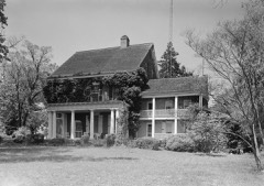 | Governor's House | building | 1972 | 72000279 |
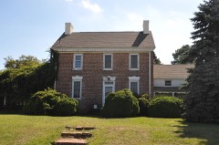 | Great Geneva | building | 1973 | 73000489 |
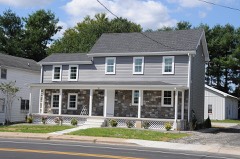 | Green Mansion House | building | 1983 | 83001369 |
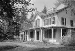 | Greenwold | building | 1973 | 73000488 |
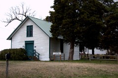 | Griffith's Chapel | building | 1983 | 83001370 |
| Robert Hill House | building | 1983 | 83001371 | |
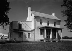 | Hoffecker-Lockwood House | building | 1983 | 83001372 |
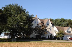 | Alfred L. Hudson House | building | 1983 | 83001373 |
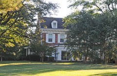 | Ivy Dale Farm | building | 1973 | 73000504 |
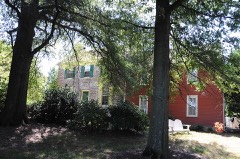 | Enoch Jones House | building | 1973 | 73000486 |
| KATHERINE M. LEE (Schooner) | structure | 1983 | 83001375 | |
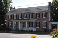 | Kenton Historic District | district | 1983 | 83001396 |
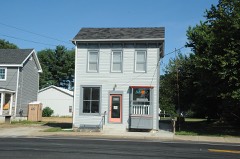 | Kenton Post Office | building | 1983 | 83001376 |
| Thomas Lamb Farm | building | 1983 | 83001374 | |
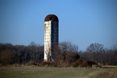 | Thomas Lamb House | building | 1983 | 83001385 |
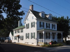 | Alexander Laws House | building | 1983 | 83001377 |
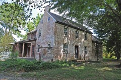 | Lewis Family Tenant Agricultural Complex | building | 1986 | 86001506 |
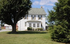 | Jefferson Lewis House | building | 1983 | 83001349 |
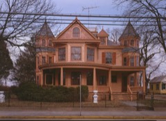 | John B. Lindale House | building | 1973 | 73002231 |
| Little Creek Hundred Rural Historic District | district | 1984 | 84000286 | |
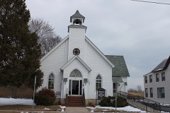 | Little Creek Methodist Church | building | 1982 | 82002316 |
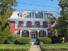 | Peter Lofland House | building | 1982 | 82002321 |
| Logan School House K-834 | building | 1979 | 79003231 | |
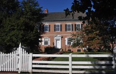 | Loockerman Hall | building | 1971 | 71000218 |
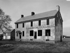 | Matthew Lowber House | building | 1971 | 71000221 |
| MAGGIE S. MYERS (schooner) | structure | 1983 | 83001378 | |
| Macomb Farm | building | 1974 | 74000597 | |
| McClary House | building | 1983 | 83001353 | |
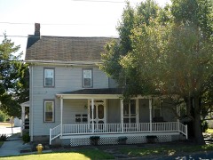 | James McColley House | building | 1983 | 83001354 |
| Delaplane McDaniel House | building | 1983 | 83001379 | |
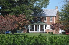 | Mifflin-Marim Agricultural Complex | building | 1984 | 84000269 |
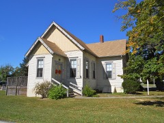 | Milford New Century Club | building | 1982 | 82002322 |
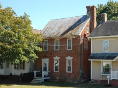 | Mill House | building | 1983 | 83001380 |
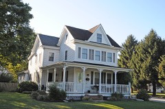 | Moore House | building | 1982 | 82001022 |
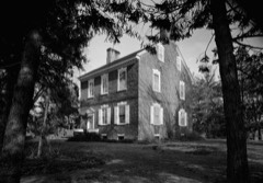 | Mordington | building | 1973 | 73000494 |
| North Milford Historic District | district | 1983 | 83001357 | |
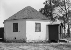 | Octagonal Schoolhouse | building | 1971 | 71000217 |
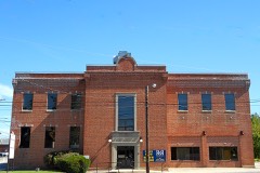 | Old Fire House | building | 1983 | 83001381 |
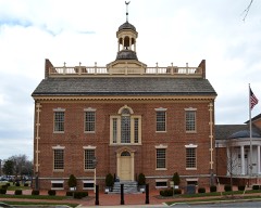 | Old Statehouse | building | 1971 | 71000219 |
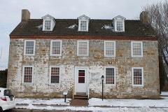 | Old Stone Tavern | building | 1973 | 73000499 |
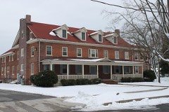 | Palmer Home | building | 1988 | 88001443 |
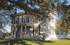 | Peterson and Mustard's Hermitage Farm | building | 1982 | 82001027 |
| Poinsett House | building | 1983 | 83001350 | |
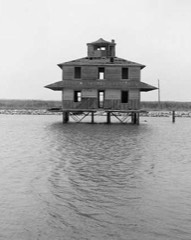 | Port Mahon Lighthouse | site | 1979 | 79000624 |
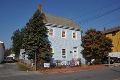 | Rawley House | building | 1983 | 83001352 |
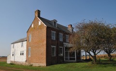 | Raymond Neck Historic District | district | 1982 | 82001026 |
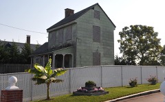 | Reed House | building | 1983 | 83001351 |
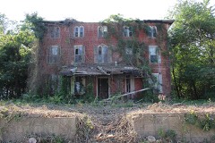 | Jehu Reed House | building | 1973 | 73000500 |
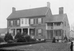 | Ruth Mansion House | building | 1973 | 73000496 |
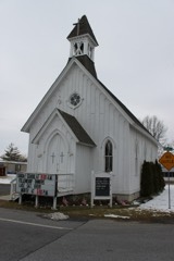 | Saxton United Methodist Church | building | 1990 | 90001070 |
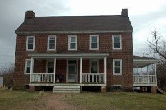 | Short's Landing Hotel Complex | building | 1983 | 83003506 |
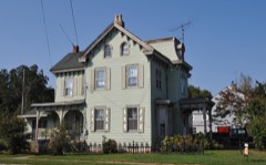 | Sipple House | building | 1982 | 82002315 |
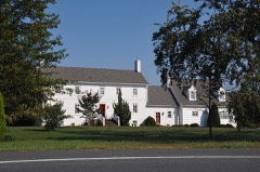 | Snowland | building | 1973 | 73000497 |
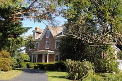 | Somerville | building | 1974 | 74000599 |
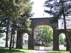 | St. Joseph's Industrial School | district | 2002 | 02001491 |
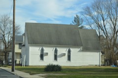 | St. Paul A.M.E. Church | building | 2016 | 16000726 |
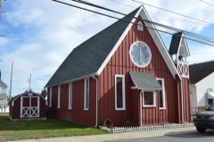 | St. Stephen's P.E. Church | building | 2014 | 14000825 |
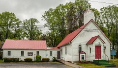 | Star Hill AME Church | building | 1994 | 94001389 |
| William Stevens House | building | 1983 | 83001406 | |
| Elizabeth Stubbs House | building | 1982 | 82002317 | |
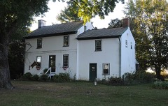 | Thomas Sutton House | building | 1973 | 73000505 |
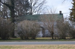 | Tharp House | building | 1973 | 73000491 |
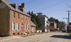 | The Smyrna Opera House | building | 1980 | 80000930 |
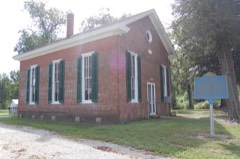 | Thomas' Methodist Episcopal Chapel | building | 1994 | 93001516 |
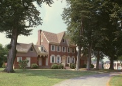 | Parson Thorne Mansion | building | 1971 | 71000222 |
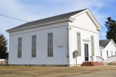 | Todd's Chapel | building | 1998 | 98001094 |
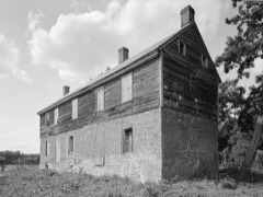 | Town Point | building | 1972 | 72000280 |
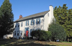 | Gov. George Truitt House | building | 1978 | 78000889 |
| Tyn Head Court | building | 1973 | 73000490 | |
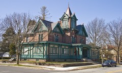 | Victorian Dover Historic District | district | 1979 | 79000622 |
| Vincelette Futuro House | building | 2023 | 100009680 | |
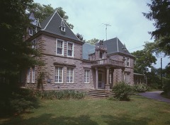 | Vogl House | building | 1976 | 76000570 |
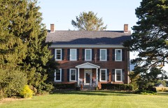 | John M. Voshell House | building | 1983 | 83003507 |
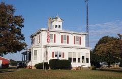 | Walnut Farm | building | 1982 | 82001025 |
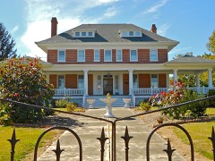 | Gov. William T. Watson Mansion | building | 1982 | 82002323 |
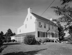 | Wheel of Fortune | building | 1973 | 73000498 |
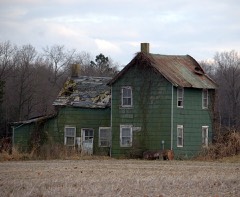 | White-Warren Tenant House | building | 2001 | 01001009 |
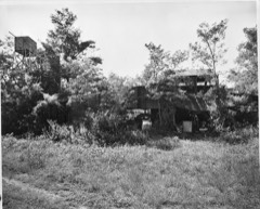 | Wilkerson, J. H., & Son Brickworks | district | 1978 | 78000892 |
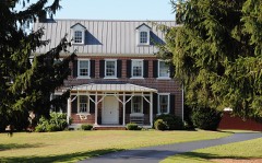 | James Williams House | building | 1983 | 83001382 |
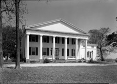 | Woodlawn | building | 1982 | 82001863 |
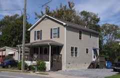 | Jonathan Woodley House | building | 1982 | 82002318 |
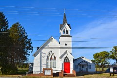 | Woodside Methodist Episcopal Church | building | 1996 | 96000107 |
| Wright-Carry House | building | 1983 | 83001383 | |
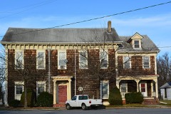 | Wyoming Historic District | district | 1987 | 86003037 |
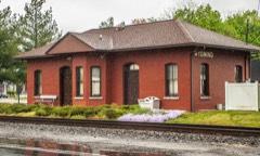 | Wyoming Railroad Station | building | 1980 | 80000931 |
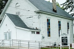 | Zion African Methodist Episcopal Church | building | 1994 | 94001388 |
Every wildfire the federal occurrence database records inside this county: 36 of them, burning about 2,948 acres. 5 started naturally and 4 were recorded as arson. Each settlement page carries the fires within five miles of it.
| Reported cause | Fires |
|---|---|
| Missing data/not specified/undetermined | 19 |
| Natural | 5 |
| Debris and open burning | 4 |
| Arson/incendiarism | 4 |
| Recreation and ceremony | 2 |
| Smoking | 1 |
| Equipment and vehicle use | 1 |
The five largest, by the area the report gives. Four of them were set deliberately.
| Date | Cause | Size | Reported by | Name on the report |
|---|---|---|---|---|
| 25 March 1995 | Arson/incendiarism | 2,000 acres | Bombay Hook National Wildlife Refuge | STEAMBOAT |
| 17 April 1999 | Missing data/not specified/undetermined | 500 acres | Bombay Hook National Wildlife Refuge | KENTISLAND |
| 20 January 2003 | Missing data/not specified/undetermined | 200 acres | Delaware State Fire Marshal's Office | not named |
| 6 April 1992 | Arson/incendiarism | 120 acres | Bombay Hook National Wildlife Refuge | RAYMONDGUT |
| 31 March 1994 | Arson/incendiarism | 95 acres | Bombay Hook National Wildlife Refuge | SHEPRNEGUT |
| 26 January 1999 | Arson/incendiarism | 7.0 acres | Blackwater National Wildlife Refuge | FB-I1 |
| 18 March 1999 | Missing data/not specified/undetermined | 7.0 acres | Bombay Hook National Wildlife Refuge | MISERY |
| 18 April 2015 | Smoking | 3.0 acres | Delaware Forest Service | SCOTTS FIRE |
Every settlement page carries the fires within five miles of it - see the settlement index below.
The NOAA Storm Events Database holds 502 reports for this county, causing 2 deaths, 59 injuries and about $9,044,500 in recorded property damage. Each settlement page carries the reports that name it.
| Kind of event | Reports |
|---|---|
| Thunderstorm Wind | 284 |
| Heavy Rain | 91 |
| Hail | 36 |
| Flash Flood | 30 |
| Tornado | 25 |
| Flood | 18 |
| Lightning | 15 |
| Funnel Cloud | 2 |
| Wildfire | 1 |
The most serious of them, by death, then injury, then recorded damage. The accounts are quoted exactly as the forecast office filed them.
| When | Event | Place named | Harm | What the report says |
|---|---|---|---|---|
| July 1983 | Tornado (F2) | not stated | 2 killed, 9 hurt, $250,000 | no account filed |
| June 1988 | Tornado (F1) | not stated | 30 hurt, $2,500,000 | no account filed |
| January 1967 | Tornado (F2) | not stated | 7 hurt, $250,000 | no account filed |
| July 1994 | Tornado (F0) | Farmington | 4 hurt, $200,000 | no account filed |
| April 1975 | Tornado (F1) | not stated | 3 hurt, $250,000 | no account filed |
| May 2014 | Tornado (EF1) | Haglettville | 2 hurt, $150,000 | An EF1 tornado with an estimated maximum wind speed of 105 mph touched down in West Dover Hundred. It touched down just west of Darling Drive and lifted just east of Darling Farm Road. Two people were injured as the worst wind damage occurred on Darling Drive. A 58-year-old man and his wife were injured after the tornado elevated, spun and then leveled their mobile home. The man had a bureau, a file cabinet and a mattress over him. The tornado damaged about seventeen homes in the area, leaving four condemned and uninhabitable. The tornado also snapped five poles. A couple of thousand homes and businesses were also without power. The tornado was embedded within a swath of other damaging winds. The estimated path length was 0.35 miles and the estimated maximum path width was 50 yards. |
| June 1977 | Tornado (F2) | not stated | 1 hurt, $250,000 | no account filed |
| February 1999 | Thunderstorm Wind | Clayton | 1 hurt, $200,000 | no account filed |
| March 2026 | Thunderstorm Wind | Haglettville | 1 hurt | Straight line wind damage consistent with wind speeds of 90 to 100 mph occurred West of Camden Delaware. Tree damage was first observed on Honeysuckle Road just south of the intersection with Westville Road. The highest degree of damage was noted near the intersection of Probst Lane and Westville Road. Several trees were snapped, including multiple trees that fell onto mobile homes. One injury was reported in this location. Sporadic tree damage was observed further east near and along Quail Run. Based on the debris direction, this was determined to be straight line wind damage. |
| February 1990 | Thunderstorm Wind | not stated | 1 hurt | no account filed |
| June 1998 | Thunderstorm Wind | Dover | $1,500,000 | no account filed |
| July 2004 | Flash Flood | North Portion | $625,000 | no account filed |
| July 1994 | Tornado (F1) | Harrington | $400,000 | Two sites along Route 13 had some wind damage. One was about 2 miles south of Felton where a warehouse lost its loading doors and sustained damage to some other doors. An empty trailer was blown off a rig which was driving south on Route 13. The second site was just west of Route 13 north of Felton where a mobile home was moved from its foundation (no tie-down) a damaged. Winds were estimated between 55 and 70 mph. |
| June 1996 | Flash Flood | Northern | $300,000 | no account filed |
| July 1992 | Tornado (F2) | not stated | $250,000 | no account filed |
| July 1991 | Tornado (F0) | not stated | $250,000 | no account filed |
| September 1999 | Flash Flood | Countywide | $224,000 | no account filed |
| June 2011 | Lightning | Farmington | $200,000 | Lightning struck a Harrington home in the Farmington area on Staytonsville Road near Wolfs Trail End Drive. The ensuing fire caused about $200,000 in damage. Four fire companies battled the blaze and the residents were evacuated without injury. One firefighter was injured battling the blaze. |
| July 1994 | Tornado (F0) | not stated | $200,000 | Two sites along Route 13 had some wind damage. One was about 2 miles south of Felton where a warehouse lost its loading doors and sustained damage to some other doors. An empty trailer was blown off a rig which was driving south on Route 13. The second site was just west of Route 13 north of Felton where a mobile home was moved from its foundation (no tie-down) a damaged. Winds were estimated between 55 and 70 mph. |
| July 1994 | Thunderstorm Wind | Felton | $200,000 | Two sites along Route 13 had some wind damage. One was about 2 miles south of Felton where a warehouse lost its loading doors and sustained damage to some other doors. An empty trailer was blown off a rig which was driving south on Route 13. The second site was just west of Route 13 north of Felton where a mobile home was moved from its foundation (no tie-down) a damaged. Winds were estimated between 55 and 70 mph. |
| September 2012 | Tornado (EF0) | Wyoming | $100,000 | An EF0 tornado touched down in the Barclay Farms Subdivision in Camden with an estimated maximum wind speed of 85 mph. The tornado damaged approximately ten homes, six of them seriously and caused two injuries. Six homes were considered uninhabitable and gas lines were turned off in the development. The tornado touched down on Dawson Lane and paralleled the train tracks from south to north. Structural damage to homes occurred from Dalby Lane north through Carey Lane. The tornado lifted after it passed Carey Lane. At one home, the wind tore the roof off a garage, damaging the two cars inside and the side of the home. The owner of the house was hospitalized after he cut his hand on a piece of broken glass. A firefighter was also injured assisting another resident. About 1,200 customers of the Delaware Electric Co-Operative lost power after the tornado moved through. All service was restored by 630 p.m. EDT that evening. The tornado's path length was approximately 0.2 miles and its maximum path width was 35 yards. |
| June 2009 | Thunderstorm Wind | Blackiston | $100,000 | A severe thunderstorm caused wind damage between Smyrna and Blackiston Crossroads mainly in Kenton Hundred. There were nine calls for fallen trees and downed wires. In Smyrna shingles were torn from one home and a downed tree damaged a porch. Between Clayton and Blackiston, two mobile homes were damaged after trees fell on them. Another mobile home was moved off its foundation. A barn was destroyed by the thunderstorm winds and a camper within it was damaged. One hundred pound propane tanks were toppled. Several homes in the Plantation Crossing development west of Clayton suffered minor structural damage. |
| June 2009 | Thunderstorm Wind | Vernon | $100,000 | A severe thunderstorm produced a swath of straight-line wind damage up to one-half mile wide in spots from just west of Harrington in southwestern Kent County in Mispillion Hundred south to the town of Greenwood in northern Sussex County. Damage began on High Stump Road west of Harrington where a few tree tops were snapped and a few other trees were uprooted. An old barn was blown down, with its roofing material blown up to one-half mile away. Farther south, two trees were blown down along Burrsville Road. Wind damage continued into Sussex County. ||Corn was stripped to the stalk on many fields within the damage swath, resulting in a total loss in some cases. Wheat and barely fields also suffered substantial damage. Combined Kent and Sussex County crop losses could easily total several hundred thousand dollars. Maximum wind speeds were estimated at 80 MPH. |
| April 2002 | Hail | Smyrna | $100,000 | no account filed |
| June 2003 | Lightning | Frederica | $80,000 | no account filed |
| June 2012 | Thunderstorm Wind | Sandtown | $50,000 | A gust front outrunning a cluster of severe thunderstorms entered near Sandtown in western Kent County at approximately 11:57 pm EDT on the 29th. This gust front produced damaging wind gusts estimated between 65 mph to 70 mph as it traversed eastward across the county. Within approximately 20 minutes of the gust front passage, a potent line of severe thunderstorms tracked eastward through Kent County, producing another round of destructive wind gusts, estimated from 65 mph to 70 mph. Large tree limbs were reported down across the county, including in Felton and Dover. In addition, several downed trees and an estimated wind gust to 70 mph were reported in Harrington. Severe thunderstorms exited eastern Kent County, including the town of Bowers, at approximately 1:10 am EDT on the 30th. |
| April 1993 | Thunderstorm Wind | Harrington | $50,000 | Downburst winds from a severe thunderstorm did considerable but spotty damage in the Harrington area. At the racetrack, about 0.5 mile south of Harrington, a 40-foot section of fiberglass fence was destroyed, three sets of aluminum bleachers were blown down while others were damaged. One mile east of Harrington, a screened porch on the back of a house and a wooden shed were destroyed. Several other houses had minor damage, a street light and TV antenna were damaged. |
| April 1993 | Tornado (F1) | Bowers Beach | $50,000 | no account filed |
| April 2026 | Thunderstorm Wind | Clayton | $40,000 | A tree was blown down onto a house in the Clayton Courts Neighborhood. |
| July 2014 | Thunderstorm Wind | Smyrna | $25,000 | A severe thunderstorm tore siding from homes, knocked down trees and mail boxes in Smyrna. |
| July 2014 | Thunderstorm Wind | Hartly | $25,000 | A severe thunderstorm knocked down several trees and wires in Hartly. One tree fell onto and damaged a building. Another downed tree damaged a house's porch. A third large downed tree took down wires along Crystal Road. |
| July 1992 | Tornado (F1) | not stated | $25,000 | no account filed |
| March 1977 | Tornado (F1) | not stated | $25,000 | no account filed |
| August 2011 | Thunderstorm Wind | Clayton | $10,000 | A severe thunderstorm tore down a couple of trees in Clayton, one of which damaged a home. |
| June 2010 | Thunderstorm Wind | Harrington | $10,000 | A severe thunderstorm tore down a tree onto a home in Harrington. No injuries were reported. The same severe thunderstorm tore down a few other large tree limbs and wires in and around Harrington. |
| May 2004 | Lightning | Felton | $10,000 | no account filed |
| July 2004 | Lightning | Smyrna | $10,000 | no account filed |
| August 2003 | Lightning | Hartly | $10,000 | no account filed |
| September 2008 | Lightning | Dover | $5,000 | A lightning strike caused two-thirds of Dover to lose power for about 90 minutes during the afternoon of the 9th. |
| April 1993 | Hail | Dover | $5,000 | no account filed |
| April 1993 | Tornado (F0) | Harrington to | $5,000 | no account filed |
| June 2005 | Lightning | Milford | $3,000 | no account filed |
| March 1964 | Tornado (F1) | not stated | $2,500 | no account filed |
| July 2014 | Thunderstorm Wind | Marydel | $1,000 | A severe thunderstorm knocked down several trees and wires in Marydel. One downed tree badly damaged an outdoor grill. |
| February 2014 | Thunderstorm Wind | Dover | $1,000 | A severe thunderstorm knocked down large tree limbs in Dover, one of which punctured the roof of the Central Delaware Habitat for Humanity ReStore building. Rain water leaked into the building and damaged the rear of the store. No injuries were reported. A wind gust to 47 mph occurred at the Dover Air Force Base. |
| September 2012 | Thunderstorm Wind | Marydel | $1,000 | A severe thunderstorm damaged the porch and shed of one home in Marydel and also knocked down several trees. |
| July 2012 | Thunderstorm Wind | Smyrna | $1,000 | A severe thunderstorm knocked down a couple of trees and wires in Smyrna. |
| April 2009 | Lightning | Little Creek | $1,000 | Lightning strikes caused several homes in Little Creek to lose power. |
| March 2026 | Thunderstorm Wind | Hickman | - | Trees and wires down along Hickman Road. Time estimated from radar. |
| March 2026 | Thunderstorm Wind | Hollandsville | - | From spotter network, tree damage reported west of Felton between Sandtown Road and Burnite Mill Road. Time estimated from radar. |
| March 2026 | Thunderstorm Wind | Camden | - | Downed trees, power lines, and a portion of a structural awning blown off of a building near Webbs Lane and New Burton Road in Dover. Time estimated from radar. Public report relayed via broadcast media. |
| March 2026 | Thunderstorm Wind | Harrington | - | Multiple trees uprooted with some snapped. Irrigation systems damage. Time estimated from radar. |
| March 2026 | Thunderstorm Wind | Felton Yorde Arpt | - | Broadcast media reported several downed trees, damaged farm equipment, and overturned construction message board trailer west of Killens Pond State Park. Time estimated by radar. |
| March 2026 | Thunderstorm Wind | Woodland Beach | - | Wires down around Hay Point Landing Road and Hawkey Branch Road. Time estimated from radar. |
| March 2026 | Thunderstorm Wind | Dover Arpt | - | A 57 knot gust was measured at Smyrna Airfield. Time given in report. |
| March 2026 | Thunderstorm Wind | (Dov)Dover Afb | - | A 66 MPH wind gust was measured at Dover Air Force Base. |
| March 2026 | Thunderstorm Wind | Brookdale Hgts | - | A 73 MPH gust was measured at DELDOT Magnolia Mesonet Station. Time given in report. |
| March 2026 | Tornado (EF1) | Frederica | - | An EF-1 tornado occurred south of Frederica. Tree damage started at the intersection of Carpenter Bridge Road and Fork Landing Road, where multiple trees were uprooted and snapped. Tree damage continued eastward along Fork Landing Road, including multiple trees snapped. One snapped tree fell into a shed, destroying the shed. Tree damage was observed along Fork Landing Road until just before Browns Branch. |
| April 2026 | Thunderstorm Wind | Clayton | - | Several large trees and power lines were blown down around Clayton. |
| April 2026 | Thunderstorm Wind | Smyrna | - | Multiple large trees and power lines were blown down in Smyrna. |
The Survey's mineral resources record lists 17 workings inside this county. 7 still produce and 10 are closed or unrecorded. Each settlement page carries the workings within five miles of it.
| Commodity | Workings |
|---|---|
| Sand and Gravel, Construction | 17 |
The least common of them first, because a county's hundredth gravel pit says nothing its first ten did not.
| Where | Site | Commodity | Status | Recorded |
|---|---|---|---|---|
| Barber Sand & Gravel Pit | Sand and Gravel, Construction | Producer | ||
| Barber Sand and Gravel Pit and Mill | Sand and Gravel, Construction | Past Producer | Sedimentary | |
| Clough and Caulk Pit and Mill | Sand and Gravel, Construction | Past Producer | Sedimentary | |
| Dover Equip. Co. Dredge No. 7 | Sand and Gravel, Construction | Producer | ||
| George Nashold Sand and Gravel Pit | Sand and Gravel, Construction | Past Producer | Sedimentary | |
| George Nashold Sand and Gravel Pit | Sand and Gravel, Construction | Producer | ||
| Hoskinson Gravel Pit | Sand and Gravel, Construction | Producer | ||
| L.D. Caulk Pit | Sand and Gravel, Construction | Past Producer | ||
| Porter Sand Pit | Sand and Gravel, Construction | Past Producer | Sedimentary | |
| Porter Sand Pit | Sand and Gravel, Construction | Producer | ||
| St Jones River Gravel Co Pit & Mill | Sand and Gravel, Construction | Past Producer | Sedimentary | |
| Stayton Pit | Sand and Gravel, Construction | Producer | ||
| Staytons Pit | Sand and Gravel, Construction | Past Producer | Sedimentary | |
| Tarburton Pit | Sand and Gravel, Construction | Past Producer | Sedimentary | |
| Tarburton Pit | Sand and Gravel, Construction | Producer | ||
| William M. Killen Sand Pit | Sand and Gravel, Construction | Past Producer | Sedimentary | |
| William M. Killen Sand Pit | Sand and Gravel, Construction | Past Producer |
Named settlements recorded in the Geographic Names Information System, each with the topographic sheets covering it. Villages, hamlets and abandoned places alike. Each is shown with the nearest named watercourse or landform and the survey quadrangle it falls on.
Harrington census division · 19950 · On Quarter Branch · Hickman quadrangle
19 sheets, 1918 to 1993
Central Kent census division · 19962 · On Thorndyk Branch · Wyoming quadrangle
29 sheets, 1899 to 1993
Central Kent census division · 19943 · On Hudson Branch · Wyoming quadrangle
29 sheets, 1899 to 1993
Harrington census division · 19952 · On Tomahawk Branch · Hickman quadrangle
19 sheets, 1918 to 1993
Dover census division · 19901 · On Puncheon Run · Dover quadrangle
29 sheets, 1899 to 1993
Harrington census division · 19952 · On Indian Branch · Harrington quadrangle
20 sheets, 1918 to 1993
Dover census division · 19934 · On Red House Branch · Wyoming quadrangle
29 sheets, 1899 to 1993
Milford North census division · 19946 · On Beaver Gut Ditch · Frederica quadrangle
30 sheets, 1899 to 1993
Central Kent census division · 19962 · Frederica quadrangle
30 sheets, 1899 to 1993
Milford North census division · 19946 · On Murderkill River · Frederica quadrangle
30 sheets, 1899 to 1993
Milford North census division · 19946 · On Murderkill River · Frederica quadrangle
30 sheets, 1899 to 1993
Dover census division · 19901 · On Newell Branch · Wyoming quadrangle
29 sheets, 1899 to 1993
Kenton census division · 19904 · On Taylor Branch · Kenton quadrangle
29 sheets, 1899 to 1993
Felton census division · 19943 · On Beaverdam Branch · Wyoming quadrangle
29 sheets, 1899 to 1993
Dover census division · 19904 · On Fork Branch · Dover quadrangle
29 sheets, 1899 to 1993
Harrington census division · 19950 · On Cattail Branch · Hickman quadrangle
19 sheets, 1918 to 1993
Dover census division · 19901 · On Alston Branch · Dover quadrangle
29 sheets, 1899 to 1993
Harrington census division · 19952 · On Indian Branch · Harrington quadrangle
20 sheets, 1918 to 1993
Milford North census division · 19946 · On Murderkill River · Frederica quadrangle
30 sheets, 1899 to 1993
Smyrna census division · 19977 · On Willis Branch · Smyrna quadrangle
32 sheets, 1899 to 1993
Dover census division · 19904 · On Newell Branch · Wyoming quadrangle
29 sheets, 1899 to 1993
Central Kent census division · 19934 · On Beaver Gut Ditch · Frederica quadrangle
30 sheets, 1899 to 1993
Dover census division · 19901 · On Newell Branch · Wyoming quadrangle
29 sheets, 1899 to 1993
Central Kent census division · 19962 · On Thorndyk Branch · Frederica quadrangle
30 sheets, 1899 to 1993
Central Kent census division · 19962 · On Newell Branch · Wyoming quadrangle
29 sheets, 1899 to 1993
Dover census division · 19904 · On Red House Branch · Wyoming quadrangle
29 sheets, 1899 to 1993
Dover census division · 19904 · On Red House Branch · Wyoming quadrangle
29 sheets, 1899 to 1993
Dover census division · 19901 · On Cahoon Branch · Dover quadrangle
29 sheets, 1899 to 1993
Dover census division · 19934 · On Newell Branch · Wyoming quadrangle
29 sheets, 1899 to 1993
Dover census division · 19901 · On Isaac Branch · Wyoming quadrangle
29 sheets, 1899 to 1993
Dover census division · 19901 · On Puncheon Run · Dover quadrangle
29 sheets, 1899 to 1993
Dover census division · 19901 · On Puncheon Run · Dover quadrangle
29 sheets, 1899 to 1993
Dover census division · 19904 · On Almshouse Branch · Dover quadrangle
29 sheets, 1899 to 1993
Dover census division · 19904 · On Maidstone Branch · Dover quadrangle
29 sheets, 1899 to 1993
Dover census division · 19901 · On Newell Branch · Wyoming quadrangle
29 sheets, 1899 to 1993
Dover census division · 19901 · On Newell Branch · Wyoming quadrangle
29 sheets, 1899 to 1993
Dover census division · 19904 · On Penrose Branch · Dover quadrangle
29 sheets, 1899 to 1993
Dover census division · 19901 · On Cahoon Branch · Dover quadrangle
29 sheets, 1899 to 1993
Dover census division · 19904 · On Maidstone Branch · Dover quadrangle
29 sheets, 1899 to 1993
Central Kent census division · 19964 · On Culbreth Marsh Ditch · Marydel quadrangle
28 sheets, 1899 to 1993
Central Kent census division · 19962 · On Beaver Gut Ditch · Frederica quadrangle
30 sheets, 1899 to 1993
Milford North census division · 19963 · Milford quadrangle
21 sheets, 1918 to 1993
Smyrna census division · 19938 · On Providence Creek · Clayton quadrangle
30 sheets, 1899 to 1993
Milford North census division · 19963 · On Tubmill Branch · Milford quadrangle
21 sheets, 1918 to 1993
Smyrna census division · 19977 · On Greens Branch · Smyrna quadrangle
32 sheets, 1899 to 1993
Dover census division · 19901 · On Puncheon Run · Dover quadrangle
29 sheets, 1899 to 1993
Dover census division · 19904 · On Puncheon Run · Dover quadrangle
29 sheets, 1899 to 1993
Central Kent census division · 19962 · On Cypress Branch · Frederica quadrangle
30 sheets, 1899 to 1993
Dover census division · 19953 · On Island Pond Marsh Ditch · Kenton quadrangle
29 sheets, 1899 to 1993
Central Kent census division · 19962 · On Thorndyk Branch · Wyoming quadrangle
29 sheets, 1899 to 1993
Central Kent census division · 19962 · On Thorndyk Branch · Wyoming quadrangle
29 sheets, 1899 to 1993
Dover census division · 19901 · On Cahoon Branch · Dover quadrangle
29 sheets, 1899 to 1993
Dover census division · 19901 · On Cahoon Branch · Dover quadrangle
29 sheets, 1899 to 1993
Central Kent census division · 19904 · On Red House Branch · Wyoming quadrangle
29 sheets, 1899 to 1993
Central Kent census division · 19904 · On Red House Branch · Wyoming quadrangle
29 sheets, 1899 to 1993
Kenton census division · 19904 · On Island Pond Marsh Ditch · Kenton quadrangle
29 sheets, 1899 to 1993
Milford North census division · 19963 · On Improvement Branch · Milford quadrangle
21 sheets, 1918 to 1993
Dover census division · 19901 · On Green Creek · Little Creek quadrangle
33 sheets, 1899 to 1993
Kenton census division · 19938 · On Muddy Bottom Ditch · Kenton quadrangle
29 sheets, 1899 to 1993
Smyrna census division · 19977 · On Duck Creek · Smyrna quadrangle
32 sheets, 1899 to 1993
Dover census division · 19901 · On Cahoon Branch · Dover quadrangle
29 sheets, 1899 to 1993
Smyrna census division · 19977 · On Hawkey Branch · Smyrna quadrangle
32 sheets, 1899 to 1993
Dover census division · 19901 · On Tidbury Creek · Frederica quadrangle
30 sheets, 1899 to 1993
Dover census division · 19934 · On Newell Branch · Wyoming quadrangle
29 sheets, 1899 to 1993
Dover census division · 19901 · On Fork Branch · Dover quadrangle
29 sheets, 1899 to 1993
Felton census division · 19943 · On Greenlees Ditch · Burrsville quadrangle
19 sheets, 1918 to 1993
Kenton census division · 19953 · On Jamison Branch · Kenton quadrangle
29 sheets, 1899 to 1993
Dover census division · 19901 · On Isaac Branch · Wyoming quadrangle
29 sheets, 1899 to 1993
Felton census division · 19943 · On Beaverdam Branch · Wyoming quadrangle
29 sheets, 1899 to 1993
Felton census division · 19943 · On Beaverdam Branch · Wyoming quadrangle
29 sheets, 1899 to 1993
Felton census division · 19943 · On Beaverdam Branch · Wyoming quadrangle
29 sheets, 1899 to 1993
Central Kent census division · 19962 · On Beaver Gut Ditch · Frederica quadrangle
30 sheets, 1899 to 1993
Kenton census division · 19938 · On Jordan Branch · Kenton quadrangle
29 sheets, 1899 to 1993
Dover census division · 19901 · On Tidbury Creek · Wyoming quadrangle
29 sheets, 1899 to 1993
Dover census division · 19904 · On Fork Branch · Dover quadrangle
29 sheets, 1899 to 1993
Dover census division · 19904 · On Maidstone Branch · Dover quadrangle
29 sheets, 1899 to 1993
Dover census division · 19904 · On Maidstone Branch · Dover quadrangle
29 sheets, 1899 to 1993
Milford North census division · 19946 · On Spring Creek · Frederica quadrangle
30 sheets, 1899 to 1993
Smyrna census division · 19977 · On Providence Creek · Smyrna quadrangle
32 sheets, 1899 to 1993
Smyrna census division · 19977 · On Willis Branch · Dover quadrangle
29 sheets, 1899 to 1993
Dover census division · 19934 · On Almshouse Branch · Wyoming quadrangle
29 sheets, 1899 to 1993
Dover census division · 19901 · On Isaac Branch · Little Creek quadrangle
33 sheets, 1899 to 1993
Central Kent census division · 19934 · Frederica quadrangle
30 sheets, 1899 to 1993
Dover census division · 19901 · On Puncheon Run · Dover quadrangle
29 sheets, 1899 to 1993
Central Kent census division · 19962 · On Beaver Gut Ditch · Frederica quadrangle
30 sheets, 1899 to 1993
Dover census division · 19904 · On Maidstone Branch · Dover quadrangle
29 sheets, 1899 to 1993
Dover census division · 19901 · On Newell Branch · Wyoming quadrangle
29 sheets, 1899 to 1993
Harrington census division · 19952 · On Prospect Branch · Burrsville quadrangle
19 sheets, 1918 to 1993
Milford North census division · 19963 · On Improvement Branch · Milford quadrangle
21 sheets, 1918 to 1993
Dover census division · 19901 · On Alston Branch · Dover quadrangle
29 sheets, 1899 to 1993
Milford North census division · 19963 · On Lednum Branch · Milford quadrangle
21 sheets, 1918 to 1993
Dover census division · 19901 · On Devious Branch · Dover quadrangle
29 sheets, 1899 to 1993
Dover census division · 19953 · On Powell Ditch · Marydel quadrangle
28 sheets, 1899 to 1993
Dover census division · 19904 · On Maidstone Branch · Dover quadrangle
29 sheets, 1899 to 1993
Harrington census division · 19950 · On Hickman Ditch · Hickman quadrangle
19 sheets, 1918 to 1993
Dover census division · 19901 · On Cahoon Branch · Dover quadrangle
29 sheets, 1899 to 1993
Smyrna census division · 19977 · On Willis Branch · Smyrna quadrangle
32 sheets, 1899 to 1993
Dover census division · 19901 · On Isaac Branch · Wyoming quadrangle
29 sheets, 1899 to 1993
Harrington census division · 19954 · On Beaverdam Branch · Harrington quadrangle
20 sheets, 1918 to 1993
Dover census division · 19904 · On Cahoon Branch · Dover quadrangle
29 sheets, 1899 to 1993
Felton census division · 19943 · On Greenlees Ditch · Burrsville quadrangle
19 sheets, 1918 to 1993
Milford North census division · 19963 · On Old Baptist Church Branch · Milford quadrangle
21 sheets, 1918 to 1993
Dover census division · 19904 · On Maidstone Branch · Dover quadrangle
29 sheets, 1899 to 1993
Central Kent census division · 19962 · On Thorndyk Branch · Frederica quadrangle
30 sheets, 1899 to 1993
Dover census division · 19901 · On Puncheon Run · Dover quadrangle
29 sheets, 1899 to 1993
Dover census division · 19901 · On Morgan Branch · Dover quadrangle
29 sheets, 1899 to 1993
Harrington census division · 19952 · Harrington quadrangle
20 sheets, 1918 to 1993
Smyrna census division · 19977 · On Providence Creek · Clayton quadrangle
30 sheets, 1899 to 1993
Dover census division · 19901 · On Puncheon Run · Dover quadrangle
29 sheets, 1899 to 1993
Kenton census division · 19938 · On Taylor Branch · Kenton quadrangle
29 sheets, 1899 to 1993
Dover census division · 19901 · On Kitts Hummock · Frederica quadrangle
30 sheets, 1899 to 1993
Milford North census division · 19963 · On Tubmill Branch · Milford quadrangle
21 sheets, 1918 to 1993
Dover census division · 19901 · On Morgan Branch · Little Creek quadrangle
33 sheets, 1899 to 1993
Smyrna census division · 19904 · On Willis Branch · Dover quadrangle
29 sheets, 1899 to 1993
Central Kent census division · 19943 · On Hudson Branch · Wyoming quadrangle
29 sheets, 1899 to 1993
Central Kent census division · 19946 · On Hudson Branch · Wyoming quadrangle
29 sheets, 1899 to 1993
Dover census division · 19901 · On Puncheon Run · Dover quadrangle
29 sheets, 1899 to 1993
Central Kent census division · 19901 · On Tidbury Creek · Wyoming quadrangle
29 sheets, 1899 to 1993
Central Kent census division · 19943 · On Hudson Branch · Wyoming quadrangle
29 sheets, 1899 to 1993
Dover census division · 19901 · On Pipe Elm Branch · Little Creek quadrangle
33 sheets, 1899 to 1993
Dover census division · 19901 · On Pipe Elm Branch · Little Creek quadrangle
33 sheets, 1899 to 1993
Milford North census division · 19946 · On Double Run · Frederica quadrangle
30 sheets, 1899 to 1993
Central Kent census division · 19962 · On Thorndyk Branch · Frederica quadrangle
30 sheets, 1899 to 1993
Smyrna census division · 19977 · On Greens Branch · Smyrna quadrangle
32 sheets, 1899 to 1993
Dover census division · 19904 · On Maidstone Branch · Dover quadrangle
29 sheets, 1899 to 1993
Milford North census division · 19963 · On Tubmill Branch · Milford quadrangle
21 sheets, 1918 to 1993
Central Kent census division · 19962 · On Beaver Gut Ditch · Frederica quadrangle
30 sheets, 1899 to 1993
Central Kent census division · 19934 · On Culbreth Marsh Ditch · Marydel quadrangle
28 sheets, 1899 to 1993
Dover census division · 19904 · On Maidstone Branch · Dover quadrangle
29 sheets, 1899 to 1993
Smyrna census division · 19977 · On Greens Branch · Smyrna quadrangle
32 sheets, 1899 to 1993
Smyrna census division · 19977 · On Alston Branch · Smyrna quadrangle
32 sheets, 1899 to 1993
Dover census division · 19901 · On Cahoon Branch · Dover quadrangle
29 sheets, 1899 to 1993
Harrington census division · 19952 · Harrington quadrangle
20 sheets, 1918 to 1993
Dover census division · 19964 · On Tappahanna Ditch · Marydel quadrangle
28 sheets, 1899 to 1993
Felton census division · 19952 · On Marshyhope Ditch · Harrington quadrangle
20 sheets, 1918 to 1993
Dover census division · 19934 · On Newell Branch · Wyoming quadrangle
29 sheets, 1899 to 1993
Central Kent census division · 19934 · On Allabands Mill Stream · Wyoming quadrangle
29 sheets, 1899 to 1993
Harrington census division · 19952 · On Hopkins Prong · Burrsville quadrangle
19 sheets, 1918 to 1993
Harrington census division · 19952 · On Indian Branch · Harrington quadrangle
20 sheets, 1918 to 1993
Harrington census division · 19952 · On Indian Branch · Harrington quadrangle
20 sheets, 1918 to 1993
Central Kent census division · 19901 · On Red House Branch · Wyoming quadrangle
29 sheets, 1899 to 1993
Milford North census division · 19963 · Near Ice Cream Island · Milford quadrangle
21 sheets, 1918 to 1993
Milford North census division · 19963 · On Old Baptist Church Branch · Milford quadrangle
21 sheets, 1918 to 1993
Smyrna census division · 19977 · On Providence Creek · Smyrna quadrangle
32 sheets, 1899 to 1993
Felton census division · 19943 · On Marshyhope Ditch · Burrsville quadrangle
19 sheets, 1918 to 1993
Central Kent census division · 19962 · On Thorndyk Branch · Frederica quadrangle
30 sheets, 1899 to 1993
Dover census division · 19901 · On Isaac Branch · Dover quadrangle
29 sheets, 1899 to 1993
Dover census division · 19901 · On Puncheon Run · Dover quadrangle
29 sheets, 1899 to 1993
Smyrna census division · 19977 · On Bennefield Branch · Smyrna quadrangle
32 sheets, 1899 to 1993
Dover census division · 19934 · On Newell Branch · Wyoming quadrangle
29 sheets, 1899 to 1993
Central Kent census division · 19962 · On Newell Branch · Wyoming quadrangle
29 sheets, 1899 to 1993
Milford North census division · 19963 · On Mullet Run · Milford quadrangle
21 sheets, 1918 to 1993
No longer a settlement
Milford North census division · 19963 · On Copper Branch · Milford quadrangle
21 sheets, 1918 to 1993
Smyrna census division · 19977 · On Willis Branch · Dover quadrangle
29 sheets, 1899 to 1993
Dover census division · 19901 · On Morgan Branch · Little Creek quadrangle
33 sheets, 1899 to 1993
Central Kent census division · 19934 · On Ross Prong · Marydel quadrangle
28 sheets, 1899 to 1993
Dover census division · 19901 · On Morgan Branch · Little Creek quadrangle
33 sheets, 1899 to 1993
Central Kent census division · 19946 · On Pratt Branch · Frederica quadrangle
30 sheets, 1899 to 1993
Dover census division · 19904 · On Penrose Branch · Dover quadrangle
29 sheets, 1899 to 1993
Dover census division · 19901 · On Newell Branch · Wyoming quadrangle
29 sheets, 1899 to 1993
Harrington census division · 19943 · On Indian Branch · Harrington quadrangle
20 sheets, 1918 to 1993
Kenton census division · 19938 · On Gravelly Run · Sudlersville quadrangle
30 sheets, 1899 to 1993
Dover census division · 19953 · On Island Pond Marsh Ditch · Kenton quadrangle
29 sheets, 1899 to 1993
Dover census division · 19901 · On Isaac Branch · Wyoming quadrangle
29 sheets, 1899 to 1993
Dover census division · 19901 · On Isaac Branch · Wyoming quadrangle
29 sheets, 1899 to 1993
Dover census division · 19901 · On Devious Branch · Dover quadrangle
29 sheets, 1899 to 1993
Central Kent census division · 19934 · On Fivefoot Prong · Marydel quadrangle
28 sheets, 1899 to 1993
Central Kent census division · 19943 · On Hudson Branch · Wyoming quadrangle
29 sheets, 1899 to 1993
Dover census division · 19904 · On Maidstone Branch · Dover quadrangle
29 sheets, 1899 to 1993
Dover census division · 19934 · On Newell Branch · Wyoming quadrangle
29 sheets, 1899 to 1993
Dover census division · 19901 · On Devious Branch · Dover quadrangle
29 sheets, 1899 to 1993
Dover census division · 19901 · On Mahon River · Little Creek quadrangle
33 sheets, 1899 to 1993
Dover census division · 19901 · On Pipe Elm Branch · Little Creek quadrangle
33 sheets, 1899 to 1993
Dover census division · 19904 · On Fork Branch · Dover quadrangle
29 sheets, 1899 to 1993
Dover census division · 19904 · On Almshouse Branch · Dover quadrangle
29 sheets, 1899 to 1993
Felton census division · 19943 · On Fan Branch · Harrington quadrangle
20 sheets, 1918 to 1993
Kenton census division · 19938 · On Blanco Ditch · Kenton quadrangle
29 sheets, 1899 to 1993
Dover census division · 19901 · On Tidbury Creek · Wyoming quadrangle
29 sheets, 1899 to 1993
Smyrna census division · 19977 · On Willis Branch · Smyrna quadrangle
32 sheets, 1899 to 1993
Central Kent census division · 19934 · On Newell Branch · Wyoming quadrangle
29 sheets, 1899 to 1993
Central Kent census division · 19946 · On Hudson Branch · Wyoming quadrangle
29 sheets, 1899 to 1993
Central Kent census division · 19934 · On Allabands Mill Stream · Wyoming quadrangle
29 sheets, 1899 to 1993
Dover census division · 19904 · On Penrose Branch · Dover quadrangle
29 sheets, 1899 to 1993
Dover census division · 19904 · On Puncheon Run · Dover quadrangle
29 sheets, 1899 to 1993
Dover census division · 19901 · On Puncheon Run · Dover quadrangle
29 sheets, 1899 to 1993
Felton census division · 19943 · On Spring Branch · Harrington quadrangle
20 sheets, 1918 to 1993
Kenton census division · 19904 · On Taylor Branch · Kenton quadrangle
29 sheets, 1899 to 1993
Dover census division · 19901 · On Newell Branch · Wyoming quadrangle
29 sheets, 1899 to 1993
Smyrna census division · 19977 · On Alston Branch · Dover quadrangle
29 sheets, 1899 to 1993
Dover census division · 19901 · On Cahoon Branch · Dover quadrangle
29 sheets, 1899 to 1993
Central Kent census division · 19943 · On Meredith Branch · Marydel quadrangle
28 sheets, 1899 to 1993
Dover census division · 19901 · On Puncheon Run · Dover quadrangle
29 sheets, 1899 to 1993
Felton census division · 19943 · On Sangston Prong · Burrsville quadrangle
19 sheets, 1918 to 1993
Felton census division · 19943 · On Spring Branch · Wyoming quadrangle
29 sheets, 1899 to 1993
Dover census division · 19904 · On Taylor Branch · Kenton quadrangle
29 sheets, 1899 to 1993
Dover census division · 19901 · On Tidbury Creek · Wyoming quadrangle
29 sheets, 1899 to 1993
Smyrna census division · 19977 · On Greens Branch · Smyrna quadrangle
32 sheets, 1899 to 1993
Smyrna census division · 19977 · On Duck Creek · Smyrna quadrangle
32 sheets, 1899 to 1993
Milford North census division · 19946 · On Murderkill River · Frederica quadrangle
30 sheets, 1899 to 1993
Milford North census division · 19963 · On Old Baptist Church Branch · Milford quadrangle
21 sheets, 1918 to 1993
Smyrna census division · 19977 · On Providence Creek · Smyrna quadrangle
32 sheets, 1899 to 1993
Dover census division · 19934 · On Newell Branch · Wyoming quadrangle
29 sheets, 1899 to 1993
Dover census division · 19901 · On Newell Branch · Wyoming quadrangle
29 sheets, 1899 to 1993
Dover census division · 19901 · On Puncheon Run · Dover quadrangle
29 sheets, 1899 to 1993
Dover census division · 19901 · On Puncheon Run · Dover quadrangle
29 sheets, 1899 to 1993
Dover census division · 19901 · On Newell Branch · Wyoming quadrangle
29 sheets, 1899 to 1993
Dover census division · 19904 · On Fork Branch · Dover quadrangle
29 sheets, 1899 to 1993
Central Kent census division · 19934 · On Newell Branch · Wyoming quadrangle
29 sheets, 1899 to 1993
Dover census division · 19934 · On Allabands Mill Stream · Wyoming quadrangle
29 sheets, 1899 to 1993
Dover census division · 19901 · On Tidbury Creek · Wyoming quadrangle
29 sheets, 1899 to 1993
Dover census division · 19901 · On Fork Branch · Dover quadrangle
29 sheets, 1899 to 1993
Central Kent census division · 19901 · On Red House Branch · Wyoming quadrangle
29 sheets, 1899 to 1993
Central Kent census division · 19901 · On Red House Branch · Wyoming quadrangle
29 sheets, 1899 to 1993
Harrington census division · 19952 · On Bright Haines Glade Branch · Burrsville quadrangle
19 sheets, 1918 to 1993
Central Kent census division · 19962 · On Thorndyk Branch · Wyoming quadrangle
29 sheets, 1899 to 1993
Smyrna census division · 19977 · On Willis Branch · Smyrna quadrangle
32 sheets, 1899 to 1993
Dover census division · 19904 · On Penrose Branch · Dover quadrangle
29 sheets, 1899 to 1993
Dover census division · 19901 · On Newell Branch · Wyoming quadrangle
29 sheets, 1899 to 1993
Milford North census division · 19946 · On Saint Jones River · Frederica quadrangle
30 sheets, 1899 to 1993
Milford North census division · 19963 · On Murderkill River · Frederica quadrangle
30 sheets, 1899 to 1993
Smyrna census division · 19977 · On Greens Branch · Smyrna quadrangle
32 sheets, 1899 to 1993
Central Kent census division · 19943 · On Heron Drain · Wyoming quadrangle
29 sheets, 1899 to 1993
Central Kent census division · 19962 · On Beaver Gut Ditch · Frederica quadrangle
30 sheets, 1899 to 1993
Smyrna census division · 19977 · On Bennefield Branch · Smyrna quadrangle
32 sheets, 1899 to 1993
Smyrna census division · 19977 · On Muddy Branch · Bombay Hook Island quadrangle
35 sheets, 1890 to 1993
Felton census division · 19952 · On White Marsh Branch · Burrsville quadrangle
19 sheets, 1918 to 1993
Central Kent census division · 19962 · On Double Run · Frederica quadrangle
30 sheets, 1899 to 1993
Harrington census division · 19954 · On Beaverdam Branch · Harrington quadrangle
20 sheets, 1918 to 1993
Central Kent census division · 19934 · On Willow Grove Prong · Marydel quadrangle
28 sheets, 1899 to 1993
Smyrna census division · 19977 · On Willis Branch · Smyrna quadrangle
32 sheets, 1899 to 1993
Central Kent census division · 19943 · On Hudson Branch · Wyoming quadrangle
29 sheets, 1899 to 1993
Central Kent census division · 19943 · On Hudson Branch · Wyoming quadrangle
29 sheets, 1899 to 1993
Dover census division · 19904 · On Puncheon Run · Dover quadrangle
29 sheets, 1899 to 1993
Central Kent census division · 19943 · On Hudson Branch · Wyoming quadrangle
29 sheets, 1899 to 1993
Smyrna census division · 19977 · Near Persimmon Hummock · Bombay Hook Island quadrangle
35 sheets, 1890 to 1993
Milford North census division · 19963 · On Swan Creek · Milford quadrangle
21 sheets, 1918 to 1993
Dover census division · 19901 · On Puncheon Run · Dover quadrangle
29 sheets, 1899 to 1993
Dover census division · 19901 · On Isaac Branch · Dover quadrangle
29 sheets, 1899 to 1993
Central Kent census division · 19980 · On Red House Branch · Wyoming quadrangle
29 sheets, 1899 to 1993
Dover census division · 19934 · On Red House Branch · Wyoming quadrangle
29 sheets, 1899 to 1993
Dover census division · 19934 · On Almshouse Branch · Wyoming quadrangle
29 sheets, 1899 to 1993
Dover census division · 19904 · On Maidstone Branch · Dover quadrangle
29 sheets, 1899 to 1993
The vanished settlements of Kent County: the places named above that are no longer on the map.