 Block
From the record
One of 411 National Register listings published here for New Castle County · listed in 2019 · category: Building.
Sources: the National Register database, National Park Service
Listed on the National Register of Historic Places in 2019.
One of 411 National Register listings published here for New Castle County · listed in 2019 · category: Building.
Sources: the National Register database, National Park Service
Regional context, not property-specific evidence. The federal wildfire occurrence database lists 16 fires within 5 miles of Parker's Dairy Palace between 2003 and 2017, burning about 4 acres in total. None started naturally. None was recorded as arson. Distance is straight-line from the map coordinates, so a fire counted here may appear on a neighbouring settlement's page as well.
| Reported cause | Fires |
|---|---|
| Missing data/not specified/undetermined | 12 |
| Equipment and vehicle use | 3 |
| Smoking | 1 |
The most recent of them, most recent first, with the day each was reported and the service that recorded it.
| Date | Cause | Size | Reported by | Name on the report |
|---|---|---|---|---|
| 22 August 2003 | Missing data/not specified/undetermined | under an acre | Delaware State Fire Marshal's Office | not named |
| 8 May 2005 | Missing data/not specified/undetermined | 1.0 acres | Delaware State Fire Marshal's Office | not named |
| 5 May 2004 | Missing data/not specified/undetermined | under an acre | Delaware State Fire Marshal's Office | not named |
| 26 April 2005 | Equipment and vehicle use | under an acre | Delaware State Fire Marshal's Office | not named |
| 22 April 2005 | Missing data/not specified/undetermined | under an acre | Delaware State Fire Marshal's Office | not named |
| 19 April 2017 | Equipment and vehicle use | under an acre | New Jersey Forest Fire Service | not named |
| 19 April 2004 | Missing data/not specified/undetermined | under an acre | Delaware State Fire Marshal's Office | not named |
| 11 April 2004 | Missing data/not specified/undetermined | under an acre | Delaware State Fire Marshal's Office | not named |
Regional context, not property-specific evidence. The federal mineral resources record lists 12 workings within 5 miles of Parker's Dairy Palace: 6 past producers, 3 producers, 3 plants. 6 still produce. What was taken out: Sand and Gravel, Construction, Clay, Aluminum, Chromium. Distance is straight-line from the map coordinates, so a quarry counted here may appear on a neighbouring settlement's page as well.
| Where | Site | Commodity | Status | Recorded |
|---|---|---|---|---|
| American Minerals/ Wilmington, De. | Chromium | Past Producer | ||
| New Castle Plant C-E Minerals | Aluminum | Plant | ||
| Wilmington Plant Dupont | Titanium | Plant | ||
| Wilmington Plantozark-Mahoning | Fluorine-Fluorite | Plant | ||
| Delaware Brick Co. Pit | Clay | Past Producer | ||
| Delaware Brick Co. Pit and Mill | Clay | Past Producer | Sedimentary | |
| Clemente Sand Wash | Sand and Gravel, Construction | Producer | ||
| Constructors Sand and Gravel Pit | Sand and Gravel, Construction | Past Producer | Sedimentary | |
| Delaware Sand and Gravel Pit | Sand and Gravel, Construction | Past Producer | Sedimentary | |
| Delaware Sand and Gravel Pit | Sand and Gravel, Construction | Past Producer |
Regional context, not property-specific evidence. The National Weather Service names New Castle, the town this property stands in, in 11 storm reports between 1998 and 2024: 5 thunderstorm wind, 4 hail, 1 flash flood, 1 flood. No death or injury is recorded in these reports. Each account below is quoted exactly as the forecast office filed it, from the NOAA Storm Events Database, and each date opens the federal record of that event.
| When | Event | Place named | Harm | What the report says |
|---|---|---|---|---|
| June 2024 | Thunderstorm Wind | New Castle | - | Report of small to medium sized branches down in Old New Castle. Time estimated from radar. |
| December 2023 | Flood | New Castle | - | Across southeast Pennsylvania and northern Delaware, flooding occurred on the Brandywine River, the Schuylkill River, the Christina River, Red Clay Creek, and White Clay Creek. The Coochs Bridge gauge crested at 12.2 ft. The Langhorne gauge crested at 13.59 ft. The Downingtown gauge crested at 10.94 ft. The Newark gauge crested at 14.45 ft. The Chadds Ford gauge crested at 12.18 ft. The Wooddale gauge crested at 8.58 ft. The Graterford gauge crested at 16.30 ft. The Chester gauge crested at 11.87 ft. The Philadelphia gauge crested at 11.82 ft. The Pottstown gauge crested at 13.92. The Norristown gauge crested at 15.85. The Langhorne gauge crested at 13.59 ft. The Wilmington gauge crested at 17.08 ft. All of these crests are above flood stage.||Flooding was reported along old Airport Road close to the Christina River. |
| June 2021 | Thunderstorm Wind | New Castle | - | Wires were downed near Second St. Time estimated from radar. |
| June 2016 | Thunderstorm Wind | New Castle | - | A tree was taken down due to thunderstorm wind gusts and fell onto a car located on Edinburg drive. |
| June 2015 | Hail | New Castle | - | Large hail fell in New Castle from a severe thunderstorm. Half dollar, nickel and dime size hail occurred. |
| June 2015 | Thunderstorm Wind | New Castle | - | A severe thunderstorm knocked down a few trees and wires in New Castle. |
| June 2013 | Flash Flood | New Castle | - | Thunderstorms with very heavy rain also caused flash flooding of smaller streams and poor drainage areas in and around New Castle. Several vehicles became trapped in flood waters. No injuries were reported. Event precipitation totals included 1.75 inches at the New Castle County Airport. |
| June 2012 | Hail | New Castle | - | A thunderstorm dropped penny-size hail in the town of New Castle. |
| June 2012 | Hail | New Castle | - | A thunderstorm dropped penny size hail in New Castle. |
| May 2010 | Hail | New Castle | - | The same thunderstorm that dropped quarter size hail in Bear, dropped nickel size hail in New Castle. |
| August 1998 | Thunderstorm Wind | New Castle | - | no account filed |
No historic map-sheet match is published for this property yet. That does not mean no map exists. This record needs a coordinate-quality review before it can be joined to a sheet boundary. Browse the county's mapped places while that work is pending.
Other National Register properties close enough to walk or drive between, ordered by distance from this one. Both positions come from the same geocoding pass that matched these properties to their map sheets.
| Photograph | Property | Distance | Listed |
|---|---|---|---|
| Florence and Isaac Budovitch House | under 500 feet | 2020 | |
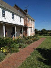 | Penn Farm of the Trustees of the New Castle Common | 1.3 miles | 1997 |
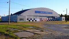 | Air Service, Inc. Hangar at Bellanca Airfield | 1.6 miles | 2005 |
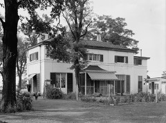 | Swanwyck | 1.6 miles | 1977 |
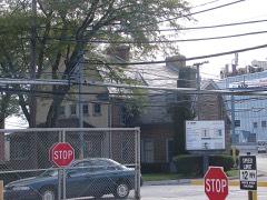 | Joseph Tatnall House | 1.9 miles | 1993 |
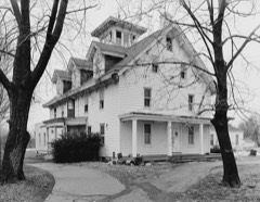 | Lobdell Estate, Minquadale Home | 1.9 miles | 1973 |
| National Archives record | The nomination case file for reference 100004513 in Record Group 79. |
| New Castle County | All 411 listed properties in this county. |