Block
From the record
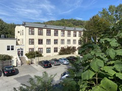
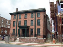
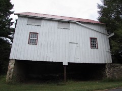
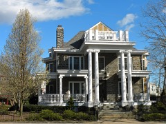
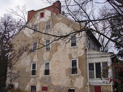
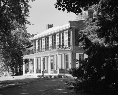
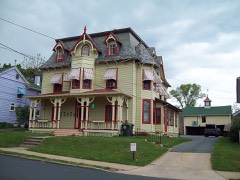
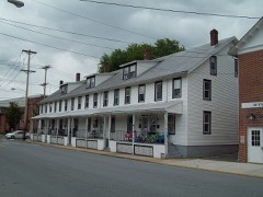
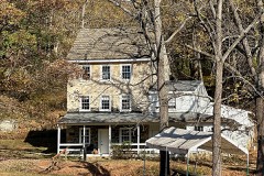
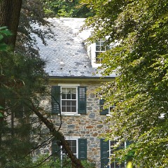
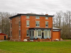
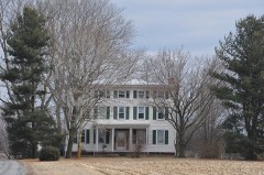
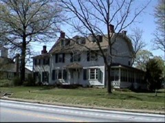
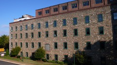
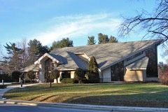
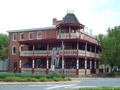
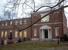
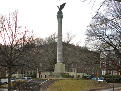
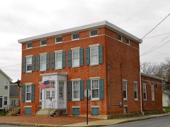
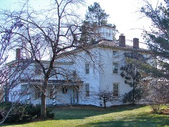
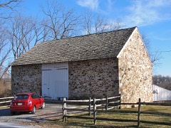
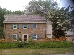
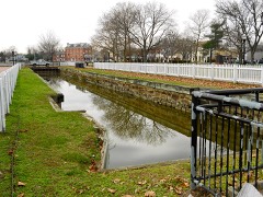
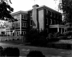
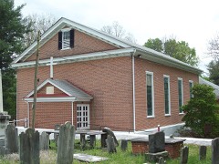
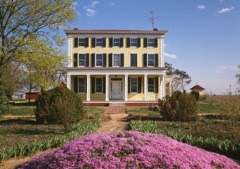
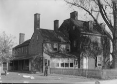
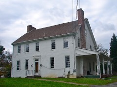
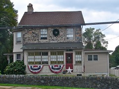
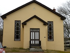
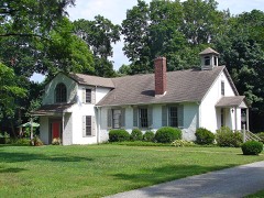
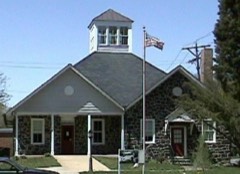
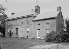
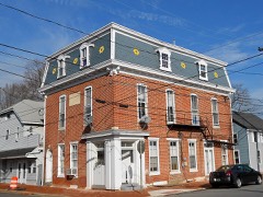
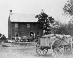
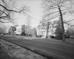
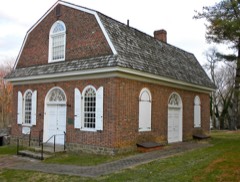
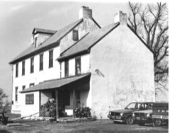
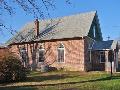
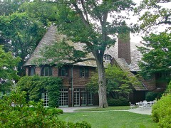
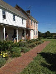
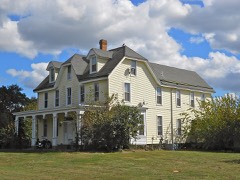
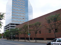
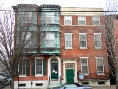
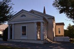
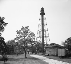
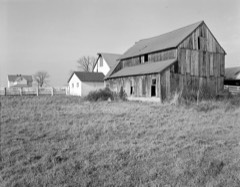
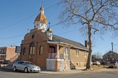
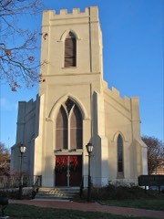
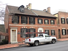
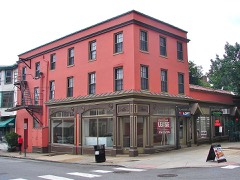
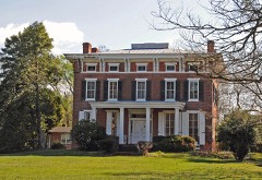
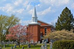
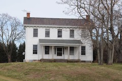
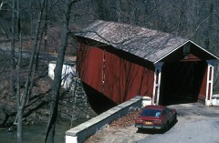
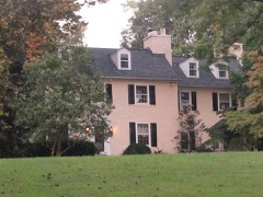
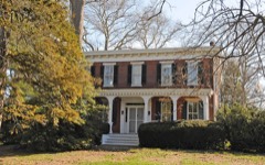
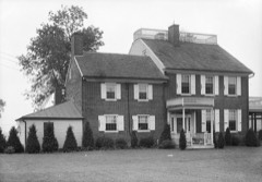
411 National Register listings published here, 12 of them National Historic Landmarks.
Sources: the county history on the Internet Archive · the National Register database, National Park Service
183 topographic sheets cover 779 settlements here, and 411 properties are on the National Register of Historic Places.
411 National Register listings published here, 12 of them National Historic Landmarks.
Sources: the county history on the Internet Archive · the National Register database, National Park Service
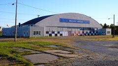
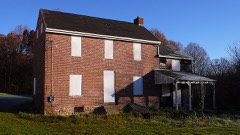
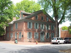
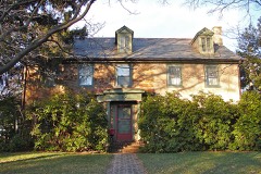
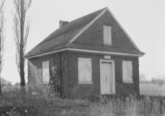
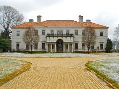
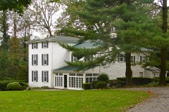
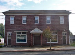
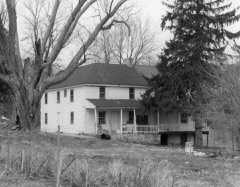
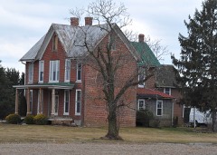
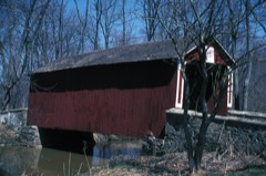
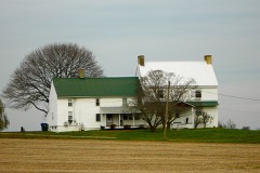
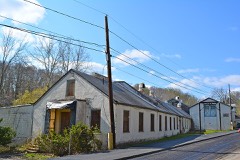
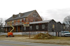
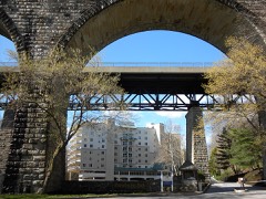
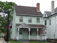
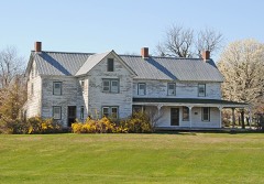
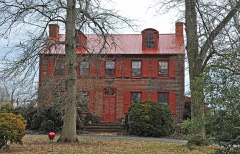
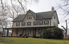
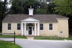
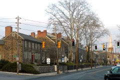
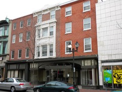
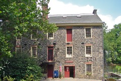
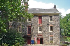
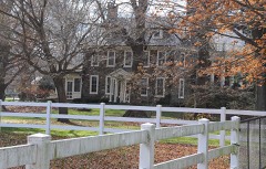
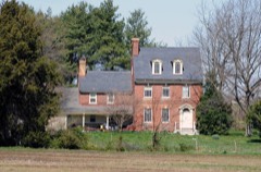
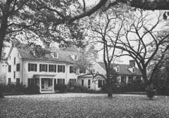
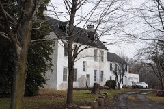
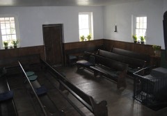
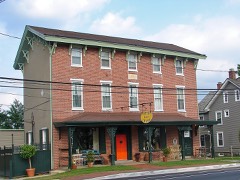
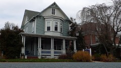
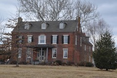
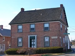
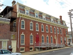
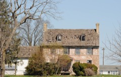
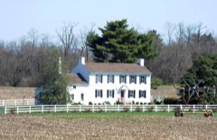
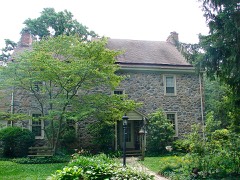
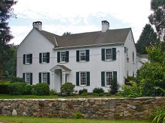
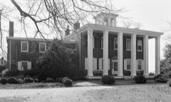
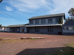
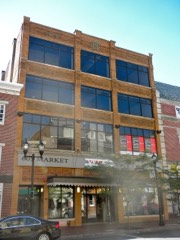
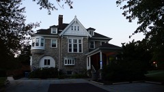
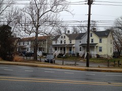
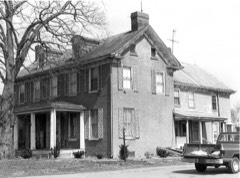
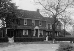
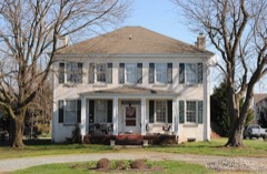
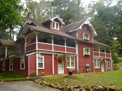
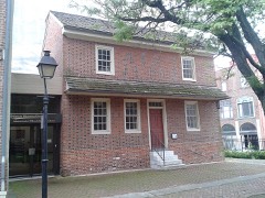
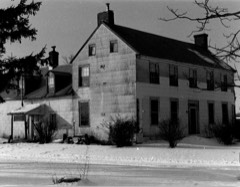
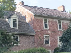
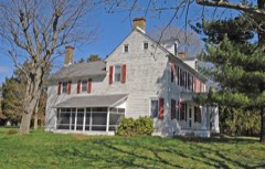
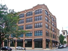
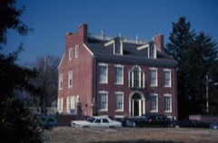
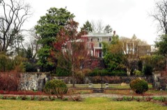
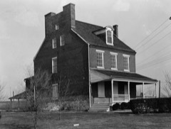
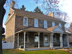
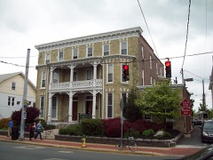
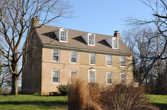
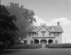
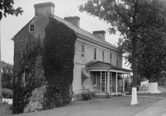
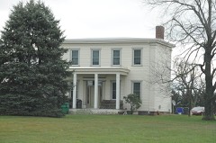
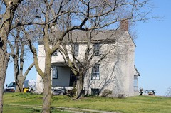
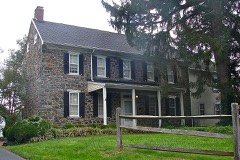
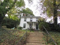
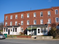
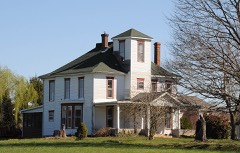
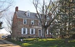
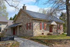
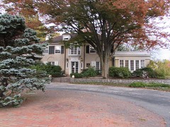
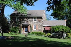
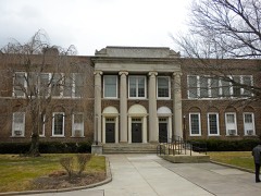
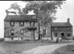
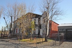
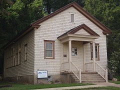
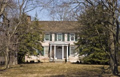
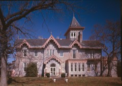
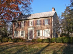
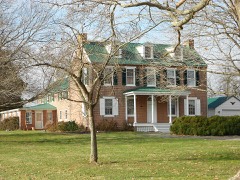
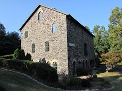
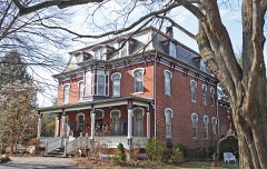
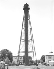
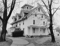
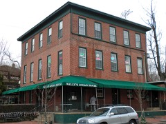
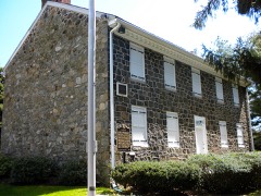
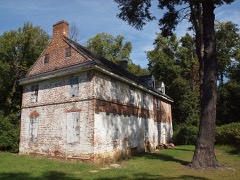
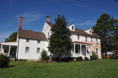
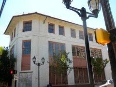
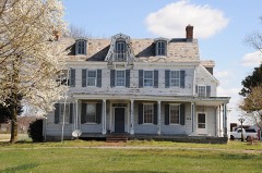
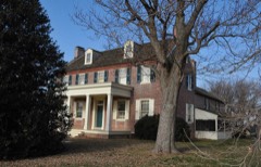
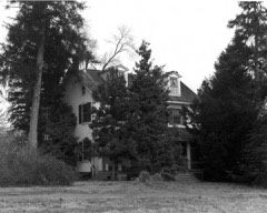
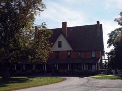
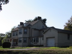
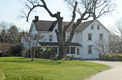
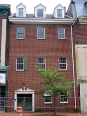
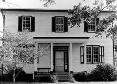
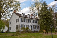
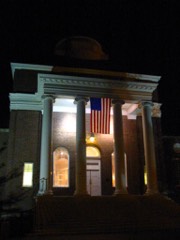
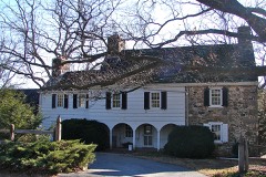
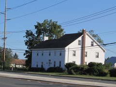
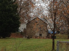
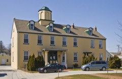
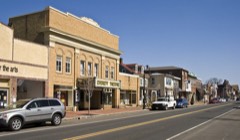
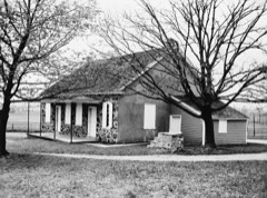
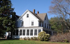
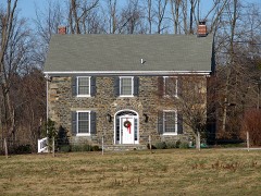
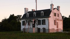
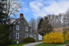
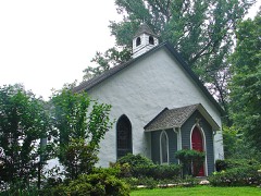
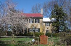
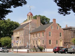
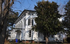
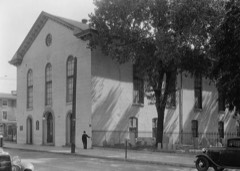
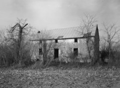
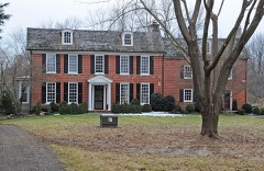
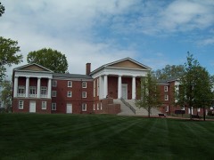
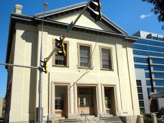
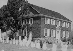
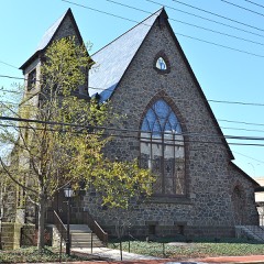
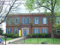
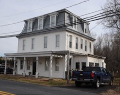
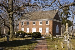
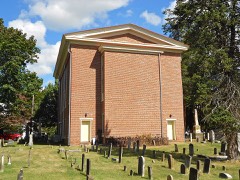
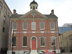
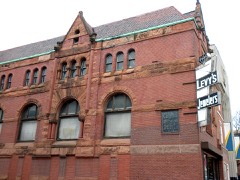
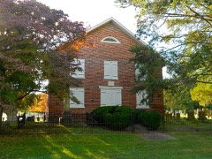
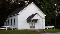
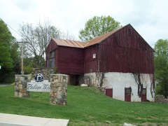
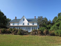
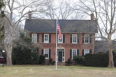
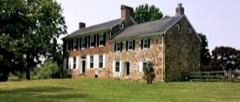
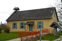
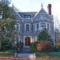
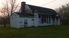
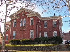
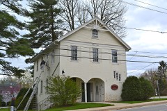
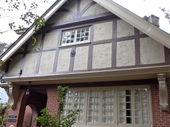
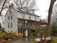
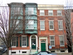
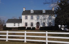
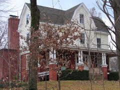
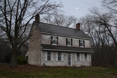
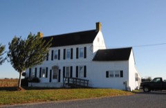
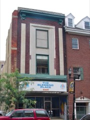
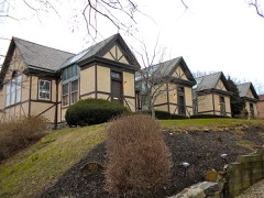
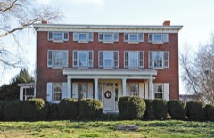
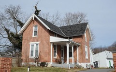
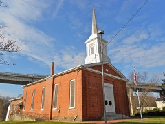
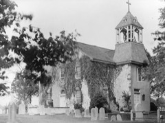
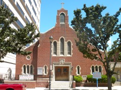
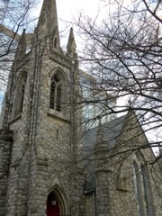
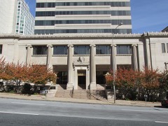
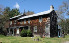
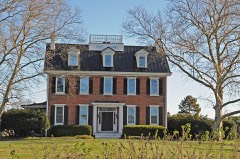
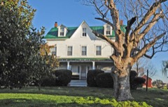
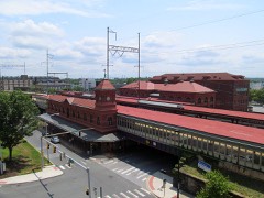
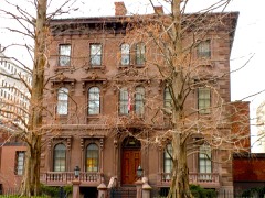
Every property in this county listed on the National Register of Historic Places, with the year it was listed and the federal nomination document.
Every wildfire the federal occurrence database records inside this county: 30 of them, burning about 25 acres. 1 started naturally and 1 was recorded as arson. Each settlement page carries the fires within five miles of it.
| Reported cause | Fires |
|---|---|
| Missing data/not specified/undetermined | 24 |
| Smoking | 3 |
| Arson/incendiarism | 1 |
| Equipment and vehicle use | 1 |
| Natural | 1 |
The five largest, by the area the report gives. One of them was set deliberately.
| Date | Cause | Size | Reported by | Name on the report |
|---|---|---|---|---|
| 26 April 2016 | Smoking | 10 acres | Delaware Forest Service | SAWMILL |
| 17 April 2005 | Missing data/not specified/undetermined | 4.0 acres | Delaware State Fire Marshal's Office | not named |
| 3 July 2016 | Arson/incendiarism | 3.0 acres | Delaware Forest Service | FISH |
| 16 November 2005 | Missing data/not specified/undetermined | 1.0 acres | Delaware State Fire Marshal's Office | not named |
| 21 May 2004 | Missing data/not specified/undetermined | 1.0 acres | Delaware State Fire Marshal's Office | not named |
| 8 May 2005 | Missing data/not specified/undetermined | 1.0 acres | Delaware State Fire Marshal's Office | not named |
| 11 April 2004 | Missing data/not specified/undetermined | under an acre | Delaware State Fire Marshal's Office | not named |
| 19 April 2004 | Missing data/not specified/undetermined | under an acre | Delaware State Fire Marshal's Office | not named |
Every settlement page carries the fires within five miles of it - see the settlement index below.
The NOAA Storm Events Database holds 874 reports for this county, causing 6 deaths, 31 injuries and about $40,051,780 in recorded property damage. Each settlement page carries the reports that name it.
| Kind of event | Reports |
|---|---|
| Thunderstorm Wind | 444 |
| Flash Flood | 156 |
| Hail | 73 |
| Flood | 71 |
| Lightning | 49 |
| Heavy Rain | 39 |
| Tornado | 28 |
| Funnel Cloud | 13 |
| Waterspout | 1 |
The most serious of them, by death, then injury, then recorded damage. The accounts are quoted exactly as the forecast office filed them.
| When | Event | Place named | Harm | What the report says |
|---|---|---|---|---|
| September 1999 | Flash Flood | Countywide | 2 killed, 1 hurt, $8,000,000 | no account filed |
| August 2011 | Flash Flood | Milford Xrds | 2 killed | no account filed |
| June 2025 | Thunderstorm Wind | Silverbrook | 1 killed, 1 hurt | A tree was blown down onto a vehicle traveling in the right westbound lane of Lancaster Pike approaching Hedgerow Place in Wilmington. There were two occupants in the vehicle. |
| July 1995 | Thunderstorm Wind | not stated | 1 killed | The oppressive heat and humidity during the day on the 15th set the stage for a complex of severe thunderstorms the early morning of the 16th. A wide swath of downed trees and power lines occurred in northern parts of the county, mostly to the north of the Chesapeake and Delaware Canals. A 52-year-old male in the Limestone Hills Development of Pike Creek was killed in his sleep as the severe thunderstorm snapped a 70-foot tall tree in half plunging it into his bedroom. His wife was unharmed. About 35,000 Delmarva Power and Light customers lost power. More than 10,000 still did not have it restored Monday morning the 17th. It was the utility's worst power outage since the March snow storm of 1958. Lightning ignited a fire that badly damaged two stores in the old post office in Hockessin Corner. |
| September 1979 | Tornado (F2) | not stated | 5 hurt, $250,000 | no account filed |
| August 2012 | Lightning | Belvidere | 4 hurt | A family of four people were struck and injured by lightning outside of the Cranston Hall Apartments in Prices Corner (Christina Hundred). They were sitting under a tree when they were indirectly struck. The 30-year-old male, 28-year-old female, 7-year-old boy and 1-year-old boy were transported to Christiana Hospital, where they were admitted and treated for minor injuries. |
| July 2024 | Thunderstorm Wind | Monroe Park | 2 hurt | Live local news coverage report of 2 people rushed to hospital after tree fell onto a home in Wilmington. Time estimated. Exact location not known. |
| August 2019 | Lightning | Roseville Park | 2 hurt | A house was struck by lightning. Two men outside in close proximity were seriously injured. The lightning struck in clear air several miles away from a thunderstorm. Time estimated by radar. |
| April 2017 | Thunderstorm Wind | Greenville | 2 hurt | A tree fell onto a car due to thunderstorm winds, Two people were injured in the car. |
| September 2003 | Flash Flood | North Portion | 1 hurt, $16,100,000 | no account filed |
| June 1989 | Tornado (F2) | not stated | 1 hurt, $2,500,000 | no account filed |
| November 1989 | Tornado (F1) | not stated | 1 hurt, $250,000 | no account filed |
| March 1976 | Tornado | not stated | 1 hurt, $250,000 | no account filed |
| July 2010 | Flash Flood | Holly Oak | 1 hurt, $50,000 | Thunderstorms with torrential downpours caused flash flooding in and around Wilmington. The flooding forced the safe evacuation of nearly three dozen infant and toddlers at an Elsmere day care center on Kirkwood Highway. The highway had up to four feet of water on it and was closed between Maple Avenue and Saunders Road. A bakery was also damaged by the flooding as were about 14 vehicles at the Veterans Affair Medical Center. In Wilmington, fire fighters made three water rescues. A man in his 50s was injured trying to rescue a woman stuck in flood waters. Three major roadways were closed including Governor Printz Boulevard. Elsewhere flooding along the Noneguch Creek near New Castle flooded Airport Road and several vehicles were stuck in high water in New Castle. The two day Doppler Radar storm total estimates reached 6 to 8 inches in the area. |
| June 2025 | Thunderstorm Wind | Granogue | 1 hurt | Tree fell onto a car resulting in an injury to the occupant. Time estimated from radar. |
| June 2024 | Thunderstorm Wind | Hockessin | 1 hurt | Video sent in of trees down on tents at a festival, causing the tents to collapse. Time estimated from radar. |
| May 2019 | Thunderstorm Wind | Claymont | 1 hurt | A tree fell onto a tent at a church festival. The tree struck and injured a musician playing inside the tent at the time. Time estimated from radar. |
| June 2016 | Thunderstorm Wind | Dunleith | 1 hurt | A Large tree was uprooted due to thunderstorm winds. The tree landed on a car located on Thompson Station Road and Brandywine Creek Road which trapped a female driver, who was injured. |
| December 2009 | Flood | Coochs Bridge | 1 hurt | Runoff from the heavy rain produced flooding along a couple of creeks and rivers in New Castle County during the morning and afternoon of the 9th along with poor drainage flooding. In Wilmington, a woman and her three children were rescued from flooding on 12th Street. Another water rescue occurred on Governor Printz Boulevard. In Stanton, an injured man was rescued from underpass flooding. Sections of Delaware State Routes 1 and 16 were closed in the county. ||The Christina River at Coochs Bridge was above its 10.5 foot flood stage from 626 a.m. EST through 215 p.m. EST on the 9th. It crested at 11.96 feet at 10 a.m. EST. The White Clay Creek near Newark was above its 13 foot flood stage from 841 a.m. EST through 240 p.m. EST. It crested at 14.15 feet at Noon EST. The Red Clay Creek at Wooddale was above its 7 foot flood stage at 856 a.m. EST through 1212 p.m. EST. It crested at 7.47 feet at 1030 a.m. EST. Farther downstream, the Red Clay Creek at Stanton was above its 15 foot flood stage from 853 a.m. EST through 152 p.m. EST on the 9th. It crested at 15.67 feet at 1130 a.m. EST. ||Event precipitation totals included 2.30 inches at the New Castle County Airport, 2.28 inches in Newport, 2.14 inches in Newark, 2.11 inches in Middletown and 2.08 inches in Bear. |
| August 2008 | Heavy Rain | Newark | 1 hurt | Heavy rain caused a roof collapse at the Towne Court Apartments on Thorn Lane just outside of Newark. Temporary roofing was in place and collapsed because of the rain. Three of the four apartments that were flooded were occupied. One person was injured and taken to the hospital. The Newark Agricultural Farm measured 0.39 inches, most of which fell within an hour. |
| July 2004 | Flash Flood | Countywide | 1 hurt | no account filed |
| January 1999 | Flash Flood | North Portion | 1 hurt | no account filed |
| November 1989 | Thunderstorm Wind | not stated | 1 hurt | no account filed |
| September 2021 | Flash Flood | Coochs Bridge | $3,600,000 | Widespread flash flooding occurred in New Castle County with many road closures. Several rivers and creeks in the county overflowed their banks, including the Christina River, the Red Clay Creek and the White Clay Creek. More than 200 residences were affected by the flooding. |
| June 1988 | Tornado (F1) | not stated | $2,500,000 | no account filed |
| September 2004 | Tornado (F2) | (Ilg)Wilmington Arpt | $1,000,000 | no account filed |
| October 2010 | Flood | Milford Xrds | $600,000 | Flooding started early in the morning on October 1st. Governor Jack Markell declared a limited state of emergency in Delaware because of the flooding in Edgemoor.. The worst flood damage occurred in Edgemoor when the Shellpot Creek flooded and tore away a small bridge and gas lines on Colony Boulevard between 2 a.m. EDT and 3 a.m. EDT on the 1st and trapped about 1000 residents in their homes at the Summit Chase Colony North and Las Casas Apartments. In Christina, flooding along the Christina River forced the evacuation of about 25 families along East Main Street. Nineteen families were evacuated from the Kingsmill Mobile Home Park in Kirkwood after a small creek flooded. In Hockessin, houses near Mill Creek had basement flooding. The basement wall of a home on Halcon Drive near New Castle collapsed. Dozens of roads throughout the county flooded and there were numerous water rescues that included ones in Stanton, Newport and Wilmington. A mudslide closed Delaware State Route 141 near Newport. Two school districts closed for the day.| |The Brandywine Creek at Wilmington was above its 16.5 foot flood stage from 335 a.m. EDT through 1122 p.m. EDT on the 1st. It crested at 17.69 feet at 6 p.m. EDT. The Christina River at Coochs Bridge had major flooding, had its fourth highest crest on record and was the highest crest since September of 2004 with the remnants of Hurricane Jeanne. The river was above its 10.5 foot flood stage from 112 a.m. EDT through 1002 a.m. EDT on the 1st. It crested at 13.06 feet at 615 a.m. EDT. The Red Clay Creek at Wooddale had major flooding and tied the fourth highest crest on record. It was the highest crest since June of 2006. The creek was above its 7 foot flood stage from 210 a.m. EDT through 1057 a.m. EDT on the 1st. It crested at 10.91 feet at 745 a.m. EDT. Farther downstream, the Red Clay Creek at Stanton had moderate flooding and its fourth highest crest on record. It was its highest crest since September of 2004 with the remnants of Hurricane Jeanne. The creek was above its 15 foot flood stage from 123 a.m. EDT through 1252 p.m. EDT on the 1st. It crested at 19.84 feet at 845 a.m. EDT. The White Clay Creek at Newark was above its 13 foot flood stage from 133 a.m. EDT through 136 p.m. EDT on the 1st. It crested at 16.0 feet at 445 a.m. EDT. ||Event precipitation totals included 9.32 inches in Claymont, 7.89 inches in Newport, 7.83 inches in Middletown and 7.58 inches at the New Castle County Airport. |
| August 2009 | Thunderstorm Wind | Newark | $500,000 | A squall line of severe thunderstorms produced wind damage across New Castle County, with the hardest hit areas in the northern part of the county. Numerous trees were uprooted and damaged, especially Tulip Poplars. In Newark, a couple of trees fell on homes and the siding was ripped away from one apartment building. In and around Wilmington, a large tree crashed through a home in Westover Hills. The Hagley Museum and Library lost eight trees. Elsmere and Hockessin were among the communties that were hardest hit by power outages. |
| July 2008 | Lightning | Kirkwood | $500,000 | A lightning strike and ensuing fire destroyed a home just east of Lump's Pond on Mariners Way in New Castle County. A firefighter suffered minor burns. Another lightning strike in Lump's Pond disrupted the county police radio communication. Communications was switched to a back-up system. |
| June 2004 | Lightning | Hockessin | $500,000 | no account filed |
| August 2011 | Thunderstorm Wind | Hockessin | $250,000 | A severe thunderstorm knocked down numerous trees in the Hockessin, Coffee Run, Westminster, Canterbury Hills and Bella Vista areas of Mill Creek Hundred. A couple of homes and vehicles were damaged by the fallen trees. In the Westmister Development, old, massive trees were knocked down. Three homes on Ambleside Drive were so badly damaged by fallen trees that they were condemned. One garage with three Cadillacs within it was crushed on the same street. In Canterbury Hills, about fifty trees alone were knocked down and caused minor damage to homes. |
| June 2009 | Thunderstorm Wind | (Ilg)Wilmington Arpt | $250,000 | A severe thunderstorm produced a wind gust to 76 mph at the New Castle County Airport. The same severe thunderstorm caused a partial roof collapse at an industrial park near New Castle County Airport, knocked down large trees in New Castle, knocked down a tree onto a vehicle in Wilmington and capsized seven boats at Battery Park on the Delaware River. The worst reported wind damage was the partial collapse of the roof of an auto parts storage facility near the airport. About a 200 foot section of the roof was torn away, another piece collapsed into the building. Pieces of the roof landed in the back yards of homes on Bunker Hill Road. Two front doors were also blown away. Two homes in New Castle suffered roof damage after trees fell on them. There were about thirty weather related incidences (downed trees and wires and transformers) reported throughout New Castle County. No injuries were reported. About 15,000 homes and businesses lost power because of the severe thunderstorm. Power was fully restored by the 3rd. |
| October 1990 | Tornado (F2) | not stated | $250,000 | no account filed |
| August 1979 | Tornado (F1) | not stated | $250,000 | no account filed |
| July 2015 | Tornado (EF0) | Garfield Park | $200,000 | An EF-0 tornado occurred in eastern New Castle County in Minquadale (Brandywine Hundred). | |The tornado touched down near a trailer park off of New Castle Avenue. Eight units of the mobile home village and apartments on New Castle Avenue were damaged. A downed transformer went through one bedroom. Shingles and gutters were ripped from other homes. Six families were displaced and the Red Cross opened an emergency shelter at William Penn High School. The tornado damage extended eastward with a telephone pole sheered off and a tree down on Revis Avenue. Farther east, additional damage occurred on Harbor View Drive where roof damage and a wall collapse occurred at an industrial park. Several trees were also knocked down on Dock View Drive. ||The EF-0 tornado path length was about half a mile with a maximum path width of 75 yards. The estimated maximum wind speeds were 65 mph. |
| July 2007 | Lightning | Newark | $200,000 | As thunderstorms moved across New Castle County, lightning caused damage to three structures. In Newark, in the Academy Hill Development, a lightning strike started a fire in the basement of one home. The home filled with smoke. It took twenty-five firefighters about forty minutes to extinguish the fire. Damage was estimated at $5,000. In New Castle, a lightning strike punched holes in an Artesian Water Tower on School Lane. It caused the tower to leak. In Delaware City, a lightning strike created a hole in the roof of a home on East Harvest Drive. The ensuing fire consumed a large portion of the roof as well as the master bedroom. Damage was estimated at $150,000. |
| July 2009 | Lightning | Bear | $125,000 | A lightning strike caused a townhouse fire on Creekside Court in the Christine Hollow Development in Bear. The fire burned the roof of the townhouse and adjacent townhouses also suffered minor damage. The townhome residents were displaced. Damage was estimated at $125,000. |
| June 2015 | Thunderstorm Wind | Lancaster Vlg | $100,000 | A severe thunderstorm tore off the roof of a third story building within Wilmington. Wind damage occurred along Elm and Madison Streets within the city. |
| June 2012 | Thunderstorm Wind | Newark | $100,000 | A gust front outrunning a cluster of severe thunderstorms entered near Newark in western New Castle County at approximately 11:57 pm EDT on the 29th. This gust front produced damaging wind gusts estimated from 65 to 70 mph as it traversed eastward across the county. Within approximately 20 minutes of the gust front passage, a potent line of severe thunderstorms tracked eastward into New Castle County. One thunderstorm cell in particular experienced rapid intensification and expansion as it tracked into New Castle County. Destructive wind gusts, estimated near 75 mph, resulted in tree and power line damage across the county. Multiple downed trees were reported in Middletown and Odessa. In addition, power poles were snapped by wind gusts estimated between 70 and 75 mph in Middletown. Severe thunderstorms exited eastern New Castle County, including Delaware City, at approximately 12:50 am EDT on the 30th. |
| June 2012 | Thunderstorm Wind | Glasgow | $100,000 | A severe thunderstorm produced wind damage across central New Castle County, mainly just north of the Chesapeake and Delaware Canal. Downed trees damaged homes in the Fieldstone Crossing and Hickory Woods Developments in the Red Lion and Bear areas of Red Lion and New Castle Hundreds. Trees were reported knocked down along State Route 72, at the intersection of State Routes 72 and 71 and from Woods Road to School House Road near Bear. Farther to the east, trees and poles were also knocked down along Delaware State Route 9 in Delaware City. There was also roof damage to a couple of structures. A mesonet site measured a wind gust of 62 mph in the city. |
| August 2011 | Thunderstorm Wind | Lancaster Vlg | $100,000 | A severe thunderstorm tore the entire roof off a home on North Harrison Street in Wilmington. About a dozen trees were knocked down throughout the city. Five or six telephone poles were knocked down on Lancaster Avenue and one tree fell onto the northbound lanes of Interstate 95. |
| August 2008 | Thunderstorm Wind | Kentmere | $100,000 | A severe thunderstorm tore down several large oak and sycamore trees at the Brandywine Zoo in Wilmington. The downed trees damaged several exhibits. The In Flight exhibit was destroyed. A downed tree also punctured a hole in the roof af the animal hospital and damaged a storage shed. No animals were injured. The zoo remained closed until the 13th. |
| May 2006 | Lightning | Townsend | $100,000 | no account filed |
| July 2003 | Lightning | Port Penn | $100,000 | no account filed |
| September 2000 | Lightning | Brandywine | $100,000 | no account filed |
| June 2004 | Thunderstorm Wind | Middletown | $75,000 | no account filed |
| July 2025 | Flash Flood | Belvidere | $50,000 | Flash flooding was reported across portions of Wilmington. Both streets and buildings were flooded. People were stranded. |
| August 2024 | Flash Flood | Porter | $50,000 | Multiple vehicles stuck in flood waters in the communities of Kirkwood and Red Lion, including some water rescues. Additionally, a trailer park had to be evacuated. |
| June 2013 | Thunderstorm Wind | Brandywine | $50,000 | A severe thunderstorm knocked down approximately a dozen trees in the Concord Hills section of Brandywine Hundred near U.S. Route 202. Some of the downed trees damaged vehicles and homes. One home on South Rockfield Drive had its roof, garage and gutter damaged by a downed tree. Ramsey Road and Thompson Bridge Road were closed because of multiple downed trees. In addition, numerous trees were knocked down along Naamans Road. No injuries were reported. |
| August 2011 | Thunderstorm Wind | Chalfonte | $50,000 | A severe thunderstorm knocked down several trees north of Wilmington in Brandywine Hundred. A downed tree so badly damaged a home on Garfield Avenue in the Claymont area that it was condemned. |
| July 2005 | Lightning | Middletown | $50,000 | no account filed |
| June 2003 | Lightning | Newark | $50,000 | no account filed |
| April 2002 | Lightning | Odessa | $50,000 | no account filed |
| September 1993 | Tornado (F1) | Summit Bridge | $50,000 | no account filed |
| September 1993 | Tornado (F2) | Mount Pleasant | $50,000 | no account filed |
| June 2015 | Lightning | Brookside | $30,000 | Lightning struck the roof of a Brookside Park house on Marlin Drive. It sparked a fire that caused about $30,000 in damage to the home and rendered it uninhabitable. The family of four were not injured and were assisted by the Red Cross in finding emergency shelter. |
| June 2015 | Thunderstorm Wind | Holly Oak | $30,000 | A severe thunderstorm knocked down several trees in the Minquadale section of New Castle Hundred. A couple of homes were damaged by the fallen trees. |
| June 2013 | Thunderstorm Wind | Wilmington | $25,000 | A severe thunderstorm knocked down a couple of trees in Wilmington. |
| August 2013 | Thunderstorm Wind | Newark | $25,000 | A severe thunderstorm that moved through Newark sheared the bricks off of one building and also damaged shutters and windows at the Studio Green Apartments. Trees and power lines were also knocked down along Elkton Road. |
| July 2012 | Lightning | Brandywine Spgs | $25,000 | A lightning strike and ensuing fire displaced more than a dozen residents in Marhsallton. (Mill Creek Hundred). Lightning struck the rooftop of a three-story building in the Villages of Clay Creek along Melson Road. The lightning strike also hit a water pipe which hampered efforts to douse the flames. |
The Survey's mineral resources record lists 22 workings inside this county. 9 still produce and 13 are closed or unrecorded. Each settlement page carries the workings within five miles of it.
| Commodity | Workings |
|---|---|
| Sand and Gravel, Construction | 11 |
| Iron | 3 |
| Clay | 2 |
| Sulfur | 1 |
| Chromium | 1 |
| Titanium | 1 |
| Aluminum | 1 |
| Fluorine-Fluorite | 1 |
| Titanium, Pigment | 1 |
The least common of them first, because a county's hundredth gravel pit says nothing its first ten did not.
| Where | Site | Commodity | Status | Recorded |
|---|---|---|---|---|
| American Minerals/ Wilmington, De. | Chromium | Past Producer | ||
| Delaware Plant Getty | Sulfur | Plant | ||
| Edgemoor Plant Ti | Titanium, Pigment | Plant | 1956 | |
| New Castle Plant C-E Minerals | Aluminum | Plant | ||
| Wilmington Plant Dupont | Titanium | Plant | ||
| Wilmington Plantozark-Mahoning | Fluorine-Fluorite | Plant | ||
| Delaware Brick Co. Pit | Clay | Past Producer | ||
| Delaware Brick Co. Pit and Mill | Clay | Past Producer | Sedimentary | |
| Chestnut Hill Mine | Iron | Past Producer | ||
| Iron Hill Mine | Iron | Past Producer | ||
| Phoenix Steel/ Claymont, De. | Iron | Plant | ||
| Constructors Sand and Gravel Pit | Sand and Gravel, Construction | Past Producer | Sedimentary | |
| Delaware Sand and Gravel Pit | Sand and Gravel, Construction | Past Producer | Sedimentary | |
| Delaware Sand and Gravel Pit | Sand and Gravel, Construction | Past Producer | ||
| Freeway Pit | Sand and Gravel, Construction | Past Producer | Sedimentary | |
| Freeway Sand Pit | Sand and Gravel, Construction | Past Producer | ||
| Route 40 Farm | Sand and Gravel, Construction | Producer | ||
| Whittington Sand & Gravel Pit & Mil | Sand and Gravel, Construction | Past Producer | Sedimentary | |
| Whittington Sand Pit | Sand and Gravel, Construction | Producer | ||
| Wilson Pit | Sand and Gravel, Construction | Producer | ||
| Woodlawn Sand & Gravel Pit | Sand and Gravel, Construction | Past Producer | ||
| Woodlawn Sand & Gravel Pit & Mill | Sand and Gravel, Construction | Past Producer | Sedimentary |
The part of each published history that is about one town: 1 chapter, each reproduced complete.
| Town | Chapter | From | Length |
|---|---|---|---|
| Wilmington | History | A History of the Original Settlements on the Delaware : from Its Discovery by Hudson to the Colonization Under William Penn : to Which Is Added an Account of the Ecclesiastical Affairs of the Swedish Settlers, and a History of Wilmington, from Its First Settlement to the Present Time (1846) | 97,702 words in 7 parts |
Named settlements recorded in the Geographic Names Information System, each with the topographic sheets covering it. Villages, hamlets and abandoned places alike. Each is shown with the nearest named watercourse or landform and the survey quadrangle it falls on.
Brandywine census division · 19703 · On Naaman Creek · Marcus Hook quadrangle
44 sheets, 1894 to 1995
Middletown-Odessa census division · 19709 · On Joy Run · Saint Georges quadrangle
32 sheets, 1904 to 1993
Brandywine census division · 19806 · On Alapocas Run · Wilmington North quadrangle
35 sheets, 1901 to 1997
Lower Christiana census division · 19805 · Near Coopers Island · Wilmington South quadrangle
33 sheets, 1904 to 1997
Lower Christiana census division · 19808 · On Hyde Run · Newark East quadrangle
32 sheets, 1904 to 1993
Lower Christiana census division · 19808 · On Hyde Run · Newark East quadrangle
32 sheets, 1904 to 1993
Pike Creek-Central Kirkwood census division · 19808 · On Mill Creek · Newark East quadrangle
32 sheets, 1904 to 1993
Middletown-Odessa census division · 19977 · Clayton quadrangle
30 sheets, 1899 to 1993
Newark census division · 19711 · On East Branch Christina River · Newark West quadrangle
38 sheets, 1898 to 1992
Brandywine census division · 19703 · On South Branch Naaman Creek · Marcus Hook quadrangle
44 sheets, 1894 to 1995
Lower Christiana census division · 19807 · On Hyde Run · Wilmington North quadrangle
35 sheets, 1901 to 1997
Brandywine census division · 19703 · On South Branch Naaman Creek · Marcus Hook quadrangle
44 sheets, 1894 to 1995
Newark census division · 19713 · Near Chestnut Hill · Newark West quadrangle
38 sheets, 1898 to 1992
Pike Creek-Central Kirkwood census division · 19808 · Newark East quadrangle
32 sheets, 1904 to 1993
Brandywine census division · 19703 · On South Branch Naaman Creek · Marcus Hook quadrangle
44 sheets, 1894 to 1995
Piedmont census division · 19707 · On Burrows Run · Kennett Square quadrangle
33 sheets, 1901 to 1993
Lower Christiana census division · 19804 · Near Coopers Island · Wilmington South quadrangle
33 sheets, 1904 to 1997
Lower Christiana census division · 19804 · Near Coopers Island · Wilmington South quadrangle
33 sheets, 1904 to 1997
Brandywine census division · 19806 · On Alapocas Run · Wilmington North quadrangle
35 sheets, 1901 to 1997
Brandywine census division · 19803 · On Alapocas Run · Wilmington North quadrangle
35 sheets, 1901 to 1997
Lower Christiana census division · 19808 · On Chestnut Run · Wilmington South quadrangle
33 sheets, 1904 to 1997
New Castle census division · 19720 · Wilmington South quadrangle
33 sheets, 1904 to 1997
New Castle census division · 19720 · On Tom Creek · Wilmington South quadrangle
33 sheets, 1904 to 1997
Brandywine census division · 19810 · Wilmington North quadrangle
35 sheets, 1901 to 1997
Brandywine census division · 19810 · Wilmington North quadrangle
35 sheets, 1901 to 1997
New Castle census division · 19702 · On Belltown Run · Saint Georges quadrangle
32 sheets, 1904 to 1993
Piedmont census division · 19711 · On Wood Duck Run · Kennett Square quadrangle
33 sheets, 1901 to 1993
Newark census division · 19702 · On Muddy Run · Newark East quadrangle
32 sheets, 1904 to 1993
Brandywine census division · 19803 · On Turkey Run · Wilmington North quadrangle
35 sheets, 1901 to 1997
Pike Creek-Central Kirkwood census division · 19808 · On Hyde Run · Newark East quadrangle
32 sheets, 1904 to 1993
Brandywine census division · 19809 · On Turkey Run · Wilmington North quadrangle
35 sheets, 1901 to 1997
Brandywine census division · 19809 · On Stoney Creek · Marcus Hook quadrangle
44 sheets, 1894 to 1995
Brandywine census division · 19809 · On Stoney Creek · Marcus Hook quadrangle
44 sheets, 1894 to 1995
Lower Christiana census division · 19804 · On Chestnut Run · Wilmington South quadrangle
33 sheets, 1904 to 1997
Lower Christiana census division · 19804 · On Chestnut Run · Wilmington South quadrangle
33 sheets, 1904 to 1997
Piedmont census division · 19711 · On Wood Duck Run · Kennett Square quadrangle
33 sheets, 1901 to 1993
Piedmont census division · 19707 · Near Horseshoe Hill · Kennett Square quadrangle
33 sheets, 1901 to 1993
Lower Christiana census division · 19804 · On Chestnut Run · Wilmington South quadrangle
33 sheets, 1904 to 1997
Middletown-Odessa census division · 19709 · Saint Georges quadrangle
32 sheets, 1904 to 1993
Brandywine census division · 19703 · On South Branch Naaman Creek · Marcus Hook quadrangle
44 sheets, 1894 to 1995
Brandywine census division · 19810 · Wilmington North quadrangle
35 sheets, 1901 to 1997
Newark census division · 19711 · On Pike Creek · Newark East quadrangle
32 sheets, 1904 to 1993
Upper Christiana census division · 19713 · On Pike Creek · Newark East quadrangle
32 sheets, 1904 to 1993
Red Lion census division · 19720 · On Scott Run · Saint Georges quadrangle
32 sheets, 1904 to 1993
Middletown-Odessa census division · 19734 · On Barlow Branch · Clayton quadrangle
30 sheets, 1899 to 1993
Middletown-Odessa census division · 19734 · On Herring Run · Middletown quadrangle
29 sheets, 1899 to 1993
Brandywine census division · 19803 · On Alapocas Run · Wilmington North quadrangle
35 sheets, 1901 to 1997
Brandywine census division · 19803 · On Willow Run · Wilmington North quadrangle
35 sheets, 1901 to 1997
Piedmont census division · 19707 · Near Horseshoe Hill · Kennett Square quadrangle
33 sheets, 1901 to 1993
Brandywine census division · 19803 · Wilmington North quadrangle
35 sheets, 1901 to 1997
Lower Christiana census division · 19804 · On Chestnut Run · Wilmington South quadrangle
33 sheets, 1904 to 1997
Middletown-Odessa census division · 19709 · Saint Georges quadrangle
32 sheets, 1904 to 1993
Piedmont census division · 19707 · Near Horseshoe Hill · Kennett Square quadrangle
33 sheets, 1901 to 1993
Piedmont census division · 19707 · Near Horseshoe Hill · Kennett Square quadrangle
33 sheets, 1901 to 1993
Brandywine census division · 19810 · On Hurricane Run · Wilmington North quadrangle
35 sheets, 1901 to 1997
Brandywine census division · 19803 · On Hurricane Run · Wilmington North quadrangle
35 sheets, 1901 to 1997
Brandywine census division · 19809 · On Perkins Run · Marcus Hook quadrangle
44 sheets, 1894 to 1995
Brandywine census division · 19810 · Wilmington North quadrangle
35 sheets, 1901 to 1997
Wilmington census division · 19802 · On Turkey Run · Wilmington North quadrangle
35 sheets, 1901 to 1997
Brandywine census division · 19803 · On Hurricane Run · Wilmington North quadrangle
35 sheets, 1901 to 1997
Pike Creek-Central Kirkwood census division · 19808 · On Hyde Run · Newark East quadrangle
32 sheets, 1904 to 1993
Piedmont census division · 19808 · On Hyde Run · Newark East quadrangle
32 sheets, 1904 to 1993
Middletown-Odessa census division · 19977 · On Morris Branch · Smyrna quadrangle
32 sheets, 1899 to 1993
Piedmont census division · 19711 · Kennett Square quadrangle
33 sheets, 1901 to 1993
Newark census division · 19711 · On East Branch Christina River · Newark West quadrangle
38 sheets, 1898 to 1992
Upper Christiana census division · 19713 · On Pike Creek · Newark East quadrangle
32 sheets, 1904 to 1993
Upper Christiana census division · 19711 · On Pike Creek · Newark East quadrangle
32 sheets, 1904 to 1993
Piedmont census division · 19707 · Near Horseshoe Hill · Kennett Square quadrangle
33 sheets, 1901 to 1993
Lower Christiana census division · 19808 · On Hyde Run · Wilmington South quadrangle
33 sheets, 1904 to 1997
Lower Christiana census division · 19808 · On Hyde Run · Kennett Square quadrangle
33 sheets, 1901 to 1993
New Castle census division · 19702 · On Belltown Run · Newark East quadrangle
32 sheets, 1904 to 1993
Brandywine census division · 19703 · On South Branch Naaman Creek · Marcus Hook quadrangle
44 sheets, 1894 to 1995
Brandywine census division · 19810 · Marcus Hook quadrangle
44 sheets, 1894 to 1995
Piedmont census division · 19707 · Near Horseshoe Hill · Kennett Square quadrangle
33 sheets, 1901 to 1993
Wilmington census division · 19805 · On Chestnut Run · Wilmington South quadrangle
33 sheets, 1904 to 1997
Piedmont census division · 19707 · Kennett Square quadrangle
33 sheets, 1901 to 1993
Pike Creek-Central Kirkwood census division · 19808 · On Calf Run · Newark East quadrangle
32 sheets, 1904 to 1993
Brandywine census division · 19810 · On Hurricane Run · Wilmington North quadrangle
35 sheets, 1901 to 1997
Pike Creek-Central Kirkwood census division · 19808 · Newark East quadrangle
32 sheets, 1904 to 1993
Brandywine census division · 19810 · On South Branch Naaman Creek · Marcus Hook quadrangle
44 sheets, 1894 to 1995
Brandywine census division · 19803 · On Turkey Run · Wilmington North quadrangle
35 sheets, 1901 to 1997
Brandywine census division · 19803 · Wilmington North quadrangle
35 sheets, 1901 to 1997
New Castle census division · 19720 · Wilmington South quadrangle
33 sheets, 1904 to 1997
Newark census division · 19713 · Near Iron Hill · Newark East quadrangle
32 sheets, 1904 to 1993
Middletown-Odessa census division · 19734 · On Barlow Branch · Clayton quadrangle
30 sheets, 1899 to 1993
Glasgow census division · 19702 · On Muddy Run · Newark East quadrangle
32 sheets, 1904 to 1993
Lower Christiana census division · 19804 · On Chestnut Run · Wilmington South quadrangle
33 sheets, 1904 to 1997
Piedmont census division · 19808 · On Hyde Run · Newark East quadrangle
32 sheets, 1904 to 1993
Lower Christiana census division · 19808 · On Hyde Run · Newark East quadrangle
32 sheets, 1904 to 1993
New Castle census division · 19702 · On Leatherems Run · Newark East quadrangle
32 sheets, 1904 to 1993
Piedmont census division · 19807 · Wilmington North quadrangle
35 sheets, 1901 to 1997
Brandywine census division · 19810 · On Hurricane Run · Wilmington North quadrangle
35 sheets, 1901 to 1997
Middletown-Odessa census division · 19734 · On Sawmill Branch · Smyrna quadrangle
32 sheets, 1899 to 1993
Lower Christiana census division · 19804 · On Chestnut Run · Wilmington South quadrangle
33 sheets, 1904 to 1997
Newark census division · 19711 · On Middle Run · Newark East quadrangle
32 sheets, 1904 to 1993
Brandywine census division · 19810 · On Hurricane Run · Wilmington North quadrangle
35 sheets, 1901 to 1997
Piedmont census division · 19707 · Near Horseshoe Hill · Kennett Square quadrangle
33 sheets, 1901 to 1993
New Castle census division · 19720 · On Nonesuch Creek · Wilmington South quadrangle
33 sheets, 1904 to 1997
New Castle census division · 19720 · On Nonesuch Creek · Wilmington South quadrangle
33 sheets, 1904 to 1997
Newark census division · 19713 · On Middle Run · Newark East quadrangle
32 sheets, 1904 to 1993
Newark census division · 19711 · On Fairfield Run · Newark West quadrangle
38 sheets, 1898 to 1992
Newark census division · 19713 · On Middle Run · Newark East quadrangle
32 sheets, 1904 to 1993
Pike Creek-Central Kirkwood census division · 19711 · On Pike Creek · Newark East quadrangle
32 sheets, 1904 to 1993
Upper Christiana census division · 19702 · On Leatherems Run · Newark East quadrangle
32 sheets, 1904 to 1993
New Castle census division · 19720 · On Nonesuch Creek · Wilmington South quadrangle
33 sheets, 1904 to 1997
Upper Christiana census division · 19702 · On Leatherems Run · Newark East quadrangle
32 sheets, 1904 to 1993
New Castle census division · 19701 · On Leatherems Run · Newark East quadrangle
32 sheets, 1904 to 1993
Upper Christiana census division · 19702 · On Leatherems Run · Newark East quadrangle
32 sheets, 1904 to 1993
Newark census division · 19711 · On East Branch Christina River · Newark West quadrangle
38 sheets, 1898 to 1992
Piedmont census division · 19707 · Near Horseshoe Hill · Kennett Square quadrangle
33 sheets, 1901 to 1993
New Castle census division · 19720 · Wilmington South quadrangle
33 sheets, 1904 to 1997
Brandywine census division · 19703 · On South Branch Naaman Creek · Marcus Hook quadrangle
44 sheets, 1894 to 1995
Brandywine census division · 19703 · On Perkins Run · Marcus Hook quadrangle
44 sheets, 1894 to 1995
Brandywine census division · 19703 · On Perkins Run · Marcus Hook quadrangle
44 sheets, 1894 to 1995
Brandywine census division · 19703 · On Naaman Creek · Marcus Hook quadrangle
44 sheets, 1894 to 1995
Brandywine census division · 19703 · On Perkins Run · Marcus Hook quadrangle
44 sheets, 1894 to 1995
Brandywine census division · 19703 · On Perkins Run · Marcus Hook quadrangle
44 sheets, 1894 to 1995
Lower Christiana census division · 19804 · On Chestnut Run · Wilmington South quadrangle
33 sheets, 1904 to 1997
New Castle census division · 19720 · On Little Mill Creek · Wilmington South quadrangle
33 sheets, 1904 to 1997
Lower Christiana census division · 19805 · Near Coopers Island · Wilmington South quadrangle
33 sheets, 1904 to 1997
Brandywine census division · 19803 · On Turkey Run · Wilmington North quadrangle
35 sheets, 1901 to 1997
Brandywine census division · 19802 · On Matson Run · Wilmington North quadrangle
35 sheets, 1901 to 1997
Brandywine census division · 19810 · On Hurricane Run · Wilmington North quadrangle
35 sheets, 1901 to 1997
Newark census division · 19711 · Near Drummond Hill · Newark East quadrangle
32 sheets, 1904 to 1993
Pike Creek-Central Kirkwood census division · 19808 · On Hyde Run · Kennett Square quadrangle
33 sheets, 1901 to 1993
Piedmont census division · 19707 · Near Horseshoe Hill · Kennett Square quadrangle
33 sheets, 1901 to 1993
Newark census division · 19711 · On West Branch Christina River · Newark West quadrangle
38 sheets, 1898 to 1992
Middletown-Odessa census division · 19734 · On Wisacco Cipus (historical) · Taylors Bridge quadrangle
32 sheets, 1899 to 1999
New Castle census division · 19720 · Wilmington South quadrangle
33 sheets, 1904 to 1997
Lower Christiana census division · 19805 · On Chestnut Run · Wilmington South quadrangle
33 sheets, 1904 to 1997
Brandywine census division · 19803 · On Hurricane Run · Wilmington North quadrangle
35 sheets, 1901 to 1997
Lower Christiana census division · 19804 · On White Clay Creek · Wilmington South quadrangle
33 sheets, 1904 to 1997
Brandywine census division · 19802 · On Alapocas Run · Wilmington North quadrangle
35 sheets, 1901 to 1997
Brandywine census division · 19803 · On Hurricane Run · Wilmington North quadrangle
35 sheets, 1901 to 1997
Brandywine census division · 19803 · On Hurricane Run · Wilmington North quadrangle
35 sheets, 1901 to 1997
Upper Christiana census division · 19713 · On Leatherems Run · Newark East quadrangle
32 sheets, 1904 to 1993
Pike Creek-Central Kirkwood census division · 19808 · On Hyde Run · Newark East quadrangle
32 sheets, 1904 to 1993
Red Lion census division · 19720 · On Pigeon Run · Saint Georges quadrangle
32 sheets, 1904 to 1993
Piedmont census division · 19711 · On Wood Duck Run · Newark East quadrangle
32 sheets, 1904 to 1993
Newark census division · 19713 · On West Branch Christina River · Newark West quadrangle
38 sheets, 1898 to 1992
Brandywine census division · 19810 · Wilmington North quadrangle
35 sheets, 1901 to 1997
Glasgow census division · 19701 · Saint Georges quadrangle
32 sheets, 1904 to 1993
New Castle census division · 19720 · On Nonesuch Creek · Newark East quadrangle
32 sheets, 1904 to 1993
Newark census division · 19711 · On East Branch Christina River · Newark West quadrangle
38 sheets, 1898 to 1992
Brandywine census division · 19809 · On Stoney Creek · Marcus Hook quadrangle
44 sheets, 1894 to 1995
Brandywine census division · 19809 · On Stoney Creek · Marcus Hook quadrangle
44 sheets, 1894 to 1995
Lower Christiana census division · 19808 · On Hyde Run · Newark East quadrangle
32 sheets, 1904 to 1993
Newark census division · 19711 · On East Branch Christina River · Newark West quadrangle
38 sheets, 1898 to 1992
Middletown-Odessa census division · 19709 · Saint Georges quadrangle
32 sheets, 1904 to 1993
Middletown-Odessa census division · 19734 · On Wisacco Cipus (historical) · Taylors Bridge quadrangle
32 sheets, 1899 to 1999
Brandywine census division · 19810 · On South Branch Naaman Creek · Marcus Hook quadrangle
44 sheets, 1894 to 1995
Brandywine census division · 19810 · Wilmington North quadrangle
35 sheets, 1901 to 1997
Brandywine census division · 19810 · Wilmington North quadrangle
35 sheets, 1901 to 1997
Newark census division · 19711 · Near Drummond Hill · Newark East quadrangle
32 sheets, 1904 to 1993
Middletown-Odessa census division · 19734 · On Sawmill Branch · Smyrna quadrangle
32 sheets, 1899 to 1993
Middletown-Odessa census division · 19734 · Middletown quadrangle
29 sheets, 1899 to 1993
Newark census division · 19702 · On Muddy Run · Newark East quadrangle
32 sheets, 1904 to 1993
Brandywine census division · 19803 · On Willow Run · Wilmington North quadrangle
35 sheets, 1901 to 1997
Brandywine census division · 19809 · On Stoney Creek · Marcus Hook quadrangle
44 sheets, 1894 to 1995
Middletown-Odessa census division · 19938 · On Dogwood Branch · Clayton quadrangle
30 sheets, 1899 to 1993
Newark census division · 19711 · On Middle Run · Newark East quadrangle
32 sheets, 1904 to 1993
Red Lion census division · 19706 · On Dragon Creek · Delaware City quadrangle
34 sheets, 1904 to 1999
Piedmont census division · 19807 · Wilmington North quadrangle
35 sheets, 1901 to 1997
Lower Christiana census division · 19804 · Near Coopers Island · Wilmington South quadrangle
33 sheets, 1904 to 1997
Pike Creek-Central Kirkwood census division · 19808 · On Mill Creek · Newark East quadrangle
32 sheets, 1904 to 1993
Brandywine census division · 19803 · On Turkey Run · Wilmington North quadrangle
35 sheets, 1901 to 1997
Brandywine census division · 19803 · On Hurricane Run · Wilmington North quadrangle
35 sheets, 1901 to 1997
Newark census division · 19711 · On West Branch Christina River · Newark West quadrangle
38 sheets, 1898 to 1992
Newark census division · 19711 · On West Branch Christina River · Newark West quadrangle
38 sheets, 1898 to 1992
Brandywine census division · 19810 · On Hurricane Run · Wilmington North quadrangle
35 sheets, 1901 to 1997
Middletown-Odessa census division · 19734 · Clayton quadrangle
30 sheets, 1899 to 1993
New Castle census division · 19720 · On Army Creek · Wilmington South quadrangle
33 sheets, 1904 to 1997
Newark census division · 19711 · Near Drummond Hill · Newark East quadrangle
32 sheets, 1904 to 1993
Newark census division · 19711 · Near Drummond Hill · Newark East quadrangle
32 sheets, 1904 to 1993
Pike Creek-Central Kirkwood census division · 19808 · On Hyde Run · Newark East quadrangle
32 sheets, 1904 to 1993
Pike Creek-Central Kirkwood census division · 19808 · On Hyde Run · Newark East quadrangle
32 sheets, 1904 to 1993
Pike Creek-Central Kirkwood census division · 19808 · On Hyde Run · Newark East quadrangle
32 sheets, 1904 to 1993
New Castle census division · 19801 · On Little Mill Creek · Wilmington South quadrangle
33 sheets, 1904 to 1997
Pike Creek-Central Kirkwood census division · 19808 · On Hyde Run · Newark East quadrangle
32 sheets, 1904 to 1993
Brandywine census division · 19809 · On Shellpot Creek · Marcus Hook quadrangle
44 sheets, 1894 to 1995
New Castle census division · 19720 · On Nonesuch Creek · Newark East quadrangle
32 sheets, 1904 to 1993
New Castle census division · 19720 · On Nonesuch Creek · Newark East quadrangle
32 sheets, 1904 to 1993
Middletown-Odessa census division · 19709 · Saint Georges quadrangle
32 sheets, 1904 to 1993
Middletown-Odessa census division · 19734 · On Sawmill Branch · Smyrna quadrangle
32 sheets, 1899 to 1993
New Castle census division · 19720 · On Little Mill Creek · Wilmington South quadrangle
33 sheets, 1904 to 1997
Pike Creek-Central Kirkwood census division · 19808 · On Pike Creek · Newark East quadrangle
32 sheets, 1904 to 1993
Pike Creek-Central Kirkwood census division · 19808 · Newark East quadrangle
32 sheets, 1904 to 1993
Pike Creek-Central Kirkwood census division · 19808 · On Pike Creek · Newark East quadrangle
32 sheets, 1904 to 1993
New Castle census division · 19720 · On Brandywine Creek · Wilmington South quadrangle
33 sheets, 1904 to 1997
Brandywine census division · 19803 · On Wilson Run · Wilmington North quadrangle
35 sheets, 1901 to 1997
Upper Christiana census division · 19702 · On Leatherems Run · Newark East quadrangle
32 sheets, 1904 to 1993
Brandywine census division · 19809 · On Shellpot Creek · Marcus Hook quadrangle
44 sheets, 1894 to 1995
Brandywine census division · 19809 · On Matson Run · Marcus Hook quadrangle
44 sheets, 1894 to 1995
Brandywine census division · 19809 · On Matson Run · Wilmington North quadrangle
35 sheets, 1901 to 1997
Brandywine census division · 19809 · On Matson Run · Wilmington North quadrangle
35 sheets, 1901 to 1997
Lower Christiana census division · 19805 · On Chestnut Run · Wilmington South quadrangle
33 sheets, 1904 to 1997
Lower Christiana census division · 19804 · On Chestnut Run · Wilmington South quadrangle
33 sheets, 1904 to 1997
Lower Christiana census division · 19805 · On Chestnut Run · Wilmington South quadrangle
33 sheets, 1904 to 1997
Pike Creek-Central Kirkwood census division · 19808 · Near Drummond Hill · Newark East quadrangle
32 sheets, 1904 to 1993
Middletown-Odessa census division · 19709 · Middletown quadrangle
29 sheets, 1899 to 1993
Middletown-Odessa census division · 19734 · On Deep Creek · Middletown quadrangle
29 sheets, 1899 to 1993
Brandywine census division · 19803 · On Willow Run · Wilmington North quadrangle
35 sheets, 1901 to 1997
Brandywine census division · 19803 · On Willow Run · Wilmington North quadrangle
35 sheets, 1901 to 1997
Newark census division · 19711 · On Fairfield Run · Newark West quadrangle
38 sheets, 1898 to 1992
Newark census division · 19711 · On Fairfield Run · Newark West quadrangle
38 sheets, 1898 to 1992
Piedmont census division · 19807 · Near Holly Island · Wilmington North quadrangle
35 sheets, 1901 to 1997
Newark census division · 19711 · Near Drummond Hill · Newark East quadrangle
32 sheets, 1904 to 1993
Lower Christiana census division · 19808 · On Hyde Run · Newark East quadrangle
32 sheets, 1904 to 1993
Lower Christiana census division · 19808 · On Hyde Run · Newark East quadrangle
32 sheets, 1904 to 1993
Piedmont census division · 19808 · On Hyde Run · Newark East quadrangle
32 sheets, 1904 to 1993
Middletown-Odessa census division · 19734 · Near The Rocks · Taylors Bridge quadrangle
32 sheets, 1899 to 1999
New Castle census division · 19720 · Near Coopers Island · Wilmington South quadrangle
33 sheets, 1904 to 1997
Middletown-Odessa census division · 19734 · Middletown quadrangle
29 sheets, 1899 to 1993
Middletown-Odessa census division · 19734 · On Sawmill Branch · Smyrna quadrangle
32 sheets, 1899 to 1993
Middletown-Odessa census division · 19734 · On Barlow Branch · Clayton quadrangle
30 sheets, 1899 to 1993
Lower Christiana census division · 19804 · Near Coopers Island · Wilmington South quadrangle
33 sheets, 1904 to 1997
Brandywine census division · 19803 · On Turkey Run · Wilmington North quadrangle
35 sheets, 1901 to 1997
Lower Christiana census division · 19805 · On Chestnut Run · Wilmington South quadrangle
33 sheets, 1904 to 1997
Brandywine census division · 19810 · Wilmington North quadrangle
35 sheets, 1901 to 1997
Glasgow census division · 19702 · Near Sandy Brae · Newark West quadrangle
38 sheets, 1898 to 1992
Glasgow census division · 19702 · Near Iron Hill · Saint Georges quadrangle
32 sheets, 1904 to 1993
Upper Christiana census division · 19713 · On Leatherems Run · Newark East quadrangle
32 sheets, 1904 to 1993
Upper Christiana census division · 19713 · On Leatherems Run · Newark East quadrangle
32 sheets, 1904 to 1993
Newark census division · 19711 · On West Branch Christina River · Newark West quadrangle
38 sheets, 1898 to 1992
Newark census division · 19711 · Near Drummond Hill · Newark East quadrangle
32 sheets, 1904 to 1993
Lower Christiana census division · 19805 · On Chestnut Run · Wilmington South quadrangle
33 sheets, 1904 to 1997
Middletown-Odessa census division · 19709 · On Scott Run · Saint Georges quadrangle
32 sheets, 1904 to 1993
Middletown-Odessa census division · 19734 · On Deep Creek · Middletown quadrangle
29 sheets, 1899 to 1993
New Castle census division · 19720 · On Little Mill Creek · Wilmington South quadrangle
33 sheets, 1904 to 1997
New Castle census division · 19701 · On Doll Run · Saint Georges quadrangle
32 sheets, 1904 to 1993
Brandywine census division · 19809 · On Turkey Run · Wilmington North quadrangle
35 sheets, 1901 to 1997
New Castle census division · 19702 · On Belltown Run · Saint Georges quadrangle
32 sheets, 1904 to 1993
Glasgow census division · 19702 · On Belltown Run · Saint Georges quadrangle
32 sheets, 1904 to 1993
Lower Christiana census division · 19804 · On Calf Run · Newark East quadrangle
32 sheets, 1904 to 1993
New Castle census division · 19702 · On Belltown Run · Newark East quadrangle
32 sheets, 1904 to 1993
Brandywine census division · 19803 · Wilmington North quadrangle
35 sheets, 1901 to 1997
Lower Christiana census division · 19804 · On Calf Run · Newark East quadrangle
32 sheets, 1904 to 1993
Glasgow census division · 19702 · On Guthrie Branch · Elkton quadrangle
34 sheets, 1898 to 1992
Brandywine census division · 19809 · On Matson Run · Wilmington North quadrangle
35 sheets, 1901 to 1997
Lower Christiana census division · 19804 · On Chestnut Run · Wilmington South quadrangle
33 sheets, 1904 to 1997
Piedmont census division · 19807 · On Beaver Creek · Wilmington North quadrangle
35 sheets, 1901 to 1997
Brandywine census division · 19803 · Wilmington North quadrangle
35 sheets, 1901 to 1997
Piedmont census division · 19711 · On Wood Duck Run · West Grove quadrangle
34 sheets, 1904 to 1999
Middletown-Odessa census division · 19709 · Middletown quadrangle
29 sheets, 1899 to 1993
Brandywine census division · 19803 · On Stoney Creek · Marcus Hook quadrangle
44 sheets, 1894 to 1995
Brandywine census division · 19803 · On Turkey Run · Wilmington North quadrangle
35 sheets, 1901 to 1997
Middletown-Odessa census division · 19977 · On Massey Branch · Clayton quadrangle
30 sheets, 1899 to 1993
Middletown-Odessa census division · 19977 · On Massey Branch · Clayton quadrangle
30 sheets, 1899 to 1993
Pike Creek-Central Kirkwood census division · 19711 · On Pike Creek · Newark East quadrangle
32 sheets, 1904 to 1993
Pike Creek-Central Kirkwood census division · 19808 · On Hyde Run · Newark East quadrangle
32 sheets, 1904 to 1993
Newark census division · 19713 · On Middle Run · Newark East quadrangle
32 sheets, 1904 to 1993
Newark census division · 19713 · On Middle Run · Newark East quadrangle
32 sheets, 1904 to 1993
Newark census division · 19713 · On Middle Run · Newark East quadrangle
32 sheets, 1904 to 1993
Brandywine census division · 19809 · On Perkins Run · Marcus Hook quadrangle
44 sheets, 1894 to 1995
Brandywine census division · 19703 · On Perkins Run · Marcus Hook quadrangle
44 sheets, 1894 to 1995
Brandywine census division · 19703 · On South Branch Naaman Creek · Marcus Hook quadrangle
44 sheets, 1894 to 1995
Piedmont census division · 19807 · Near Holly Island · Wilmington North quadrangle
35 sheets, 1901 to 1997
Piedmont census division · 19807 · Near Holly Island · Wilmington North quadrangle
35 sheets, 1901 to 1997
Piedmont census division · 19807 · Near Holly Island · Wilmington North quadrangle
35 sheets, 1901 to 1997
Piedmont census division · 19807 · Near Holly Island · Wilmington North quadrangle
35 sheets, 1901 to 1997
Pike Creek-Central Kirkwood census division · 19808 · Newark East quadrangle
32 sheets, 1904 to 1993
Brandywine census division · 19803 · On Turkey Run · Wilmington North quadrangle
35 sheets, 1901 to 1997
Brandywine census division · 19703 · On Perkins Run · Marcus Hook quadrangle
44 sheets, 1894 to 1995
Brandywine census division · 19803 · On Turkey Run · Wilmington North quadrangle
35 sheets, 1901 to 1997
Piedmont census division · 19807 · On Carney Run · Wilmington North quadrangle
35 sheets, 1901 to 1997
Brandywine census division · 19809 · On Perkins Run · Marcus Hook quadrangle
44 sheets, 1894 to 1995
Middletown-Odessa census division · 19734 · On Barlow Branch · Middletown quadrangle
29 sheets, 1899 to 1993
New Castle census division · 19720 · On Little Mill Creek · Wilmington South quadrangle
33 sheets, 1904 to 1997
New Castle census division · 19720 · On Army Creek · Wilmington South quadrangle
33 sheets, 1904 to 1997
Upper Christiana census division · 19711 · On Pike Creek · Newark East quadrangle
32 sheets, 1904 to 1993
Upper Christiana census division · 19711 · On Pike Creek · Newark East quadrangle
32 sheets, 1904 to 1993
New Castle census division · 19720 · Near Coopers Island · Wilmington South quadrangle
33 sheets, 1904 to 1997
New Castle census division · 19720 · On Little Mill Creek · Wilmington South quadrangle
33 sheets, 1904 to 1997
Pike Creek-Central Kirkwood census division · 19707 · Kennett Square quadrangle
33 sheets, 1901 to 1993
New Castle census division · 19702 · On Belltown Run · Newark East quadrangle
32 sheets, 1904 to 1993
Brandywine census division · 19803 · Wilmington North quadrangle
35 sheets, 1901 to 1997
Newark census division · 19711 · Near Drummond Hill · Newark East quadrangle
32 sheets, 1904 to 1993
Piedmont census division · 19807 · Near Holly Island · Wilmington North quadrangle
35 sheets, 1901 to 1997
Pike Creek-Central Kirkwood census division · 19808 · Newark East quadrangle
32 sheets, 1904 to 1993
Pike Creek-Central Kirkwood census division · 19808 · On Pike Creek · Newark East quadrangle
32 sheets, 1904 to 1993
Brandywine census division · 19809 · On Turkey Run · Wilmington North quadrangle
35 sheets, 1901 to 1997
Piedmont census division · 19707 · Near Horseshoe Hill · Kennett Square quadrangle
33 sheets, 1901 to 1993
Pike Creek-Central Kirkwood census division · 19808 · Kennett Square quadrangle
33 sheets, 1901 to 1993
Brandywine census division · 19809 · On Matson Run · Wilmington North quadrangle
35 sheets, 1901 to 1997
Brandywine census division · 19809 · On Perkins Run · Marcus Hook quadrangle
44 sheets, 1894 to 1995
Upper Christiana census division · 19713 · On Pike Creek · Newark East quadrangle
32 sheets, 1904 to 1993
Brandywine census division · 19809 · On Stoney Creek · Marcus Hook quadrangle
44 sheets, 1894 to 1995
Piedmont census division · 19707 · Near Horseshoe Hill · Kennett Square quadrangle
33 sheets, 1901 to 1993
Brandywine census division · 19810 · Wilmington North quadrangle
35 sheets, 1901 to 1997
Piedmont census division · 19807 · Wilmington North quadrangle
35 sheets, 1901 to 1997
New Castle census division · 19720 · Wilmington South quadrangle
33 sheets, 1904 to 1997
Brandywine census division · 19810 · On Perkins Run · Marcus Hook quadrangle
44 sheets, 1894 to 1995
Brandywine census division · 19809 · On Perkins Run · Marcus Hook quadrangle
44 sheets, 1894 to 1995
Brandywine census division · 19809 · On Stoney Creek · Marcus Hook quadrangle
44 sheets, 1894 to 1995
Piedmont census division · 19707 · On Horseshoe Hill · Kennett Square quadrangle
33 sheets, 1901 to 1993
Newark census division · 19711 · On East Branch Christina River · Newark West quadrangle
38 sheets, 1898 to 1992
Pike Creek-Central Kirkwood census division · 19808 · On Hyde Run · Newark East quadrangle
32 sheets, 1904 to 1993
Lower Christiana census division · 19804 · Near Coopers Island · Wilmington South quadrangle
33 sheets, 1904 to 1997
Brandywine census division · 19810 · On South Branch Naaman Creek · Marcus Hook quadrangle
44 sheets, 1894 to 1995
Piedmont census division · 19707 · Near Horseshoe Hill · Kennett Square quadrangle
33 sheets, 1901 to 1993
Glasgow census division · 19702 · On Iron Hill · Newark West quadrangle
38 sheets, 1898 to 1992
New Castle census division · 19720 · On Nonesuch Creek · Newark East quadrangle
32 sheets, 1904 to 1993
Middletown-Odessa census division · 19709 · Saint Georges quadrangle
32 sheets, 1904 to 1993
New Castle census division · 19720 · Wilmington South quadrangle
33 sheets, 1904 to 1997
Glasgow census division · 19701 · On Belltown Run · Saint Georges quadrangle
32 sheets, 1904 to 1993
Wilmington census division · 19806 · On Alapocas Run · Wilmington North quadrangle
35 sheets, 1901 to 1997
Brandywine census division · 19810 · Wilmington North quadrangle
35 sheets, 1901 to 1997
Lower Christiana census division · 19804 · On Chestnut Run · Wilmington South quadrangle
33 sheets, 1904 to 1997
Pike Creek-Central Kirkwood census division · 19808 · On Calf Run · Newark East quadrangle
32 sheets, 1904 to 1993
Pike Creek-Central Kirkwood census division · 19804 · On Calf Run · Newark East quadrangle
32 sheets, 1904 to 1993
Lower Christiana census division · 19804 · On Calf Run · Newark East quadrangle
32 sheets, 1904 to 1993
Brandywine census division · 19810 · Wilmington North quadrangle
35 sheets, 1901 to 1997
Newark census division · 19713 · On Middle Run · Newark East quadrangle
32 sheets, 1904 to 1993
New Castle census division · 19701 · On Doll Run · Saint Georges quadrangle
32 sheets, 1904 to 1993
New Castle census division · 19701 · On Doll Run · Saint Georges quadrangle
32 sheets, 1904 to 1993
Pike Creek-Central Kirkwood census division · 19808 · On Hyde Run · Newark East quadrangle
32 sheets, 1904 to 1993
Pike Creek-Central Kirkwood census division · 19808 · On Calf Run · Newark East quadrangle
32 sheets, 1904 to 1993
New Castle census division · 19701 · On Leatherems Run · Newark East quadrangle
32 sheets, 1904 to 1993
Pike Creek-Central Kirkwood census division · 19707 · Kennett Square quadrangle
33 sheets, 1901 to 1993
Lower Christiana census division · 19805 · On Chestnut Run · Wilmington North quadrangle
35 sheets, 1901 to 1997
Lower Christiana census division · 19805 · On Chestnut Run · Wilmington South quadrangle
33 sheets, 1904 to 1997
Lower Christiana census division · On Chestnut Run · Wilmington South quadrangle
33 sheets, 1904 to 1997
New Castle census division · 19720 · Wilmington South quadrangle
33 sheets, 1904 to 1997
Wilmington census division · 19802 · On Brandywine Creek · Wilmington South quadrangle
33 sheets, 1904 to 1997
Piedmont census division · 19707 · Near Horseshoe Hill · Kennett Square quadrangle
33 sheets, 1901 to 1993
Lower Christiana census division · 19805 · Near Coopers Island · Wilmington South quadrangle
33 sheets, 1904 to 1997
New Castle census division · 19701 · On Doll Run · Saint Georges quadrangle
32 sheets, 1904 to 1993
New Castle census division · 19720 · Wilmington South quadrangle
33 sheets, 1904 to 1997
Lower Christiana census division · 19804 · On Chestnut Run · Wilmington South quadrangle
33 sheets, 1904 to 1997
Brandywine census division · 19803 · On Turkey Run · Wilmington North quadrangle
35 sheets, 1901 to 1997
Pike Creek-Central Kirkwood census division · 19808 · On Mill Creek · Newark East quadrangle
32 sheets, 1904 to 1993
Pike Creek-Central Kirkwood census division · 19808 · On Calf Run · Newark East quadrangle
32 sheets, 1904 to 1993
Pike Creek-Central Kirkwood census division · 19808 · On Calf Run · Newark East quadrangle
32 sheets, 1904 to 1993
Pike Creek-Central Kirkwood census division · 19808 · Kennett Square quadrangle
33 sheets, 1901 to 1993
Brandywine census division · 19809 · On Stoney Creek · Marcus Hook quadrangle
44 sheets, 1894 to 1995
Pike Creek-Central Kirkwood census division · 19808 · Newark East quadrangle
32 sheets, 1904 to 1993
Pike Creek-Central Kirkwood census division · 19808 · On Mill Creek · Newark East quadrangle
32 sheets, 1904 to 1993
Pike Creek-Central Kirkwood census division · 19808 · Newark East quadrangle
32 sheets, 1904 to 1993
Pike Creek-Central Kirkwood census division · 19808 · Near Drummond Hill · Newark East quadrangle
32 sheets, 1904 to 1993
Pike Creek-Central Kirkwood census division · 19808 · Near Drummond Hill · Newark East quadrangle
32 sheets, 1904 to 1993
Piedmont census division · 19711 · Kennett Square quadrangle
33 sheets, 1901 to 1993
Glasgow census division · 19701 · On Crystal Run · Saint Georges quadrangle
32 sheets, 1904 to 1993
New Castle census division · 19720 · Wilmington South quadrangle
33 sheets, 1904 to 1997
Brandywine census division · 19810 · On South Branch Naaman Creek · Marcus Hook quadrangle
44 sheets, 1894 to 1995
Brandywine census division · 19810 · On Hurricane Run · Wilmington North quadrangle
35 sheets, 1901 to 1997
Middletown-Odessa census division · 19709 · On Joy Run · Saint Georges quadrangle
32 sheets, 1904 to 1993
Piedmont census division · 19707 · Near Horseshoe Hill · Kennett Square quadrangle
33 sheets, 1901 to 1993
Newark census division · 19711 · On Middle Run · Newark East quadrangle
32 sheets, 1904 to 1993
Glasgow census division · 19701 · Saint Georges quadrangle
32 sheets, 1904 to 1993
Lower Christiana census division · 19804 · On Chestnut Run · Wilmington South quadrangle
33 sheets, 1904 to 1997
Lower Christiana census division · 19804 · On Chestnut Run · Wilmington South quadrangle
33 sheets, 1904 to 1997
Brandywine census division · 19803 · On Turkey Run · Wilmington North quadrangle
35 sheets, 1901 to 1997
Brandywine census division · 19803 · On Turkey Run · Wilmington North quadrangle
35 sheets, 1901 to 1997
Pike Creek-Central Kirkwood census division · 19808 · On Mill Creek · Newark East quadrangle
32 sheets, 1904 to 1993
New Castle census division · 19720 · On Nonesuch Creek · Wilmington South quadrangle
33 sheets, 1904 to 1997
Pike Creek-Central Kirkwood census division · 19808 · On Calf Run · Newark East quadrangle
32 sheets, 1904 to 1993
Pike Creek-Central Kirkwood census division · 19808 · On Calf Run · Newark East quadrangle
32 sheets, 1904 to 1993
Pike Creek-Central Kirkwood census division · 19808 · On Hyde Run · Newark East quadrangle
32 sheets, 1904 to 1993
Pike Creek-Central Kirkwood census division · 19808 · On Calf Run · Newark East quadrangle
32 sheets, 1904 to 1993
Newark census division · 19713 · On Leatherems Run · Newark East quadrangle
32 sheets, 1904 to 1993
Lower Christiana census division · 19804 · On Chestnut Run · Wilmington South quadrangle
33 sheets, 1904 to 1997
New Castle census division · 19720 · On Little Mill Creek · Wilmington South quadrangle
33 sheets, 1904 to 1997
Newark census division · 19711 · On East Branch Christina River · Newark West quadrangle
38 sheets, 1898 to 1992
Brandywine census division · 19803 · On Rocky Run · Wilmington North quadrangle
35 sheets, 1901 to 1997
Middletown-Odessa census division · 19734 · Middletown quadrangle
29 sheets, 1899 to 1993
Middletown-Odessa census division · 19709 · Saint Georges quadrangle
32 sheets, 1904 to 1993
Middletown-Odessa census division · 19709 · Saint Georges quadrangle
32 sheets, 1904 to 1993
Pike Creek-Central Kirkwood census division · 19711 · On Pike Creek · Newark East quadrangle
32 sheets, 1904 to 1993
Newark census division · 19711 · On East Branch Christina River · Newark West quadrangle
38 sheets, 1898 to 1992
Piedmont census division · 19707 · Near Horseshoe Hill · Kennett Square quadrangle
33 sheets, 1901 to 1993
Piedmont census division · 19707 · Near Horseshoe Hill · Kennett Square quadrangle
33 sheets, 1901 to 1993
Glasgow census division · 19702 · Saint Georges quadrangle
32 sheets, 1904 to 1993
Pike Creek-Central Kirkwood census division · 19808 · Kennett Square quadrangle
33 sheets, 1901 to 1993
Pike Creek-Central Kirkwood census division · 19808 · Newark East quadrangle
32 sheets, 1904 to 1993
Pike Creek-Central Kirkwood census division · 19808 · Newark East quadrangle
32 sheets, 1904 to 1993
Lower Christiana census division · 19804 · Near Coopers Island · Wilmington South quadrangle
33 sheets, 1904 to 1997
Wilmington census division · 19801 · On Brandywine Creek · Wilmington South quadrangle
33 sheets, 1904 to 1997
Lower Christiana census division · 19804 · Near Coopers Island · Wilmington South quadrangle
33 sheets, 1904 to 1997
Middletown-Odessa census division · 19709 · Middletown quadrangle
29 sheets, 1899 to 1993
New Castle census division · 19720 · On Army Creek · Wilmington South quadrangle
33 sheets, 1904 to 1997
Newark census division · 19711 · On Wood Duck Run · Newark East quadrangle
32 sheets, 1904 to 1993
Newark census division · 19711 · On Middle Run · Newark East quadrangle
32 sheets, 1904 to 1993
New Castle census division · 19720 · On Little Mill Creek · Wilmington South quadrangle
33 sheets, 1904 to 1997
Pike Creek-Central Kirkwood census division · 19808 · Newark East quadrangle
32 sheets, 1904 to 1993
New Castle census division · 19720 · On Little Mill Creek · Wilmington South quadrangle
33 sheets, 1904 to 1997
Piedmont census division · 19808 · On Hyde Run · Kennett Square quadrangle
33 sheets, 1901 to 1993
Pike Creek-Central Kirkwood census division · 19707 · Kennett Square quadrangle
33 sheets, 1901 to 1993
Pike Creek-Central Kirkwood census division · 19707 · Kennett Square quadrangle
33 sheets, 1901 to 1993
Piedmont census division · 19807 · Near Holly Island · Wilmington North quadrangle
35 sheets, 1901 to 1997
Piedmont census division · 19807 · Near Holly Island · Wilmington North quadrangle
35 sheets, 1901 to 1997
Piedmont census division · 19710 · On Wilson Run · Wilmington North quadrangle
35 sheets, 1901 to 1997
Pike Creek-Central Kirkwood census division · 19808 · Newark East quadrangle
32 sheets, 1904 to 1993
New Castle census division · 19720 · On Pigeon Run · Newark East quadrangle
32 sheets, 1904 to 1993
Piedmont census division · 19707 · Near Horseshoe Hill · Kennett Square quadrangle
33 sheets, 1901 to 1993
New Castle census division · 19701 · On Doll Run · Saint Georges quadrangle
32 sheets, 1904 to 1993
Piedmont census division · 19807 · On Burrows Run · Kennett Square quadrangle
33 sheets, 1901 to 1993
Middletown-Odessa census division · 19709 · Saint Georges quadrangle
32 sheets, 1904 to 1993
Brandywine census division · 19703 · On South Branch Naaman Creek · Marcus Hook quadrangle
44 sheets, 1894 to 1995
Brandywine census division · 19810 · Wilmington North quadrangle
35 sheets, 1901 to 1997
Brandywine census division · 19810 · Wilmington North quadrangle
35 sheets, 1901 to 1997
Piedmont census division · 19807 · Near Holly Island · Wilmington North quadrangle
35 sheets, 1901 to 1997
New Castle census division · 19720 · On Army Creek · Wilmington South quadrangle
33 sheets, 1904 to 1997
Newark census division · 19711 · On Bogy Run · Newark East quadrangle
32 sheets, 1904 to 1993
Newark census division · 19713 · On Middle Run · Newark East quadrangle
32 sheets, 1904 to 1993
Newark census division · 19711 · On Pike Creek · Newark East quadrangle
32 sheets, 1904 to 1993
Lower Christiana census division · 19804 · On White Clay Creek · Wilmington South quadrangle
33 sheets, 1904 to 1997
Lower Christiana census division · 19804 · On White Clay Creek · Wilmington South quadrangle
33 sheets, 1904 to 1997
Newark census division · 19711 · On Bogy Run · Newark West quadrangle
38 sheets, 1898 to 1992
Brandywine census division · 19803 · On Turkey Run · Wilmington North quadrangle
35 sheets, 1901 to 1997
Brandywine census division · 19809 · On Turkey Run · Wilmington North quadrangle
35 sheets, 1901 to 1997
Brandywine census division · 19810 · Wilmington North quadrangle
35 sheets, 1901 to 1997
Piedmont census division · 19711 · Kennett Square quadrangle
33 sheets, 1901 to 1993
Brandywine census division · 19809 · On Stoney Creek · Marcus Hook quadrangle
44 sheets, 1894 to 1995
Newark census division · 19711 · On East Branch Christina River · Newark West quadrangle
38 sheets, 1898 to 1992
Newark census division · 19711 · On Fairfield Run · Newark West quadrangle
38 sheets, 1898 to 1992
Brandywine census division · 19803 · Wilmington North quadrangle
35 sheets, 1901 to 1997
Newark census division · 19713 · On Leatherems Run · Newark East quadrangle
32 sheets, 1904 to 1993
Newark census division · 19711 · On Fairfield Run · Newark West quadrangle
38 sheets, 1898 to 1992
New Castle census division · 19720 · On Little Mill Creek · Wilmington South quadrangle
33 sheets, 1904 to 1997
Pike Creek-Central Kirkwood census division · 19808 · Kennett Square quadrangle
33 sheets, 1901 to 1993
Middletown-Odessa census division · 19730 · On Deep Creek · Middletown quadrangle
29 sheets, 1899 to 1993
Middletown-Odessa census division · 19730 · On Deep Creek · Middletown quadrangle
29 sheets, 1899 to 1993
Newark census division · 19713 · On Pike Creek · Newark East quadrangle
32 sheets, 1904 to 1993
Upper Christiana census division · 19711 · On Pike Creek · Newark East quadrangle
32 sheets, 1904 to 1993
Brandywine census division · 19703 · On Perkins Run · Marcus Hook quadrangle
44 sheets, 1894 to 1995
New Castle census division · 19720 · On Little Mill Creek · Wilmington South quadrangle
33 sheets, 1904 to 1997
Piedmont census division · 19807 · On Burrows Run · Kennett Square quadrangle
33 sheets, 1901 to 1993
Newark census division · 19713 · On Persimmon Run · Newark West quadrangle
38 sheets, 1898 to 1992
Brandywine census division · 19809 · On Stoney Creek · Marcus Hook quadrangle
44 sheets, 1894 to 1995
Glasgow census division · 19701 · On Crystal Run · Saint Georges quadrangle
32 sheets, 1904 to 1993
Pike Creek-Central Kirkwood census division · 19808 · On Hyde Run · Newark East quadrangle
32 sheets, 1904 to 1993
Pike Creek-Central Kirkwood census division · 19711 · On Pike Creek · Newark East quadrangle
32 sheets, 1904 to 1993
Glasgow census division · 19702 · Near Iron Hill · Newark East quadrangle
32 sheets, 1904 to 1993
Pike Creek-Central Kirkwood census division · 19808 · On Mill Creek · Newark East quadrangle
32 sheets, 1904 to 1993
Pike Creek-Central Kirkwood census division · 19808 · On Mill Creek · Newark East quadrangle
32 sheets, 1904 to 1993
New Castle census division · 19720 · On Army Creek · Wilmington South quadrangle
33 sheets, 1904 to 1997
Brandywine census division · 19802 · On Matson Run · Wilmington North quadrangle
35 sheets, 1901 to 1997
Brandywine census division · 19810 · Wilmington North quadrangle
35 sheets, 1901 to 1997
Pike Creek-Central Kirkwood census division · 19808 · On Pike Creek · Newark East quadrangle
32 sheets, 1904 to 1993
Brandywine census division · 19809 · On Matson Run · Wilmington North quadrangle
35 sheets, 1901 to 1997
Brandywine census division · 19809 · On Turkey Run · Wilmington North quadrangle
35 sheets, 1901 to 1997
Brandywine census division · 19809 · On Matson Run · Wilmington North quadrangle
35 sheets, 1901 to 1997
Brandywine census division · 19809 · On Perkins Run · Marcus Hook quadrangle
44 sheets, 1894 to 1995
Brandywine census division · 19809 · On Turkey Run · Wilmington North quadrangle
35 sheets, 1901 to 1997
Newark census division · 19702 · On Muddy Run · Newark East quadrangle
32 sheets, 1904 to 1993
Brandywine census division · 19810 · On Hurricane Run · Wilmington North quadrangle
35 sheets, 1901 to 1997
New Castle census division · 19701 · On Doll Run · Newark East quadrangle
32 sheets, 1904 to 1993
Newark census division · 19711 · Near Drummond Hill · Newark East quadrangle
32 sheets, 1904 to 1993
Pike Creek-Central Kirkwood census division · 19808 · Newark East quadrangle
32 sheets, 1904 to 1993
Upper Christiana census division · 19713 · On Leatherems Run · Newark East quadrangle
32 sheets, 1904 to 1993
Middletown-Odessa census division · 19734 · Middletown quadrangle
29 sheets, 1899 to 1993
Middletown-Odessa census division · 19709 · Saint Georges quadrangle
32 sheets, 1904 to 1993
Pike Creek-Central Kirkwood census division · 19808 · On Mill Creek · Newark East quadrangle
32 sheets, 1904 to 1993
Piedmont census division · 19711 · On Wood Duck Run · Newark East quadrangle
32 sheets, 1904 to 1993
Lower Christiana census division · 19804 · Near Bread and Cheese Island · Wilmington South quadrangle
33 sheets, 1904 to 1997
Pike Creek-Central Kirkwood census division · 19808 · Near Drummond Hill · Newark East quadrangle
32 sheets, 1904 to 1993
Middletown-Odessa census division · 19734 · On Barlow Branch · Middletown quadrangle
29 sheets, 1899 to 1993
Middletown-Odessa census division · 19731 · Near Reedy Island · Delaware City quadrangle
34 sheets, 1904 to 1999
Lower Christiana census division · 19805 · On Hyde Run · Wilmington South quadrangle
33 sheets, 1904 to 1997
Brandywine census division · 19810 · On South Branch Naaman Creek · Marcus Hook quadrangle
44 sheets, 1894 to 1995
New Castle census division · 19702 · On Leatherems Run · Newark East quadrangle
32 sheets, 1904 to 1993
Pike Creek-Central Kirkwood census division · 19707 · Kennett Square quadrangle
33 sheets, 1901 to 1993
Piedmont census division · 19707 · Near Horseshoe Hill · Kennett Square quadrangle
33 sheets, 1901 to 1993
Brandywine census division · 19809 · On Stoney Creek · Marcus Hook quadrangle
44 sheets, 1894 to 1995
Piedmont census division · 19807 · On Ramsey Run · Wilmington North quadrangle
35 sheets, 1901 to 1997
Brandywine census division · 19703 · On South Branch Naaman Creek · Marcus Hook quadrangle
44 sheets, 1894 to 1995
Upper Christiana census division · 19702 · On Leatherems Run · Newark East quadrangle
32 sheets, 1904 to 1993
Brandywine census division · 19810 · On South Branch Naaman Creek · Marcus Hook quadrangle
44 sheets, 1894 to 1995
New Castle census division · 19720 · Wilmington South quadrangle
33 sheets, 1904 to 1997
New Castle census division · 19701 · On Doll Run · Saint Georges quadrangle
32 sheets, 1904 to 1993
Newark census division · 19711 · On Middle Run · Newark East quadrangle
32 sheets, 1904 to 1993
Lower Christiana census division · 19804 · On Calf Run · Newark East quadrangle
32 sheets, 1904 to 1993
Red Lion census division · 19720 · On Red Lion Creek · Saint Georges quadrangle
32 sheets, 1904 to 1993
Lower Christiana census division · 19804 · On Chestnut Run · Wilmington South quadrangle
33 sheets, 1904 to 1997
Brandywine census division · 19809 · On Turkey Run · Wilmington North quadrangle
35 sheets, 1901 to 1997
New Castle census division · 19720 · Wilmington South quadrangle
33 sheets, 1904 to 1997
New Castle census division · 19701 · On Leatherems Run · Newark East quadrangle
32 sheets, 1904 to 1993
Brandywine census division · 19703 · On Perkins Run · Marcus Hook quadrangle
44 sheets, 1894 to 1995
Brandywine census division · 19703 · On Perkins Run · Marcus Hook quadrangle
44 sheets, 1894 to 1995
Brandywine census division · 19703 · On South Branch Naaman Creek · Marcus Hook quadrangle
44 sheets, 1894 to 1995
Newark census division · 19713 · On West Branch Christina River · Newark East quadrangle
32 sheets, 1904 to 1993
Brandywine census division · 19803 · On Alapocas Run · Wilmington North quadrangle
35 sheets, 1901 to 1997
Brandywine census division · 19732 · On Wilson Run · Wilmington North quadrangle
35 sheets, 1901 to 1997
Piedmont census division · 19732 · On Wilson Run · Wilmington North quadrangle
35 sheets, 1901 to 1997
Brandywine census division · 19803 · On Turkey Run · Wilmington North quadrangle
35 sheets, 1901 to 1997
Brandywine census division · 19802 · On Turkey Run · Wilmington North quadrangle
35 sheets, 1901 to 1997
New Castle census division · 19720 · On Little Mill Creek · Wilmington South quadrangle
33 sheets, 1904 to 1997
New Castle census division · 19720 · Wilmington South quadrangle
33 sheets, 1904 to 1997
Pike Creek-Central Kirkwood census division · 19804 · On Calf Run · Newark East quadrangle
32 sheets, 1904 to 1993
Brandywine census division · 19703 · On Perkins Run · Marcus Hook quadrangle
44 sheets, 1894 to 1995
Pike Creek-Central Kirkwood census division · 19707 · Kennett Square quadrangle
33 sheets, 1901 to 1993
New Castle census division · 19720 · On Little Mill Creek · Wilmington South quadrangle
33 sheets, 1904 to 1997
Middletown-Odessa census division · 19734 · Middletown quadrangle
29 sheets, 1899 to 1993
New Castle census division · 19720 · On Little Mill Creek · Wilmington South quadrangle
33 sheets, 1904 to 1997
Lower Christiana census division · 19805 · On Chestnut Run · Wilmington South quadrangle
33 sheets, 1904 to 1997
Newark census division · 19711 · On Middle Run · Newark East quadrangle
32 sheets, 1904 to 1993
Pike Creek-Central Kirkwood census division · 19707 · Kennett Square quadrangle
33 sheets, 1901 to 1993
Upper Christiana census division · 19713 · On Pike Creek · Newark East quadrangle
32 sheets, 1904 to 1993
New Castle census division · 19720 · Wilmington South quadrangle
33 sheets, 1904 to 1997
Red Lion census division · 19733 · Saint Georges quadrangle
32 sheets, 1904 to 1993
Upper Christiana census division · 19702 · On Muddy Run · Newark East quadrangle
32 sheets, 1904 to 1993
Lower Christiana census division · 19804 · On Chestnut Run · Wilmington South quadrangle
33 sheets, 1904 to 1997
Piedmont census division · 19807 · On Hyde Run · Wilmington North quadrangle
35 sheets, 1901 to 1997
Brandywine census division · 19809 · On Stoney Creek · Marcus Hook quadrangle
44 sheets, 1894 to 1995
Brandywine census division · 19809 · On Stoney Creek · Marcus Hook quadrangle
44 sheets, 1894 to 1995
Brandywine census division · 19803 · On Willow Run · Wilmington North quadrangle
35 sheets, 1901 to 1997
Upper Christiana census division · 19711 · On Pike Creek · Newark East quadrangle
32 sheets, 1904 to 1993
Brandywine census division · 19803 · On Turkey Run · Wilmington North quadrangle
35 sheets, 1901 to 1997
Middletown-Odessa census division · 19709 · Saint Georges quadrangle
32 sheets, 1904 to 1993
Pike Creek-Central Kirkwood census division · 19808 · On Calf Run · Newark East quadrangle
32 sheets, 1904 to 1993
Upper Christiana census division · 19713 · On Leatherems Run · Newark East quadrangle
32 sheets, 1904 to 1993
Pike Creek-Central Kirkwood census division · 19808 · On Hyde Run · Newark East quadrangle
32 sheets, 1904 to 1993
Middletown-Odessa census division · 19709 · On Saint Georges Creek · Delaware City quadrangle
34 sheets, 1904 to 1999
Brandywine census division · 19803 · On Hurricane Run · Wilmington North quadrangle
35 sheets, 1901 to 1997
Brandywine census division · 19803 · On Turkey Run · Wilmington North quadrangle
35 sheets, 1901 to 1997
Brandywine census division · 19803 · On Turkey Run · Wilmington North quadrangle
35 sheets, 1901 to 1997
Brandywine census division · 19810 · On Hurricane Run · Wilmington North quadrangle
35 sheets, 1901 to 1997
Newark census division · 19713 · On West Branch Christina River · Newark West quadrangle
38 sheets, 1898 to 1992
Piedmont census division · 19805 · On Chestnut Run · Wilmington North quadrangle
35 sheets, 1901 to 1997
Lower Christiana census division · 19805 · On Chestnut Run · Wilmington North quadrangle
35 sheets, 1901 to 1997
Wilmington census division · 19805 · On Chestnut Run · Wilmington South quadrangle
33 sheets, 1904 to 1997
Brandywine census division · 19809 · On Perkins Run · Marcus Hook quadrangle
44 sheets, 1894 to 1995
Brandywine census division · 19809 · On Perkins Run · Marcus Hook quadrangle
44 sheets, 1894 to 1995
Lower Christiana census division · 19804 · Near Bread and Cheese Island · Wilmington South quadrangle
33 sheets, 1904 to 1997
New Castle census division · 19720 · On Little Mill Creek · Wilmington South quadrangle
33 sheets, 1904 to 1997
Pike Creek-Central Kirkwood census division · 19808 · Newark East quadrangle
32 sheets, 1904 to 1993
Piedmont census division · 19707 · Near Horseshoe Hill · Kennett Square quadrangle
33 sheets, 1901 to 1993
Pike Creek-Central Kirkwood census division · 19808 · Near Drummond Hill · Newark East quadrangle
32 sheets, 1904 to 1993
Newark census division · 19711 · Near Drummond Hill · Newark East quadrangle
32 sheets, 1904 to 1993
Piedmont census division · 19707 · Near Horseshoe Hill · Kennett Square quadrangle
33 sheets, 1901 to 1993
Wilmington census division · 19801 · On Brandywine Creek · Wilmington South quadrangle
33 sheets, 1904 to 1997
Newark census division · 19711 · Near Drummond Hill · Newark East quadrangle
32 sheets, 1904 to 1993
Pike Creek-Central Kirkwood census division · 19804 · On Calf Run · Newark East quadrangle
32 sheets, 1904 to 1993
Pike Creek-Central Kirkwood census division · 19804 · On Calf Run · Newark East quadrangle
32 sheets, 1904 to 1993
Middletown-Odessa census division · 19734 · On Fishing Creek · Taylors Bridge quadrangle
32 sheets, 1899 to 1999
Brandywine census division · 19703 · On South Branch Naaman Creek · Marcus Hook quadrangle
44 sheets, 1894 to 1995
New Castle census division · 19720 · On Army Creek · Wilmington South quadrangle
33 sheets, 1904 to 1997
Brandywine census division · 19809 · On Matson Run · Wilmington North quadrangle
35 sheets, 1901 to 1997
Glasgow census division · 19702 · Near Iron Hill · Newark East quadrangle
32 sheets, 1904 to 1993
Glasgow census division · 19702 · Near Iron Hill · Newark East quadrangle
32 sheets, 1904 to 1993
Lower Christiana census division · 19805 · On Hyde Run · Wilmington South quadrangle
33 sheets, 1904 to 1997
Piedmont census division · 19707 · Near Horseshoe Hill · Kennett Square quadrangle
33 sheets, 1901 to 1993
Middletown-Odessa census division · 19709 · On Drawyer Creek · Middletown quadrangle
29 sheets, 1899 to 1993
Upper Christiana census division · 19702 · On Leatherems Run · Newark East quadrangle
32 sheets, 1904 to 1993
Middletown-Odessa census division · 19709 · On Crystal Run · Saint Georges quadrangle
32 sheets, 1904 to 1993
Newark census division · 19713 · Near Chestnut Hill · Newark West quadrangle
38 sheets, 1898 to 1992
Brandywine census division · 19803 · Wilmington North quadrangle
35 sheets, 1901 to 1997
Piedmont census division · 19807 · On Burrows Run · Kennett Square quadrangle
33 sheets, 1901 to 1993
New Castle census division · 19720 · Wilmington South quadrangle
33 sheets, 1904 to 1997
New Castle census division · 19720 · Wilmington South quadrangle
33 sheets, 1904 to 1997
Middletown-Odessa census division · 19734 · On Deep Creek · Middletown quadrangle
29 sheets, 1899 to 1993
Newark census division · 19711 · On Middle Run · Newark East quadrangle
32 sheets, 1904 to 1993
Brandywine census division · 19810 · On Hurricane Run · Wilmington North quadrangle
35 sheets, 1901 to 1997
Brandywine census division · 19810 · Wilmington North quadrangle
35 sheets, 1901 to 1997
Brandywine census division · 19803 · On Hurricane Run · Wilmington North quadrangle
35 sheets, 1901 to 1997
Brandywine census division · 19803 · On Rocky Run · Wilmington North quadrangle
35 sheets, 1901 to 1997
Middletown-Odessa census division · 19734 · Middletown quadrangle
29 sheets, 1899 to 1993
New Castle census division · 19702 · On Leatherems Run · Newark East quadrangle
32 sheets, 1904 to 1993
Newark census division · 19711 · Near Drummond Hill · Newark East quadrangle
32 sheets, 1904 to 1993
Piedmont census division · 19808 · On Hyde Run · Newark East quadrangle
32 sheets, 1904 to 1993
Pike Creek-Central Kirkwood census division · 19808 · On Pike Creek · Newark East quadrangle
32 sheets, 1904 to 1993
Pike Creek-Central Kirkwood census division · 19808 · Near Drummond Hill · Newark East quadrangle
32 sheets, 1904 to 1993
Middletown-Odessa census division · 19709 · On The Island · Taylors Bridge quadrangle
32 sheets, 1899 to 1999
Pike Creek-Central Kirkwood census division · 19808 · Newark East quadrangle
32 sheets, 1904 to 1993
Newark census division · 19711 · Near Drummond Hill · Newark East quadrangle
32 sheets, 1904 to 1993
Upper Christiana census division · 19702 · On Nonesuch Creek · Newark East quadrangle
32 sheets, 1904 to 1993
Middletown-Odessa census division · 19709 · On Hangmans Run · Taylors Bridge quadrangle
32 sheets, 1899 to 1999
Newark census division · 19711 · On Lamborn Run · Newark West quadrangle
38 sheets, 1898 to 1992
Middletown-Odessa census division · 19709 · Delaware City quadrangle
34 sheets, 1904 to 1999
New Castle census division · 19701 · On Doll Run · Saint Georges quadrangle
32 sheets, 1904 to 1993
Newark census division · 19711 · On East Branch Christina River · Newark West quadrangle
38 sheets, 1898 to 1992
Piedmont census division · 19707 · Near Horseshoe Hill · Kennett Square quadrangle
33 sheets, 1901 to 1993
Piedmont census division · 19707 · Near Horseshoe Hill · Kennett Square quadrangle
33 sheets, 1901 to 1993
Lower Christiana census division · 19804 · On Calf Run · Wilmington South quadrangle
33 sheets, 1904 to 1997
Brandywine census division · 19803 · On Willow Run · Wilmington North quadrangle
35 sheets, 1901 to 1997
New Castle census division · 19720 · On Pigeon Run · Saint Georges quadrangle
32 sheets, 1904 to 1993
Lower Christiana census division · 19808 · On Hyde Run · Newark East quadrangle
32 sheets, 1904 to 1993
Brandywine census division · 19810 · On South Branch Naaman Creek · Marcus Hook quadrangle
44 sheets, 1894 to 1995
Piedmont census division · 19707 · Near Horseshoe Hill · Kennett Square quadrangle
33 sheets, 1901 to 1993
Upper Christiana census division · 19702 · On Leatherems Run · Newark East quadrangle
32 sheets, 1904 to 1993
New Castle census division · 19720 · Newark East quadrangle
32 sheets, 1904 to 1993
Brandywine census division · 19803 · On Hurricane Run · Wilmington North quadrangle
35 sheets, 1901 to 1997
Piedmont census division · 19707 · Kennett Square quadrangle
33 sheets, 1901 to 1993
Middletown-Odessa census division · 19977 · On Morris Branch · Smyrna quadrangle
32 sheets, 1899 to 1993
Piedmont census division · 19807 · On Burrows Run · Kennett Square quadrangle
33 sheets, 1901 to 1993
Pike Creek-Central Kirkwood census division · 19808 · On Calf Run · Newark East quadrangle
32 sheets, 1904 to 1993
New Castle census division · 19720 · On Army Creek · Wilmington South quadrangle
33 sheets, 1904 to 1997
Wilmington census division · 19805 · On Alapocas Run · Wilmington North quadrangle
35 sheets, 1901 to 1997
Brandywine census division · 19810 · Wilmington North quadrangle
35 sheets, 1901 to 1997
Pike Creek-Central Kirkwood census division · 19808 · Newark East quadrangle
32 sheets, 1904 to 1993
Brandywine census division · 19810 · Wilmington North quadrangle
35 sheets, 1901 to 1997
Brandywine census division · 19803 · Wilmington North quadrangle
35 sheets, 1901 to 1997
Newark census division · 19711 · On East Branch Christina River · Newark West quadrangle
38 sheets, 1898 to 1992
Brandywine census division · 19803 · On Turkey Run · Wilmington North quadrangle
35 sheets, 1901 to 1997
Brandywine census division · 19803 · On Turkey Run · Wilmington North quadrangle
35 sheets, 1901 to 1997
Brandywine census division · 19803 · On Turkey Run · Wilmington North quadrangle
35 sheets, 1901 to 1997
Piedmont census division · 19707 · Kennett Square quadrangle
33 sheets, 1901 to 1993
New Castle census division · 19702 · On Belltown Run · Newark East quadrangle
32 sheets, 1904 to 1993
Brandywine census division · 19803 · On Turkey Run · Wilmington North quadrangle
35 sheets, 1901 to 1997
Brandywine census division · 19809 · On Perkins Run · Marcus Hook quadrangle
44 sheets, 1894 to 1995
Piedmont census division · 19807 · On Wilson Run · Wilmington North quadrangle
35 sheets, 1901 to 1997
Piedmont census division · 19807 · Near Holly Island · Wilmington North quadrangle
35 sheets, 1901 to 1997
Newark census division · 19711 · On Middle Run · Newark East quadrangle
32 sheets, 1904 to 1993
New Castle census division · 19720 · On Little Mill Creek · Wilmington South quadrangle
33 sheets, 1904 to 1997
Lower Christiana census division · 19805 · On Chestnut Run · Wilmington North quadrangle
35 sheets, 1901 to 1997
Pike Creek-Central Kirkwood census division · 19804 · On Calf Run · Newark East quadrangle
32 sheets, 1904 to 1993
Piedmont census division · 19808 · On Hyde Run · Kennett Square quadrangle
33 sheets, 1901 to 1993
Piedmont census division · 19808 · On Hyde Run · Kennett Square quadrangle
33 sheets, 1901 to 1993
Piedmont census division · 19807 · Near Holly Island · Wilmington North quadrangle
35 sheets, 1901 to 1997
Lower Christiana census division · 19804 · On Chestnut Run · Wilmington South quadrangle
33 sheets, 1904 to 1997
Brandywine census division · 19810 · Wilmington North quadrangle
35 sheets, 1901 to 1997
Brandywine census division · 19810 · On Hurricane Run · Wilmington North quadrangle
35 sheets, 1901 to 1997
Piedmont census division · 19707 · Near Horseshoe Hill · Kennett Square quadrangle
33 sheets, 1901 to 1993
Brandywine census division · 19703 · On South Branch Naaman Creek · Marcus Hook quadrangle
44 sheets, 1894 to 1995
Brandywine census division · 19703 · On South Branch Naaman Creek · Marcus Hook quadrangle
44 sheets, 1894 to 1995
Middletown-Odessa census division · 19734 · Middletown quadrangle
29 sheets, 1899 to 1993
Piedmont census division · 19807 · On Ramsey Run · Wilmington North quadrangle
35 sheets, 1901 to 1997
Brandywine census division · 19810 · Wilmington North quadrangle
35 sheets, 1901 to 1997
Lower Christiana census division · 19805 · On Chestnut Run · Wilmington South quadrangle
33 sheets, 1904 to 1997
Wilmington census division · 19801 · On Brandywine Creek · Wilmington South quadrangle
33 sheets, 1904 to 1997
New Castle census division · 19720 · Wilmington South quadrangle
33 sheets, 1904 to 1997
New Castle census division · 19720 · On Army Creek · Wilmington South quadrangle
33 sheets, 1904 to 1997
Brandywine census division · 19803 · On Hurricane Run · Wilmington North quadrangle
35 sheets, 1901 to 1997
Newark census division · 19713 · On West Branch Christina River · Newark East quadrangle
32 sheets, 1904 to 1993
Brandywine census division · 19803 · Wilmington North quadrangle
35 sheets, 1901 to 1997
Brandywine census division · 19810 · On Perkins Run · Marcus Hook quadrangle
44 sheets, 1894 to 1995
Newark census division · 19711 · On Middle Run · Newark East quadrangle
32 sheets, 1904 to 1993
Newark census division · 19711 · On Middle Run · Newark East quadrangle
32 sheets, 1904 to 1993
Newark census division · 19711 · On Middle Run · Newark East quadrangle
32 sheets, 1904 to 1993
Brandywine census division · 19810 · Wilmington North quadrangle
35 sheets, 1901 to 1997
Piedmont census division · 19807 · On Wilson Run · Wilmington North quadrangle
35 sheets, 1901 to 1997
Pike Creek-Central Kirkwood census division · 19808 · On Mill Creek · Newark East quadrangle
32 sheets, 1904 to 1993
Lower Christiana census division · 19805 · On Chestnut Run · Wilmington South quadrangle
33 sheets, 1904 to 1997
Brandywine census division · 19703 · On South Branch Naaman Creek · Marcus Hook quadrangle
44 sheets, 1894 to 1995
Brandywine census division · 19803 · On Willow Run · Wilmington North quadrangle
35 sheets, 1901 to 1997
Pike Creek-Central Kirkwood census division · 19808 · Newark East quadrangle
32 sheets, 1904 to 1993
Lower Christiana census division · 19804 · On Chestnut Run · Wilmington South quadrangle
33 sheets, 1904 to 1997
Piedmont census division · 19807 · On Hyde Run · Kennett Square quadrangle
33 sheets, 1901 to 1993
Lower Christiana census division · 19805 · On Chestnut Run · Wilmington South quadrangle
33 sheets, 1904 to 1997
Lower Christiana census division · 19805 · On Hyde Run · Wilmington South quadrangle
33 sheets, 1904 to 1997
Upper Christiana census division · 19702 · On Leatherems Run · Newark East quadrangle
32 sheets, 1904 to 1993
Brandywine census division · 19809 · On Perkins Run · Marcus Hook quadrangle
44 sheets, 1894 to 1995
Brandywine census division · 19703 · On South Branch Naaman Creek · Marcus Hook quadrangle
44 sheets, 1894 to 1995
Brandywine census division · 19703 · On South Branch Naaman Creek · Marcus Hook quadrangle
44 sheets, 1894 to 1995
Glasgow census division · 19701 · Saint Georges quadrangle
32 sheets, 1904 to 1993
Brandywine census division · 19809 · On Perkins Run · Marcus Hook quadrangle
44 sheets, 1894 to 1995
Piedmont census division · 19707 · Near Horseshoe Hill · Kennett Square quadrangle
33 sheets, 1901 to 1993
Piedmont census division · 19707 · Near Horseshoe Hill · Kennett Square quadrangle
33 sheets, 1901 to 1993
Newark census division · 19713 · Near Iron Hill · Newark East quadrangle
32 sheets, 1904 to 1993