 Block
From the record
One of 136 National Register listings published here for Sussex County · listed in 2025 · category: Building.
Sources: the National Register database, National Park Service
Listed on the National Register of Historic Places in 2025.
One of 136 National Register listings published here for Sussex County · listed in 2025 · category: Building.
Sources: the National Register database, National Park Service
Regional context, not property-specific evidence. The federal wildfire occurrence database lists 30 fires within 5 miles of Isaacs & Sons Cold Storage Building between 2002 and 2020, burning about 103 acres in total. 2 started naturally. None was recorded as arson. Distance is straight-line from the map coordinates, so a fire counted here may appear on a neighbouring settlement's page as well.
| Reported cause | Fires |
|---|---|
| Smoking | 7 |
| Debris and open burning | 6 |
| Missing data/not specified/undetermined | 6 |
| Equipment and vehicle use | 3 |
| Recreation and ceremony | 2 |
| Natural | 2 |
| Railroad operations and maintenance | 2 |
| Fireworks | 1 |
| Other causes | 1 |
The most recent of them, most recent first, with the day each was reported and the service that recorded it.
| Date | Cause | Size | Reported by | Name on the report |
|---|---|---|---|---|
| 9 September 2013 | Smoking | under an acre | Delaware Forest Service | not named |
| 3 September 2015 | Smoking | 1.0 acres | Delaware Forest Service | SMOKE FIRE |
| 3 September 2015 | Debris and open burning | under an acre | Delaware Forest Service | DEEP FIRE |
| 28 September 2015 | Recreation and ceremony | 10 acres | Delaware Forest Service | WALMART FIRE |
| 6 August 2002 | Natural | under an acre | Delaware State Fire Marshal's Office | not named |
| 31 August 2015 | Debris and open burning | 1.0 acres | Delaware Forest Service | SNAG FIRE |
| 20 August 2010 | Railroad operations and maintenance | 3.0 acres | Delaware Forest Service | not named |
| 7 July 2012 | Smoking | 2.0 acres | Delaware Forest Service | not named |
Regional context, not property-specific evidence. The National Weather Service names Georgetown, the town this property stands in, in 44 storm reports between 1997 and 2025: 24 thunderstorm wind, 12 heavy rain, 5 lightning, 1 wildfire. No death or injury is recorded in these reports. Each account below is quoted exactly as the forecast office filed it, from the NOAA Storm Events Database, and each date opens the federal record of that event.
| When | Event | Place named | Harm | What the report says |
|---|---|---|---|---|
| July 2007 | Lightning | Georgetown | $300,000 | A lightning strike quickly caused a fire at a house on Avalon Road in Georgetown. When firefighters from five separate companies arrived, the rear of the home was already engulfed in flames and the fire had extended to a nearby storage shed. Two people were home at the time of the lightning strike and escaped before being injured. Damage to the home was estimated at $300,000. |
| June 2008 | Thunderstorm Wind | Georgetown | $250,000 | A squall line of severe thunderstorms caused wind damage, especially in the eastern part of Sussex County with the corridor from Georgetown to Lewes reporting the most damage with a secondary maximum of wind damage from Dagsboro to Bethany Beach. There were about fifty weather related incidents throughout the county.||Just northeast of Georgetown, dozens of trees were toppled at the Sand Hill Mobile Home Park. Seven homes and four vehicles were damaged by fallen trees. Many trees were twisted, uprooted and shredded in and around the park. In Georgetown, the damaging winds ripped part of the roof and siding off one warehouse owned by Besche Brother Furniture and picked up and moved another large warehouse twenty-five feet off its foundation. In Lewes near the intersection of Delaware State Route 1 and Darmouth Drive, half of the front wall of the Furniture and More Galleries collapsed. The ensuing rain soaked mattresses, beds and futons at the front of the store. A 62 mph wind gust was recorded in Lewes. ||The squall line also knocked down trees in Dagsboro and Ocean View. A chimney was damaged by the high winds in Bethany Beach. |
| August 2001 | Lightning | Georgetown | $150,000 | no account filed |
| August 2011 | Lightning | Georgetown | $50,000 | A pair of lightning strikes helped trigger fires that damaged two homes in Georgetown. One fire occurred on Avalon Drive and the second on Donaway Road. Four fire companies responded to each blaze. No injuries were reported. |
| July 2011 | Thunderstorm Wind | Georgetown | $10,000 | A severe thunderstorm knocked down a couple of trees in Georgetown, one fell onto and damaged a house. |
| June 2025 | Thunderstorm Wind | Georgetown | - | Tree reported down. Time estimated from radar. |
| August 2022 | Thunderstorm Wind | Georgetown | - | Reports of wires down in Georgetown. Time estimated from radar. |
| February 2020 | Thunderstorm Wind | Georgetown | - | Damage to billboards, power lines, and traffic signals occurred in the Georgetown area. Time estimated from radar. |
| February 2020 | Thunderstorm Wind | Georgetown | - | Damage to billboards, power lines, and traffic signals occurred in the Georgetown area. Time estimated from radar. |
| February 2020 | Thunderstorm Wind | Georgetown | - | Damage to billboards, power lines, and traffic signals occurred in the Georgetown area. Time estimated from radar. |
| May 2019 | Thunderstorm Wind | Georgetown | - | Trees down in Georgetown. Time estimated from radar. |
| August 2017 | Thunderstorm Wind | Georgetown | - | Wires downed due to thunderstorm winds on Cedar Lane. |
| April 2016 | Thunderstorm Wind | Georgetown | - | Thunderstorms associated with a strong cold front moving across the area during the late evening hours on the 2nd and early morning hours on the 3rd produced wind gusts which blew a tractor trailer over a shopping center parking lot in Georgetown. |
| June 2016 | Thunderstorm Wind | Georgetown | - | Trees and power lines were taken down due to thunderstorm wind gusts. |
| September 2016 | Heavy Rain | Georgetown | - | Just under four and a half inches of rain fell. |
| September 2016 | Flood | Georgetown | - | Delaware Technical Community College had many roads that were impassable and closed the campus early in the afternoon on the 29th due to flooding. |
| September 2016 | Heavy Rain | Georgetown | - | Four and a half inches of rain fell. |
| September 2016 | Heavy Rain | Georgetown | - | Just over 2 inches of rain was measured. |
| September 2016 | Heavy Rain | Georgetown | - | Two a two thirds inches of rain fell. |
| September 2016 | Heavy Rain | Georgetown | - | Three and a half inches of rain fell. |
| September 2016 | Heavy Rain | Georgetown | - | Just over 4 inches of rain fell. |
| September 2016 | Heavy Rain | Georgetown | - | Four and two thirds inches of rain fell. |
| September 2016 | Heavy Rain | Georgetown | - | Just under five inches of rain fell. |
| September 2016 | Heavy Rain | Georgetown | - | Almost five inches of rain fell. |
| September 2016 | Heavy Rain | Georgetown | - | Just under five inches of rain fell. |
| September 2016 | Heavy Rain | Georgetown | - | Just under four and a half inches rain fell. |
| June 2015 | Thunderstorm Wind | Georgetown | - | A severe thunderstorm knocked down large tree limbs and wires along Bridgeville Road (Delaware State Route 18) in Georgetown. |
| May 2014 | Thunderstorm Wind | Georgetown | - | A severe thunderstorm knocked down several whole trees in Georgetown. |
| August 2011 | Thunderstorm Wind | Georgetown | - | A severe thunderstorm knocked down large tree limbs and wires in Georgetown. |
| June 2010 | Thunderstorm Wind | Georgetown | - | A severe thunderstorm knocked down a few trees in Georgetown. |
| July 2010 | Thunderstorm Wind | Georgetown | - | A severe thunderstorm knocked down a few trees and tree limbs in Georgetown. One downed large tree knocked down a fence and a screened in porch of one home in the Cinderberry section of the town. |
| September 2008 | Thunderstorm Wind | Georgetown | - | Trees and wires were knocked down on the south side of Georgetown. |
| August 2007 | Thunderstorm Wind | Georgetown | - | The second severe thunderstorm of the night caused wind damage mainly in the southeastern part of Georgetown. A flag pole was snapped. One telephone pole was leaning. A downed tree damaged a garage on South Bedford Street. Another downed tree damaged a shed. A gazebo was mangled. A two-person swing set was turned upside down. A few other trees were split. Parts of trees were tossed 200 feet. An outhouse overturned at the Marvel Carriage Museum. The combination of wind and lightning caused about 7,000 homes and businesses to lose power in Sussex County. All power was restored by 3 a.m. EDT on the 17th. |
| August 2007 | Thunderstorm Wind | Georgetown | - | A severe thunderstorm tore down numerous trees in and around Georgetown. A bit farther to the east, the same thunderstorm snapped and/or downed eight utility poles on Southbound Delaware State Route 1 just north of the Indian River Inlet Bridge. Motorists on the roadway were stranded because of the downed poles. The downed poles also halted access in and out of Inlet Road and the Indian River Marina. Delaware State Route 1 was not completely reopened until the 18th. |
| July 2006 | Thunderstorm Wind | Georgetown | - | no account filed |
| May 2004 | Lightning | Georgetown | - | no account filed |
| May 2004 | Flash Flood | Georgetown | - | no account filed |
| May 2004 | Thunderstorm Wind | Georgetown | - | no account filed |
| July 2003 | Heavy Rain | Georgetown | - | no account filed |
| February 2002 | Wildfire | Georgetown | - | no account filed |
| February 1999 | Thunderstorm Wind | Georgetown | - | no account filed |
| April 1999 | Lightning | Georgetown | - | no account filed |
| March 1997 | Thunderstorm Wind | Georgetown | - | no account filed |
| September 1997 | Thunderstorm Wind | Georgetown | - | no account filed |
No historic map-sheet match is published for this property yet. That does not mean no map exists. This record needs a coordinate-quality review before it can be joined to a sheet boundary. Browse the county's mapped places while that work is pending.
Other National Register properties close enough to walk or drive between, ordered by distance from this one. Both positions come from the same geocoding pass that matched these properties to their map sheets.
| Photograph | Property | Distance | Listed |
|---|---|---|---|
| Georgetown Coal Gasification Plant | 0.1 miles | 1985 | |
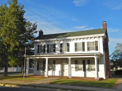 | Thomas Sipple House | 0.1 miles | 1985 |
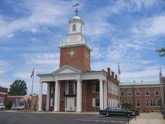 | Sussex County Courthouse and the Circle | 0.1 miles | 1973 |
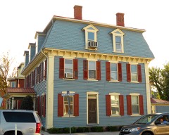 | Richards Mansion | 0.2 miles | 1979 |
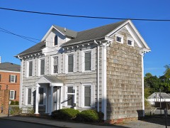 | Joseph T. Adams House | 0.2 miles | 1998 |
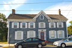 | Peter S. Faucett House | 0.2 miles | 1985 |
| National Archives record | The nomination case file for reference 100011239 in Record Group 79. |
| Sussex County | All 136 listed properties in this county. |