Block
From the record
136 National Register listings published here, 1 of them a National Historic Landmark.
Sources: the National Register database, National Park Service
201 topographic sheets cover 499 settlements here, and 136 properties are on the National Register of Historic Places.
136 National Register listings published here, 1 of them a National Historic Landmark.
Sources: the National Register database, National Park Service
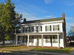
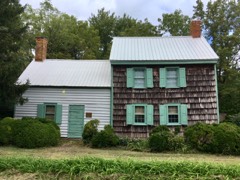
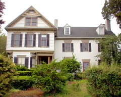
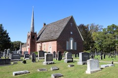
Every property in this county listed on the National Register of Historic Places, with the year it was listed and the federal nomination document.
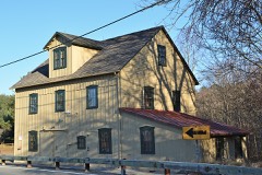
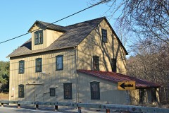
Sussex County has 1 covered bridge on the National Register. Each is a listed structure with a federal nomination on file.
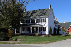 | Hopkins' Covered Bridge Farm | Listed 1991 |
Every wildfire the federal occurrence database records inside this county: 132 of them, burning about 1,888 acres. 4 started naturally and 22 were recorded as arson. Each settlement page carries the fires within five miles of it.
| Reported cause | Fires |
|---|---|
| Missing data/not specified/undetermined | 28 |
| Debris and open burning | 23 |
| Arson/incendiarism | 22 |
| Smoking | 20 |
| Equipment and vehicle use | 14 |
| Recreation and ceremony | 12 |
| Natural | 4 |
| Other causes | 3 |
| Railroad operations and maintenance | 3 |
| Misuse of fire by a minor | 1 |
| Fireworks | 1 |
| Power generation/transmission/distribution | 1 |
The five largest, by the area the report gives. One of them was set deliberately.
| Date | Cause | Size | Reported by | Name on the report |
|---|---|---|---|---|
| 10 March 2002 | Missing data/not specified/undetermined | 1,250 acres | Prime Hook National Wildlife Refuge | SLAUGHTERBEACH |
| 13 April 2005 | Missing data/not specified/undetermined | 160 acres | Blackwater National Wildlife Refuge | MILLSBORO FIRE |
| 9 July 2004 | Arson/incendiarism | 100 acres | Blackwater National Wildlife Refuge | WOODLAND CHURCH RD. |
| 26 March 2003 | Equipment and vehicle use | 30 acres | Delaware State Fire Marshal's Office | not named |
| 26 March 2003 | Equipment and vehicle use | 30 acres | Delaware State Fire Marshal's Office | not named |
| 13 June 2015 | Equipment and vehicle use | 30 acres | Delaware Forest Service | FLEA FIRE |
| 1 July 2004 | Missing data/not specified/undetermined | 17 acres | Delaware State Fire Marshal's Office | not named |
| 26 May 2015 | Smoking | 16 acres | Delaware Forest Service | SAVAGES FIRE |
Every settlement page carries the fires within five miles of it - see the settlement index below.
The NOAA Storm Events Database holds 851 reports for this county, causing 5 deaths, 62 injuries and about $9,544,560 in recorded property damage. Each settlement page carries the reports that name it.
| Kind of event | Reports |
|---|---|
| Thunderstorm Wind | 368 |
| Heavy Rain | 192 |
| Lightning | 80 |
| Flash Flood | 68 |
| Hail | 48 |
| Flood | 32 |
| Tornado | 28 |
| Funnel Cloud | 17 |
| Rip Current | 12 |
| Waterspout | 4 |
| Wildfire | 2 |
The most serious of them, by death, then injury, then recorded damage. The accounts are quoted exactly as the forecast office filed them.
| When | Event | Place named | Harm | What the report says |
|---|---|---|---|---|
| April 2023 | Tornado (EF3) | Dublin Hill | 1 killed | The Bridgeville-Ellendale Tornado began around 5:59 PM EDT near the intersection of Polk Road and Dublin Hill Road where a section of a small barn roof was blown off. The tornado continued east-northeast crossing Seashore Highway. Along this section of the |damage path, a couple wooden power poles were blown down along with several trees uprooted or snapped. On tree fell onto a house causing significant collateral roof damage. The tornado continued eastward paralleling Newton Road where a farmstead sustain significant tree damage. About a half dozen parked semi-trailers were blow over along a driveway. Farther east, more tree damage and snapped power poles were observed. Near the intersection of Precious Lane and Newton Road, a 2 story house was collapsed after appearing to have slid off its foundation. A small outbuilding was also severely damaged nearby. Debris from this area was blown several hundred yards east into nearby fields. Another farmstead was struck by the tornado as it continued east on Dale Farm Road. A large barn had 2 exterior walls blown out and a smaller shed was blown over. Several trees were also snapped or uprooted on the |property.||The tornado continued east, crossing a railroad track and impacting a Delaware Department of Transportation facility. Along the railroad track, a half dozen or more wooden high tension power poles were snapped and collapsed along with 2 steel high tension power poles. This is where the tornado's estimated peak wind speeds of 140 mph were reached. The DE DOT facility sustained significant damage. A maintenance garage building experienced a collapse of an exterior wall and large portion of its roof. 2 smaller garage buildings nearby experienced several garage doors blown out, roofing material removal, and exterior wall damage. A building storing road salt had it's roof completely destroyed. The facility's office building had a few windows blown out, siding, |and roofing material blown off. Some of the siding material was found embedded into the ground downstream where a Delaware Environmental Observing System mesonet gauge measured a 98 mph wind gust at 3 meters (10 feet) above the ground at 6:05 PM EDT.||The tornado continued across a field, then crossed US Route 13 where a few utility poles were snapped. The tornado continued east into a wooded area where significant tree damage occurred. Numerous trees were snapped, one of which fell onto a double-wide manufactured home. After continuing through the wooded area, the tornado emerged into a field along Sugar Hill Road. A house along the road sustained significant roof removal, exterior wall damage, and blown out windows. A small outbuilding sustained roof material removal and several trees near the house were snapped or |uprooted. The tornado continued across Sugar Hill Road and east into another field where 2 irrigation pivots were blown over. The tornado emerged into a wooded residential area along Fawn Road where the tornado appeared to have intensified. The tornado cause significant uprooted and snapped trees in the area as well as significant removal of roofing material and blown out windows to some of the single-family houses along Fawn Road. Farther east, the significant tree damage continued and a large detached garage collapsed.||The tornado continued northeast toward the northern extension of Fawn Road where more significant tree damage occurred. A single story single family home appeared to have slid off its foundation and collapsed. A few other homes sustained roofing material and other cosmetic material blown off. The tornado continued east into another wooded residential area along Quail Hollow Road where mostly significant tree damage occurred. Numerous trees were snapped or uprooted. One snapped tree fell into a house causing significant collateral damage. On large detached garage was severely damaged with exterior walls and roof collapse near Tuckers Road And Quail Hollow Road.||The tornado moved northeast from this area into a wooded area just south of Tuckers Road, emerging into an open field. This was the point where the tornado reached its maximum with of about 700 yards (0.4 miles). The tornado struck a small farmstead along Tuckers Road. The house appeared to have slide off its foundation and collapsed. 2 barns on the property were completely destroyed along with snapped trees and power poles. Farther east, several homes sustained damage from fallen trees and wind blowing off roof material. A few irrigation pivots were blown over in this area. Numerous trees were snapped or uprooted along Owens Road and Sharps Mill Road near Tuckers Road. Just east of Tuckers Road, a single family house sustained significant structural damage. A large section of roof was blown off and an exterior wall was partially blown out. Several windows were blown out and the vinyl fencing on the property was almost completely blown away. A few more trees and minor cosmetic damage to structures occurred a few hundred yards east of Tuckers Road as the tornado continued northeast. Another residence was struck by the tornado on Tuckers |Road where a large portion of exterior wall along the attic was blown off. The home's chimney was also blown off and a few windows were blown out. A detached garage on the property had its roof almost completely blown off. A chicken house behind the residence had a small portion of its roof blown off. Some trees were uprooted along a tree line before the tornado moved into a large and inaccessible wooded area.||The tornado appeared to have maintained a fairly steady intensity as it continued northeast toward Ellendale while crossing several roads. The tornado crossed Oak Road, B and R Road, Oakley Road, Union Church Road, and Beaver Dam Road. Along these road crossings, the tornado produced consistent tree damage and some minor cosmetic damage to some homes. More notable areas of damage include: a large chicken house along B and R Road was severely damaged with some collapse of the northern end of the structure; A house along Oakley Road had an exterior garage wall pushed inward; more significant tree damage was also noted along Oakley Road; and a small portion of a single family house was blown off on Beaver Dam Road.||The tornado crossed US Route 113 into Ellendale where sporadic tree damage occurred in a residential area along Sharons Road. An entire attached garage roof and walls were blown off on a single family home on Pine Oak Street near Sharons Road. Some other houses sustained roof material blown off in this area. The tornado crossed Beach Highway/Main Street near Old State Road where some minor tree damage occurred and some shingles were blown off of a few homes. The tornado crossed Washington Avenue and McCaulley Avenue where a small portion of roof material was blow off of a |free standing garage. The tornado began to weaken considerably moving northeast of downtown Ellendale. It crossed Ponder Road where some roof material was blown off of a automotive service building. The tornado continued into a wooded area then crossed |Holly Tree Road emerging into a field. The tornado circulation dissipated around 6:19 PM EDT just after turning over an irrigation pivot near Hummingbird Road and Benson Road. |
| September 2005 | Rip Current | Dewey Beach | 1 killed | no account filed |
| September 2002 | Rip Current | Rehoboth Beach | 1 killed | no account filed |
| August 2001 | Rip Current | Rehoboth Beach | 1 killed | no account filed |
| August 1998 | Rip Current | Lewes | 1 killed | no account filed |
| July 2001 | Rip Current | Rehoboth Beach | 20 hurt | no account filed |
| May 1984 | Tornado (F1) | not stated | 8 hurt, $250,000 | no account filed |
| July 2001 | Rip Current | Rehoboth Beach | 7 hurt | no account filed |
| August 2001 | Rip Current | Rehoboth Beach | 5 hurt | no account filed |
| August 1999 | Rip Current | Henlopen Acres | 4 hurt | no account filed |
| May 1984 | Tornado (F1) | not stated | 2 hurt, $250,000 | no account filed |
| August 2001 | Lightning | Rehoboth Beach | 2 hurt, $10,000 | no account filed |
| July 1991 | Thunderstorm Wind | not stated | 2 hurt | no account filed |
| March 1988 | Thunderstorm Wind | not stated | 2 hurt | no account filed |
| July 1985 | Thunderstorm Wind | not stated | 2 hurt | no account filed |
| September 1999 | Flash Flood | Countywide | 1 hurt, $150,000 | no account filed |
| August 1955 | Tornado (F2) | not stated | 1 hurt, $2,500 | no account filed |
| August 2022 | Thunderstorm Wind | Pepper | 1 hurt | A tree fell into a camping trailer at Trap Pond State Park. 1 minor injury was reported. Time estimated from radar. |
| June 2021 | Lightning | Angola Beach | 1 hurt | A person was struck by lightning in Angola, receiving non-fatal injuries. Time estimated from dispatch calls. |
| April 2019 | Tornado (EF2) | Bethel | 1 hurt | A tornado traveled from Woodland Ferry Road northeast to Pepper Road. One barn was destroyed. A tree fell on a house, resulting in one injury. In addition, there was roof damage to several other homes and barns. Many trees were uprooted along the tornado path, and a few were snapped. |
| July 2001 | Lightning | Laurel | 1 hurt | no account filed |
| September 1998 | Lightning | Ocean View | 1 hurt | no account filed |
| June 1986 | Thunderstorm Wind | not stated | 1 hurt | no account filed |
| August 2001 | Flash Flood | Southwest Portion | $1,100,000 | no account filed |
| November 1995 | Thunderstorm Wind | Dewey Beach | $1,000,000 | A very strong cold front blasted through the region the evening of the 11th. Southerly winds increased during the day and started gusting over 50 mph during the early evening. They peaked as the cold front moved through between 8 pm and 1030 pm. The worst damage occurred in Dewey Beach as a severe thunderstorm exacerbated the damaging wind gusts. The Dodd Avenue and Chicago Street areas were hardest hit. Four houses were severely damaged and more than thirty others suffered minor damage. Part of the roof of one Dodd Street house was found three blocks away. Delaware State Route 1 within Dewey Beach was closed because of strewn debris. Damage estimates were around one million dollars and miraculously no serious injuries were reported. Wind related damage was reported elsewhere throughout the state. About 2,500 Delmarva Power and Light customers lost power in Cecil and New Castle Counties. Porter Road south of Christiana was closed because of fallen trees. In Kent County, a house near Clayton suffered major wind damage. In Sussex County, a chicken house in Millville collapsed, killing 10,000 chickens. Elsewhere in Sussex County a house was badly damaged in Angola, a barn was destroyed in Cool Spring, a garage was flattened and chimney damaged in Georgetown and the Pilot Tower at Cape Henlopen recorded a wind gust to 78 mph. ~ DEZ002>004,14,1200EST- *,14,1600EST,,,0,0,,,Coastal Flooding The first nor'easter of the fall/winter season caused minor tidal flooding the afternoon of the 14th in Kent and Sussex Counties. The gradient between a high pressure system in Quebec Province and the developing nor'easter east of North Carolina produced a stiff east wind. Consequently, the high tides were a little more than three feet above normal. This produced a high tide of 7.1 feet (Above Mean Low Water) in Lewes. Roads susceptible to tidal flooding were covered and/or closed at high tide. In Kent County Hubbard Avenue in Bowers Beach was under water. A parking lot in Little Creek was submerged. Parts of the bayside communities of Woodland Beach and Pickering Beach were inaccessible. South Bowers became an island as waves were breaking on Kent County Road 121, the only road into South Bowers. In addition, the high tide caused flooding along the Murderkill River, which flooded near Webb Landing shutting it off further. In Sussex County the road between the Indian River Outlet and the South Shore Marina was under two and a half feet of water. Tidal flooding caused roadway flooding in Lewes, Dewey and along State Route 54. By the overnight high tide, the nor'easter moved inland into Southern New Jersey and tidal flooding was less. |
| June 2006 | Flash Flood | Southwest Portion | $1,000,000 | no account filed |
| August 2003 | Lightning | Dagsboro | $800,000 | no account filed |
| August 2012 | Flash Flood | Nassau | $500,000 | Thunderstorms with torrential downpours caused flash flooding in Eastern Sussex County. The hardest hit area was in and around Long Neck. Many roadways were flooded and closed. One road collapsed in Oak Orchard. In Oak Orchard, River Road was under water and the bulkhead of one home was damaged at the Riverwinds Development. Holly Lake Road was also closed Flooding was also reported along Beaver Dam Road and Delaware State Ropute 5. Along the coast, Delaware State Route 1 in Dewey Beach and Delaware State Route 26 leading into Bethany Beach were flooded. Event precipitation totals included 7.21 in Rehoboth Beach, 6.83 inches in Harbeson, 6.39 inches in Bethany Beach and 5.76 inches in Indian River Inlet. |
| August 2012 | Lightning | Delmar | $300,000 | A lightning strike and ensuing fire caused extensive damage to a home on Eagle Run Lane in Delmar. No injuries were reported. |
| July 2007 | Lightning | Georgetown | $300,000 | A lightning strike quickly caused a fire at a house on Avalon Road in Georgetown. When firefighters from five separate companies arrived, the rear of the home was already engulfed in flames and the fire had extended to a nearby storage shed. Two people were home at the time of the lightning strike and escaped before being injured. Damage to the home was estimated at $300,000. |
| June 2009 | Lightning | Rehoboth Beach | $250,000 | In Rehoboth Beach, a lightning strike and ensuing fire caused about an estimated $250,000 in damage to a house on Coventry Lane in the Rehoboth Beach Yacht and Country Club development. Lightning apparently struck the attic of the home. Six fire companies fought the blaze. |
| June 2008 | Thunderstorm Wind | Georgetown | $250,000 | A squall line of severe thunderstorms caused wind damage, especially in the eastern part of Sussex County with the corridor from Georgetown to Lewes reporting the most damage with a secondary maximum of wind damage from Dagsboro to Bethany Beach. There were about fifty weather related incidents throughout the county.||Just northeast of Georgetown, dozens of trees were toppled at the Sand Hill Mobile Home Park. Seven homes and four vehicles were damaged by fallen trees. Many trees were twisted, uprooted and shredded in and around the park. In Georgetown, the damaging winds ripped part of the roof and siding off one warehouse owned by Besche Brother Furniture and picked up and moved another large warehouse twenty-five feet off its foundation. In Lewes near the intersection of Delaware State Route 1 and Darmouth Drive, half of the front wall of the Furniture and More Galleries collapsed. The ensuing rain soaked mattresses, beds and futons at the front of the store. A 62 mph wind gust was recorded in Lewes. ||The squall line also knocked down trees in Dagsboro and Ocean View. A chimney was damaged by the high winds in Bethany Beach. |
| July 2002 | Lightning | Bethany Beach | $250,000 | no account filed |
| July 2007 | Lightning | Seaford | $200,000 | Lightning struck a few homes across Sussex County between 330 p.m. EDT and 415 p.m. EDT on the 28th. A lightning strike and ensuing fire damaged a Kelley Circle home near Seaford. In addition to wind damage elsewhere, lightning struck a home on Clayton Street in Frankford. The ensuing fire damaged the outer wall of the home. Three fire companies assisted in battling the blaze. The worst reported damage occurred to a home struck by lightning in Lewes. Lightning struck a home in the Bay Crossing Community on Anchor Way. Four fire companies fought the ensuing blaze which caused heavy damage to the second floor and roof of the home. No serious injuries were reported with any of the fires. |
| August 2001 | Lightning | Seaford | $200,000 | no account filed |
| August 2007 | Lightning | Dewey Beach | $175,000 | Thunderstorms produced about 2,300 cloud-to-surface lightning strikes in Sussex County and the nearby waters between 11 p.m. EDT and Midnight EDT. Two lightning strikes caused damage. Lightning struck the chimney of an unoccupied unit of a townhouse complex in Port Lewes. The ensuing fire spread along the exterior of the unit to the adjoining unit in the complex. The residents of that unit were evacuated. Four fire companies battled the blaze. Damage was estimated at $150,000. No serious injuries were reported. In Rehoboth Beach, the fire station and city hall were struck by lightning. The strike fried the 911 system. The combination of wind and lightning caused about 7,000 homes and businesses to lose power in Sussex County. All power was restored by 3 a.m. EDT on the 17th.| |
| August 1998 | Lightning | Rehoboth Beach | $175,000 | no account filed |
| August 2001 | Lightning | Seaford | $160,000 | no account filed |
| August 2001 | Lightning | Georgetown | $150,000 | no account filed |
| August 2012 | Flash Flood | Midway | $100,000 | Thunderstorms with torrential downpours caused roadway flash flooding in Rehoboth Beach. First Street was under two feet of water and at least one resort garage was flooded. Over two dozen vehicles were damaged. Event precipitation total was 7.21 inches. |
| June 2012 | Thunderstorm Wind | Seaford | $100,000 | A gust front outrunning a cluster of severe thunderstorms entered near Seaford in western Sussex County at approximately 11:57 pm EDT on the 29th. This gust front produced damaging wind gusts estimated between 65 mph to 70 mph as it traversed eastward across the county. Within approximately 20 minutes of the gust front passage, a potent line of severe thunderstorms tracked eastward through Sussex county, producing another round of destructive wind gusts, estimated from 65 mph to 70 mph. Large tree limbs were reported down across the county, including in Seaford, Lincoln, Lewes, and Millsboro. In addition, multiple downed trees were reported in Selbyville, and a wind gust to 70 mph was estimated in Bridgeville. Severe thunderstorms exited eastern Sussex County, including the town of Lewes, at approximately 1:10 am EDT on the 30th. Measured wind gusts included 69 mph in Dewey Beach and 63 mph in Lewes. |
| June 2012 | Thunderstorm Wind | Rosedale Beach | $100,000 | A severe thunderstorm damaged two county buildings that were under construction at the Inland Bays Wastewater Treatment plant near Millsboro. On one building, a large section of the metal roofing flew off. The second building collapsed. No injuries were reported. |
| June 2009 | Thunderstorm Wind | Greenwood | $100,000 | A severe thunderstorm produced a swath of straight-line wind damage up to one-half mile wide in spots from southwestern Kent County into western Sussex County. Most of the wind damage occurred in Northwest Fork Hundred. Maximum wind gusts were estimated at 80 mph and caused property as well as substantial crop damage. One home sustained substantial damage. There was widespread crop damage from large hail.||Wind damage in Sussex County started near County Route 16 near Blanchard. The most significant damage occurred parallel to McDowell Road east of Woodbridge Road. A porch roof was ripped away from a wood-framed farm house, and a steel antenna tower next to the house was bent. A tree near the house was blown down, and a large chicken barn near the house collapsed. Farther east, another steel antenna tower was bent, and some shingles were torn off the roof of a nearby house. ||Corn was stripped to the stalk on many fields within the damage swath, resulting in a total loss in some cases. Wheat and barely fields also suffered substantial damage. Crop losses mainly from hail could easily total several hundred thousand dollars. ||Tree damage was also noted in the town of Greenwood. Small to medium sized limbs were torn away along Minor Street in downtown Greenwood. Some lawn furniture was blown around, and streets and driveways were littered with leaves. Some funnel clouds were reported, but they did not touch down. |
| December 2008 | Thunderstorm Wind | Greenwood | $100,000 | A line of showers was accompanied by damaging winds as it moved through Greenwood around 1 a.m. EST. A radio tower lost part of its antenna, siding was ripped away from a storage center and the price sign and roof of a gas station was damaged. No injuries were reported. |
| April 2006 | Lightning | Bethany Beach | $100,000 | no account filed |
| August 2003 | Lightning | Ocean View | $100,000 | no account filed |
| April 2002 | Thunderstorm Wind | Lincoln | $100,000 | no account filed |
| May 2004 | Lightning | Frankford | $81,000 | no account filed |
| August 2011 | Lightning | Lewes | $75,000 | The roof of a Drake Knoll home in Lewes was struck by lightning and started a fire. Five fire companies battled the blaze that was mainly confined to the roof. No serious injuries were reported. |
| July 2007 | Lightning | Lewes | $75,000 | A series of thunderstorms over a period of three hours produced about 1100 cloud-to-surface lightning strikes in Sussex County and Delaware Bay from 4 p.m. EDT through 7 p.m. EDT on the 16th. About ten structures were struck by lightning in and around Lewes. The worst reported property damage was the ensuing fire that occurred after a lightning strike to a Brighton Drive home. The fire damage was estimated at $50,000. The lightning strike in the Sussex East Mobile Home Park started a shed fire which spread to a home, but was quickly extinguished. Two small fires were started by lightning strikes to homes in the Eagle Point Landing Development. Another lightning strike occurred at an apartment building at the Village of Five Points development. Lightning struck a Home Depot twice on Delaware State Route 1. Lightning also struck the Furniture Galley on Delaware State Route 1 and Practically Yours on U.S. Route 9. No serious injuries were reported with any of the fires. |
| July 2005 | Lightning | Laurel | $75,000 | no account filed |
| July 2005 | Lightning | Seaford | $60,000 | no account filed |
| July 2013 | Flash Flood | Williamsville | $50,000 | Thunderstorms with very heavy rain led to flash flooding from Selbyville east in southern Sussex County. A few roads were closed and sections of Lighthouse and Sand Cove Roads collapsed. Event precipitation totals included 5.50 inches in Selbyville. |
| August 2012 | Lightning | Ocean View | $50,000 | A lightning strike and ensuing fire caused extensive damage to a home on Inlet View Court in Bethany Beach. No injuries were reported. |
| June 2012 | Thunderstorm Wind | Angola Beach | $50,000 | A severe thunderstorm knocked down several trees onto homes and sheds along Banks Road and Canal Drive in Oak Orchard around 905 AM EDT on June 25th. |
| June 2012 | Thunderstorm Wind | Dewey Beach | $50,000 | A severe thunderstorm caused wind damage as it moved through Dewey Beach. The thunderstorm winds damaged mobile homes on Rodney Street. The severe thunderstorm ripped apart sections of the observation deck roof, the deck itself and awning of the Lighthouse Restaurant. The Rusty Rudder Restaurant also was damaged. The severe thunderstorm also knocked down trees and electrical poles. There was one pole fire on Collins Street Northbound Delaware State Route 1 was closed until the afternoon of the 25th. Delmarva Power and Light reported about 170 of its customers in Dewey Beach lost power. A wind gust of 69 mph was measured at a WeatherFlow mesonet site within Dewey Beach. |
| August 2011 | Lightning | Georgetown | $50,000 | A pair of lightning strikes helped trigger fires that damaged two homes in Georgetown. One fire occurred on Avalon Drive and the second on Donaway Road. Four fire companies responded to each blaze. No injuries were reported. |
| August 1997 | Thunderstorm Wind | Fenwick Is | $50,000 | no account filed |
| May 2009 | Lightning | Ocean View | $40,000 | A lightning strike and ensuing fire sparked a garage and house fire on Oyster Shell Cove in Salt Pond in Baltimore Hundred. The garage was struck by lightning and the fire then spread to the home. Damage was estimated at $40,000. No injuries were reported. |
| May 2025 | Thunderstorm Wind | Laurel | $30,000 | Additional wind damage east of the path of the tornado was noted continuing eastward towards Laurel. This was the result of straight-line winds associated with the rear-flank downdraft which also caused the loss of all of the metal roofing on one commercial building as well as the partial loss of metal roofing on another commercial building in Laurel as well as additional tree damage south of Chipman Pond. |
The Survey's mineral resources record lists 9 workings inside this county. 2 still produce and 7 are closed or unrecorded. Each settlement page carries the workings within five miles of it.
| Commodity | Workings |
|---|---|
| Iron | 6 |
| Sand and Gravel, Construction | 2 |
| Magnesite | 1 |
The least common of them first, because a county's hundredth gravel pit says nothing its first ten did not.
| Where | Site | Commodity | Status | Recorded |
|---|---|---|---|---|
| Barcroft | Magnesite | Producer | 1972 | |
| Lewes Pit | Sand and Gravel, Construction | Producer | ||
| Sussex Sand and Gravel Pit and Mill | Sand and Gravel, Construction | Past Producer | Sedimentary | |
| Collins Mine and Plant | Iron | Past Producer | ||
| Deep Creek Mine | Iron | Past Producer | ||
| Elliot Farm Prospect | Iron | Prospect | ||
| Gravelly Delight Mine | Iron | Past Producer | ||
| Mine Hill Mine | Iron | Past Producer | ||
| Pine Creek Forge Mine | Iron | Past Producer |
Named settlements recorded in the Geographic Names Information System, each with the topographic sheets covering it. Villages, hamlets and abandoned places alike. Each is shown with the nearest named watercourse or landform and the survey quadrangle it falls on.
Milford South census division · 19963 · On Tantrough Branch · Milford quadrangle
21 sheets, 1918 to 1993
Bridgeville-Greenwood census division · 19950 · On Double Fork Branch · Hickman quadrangle
19 sheets, 1918 to 1993
Milford South census division · 19960 · On Church Branch · Milton quadrangle
22 sheets, 1918 to 1992
Lewes census division · 19958 · On Herring Creek · Fairmount quadrangle
31 sheets, 1918 to 1984
Lewes census division · 19958 · On Sarah Run · Fairmount quadrangle
31 sheets, 1918 to 1984
Lewes census division · 19971 · On Stockley Creek · Rehoboth Beach quadrangle
31 sheets, 1918 to 1984
Milton census division · 19958 · On Martin Branch · Fairmount quadrangle
31 sheets, 1918 to 1984
Lewes census division · 19971 · On Pot Hook Creek · Fairmount quadrangle
31 sheets, 1918 to 1984
Bridgeville-Greenwood census division · 19933 · Seaford West quadrangle
19 sheets, 1915 to 1992
Laurel-Delmar census division · 19956 · On Gill Branch · Laurel quadrangle
20 sheets, 1915 to 1992
Laurel-Delmar census division · 19973 · On Tussocky Branch · Sharptown quadrangle
19 sheets, 1915 to 1992
Lewes census division · 19971 · On Stockley Creek · Rehoboth Beach quadrangle
31 sheets, 1918 to 1984
Selbyville-Frankford census division · 19970 · On Derrickson Ditch · Bethany Beach quadrangle
31 sheets, 1918 to 1984
Selbyville-Frankford census division · 19970 · On Derrickson Ditch · Bethany Beach quadrangle
31 sheets, 1918 to 1984
Selbyville-Frankford census division · 19970 · On Derrickson Ditch · Bethany Beach quadrangle
31 sheets, 1918 to 1984
Selbyville-Frankford census division · 19970 · On Derrickson Ditch · Bethany Beach quadrangle
31 sheets, 1918 to 1984
Selbyville-Frankford census division · 19970 · On Derrickson Ditch · Bethany Beach quadrangle
31 sheets, 1918 to 1984
Selbyville-Frankford census division · 19939 · On Indian River · Frankford quadrangle
30 sheets, 1918 to 1984
Lewes census division · 19971 · On Stockley Creek · Rehoboth Beach quadrangle
31 sheets, 1918 to 1984
Lewes census division · 19958 · On Dorman Branch · Fairmount quadrangle
31 sheets, 1918 to 1984
Selbyville-Frankford census division · 19975 · On Buntings Branch · Selbyville quadrangle
25 sheets, 1901 to 1992
Selbyville-Frankford census division · 19930 · Near Poke Hill · Bethany Beach quadrangle
31 sheets, 1918 to 1984
Lewes census division · 19971 · Near Thompson Island · Rehoboth Beach quadrangle
31 sheets, 1918 to 1984
Selbyville-Frankford census division · 19945 · On Agricultural Ditch · Frankford quadrangle
30 sheets, 1918 to 1984
Selbyville-Frankford census division · 19930 · Near Cottonpatch Hill · Bethany Beach quadrangle
31 sheets, 1918 to 1984
Selbyville-Frankford census division · 19970 · Near Cottonpatch Hill · Bethany Beach quadrangle
31 sheets, 1918 to 1984
Selbyville-Frankford census division · 19975 · On Drum Creek · Assawoman Bay quadrangle
27 sheets, 1901 to 1997
Lewes census division · 19971 · On Munchy Branch · Rehoboth Beach quadrangle
31 sheets, 1918 to 1984
Selbyville-Frankford census division · 19945 · On Bearhole Ditch · Selbyville quadrangle
25 sheets, 1901 to 1992
Lewes census division · 19958 · On Wall Branch · Fairmount quadrangle
31 sheets, 1918 to 1984
Seaford census division · 19973 · On Herring Run · Seaford East quadrangle
19 sheets, 1915 to 1992
Lewes census division · 19958 · On Burton Prong · Fairmount quadrangle
31 sheets, 1918 to 1984
Selbyville-Frankford census division · 19930 · Near Cat Hill · Bethany Beach quadrangle
31 sheets, 1918 to 1984
Selbyville-Frankford census division · 19930 · Near Cottonpatch Hill · Bethany Beach quadrangle
31 sheets, 1918 to 1984
Selbyville-Frankford census division · 19930 · Near Cottonpatch Hill · Bethany Beach quadrangle
31 sheets, 1918 to 1984
Laurel-Delmar census division · 19966 · On Bald Cypress Branch · Whaleyville quadrangle
19 sheets, 1902 to 1992
Laurel-Delmar census division · 19966 · On Bald Cypress Branch · Whaleyville quadrangle
19 sheets, 1902 to 1992
Lewes census division · 19958 · On Fisher Creek · Lewes quadrangle
27 sheets, 1918 to 1997
Selbyville-Frankford census division · 19945 · On Clarksville Branch · Frankford quadrangle
30 sheets, 1918 to 1984
Selbyville-Frankford census division · 19939 · On Blackwater Creek · Frankford quadrangle
30 sheets, 1918 to 1984
Selbyville-Frankford census division · 19939 · On Clarksville Branch · Frankford quadrangle
30 sheets, 1918 to 1984
Selbyville-Frankford census division · 19939 · On Clarksville Branch · Frankford quadrangle
30 sheets, 1918 to 1984
Seaford census division · 19973 · Near Morgan Island · Seaford East quadrangle
19 sheets, 1915 to 1992
Bridgeville-Greenwood census division · 19950 · Hickman quadrangle
19 sheets, 1918 to 1993
Lewes census division · 19958 · Near Horse Island · Fairmount quadrangle
31 sheets, 1918 to 1984
Seaford census division · 19973 · On Clear Brook · Seaford West quadrangle
19 sheets, 1915 to 1992
Lewes census division · 19971 · Near Big Cedar Island · Bethany Beach quadrangle
31 sheets, 1918 to 1984
Georgetown census division · 19947 · On Black Savannah Ditch · Harbeson quadrangle
22 sheets, 1917 to 1992
No longer a settlement
Selbyville-Frankford census division · 19945 · On Clarksville Branch · Frankford quadrangle
30 sheets, 1918 to 1984
Seaford census division · 19973 · On Green Briar Branch · Seaford West quadrangle
19 sheets, 1915 to 1992
Lewes census division · 19971 · On Munchy Branch · Fairmount quadrangle
31 sheets, 1918 to 1984
Seaford census division · 19973 · On Freidel Prong · Seaford West quadrangle
19 sheets, 1915 to 1992
Bridgeville-Greenwood census division · 19933 · On Bridgeville Branch · Seaford East quadrangle
19 sheets, 1915 to 1992
Bridgeville-Greenwood census division · 19933 · On Bridgeville Branch · Seaford East quadrangle
19 sheets, 1915 to 1992
Bridgeville-Greenwood census division · 19933 · On Polk Branch · Greenwood quadrangle
19 sheets, 1918 to 1992
Seaford census division · 19973 · On Tubbs Branch · Seaford East quadrangle
19 sheets, 1915 to 1992
Laurel-Delmar census division · 19956 · On Tussocky Branch · Laurel quadrangle
20 sheets, 1915 to 1992
Lewes census division · 19968 · On Primehook Creek · Lewes quadrangle
27 sheets, 1918 to 1997
Milford South census division · 19963 · On Deep Branch · Milford quadrangle
21 sheets, 1918 to 1993
Seaford census division · 19973 · On Bucks Branch · Seaford East quadrangle
19 sheets, 1915 to 1992
Selbyville-Frankford census division · 19939 · On Fork Number One Pepper Creek · Frankford quadrangle
30 sheets, 1918 to 1984
Millsboro census division · 19966 · On Warwick Gut · Frankford quadrangle
30 sheets, 1918 to 1984
Selbyville-Frankford census division · 19975 · On Buntings Branch · Selbyville quadrangle
25 sheets, 1901 to 1992
Millsboro census division · 19939 · On Iron Branch · Millsboro quadrangle
20 sheets, 1917 to 1992
Selbyville-Frankford census division · 19970 · On Derrickson Ditch · Bethany Beach quadrangle
31 sheets, 1918 to 1984
Selbyville-Frankford census division · 19939 · Near Simon Glade · Bethany Beach quadrangle
31 sheets, 1918 to 1984
Seaford census division · 19933 · On Gilbert Trivitts Ditch · Seaford East quadrangle
19 sheets, 1915 to 1992
Lewes census division · 19958 · On Pot Hook Creek · Fairmount quadrangle
31 sheets, 1918 to 1984
Milton census division · 19958 · On Martin Branch · Lewes quadrangle
27 sheets, 1918 to 1997
Milton census division · 19968 · On Round Pole Branch · Milton quadrangle
22 sheets, 1918 to 1992
Selbyville-Frankford census division · 19970 · On White Creek · Bethany Beach quadrangle
31 sheets, 1918 to 1984
Seaford census division · 19973 · On Deep Creek · Seaford East quadrangle
19 sheets, 1915 to 1992
Seaford census division · 19933 · Seaford West quadrangle
19 sheets, 1915 to 1992
Selbyville-Frankford census division · 19939 · On Clarksville Branch · Frankford quadrangle
30 sheets, 1918 to 1984
Selbyville-Frankford census division · 19970 · On Derrickson Ditch · Bethany Beach quadrangle
31 sheets, 1918 to 1984
Bridgeville-Greenwood census division · 19933 · On Bee Branch · Greenwood quadrangle
19 sheets, 1918 to 1992
Selbyville-Frankford census division · 19970 · On Derrickson Ditch · Bethany Beach quadrangle
31 sheets, 1918 to 1984
Georgetown census division · 19933 · On Tussocky Branch · Seaford East quadrangle
19 sheets, 1915 to 1992
Georgetown census division · 19947 · On Tussocky Branch · Seaford East quadrangle
19 sheets, 1915 to 1992
Milton census division · 19968 · On Pemberton Branch · Milton quadrangle
22 sheets, 1918 to 1992
Seaford census division · 19973 · On Tubbs Branch · Seaford East quadrangle
19 sheets, 1915 to 1992
Seaford census division · 19973 · On Baker Mill Branch · Seaford East quadrangle
19 sheets, 1915 to 1992
Milton census division · 19968 · On Martin Branch · Fairmount quadrangle
31 sheets, 1918 to 1984
Milford South census division · 19963 · On Herring Branch · Milford quadrangle
21 sheets, 1918 to 1993
Selbyville-Frankford census division · 19970 · On Derrickson Ditch · Bethany Beach quadrangle
31 sheets, 1918 to 1984
Lewes census division · 19958 · On Love Creek · Fairmount quadrangle
31 sheets, 1918 to 1984
Georgetown census division · 19933 · On Tussocky Branch · Seaford East quadrangle
19 sheets, 1915 to 1992
Lewes census division · 19958 · On Ebenezer Branch · Lewes quadrangle
27 sheets, 1918 to 1997
Seaford census division · 19973 · On Chapel Branch · Seaford West quadrangle
19 sheets, 1915 to 1992
Milton census division · 19968 · On Martin Branch · Lewes quadrangle
27 sheets, 1918 to 1997
Millsboro census division · 19966 · On Sunset Branch · Millsboro quadrangle
20 sheets, 1917 to 1992
Selbyville-Frankford census division · 19945 · On McCrays Branch · Frankford quadrangle
30 sheets, 1918 to 1984
Selbyville-Frankford census division · 19939 · On Fork Number One Pepper Creek · Frankford quadrangle
30 sheets, 1918 to 1984
Milton census division · 19951 · On Wall Branch · Fairmount quadrangle
31 sheets, 1918 to 1984
Bridgeville-Greenwood census division · 19950 · On Cart Branch · Greenwood quadrangle
19 sheets, 1918 to 1992
Selbyville-Frankford census division · 19970 · On Derrickson Ditch · Bethany Beach quadrangle
31 sheets, 1918 to 1984
Selbyville-Frankford census division · 19967 · On Derrickson Ditch · Bethany Beach quadrangle
31 sheets, 1918 to 1984
Lewes census division · 19971 · On Stockley Creek · Rehoboth Beach quadrangle
31 sheets, 1918 to 1984
Lewes census division · 19971 · On Stockley Creek · Rehoboth Beach quadrangle
31 sheets, 1918 to 1984
Laurel-Delmar census division · 19956 · On Holly Branch · Laurel quadrangle
20 sheets, 1915 to 1992
Lewes census division · 19958 · On Ebenezer Branch · Lewes quadrangle
27 sheets, 1918 to 1997
Lewes census division · 19958 · On Ebenezer Branch · Lewes quadrangle
27 sheets, 1918 to 1997
Seaford census division · 19973 · On Deep Creek · Seaford East quadrangle
19 sheets, 1915 to 1992
Milton census division · 19968 · On Beaverdam Creek · Milton quadrangle
22 sheets, 1918 to 1992
Bridgeville-Greenwood census division · 19933 · Hickman quadrangle
19 sheets, 1918 to 1993
Lewes census division · 19958 · On Ebenezer Branch · Lewes quadrangle
27 sheets, 1918 to 1997
Milton census division · 19968 · On Martin Branch · Lewes quadrangle
27 sheets, 1918 to 1997
Milton census division · 19968 · On Round Pole Branch · Milton quadrangle
22 sheets, 1918 to 1992
Milford South census division · 19963 · On Herring Branch · Milford quadrangle
21 sheets, 1918 to 1993
Milton census division · 19958 · On Martin Branch · Lewes quadrangle
27 sheets, 1918 to 1997
Selbyville-Frankford census division · 19939 · On Clarksville Branch · Frankford quadrangle
30 sheets, 1918 to 1984
Milford South census division · 19963 · On Bowman Branch · Milford quadrangle
21 sheets, 1918 to 1993
Lewes census division · 19951 · On Wall Branch · Fairmount quadrangle
31 sheets, 1918 to 1984
Selbyville-Frankford census division · 19939 · On Blackwater Creek · Frankford quadrangle
30 sheets, 1918 to 1984
Selbyville-Frankford census division · 19944 · Near Fenwick Island · Assawoman Bay quadrangle
27 sheets, 1901 to 1997
Selbyville-Frankford census division · 19944 · Near Fenwick Island · Assawoman Bay quadrangle
27 sheets, 1901 to 1997
Selbyville-Frankford census division · 19944 · Near Marsh Island (historical) · Assawoman Bay quadrangle
27 sheets, 1901 to 1997
Selbyville-Frankford census division · 19975 · Near Marsh Island (historical) · Assawoman Bay quadrangle
27 sheets, 1901 to 1997
Selbyville-Frankford census division · 19975 · On Batson Branch · Assawoman Bay quadrangle
27 sheets, 1901 to 1997
Seaford census division · 19973 · On Tubbs Branch · Seaford East quadrangle
19 sheets, 1915 to 1992
Millsboro census division · 19966 · On Swan Creek · Frankford quadrangle
30 sheets, 1918 to 1984
Lewes census division · 19971 · On Munchy Branch · Rehoboth Beach quadrangle
31 sheets, 1918 to 1984
Lewes census division · 19958 · On Bundicks Branch · Fairmount quadrangle
31 sheets, 1918 to 1984
Seaford census division · 19933 · On Gravelly Branch · Seaford East quadrangle
19 sheets, 1915 to 1992
Lewes census division · 19958 · On Ebenezer Branch · Fairmount quadrangle
31 sheets, 1918 to 1984
Georgetown census division · 19947 · On New Ditch · Georgetown quadrangle
19 sheets, 1917 to 1992
Lewes census division · 19968 · Near Horse Island · Milton quadrangle
22 sheets, 1918 to 1992
Lewes census division · 19958 · On Love Creek · Fairmount quadrangle
31 sheets, 1918 to 1984
Selbyville-Frankford census division · 19945 · Near Cat Hill · Bethany Beach quadrangle
31 sheets, 1918 to 1984
Selbyville-Frankford census division · 19945 · Frankford quadrangle
30 sheets, 1918 to 1984
Laurel-Delmar census division · 19956 · On Dukes Ditch · Laurel quadrangle
20 sheets, 1915 to 1992
Milford South census division · 19963 · On Johnson Branch · Milford quadrangle
21 sheets, 1918 to 1993
Seaford census division · 19973 · On William H Newton Ditch · Seaford East quadrangle
19 sheets, 1915 to 1992
Lewes census division · 19958 · On Bundicks Branch · Fairmount quadrangle
31 sheets, 1918 to 1984
Georgetown census division · 19966 · On Stockley Branch · Harbeson quadrangle
22 sheets, 1917 to 1992
Selbyville-Frankford census division · 19970 · On Derrickson Ditch · Bethany Beach quadrangle
31 sheets, 1918 to 1984
Lewes census division · 19958 · On Canary Creek · Lewes quadrangle
27 sheets, 1918 to 1997
Georgetown census division · 19947 · On Black Savannah Ditch · Harbeson quadrangle
22 sheets, 1917 to 1992
Millsboro census division · 19966 · On Burton Prong · Fairmount quadrangle
31 sheets, 1918 to 1984
Bridgeville-Greenwood census division · 19950 · On White Marsh Branch · Greenwood quadrangle
19 sheets, 1918 to 1992
Bridgeville-Greenwood census division · 19950 · On Cart Branch · Greenwood quadrangle
19 sheets, 1918 to 1992
Millsboro census division · 19966 · On Island Creek · Frankford quadrangle
30 sheets, 1918 to 1984
Selbyville-Frankford census division · 19930 · Near Cottonpatch Hill · Bethany Beach quadrangle
31 sheets, 1918 to 1984
Laurel-Delmar census division · 19966 · On Lewis Prong · Whaleyville quadrangle
19 sheets, 1902 to 1992
Laurel-Delmar census division · 19973 · On Asketum Branch · Trap Pond quadrangle
19 sheets, 1917 to 1992
Lewes census division · 19968 · Near Wall Island · Lewes quadrangle
27 sheets, 1918 to 1997
Laurel-Delmar census division · 19956 · On Old Forge Branch · Laurel quadrangle
20 sheets, 1915 to 1992
Seaford census division · 19973 · On Bucks Branch · Seaford East quadrangle
19 sheets, 1915 to 1992
Selbyville-Frankford census division · 19939 · On Herring Branch · Frankford quadrangle
30 sheets, 1918 to 1984
Lewes census division · 19971 · On Holland Glade · Rehoboth Beach quadrangle
31 sheets, 1918 to 1984
Lewes census division · 19971 · On Munchy Branch · Rehoboth Beach quadrangle
31 sheets, 1918 to 1984
Milton census division · 19968 · On Martin Branch · Lewes quadrangle
27 sheets, 1918 to 1997
Millsboro census division · 19966 · On Unity Branch · Fairmount quadrangle
31 sheets, 1918 to 1984
Lewes census division · 19958 · Near Island in the Narrows · Fairmount quadrangle
31 sheets, 1918 to 1984
Selbyville-Frankford census division · 19939 · Millsboro quadrangle
20 sheets, 1917 to 1992
Bridgeville-Greenwood census division · 19950 · On White Marsh Branch · Greenwood quadrangle
19 sheets, 1918 to 1992
Lewes census division · 19958 · On Ebenezer Branch · Lewes quadrangle
27 sheets, 1918 to 1997
Lewes census division · 19958 · On Ebenezer Branch · Lewes quadrangle
27 sheets, 1918 to 1997
Seaford census division · 19973 · On Morgan Branch · Laurel quadrangle
20 sheets, 1915 to 1992
Laurel-Delmar census division · 19956 · Trap Pond quadrangle
19 sheets, 1917 to 1992
Millsboro census division · 19939 · On Iron Branch · Millsboro quadrangle
20 sheets, 1917 to 1992
Selbyville-Frankford census division · 19939 · Millsboro quadrangle
20 sheets, 1917 to 1992
Selbyville-Frankford census division · 19945 · Frankford quadrangle
30 sheets, 1918 to 1984
Selbyville-Frankford census division · 19970 · On White Creek · Bethany Beach quadrangle
31 sheets, 1918 to 1984
Millsboro census division · 19951 · On Wall Branch · Fairmount quadrangle
31 sheets, 1918 to 1984
Milton census division · 19968 · On Wall Branch · Fairmount quadrangle
31 sheets, 1918 to 1984
Laurel-Delmar census division · 19956 · On Little Creek · Laurel quadrangle
20 sheets, 1915 to 1992
Lewes census division · 19968 · On Beaverdam Creek · Lewes quadrangle
27 sheets, 1918 to 1997
Selbyville-Frankford census division · 19939 · On Clarksville Branch · Frankford quadrangle
30 sheets, 1918 to 1984
Selbyville-Frankford census division · 19975 · Selbyville quadrangle
25 sheets, 1901 to 1992
Milford South census division · 19960 · Ellendale quadrangle
20 sheets, 1918 to 1992
Seaford census division · 19973 · On Clear Brook · Seaford East quadrangle
19 sheets, 1915 to 1992
Lewes census division · 19971 · On Stockley Creek · Rehoboth Beach quadrangle
31 sheets, 1918 to 1984
Selbyville-Frankford census division · 19945 · On Brasures Branch · Assawoman Bay quadrangle
27 sheets, 1901 to 1997
Selbyville-Frankford census division · 19930 · Near Cottonpatch Hill · Bethany Beach quadrangle
31 sheets, 1918 to 1984
Milton census division · 19951 · On Wall Branch · Fairmount quadrangle
31 sheets, 1918 to 1984
Selbyville-Frankford census division · 19939 · On Blackwater Creek · Frankford quadrangle
30 sheets, 1918 to 1984
Selbyville-Frankford census division · 19939 · On Indian River · Frankford quadrangle
30 sheets, 1918 to 1984
Selbyville-Frankford census division · 19939 · On Vines Creek · Frankford quadrangle
30 sheets, 1918 to 1984
Bridgeville-Greenwood census division · 19933 · Seaford West quadrangle
19 sheets, 1915 to 1992
Milford South census division · 19963 · On Piney Branch · Milton quadrangle
22 sheets, 1918 to 1992
Lewes census division · 19958 · On Goslee Creek · Fairmount quadrangle
31 sheets, 1918 to 1984
Lewes census division · 19958 · On Burton Prong · Fairmount quadrangle
31 sheets, 1918 to 1984
Selbyville-Frankford census division · 19975 · On Bearhole Ditch · Selbyville quadrangle
25 sheets, 1901 to 1992
Seaford census division · 19973 · Near Easter Hill · Laurel quadrangle
20 sheets, 1915 to 1992
Laurel-Delmar census division · 19956 · Trap Pond quadrangle
19 sheets, 1917 to 1992
Millsboro census division · 19947 · On Simpler Branch · Harbeson quadrangle
22 sheets, 1917 to 1992
Selbyville-Frankford census division · 19975 · On Roy Creek · Assawoman Bay quadrangle
27 sheets, 1901 to 1997
Selbyville-Frankford census division · 19975 · On Drum Creek · Assawoman Bay quadrangle
27 sheets, 1901 to 1997
Selbyville-Frankford census division · 19975 · On Drum Creek · Assawoman Bay quadrangle
27 sheets, 1901 to 1997
Seaford census division · 19973 · On William H Newton Ditch · Seaford East quadrangle
19 sheets, 1915 to 1992
Millsboro census division · 19966 · On Iron Branch · Millsboro quadrangle
20 sheets, 1917 to 1992
Lewes census division · 19971 · On Stockley Creek · Rehoboth Beach quadrangle
31 sheets, 1918 to 1984
Milford South census division · 19947 · On Prong Number One · Georgetown quadrangle
19 sheets, 1917 to 1992
Selbyville-Frankford census division · 19944 · Near Bush Island · Assawoman Bay quadrangle
27 sheets, 1901 to 1997
Georgetown census division · 19947 · Georgetown quadrangle
19 sheets, 1917 to 1992
Georgetown census division · 19947 · On Big Mill Branch · Georgetown quadrangle
19 sheets, 1917 to 1992
Laurel-Delmar census division · 19956 · On James Branch · Laurel quadrangle
20 sheets, 1915 to 1992
Seaford census division · 19973 · On Bucks Branch · Seaford East quadrangle
19 sheets, 1915 to 1992
Laurel-Delmar census division · 19956 · On Cooper Branch · Laurel quadrangle
20 sheets, 1915 to 1992
Millsboro census division · 19966 · On Shoals Branch · Millsboro quadrangle
20 sheets, 1917 to 1992
Milford South census division · 19963 · On Johnson Branch · Milford quadrangle
21 sheets, 1918 to 1993
Milford South census division · 19963 · On Johnson Branch · Milford quadrangle
21 sheets, 1918 to 1993
Milford South census division · 19963 · On Bowman Branch · Milford quadrangle
21 sheets, 1918 to 1993
Selbyville-Frankford census division · 19970 · On Derrickson Ditch · Bethany Beach quadrangle
31 sheets, 1918 to 1984
Laurel-Delmar census division · 19956 · On Cooper Branch · Laurel quadrangle
20 sheets, 1915 to 1992
Laurel-Delmar census division · 19956 · On Rossakatum Branch · Laurel quadrangle
20 sheets, 1915 to 1992
Lewes census division · 19958 · On Broadkill River · Lewes quadrangle
27 sheets, 1918 to 1997
Seaford census division · 19973 · On Deep Creek · Seaford East quadrangle
19 sheets, 1915 to 1992
Milford South census division · 19960 · Ellendale quadrangle
20 sheets, 1918 to 1992
Millsboro census division · 19966 · On Lee Joseph Creek · Rehoboth Beach quadrangle
31 sheets, 1918 to 1984
Laurel-Delmar census division · 19956 · On Vena Gains Branch · Delmar quadrangle
19 sheets, 1901 to 1992
Lewes census division · 19958 · On Chapel Branch · Fairmount quadrangle
31 sheets, 1918 to 1984
Lewes census division · 19958 · On Bundicks Branch · Fairmount quadrangle
31 sheets, 1918 to 1984
Millsboro census division · 19966 · On Lingo Creek · Frankford quadrangle
30 sheets, 1918 to 1984
Laurel-Delmar census division · 19956 · On Hitch Pond Branch · Laurel quadrangle
20 sheets, 1915 to 1992
Laurel-Delmar census division · 19966 · On Hill Savannah Ditch · Trap Pond quadrangle
19 sheets, 1917 to 1992
Selbyville-Frankford census division · 19975 · On Williams Creek · Assawoman Bay quadrangle
27 sheets, 1901 to 1997
Milton census division · 19958 · On Martin Branch · Fairmount quadrangle
31 sheets, 1918 to 1984
Lewes census division · 19971 · On Munchy Branch · Fairmount quadrangle
31 sheets, 1918 to 1984
Lewes census division · 19958 · On Love Creek · Fairmount quadrangle
31 sheets, 1918 to 1984
Millsboro census division · 19966 · Near Middle Island · Rehoboth Beach quadrangle
31 sheets, 1918 to 1984
Georgetown census division · 19947 · On New Ditch · Georgetown quadrangle
19 sheets, 1917 to 1992
Lewes census division · 19958 · On Ebenezer Branch · Lewes quadrangle
27 sheets, 1918 to 1997
Seaford census division · 19973 · On Hurley Drain · Seaford East quadrangle
19 sheets, 1915 to 1992
Seaford census division · 19973 · On Tubbs Branch · Seaford East quadrangle
19 sheets, 1915 to 1992
Seaford census division · 19933 · On Tussocky Branch · Seaford East quadrangle
19 sheets, 1915 to 1992
Selbyville-Frankford census division · 19970 · On Derrickson Ditch · Bethany Beach quadrangle
31 sheets, 1918 to 1984
Seaford census division · 19973 · On Hurley Drain · Seaford East quadrangle
19 sheets, 1915 to 1992
Seaford census division · 19973 · On Bucks Branch · Seaford East quadrangle
19 sheets, 1915 to 1992
Selbyville-Frankford census division · 19930 · Near Cat Hill · Bethany Beach quadrangle
31 sheets, 1918 to 1984
Laurel-Delmar census division · 19956 · On Beaverdam Branch · Laurel quadrangle
20 sheets, 1915 to 1992
Lewes census division · 19971 · On Munchy Branch · Fairmount quadrangle
31 sheets, 1918 to 1984
Lewes census division · 19971 · On Pot Hook Creek · Fairmount quadrangle
31 sheets, 1918 to 1984
Milford South census division · 19963 · On Presbyterian Branch · Milford quadrangle
21 sheets, 1918 to 1993
Selbyville-Frankford census division · 19970 · On Derrickson Ditch · Bethany Beach quadrangle
31 sheets, 1918 to 1984
Lewes census division · 19958 · On Fisher Creek · Lewes quadrangle
27 sheets, 1918 to 1997
Millsboro census division · 19966 · On Cow Bridge Branch · Millsboro quadrangle
20 sheets, 1917 to 1992
Selbyville-Frankford census division · 19967 · On Derrickson Ditch · Bethany Beach quadrangle
31 sheets, 1918 to 1984
Milton census division · 19968 · On Round Pole Branch · Milton quadrangle
22 sheets, 1918 to 1992
Milford South census division · 19963 · On Cedar Creek · Mispillion River quadrangle
23 sheets, 1918 to 1993
Millsboro census division · 19966 · On Sunset Branch · Millsboro quadrangle
20 sheets, 1917 to 1992
Millsboro census division · 19947 · On Stockley Branch · Harbeson quadrangle
22 sheets, 1917 to 1992
Millsboro census division · 19966 · On Stockley Branch · Harbeson quadrangle
22 sheets, 1917 to 1992
Selbyville-Frankford census division · 19945 · On Dirickson Creek · Assawoman Bay quadrangle
27 sheets, 1901 to 1997
Selbyville-Frankford census division · 19970 · On White Creek · Bethany Beach quadrangle
31 sheets, 1918 to 1984
Lewes census division · 19958 · On Ebenezer Branch · Lewes quadrangle
27 sheets, 1918 to 1997
Georgetown census division · 19947 · On Savannah Ditch · Georgetown quadrangle
19 sheets, 1917 to 1992
Selbyville-Frankford census division · 19970 · On Derrickson Ditch · Bethany Beach quadrangle
31 sheets, 1918 to 1984
Selbyville-Frankford census division · 19970 · On White Creek · Bethany Beach quadrangle
31 sheets, 1918 to 1984
Seaford census division · 19973 · On Deep Creek · Seaford East quadrangle
19 sheets, 1915 to 1992
Seaford census division · 19973 · On Morgan Branch · Laurel quadrangle
20 sheets, 1915 to 1992
Laurel-Delmar census division · 19966 · On Cowhouse Branch · Millsboro quadrangle
20 sheets, 1917 to 1992
Bridgeville-Greenwood census division · 19933 · On Polk Branch · Greenwood quadrangle
19 sheets, 1918 to 1992
Selbyville-Frankford census division · 19970 · Near Cottonpatch Hill · Bethany Beach quadrangle
31 sheets, 1918 to 1984
Seaford census division · 19973 · On Herring Run · Seaford East quadrangle
19 sheets, 1915 to 1992
Seaford census division · 19973 · On Deep Creek · Seaford East quadrangle
19 sheets, 1915 to 1992
Seaford census division · 19973 · On Deep Creek · Seaford East quadrangle
19 sheets, 1915 to 1992
Seaford census division · 19973 · On William H Newton Ditch · Seaford East quadrangle
19 sheets, 1915 to 1992
Selbyville-Frankford census division · 19945 · On Brasures Branch · Assawoman Bay quadrangle
27 sheets, 1901 to 1997
Millsboro census division · 19966 · On Long Drain Ditch · Millsboro quadrangle
20 sheets, 1917 to 1992
Millsboro census division · 19966 · On Pepper Creek · Frankford quadrangle
30 sheets, 1918 to 1984
Bridgeville-Greenwood census division · 19941 · On Stallion Head Branch · Ellendale quadrangle
20 sheets, 1918 to 1992
Selbyville-Frankford census division · 19970 · On Derrickson Ditch · Bethany Beach quadrangle
31 sheets, 1918 to 1984
Selbyville-Frankford census division · 19930 · Near Cottonpatch Hill · Bethany Beach quadrangle
31 sheets, 1918 to 1984
Selbyville-Frankford census division · 19970 · Near Cat Hill · Bethany Beach quadrangle
31 sheets, 1918 to 1984
Seaford census division · 19947 · On Shorts Ditch · Seaford East quadrangle
19 sheets, 1915 to 1992
Lewes census division · 19971 · On Arnell Creek · Fairmount quadrangle
31 sheets, 1918 to 1984
Lewes census division · 19971 · On Arnell Creek · Fairmount quadrangle
31 sheets, 1918 to 1984
Lewes census division · 19971 · On Johnson Branch · Fairmount quadrangle
31 sheets, 1918 to 1984
Seaford census division · 19973 · On Gum Branch · Sharptown quadrangle
19 sheets, 1915 to 1992
Selbyville-Frankford census division · 19945 · On McCrays Branch · Frankford quadrangle
30 sheets, 1918 to 1984
Millsboro census division · 19966 · On Pepper Creek · Frankford quadrangle
30 sheets, 1918 to 1984
Milton census division · 19968 · On Martin Branch · Lewes quadrangle
27 sheets, 1918 to 1997
Bridgeville-Greenwood census division · 19950 · On Crony Pond Branch · Greenwood quadrangle
19 sheets, 1918 to 1992
Lewes census division · 19968 · On Old Mill Creek · Lewes quadrangle
27 sheets, 1918 to 1997
Laurel-Delmar census division · 19940 · On Blackwater Creek · Hebron quadrangle
18 sheets, 1901 to 1992
Laurel-Delmar census division · 19973 · On Turtle Branch · Sharptown quadrangle
19 sheets, 1915 to 1992
Laurel-Delmar census division · 19956 · On Grays Branch · Trap Pond quadrangle
19 sheets, 1917 to 1992
Laurel-Delmar census division · 19956 · On Saunders Branch · Pittsville quadrangle
18 sheets, 1902 to 1992
Selbyville-Frankford census division · 19975 · On Dirickson Creek · Assawoman Bay quadrangle
27 sheets, 1901 to 1997
Lewes census division · 19971 · On Johnson Branch · Rehoboth Beach quadrangle
31 sheets, 1918 to 1984
Millsboro census division · 19966 · On Wiley Branch Ditch · Millsboro quadrangle
20 sheets, 1917 to 1992
Lewes census division · 19958 · On Broadkill River · Lewes quadrangle
27 sheets, 1918 to 1997
Selbyville-Frankford census division · 19970 · On Derrickson Ditch · Bethany Beach quadrangle
31 sheets, 1918 to 1984
Millsboro census division · 19947 · On Welsh Branch · Harbeson quadrangle
22 sheets, 1917 to 1992
Millsboro census division · 19966 · On Long Drain Ditch · Millsboro quadrangle
20 sheets, 1917 to 1992
Selbyville-Frankford census division · 19945 · Frankford quadrangle
30 sheets, 1918 to 1984
Millsboro census division · 19951 · On Unity Branch · Fairmount quadrangle
31 sheets, 1918 to 1984
Millsboro census division · 19951 · On Burton Prong · Fairmount quadrangle
31 sheets, 1918 to 1984
Milton census division · 19958 · On Martin Branch · Fairmount quadrangle
31 sheets, 1918 to 1984
Lewes census division · 19971 · On Munchy Branch · Rehoboth Beach quadrangle
31 sheets, 1918 to 1984
Georgetown census division · 19947 · On Horse Pound Swamp Ditch · Harbeson quadrangle
22 sheets, 1917 to 1992
Selbyville-Frankford census division · 19970 · On White Creek · Bethany Beach quadrangle
31 sheets, 1918 to 1984
Selbyville-Frankford census division · 19930 · Bethany Beach quadrangle
31 sheets, 1918 to 1984
Laurel-Delmar census division · 19956 · On Tussocky Branch · Sharptown quadrangle
19 sheets, 1915 to 1992
Millsboro census division · 19966 · On Lingo Creek · Frankford quadrangle
30 sheets, 1918 to 1984
Milford South census division · 19963 · Near Hay Hummock · Lewes quadrangle
27 sheets, 1918 to 1997
Selbyville-Frankford census division · 19939 · On Fork Number One Pepper Creek · Frankford quadrangle
30 sheets, 1918 to 1984
Laurel-Delmar census division · 19966 · Trap Pond quadrangle
19 sheets, 1917 to 1992
Laurel-Delmar census division · 19956 · On Cooper Branch · Laurel quadrangle
20 sheets, 1915 to 1992
Lewes census division · 19958 · On Ebenezer Branch · Lewes quadrangle
27 sheets, 1918 to 1997
Lewes census division · 19958 · On Ebenezer Branch · Lewes quadrangle
27 sheets, 1918 to 1997
Selbyville-Frankford census division · 19944 · Near Bush Island · Assawoman Bay quadrangle
27 sheets, 1901 to 1997
Selbyville-Frankford census division · 19930 · Near Cottonpatch Hill · Bethany Beach quadrangle
31 sheets, 1918 to 1984
Laurel-Delmar census division · 19956 · On Wheeling Branch · Sharptown quadrangle
19 sheets, 1915 to 1992
Laurel-Delmar census division · 19956 · On Holly Branch · Laurel quadrangle
20 sheets, 1915 to 1992
Milton census division · 19958 · On Martin Branch · Fairmount quadrangle
31 sheets, 1918 to 1984
Georgetown census division · 19947 · On Gravelly Ditch · Georgetown quadrangle
19 sheets, 1917 to 1992
Georgetown census division · 19947 · On Gravelly Ditch · Georgetown quadrangle
19 sheets, 1917 to 1992
Lewes census division · 19971 · On Holland Glade · Rehoboth Beach quadrangle
31 sheets, 1918 to 1984
Lewes census division · 19971 · On Stockley Creek · Rehoboth Beach quadrangle
31 sheets, 1918 to 1984
Milford South census division · 19941 · On Piney Branch · Milton quadrangle
22 sheets, 1918 to 1992
Seaford census division · 19973 · On Freidel Prong · Seaford West quadrangle
19 sheets, 1915 to 1992
Seaford census division · 19973 · On Freidel Prong · Seaford West quadrangle
19 sheets, 1915 to 1992
Laurel-Delmar census division · 19956 · On Tussocky Branch · Sharptown quadrangle
19 sheets, 1915 to 1992
Millsboro census division · 19966 · On Island Creek · Frankford quadrangle
30 sheets, 1918 to 1984
Millsboro census division · 19966 · On Island Creek · Frankford quadrangle
30 sheets, 1918 to 1984
Millsboro census division · 19966 · On Iron Branch · Millsboro quadrangle
20 sheets, 1917 to 1992
Milford South census division · 19947 · On Gravelly Ditch · Ellendale quadrangle
20 sheets, 1918 to 1992
Lewes census division · 19968 · On Doty Glade · Lewes quadrangle
27 sheets, 1918 to 1997
Lewes census division · 19958 · On Dorman Branch · Fairmount quadrangle
31 sheets, 1918 to 1984
Lewes census division · 19958 · On Bundicks Branch · Fairmount quadrangle
31 sheets, 1918 to 1984
Milton census division · 19947 · On Black Savannah Ditch · Harbeson quadrangle
22 sheets, 1917 to 1992
Selbyville-Frankford census division · 19970 · On Derrickson Ditch · Bethany Beach quadrangle
31 sheets, 1918 to 1984
Selbyville-Frankford census division · 19970 · On Derrickson Ditch · Bethany Beach quadrangle
31 sheets, 1918 to 1984
Seaford census division · 19973 · On Herring Run · Seaford East quadrangle
19 sheets, 1915 to 1992
Selbyville-Frankford census division · 19970 · On Derrickson Ditch · Frankford quadrangle
30 sheets, 1918 to 1984
Seaford census division · 19973 · On Hurley Drain · Seaford East quadrangle
19 sheets, 1915 to 1992
Laurel-Delmar census division · 19940 · On Gill Branch · Delmar quadrangle
19 sheets, 1901 to 1992
Bridgeville-Greenwood census division · 19950 · On White Marsh Branch · Greenwood quadrangle
19 sheets, 1918 to 1992
Lewes census division · 19958 · On Ebenezer Branch · Lewes quadrangle
27 sheets, 1918 to 1997
Milton census division · 19968 · On Dutton Ditch · Harbeson quadrangle
22 sheets, 1917 to 1992
Selbyville-Frankford census division · 19939 · On Whartons Branch · Millsboro quadrangle
20 sheets, 1917 to 1992
Lewes census division · 19958 · On Pot Hook Creek · Fairmount quadrangle
31 sheets, 1918 to 1984
Laurel-Delmar census division · 19956 · On Elliott Pond Branch · Laurel quadrangle
20 sheets, 1915 to 1992
Selbyville-Frankford census division · 19939 · On Stump Creek · Frankford quadrangle
30 sheets, 1918 to 1984
Selbyville-Frankford census division · 19945 · Near Little Sheep Hammock · Assawoman Bay quadrangle
27 sheets, 1901 to 1997
Lewes census division · 19958 · On Ebenezer Branch · Lewes quadrangle
27 sheets, 1918 to 1997
Bridgeville-Greenwood census division · 19933 · Hickman quadrangle
19 sheets, 1918 to 1993
Selbyville-Frankford census division · 19930 · Near Cat Hill · Bethany Beach quadrangle
31 sheets, 1918 to 1984
Selbyville-Frankford census division · 19930 · Near Cat Hill · Bethany Beach quadrangle
31 sheets, 1918 to 1984
Selbyville-Frankford census division · 19930 · Near Cottonpatch Hill · Bethany Beach quadrangle
31 sheets, 1918 to 1984
Selbyville-Frankford census division · 19944 · Near Cherrybush Island · Assawoman Bay quadrangle
27 sheets, 1901 to 1997
Millsboro census division · 19966 · On Lingo Creek · Fairmount quadrangle
31 sheets, 1918 to 1984
Milton census division · 19958 · On Goslee Creek · Fairmount quadrangle
31 sheets, 1918 to 1984
Selbyville-Frankford census division · 19930 · Bethany Beach quadrangle
31 sheets, 1918 to 1984
Lewes census division · 19971 · On Stockley Creek · Rehoboth Beach quadrangle
31 sheets, 1918 to 1984
Seaford census division · 19973 · On Clear Brook · Seaford East quadrangle
19 sheets, 1915 to 1992
Seaford census division · 19973 · On Herring Run · Seaford East quadrangle
19 sheets, 1915 to 1992
Selbyville-Frankford census division · 19944 · Near Bush Island · Assawoman Bay quadrangle
27 sheets, 1901 to 1997
Selbyville-Frankford census division · 19944 · Near Bush Island · Assawoman Bay quadrangle
27 sheets, 1901 to 1997
Selbyville-Frankford census division · 19975 · On Polly Branch · Selbyville quadrangle
25 sheets, 1901 to 1992
Lewes census division · 19971 · On Munchy Branch · Rehoboth Beach quadrangle
31 sheets, 1918 to 1984
Lewes census division · 19971 · On Munchy Branch · Rehoboth Beach quadrangle
31 sheets, 1918 to 1984
Milton census division · 19958 · On Martin Branch · Lewes quadrangle
27 sheets, 1918 to 1997
Lewes census division · 19958 · On Ebenezer Branch · Lewes quadrangle
27 sheets, 1918 to 1997
Millsboro census division · 19966 · On Cowhouse Branch · Millsboro quadrangle
20 sheets, 1917 to 1992
Milford South census division · 19963 · On Johnson Branch · Milford quadrangle
21 sheets, 1918 to 1993
Milford South census division · 19963 · On Herring Branch · Milford quadrangle
21 sheets, 1918 to 1993
Millsboro census division · 19966 · On Guinea Creek · Fairmount quadrangle
31 sheets, 1918 to 1984
Lewes census division · 19958 · Near Horse Island · Fairmount quadrangle
31 sheets, 1918 to 1984
Selbyville-Frankford census division · 19945 · Frankford quadrangle
30 sheets, 1918 to 1984
Lewes census division · 19971 · On Johnson Branch · Rehoboth Beach quadrangle
31 sheets, 1918 to 1984
Lewes census division · 19971 · On Munchy Branch · Rehoboth Beach quadrangle
31 sheets, 1918 to 1984
Seaford census division · 19973 · On Green Briar Branch · Seaford West quadrangle
19 sheets, 1915 to 1992
Lewes census division · 19971 · On Stockley Creek · Rehoboth Beach quadrangle
31 sheets, 1918 to 1984
Lewes census division · 19971 · On Stockley Creek · Rehoboth Beach quadrangle
31 sheets, 1918 to 1984
Lewes census division · 19971 · On Johnson Branch · Rehoboth Beach quadrangle
31 sheets, 1918 to 1984
Milford South census division · 19963 · Near Todds Island · Mispillion River quadrangle
23 sheets, 1918 to 1993
Lewes census division · 19958 · Near Big Piney Island (historical) · Fairmount quadrangle
31 sheets, 1918 to 1984
Laurel-Delmar census division · 19940 · On Wards Branch · Delmar quadrangle
19 sheets, 1901 to 1992
Milton census division · 19968 · On Beaverdam Creek · Milton quadrangle
22 sheets, 1918 to 1992
Selbyville-Frankford census division · 19975 · On Sandy Branch · Selbyville quadrangle
25 sheets, 1901 to 1992
Seaford census division · 19973 · On William H Newton Ditch · Seaford East quadrangle
19 sheets, 1915 to 1992
Selbyville-Frankford census division · 19930 · Near Cat Hill · Bethany Beach quadrangle
31 sheets, 1918 to 1984
Milford South census division · 19963 · On Presbyterian Branch · Milford quadrangle
21 sheets, 1918 to 1993
No longer a settlement
Selbyville-Frankford census division · 19945 · On Agricultural Ditch · Selbyville quadrangle
25 sheets, 1901 to 1992
Lewes census division · 19971 · On Stockley Creek · Rehoboth Beach quadrangle
31 sheets, 1918 to 1984
Milton census division · 19947 · On Sockorockets Ditch · Harbeson quadrangle
22 sheets, 1917 to 1992
Georgetown census division · 19947 · On McGee Ditch · Harbeson quadrangle
22 sheets, 1917 to 1992
Milford South census division · 19963 · On Johnson Branch · Milford quadrangle
21 sheets, 1918 to 1993
Bridgeville-Greenwood census division · 19950 · Greenwood quadrangle
19 sheets, 1918 to 1992
Lewes census division · 19968 · On Beaverdam Creek · Lewes quadrangle
27 sheets, 1918 to 1997
Selbyville-Frankford census division · 19970 · Near Cottonpatch Hill · Bethany Beach quadrangle
31 sheets, 1918 to 1984
Millsboro census division · 19947 · On Alms House Ditch · Harbeson quadrangle
22 sheets, 1917 to 1992
Selbyville-Frankford census division · 19945 · Near Big Sheep Hammock · Bethany Beach quadrangle
31 sheets, 1918 to 1984
Laurel-Delmar census division · 19940 · Hebron quadrangle
18 sheets, 1901 to 1992
Selbyville-Frankford census division · 19930 · Bethany Beach quadrangle
31 sheets, 1918 to 1984
Lewes census division · 19958 · On Ebenezer Branch · Lewes quadrangle
27 sheets, 1918 to 1997
Selbyville-Frankford census division · 19975 · On Dirickson Creek · Assawoman Bay quadrangle
27 sheets, 1901 to 1997
Laurel-Delmar census division · 19956 · On Dukes Ditch · Trap Pond quadrangle
19 sheets, 1917 to 1992
Selbyville-Frankford census division · 19975 · On Drum Creek · Assawoman Bay quadrangle
27 sheets, 1901 to 1997
Milford South census division · 19960 · Ellendale quadrangle
20 sheets, 1918 to 1992
Selbyville-Frankford census division · 19939 · On Herring Branch · Frankford quadrangle
30 sheets, 1918 to 1984
Lewes census division · 19971 · On Holland Glade · Rehoboth Beach quadrangle
31 sheets, 1918 to 1984
Milford South census division · 19963 · On Johnson Branch · Milford quadrangle
21 sheets, 1918 to 1993
Seaford census division · 19973 · Near Bell Memorial Chapel · Seaford East quadrangle
19 sheets, 1915 to 1992
Lewes census division · 19971 · On Johnson Branch · Fairmount quadrangle
31 sheets, 1918 to 1984
Lewes census division · 19971 · On Johnson Branch · Fairmount quadrangle
31 sheets, 1918 to 1984
Selbyville-Frankford census division · 19945 · Near Big Sheep Hammock · Assawoman Bay quadrangle
27 sheets, 1901 to 1997
Seaford census division · 19973 · On Herring Run · Seaford East quadrangle
19 sheets, 1915 to 1992
Lewes census division · 19958 · On Goslee Creek · Fairmount quadrangle
31 sheets, 1918 to 1984
Selbyville-Frankford census division · 19970 · On White Creek · Bethany Beach quadrangle
31 sheets, 1918 to 1984
Selbyville-Frankford census division · 19944 · Near Cherrybush Island · Assawoman Bay quadrangle
27 sheets, 1901 to 1997
Lewes census division · 19958 · On Chapel Branch · Fairmount quadrangle
31 sheets, 1918 to 1984
Lewes census division · 19958 · Near Horse Island · Fairmount quadrangle
31 sheets, 1918 to 1984
Selbyville-Frankford census division · 19930 · Near Cottonpatch Hill · Bethany Beach quadrangle
31 sheets, 1918 to 1984
Lewes census division · 19971 · On Munchy Branch · Rehoboth Beach quadrangle
31 sheets, 1918 to 1984
Lewes census division · 19971 · On Munchy Branch · Fairmount quadrangle
31 sheets, 1918 to 1984
Lewes census division · 19971 · On Stockley Creek · Rehoboth Beach quadrangle
31 sheets, 1918 to 1984
Selbyville-Frankford census division · 19939 · Near Simon Glade · Bethany Beach quadrangle
31 sheets, 1918 to 1984
Laurel-Delmar census division · 19956 · On Turkey Branch · Sharptown quadrangle
19 sheets, 1915 to 1992
Milton census division · 19968 · Near Rattlesnake Hill · Milton quadrangle
22 sheets, 1918 to 1992
Seaford census division · 19973 · Near The Island · Seaford East quadrangle
19 sheets, 1915 to 1992
Milford South census division · 19968 · On North Prong · Milton quadrangle
22 sheets, 1918 to 1992
Milton census division · 19968 · On Ingram Branch · Milton quadrangle
22 sheets, 1918 to 1992
Laurel-Delmar census division · 19940 · On Morris Branch · Pittsville quadrangle
18 sheets, 1902 to 1992
Millsboro census division · 19966 · On Warwick Gut · Frankford quadrangle
30 sheets, 1918 to 1984
Millsboro census division · 19966 · On Warwick Gut · Frankford quadrangle
30 sheets, 1918 to 1984
Lewes census division · 19971 · On Stockley Creek · Rehoboth Beach quadrangle
31 sheets, 1918 to 1984
Seaford census division · 19973 · On Baker Mill Branch · Seaford East quadrangle
19 sheets, 1915 to 1992
Lewes census division · 19958 · On Bundicks Branch · Fairmount quadrangle
31 sheets, 1918 to 1984
Milford South census division · 19963 · On Bowman Branch · Milford quadrangle
21 sheets, 1918 to 1993
Lewes census division · 19958 · On Ebenezer Branch · Lewes quadrangle
27 sheets, 1918 to 1997
Selbyville-Frankford census division · 19939 · On Blackwater Creek · Frankford quadrangle
30 sheets, 1918 to 1984
Lewes census division · 19971 · On Johnson Branch · Rehoboth Beach quadrangle
31 sheets, 1918 to 1984
Laurel-Delmar census division · 19945 · On Cowhouse Branch · Whaleyville quadrangle
19 sheets, 1902 to 1992
Laurel-Delmar census division · 19956 · On Terrapin Pond · Trap Pond quadrangle
19 sheets, 1917 to 1992
Selbyville-Frankford census division · 19970 · On Derrickson Ditch · Bethany Beach quadrangle
31 sheets, 1918 to 1984
Laurel-Delmar census division · 19956 · On Broad Creek · Sharptown quadrangle
19 sheets, 1915 to 1992
Millsboro census division · 19966 · Fairmount quadrangle
31 sheets, 1918 to 1984
Selbyville-Frankford census division · 19975 · On Buntings Branch · Selbyville quadrangle
25 sheets, 1901 to 1992
Lewes census division · 19968 · On Doty Glade · Lewes quadrangle
27 sheets, 1918 to 1997
Millsboro census division · 19966 · On Guinea Creek · Fairmount quadrangle
31 sheets, 1918 to 1984
Milford South census division · 19963 · On Johnson Branch · Milford quadrangle
21 sheets, 1918 to 1993
Georgetown census division · 19947 · On McGee Ditch · Harbeson quadrangle
22 sheets, 1917 to 1992
Seaford census division · 19973 · On Cool Branch · Laurel quadrangle
20 sheets, 1915 to 1992
Bridgeville-Greenwood census division · 19950 · On Iron Mine Branch · Hickman quadrangle
19 sheets, 1918 to 1993
Seaford census division · 19973 · On Turtle Branch · Sharptown quadrangle
19 sheets, 1915 to 1992
Laurel-Delmar census division · 19956 · On Cooper Branch · Laurel quadrangle
20 sheets, 1915 to 1992
Seaford census division · 19973 · On Green Briar Branch · Seaford West quadrangle
19 sheets, 1915 to 1992
Lewes census division · 19958 · On Love Creek · Fairmount quadrangle
31 sheets, 1918 to 1984
Selbyville-Frankford census division · 19930 · Near Poke Hill · Bethany Beach quadrangle
31 sheets, 1918 to 1984
Millsboro census division · 19947 · On Peterkins Branch · Harbeson quadrangle
22 sheets, 1917 to 1992
The vanished settlements of Sussex County: the places named above that are no longer on the map.