BlockBefore
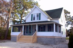
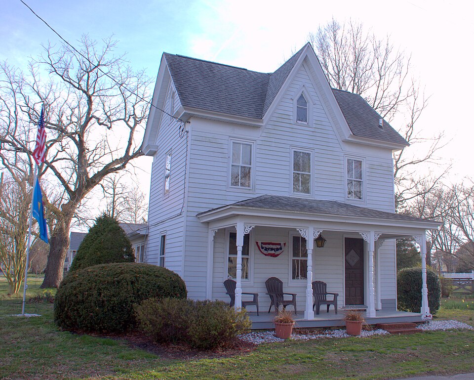
Photograph of Evans-West House
Photograph by Linda Roy Walls, CC BY-SA 4.0. Via Wikimedia Commons.

Evans-West House

Listed on the National Register of Historic Places in 2015.

From the record

“The Evans-West House is a historic house at 40 West Avenue in Ocean View, Delaware. It is a L-shaped wood-frame house, with clapboard siding, a cross-gable roof configuration, and a brick foundation.”

Wikipedia article Evans-West House, CC BY-SA 4.0.

One of 136 National Register listings published here for Sussex County · listed in 2015 · category: Building.

Sources: the Wikipedia article · the National Register database, National Park Service
The listing

  • What is counted as historic. The nomination lists 3 buildingss, 1 site as contributing to the listing.
  • Still standing. The Park Service records this property as extant.
  • Address. 40 West Ave., Ocean View, 19970
  • When was it listed? December 2015
  • Category. building
  • Census division. Selbyville-Frankford
  • Architectural style. Gothic Revival
  • National Register reference number. 15000844 - assigned by the National Park Service when the property was listed.

Storms near this property

13 since 1998

Regional context, not property-specific evidence. The National Weather Service names Ocean View, the town this property stands in, in 13 storm reports between 1998 and 2025: 6 lightning, 3 thunderstorm wind, 3 flash flood, 1 funnel cloud. The reports record 1 injury. Each account below is quoted exactly as the forecast office filed it, from the NOAA Storm Events Database, and each date opens the federal record of that event.

WhenEvent Place namedHarm What the report says
September 1998LightningOcean View1 hurtno account filed
August 2003LightningOcean View$100,000no account filed
August 2012LightningOcean View$50,000A lightning strike and ensuing fire caused extensive damage to a home on Inlet View Court in Bethany Beach. No injuries were reported.
May 2009LightningOcean View$40,000A lightning strike and ensuing fire sparked a garage and house fire on Oyster Shell Cove in Salt Pond in Baltimore Hundred. The garage was struck by lightning and the fire then spread to the home. Damage was estimated at $40,000. No injuries were reported.
July 2025Flash FloodOcean View-Flash flooding occurred along portions of SR 1 Coastal Hwy.
June 2021LightningOcean View-An outbuilding fire due to a lightning strike was reported on Oakwood Rd. Time estimated from dispatch calls.
June 2021LightningOcean View-Fire departments responded to a structure fire due to lightning on Oakwood Rd. Time estimated from dispatch calls.
July 2021Funnel CloudOcean View-A funnel cloud was reported north of Bethany Beach. This was likely the same funnel which would become a waterspout offshore, but there was no confirmation it ever touched down over land.
April 2019Thunderstorm WindOcean View-A mesonet site at Indian River Inlet measured a 50 knot wind gust.
May 2019Thunderstorm WindOcean View-Several trees down in the Millville and Pcean View Area. Time estimated from radar.
August 2013Flash FloodOcean View-Thunderstorms with heavy downpours caused flash flooding of small streams, fields as well as poor drainage flooding in southeastern Sussex County. Event precipitation totals included 4.13 inches in Bethany Beach, 3.80 inches in Selbyville and 3.50 inches in Gumboro.
August 2008Flash FloodOcean View-Thunderstorms with heavy downpours caused the flooding of Delaware State Route 1 on the south end of the Indian River Inlet Bridge. Other stream and poor drainage flooding occurred in Indian River Hundred and Lewes and Rehoboth Hundred. Doppler Radar storm total estimates reached between 3 and 6 inches across east central Sussex County with the highest estimates along the border between Indian River and Lewes and Rehoboth Hundreds.
August 2007Thunderstorm WindOcean View-A severe thunderstorm knocked down several trees in Ocean View.

Every storm recorded in Sussex County

Map coverage status

No historic map-sheet match is published for this property yet. That does not mean no map exists. This record needs a coordinate-quality review before it can be joined to a sheet boundary. Browse the county's mapped places while that work is pending.

Listed places nearby

6 within 8 miles

Other National Register properties close enough to walk or drive between, ordered by distance from this one. Both positions come from the same geocoding pass that matched these properties to their map sheets.

Photograph PropertyDistance Listed
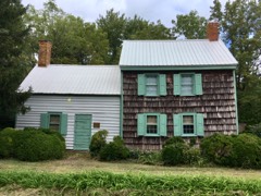
Tunnell-West House0.2 miles2012
Dinker-Irvin Cottage1.6 miles2017
Spring Banke2.9 miles1976
Union Wesley Methodist Episcopal Church Complex3.2 miles2014
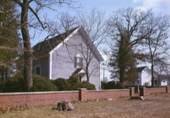
Blackwater Presbyterian Church4.0 miles1976
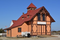
Indian River Life Saving Service Station6.1 miles1976

Sources for this property

National Archives recordThe nomination case file for reference 15000844 in Record Group 79.
Wikipedia articleCommunity-written account of this property, licensed CC BY-SA.
Sussex CountyAll 136 listed properties in this county.

Provenance

  • Listing record. National Park Service National Register of Historic Places, listed-properties dataset, current to 2026-05-22.
  • Map join. Address geocoded through the United States Census geocoder, then tested against the published boundary of every sheet in the USGS Historical Topographic Map Collection.
  • How this page is made. Listing fields come from federal records; map-sheet coverage is a labelled coordinate-to-boundary calculation, not a source-field claim.
  • Storms. NOAA National Centers for Environmental Information, Storm Events Database https://www.ncei.noaa.gov/stormevents/ A work of the United States government, no copyright under 17 U.S.C. 105. Narratives are quoted verbatim from the National Weather Service report and are not edited or summarised.