BlockBefore

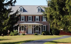
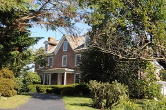
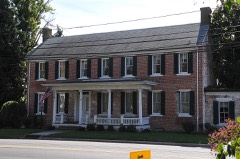
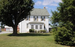
T. H. Denny House

Listed on the National Register of Historic Places in 1983.

From the record

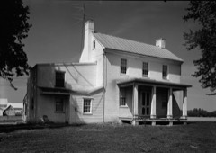
“Denny House, also known as "Mount Pinder," is a historic home and farm located at Kenton, Kent County, Delaware. The house dates to the last quarter of the 18th century, and is a two-story, five-bay, center hall plan brick dwelling.”

Wikipedia article T. H. Denny House, CC BY-SA 4.0.

One of 136 National Register listings published here for Kent County · listed in 1983 · category: Building.

Sources: the Wikipedia article · the case file at the National Archives · the National Register database, National Park Service
The listing

  • What is counted as historic. The nomination lists 4 buildingss as contributing to the listing.
  • Listed as. Denny, T. H., House - the National Register files a house under its owner's surname.
  • Address. DE 42, Kenton, 19904
  • When was it listed? June 1983
  • Category. building
  • Also known as. Kenton Hundred MRA
  • Census division. Dover
  • National Register reference number. 83001367 - the number the National Park Service assigned this property when it was listed, and the key its nomination file is catalogued under at the National Archives.

Storms near this property

5 since 2003

Regional context, not property-specific evidence. The National Weather Service names Kenton, the town this property stands in, in 5 storm reports between 2003 and 2025: 4 thunderstorm wind, 1 heavy rain. No death or injury is recorded in these reports. Each account below is quoted exactly as the forecast office filed it, from the NOAA Storm Events Database, and each date opens the federal record of that event.

WhenEvent Place namedHarm What the report says
March 2025Thunderstorm WindKenton-Multiple wires blown down.
July 2017Heavy RainKenton-Just over two inches of rain fell at this DEOS.
April 2016Thunderstorm WindKenton-A convectively-driven wind gust brought down a tree onto wires in Kenton.
May 2007Thunderstorm WindKenton-A severe thunderstorm knocked down a few trees in Kenton.
July 2003Thunderstorm WindKenton-no account filed

Every storm recorded in Kent County

Map coverage status

No historic map-sheet match is published for this property yet. That does not mean no map exists. This record needs a coordinate-quality review before it can be joined to a sheet boundary. Browse the county's mapped places while that work is pending.

Listed places nearby

6 within 8 miles

Other National Register properties close enough to walk or drive between, ordered by distance from this one. Both positions come from the same geocoding pass that matched these properties to their map sheets.

Photograph PropertyDistance Listed
Hoffecker-Lockwood House1.1 miles1983
Delaplane McDaniel House1.1 miles1983
Jefferson Lewis House1.4 miles1983
James Williams House2.2 miles1983
Somerville2.2 miles1974
Kenton Historic District2.4 miles1983

Sources for this property

National Archives recordThe nomination case file for reference 83001367 in Record Group 79.
Wikipedia articleCommunity-written account of this property, licensed CC BY-SA.
Kent CountyAll 136 listed properties in this county.

Provenance

  • Listing record. National Park Service National Register of Historic Places, listed-properties dataset, current to 2026-05-22.
  • Map join. Address geocoded through the United States Census geocoder, then tested against the published boundary of every sheet in the USGS Historical Topographic Map Collection.
  • How this page is made. Listing fields come from federal records; map-sheet coverage is a labelled coordinate-to-boundary calculation, not a source-field claim.
  • Storms. NOAA National Centers for Environmental Information, Storm Events Database https://www.ncei.noaa.gov/stormevents/ A work of the United States government, no copyright under 17 U.S.C. 105. Narratives are quoted verbatim from the National Weather Service report and are not edited or summarised.