Listed on the National Register of Historic Places in 1983.
From the record
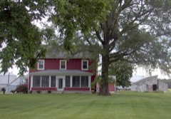
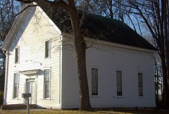
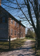
“Richards Historic District is a national historic district located in Greenwood, Sussex County, Delaware. The district includes 21 contributing buildings and 1 contributing site encompassing portions of three separate farms with three groupings of farm buildings.”
Wikipedia article Richards Historic District, CC BY-SA 4.0.
One of 136 National Register listings published here for Sussex County · listed in 1983 · category: District.
National Register reference number.83003522- the number the National Park Service assigned this property when it was listed, and the key its nomination file is catalogued under at the National Archives.
Fires near this property
6 since 2007
Regional context, not property-specific
evidence. The
federal wildfire occurrence database
lists 6 fires within 5 miles of Richards Historic District
between 2007 and 2020, burning about 9 acres in total. None started naturally. 2 were recorded as arson.
Distance is straight-line from the map coordinates, so a fire counted
here may appear on a neighbouring settlement's page as well.
Reported cause
Fires
Arson/incendiarism
2
Equipment and vehicle use
2
Debris and open burning
1
Missing data/not specified/undetermined
1
The most recent of
them, most recent first, with the day each was reported and the service
that recorded it.
Date
Cause
Size
Reported by
Name on the report
22 September 2007
Equipment and vehicle use
2.6 acres
Maryland Department of Natural Resources Forest Service
not named
6 August 2010
Missing data/not specified/undetermined
under an acre
Maryland Department of Natural Resources Forest Service
Regional context, not property-specific
evidence. The National Weather Service names
Greenwood, the town this property stands in, in 31 storm reports between 1997 and 2023: 16 thunderstorm wind, 7 heavy rain, 3 funnel cloud, 2 hail.
No death or injury is recorded in these reports. Each account below is quoted exactly as the forecast office
filed it, from the NOAA Storm Events Database, and each date
opens the federal record of that event.
A severe thunderstorm produced a swath of straight-line wind damage up to one-half mile wide in spots from southwestern Kent County into western Sussex County. Most of the wind damage occurred in Northwest Fork Hundred. Maximum wind gusts were estimated at 80 mph and caused property as well as substantial crop damage. One home sustained substantial damage. There was widespread crop damage from large hail.||Wind damage in Sussex County started near County Route 16 near Blanchard. The most significant damage occurred parallel to McDowell Road east of Woodbridge Road. A porch roof was ripped away from a wood-framed farm house, and a steel antenna tower next to the house was bent. A tree near the house was blown down, and a large chicken barn near the house collapsed. Farther east, another steel antenna tower was bent, and some shingles were torn off the roof of a nearby house. ||Corn was stripped to the stalk on many fields within the damage swath, resulting in a total loss in some cases. Wheat and barely fields also suffered substantial damage. Crop losses mainly from hail could easily total several hundred thousand dollars. ||Tree damage was also noted in the town of Greenwood. Small to medium sized limbs were torn away along Minor Street in downtown Greenwood. Some lawn furniture was blown around, and streets and driveways were littered with leaves. Some funnel clouds were reported, but they did not touch down.
A line of showers was accompanied by damaging winds as it moved through Greenwood around 1 a.m. EST. A radio tower lost part of its antenna, siding was ripped away from a storage center and the price sign and roof of a gas station was damaged. No injuries were reported.
Radar data indicated a rotation |signature which intensified for a time as an outflow boundary |settled southeastward and interacted with this storm. The radar |was scanning within 600 feet above ground level, with even|evidence of a tornado debris signature in the dual-pol data. A |tornado touched down between Nanticoke River and the intersection |of Sugar Hill Road and St. Johnstown Road, and tracked |northeastward for about 0.6 miles before lifting. There was |significant damage to a farm, with a couple of small barns |destroyed with a lot of debris lofted and blown far across an |adjacent field. Several trees were snapped or blown over along |with damage to a few nearby power poles and wires. A large |unoccupied chicken coup, about 200 feet in length, was lifted and |moved several feet off its foundation with some metal roof panels |on the north end were twisted in a southerly direction. Across the|street from the farm on Sugar Hill Road, a couple sections of |large central pivot irrigation systems were lifted and tipped onto|their side. Each section of the irrigation weighs about 8800 pounds.
A severe thunderstorm also produced large hail west of Greenwood in Sussex County. There was widespread crop damage from large hail. The hail caused corn to be stripped to the stalk. Wheat and barely fields also suffered substantial damage. Crop losses could easily total several hundred thousand dollars. In the nearby garden, strawberry plants were pulverized by the hail. The most significant hail damage occurred parallel to McDowell Road east of Woodbridge Road. Hail size was estimated.
A funnel cloud was sighted during a severe thunderstorm in northwest Sussex County. A National Weather Service damage survey indicated that all of the wind damage was straight line and that the funnel did not touch the ground.
Precipitation totals in Sussex County included 2.07 inches in Millsboro, 1.92 inches in Redden, 1.87 inches in Prime Hook and 1.81 inches in Georgetown.
No historic map-sheet match is published
for this property yet. That does not mean no map exists. This record needs
a coordinate-quality review before it can be joined to a sheet boundary.
Browse the county's mapped places while that work is
pending.
Listed places nearby
6 within 8 miles
Other National Register properties close
enough to walk or drive between, ordered by distance from this one. Both
positions come from the same geocoding pass that matched these properties
to their map sheets.
Listing record. National Park Service National Register of Historic Places, listed-properties dataset, current to 2026-05-22.
Map join. Address geocoded through the United States Census geocoder, then tested against the published boundary of every sheet in the USGS Historical Topographic Map Collection.
How this page is made. Listing fields come from federal records; map-sheet coverage is a labelled coordinate-to-boundary calculation, not a source-field claim.
Wildfire. Short, Karen C. 2022. Spatial wildfire occurrence data for the United States, 1992-2020 [FPA_FOD_20221014]. 6th Edition. Fort Collins, CO: Forest Service Research Data Archive. https://doi.org/10.2737/RDS-2013-0009.6 Collected with United States Government funding and usable without additional permissions or fees.
Storms. NOAA National Centers for Environmental Information, Storm Events Database https://www.ncei.noaa.gov/stormevents/ A work of the United States government, no copyright under 17 U.S.C. 105. Narratives are quoted verbatim from the National Weather Service report and are not edited or summarised.
 Block