 Block
From the record
One of 411 National Register listings published here for New Castle County · listed in 1986 · category: Building.
Sources: the case file at the National Archives · the National Register database, National Park Service
Listed on the National Register of Historic Places in 1986.
One of 411 National Register listings published here for New Castle County · listed in 1986 · category: Building.
Sources: the case file at the National Archives · the National Register database, National Park Service
Regional context, not property-specific evidence. The federal wildfire occurrence database lists 29 fires within 5 miles of J. Walker Farm between 2003 and 2006, burning about 12 acres in total. 1 started naturally. 1 was recorded as arson. Distance is straight-line from the map coordinates, so a fire counted here may appear on a neighbouring settlement's page as well.
| Reported cause | Fires |
|---|---|
| Missing data/not specified/undetermined | 24 |
| Smoking | 2 |
| Equipment and vehicle use | 1 |
| Natural | 1 |
| Arson/incendiarism | 1 |
The most recent of them, most recent first, with the day each was reported and the service that recorded it.
| Date | Cause | Size | Reported by | Name on the report |
|---|---|---|---|---|
| 22 August 2003 | Missing data/not specified/undetermined | under an acre | Delaware State Fire Marshal's Office | not named |
| 22 August 2003 | Smoking | under an acre | Delaware State Fire Marshal's Office | not named |
| 23 June 2005 | Missing data/not specified/undetermined | under an acre | Delaware State Fire Marshal's Office | not named |
| 23 June 2003 | Missing data/not specified/undetermined | under an acre | Delaware State Fire Marshal's Office | not named |
| 8 May 2005 | Missing data/not specified/undetermined | 1.0 acres | Delaware State Fire Marshal's Office | not named |
| 5 May 2004 | Missing data/not specified/undetermined | under an acre | Delaware State Fire Marshal's Office | not named |
| 21 May 2004 | Missing data/not specified/undetermined | 1.0 acres | Delaware State Fire Marshal's Office | not named |
| 29 April 2006 | Arson/incendiarism | under an acre | Pennsylvania Division of Forest Fire Protection | not named |
Regional context, not property-specific evidence. The National Weather Service names Newark, the town this property stands in, in 61 storm reports between 1995 and 2026: 36 thunderstorm wind, 9 hail, 6 lightning, 4 flood. The reports record 1 injury. Each account below is quoted exactly as the forecast office filed it, from the NOAA Storm Events Database, and each date opens the federal record of that event.
| When | Event | Place named | Harm | What the report says |
|---|---|---|---|---|
| August 2008 | Heavy Rain | Newark | 1 hurt | Heavy rain caused a roof collapse at the Towne Court Apartments on Thorn Lane just outside of Newark. Temporary roofing was in place and collapsed because of the rain. Three of the four apartments that were flooded were occupied. One person was injured and taken to the hospital. The Newark Agricultural Farm measured 0.39 inches, most of which fell within an hour. |
| August 2009 | Thunderstorm Wind | Newark | $500,000 | A squall line of severe thunderstorms produced wind damage across New Castle County, with the hardest hit areas in the northern part of the county. Numerous trees were uprooted and damaged, especially Tulip Poplars. In Newark, a couple of trees fell on homes and the siding was ripped away from one apartment building. In and around Wilmington, a large tree crashed through a home in Westover Hills. The Hagley Museum and Library lost eight trees. Elsmere and Hockessin were among the communties that were hardest hit by power outages. |
| July 2007 | Lightning | Newark | $200,000 | As thunderstorms moved across New Castle County, lightning caused damage to three structures. In Newark, in the Academy Hill Development, a lightning strike started a fire in the basement of one home. The home filled with smoke. It took twenty-five firefighters about forty minutes to extinguish the fire. Damage was estimated at $5,000. In New Castle, a lightning strike punched holes in an Artesian Water Tower on School Lane. It caused the tower to leak. In Delaware City, a lightning strike created a hole in the roof of a home on East Harvest Drive. The ensuing fire consumed a large portion of the roof as well as the master bedroom. Damage was estimated at $150,000. |
| June 2012 | Thunderstorm Wind | Newark | $100,000 | A gust front outrunning a cluster of severe thunderstorms entered near Newark in western New Castle County at approximately 11:57 pm EDT on the 29th. This gust front produced damaging wind gusts estimated from 65 to 70 mph as it traversed eastward across the county. Within approximately 20 minutes of the gust front passage, a potent line of severe thunderstorms tracked eastward into New Castle County. One thunderstorm cell in particular experienced rapid intensification and expansion as it tracked into New Castle County. Destructive wind gusts, estimated near 75 mph, resulted in tree and power line damage across the county. Multiple downed trees were reported in Middletown and Odessa. In addition, power poles were snapped by wind gusts estimated between 70 and 75 mph in Middletown. Severe thunderstorms exited eastern New Castle County, including Delaware City, at approximately 12:50 am EDT on the 30th. |
| June 2003 | Lightning | Newark | $50,000 | no account filed |
| August 2013 | Thunderstorm Wind | Newark | $25,000 | A severe thunderstorm that moved through Newark sheared the bricks off of one building and also damaged shutters and windows at the Studio Green Apartments. Trees and power lines were also knocked down along Elkton Road. |
| July 2023 | Lightning | Newark | $10,000 | House struck by lightning on the east side of Newark resulting in a fire and significant damage. Time estimated by radar and lightning data. |
| August 2011 | Lightning | Newark | $10,000 | Lightning struck a home in Newark and caused minor damage to it. |
| June 2004 | Lightning | Newark | $5,000 | no account filed |
| July 2007 | Lightning | Newark | $1,000 | The combination of lightning strikes and damaging winds caused about 5,200 homes and businesses to lose power across New Castle County. |
| March 2026 | Thunderstorm Wind | Newark | - | Transformer blown on Old Harmony Road. Time estimated from radar. |
| March 2026 | Thunderstorm Wind | Newark | - | A metal sheeting barn roof was blown off a barn. Walls also of metal sheeting subsequently collapsed. Time estimate from radar and nearby observations. |
| June 2024 | Thunderstorm Wind | Newark | - | Picture sent in of several trees down on power lines. Time estimated from radar. |
| April 2023 | Thunderstorm Wind | Newark | - | Multiple trees into houses reported around Newark. Time estimated via radar. |
| April 2023 | Thunderstorm Wind | Newark | - | NWS Storm Survey found sporadic straight line wind damage continuing into New Castle County not to be associated with the upstream tornado which had dissipated in Cecil County. Time estimated from radar. |
| August 2023 | Thunderstorm Wind | Newark | - | Report of trees down in Newark, DE near the DE/MD border. Time estimated from radar. |
| August 2023 | Thunderstorm Wind | Newark | - | Public report of large tree down in backyard on social media. Photo provided. Time estimated via radar. |
| February 2022 | Thunderstorm Wind | Newark | - | Several trees were downed around Newark. Time estimated from radar. |
| June 2021 | Thunderstorm Wind | Newark | - | A tree was downed on a house on Squirrel Ln in Newark. A family of 5 were inside at the time. One woman, a grandmother, had to be rescued by firefighters but did not suffer serious injury. The other occupants escaped on their own. Time estimated from radar. |
| July 2021 | Thunderstorm Wind | Newark | - | A tree was downed in the 400 block of Lark Dr. Time estimated from radar. |
| November 2020 | Thunderstorm Wind | Newark | - | Downed trees and wires closed Wedgewood Rd between Fox Ln and Wallace Dr. Time estimated from radar. |
| June 2019 | Thunderstorm Wind | Newark | - | A spotter reported tree damage and winds estimated to be 60 to 65mph. Time estimated from radar. |
| June 2019 | Hail | Newark | - | Time was estimated from radar. |
| July 2019 | Thunderstorm Wind | Newark | - | Photo received via social media of a tree snapped. Time estimated from radar. |
| April 2017 | Thunderstorm Wind | Newark | - | Trees and wires downed due to thunderstorm winds. |
| April 2016 | Thunderstorm Wind | Newark | - | Thunderstorm wind gusts associated with a strong cold front moving across the area during the late evening hours on the 2nd toppled a tree, hitting a house in Newark. Scattered power outages also occurred in New Castle County. |
| June 2016 | Thunderstorm Wind | Newark | - | Tree snapped in half due to thunderstorm wind gusts. |
| June 2015 | Flash Flood | Newark | - | Thunderstorms with heavy rain caused flash flooding in and around Newark. Vehicles became stuck in flood waters in Newark. The afternoon and evening event precipitation totals included 2.55 inches in Newark. |
| June 2015 | Thunderstorm Wind | Newark | - | A severe thunderstorm knocked down trees and wires in Newark (White Clay Hundred). |
| June 2015 | Funnel Cloud | Newark | - | A funnel cloud was sighted over Newark. While there was thunderstorm wind damage across the northern tier of Delaware, the circulation did not reach downward to the ground. |
| June 2013 | Flood | Newark | - | The Christina River at Coochs Bridge had moderate flooding and was above its 10.5 foot flood stage from 716 p.m. EDT through 1101 p.m. EDT on the 17th. It crested at 11.80 feet at 715 p.m. EDT. Flooding was reported on Delaware State Route 72 near Interstate 95 in Newark. Flooding was also reported along U.S. Route 40 in Bear. Event precipitation totals included 1.81 inches in Bear, 1.73 inches in Newark, 1.21 inches in Middletown and 1.10 inches in Hockessin. |
| June 2013 | Hail | Newark | - | Penny size hail fell from a thunderstorm in Newark. |
| November 2013 | Thunderstorm Wind | Newark | - | A convective line knocked down large tree limbs and wires in Newark. |
| June 2012 | Hail | Newark | - | A large and intense thunderstorm dropped golf-ball size hail in Newark. |
| September 2012 | Thunderstorm Wind | Newark | - | A severe thunderstorm knocked down several large tree limbs and wires throughout New Castle County. |
| August 2011 | Thunderstorm Wind | Newark | - | A severe thunderstorm knocked down several trees and wires in and around the Newark area. |
| May 2010 | Hail | Newark | - | Penny size hail fell in Newark. |
| June 2010 | Thunderstorm Wind | Newark | - | A severe thunderstorm knocked down several trees in Newark. |
| June 2010 | Hail | Newark | - | A severe thunderstorm dropped quarter size hail in Newark. |
| September 2010 | Hail | Newark | - | Penny size hail fell in Newark. |
| March 2009 | Thunderstorm Wind | Newark | - | A severe thunderstorm knocked down a couple of trees in Newark. About 300 homes and businesses lost power. |
| August 2009 | Thunderstorm Wind | Newark | - | A severe thunderstorm tore down a few trees and wires in Newark. |
| July 2009 | Funnel Cloud | Newark | - | A funnel cloud was spotted over Newark, but it did not touch down and cause any damage. |
| July 2009 | Thunderstorm Wind | Newark | - | While the funnel cloud did not touch down, the parent severe thunderstorm did produce downburst straight line winds that tore down tree limbs and wires in Newark. |
| March 2008 | Thunderstorm Wind | Newark | - | The squall line of severe storms caused about twenty related wind accidents on Interstate 95 and closed the roadway. There were numerous reports of trees, poles and wires down in the northern part of the county and caused outages. It took until the 10th for all power to be restored. Hardest hit were Arden, Brandywine Hundred, Newark and Wilmington. A wind gust to 62 mph was measured in Bear as the squall line moved through. A wind gust of 56 mph was also reported at the New Castle County Airport. |
| March 2007 | Flood | Newark | - | Heavy rainfall early on the 2nd produced street flooding. Water covered parts of Delaware 9, south of Dobbinsville, slowing traffic. The Christina River at Coochs Bridge rose above its flood stage of 10.5 feet at 5:29 AM EST, crested at 11.54 feet at 8:45 AM EST, and then dropped below flood stage at 12:36 PM EST.| |The White Clay Creek at Newark went above the flood stage of 13.0 feet at 7:49 AM EST, crested at 14.17 feet at 1:00 PM EST, and then dropped below flood stage at 2:55 PM EST. The White Clay Creek at Strickersville went above its flood stage of 9.5 feet at 8:43 AM EST, crested at 9.52 feet at 8:45 AM EST, and then dropped below flood stage at 8:55 AM EST.||The Red Clay Creek at Wooddale went above its flood stage of 7.0 feet at 6:18 AM EST, crested at 8.37 feet at 9:15 AM EST, then dropped below flood stage at 12:53 PM EST At Stanton, the flood stage of 15.0 feet was surpassed at 6:41 AM EST, crested at 15.90 feet at 10:15 AM EST, then dropped below flood stage at 1:39 PM EST. ||The Brandywine Creek at Wilmington rose above its flood stage of 11.0 feet at 4:59 AM EST, crested at 13.24 feet at 10:15 AM EST, and then dropped below flood stage at 7:02 PM EST. (all times on the 2nd). |
| April 2007 | Flood | Newark | - | The heavy rain and stream and river flooding caused flooding of roads and basements. a mother and daughter were rescued from a stranded car near the Delaware River just south of New Castle. On the 16th, a school bus became stuck on Delaware State Route 9 near Army Creek in New Castle after the driver drove around barricades. Two students on board were also rescued. About three to four homes were flooded in Christina. Roads were flooded in Glasgow. Impassable roads included Delaware State Route 9, Airport Road, Commons Road and the southbound lanes of the Flemings Landing Bridge |The Christina River at Coochs Bridge was above its 10.5 foot flood stage from 648 am EDT on the 15th through 701 pm EDT on the 15th. It crested at 11.79 feet at 202 pm EDT on the 15th. The White Clay Creek at Newark was above its 13 foot flood stage from 1043 am EDT on the 15th through 855 pm EDT on the 15th. It crested at 14.66 feet at 330 pm EDT on the 15th. The Red Clay Creek at Wooddale was above its 7 foot flood stage from 1120 am EDT on the 15th through 621 pm EDT on the 15th. It crested at 7.78 feet at 315 pm EDT on the 15th. Farther downstream, the Red Clay Creek at Stanton was above its 15 foot flood stage from 1151 am EDT on the 15th through 742 pm EDT on the 15th. It crested at 15.79 feet at 300 pm EDT on the 15th. The Brandywine Creek at Wilmington was above its 11 foot flood stage from before 530 am EDT on the 16th through 711 pm EDT on the 16th. It crested at 13.34 feet at 530 am EDT on the 16th. |Precipitation totals included 5.05 inches in Bear, 4.87 inches at the New Castle County Airport, 4.77 inches in Newark, 4.70 inches in Wilmington and 2.73 inches in Blackbird. Snow accumulations included 1.0 inch in Yorklyn. |
| April 1995 | Thunderstorm Wind | Newark | - | A squall line of severe thunderstorms uprooted an 85-year old white oak tree on Sypherd Drive. The tree landed on and damaged the roof and side of a house. Elsewhere in Newark, three large Bradford Pear trees were blown over and there were numerous reports of fallen limbs. FLORIDA |
| April 2007 | Heavy Rain | Newark | - | no account filed |
| June 2006 | Flood | Newark | - | no account filed |
| July 2006 | Thunderstorm Wind | Newark | - | no account filed |
| August 2006 | Funnel Cloud | Newark | - | no account filed |
| June 2003 | Thunderstorm Wind | Newark | - | no account filed |
| July 2002 | Thunderstorm Wind | Newark | - | no account filed |
| June 2002 | Thunderstorm Wind | Newark | - | no account filed |
| September 2001 | Thunderstorm Wind | Newark | - | no account filed |
| May 2000 | Hail | Newark | - | no account filed |
| May 1999 | Thunderstorm Wind | Newark | - | no account filed |
| May 1999 | Hail | Newark | - | no account filed |
| August 1998 | Thunderstorm Wind | Newark | - | no account filed |
No historic map-sheet match is published for this property yet. That does not mean no map exists. This record needs a coordinate-quality review before it can be joined to a sheet boundary. Browse the county's mapped places while that work is pending.
Other National Register properties close enough to walk or drive between, ordered by distance from this one. Both positions come from the same geocoding pass that matched these properties to their map sheets.
| Photograph | Property | Distance | Listed |
|---|---|---|---|
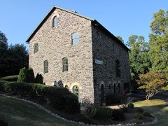 | J. Lindsay Barn | 0.4 miles | 1986 |
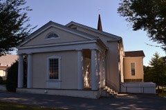 | Red Clay Creek Presbyterian Church | 0.5 miles | 1973 |
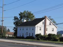 | Mermaid Tavern | 0.9 miles | 1973 |
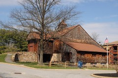 | R. Walker Barn | 1.1 miles | 1986 |
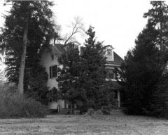 | J. McCormack Farm | 1.3 miles | 1986 |
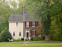 | Montgomery House | 1.4 miles | 1988 |
| National Archives record | The nomination case file for reference 86003081 in Record Group 79. |
| New Castle County | All 411 listed properties in this county. |