 Block
BlockCape Coral, Florida
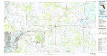
15 topographic sheets cover this place, the earliest surveyed in 1956 and the latest in 1987. It stands in the Cape Coral census division. It lies in ZIP code area 33904. The Survey maps it on the Fort Myers SW quadrangle. 194,016 people lived here at the 2020 count. It stands 7 feet above sea level.
Research this city
Then and now
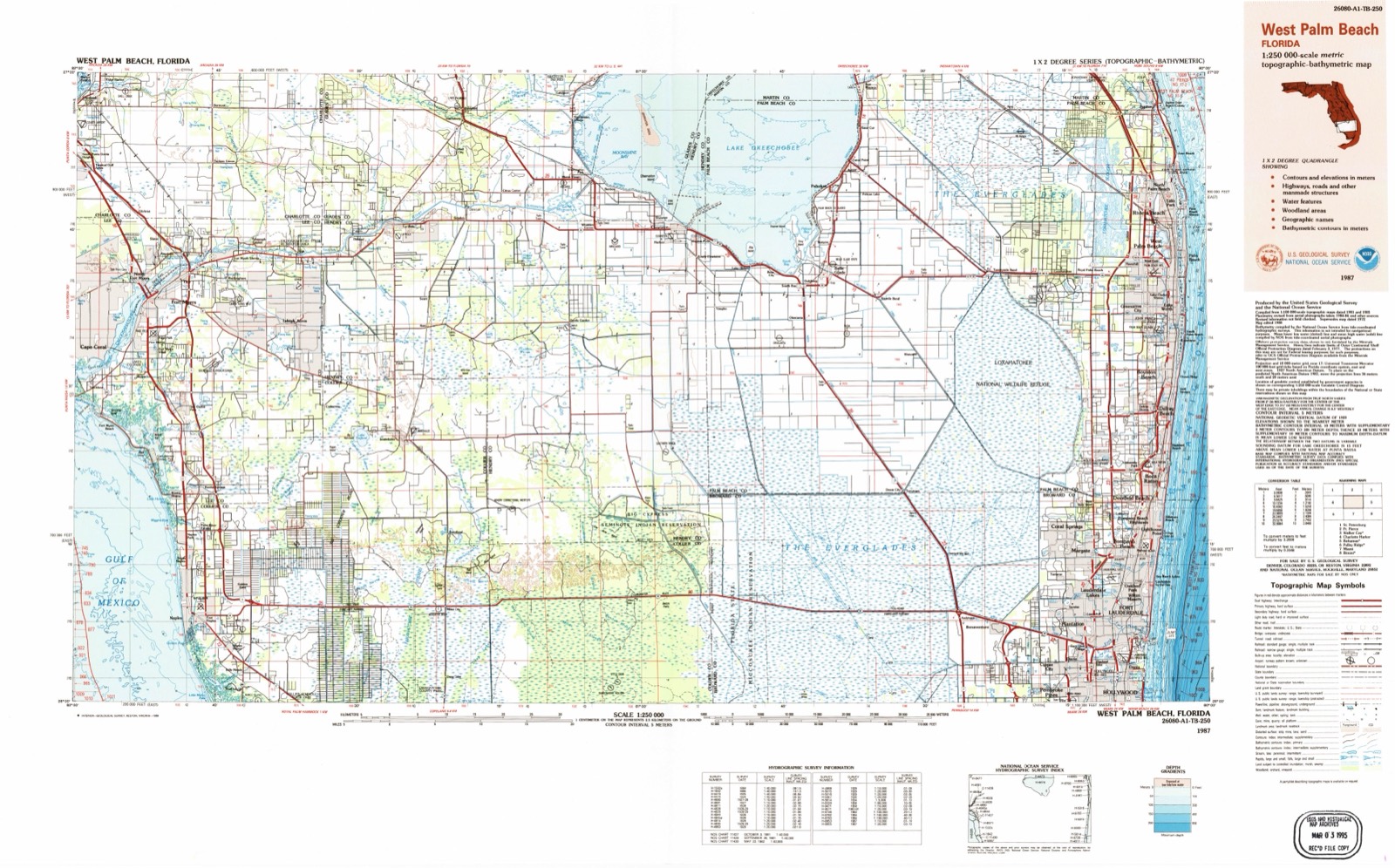
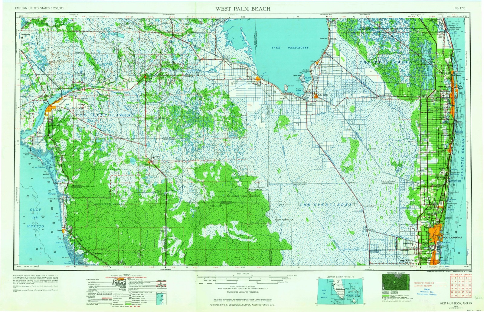
1956 to 1987The same ground, surveyed 31 years apart. Drag the handle to wipe between them. Both sheets are United States Geological Survey originals; neither has been altered.
Population over time
2 figuresCape Coral grew from 154,305 to 194,016 between 2010 and 2020. These are the recorded population figures Wikidata holds for this place, reached through the Geographic Names Information System number this page is keyed on rather than by name, so they belong to this place and not to another of the same name. Most are census counts, but not all are: an early figure may be a founding or settlement estimate, and an estimate published within five years of a census is left out. The change column is computed, and is left blank where more than 20 years separate a figure from the one before it, because a gap that long is not a change between two counts.
| Year | People | Change |
|---|---|---|
| 2010 | 154,305 | |
| 2020 | 194,016 | +39,711 (+26%) |
Topographic sheets covering this place
7 surveys from 15 printed sheetsMatched by testing this settlement's coordinate against the published boundary of every sheet in the United States Geological Survey's historical collection. Each opens the scanned sheet at the Survey.
- 1956 USGS West Palm Beach quadrangle1:250000, 2 printings
- 1957 USGS West Palm Beach quadrangle1:250000
- 1958 USGS Fort Myers SW quadrangle1:24000, 6 printings
- 1958 USGS West Palm Beach quadrangle1:250000, 2 printings
- 1981 USGS Fort Myers quadrangle1:100000
- 1985 USGS Fort Myers quadrangle1:100000
- 1987 USGS West Palm Beach quadrangle1:250000, 2 printings




Fires near this place
41 since 1992Regional context, not property-specific evidence. The federal wildfire occurrence database lists 41 fires within 5 miles of Cape Coral between 1992 and 2017, burning about 114 acres in total. 7 started naturally. 9 were recorded as arson. Distance is straight-line from the map coordinates, so a fire counted here may appear on a neighbouring settlement's page as well.
| Reported cause | Fires |
|---|---|
| Railroad operations and maintenance | 12 |
| Arson/incendiarism | 9 |
| Natural | 7 |
| Misuse of fire by a minor | 4 |
| Missing data/not specified/undetermined | 4 |
| Equipment and vehicle use | 3 |
| Debris and open burning | 1 |
| Recreation and ceremony | 1 |
The most recent of them, most recent first, with the day each was reported and the service that recorded it.
| Date | Cause | Size | Reported by | Name on the report |
|---|---|---|---|---|
| 5 July 1994 | Railroad operations and maintenance | 1.0 acres | Florida Forest Service | not named |
| 16 July 2007 | Natural | 2.5 acres | Florida Forest Service | 36/OASIS FIRE |
| 13 July 1995 | Natural | under an acre | Florida Forest Service | not named |
| 1 July 1994 | Railroad operations and maintenance | 10 acres | Florida Forest Service | not named |
| 9 June 1994 | Railroad operations and maintenance | 1.0 acres | Florida Forest Service | not named |
| 7 June 1993 | Debris and open burning | 7.0 acres | Florida Forest Service | not named |
| 20 June 2007 | Natural | under an acre | Florida Forest Service | 36/ THE OLD SOUTH FIRE |
| 17 June 2001 | Natural | 6.0 acres | Florida Forest Service | not named |
Settlements close enough to share some of these fires:
Storms near this place
60 of 113 shownRegional context, not property-specific evidence. The National Weather Service names Cape Coral in 113 storm reports between 1993 and 2024: 36 thunderstorm wind, 21 hail, 16 tornado, 15 lightning. The reports record 7 injuries. Each account below is quoted exactly as the forecast office filed it, from the NOAA Storm Events Database, and each date opens the federal record of that event.
| When | Event | Place named | Harm | What the report says |
|---|---|---|---|---|
| July 1996 | Tornado (F0) | Cape Coral | 2 hurt, $250,000 | no account filed |
| August 2009 | Lightning | Cape Coral | 2 hurt | Two women were struck by lightning during a storm that moved over Cape Coral. One 40-year-old woman felt lightning move through her arm as she was holding an umbrella next to a truck. Another 34-year-old woman felt lightning come through her keyboard while she was on her computer. Both were transported to the hospital in stable condition. |
| September 2007 | Tornado (EF1) | Cape Coral | 1 hurt, $4,000,000 | Thunderstorms continued to develop northward along the sea breeze front and produced a tornado that traveled due north from near the intersection of Rose Garden and and El Dorado Parkway West to near Skyline Boulevard and Veterans memorial Parkway. The damage path was less than the size of a single family home for most of the track and the average wind speed based on the damage was 65-75 MPH. The EF1 damage was of a home nearly cut in half by the tornado with wind speeds estimated at 105 MPH. The lower than expected wind estimate was a result of older building codes and the roof blowout occurred as a result of a large picture window being blown in. About 138 homes were damaged. Six homes received moderate damage and one home was destroyed. The tornado snapped several power poles and damaged numerous fences, sheds and trees. Several vehicles and boats were flipped over. There was one injury as a gentleman looked outside to see the tornado and was struck by debris. Thirty people were displaced from their homes. Damage estimates were based on a survey completed by Cape Coral Emergency Management. |
| August 2006 | Lightning | Cape Coral | 1 hurt, $114,000 | Sixteen single family homes were damaged by flying debris and reverberations caused by an explosion of a 40 foot decaying pine tree due to a lightning strike. The expanding steam and resin from the wet but dead tree created a one block debris field. The explosion from the strike shattered windows, lifted roofs, caved ceilings, dented cars, and bent fences. A 14-foot long trench about a half a foot deep was formed as the roots exploded. In all, 29 windows were broken and 2 homes reported damage of $30,000 or more. One man was treated for minor injuries. |
| July 1998 | Lightning | Cape Coral | 1 hurt | Lightning struck and injured a 42 year old man that was boating near Cabbage Key. The man suffered full cardiac arrest from the lightning strike and was later resuscitated with CPR administered by a nurse. |
| October 2019 | Tornado (EF1) | Cape Coral | $600,000 | A tornado touched down in northwest Cape Coral, damaging 18 homes and several vehicles. Most of the damage to homes involved partial roof damage, and fascia, siding, and awnings being blown off the homes. A couple of cars were rolled over, totaling the vehicles. No injuries were reported. |
| January 2024 | Flood | Cape Coral | $500,000 | Broadcast media relayed initial reports of multiple streets and roadways flooded in the Cape Coral area just northeast of the intersection of Pelican Boulevard and Mohawk Parkway; near 2nd and 3rd Avenue, and 38th and 39th Street. Shortly thereafter, county officials confirmed around 50 stalled vehicles due to ongoing street and road flooding in central and southern Cape Coral, although unofficial estimates topped 100 vehicles. Additional flooding of streets and roadways as well as neighborhoods occurred across other parts and Cape Coral and Fort Myers, however, no injuries or additional damage were reported. |
| June 1999 | Flash Flood | Cape Coral | $500,000 | The State of Florida Division of Emergency Management reported that six to eight inches of rainfall in less than three hours caused widespread flooding to numerous roadways and water damage to homes throughout Cape Coral. Nearly 50 homes reported water damage to carpets while an additional nine homes received major structural damage from floodwaters throughout Cape Coral. |
| December 1994 | Thunderstorm Wind | Cape Coral | $500,000 | Severe thunderstorm wind gusts blew tiles off house roofs and tore down trees over a widespread area in Cape Coral. |
| April 1993 | Thunderstorm Wind | Cape Coral | $500,000 | Fifty homes near the Cape Coral Yacht Club received minor damage from high winds. Most of the damage was to screen enclosures, patio furniture, downed trees and power lines. |
| June 1997 | Tornado (F0) | Cape Coral | $214,000 | A waterspout moved onshore as a tornado near SE 28th Street and SE 24th Place in Cape Coral and moved northwest. The tornado caused minor to moderate roof, carport, lanai, boat, power line and tree damage in the heavily residential area of eastern Cape Coral. A total of 92 residences sustained damage from the tornado. One boat was blown from dry-dock on land into a canal.The tornado moved northwest and crossed Everest Parkway and Del Prado Boulevard before it lifted near the intersection of SE 18th Street and SE 12th Place. Total damage estimated by Lee County Emergency Management and Cape Coral Fire officials was $214,000 dollars. |
| July 2006 | Lightning | Cape Coral | $200,000 | Lightning ignited a fire that destroyed a home on the 1500 block of SW 29th Terrace. The owners were not home at the time and the hurricane shutters had to be cut off the home so fire fighters could battle the blaze. Damage was estimated at $185,000 for the structure and $15,000 for the contents. |
| July 2006 | Lightning | Cape Coral | $200,000 | Lightning ignited a fire that destroyed a one story home on the 1500 block of 49th Terrace. The home owners were on vacation. |
| September 1997 | Flash Flood | Cape Coral | $200,000 | no account filed |
| October 2004 | Lightning | Cape Coral | $150,000 | A home was struck by lightning, which caused a fire that spread throughout the attic and eventually consumed much of the house. There were no injuries. |
| August 2001 | Thunderstorm Wind | Cape Coral | $150,000 | Lee county emergency management reported that thunderstorm winds downed numerous large trees and branches which damaged at least 25 homes and two businesses across Cape Coral. |
| June 2008 | Tornado (EF0) | Cape Coral | $110,000 | Damage was sustained by 18 homes near Pelican Boulevard. Fourteen homes incurred minor damage to pool cages and roof shingles. Four homes had moderate damage to roofs and soffits. The brief tornado occurred on the leading edge of a thunderstorm gust front. Wind speeds were estimated around 80mph. |
| August 2009 | Tornado (EF0) | Cape Coral | $103,000 | Twenty three homes were damaged from an EF-0 tornado with winds estimated at 70 to 80mph. Eleven homes suffered the most damage mainly to roofs, fascia, soffits, broken windows, and outdoor equipment such as satellite and electric systems. |
| August 1999 | Thunderstorm Wind | Cape Coral | $100,000 | The Lee County Emergency Management reported that thunderstorm winds damaged roofs and screened lanai's of a few homes and the carports of several homes from St. James City on Pine Island to Cape Coral. |
| November 1997 | Thunderstorm Wind | Cape Coral | $90,000 | Thunderstorm winds caused minor roof shingle and lanai damage to 42 structures near the intersection of Del Prado Boulevard and SE 40th Street in Cape Coral. |
| June 2000 | Thunderstorm Wind | Cape Coral | $67,000 | Lee County Emergency Management reported that thunderstorm winds caused minor to moderate roof damage to several homes along 21st Place SE, 22nd Avenue, 36th Terrace SE and 36th Street SE along the Caloosahatchee River in Cape Coral. |
| August 2000 | Thunderstorm Wind | Cape Coral | $56,000 | The public reported that thunderstorm winds damaged an elevated 24 foot long pontoon boat and damaged six additional elevated small boats at a retail boat store located near the intersection of Delprado and 46th Street in Cape Coral. |
| July 1999 | Lightning | Cape Coral | $50,000 | Lightning struck and damaged the roof and second floor of a home on the 11000 block of Tawas Court on Pine Island. |
| October 1996 | Thunderstorm Wind | Cape Coral | $44,000 | no account filed |
| July 2006 | Flash Flood | Cape Coral | $40,000 | Lee County Emergency Management reported numerous cars stalled in flooded streets in Cape Coral and Fort Myers. Water entered several homes in Fort Myers near Dean Park. |
| June 2004 | Tornado (F0) | Cape Coral | $35,000 | The Cape Coral Fire Department reported a weak slow moving tornado that passed through the 2600 block of SW 31st Lane to the 3700 block of Oasis. Two lanais were destroyed, shingles were blown off several roofs, and a fence was blown down. |
| December 1997 | Lightning | Cape Coral | $35,000 | Lightning struck and burned to the ground a home on the 1400 block of Vincennes Court in Cape Coral. The lightning struck near the kitchen and spread the fire through the remainder of the home. |
| June 2001 | Thunderstorm Wind | Cape Coral | $30,000 | Lee county emergency management reported that thunderstorm winds peeled off a portion of the roof on the south side of a three duplex structure on the 500 block of 8th Street S.E. in Cape Coral. |
| January 1998 | Flood | Cape Coral | $25,000 | Heavy rain of three to five inches in less than three hours caused localized flooding of roads and low lying areas in Cape Coral. A few cars stalled and incurred water damage from the floodwaters in Cape Coral. |
| August 1998 | Thunderstorm Wind | Cape Coral | $25,000 | Thunderstorm winds downed numerous trees and power lines over southern portions of Cape Coral. Thunderstorm winds also downed a large tree limb from an Australian pine tree which crushed the roof of a station wagon in Sanibel. |
| December 2003 | Thunderstorm Wind | Cape Coral | $20,000 | Thunderstorms along a strong cold front produced damaging winds that knocked down several trees and power lines at the intersection of Nicholas Parkway and 4th Avenue Southeast. |
| February 1998 | Tornado (F0) | Cape Coral | $20,000 | A short lived tornado touched down along Sanibel Captiva Road near Blind Pass on Sanibel Island and downed a few trees before it lifted and dissipated. |
| July 1997 | Thunderstorm Wind | Cape Coral | $20,000 | Thunderstorm winds damaged a few pool enclosures on SE 33rd Terrace in Cape Coral. A few trees and power lines were also downed by the thunderstorm wind. |
| June 2000 | Thunderstorm Wind | Cape Coral | $15,000 | Lee county Emergency Management reported that thunderstorm winds of up to 50 mph caused minor paint damage to several vehicles at a Walmart supercenter along Del Prado Parkway in Cape Coral. |
| May 1998 | Thunderstorm Wind | Cape Coral | $15,000 | Thunderstorm winds blew off the roof of a commercial building at the intersection of Pine Island Road and Andalusia Boulevard. Also, thunderstorm winds downed several large branches on Sanibel Island. |
| February 1998 | High Wind | Cape Coral | $15,000 | Gradient wind of up to 45 mph caused $15,000 dollars worth of damage to the front door of Fire Station No. 4 on Santa Barbara Boulevard in Cape Coral. |
| March 2011 | Thunderstorm Wind | Cape Coral | $10,000 | Several trees and numerous branches were downed at the Coral Oaks Golf Course. |
| June 2010 | Lightning | Cape Coral | $10,000 | A roof was damaged by a lightning strike. |
| July 2003 | Thunderstorm Wind | Cape Coral | $10,000 | Thunderstorm winds damaged several car ports at the Jamaica Bay Mobile Home Park. Other damage included torn screens in lanai areas, a pushed over wood fence in disrepair, and loose soffets blown down. |
| August 2000 | Thunderstorm Wind | Cape Coral | $10,000 | Skywarn Spotters and a local utility reported a few large trees and numerous branches downed from Pine Island to Cape Coral of western Lee county. |
| July 2000 | Thunderstorm Wind | Cape Coral | $10,000 | The public reported, through WFTX-TV of Cape Coral, that thunderstorm winds downed a few trees, several branches and power lines along Nicholas Parkway in Cape Coral. |
| February 1998 | Thunderstorm Wind | Cape Coral | $10,000 | Thunderstorm winds downed several power lines along Sanibel Captiva Road on Sanibel Island. |
| February 1998 | Thunderstorm Wind | Cape Coral | $10,000 | Thunderstorm winds estimated at 60 to 70 mph downed several trees in Cape Coral. |
| July 1997 | Lightning | Cape Coral | $10,000 | Lightning ignited six brush fires and consumed nearly 25 acres in Cape Coral. |
| June 1996 | Lightning | Cape Coral | $10,000 | no account filed |
| January 1995 | Thunderstorm Wind | Cape Coral | $6,000 | Six to eight trees were downed and three homes suffered minor roof damage from severe thunderstorm winds in Cape Coral. |
| August 1999 | Lightning | Cape Coral | $5,000 | Lightning struck and ignited a fire in the electrical wiring of the kitchen of a home on the 5000 block of Seagull Court in Cape Coral. |
| June 1998 | Thunderstorm Wind | Cape Coral | $5,000 | Thunderstorm winds downed several large palm trees, uprooted several small fruit trees and blew a trampoline through a screen pool enclosure in Cape Coral. |
| February 1998 | Thunderstorm Wind | Cape Coral | $5,000 | Thunderstorm winds downed several power lines along Del Prado Boulevard in Cape Coral. |
| February 1998 | Thunderstorm Wind | Cape Coral | $5,000 | Thunderstorm winds damaged pool cages and downed two large trees in Cape Coral. |
| June 1994 | Thunderstorm Wind | Cape Coral | $5,000 | Part of a shopping center roof was blown off damaging vehicles in parking lot. A boat was blown off its davit into a house. |
| August 1993 | Tornado (F0) | Cape Coral | $5,000 | A small tornado damaged the roof of a home and moved a parked car. |
| August 1993 | Tornado (F0) | Cape Coral | $5,000 | A small tornado damaged a screen enclosure, and injured a pet. |
| June 2010 | Thunderstorm Wind | Cape Coral | $3,000 | The public reported damage to a lanai roof and screen on a vacant home and a few tree branches were downed. |
| June 2009 | Flash Flood | Cape Coral | $2,500 | Numerous cars were flooded, some floating down the roads, and there were several road closures around Cape Coral from 4.00 to 4.50 inches of rain falling in a two hour period. Water was two to three feet deep in some locations along Del Prado Boulevard and along Northwest 3rd Avenue. |
| September 2007 | Thunderstorm Wind | Cape Coral | $2,000 | Down burst winds wrapping around a tornado three blocks to the east caused minor damage to several homes in the area around the intersection of Beach Parkway West and Agualinda Boulevard. |
| July 1997 | Thunderstorm Wind | Cape Coral | $2,000 | Thunderstorm wind caused minor damage to the roof of a home in Cape Coral. |
| January 1995 | Thunderstorm Wind | Cape Coral | $2,000 | Trees were uprooted and a boat was lifted out of the water onto a dock during a severe thunderstorm. |
| August 2013 | Thunderstorm Wind | Cape Coral | $1,500 | Cape Coral Police Department reported a couple of downed trees in the Veterans Parkway and Skyline Boulevard area. Time estimated off radar velocities. |
| July 1998 | Lightning | Cape Coral | $1,000 | Lightning struck a vehicle and damaged its onboard computer system near the intersection of Miracle Parkway and Chiquita Boulevard in Cape Coral. Two passengers inside the vehicle struck by lightning were uninjured. |
Nearest settlements
The eight closest, with where each one stands in the county. Distances are straight-line, computed from the Geographic Names Information System coordinates.
| Map | Place | Distance | Sheets |
|---|---|---|---|
| McGregor | 1.9 miles | 15 | |
| Caloosahatchee (historical) | 2.3 miles | 15 | |
| Iona | 3.0 miles | 15 | |
| Cypress Lake | 3.2 miles | 15 | |
| Whiskey Creek | 3.2 miles | 15 | |
| Harlem Heights | 3.4 miles | 15 | |
| Pine Manor | 3.8 miles | 15 | |
| Shell Point Village | 3.9 miles | 15 |
Elsewhere
Matched on this settlement's Geographic Names Information System number rather than its name, so it cannot be a different place of the same name in another state.
| Wikipedia article on Cape Coral | An encyclopaedic summary. Its text is share-alike, so it is linked here rather than copied. |
| Wikidata item Q462789 | The structured record the population and elevation above come from. Public domain (CC0). |
Provenance
This settlement is recorded in the Geographic Names Information System as feature 279997. The sheet list is computed by point-in-boundary test against the United States Geological Survey's historical topographic inventory. Both are works of the United States government and carry no copyright under 17 U.S.C. 105.
Wildfire. Short, Karen C. 2022. Spatial wildfire occurrence data for the United States, 1992-2020 [FPA_FOD_20221014]. 6th Edition. Fort Collins, CO: Forest Service Research Data Archive. https://doi.org/10.2737/RDS-2013-0009.6 Collected with United States Government funding and usable without additional permissions or fees.
Storms. NOAA National Centers for Environmental Information, Storm Events Database https://www.ncei.noaa.gov/stormevents/ A work of the United States government, no copyright under 17 U.S.C. 105. Narratives are quoted verbatim from the National Weather Service report and are not edited or summarised.