 Block
BlockCrystal River, Florida
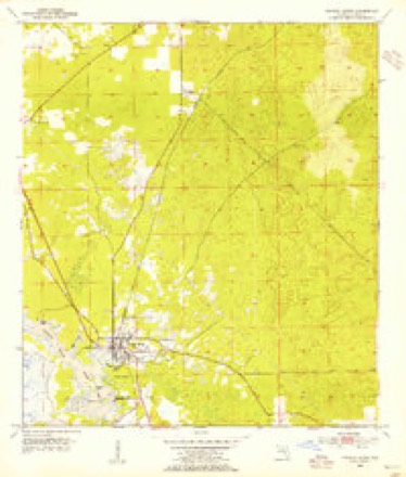
14 topographic sheets cover this place, the earliest surveyed in 1954 and the latest in 1979. It stands in the Crystal River census division. It lies in ZIP code area 34428. It stands on Magnolia Creek. The Survey maps it on the Crystal River quadrangle. 3,396 people lived here at the 2020 count. It stands 7 feet above sea level.
Research this city
Then and now
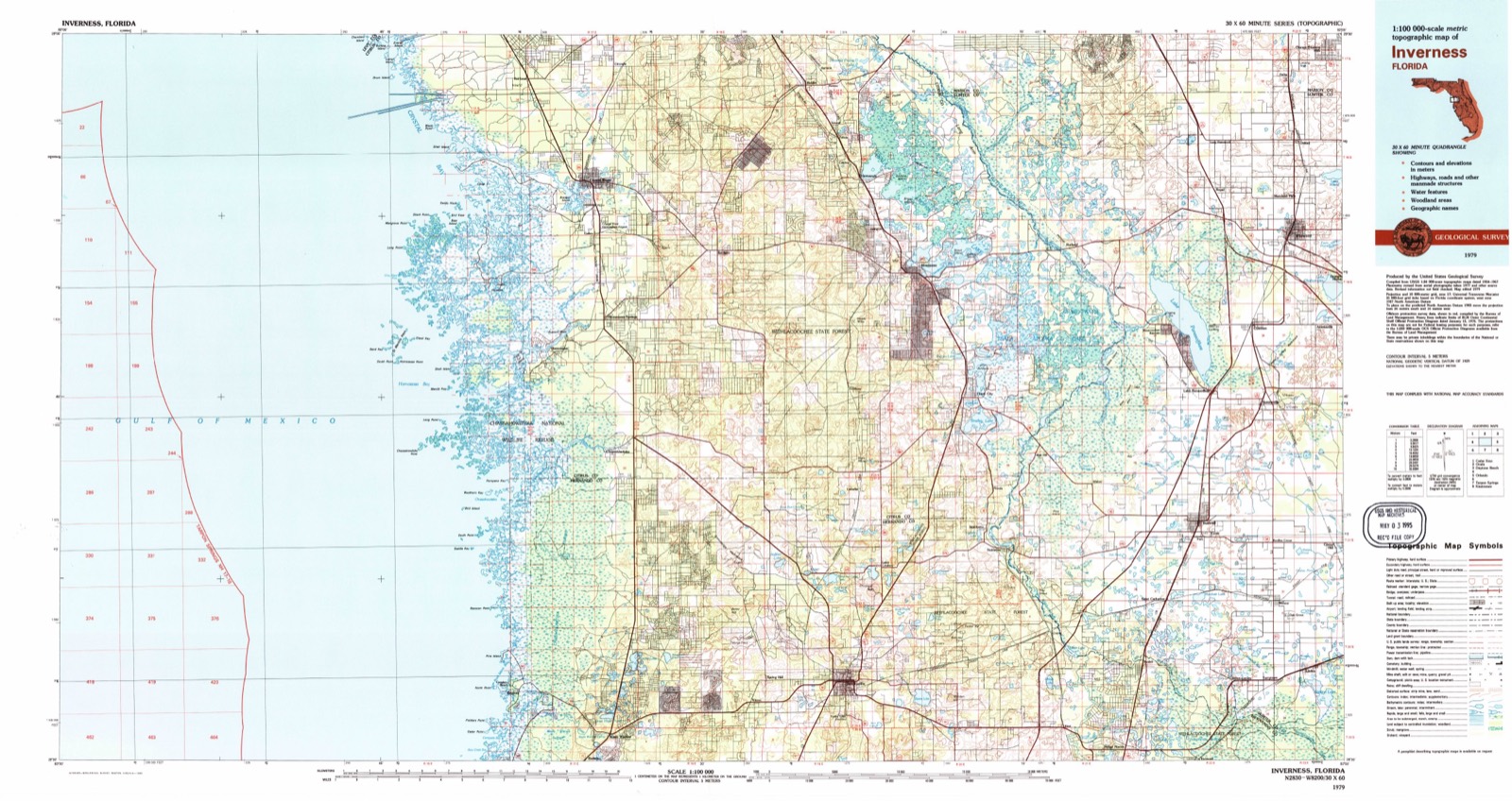
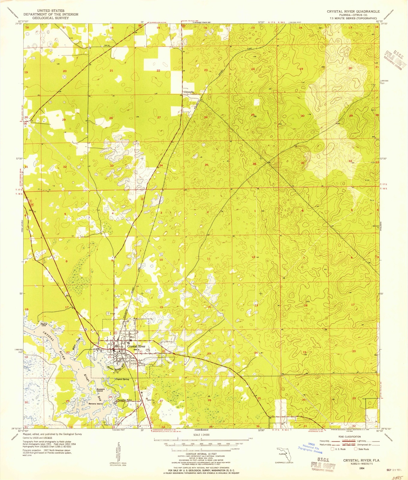
1954 to 1979The same ground, surveyed 25 years apart. Drag the handle to wipe between them. Both sheets are United States Geological Survey originals; neither has been altered.
On record in Crystal River
Buildings and businesses the archive holds for this place. Each opens its own page, with the source record it came from.
On the National Register 2 records
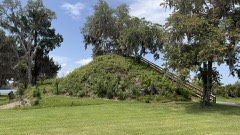 Crystal River Indian MoundsNational Historic Landmark · listed 1970
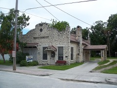 Crystal River Old City Halllisted 1998
Population over time
2 figuresCrystal River grew from 3,108 to 3,396 between 2010 and 2020. These are the recorded population figures Wikidata holds for this place, reached through the Geographic Names Information System number this page is keyed on rather than by name, so they belong to this place and not to another of the same name. Most are census counts, but not all are: an early figure may be a founding or settlement estimate, and an estimate published within five years of a census is left out. The change column is computed, and is left blank where more than 20 years separate a figure from the one before it, because a gap that long is not a change between two counts.
| Year | People | Change |
|---|---|---|
| 2010 | 3,108 | |
| 2020 | 3,396 | +288 (+9%) |
Topographic sheets covering this place
7 surveys from 14 printed sheetsMatched by testing this settlement's coordinate against the published boundary of every sheet in the United States Geological Survey's historical collection. Each opens the scanned sheet at the Survey.
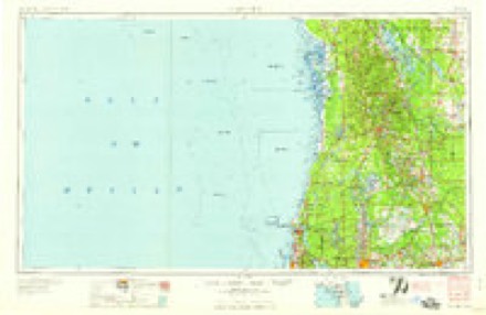
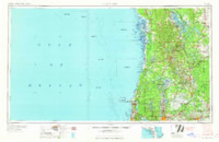
- 1954 USGS Crystal River quadrangle1:24000, 3 printings
- 1955 USGS Plant City quadrangle1:250000, 3 printings
- 1955 USGS Tarpon Springs quadrangle1:250000, 3 printings
- 1958 USGS Plant City quadrangle1:250000
- 1959 USGS Plant City quadrangle1:250000
- 1964 USGS Plant City quadrangle1:250000
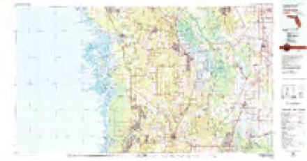
- 1979 USGS Inverness quadrangle1:100000, 2 printings
Fires near this place
427 since 1992Regional context, not property-specific evidence. The federal wildfire occurrence database lists 427 fires within 5 miles of Crystal River between 1992 and 2020, burning about 3,942 acres in total. 92 started naturally. 49 were recorded as arson. Distance is straight-line from the map coordinates, so a fire counted here may appear on a neighbouring settlement's page as well.
| Reported cause | Fires |
|---|---|
| Natural | 92 |
| Debris and open burning | 69 |
| Equipment and vehicle use | 64 |
| Missing data/not specified/undetermined | 61 |
| Railroad operations and maintenance | 54 |
| Arson/incendiarism | 49 |
| Misuse of fire by a minor | 23 |
| Recreation and ceremony | 7 |
| Power generation/transmission/distribution | 6 |
| Fireworks | 1 |
| Other causes | 1 |
The most recent of them, most recent first, with the day each was reported and the service that recorded it.
| Date | Cause | Size | Reported by | Name on the report |
|---|---|---|---|---|
| 9 September 2009 | Debris and open burning | 385 acres | Florida Forest Service | PRESERVE FIRE |
| 6 September 2012 | Missing data/not specified/undetermined | 3.0 acres | Florida Forest Service | ALGIERES (09) |
| 4 September 2001 | Natural | 1.5 acres | Florida Forest Service | not named |
| 3 September 2014 | Natural | 4.0 acres | Florida Forest Service | CANDLENUT (09) |
| 2 September 1999 | Railroad operations and maintenance | 1.0 acres | Florida Forest Service | not named |
| 18 September 2014 | Natural | 4.0 acres | Florida Forest Service | CEMETERY (09) |
| 18 September 2003 | Arson/incendiarism | under an acre | Florida Forest Service | BICENTENNIAL FIRE 1172 |
| 16 September 2013 | Missing data/not specified/undetermined | 28 acres | Florida Forest Service | BROOKSHIRE (09) |
Settlements close enough to share some of these fires:
Mines and quarries near this place
3 within 5 milesRegional context, not property-specific evidence. The federal mineral resources record lists 3 workings within 5 miles of Crystal River: 2 producers, 1 occurrence. 2 still produce. What was taken out: Stone, Crushed/Broken, Dolomite, Phosphorus-Phosphates. Distance is straight-line from the map coordinates, so a quarry counted here may appear on a neighbouring settlement's page as well.
| Where | Site | Commodity | Status | Recorded |
|---|---|---|---|---|
| E.M. Kellogg - Kellogg's Mine | Phosphorus-Phosphates | Producer | ||
| Red Level Mine | Stone, Crushed/Broken | Producer | ||
| Turner's Farm Dolomite Prospect | Dolomite | Occurrence |
Storms near this place
51 since 1993Regional context, not property-specific evidence. The National Weather Service names Crystal River in 51 storm reports between 1993 and 2024: 19 thunderstorm wind, 8 hail, 6 tornado, 6 flood. The reports record 1 death and 7 injuries. Each account below is quoted exactly as the forecast office filed it, from the NOAA Storm Events Database, and each date opens the federal record of that event.
| When | Event | Place named | Harm | What the report says |
|---|---|---|---|---|
| July 2002 | Lightning | Crystal River | 1 killed | Lightning knocked victim out of the boat. A second man in the boat jumped into the water and pulled his friend back in but could not revive the victim. |
| March 1993 | Tornado (F1) | Crystal River | 3 hurt, $5,000,000 | A tornado formed just west of town and moved in. Fifteen homes were damaged, several heavily. Three people suffered injuries. |
| September 1998 | Tornado (F2) | Crystal River | 2 hurt, $500,000 | A tornado (F2), associated with an outer band of Hurricane Earl, touched down along N. Fairport Avenue, east of the intersection of County Road 495 and West Dunklin Road, six miles northeast of Crystal River. The tornado moved northeast, sporadically touched down along a narrow path, and destroyed a two story family structure, seven mobile homes and caused minor damage to an additional eight single family and sixteen mobile homes. Several large trees, sheds and power lines were downed by the tornado before it lifted and dissipated near County Road 488 and N. Circle M Avenue.Of note, a homeowner on W. Wheatfield Lane in Citrus Springs was alerted to the impending tornado by his four dogs who stubbornly refused to venture outdoors nearly ten minutes prior to the touchdown. The homeowner on W. Wheatfield Lane described the sound of the tornado similar to that of a roaring train as it passed over and damaged his home and downed nearby trees.Two injuries occurred to the occupants of the two story home that was destroyed by the tornado before it lifted and dissipated. |
| February 2004 | Thunderstorm Wind | Crystal River | 2 hurt, $300,000 | A severe thunderstorm wind gust of 70 mph caused tree and home damage to a rectangular area 4.5 miles by 3 miles across in north central Citrus county. Citrus County Emergency Management conducted a survey and found the damage was caused by straight line winds. Seven mobile homes were destroyed, seven homes had major damage, and 33 homes had minor damage. Most of the minor damage included damage to pool cages, car ports, and skirting around mobile homes. Two injuries were reported on the 8500 block of West Moonhaze Court. One man suffered minor back injury as the wall of his mobile home fell on him as he slept. One women suffered an eye injury from debris as her mobile home lost its roof. Numerous trees were downed or damaged along the path of the storm. Debris removal costs were $36,000. |
| June 2003 | Flash Flood | Crystal River | $502,000 | Most of the flooding problems occurred east of Highway 19 from Cardinal Lane to Green Acres and in the Crystal Manor area. Several homes along South Line Road in Lecanto had 18 inches of water inside after a county drainage retention pond overflowed. Rainfall totals for the day were 10.53 inches 3 miles east of Floral City and 6.51 inches in Chassahowitzka. |
| June 2003 | Flash Flood | Crystal River | $300,000 | State Road 490 in the western part of the county was closed due to flooding and motorists were stranded in the streets in Crystal River. A gully overflowed near Highway 19 South in Homosassa and the water flowed into a nearby restaurant "like a river". Numerous cars received moderate damage as the flood waters inundated an auto dealer lot. Rain fall totals for the day were 4.51 inches in Chassahowitzka and 3.36 inches 3 miles east of Floral City. |
| March 2001 | Tornado (F0) | Crystal River | $200,000 | National Weather Service damage survey indicated that a high end F0 tornado, that averaged 50 yards in width, touched down and caused heavy roof damage to a mobile home along West Jennifer Court, east of County Road 495. The tornado continued northeast and sporadically touched down on North Fairport Avenue near West Dunklin Street where minor to moderate damage occurred to rooftops, sheds and lanais, including several downed pines trees and large branches. Also, the tornadic winds rolled over one mobile home along the 4500 block of North Fairport near West Dunklin Street.The tornado continued northeast and caused sporadic damage to mainly roof tiles, shingles, lanais and trees in and along the Citrus Springs Country Club. The tornado downed a few additional trees and large branches near County Road 39 and North Perkins Path before it lifted and dissipated. |
| June 2024 | Tornado (EFU) | Crystal River | $100,000 | Pictures from the public showed a funnel associated with a waterspout over Kings Bay that would later move ashore over western Kings Bay, becoming a tornado and damaging two structures. Additional pictures relayed by local EM showed significant damage to the structures, however the initial integrity of the structures in question could not be confirmed, as they were likely somewhat aged. |
| June 2001 | Thunderstorm Wind | Crystal River | $50,000 | Citrus county emergency management reported that thunderstorm winds downed several large trees, branches and power line in Crystal River. |
| February 1998 | Tornado (F0) | Crystal River | $50,000 | A short-lived tornado touched down and destroyed a 10 by 18 foot building that housed well and pump equipment at the St. Martin's Marsh and Aquatic Preserve west of U.S. Highway 19. |
| August 2000 | Flood | Crystal River | $25,000 | Heavy rainfall of three to five inches in less than three hours caused localized urban flooding from Crystal River to Beverly Hills. A few vehicles incurred water damage at low-lying intersections from the urban floodwaters in Crystal River and Beverly Hills. |
| March 2003 | Thunderstorm Wind | Crystal River | $20,000 | Emergency management reported power lines downed by falling trees near SE 7th Avenue and minor building damage at the airport off of US Highway 19. |
| June 1998 | Thunderstorm Wind | Crystal River | $20,000 | Thunderstorm winds blew off the roof of a commercial building along U.S. Highway 19. |
| July 2003 | Thunderstorm Wind | Crystal River | $15,000 | Thunderstorm downburst winds toppled trees with diameters of two feet onto four homes near the intersection of Rockcrusher Road and Vendable Road. One home sustained moderate damage to the roof. |
| June 1996 | Lightning | Crystal River | $15,000 | no account filed |
| June 2008 | Thunderstorm Wind | Crystal River | $10,000 | Numerous trees were downed across the northwest portion of the county. |
| September 1999 | Flood | Crystal River | $10,000 | Four to five inches of rain fell in less than three hours along the U.S. Highway 19 corridor from Crystal River south to Chassahowitzka in Citrus county. A few vehicles incurred water damage at low-lying intersections along U.S. Highway 19 in Crystal River. |
| January 1999 | Thunderstorm Wind | Crystal River | $10,000 | Thunderstorm wind gusts of up to 65 mph caused minor roof, shed and carport damage four miles south of Crystal River. A few large trees and several branches were downed by the thunderstorm winds along the U.S. Highway 19 corridor south of Crystal River. |
| June 1998 | Lightning | Crystal River | $10,000 | Lightning ignited several brushfires along U.S. Highway 19 near County Road 488. |
| July 1998 | Flood | Crystal River | $10,000 | no account filed |
| February 1998 | Flood | Crystal River | $10,000 | no account filed |
| July 1998 | Flood | Crystal River | $5,000 | Two to four inches of heavy rain fell in less than two hours and caused localized flooding of low lying areas west of U.S. Highway 19 between Crystal River and Homosassa. |
| August 1993 | Thunderstorm Wind | Crystal River | $5,000 | Strong thunderstorm winds ripped the roof off a building. |
| June 1999 | Thunderstorm Wind | Crystal River | $4,000 | A Skywarn Spotter estimated that 60 mph winds downed four large trees near the intersection of County Road 494 and U.S. Highway 19. |
| April 1997 | Thunderstorm Wind | Crystal River | $4,000 | Thunderstorm winds caused minor roof and carport damage to a home on Cardinal Lane and U.S. Highway 19. |
| March 1995 | Thunderstorm Wind | Crystal River | $4,000 | Severe thunderstorm winds did about $4 thousand damage to the roof of a business in Crystal River. |
| April 1996 | Thunderstorm Wind | Crystal River | $3,000 | no account filed |
| October 1997 | Flood | Crystal River | $1,000 | no account filed |
| March 1993 | Thunderstorm Wind | Crystal River | $500 | Thunderstorm winds blew down trees and power lines. |
| August 1993 | Tornado (F0) | Crystal River | $500 | A small tornado lifted a metal storage building and threw it into telephone wires. |
| August 1993 | Thunderstorm Wind | Crystal River | $500 | Strong thunderstorm winds toppled about 20 trees on a golf course. |
| April 2019 | Thunderstorm Wind | Crystal River | - | A WeatherSTEM Marine Science Station reported a 50 knot wind gust. |
| June 2011 | Hail | Crystal River | - | Quarter sized hail was reported near Crystal River. |
| March 2011 | Thunderstorm Wind | Crystal River | - | Tree damage was reported on West Fort Island Trail Road. Winds at the Crystal River Airport 7 miles to the southeast were measured at 55 MPH (48 knots). |
| August 2008 | Heavy Rain | Crystal River | - | The observer recorded 8.53 inches of rain. |
| February 2007 | Hail | Crystal River | - | Quarter size hail was reported by the pubulic along Highway 19 in Crystal River. |
| June 2006 | Hail | Crystal River | - | A public report of 1 inch hail was relayed through the broadcast media. |
| April 2005 | Thunderstorm Wind | Crystal River | - | The gust was recorded at the Crystal River Power Plant. |
| April 2003 | Thunderstorm Wind | Crystal River | - | Local utility reported numerous trees and power lines down in the western part of the county. Some homes were without power for 24 hours. |
| June 2002 | Thunderstorm Wind | Crystal River | - | Several large limbs and one tree fell on a vehicle along County Road 486. |
| June 2002 | Lightning | Crystal River | - | Lightning hit a 230,000 volt switchyard a few hundred feet from the nuclear power plant and knocked out one of the plant's dual power feeds. |
| March 2000 | Wildfire | Crystal River | - | A wildfire consumed nearly 600 acres of brush and timber along the U.S. Highway 19 corridor between Crystal River and County Road 488. |
| June 1998 | Waterspout | Crystal River | - | A waterspout was observed in Kings Bay. |
| March 2003 | Hail | Crystal River | - | no account filed |
| August 2002 | Funnel Cloud | Crystal River | - | no account filed |
| December 1999 | Frost/Freeze | Crystal River | - | no account filed |
| February 1998 | Hail | Crystal River | - | no account filed |
| June 1996 | Hail | Crystal River | - | no account filed |
| June 1996 | Hail | Crystal River | - | no account filed |
| June 1996 | Hail | Crystal River | - | no account filed |
| August 1996 | Waterspout | Crystal River | - | no account filed |
Nearest settlements
The eight closest, with where each one stands in the county. Distances are straight-line, computed from the Geographic Names Information System coordinates.
| Map | Place | Distance | Sheets |
|---|---|---|---|
| Paradise Point | 1.3 miles | 14 | |
| Cutlers | 2.8 miles | 15 | |
| Red Level | 5.2 miles | 16 | |
| Citronelle | 5.4 miles | 14 | |
| Black Diamond | 5.7 miles | 23 | |
| Ozello | 6.3 miles | 17 | |
| Lecanto | 6.6 miles | 25 | |
| Pine Ridge | 6.8 miles | 23 |
Elsewhere
Matched on this settlement's Geographic Names Information System number rather than its name, so it cannot be a different place of the same name in another state.
| Wikipedia article on Crystal River | An encyclopaedic summary. Its text is share-alike, so it is linked here rather than copied. |
| Wikidata item Q994967 | The structured record the population and elevation above come from. Public domain (CC0). |
Provenance
This settlement is recorded in the Geographic Names Information System as feature 281135. The sheet list is computed by point-in-boundary test against the United States Geological Survey's historical topographic inventory. Both are works of the United States government and carry no copyright under 17 U.S.C. 105.
Wildfire. Short, Karen C. 2022. Spatial wildfire occurrence data for the United States, 1992-2020 [FPA_FOD_20221014]. 6th Edition. Fort Collins, CO: Forest Service Research Data Archive. https://doi.org/10.2737/RDS-2013-0009.6 Collected with United States Government funding and usable without additional permissions or fees.
Mines and quarries. USGS Mineral Resources Data System (MRDS) https://mrdata.usgs.gov/mrds/ A work of the United States government, no copyright under 17 U.S.C. 105.
Storms. NOAA National Centers for Environmental Information, Storm Events Database https://www.ncei.noaa.gov/stormevents/ A work of the United States government, no copyright under 17 U.S.C. 105. Narratives are quoted verbatim from the National Weather Service report and are not edited or summarised.