 Block
BlockDade City, Florida
14 topographic sheets cover this place, the earliest surveyed in 1955 and the latest in 1978. It stands in the Dade City census division. It lies in ZIP code area 33525. The Survey maps it on the Dade City quadrangle. 7,275 people lived here at the 2020 count. It stands 118 feet above sea level.
Then and now
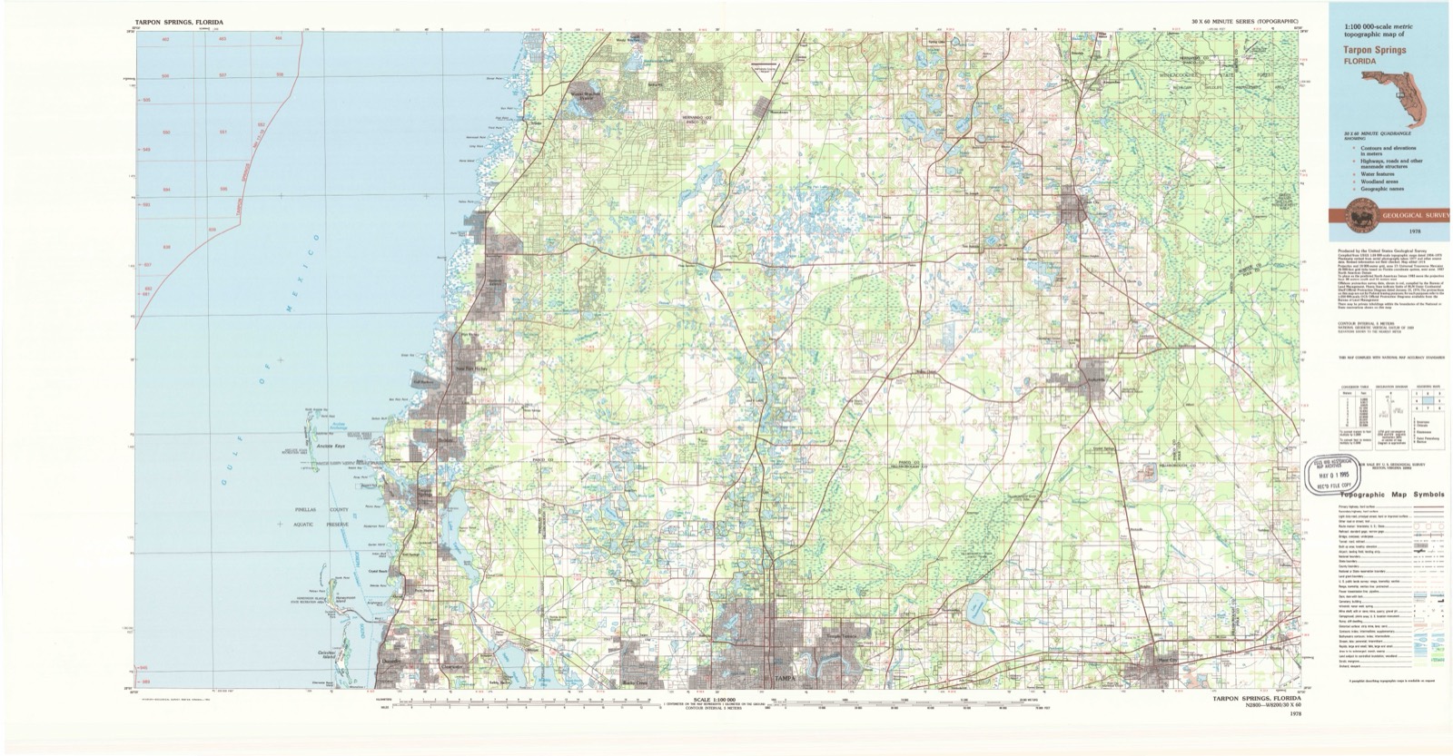
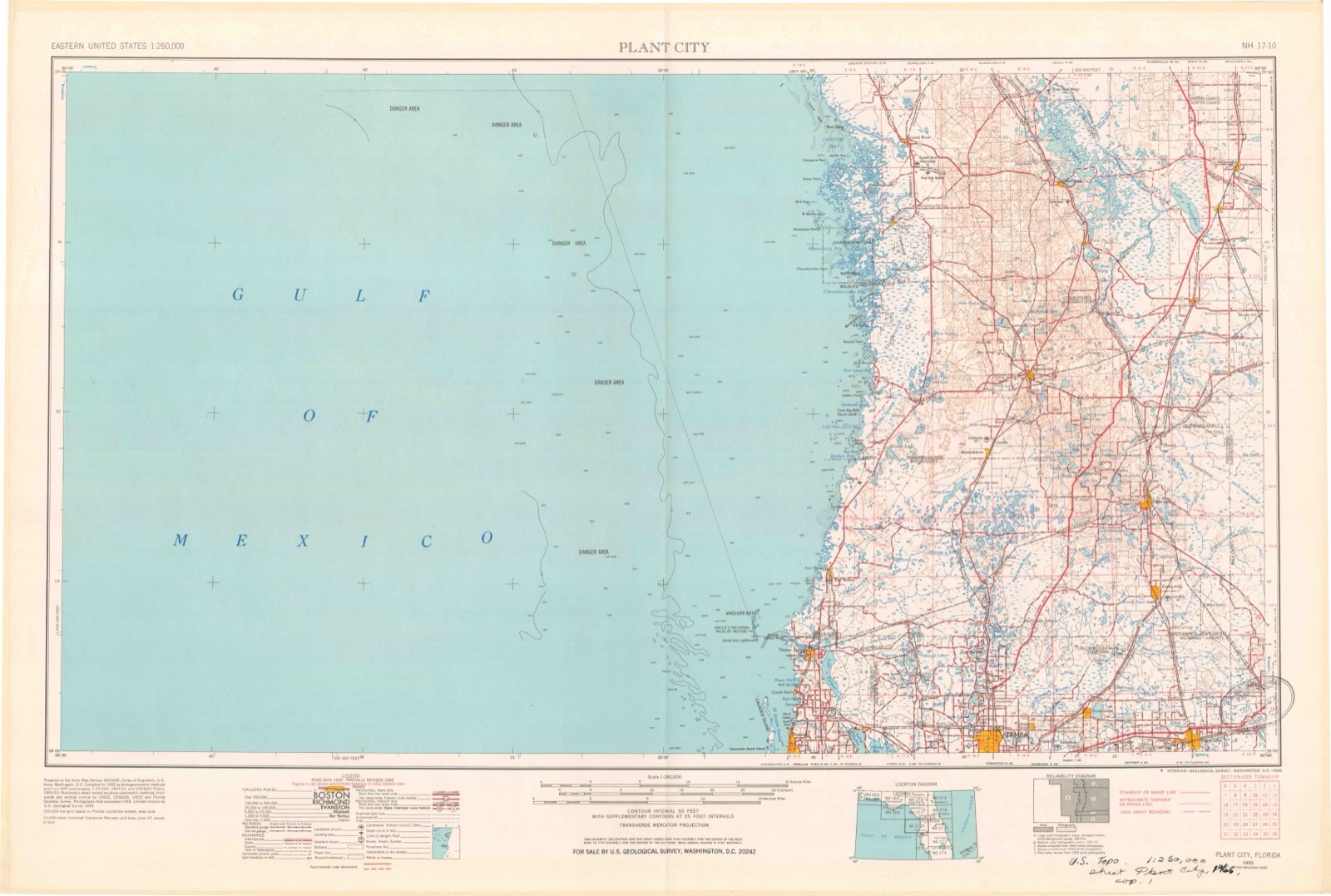
1955 to 1978The same ground, surveyed 23 years apart. Drag the handle to wipe between them. Both sheets are United States Geological Survey originals; neither has been altered.
On record in Dade City
Buildings and businesses the archive holds for this place. Each opens its own page, with the source record it came from.
On the National Register 4 records
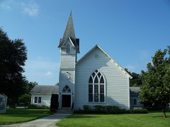 Church Street Historic Districtlisted 1997
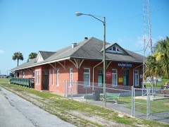 Dade City Atlantic Coast Line Railroad Depotlisted 1994
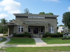 Dade City Woman's Clublisted 2003
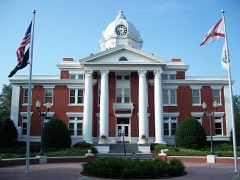 Pasco County Courthouselisted 2006
Population over time
2 figuresDade City grew from 6,437 to 7,275 between 2010 and 2020. These are the recorded population figures Wikidata holds for this place, reached through the Geographic Names Information System number this page is keyed on rather than by name, so they belong to this place and not to another of the same name. Most are census counts, but not all are: an early figure may be a founding or settlement estimate, and an estimate published within five years of a census is left out. The change column is computed, and is left blank where more than 20 years separate a figure from the one before it, because a gap that long is not a change between two counts.
| Year | People | Change |
|---|---|---|
| 2010 | 6,437 | |
| 2020 | 7,275 | +838 (+13%) |
Topographic sheets covering this place
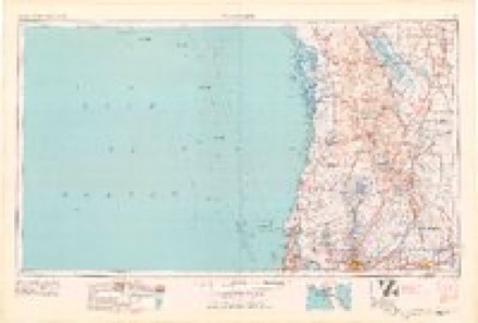
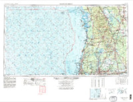
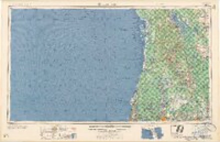
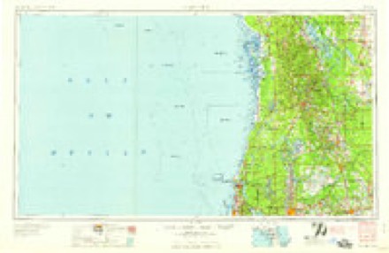
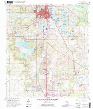
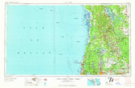
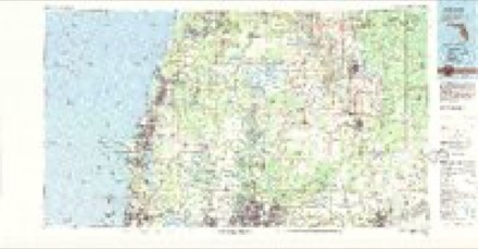
7 surveys from 14 printed sheetsMatched by testing this settlement's coordinate against the published boundary of every sheet in the United States Geological Survey's historical collection. Each opens the scanned sheet at the Survey.
- 1955 USGS Plant City quadrangle1:250000, 3 printings
- 1955 USGS Tarpon Springs quadrangle1:250000, 3 printings
- 1958 USGS Plant City quadrangle1:250000
- 1959 USGS Plant City quadrangle1:250000
- 1960 USGS Dade City quadrangle1:24000, 4 printings
- 1964 USGS Plant City quadrangle1:250000
- 1978 USGS Tarpon Springs quadrangle1:100000
Fires near this place
69 since 1992Regional context, not property-specific evidence. The federal wildfire occurrence database lists 69 fires within 5 miles of Dade City between 1992 and 2020, burning about 929 acres in total. 11 started naturally. 1 was recorded as arson. Distance is straight-line from the map coordinates, so a fire counted here may appear on a neighbouring settlement's page as well.
| Reported cause | Fires |
|---|---|
| Debris and open burning | 15 |
| Railroad operations and maintenance | 14 |
| Natural | 11 |
| Equipment and vehicle use | 10 |
| Missing data/not specified/undetermined | 7 |
| Misuse of fire by a minor | 5 |
| Fireworks | 2 |
| Power generation/transmission/distribution | 2 |
| Smoking | 2 |
| Arson/incendiarism | 1 |
The most recent of them, most recent first, with the day each was reported and the service that recorded it.
| Date | Cause | Size | Reported by | Name on the report |
|---|---|---|---|---|
| 5 September 2007 | Smoking | 1.5 acres | Florida Forest Service | 51/LYNAN FIRE/1116 |
| 18 August 1999 | Natural | 5.0 acres | Florida Forest Service | not named |
| 15 August 2006 | Natural | under an acre | Florida Forest Service | 51/LITTLE EVERGLADES/0902 |
| 4 July 1998 | Natural | under an acre | Florida Forest Service | not named |
| 27 July 1994 | Natural | 8.0 acres | Florida Forest Service | not named |
| 15 July 2001 | Railroad operations and maintenance | under an acre | Florida Forest Service | not named |
| 14 July 1995 | Natural | 2.0 acres | Florida Forest Service | not named |
| 14 July 1992 | Natural | 5.0 acres | Florida Forest Service | not named |
Settlements close enough to share some of these fires:
Storms near this place
36 since 1995Regional context, not property-specific evidence. The National Weather Service names Dade City in 36 storm reports between 1995 and 2021: 19 thunderstorm wind, 6 hail, 5 flood, 4 tornado. The reports record 1 injury. Each account below is quoted exactly as the forecast office filed it, from the NOAA Storm Events Database, and each date opens the federal record of that event.
| When | Event | Place named | Harm | What the report says |
|---|---|---|---|---|
| April 2007 | Thunderstorm Wind | Dade City | 1 hurt, $25,000 | Damaging down burst winds downed a tree onto a vehicle with one person trapped inside 2 miles northwest of Dade City. Trees and wires were downed in Dade City at the intersection of Rose Avenue and 14th Street. |
| December 1997 | Flood | Dade City | $200,000 | The Withlacoochee River in Dade City crested at 16 feet, four feet above flood stage and flooded several homes including the Withlacoochee RV park and Canoe Rental. |
| March 2001 | Tornado (F0) | Dade City | $150,000 | The Pasco county emergency management reported that a tornado touched down three miles southwest of Dade City and caused minor to moderate roof and lanai damage to homes along Roberts Road between Smith Road and County Road 41. The tornado continued east-northeast and sporadically touched down leveling a few trees and sheds in it's path before it lifted and dissipated near County Road 34A, two miles southeast of Dade City. |
| May 1999 | Lightning | Dade City | $150,000 | Lightning struck, burned and destroyed a 5,000 square foot concrete block home on the 36000 block of Lake Pasadena Road, west of County Road 41, and two miles southwest of Dade City. |
| March 2016 | Thunderstorm Wind | Dade City | $145,000 | Pasco County Emergency Management reported that strong wind gusts destroyed one mobile home and caused minor damage to 38 others in Dade City. The destroyed home had the roof ripped off. The minor damage included roof damage, car ports and screened enclosures damaged or removed, and pieces of siding peeled back. Debris was scattered in a uniform damage, indicating straight line wind damage. |
| March 1995 | Tornado (F0) | Dade City | $120,000 | An F0 tornado touched down on the St. Leo Golf Course, four miles southwest of Dade City along Highway 52, and downed a few large trees. The tornado skipped along a four mile-long path, damaging six to eight mobile homes in Parkview Estates. Six to eight wood houses and a church suffered minor to moderate roof damage in the Tank Hill area before the tornado dissipated near the intersection of Highways U.S. 98 and SR 41. |
| June 2003 | Tornado (F0) | Dade City | $40,000 | A tornado passed through Dade City and damaged mostly trees and power lines over an area 12 blocks long and one block wide, basically along Coleman Street between 7th Ave and 17th Ave. The tornado wind estimate was 70 mph. Damage to four homes and three cars were a result of trees falling on them. Many trees were pushed over by the tornado but most of these trees had signs of rot and the ground was saturated. The local utility reported 2,700 people without power after the event. Damage was estimated at $40,000 but cleanup costs was estimated at $60,000. |
| August 2000 | Thunderstorm Wind | Dade City | $40,000 | The public reported that thunderstorm winds toppled two large trees and several large branches which caused significant roof and attic damage to two homes on the 37,000 block of Beu Champ Avenue in Dade City. |
| September 1997 | Flood | Dade City | $30,000 | Three to five inches of rain caused localized flooding of streets and low-lying areas along U.S. Highway 301 between Dade City south to Zephyrhills over eastern Pasco county. A few vehicles and mobile homes in low-lying areas suffered water damage. |
| September 1997 | Flood | Dade City | $30,000 | no account filed |
| May 2019 | Thunderstorm Wind | Dade City | $25,000 | Broadcast media reported that a church near the downtown portion of Dade City had a portion of it's roof ripped off. |
| September 1997 | Flood | Dade City | $20,000 | Three to five inches of rain caused minor flooding of roads and low-lying areas of eastern Pasco county from Dade City south to Zephyrhills. A few cars and mobile homes suffered minor water damage. |
| March 2011 | Thunderstorm Wind | Dade City | $15,000 | Trees uprooted and limbs down in the Dade City area. One pole barn was destroyed. |
| August 2014 | Thunderstorm Wind | Dade City | $10,000 | A social media page for an animal attraction in Dade City reported numerous trees knocked down from thunderstorm wind gusts. |
| May 2002 | Thunderstorm Wind | Dade City | $10,000 | A tree fell onto a vehicle in Dade City. The Zephyrhills Police Department reported a roof off at 543 PM EDT. A spotter reported three quarter inch hail between 549 and 554 PM EDT, along with torrential rains. A retired NWS employee measured 58 mph winds near the center of town at 548 PM EDT. Winds at the Zephyrhills municipal airport were clocked at 52 mph at 550 PM EDT. |
| August 2000 | Thunderstorm Wind | Dade City | $10,000 | The Tampa Electric Company reported that thunderstorm winds downed a few trees and power lines in Dade City. |
| July 1998 | Flood | Dade City | $10,000 | no account filed |
| April 1996 | Thunderstorm Wind | Dade City | $8,000 | no account filed |
| June 2001 | Thunderstorm Wind | Dade City | $5,000 | The Dade City police department and a local utility reported that thunderstorm winds downed a few power lines and large trees near the intersection of County Road 41 (Ft King Rd) and Covington Road, four miles south southwest of Dade City. |
| June 2001 | Thunderstorm Wind | Dade City | $5,000 | Pasco county emergency management reported that thunderstorm winds downed several large branches in Dade City in eastern Pasco county. |
| October 1998 | Thunderstorm Wind | Dade City | $5,000 | Thunderstorm winds of up to 50 mph damaged the roof of a mobile home near the 37,000 block of Teresa Road. |
| February 1998 | Tornado (F0) | Dade City | $5,000 | A short-lived tornado touched down along State Road 52 near San Antonio and caused minor roof damage to a few homes before it lifted and dissipated. Several large tree limbs were also snapped by the brief tornado. |
| June 1997 | Thunderstorm Wind | Dade City | $5,000 | Thunderstorm winds downed several trees near the intersection of Interstate 75 and State Road 41. |
| July 1995 | Thunderstorm Wind | Dade City | $5,000 | Numerous trees, large braches, and power lines were downed by thunderstorm winds. |
| June 1996 | Thunderstorm Wind | Dade City | $5,000 | no account filed |
| March 2021 | Thunderstorm Wind | Dade City | $1,000 | Emergency Manager reported large branches and fencing down around the Hampton Inn in Dade City. |
| March 2013 | Thunderstorm Wind | Dade City | - | The Pasco County Sheriff's Department received numerous calls about downed power lines, trees down, and blown transformers in and around Dade City during a strong thunderstorm. |
| August 2013 | Heavy Rain | Dade City | - | Pasco County Emergency Management reported heavy rainfall causing flooding on the roads near the Dade City Hospital. Doppler radar estimated up to 3 inches of rain had fallen. |
| April 2007 | Hail | Dade City | - | A public report of nickel size hail and 60 MPH winds was received. |
| April 2007 | Thunderstorm Wind | Dade City | - | A public report of nickel size hail and 60 MPH winds was received. |
| June 2007 | Thunderstorm Wind | Dade City | - | Thunderstorm winds knocked down several trees in Dade City. One large tree downed power lines onto a vehicle near the 1300 block of 19th Street. |
| June 2001 | Hail | Dade City | - | Dime sized hail was reported by the Pasco county sheriffs department four miles north of Dade City. |
| May 2000 | Hail | Dade City | - | Quarter sized hail was reported by the Pasco County Fire and Rescue department near the intersection of Lacoochee Clay Sink Road and County Road 471 over rural extreme northeast Pasco county. |
| June 2000 | Hail | Dade City | - | The public reported dime sized hail in Dade City through WFLA-TV (NBC) of Tampa. |
| June 1996 | Hail | Dade City | - | no account filed |
| May 1995 | Hail | Dade City | - | no account filed |
Nearest settlements
The eight closest, with where each one stands in the county. Distances are straight-line, computed from the Geographic Names Information System coordinates.
| Map | Place | Distance | Sheets |
|---|---|---|---|
| Tommytown | 0.9 miles | 12 | |
| Clinton Heights | 2.4 miles | 14 | |
| Lake Pasadena Heights | 2.9 miles | 14 | |
| South Clinton Heights | 3.0 miles | 14 | |
| Pasadena Shores | 3.5 miles | 14 | |
| Old Henley Place | 3.7 miles | 12 | |
| Saint Leo | 3.8 miles | 14 | |
| Blanton | 4.2 miles | 12 |
Elsewhere
Matched on this settlement's Geographic Names Information System number rather than its name, so it cannot be a different place of the same name in another state.
| Wikipedia article on Dade City | An encyclopaedic summary. Its text is share-alike, so it is linked here rather than copied. |
| Wikidata item Q2156477 | The structured record the population and elevation above come from. Public domain (CC0). |
Provenance
This settlement is recorded in the Geographic Names Information System as feature 281254. The sheet list is computed by point-in-boundary test against the United States Geological Survey's historical topographic inventory. Both are works of the United States government and carry no copyright under 17 U.S.C. 105.
Wildfire. Short, Karen C. 2022. Spatial wildfire occurrence data for the United States, 1992-2020 [FPA_FOD_20221014]. 6th Edition. Fort Collins, CO: Forest Service Research Data Archive. https://doi.org/10.2737/RDS-2013-0009.6 Collected with United States Government funding and usable without additional permissions or fees.
Storms. NOAA National Centers for Environmental Information, Storm Events Database https://www.ncei.noaa.gov/stormevents/ A work of the United States government, no copyright under 17 U.S.C. 105. Narratives are quoted verbatim from the National Weather Service report and are not edited or summarised.