 Block
BlockDurbin, Florida
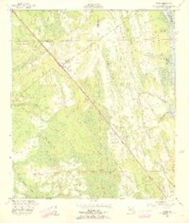
16 topographic sheets cover this place, the earliest surveyed in 1918 and the latest in 1988. It stands in the St. Augustine census division. It lies in ZIP code area 32081. The Survey maps it on the Durbin quadrangle.
Then and now
1918 to 1988The same ground, surveyed 70 years apart. Drag the handle to wipe between them. Both sheets are United States Geological Survey originals; neither has been altered.
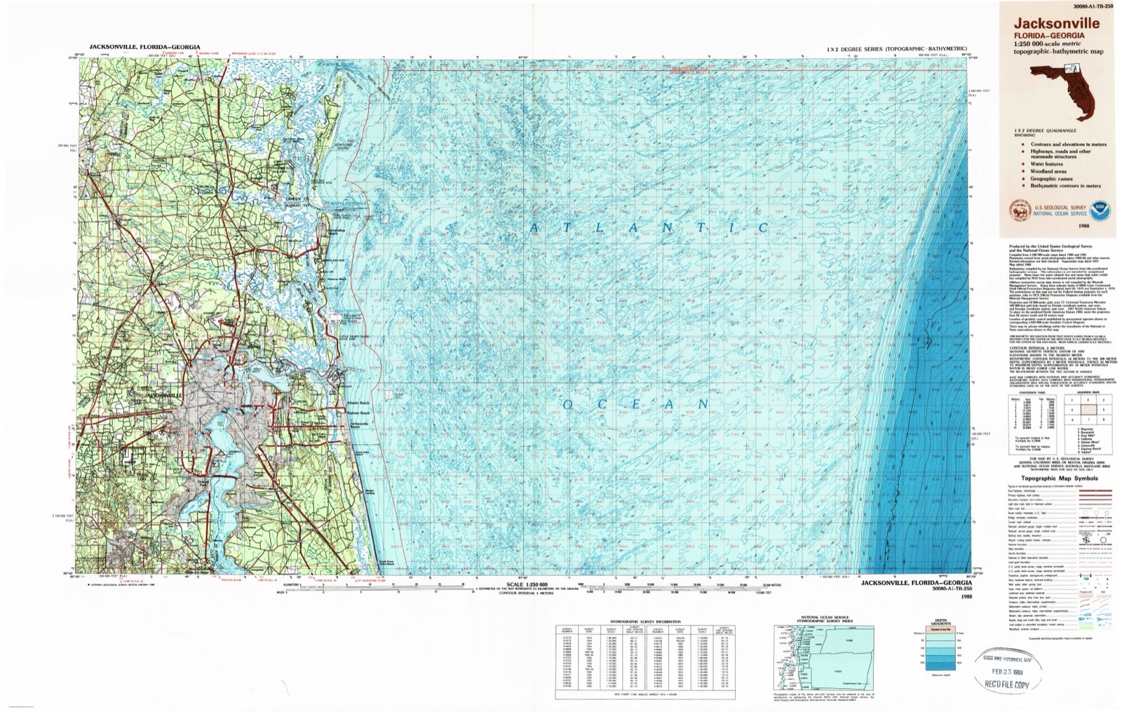
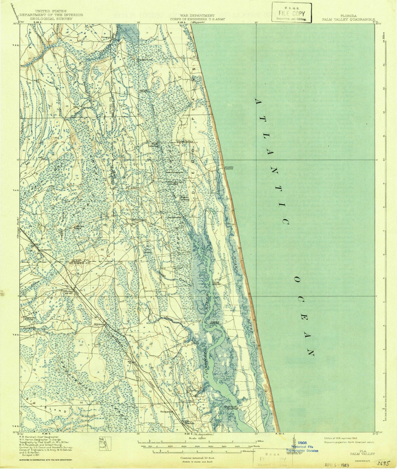
Topographic sheets covering this place
9 surveys from 16 printed sheetsMatched by testing this settlement's coordinate against the published boundary of every sheet in the United States Geological Survey's historical collection. Each opens the scanned sheet at the Survey.
- 1918 USGS Palm Valley quadrangle1:62500, 4 printings
- 1948 USGS Jacksonville quadrangle1:250000
- 1952 USGS Durbin quadrangle1:24000, 3 printings
- 1957 USGS Jacksonville quadrangle1:250000, 3 printings
- 1959 USGS Jacksonville quadrangle1:250000
- 1960 USGS Jacksonville quadrangle1:250000
- 1977 USGS Jacksonville quadrangle1:100000
- 1980 USGS Jacksonville quadrangle1:100000
- 1988 USGS Jacksonville quadrangle1:250000
Fires near this place
264 since 1992Regional context, not property-specific evidence. The federal wildfire occurrence database lists 264 fires within 5 miles of Durbin between 1992 and 2020, burning about 2,456 acres in total. 126 started naturally. 29 were recorded as arson. Distance is straight-line from the map coordinates, so a fire counted here may appear on a neighbouring settlement's page as well.
| Reported cause | Fires |
|---|---|
| Natural | 126 |
| Equipment and vehicle use | 50 |
| Arson/incendiarism | 29 |
| Missing data/not specified/undetermined | 19 |
| Misuse of fire by a minor | 13 |
| Railroad operations and maintenance | 11 |
| Debris and open burning | 6 |
| Power generation/transmission/distribution | 5 |
| Recreation and ceremony | 4 |
| Fireworks | 1 |
The most recent of them, most recent first, with the day each was reported and the service that recorded it.
| Date | Cause | Size | Reported by | Name on the report |
|---|---|---|---|---|
| 8 September 2013 | Arson/incendiarism | 8.3 acres | Florida Forest Service | STRATTONRD1(55) |
| 6 September 1999 | Natural | 5.0 acres | Florida Forest Service | not named |
| 5 September 1999 | Natural | 1.0 acres | Florida Forest Service | not named |
| 5 September 1999 | Natural | 20 acres | Florida Forest Service | not named |
| 29 September 2019 | Missing data/not specified/undetermined | 7.0 acres | Florida Forest Service | WHEATFIELD (55) |
| 29 September 2017 | Missing data/not specified/undetermined | under an acre | Florida Forest Service | CORKLAN DRIVE (16) |
| 25 September 1999 | Equipment and vehicle use | 3.0 acres | Florida Forest Service | not named |
| 24 September 2010 | Natural | 20 acres | Florida Forest Service | 16-BARN HILL FIRE-2010-07-0492 |
Settlements close enough to share some of these fires:
Mines and quarries near this place
1 within 5 milesRegional context, not property-specific evidence. The federal mineral resources record lists 1 working within 5 miles of Durbin: 1 prospect. None of them still produces. What was taken out: Phosphorus-Phosphates, Uranium, Iron, Magnesite, Aluminum, Fluorine-Fluorite. Distance is straight-line from the map coordinates, so a quarry counted here may appear on a neighbouring settlement's page as well.
| Where | Site | Commodity | Status | Recorded |
|---|---|---|---|---|
| Northeast Florida Phosphate Deposit | Phosphorus-Phosphates, Uranium, Iron, Magnesite, Aluminum, Fluorine-Fluorite | Prospect | 1965 |
Storms near this place
38 since 1998Regional context, not property-specific evidence. The National Weather Service names Durbin in 38 storm reports between 1998 and 2025: 11 thunderstorm wind, 11 heavy rain, 5 funnel cloud, 4 tornado. The reports record 2 injuries. Each account below is quoted exactly as the forecast office filed it, from the NOAA Storm Events Database, and each date opens the federal record of that event.
| When | Event | Place named | Harm | What the report says |
|---|---|---|---|---|
| January 2010 | Thunderstorm Wind | Durbin | 2 hurt | Two construction workers were blown off of an overpass. Both men suffered minor injuries. |
| September 2004 | Tornado (F0) | Durbin | $60,000 | Hurricane "Frances"F0 tornado damage to homes near State Road 13 North between Roberts Road and Greenbriar Road. Dollar damage estimate from St. Johns County EMA. |
| August 2017 | Lightning | Durbin | $5,000 | Lightning caused a house fire on Kenmore Avenue. The cost of damage was unknown, but it was estimated so this event could be included in Storm Data. |
| April 2019 | Thunderstorm Wind | Durbin | $1,000 | Power lines were blown down along Phillips Highway near the St. Johns County and Duval County Line. The time of damage was based on radar. The cost of damage was estimated for the inclusion of the event in Storm Data. |
| June 2017 | Lightning | South Durbin | $500 | Lightning struck a tree and caught fire. Fire was extinguished by fire crews. Cost of property damage was not reported, but estimated so the event could be included in storm data. |
| May 2025 | Hail | Durbin | - | Action News Jax relayed a report of pea to | penny sized hail in the vicinity of Nocatee. |
| May 2025 | Thunderstorm Wind | South Durbin | - | Multiple trees down area-wide in St Johns | County spanning areas between US-1 and World | Golf Villages. |
| May 2025 | Thunderstorm Wind | Durbin | - | Action News Jax relayed | photos of structural damage to the Loop | Restaurant in Nocatee. Also a separate | public report of a large maple tree downed | in a nearby neighborhood off Nocatee | Parkway. Time of damage based on radar data. |
| August 2025 | Heavy Rain | Durbin | - | A personal Weather Station Addison Park at Nocatee - KFLPONTE40 reported 2.10 inches of rainfall during the past hour. |
| September 2024 | Heavy Rain | Durbin | - | A public weather station in the Durbin area | reported 4 inches of rain in just over an | hour. Several nearby stations measured | between 2.5 and 4 inches during the same | period. |
| September 2024 | Heavy Rain | Durbin | - | A public weather station along Austin Park | Avenue has measured 2.5 inches of rainfall | within the past hour. |
| April 2024 | Tornado (EF0) | Durbin | - | A little after Noon on 04/03/2024, a Quasi Linear Convective |System tornado briefly developed and touched down in the Beacon |Lake Neighborhood in Northern St Johns county near US highway 1. |The tornado caused damage to roofs, fences, and patio furniture |from Beam Ln east northeast into Strobe Ct and ending at Convex |Ln along it's path that measured about one quarter of a mile. A |NWS survey of the damage found the tornado was 125 yards at it's |widest point and had winds around 70 to 80 mph at it's peak. On |the right hand side of the track was damage from the storm's |rear flank downdraft in the range of 60-70 mph. |
| April 2024 | Thunderstorm Wind | Durbin | - | A brief tornado touched down in the Beacon Lake neighborhood. On the right hand side of the tornado track, damage from the rear-flank downdraft caused straight line wind damage including damage to fences, small trees uprooted and some roof damage. Peak winds from the NWS storm survey were 60-70 mph. |
| July 2023 | Thunderstorm Wind | South Durbin | - | Trees were blown down onto power lines by the crossroads of Catlett Road and US Highway 1 North. The time of damage was based on radar. |
| September 2023 | Heavy Rain | South Durbin | - | A public weather station along Lakeshore Drive, north of the St. Augustine airport, measured 6.67 inches of storm total daily rainfall. Another location just north along Sophia Terrace measured 6.58 inches of daily rainfall. |
| September 2023 | Thunderstorm Wind | South Durbin | - | Florida Power and Light (FPL) reported that a tree or branch damaged electrical equipment near Sherry Lane. The time of damage was based on radar. |
| December 2023 | Heavy Rain | Durbin | - | Storm total rainfall in 24 hours was 5.42 inches in Nocatee. |
| April 2022 | Hail | Durbin | - | NWS received multiple reports of 0.75 inch hail around the Nocatee area around 1:40 PM EST. |
| July 2021 | Heavy Rain | South Durbin | - | A weather station in Palencia measured 4.90 inches of storm total rainfall. Surrounding sites measured 2 to around 4.5 inches of daily rainfall since 2 am. |
| August 2020 | Heavy Rain | Durbin | - | A broadcast meteorologist relayed a report of 3.42 inches measured in Nocatee. |
| July 2019 | Thunderstorm Wind | Durbin | - | A tree was split and hung over Austin Park Drive in Nocatee. |
| July 2018 | Tornado (EF0) | South Durbin | - | A brief EF0 tornado touched down along Rio del Norte along the Intracoastal Waterway in the Palencia area. Minor damage occurred to tow newly constructed roofs and a fence was partially blown down. Several trees were blown down and uprooted in the area. |
| May 2017 | Heavy Rain | Durbin | - | Rainfall since midnight was 6.59 inches in Nocatee. The total measured since Monday was 9.59 inches. |
| April 2017 | Heavy Rain | Durbin | - | An observer measured 3.39 inches between 4 am and 12 pm. |
| June 2017 | Flood | Durbin | - | A spotter reported 1 foot of rainfall across County Road 210 between Highway 1 and Interstate 95. |
| December 2014 | Funnel Cloud | Durbin | - | A funnel cloud was reported in the Sawgrass area. |
| July 2013 | Thunderstorm Wind | South Durbin | - | A large oak tree was blown down along Coopers Cove Road. The time of the event was based on radar imagery. |
| July 2013 | Thunderstorm Wind | South Durbin | - | A 15 ft boat was capsized by thunderstorm winds. The boat had 1 soul on board, and the person was rescued. The event occurred in the Intracoastal Waterway of Guana River State Park. |
| May 2011 | Hail | Durbin | - | Quarter size hail was reported at the Palm Valley Golf Club. |
| May 2010 | Funnel Cloud | Durbin | - | The public reported a funnel cloud near the intersection of U.S. Highway 1 and Race Track Road. |
| September 2004 | Funnel Cloud | Durbin | - | Hurricane "Frances." |
| May 2005 | Hail | Durbin | - | no account filed |
| October 2005 | Heavy Rain | Durbin | - | no account filed |
| June 2004 | Funnel Cloud | Durbin | - | no account filed |
| August 2004 | Thunderstorm Wind | Durbin | - | no account filed |
| August 2004 | Heavy Rain | Durbin | - | no account filed |
| September 2004 | Tornado (F0) | Durbin | - | no account filed |
| August 1998 | Funnel Cloud | Durbin | - | no account filed |
Nearest settlements
The eight closest, with where each one stands in the county. Distances are straight-line, computed from the Geographic Names Information System coordinates.
| Map | Place | Distance | Sheets |
|---|---|---|---|
| Hilden | 1.9 miles | 16 | |
| Sampson | 2.7 miles | 18 | |
| Twentymile | 3.4 miles | 20 | |
| Whites Ford | 5.4 miles | 18 | |
| Blacks Ford | 5.9 miles | 18 | |
| Palm Valley Landing | 6.9 miles | 20 | |
| Julia (historical) | 7.1 miles | 18 | |
| Pine Bluff | 7.1 miles | 18 |
Provenance
This settlement is recorded in the Geographic Names Information System as feature 307939. The sheet list is computed by point-in-boundary test against the United States Geological Survey's historical topographic inventory. Both are works of the United States government and carry no copyright under 17 U.S.C. 105.
Wildfire. Short, Karen C. 2022. Spatial wildfire occurrence data for the United States, 1992-2020 [FPA_FOD_20221014]. 6th Edition. Fort Collins, CO: Forest Service Research Data Archive. https://doi.org/10.2737/RDS-2013-0009.6 Collected with United States Government funding and usable without additional permissions or fees.
Mines and quarries. USGS Mineral Resources Data System (MRDS) https://mrdata.usgs.gov/mrds/ A work of the United States government, no copyright under 17 U.S.C. 105.
Storms. NOAA National Centers for Environmental Information, Storm Events Database https://www.ncei.noaa.gov/stormevents/ A work of the United States government, no copyright under 17 U.S.C. 105. Narratives are quoted verbatim from the National Weather Service report and are not edited or summarised.