 Block
BlockEstero, Florida
15 topographic sheets cover this place, the earliest surveyed in 1956 and the latest in 1987. It stands in the Bonita Springs census division. It lies in ZIP code area 33928. It stands on Halfway Creek. The Survey maps it on the Estero quadrangle.
Then and now
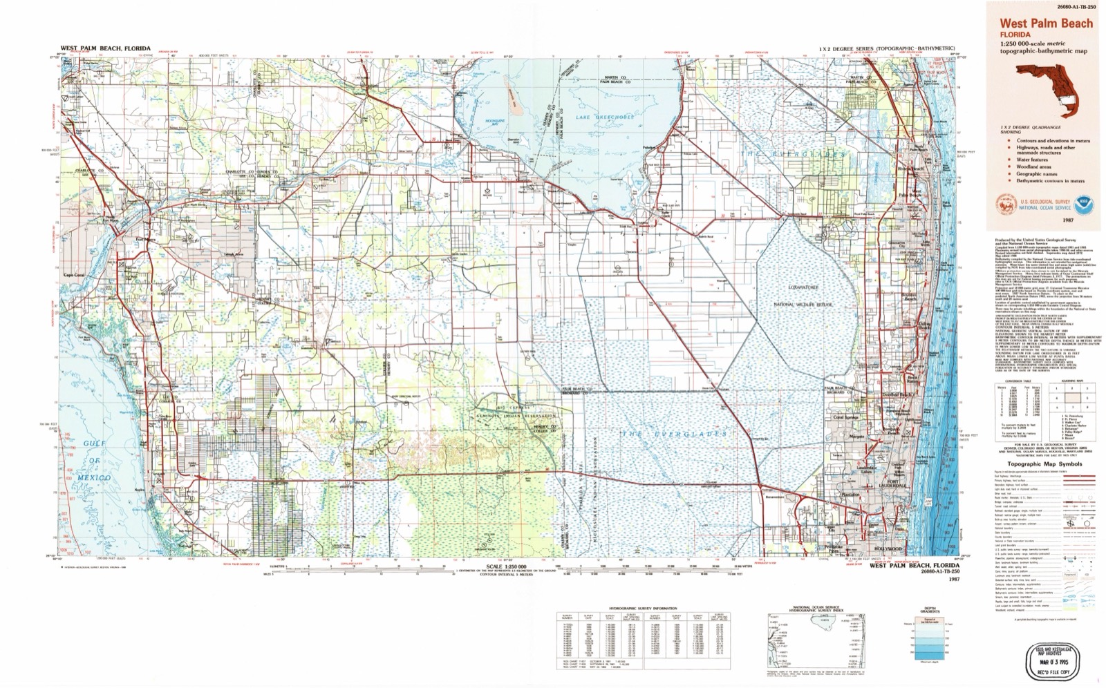
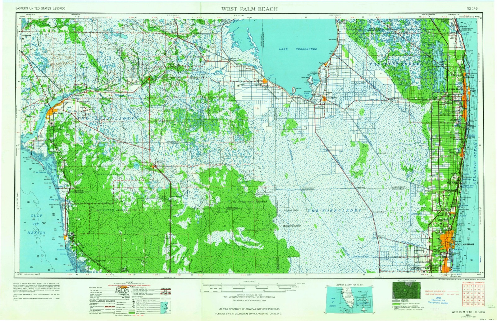
1956 to 1987The same ground, surveyed 31 years apart. Drag the handle to wipe between them. Both sheets are United States Geological Survey originals; neither has been altered.
On record in Estero
Buildings and businesses the archive holds for this place. Each opens its own page, with the source record it came from.
On the National Register 1 record
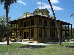 Koreshan Unity Settlement Historic Districtlisted 1976
Topographic sheets covering this place
6 surveys from 15 printed sheetsMatched by testing this settlement's coordinate against the published boundary of every sheet in the United States Geological Survey's historical collection. Each opens the scanned sheet at the Survey.
- 1956 USGS West Palm Beach quadrangle1:250000, 2 printings
- 1957 USGS West Palm Beach quadrangle1:250000
- 1958 USGS Estero quadrangle1:24000, 6 printings
- 1958 USGS West Palm Beach quadrangle1:250000, 2 printings
- 1985 USGS Naples quadrangle1:100000, 2 printings
- 1987 USGS West Palm Beach quadrangle1:250000, 2 printings




Fires near this place
183 since 1992Regional context, not property-specific evidence. The federal wildfire occurrence database lists 183 fires within 5 miles of Estero between 1992 and 2020, burning about 4,221 acres in total. 71 started naturally. 15 were recorded as arson. Distance is straight-line from the map coordinates, so a fire counted here may appear on a neighbouring settlement's page as well.
| Reported cause | Fires |
|---|---|
| Natural | 71 |
| Railroad operations and maintenance | 34 |
| Missing data/not specified/undetermined | 25 |
| Equipment and vehicle use | 18 |
| Arson/incendiarism | 15 |
| Misuse of fire by a minor | 8 |
| Debris and open burning | 5 |
| Recreation and ceremony | 3 |
| Fireworks | 2 |
| Power generation/transmission/distribution | 2 |
The most recent of them, most recent first, with the day each was reported and the service that recorded it.
| Date | Cause | Size | Reported by | Name on the report |
|---|---|---|---|---|
| 27 September 1996 | Railroad operations and maintenance | 1.0 acres | Florida Forest Service | not named |
| 20 September 1996 | Railroad operations and maintenance | 7.0 acres | Florida Forest Service | not named |
| 2 September 2007 | Natural | 15 acres | Florida Forest Service | 36/CROSS ROAD FIRE |
| 15 September 1995 | Railroad operations and maintenance | 1.0 acres | Florida Forest Service | not named |
| 11 September 2006 | Natural | under an acre | Florida Forest Service | 11/ TECO ARENA FIRE |
| 9 August 1994 | Natural | 1.0 acres | Florida Forest Service | not named |
| 4 August 2012 | Natural | 2.0 acres | Florida Forest Service | CORRECTION (36) |
| 4 August 2011 | Natural | 4.0 acres | Florida Forest Service | BAY PRESERVE (36) |
Settlements close enough to share some of these fires:
Mines and quarries near this place
3 within 5 milesRegional context, not property-specific evidence. The federal mineral resources record lists 3 workings within 5 miles of Estero: 3 producers. All of them still produce. What was taken out: Limestone, General, Stone, Crushed/Broken. Distance is straight-line from the map coordinates, so a quarry counted here may appear on a neighbouring settlement's page as well.
| Where | Site | Commodity | Status | Recorded |
|---|---|---|---|---|
| Estero Quarry | Stone, Crushed/Broken | Producer | ||
| Fl Rock Ind.,Inc.(Ft. Myers Plant) | Limestone, General | Producer | Limestone | |
| Stephens Const. Mat. Contractors | Limestone, General | Producer | Limestone |
Storms near this place
15 since 2000Regional context, not property-specific evidence. The National Weather Service names Estero in 15 storm reports between 2000 and 2022: 6 thunderstorm wind, 4 hail, 1 tornado, 1 heavy rain. No death or injury is recorded in these reports. Each account below is quoted exactly as the forecast office filed it, from the NOAA Storm Events Database, and each date opens the federal record of that event.
| When | Event | Place named | Harm | What the report says |
|---|---|---|---|---|
| August 2008 | Flood | Estero | $500,000 | Heavy rains of 6-14 inches associated with Tropical Storm Fay caused extensive sheet flow flooding from the Imperial River that runs through Bonita Springs. Flood damage was reported to numerous roads and homes with 500 residents evacuated to shelters. The preliminary damage estimates included $250,000 to roads and $250,000 to homes. |
| January 2000 | Tornado (F1) | Estero | $500,000 | A tornado (F1) touched down approximately one mile southwest of Corkscrew road on Lazy D Farms road where it downed a few trees, caused minor damage to a weathered mobile home, slightly damaged two vehicles and killed two cows. The tornado continued northeast where it caused minor damage to three planes and a recreational vehicle in a hanger on Corkscrew Trace road.The tornado crossed Corkscrew road and caused moderate damage to a 3000 gallon water tank on the north side of the road. The water tank was moved nearly a thousand yards by the tornadic wind. The tornado proceeded northeast and caused minor to moderate damage to a couple of pole barns and destroyed a storage shed along Katydid Lane.The tornado caused minor to moderate damage to a few weathered mobile homes, pole barns and sheds along Wildcat road before it lifted and dissipated.A total of eight homes, four pole barns, four storage sheds, several cars, an airplane hanger and several trees, were damaged by the F1 tornado. |
| June 2001 | Hail | Estero | $50,000 | A Skywarn Spotter reported that golf ball sized hail broke a few windshields and damaged the paint of a few vehicles near the intersection of U.S. Highway 41 and Corkscrew Road one mile south of Estero. |
| August 2001 | Thunderstorm Wind | Estero | $50,000 | Thunderstorm winds downed a few large trees, numerous branches and several power lines in Estero leaving nearly 1,500 residents without power for several hours. |
| April 2017 | Dust Devil | Estero | $30,000 | Emergency management and broadcast media reported damage to a carport and the roof of a mobile home in Tahiti Village. A witness reported a mini tornado without a cloud in the sky at around 1:45 PM EDT. Skies were clear at the time. |
| May 2014 | Thunderstorm Wind | Estero | $10,000 | Lee County Emergency Management reported that a neighborhood clubhouse sustained roof damage, and two surrounding manufactured homes had skirting material pulled away. Surrounding trees and houses were undamaged. Residents reported seeing a narrow funnel descend and produce the damage, which combined with damage pictures and radar data are fitting with a gustnado. |
| June 2019 | Thunderstorm Wind | Estero | $5,000 | Broadcast media shared a video of a tree that fell through a screened pool enclosure in San Carlos Park. |
| June 2001 | Thunderstorm Wind | Estero | $5,000 | A Skywarn Spotter reported that thunderstorm winds downed several tree tops and large branches near the intersection of U.S. Highway 41 and Corkscrew Road. |
| September 2014 | Thunderstorm Wind | Estero | $1,000 | A picture was received via social media of an uprooted tree on Three Oaks Parkway, about a quarter mile north of Estero Parkway. Time was estimated via radar. |
| May 2022 | Funnel Cloud | Estero | - | Broadcast media relayed video of funnel cloud briefly becoming a waterspout after touching down over a small lake near Estero. |
| August 2012 | Hail | Estero | - | A SKYWARN spotter reported penny sized hail and heavy rain near Bonita Springs. |
| July 2008 | Heavy Rain | Estero | - | Law enforcement reported street flooding at the intersection of Corkscrew Road and 3 Oaks Parkway in San Carlos Park. |
| June 2008 | Hail | Estero | - | Nickel sized hail was reported near Interstate 75 and Corkscrew Road. |
| July 2003 | Thunderstorm Wind | Estero | - | A trained storm spotter reported large hail and damaging wind near the intersection of U.S. Highway 41 and Corkscrew Road. |
| July 2003 | Hail | Estero | - | no account filed |
Nearest settlements
The eight closest, with where each one stands in the county. Distances are straight-line, computed from the Geographic Names Information System coordinates.
| Map | Place | Distance | Sheets |
|---|---|---|---|
| San Carlos Park | 2.0 miles | 15 | |
| Three Oaks | 2.3 miles | 15 | |
| Miromar Lakes | 3.2 miles | 15 | |
| Coconut | 3.2 miles | 15 | |
| Council | 4.3 miles | 15 | |
| Forest Island Park | 4.7 miles | 15 | |
| Bonita Springs | 6.9 miles | 14 | |
| Biggar | 7.2 miles | 15 |
Provenance
This settlement is recorded in the Geographic Names Information System as feature 282257. The sheet list is computed by point-in-boundary test against the United States Geological Survey's historical topographic inventory. Both are works of the United States government and carry no copyright under 17 U.S.C. 105.
Wildfire. Short, Karen C. 2022. Spatial wildfire occurrence data for the United States, 1992-2020 [FPA_FOD_20221014]. 6th Edition. Fort Collins, CO: Forest Service Research Data Archive. https://doi.org/10.2737/RDS-2013-0009.6 Collected with United States Government funding and usable without additional permissions or fees.
Mines and quarries. USGS Mineral Resources Data System (MRDS) https://mrdata.usgs.gov/mrds/ A work of the United States government, no copyright under 17 U.S.C. 105.
Storms. NOAA National Centers for Environmental Information, Storm Events Database https://www.ncei.noaa.gov/stormevents/ A work of the United States government, no copyright under 17 U.S.C. 105. Narratives are quoted verbatim from the National Weather Service report and are not edited or summarised.