 Block
BlockFernandina Beach, Florida
22 topographic sheets cover this place, the earliest surveyed in 1919 and the latest in 1994. It stands in the Fernandina Beach census division. It lies in ZIP code area 32034. It stands on Bells River. The Survey maps it on the Fernandina Beach quadrangle. 13,052 people lived here at the 2020 count. It stands 249 feet above sea level.
Then and now
1919 to 1994The same ground, surveyed 75 years apart. Drag the handle to wipe between them. Both sheets are United States Geological Survey originals; neither has been altered.
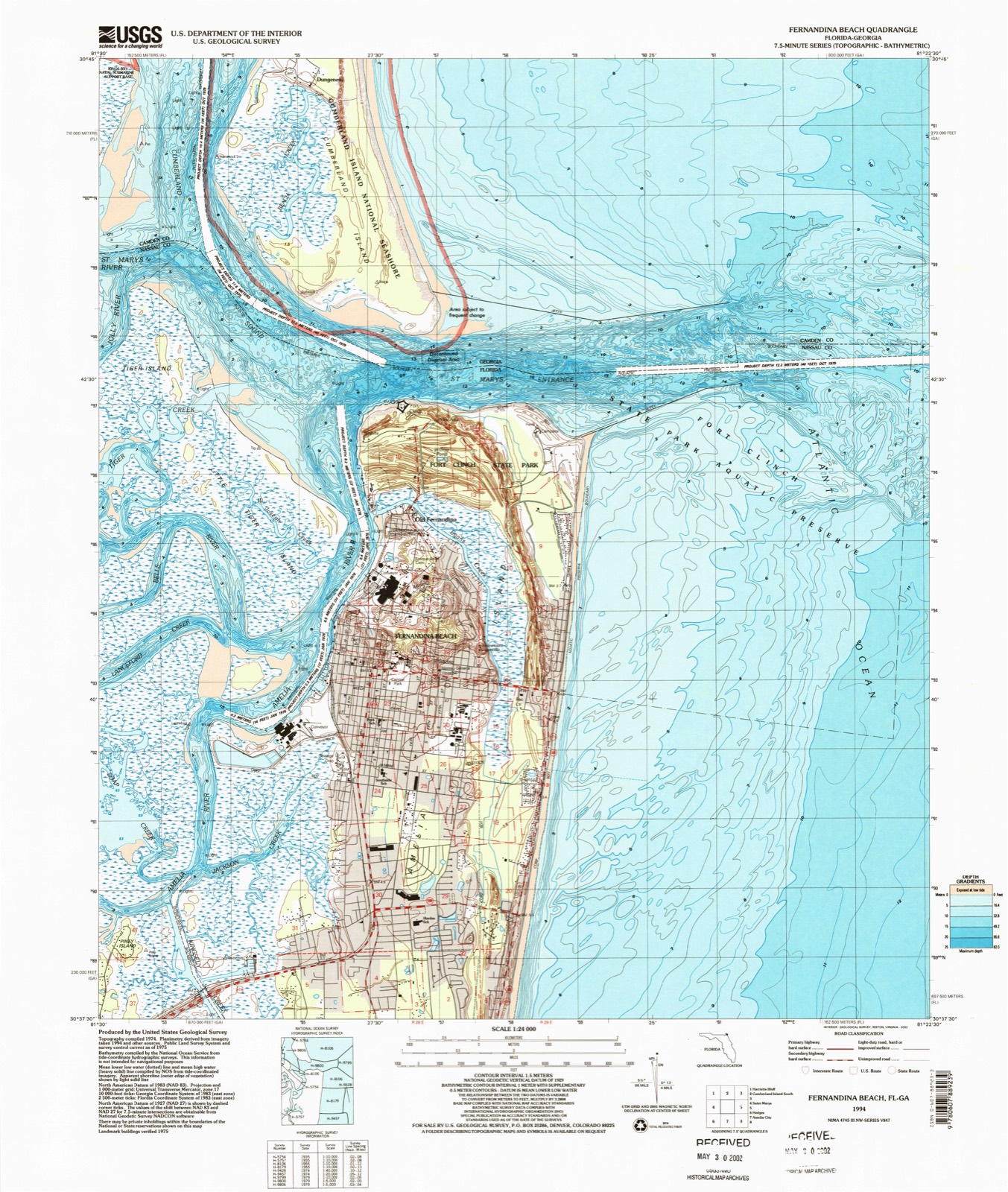
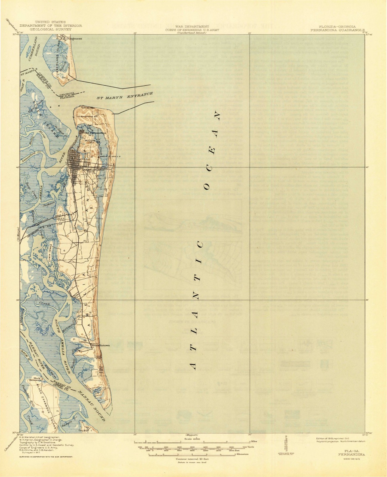
Compare 1919 against another survey:
On record in Fernandina Beach
Buildings and businesses the archive holds for this place. Each opens its own page, with the source record it came from.
On the National Register 11 records
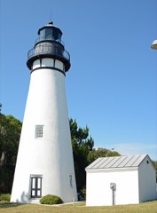 Amelia Island Lighthouselisted 2003
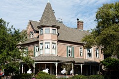 Bailey Houselisted 1973
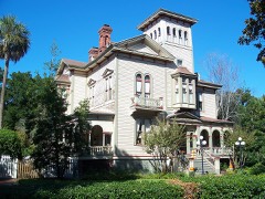 Fairbanks Houselisted 1973
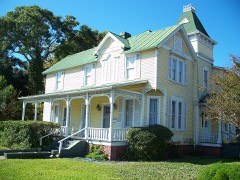 Fernandina Beach Historic Districtlisted 1973
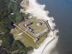 Fort Clinchlisted 1972
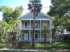 Merrick-Simmons Houselisted 1983
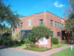 Nassau County Jaillisted 2009
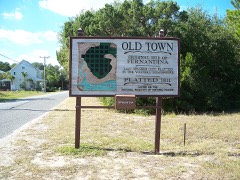 Original Town of Fernandina Historic Sitelisted 1990
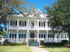 John Denham Palmer Houselisted 1986
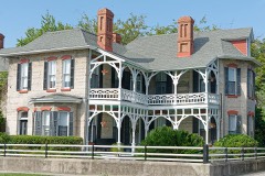 Tabby Houselisted 1973
- Fernandina Beach Historic District (Boundary Increase)listed 1987
Population over time
3 figuresFernandina Beach grew from 10,549 to 13,052 between 2000 and 2020. These are the recorded population figures Wikidata holds for this place, reached through the Geographic Names Information System number this page is keyed on rather than by name, so they belong to this place and not to another of the same name. Most are census counts, but not all are: an early figure may be a founding or settlement estimate, and an estimate published within five years of a census is left out. The change column is computed, and is left blank where more than 20 years separate a figure from the one before it, because a gap that long is not a change between two counts.
| Year | People | Change |
|---|---|---|
| 2000 | 10,549 | |
| 2010 | 11,487 | +938 (+9%) |
| 2020 | 13,052 | +1,565 (+14%) |
Topographic sheets covering this place
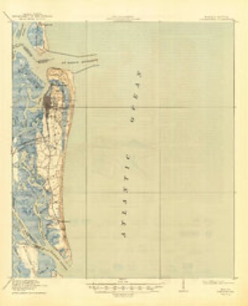
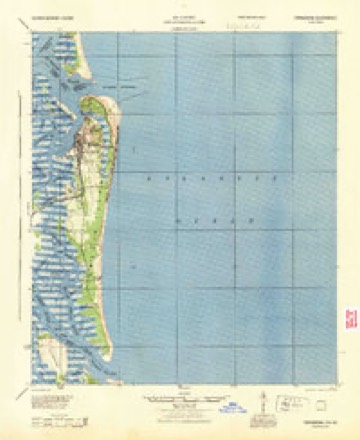
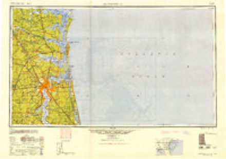
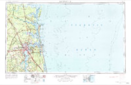
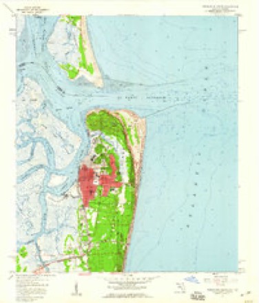
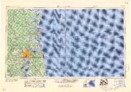
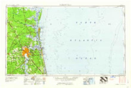
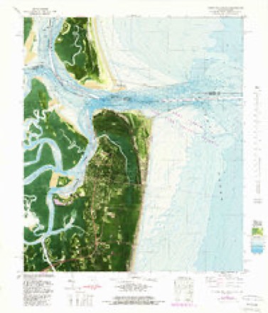
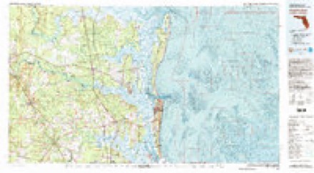
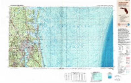
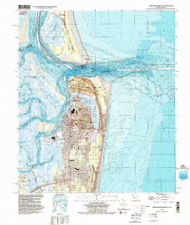
11 surveys from 22 printed sheetsMatched by testing this settlement's coordinate against the published boundary of every sheet in the United States Geological Survey's historical collection. Each opens the scanned sheet at the Survey.
- 1919 USGS Fernandina quadrangle1:62500, 4 printings
- 1944 USGS Fernandina quadrangle1:62500
- 1948 USGS Jacksonville quadrangle1:250000
- 1957 USGS Jacksonville quadrangle1:250000, 3 printings
- 1958 USGS Fernandina Beach quadrangle1:24000, 2 printings
- 1959 USGS Jacksonville quadrangle1:250000
- 1960 USGS Jacksonville quadrangle1:250000
- 1981 USGS Fernandina Beach quadrangle1:24000, 4 printings
- 1981 USGS Fernandina Beach quadrangle1:100000, 3 printings
- 1988 USGS Jacksonville quadrangle1:250000
- 1994 USGS Fernandina Beach quadrangle1:24000
Fires near this place
52 since 1992Regional context, not property-specific evidence. The federal wildfire occurrence database lists 52 fires within 5 miles of Fernandina Beach between 1992 and 2020, burning about 192 acres in total. 13 started naturally. 9 were recorded as arson. Distance is straight-line from the map coordinates, so a fire counted here may appear on a neighbouring settlement's page as well.
| Reported cause | Fires |
|---|---|
| Natural | 13 |
| Arson/incendiarism | 9 |
| Railroad operations and maintenance | 8 |
| Debris and open burning | 8 |
| Equipment and vehicle use | 5 |
| Misuse of fire by a minor | 4 |
| Missing data/not specified/undetermined | 3 |
| Power generation/transmission/distribution | 1 |
| Recreation and ceremony | 1 |
The most recent of them, most recent first, with the day each was reported and the service that recorded it.
| Date | Cause | Size | Reported by | Name on the report |
|---|---|---|---|---|
| 7 September 2011 | Equipment and vehicle use | under an acre | Florida Forest Service | BUCCANEER (45) |
| 14 September 2019 | Missing data/not specified/undetermined | under an acre | Florida Forest Service | SWEETBRIAR (45) |
| 25 August 2000 | Railroad operations and maintenance | 15 acres | Florida Forest Service | not named |
| 24 August 2007 | Arson/incendiarism | 1.0 acres | Florida Forest Service | 45 CHESTER ROAD 2007-07-0498 |
| 19 August 1995 | Natural | 1.5 acres | Florida Forest Service | not named |
| 19 August 1995 | Natural | 1.0 acres | Florida Forest Service | not named |
| 8 July 1992 | Equipment and vehicle use | 3.5 acres | Florida Forest Service | not named |
| 4 July 2015 | Natural | 1.0 acres | Florida Forest Service | INDEPENDENCE (45) |
Settlements close enough to share some of these fires:
Mines and quarries near this place
1 within 5 milesRegional context, not property-specific evidence. The federal mineral resources record lists 1 working within 5 miles of Fernandina Beach: 1 occurrence. None of them still produces. What was taken out: Titanium-Heavy Minerals. Distance is straight-line from the map coordinates, so a quarry counted here may appear on a neighbouring settlement's page as well.
| Where | Site | Commodity | Status | Recorded |
|---|---|---|---|---|
| Amelia Island Placer | Titanium-Heavy Minerals | Occurrence | Monazite, Zircon, Rutile, Ilmenite |
Storms near this place
56 since 1995Regional context, not property-specific evidence. The National Weather Service names Fernandina Beach in 56 storm reports between 1995 and 2025: 25 thunderstorm wind, 10 hail, 8 heavy rain, 3 rip current. The reports record 3 deaths and 2 injuries. Each account below is quoted exactly as the forecast office filed it, from the NOAA Storm Events Database, and each date opens the federal record of that event.
| When | Event | Place named | Harm | What the report says |
|---|---|---|---|---|
| May 2002 | Rip Current | Fernandina Beach | 1 killed | Tourist, caught in Rip Current drowned approximately 200 yards off the beach. |
| July 2004 | Rip Current | Fernandina Beach | 1 killed | no account filed |
| August 1998 | Rip Current | Fernandina Beach | 1 killed | no account filed |
| May 2001 | Lightning | Fernandina Beach | 2 hurt | Walking on Amelia Island Beach. |
| October 1996 | Flash Flood | Fernandina Beach | $250,000 | no account filed |
| November 1995 | Thunderstorm Wind | Fernandina Beach | $20,000 | A roof on a beachfront home in the 700 block of South Fletcher Avenue was lifted off and blown onto the beach. Large limbs and power lines were blown down throughout the county. |
| July 1999 | Thunderstorm Wind | Fernandina Beach | $15,000 | Light poles snapped. One boat damaged. |
| June 2001 | Thunderstorm Wind | Fernandina Beach | $3,500 | Large trees and power lines were blown down at South Fletcher and Sadler Rd. |
| April 1998 | Thunderstorm Wind | Fernandina Beach | $2,500 | Large trees were uprooted. |
| July 2015 | Thunderstorm Wind | Fernandina Beach | $2,000 | Large limbs and road signs were blown down. The spotter estimated wind gusts to 55 mph. The cost of damage was unknown but estimated for the event to be included in Storm Data. |
| April 2000 | Thunderstorm Wind | Fernandina Beach | $1,500 | Large trees were blown down. |
| April 2024 | Thunderstorm Wind | Fernandina Beach | $500 | A power line was blown down across Buccaneer Trail near McArthur Estates. The time of damage was based on radar. The cost of damage was unknown but it was estimated for inclusion of the event in Storm Data. |
| July 2018 | Thunderstorm Wind | Fernandina Beach | $500 | Power lines were blown down at the intersection of South 14th Street and Hickory Street. The time of damage was based on radar. The cost of damage was unknown, but it was estimated for the event to be included in Storm Data. |
| July 2018 | Thunderstorm Wind | Fernandina Beach | $500 | Power lines were blown down at the intersection south Fletcher Avenue and Jasmine St in Fernandina Beach. The time of damage was based on radar. The cost of damage was unknown, but it was estimated for inclusion of the event in Storm Data. |
| September 2001 | Tornado (F0) | Fernandina Beach | $500 | Weak F0. Waterspout moved on shore. Damaged the tops of a few trees. |
| June 2024 | Thunderstorm Wind | Fernandina Beach | $100 | A tree was blown down near Olive Street. The time of damage was based on radar. The cost of damage was unknown, but it was estimated for inclusion of the event in Storm Data. |
| August 2025 | Heavy Rain | Fernandina Beach | - | A mesonet station FW5640 Fernandina Beach measured 4.39 inches of rain. Rain began around 1030 AM. |
| September 2025 | Flood | Fernandina Beach | - | Fernandina Beach Police Department reported road closures along South Fletcher Ave between Atlantic Ave to Sadler Road and road closures on South 3rd Street between Elm Street and Gum Street. |
| September 2025 | Heavy Rain | Fernandina Beach | - | Mesonet station FW5640 Fernandina Beach 2.5 inches of rain in one hour. |
| September 2025 | Heavy Rain | Fernandina Beach | - | A personal weather station KFLFERNA8 measured 3.11 inches of rain in about an hour. |
| September 2024 | Heavy Rain | Fernandina Beach | - | A personal weather station Island Time - KFLFERNA100 measured 4.06 inches of rain. | Rain began around 545 AM. About 3 inches | fell between 545 AM and 745 AM. |
| September 2024 | Heavy Rain | Fernandina Beach | - | A mesonet station FW5640 Fernandina Beach measured | 5.63 inches of rain. About 2 inches fell | between 630 and 730 am. |
| September 2024 | Tornado (EF0) | Fernandina Beach | - | A waterspout moved onshore as a landspout on Amelia Island. There was some debris lofted near oceanfront homes, likely from the roofs, as the landspout moved inland. The location is approximated. |
| July 2023 | Flood | Fernandina Beach | - | Street flooding was reported at the intersection of Front Street and Centre Street in Fernandina Beach. |
| July 2022 | Heavy Rain | Fernandina Beach | - | A public site in Fernandina Beach received 2.28 inches of rainfall in 1 hour. |
| May 2020 | Hail | Fernandina Beach | - | Penny size hail occurred in Fernandina Beach. |
| June 2019 | Thunderstorm Wind | Fernandina Beach | - | Power lines were blown down near the intersection of Gum Street and South 9th Street. The time of damage was based on radar. |
| June 2017 | Thunderstorm Wind | Fernandina Beach | - | Two trees were blown down in Fernandina Beach. One was blown down across a power line. The other was blown down across a road. The time of the events was based on radar. |
| September 2017 | Tornado (EF0) | Fernandina Beach | - | This weak tornado touched down on the northern end of Amelia Island and tracked west across open marsh areas. Damage was limited to trees and shrubs and damage was not reported. The path width was estimated at 100 yards as the circulation tracked generally over open marsh land then dissipated over rural marsh land. There was a clear tornado debris signature on radar. |
| August 2015 | Thunderstorm Wind | Fernandina Beach | - | Wires were blown down in Fernandina Beach. The time of damage was estimated. |
| August 2015 | Thunderstorm Wind | Fernandina Beach | - | A tree and power line were blown down on Beech Street. The time of damage was based on radar. |
| May 2012 | Hail | Fernandina Beach | - | Penny size hail was reported for 5 minutes with thunderstorm wind gusts of 40 to 50 mph (estimated). |
| September 2011 | Thunderstorm Wind | Fernandina Beach | - | Trees were blown down along Tarpon Street. The time of damage was based on radar imagery. |
| September 2011 | Heavy Rain | Fernandina Beach | - | The park ranger at Fort Clinch state park reported standing water of 1 foot on the roads. Fire trucks had difficulty maneuvering the roads to respond to lightning damage calls. NWS radar estimated 8 to 10 inches across Fernandina. |
| June 2010 | Thunderstorm Wind | Fernandina Beach | - | Numerous trees and power lines were blown down across Amelia Island including Amelia City and Fernandina Beach. |
| December 2009 | Heavy Rain | Fernandina Beach | - | A volunteer measured a 24 hour rainfall total of 2.40 inches. |
| October 2005 | Funnel Cloud | Fernandina Beach | - | Fernandina Beach Fire Chief and several Police Officers spotted funnel near State Road A1A and Sadler Road (Five Points). FD Chief was one half mile from funnel when spotted and followed it to the municipal marina in downtown Fernandina Beach. Funnel moved over the Amelia River with NO spray on the river. As it moved over the marshes toward Camden County, Georgia it dissipated. |
| June 1995 | Thunderstorm Wind | Fernandina Beach | - | Winds measured at 63 mph were reported at Fernandina Harbor Marina. |
| May 1995 | Thunderstorm Wind | Fernandina Beach | - | Wind gust of 71 mph reported at Fernandina Harbor Marina. |
| May 2006 | Hail | Fernandina Beach | - | no account filed |
| July 2006 | Thunderstorm Wind | Fernandina Beach | - | no account filed |
| June 2006 | Hail | Fernandina Beach | - | no account filed |
| June 2006 | Hail | Fernandina Beach | - | no account filed |
| June 2006 | Hail | Fernandina Beach | - | no account filed |
| June 2006 | Thunderstorm Wind | Fernandina Beach | - | no account filed |
| March 2005 | Thunderstorm Wind | Fernandina Beach | - | no account filed |
| March 2005 | Thunderstorm Wind | Fernandina Beach | - | no account filed |
| March 2005 | Hail | Fernandina Beach | - | no account filed |
| October 2005 | Funnel Cloud | Fernandina Beach | - | no account filed |
| June 2004 | Hail | Fernandina Beach | - | no account filed |
| June 2004 | Thunderstorm Wind | Fernandina Beach | - | no account filed |
| June 2004 | Hail | Fernandina Beach | - | no account filed |
| July 2004 | Thunderstorm Wind | Fernandina Beach | - | no account filed |
| October 2002 | Hail | Fernandina Beach | - | no account filed |
| May 1996 | Thunderstorm Wind | Fernandina Beach | - | no account filed |
| August 1996 | Waterspout | Fernandina Beach | - | no account filed |
Nearest settlements
The eight closest, with where each one stands in the county. Distances are straight-line, computed from the Geographic Names Information System coordinates.
| Map | Place | Distance | Sheets |
|---|---|---|---|
| Old Fernandina | 1.5 miles | 22 | |
| Glenwood | 3.5 miles | 23 | |
| Chester | 4.2 miles | 23 | |
| O'Neil | 4.5 miles | 22 | |
| Amelia City | 5.5 miles | 21 | |
| American Beach | 6.6 miles | 21 | |
| Nassauville | 7.5 miles | 22 | |
| Franklintown | 7.9 miles | 21 |
Elsewhere
Matched on this settlement's Geographic Names Information System number rather than its name, so it cannot be a different place of the same name in another state.
| Wikipedia article on Fernandina Beach | An encyclopaedic summary. Its text is share-alike, so it is linked here rather than copied. |
| Wikidata item Q1975746 | The structured record the population and elevation above come from. Public domain (CC0). |
Provenance
This settlement is recorded in the Geographic Names Information System as feature 294308. The sheet list is computed by point-in-boundary test against the United States Geological Survey's historical topographic inventory. Both are works of the United States government and carry no copyright under 17 U.S.C. 105.
Wildfire. Short, Karen C. 2022. Spatial wildfire occurrence data for the United States, 1992-2020 [FPA_FOD_20221014]. 6th Edition. Fort Collins, CO: Forest Service Research Data Archive. https://doi.org/10.2737/RDS-2013-0009.6 Collected with United States Government funding and usable without additional permissions or fees.
Mines and quarries. USGS Mineral Resources Data System (MRDS) https://mrdata.usgs.gov/mrds/ A work of the United States government, no copyright under 17 U.S.C. 105.
Storms. NOAA National Centers for Environmental Information, Storm Events Database https://www.ncei.noaa.gov/stormevents/ A work of the United States government, no copyright under 17 U.S.C. 105. Narratives are quoted verbatim from the National Weather Service report and are not edited or summarised.