 Block
BlockGilberts Mill, Florida
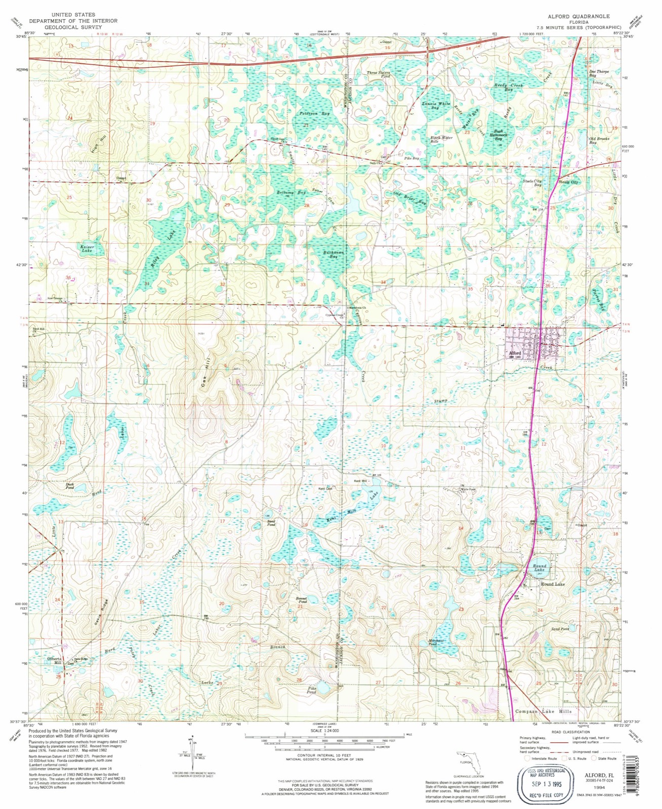
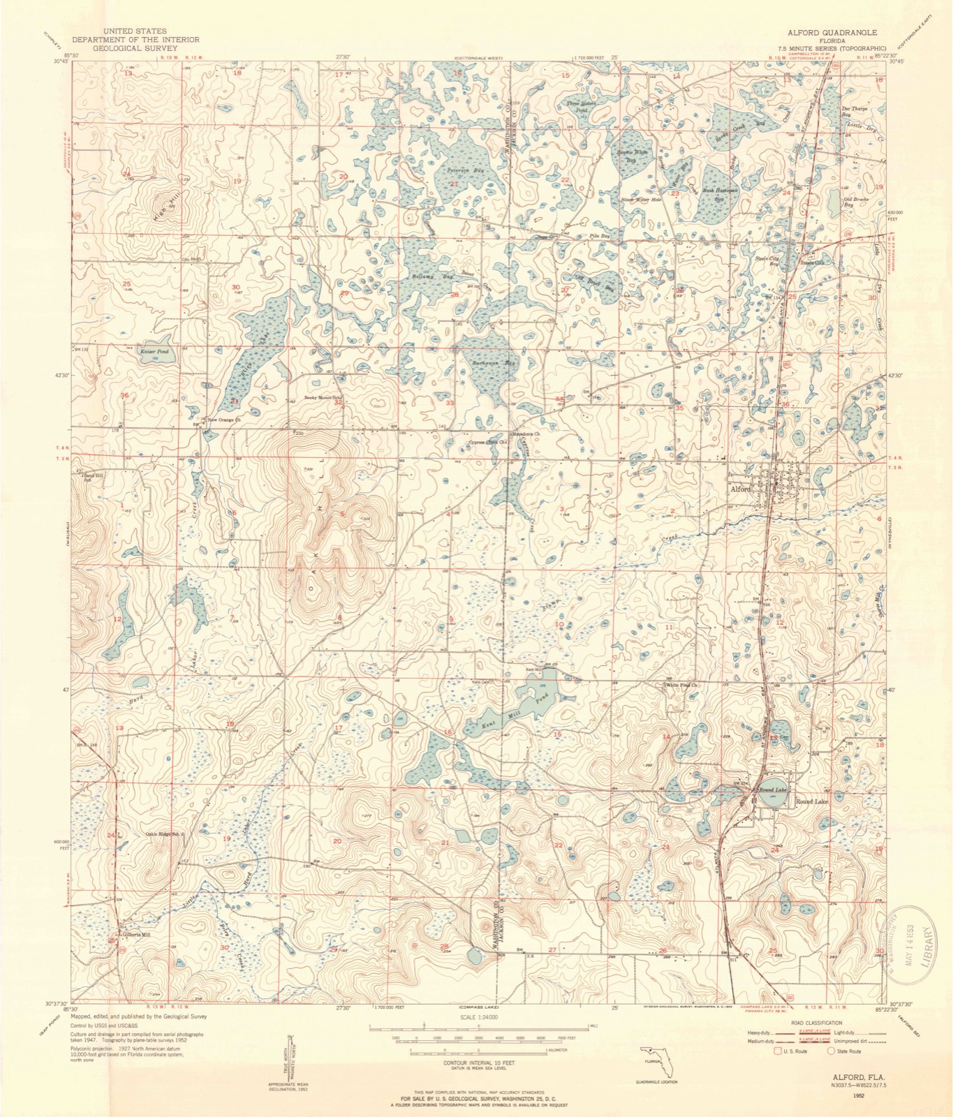
15 topographic sheets cover this place, the earliest surveyed in 1952 and the latest in 1994. It stands in the Vernon census division. It lies in ZIP code area 32428. It stands on Poley Creek. The Survey maps it on the Alford quadrangle.
Then and now
1952 to 1994The same ground, surveyed 42 years apart. Drag the handle to wipe between them. Both sheets are United States Geological Survey originals; neither has been altered.
Compare 1952 against another survey:
Topographic sheets covering this place
8 surveys from 15 printed sheetsMatched by testing this settlement's coordinate against the published boundary of every sheet in the United States Geological Survey's historical collection. Each opens the scanned sheet at the Survey.
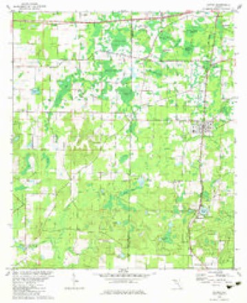
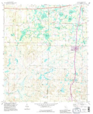
- 1952 USGS Alford quadrangle1:24000, 3 printings
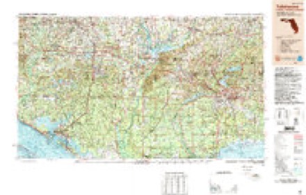
- 1954 USGS Tallahassee quadrangle1:250000, 4 printings
- 1959 USGS Tallahassee quadrangle1:250000
- 1960 USGS Tallahassee quadrangle1:250000
- 1979 USGS Marianna quadrangle1:100000, 2 printings
- 1982 USGS Alford quadrangle1:24000
- 1988 USGS Tallahassee quadrangle1:250000, 2 printings
- 1994 USGS Alford quadrangle1:24000
Fires near this place
152 since 1992Regional context, not property-specific evidence. The federal wildfire occurrence database lists 152 fires within 5 miles of Gilberts Mill between 1992 and 2020, burning about 1,192 acres in total. 13 started naturally. 9 were recorded as arson. Distance is straight-line from the map coordinates, so a fire counted here may appear on a neighbouring settlement's page as well.
| Reported cause | Fires |
|---|---|
| Debris and open burning | 63 |
| Railroad operations and maintenance | 20 |
| Smoking | 15 |
| Missing data/not specified/undetermined | 15 |
| Natural | 13 |
| Equipment and vehicle use | 9 |
| Arson/incendiarism | 9 |
| Misuse of fire by a minor | 6 |
| Other causes | 1 |
| Power generation/transmission/distribution | 1 |
The most recent of them, most recent first, with the day each was reported and the service that recorded it.
| Date | Cause | Size | Reported by | Name on the report |
|---|---|---|---|---|
| 27 September 2007 | Natural | 2.0 acres | Florida Forest Service | 67/ARCHIE SAPP RD-0969 |
| 24 September 2019 | Missing data/not specified/undetermined | under an acre | Florida Forest Service | GAINER ROAD (67) |
| 23 September 1999 | Railroad operations and maintenance | 6.0 acres | Florida Forest Service | not named |
| 17 September 2007 | Missing data/not specified/undetermined | 10 acres | Florida Forest Service | 67/WAXMANSKI-0954 |
| 4 August 1998 | Debris and open burning | 30 acres | Florida Forest Service | not named |
| 28 August 2017 | Equipment and vehicle use | 2.0 acres | Florida Forest Service | ROLAND ROAD (67) |
| 18 August 1999 | Debris and open burning | under an acre | Florida Forest Service | not named |
| 6 July 2006 | Natural | under an acre | Florida Forest Service | not named |
Settlements close enough to share some of these fires:
Mines and quarries near this place
10 of 11 shownRegional context, not property-specific evidence. The federal mineral resources record lists 11 workings within 5 miles of Gilberts Mill: 5 unknowns, 3 past producers, 2 prospects, 1 occurrence. None of them still produces. What was taken out: Clay, Sand, Stone, Crushed/Broken, Kaolin. Distance is straight-line from the map coordinates, so a quarry counted here may appear on a neighbouring settlement's page as well.
| Where | Site | Commodity | Status | Recorded |
|---|---|---|---|---|
| Unnamed Kaolin Deposit | Kaolin | Prospect | ||
| Bruner E J Limestone Deposit | Stone, Crushed/Broken | Prospect | ||
| Dickinson Limestone Prospect | Stone, Crushed/Broken | Occurrence | ||
| Jackson Co. Bd. of Co. Comm. - Compass Lake Mine | Sand | Unknown | ||
| Rex Windham - Windham Diamond 1 Mine | Sand | Unknown | ||
| Rex Windham - Windham Diamond 2 Mine | Sand | Unknown | ||
| Barbour A J Clay Pit | Clay | Past Producer | ||
| Unnamed Clay Depoist | Clay | Past Producer | ||
| Unnamed Clay Deposit | Clay | Past Producer | ||
| Washington Co. Comm. - Gilbert Mine | Clay | Unknown |
Storms near this place
14 since 2004Regional context, not property-specific evidence. The National Weather Service names Gilberts Mill in 14 storm reports between 2004 and 2024: 5 thunderstorm wind, 4 tornado, 4 flash flood, 1 hail. The reports record 2 deaths and 1 injury. Each account below is quoted exactly as the forecast office filed it, from the NOAA Storm Events Database, and each date opens the federal record of that event.
| When | Event | Place named | Harm | What the report says |
|---|---|---|---|---|
| March 2022 | Tornado (EF3) | Gilberts Mill | 2 killed, 1 hurt, $500,000 | An EF-3 tornado tracked through Washington County into Jackson County Florida during the early morning hours of Thursday, March 31, 2022. The tornado began near Roland Rd and Ovid Ln in Washington County where it snapped tree trunks as it moved northeastward. The tornado crossed Orange Hill Rd and continued on to Gilberts Mill Rd. On Gilberts Mill Rd near Stewart Rd, a barn was destroyed and a manufactured home was damaged and shifted on its foundation, which is in line with EF-1 damage. Snapped and uprooted trees were observed all along Gilberts Mill Rd. Further northeast, a manufactured home sustained significant damage and several outbuildings were destroyed. A camper and a greenhouse were also destroyed here, consistent with EF-1 damage. The tornado strengthened as it continued northeastward along Gilberts Mill Rd before completely destroying and sweeping away an anchored double wide manufactured home and a newer, anchored single wide home. The double wide home was the site of the two fatalities, and one person in the single wide was injured when he was thrown into the tree line grasping his mattress. Several projectiles were driven into the ground at this location. A large boat was also thrown from its trailer and overturned. Damage at this location was consistent with strong EF-2 winds. The tornado continued to strengthen as it moved across Jewel Rd and at that location, a well-built brick home was partially destroyed and likely was sideswiped by the tornado. The end of the home that was hit sustained major collapse of roof and exterior brick walls as well as a generator ripped from its anchoring and thrown across a field. The other end of the home was less severely damaged but still suffered major roof loss. A car in the driveway was pushed off of the driveway, and an attached carport was destroyed. Across the street, a wood frame home with block foundation was completely destroyed and swept from the foundation, leaving only some cinder blocks and a floor joist. The debris from the house was thrown into a pole barn which was also destroyed. An injury occurred at this site when the home occupant ran to the barn and dove under his pickup truck. The damage to this home and the brick home are consistent with EF3 damage and maximum winds of 150 mph. The tornado weakened some as it moved northeast, inflicting roof damage to a home and damage to out buildings along Archie Sapp Rd. On Syfrett Rd, several sheds and outbuildings were destroyed, a single wide manufactured home was flipped onto its side, and a brick home sustained major roof damage. This damage along Archie Sapp Rd and Syfrett Rd are consistent with EF1 damage. The tornado snapped a couple of tree trunks along Dilmore Rd before lifting just south of Interstate 10 near Standland Rd. |
| September 2004 | Tornado (F0) | Gilberts Mill | $50,000 | A tornado caused minor damage to several homes, and downed trees and power lines. Reported by the Washington County EMA. |
| February 2021 | Tornado (EF0) | Gilberts Mill | $25,000 | A tornado briefly touched down near Wheeler Lane and tracked north-northeast for a short distance before lifting. On the Wheeler Farm property, an outbuilding was pulled from its anchorage and lofted about 20 yards. It has been anchored by wooden poles in concrete, although the concrete was shallow. Nearby outbuildings were not damaged. A few pine trees along the driveway of the property were snapped. Further north on Wheeler lane, a double wide manufactured home has some roof damage. Other trees were uprooted on Pineoaks Lane and Akers Trail. The damage was consistent with a high end EF0 with max estimated winds around 85 mph. |
| September 2016 | Thunderstorm Wind | Gilberts Mill | $5,000 | One home sustained significant roof damage from wind on Tumble Creek Road. This was likely a microburst. Damage was estimated. |
| May 2022 | Thunderstorm Wind | Gilberts Mill | $1,000 | A power line was blown down along Elkcam Blvd. |
| August 2015 | Thunderstorm Wind | Gilberts Mill | $1,000 | A power line was blown down on Orange Hill Road just south of Gilberts Mill. |
| June 2012 | Thunderstorm Wind | Gilberts Mill | $1,000 | Two trees were blown down near the Gilberts Mill area. Monetary damage was estimated. |
| January 2024 | Thunderstorm Wind | Gilberts Mill | - | A tree was blown down at Orange Hill Road and Highview Lane. |
| January 2024 | Tornado (EF0) | Gilberts Mill | - | A brief EF0 tornado touched down in far eastern Washington county. The only damage was to trees, and this was coincident with a brief TDS from EVX radar. |
| August 2021 | Flash Flood | Gilberts Mill | - | Quail Hollow Road was underwater at Rush Road. |
| August 2021 | Flash Flood | Gilberts Mill | - | Water was across Ledger Road and Olie Road. |
| August 2021 | Flash Flood | Gilberts Mill | - | Suggs Road was underwater. |
| April 2014 | Flash Flood | Gilberts Mill | - | Ledger Road was closed due to flash flooding from heavy rain in a short period of time. |
| May 2006 | Hail | Gilberts Mill | - | Penny size hail reported on Alford Road by a Florida Electric Company manager in Graceville. |
Nearest settlements
The eight closest, with where each one stands in the county. Distances are straight-line, computed from the Geographic Names Information System coordinates.
| Map | Place | Distance | Sheets |
|---|---|---|---|
| Bradford | 3.4 miles | 14 | |
| Bells Mill | 4.8 miles | 14 | |
| Wausau | 5.1 miles | 14 | |
| Brock Crossroad | 8.2 miles | 13 | |
| Macom | 8.3 miles | 14 | |
| Sylvania | 9.7 miles | 14 | |
| Poplar Head | 10.0 miles | 13 | |
| Grantham | 10.3 miles | 14 |
Elsewhere
Matched on this settlement's Geographic Names Information System number rather than its name, so it cannot be a different place of the same name in another state.
| Wikidata item Q122557382 | The structured record the population and elevation above come from. Public domain (CC0). |
Provenance
This settlement is recorded in the Geographic Names Information System as feature 295314. The sheet list is computed by point-in-boundary test against the United States Geological Survey's historical topographic inventory. Both are works of the United States government and carry no copyright under 17 U.S.C. 105.
Wildfire. Short, Karen C. 2022. Spatial wildfire occurrence data for the United States, 1992-2020 [FPA_FOD_20221014]. 6th Edition. Fort Collins, CO: Forest Service Research Data Archive. https://doi.org/10.2737/RDS-2013-0009.6 Collected with United States Government funding and usable without additional permissions or fees.
Mines and quarries. USGS Mineral Resources Data System (MRDS) https://mrdata.usgs.gov/mrds/ A work of the United States government, no copyright under 17 U.S.C. 105.
Storms. NOAA National Centers for Environmental Information, Storm Events Database https://www.ncei.noaa.gov/stormevents/ A work of the United States government, no copyright under 17 U.S.C. 105. Narratives are quoted verbatim from the National Weather Service report and are not edited or summarised.