 Block
BlockGreenville, Florida
9 topographic sheets cover this place, the earliest surveyed in 1954 and the latest in 1979. It stands in the Greenville census division. It lies in ZIP code area 32331. The Survey maps it on the Greenville quadrangle. 746 people lived here at the 2020 count. It stands 66 feet above sea level.
Then and now
1954 to 1979The same ground, surveyed 25 years apart. Drag the handle to wipe between them. Both sheets are United States Geological Survey originals; neither has been altered.
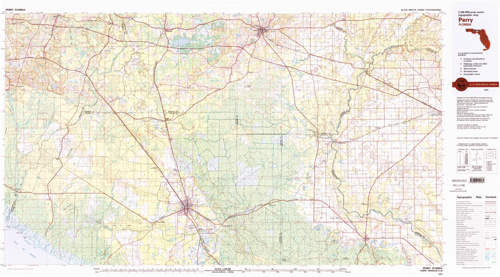
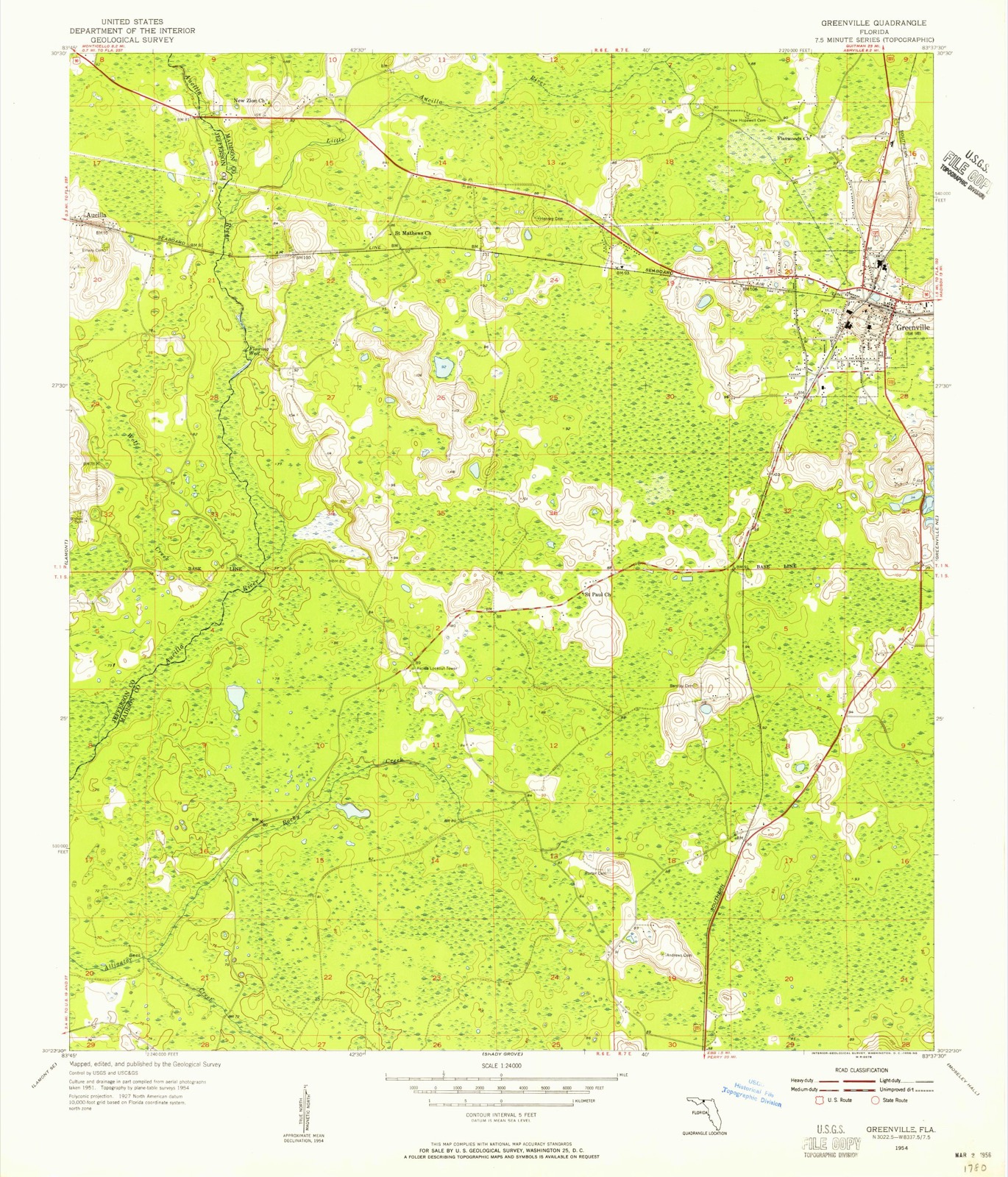
Compare 1954 against another survey:
On record in Greenville
Buildings and businesses the archive holds for this place. Each opens its own page, with the source record it came from.
On the National Register 1 record
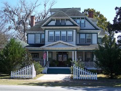 Bishop-Andrews Hotellisted 1990
Population over time
3 figuresGreenville fell from 837 to 746 between 2000 and 2020. These are the recorded population figures Wikidata holds for this place, reached through the Geographic Names Information System number this page is keyed on rather than by name, so they belong to this place and not to another of the same name. Most are census counts, but not all are: an early figure may be a founding or settlement estimate, and an estimate published within five years of a census is left out. The change column is computed, and is left blank where more than 20 years separate a figure from the one before it, because a gap that long is not a change between two counts.
| Year | People | Change |
|---|---|---|
| 2000 | 837 | |
| 2010 | 843 | +6 (+1%) |
| 2020 | 746 | -97 (-12%) |
Topographic sheets covering this place
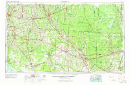
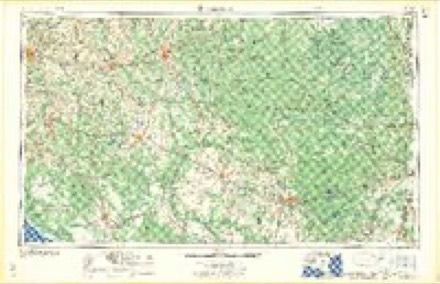
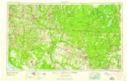
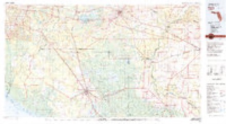
5 surveys from 9 printed sheetsMatched by testing this settlement's coordinate against the published boundary of every sheet in the United States Geological Survey's historical collection. Each opens the scanned sheet at the Survey.
- 1954 USGS Greenville quadrangle1:24000, 3 printings
- 1954 USGS Valdosta quadrangle1:250000, 2 printings
- 1958 USGS Valdosta quadrangle1:250000
- 1959 USGS Valdosta quadrangle1:250000
- 1979 USGS Perry quadrangle1:100000, 2 printings
Fires near this place
109 since 1992Regional context, not property-specific evidence. The federal wildfire occurrence database lists 109 fires within 5 miles of Greenville between 1992 and 2020, burning about 214 acres in total. 3 started naturally. 3 were recorded as arson. Distance is straight-line from the map coordinates, so a fire counted here may appear on a neighbouring settlement's page as well.
| Reported cause | Fires |
|---|---|
| Debris and open burning | 33 |
| Equipment and vehicle use | 31 |
| Railroad operations and maintenance | 11 |
| Missing data/not specified/undetermined | 9 |
| Recreation and ceremony | 8 |
| Power generation/transmission/distribution | 7 |
| Arson/incendiarism | 3 |
| Natural | 3 |
| Other causes | 2 |
| Misuse of fire by a minor | 2 |
The most recent of them, most recent first, with the day each was reported and the service that recorded it.
| Date | Cause | Size | Reported by | Name on the report |
|---|---|---|---|---|
| 6 September 2014 | Other causes | under an acre | Florida Forest Service | HONEY LAKE (40) |
| 30 September 2016 | Equipment and vehicle use | 1.0 acres | Florida Forest Service | MILE MARKER 241 (40) |
| 30 September 2016 | Missing data/not specified/undetermined | 1.0 acres | Florida Forest Service | 238 MILE MARKER (40) |
| 29 September 2009 | Equipment and vehicle use | under an acre | Florida Forest Service | 40 - B. LOPER FIRE-0218 |
| 28 September 2012 | Equipment and vehicle use | under an acre | Florida Forest Service | MILE MARKER 246 (40) |
| 23 September 2013 | Equipment and vehicle use | under an acre | Florida Forest Service | WHITE WING DOVE SWAMP (40) |
| 16 September 1997 | Debris and open burning | under an acre | Florida Forest Service | not named |
| 14 September 2011 | Debris and open burning | 1.5 acres | Florida Forest Service | OSLO (40) |
Settlements close enough to share some of these fires:
Storms near this place
60 of 61 shownRegional context, not property-specific evidence. The National Weather Service names Greenville in 61 storm reports between 1995 and 2026: 52 thunderstorm wind, 3 tornado, 2 hail, 2 lightning. The reports record 5 injuries. Each account below is quoted exactly as the forecast office filed it, from the NOAA Storm Events Database, and each date opens the federal record of that event.
| When | Event | Place named | Harm | What the report says |
|---|---|---|---|---|
| July 2000 | Lightning | Greenville | 2 hurt, $300,000 | Lightning sparked a fire which completely destroyed a mansion home two and a half miles off of State Road 221 on Sundown Creek Road. Three of the four residents escaped unharmed, but two firefighters were injured while tackling the blaze. Several county fire and volunteer fire departments responded. Reported by the Madison Enterprise Recorder. |
| June 1999 | Lightning | Greenville | 2 hurt | Madison County EMA reported two youths injured by lightning at the Greenville Academy. |
| June 2001 | Tornado (F1) | Greenville | 1 hurt, $200,000 | An F1 tornado touched down near Lake Logan Road north of U.S. Highway 90. The tornado destroyed three double wide trailers, flipped over several vehicles, and downed numerous trees and power lines. One person sustained minor injuries from flying debris. Reported by the Madison County EMA. |
| April 2011 | Thunderstorm Wind | Greenville | $100,000 | A home was destroyed by a falling tree. The monetary damage figure provided is a rough estimate. |
| August 2008 | Flash Flood | Greenville | $100,000 | Many roads and low lying areas in and around Greenville were flooded. Pond overflowed and covered portions of U.S. Highway 90. Rainfall amounts ranged from four to eight inches across eastern portions of the county, to as much as sixteen inches over western portions. |
| August 2023 | Thunderstorm Wind | Greenville | $10,000 | A tree blew down into the westbound lanes of I-10 at Mile Marker 241 and struck a truck. |
| August 2011 | Thunderstorm Wind | Greenville | $7,500 | Eight to ten trees were blown down along Highway 90 West of Greenville and completely blocked the road. The monetary damage figure provided is a rough estimate. |
| June 2010 | Thunderstorm Wind | Greenville | $7,000 | One tree was blown down onto a car and several power lines were down. The monetary damage figure provided is a rough estimate. |
| August 2015 | Thunderstorm Wind | Greenville | $3,000 | Trees were blown down onto power lines resulting in power outages near Pelis Road. |
| August 2015 | Thunderstorm Wind | Greenville | $3,000 | Trees were blown down onto power lines resulting in power outages near NW 85th Ave. |
| April 2018 | Thunderstorm Wind | Greenville | $2,000 | A power line was blown down on Lovett Road near Highway 140. |
| July 2017 | Thunderstorm Wind | Greenville | $2,000 | A few trees were down on power lines causing sporadic power outages in the area. |
| July 2011 | Thunderstorm Wind | Greenville | $2,000 | Trees were blown down near Greenville. The monetary damage figure provided is a rough estimate. |
| April 2011 | Thunderstorm Wind | Greenville | $1,500 | A couple of trees were blown down near I-10 south of Greenville. The monetary damage figure provided is a rough estimate. |
| February 2015 | Thunderstorm Wind | Greenville | $1,000 | A tree was blown down on Highway 90 east of Greenville. |
| April 2014 | Thunderstorm Wind | Greenville | $1,000 | Trees were blown down around Greenville. |
| June 2014 | Thunderstorm Wind | Greenville | $1,000 | Trees were blown down west of Greenville. |
| June 2014 | Thunderstorm Wind | Greenville | $1,000 | Trees were blown down on Highway 90 west of Greenville. |
| June 2014 | Thunderstorm Wind | Greenville | $1,000 | Trees were blown down on County Road 150. |
| July 2013 | Thunderstorm Wind | Greenville | $1,000 | A tree was blown down on Highway 221 just north of Greenville with no other damage reported in the area. |
| July 2004 | Thunderstorm Wind | Greenville | $1,000 | Downed trees reported by a SKYWARN storm spotter. |
| September 2000 | Tornado (F0) | Greenville | $1,000 | A brief F0 tornado touched down along Lake Logan Road and uprooted numerous trees. Reported by the Madison County EMA. |
| May 1998 | Thunderstorm Wind | Greenville | $1,000 | Trees down along U.S. Highway 90 in southeast Greenville. |
| August 1995 | Thunderstorm Wind | Greenville | $1,000 | Trees and power lines were blown by thunderstorm winds around the county. |
| June 1998 | Thunderstorm Wind | Greenville | $1,000 | no account filed |
| July 1998 | Thunderstorm Wind | Greenville | $1,000 | no account filed |
| August 2014 | Thunderstorm Wind | Greenville | $500 | A tree was blown down onto U.S Highway 221. |
| May 2014 | Thunderstorm Wind | Greenville | $500 | A tree was blown down on I-10 between mile markers 240 and 241. |
| May 2014 | Thunderstorm Wind | Greenville | $500 | A tree was blown down at Highway 221 and Honeylake Road. |
| May 2014 | Thunderstorm Wind | Greenville | $500 | A tree was blown down across the road on Highway 90 at Whippoorwill Road. |
| May 2012 | Thunderstorm Wind | Greenville | $500 | A single tree was blown down near Highway 221 just north of Interstate 10. There were no other reports of trees blown down anywhere else in the surrounding area. Monetary damage was estimated. |
| June 2006 | Thunderstorm Wind | Greenville | $500 | A Florida DOT official reported a few trees down on County Road 150. |
| February 2007 | Thunderstorm Wind | Greenville | $250 | A Madison County 911 dispatcher reported a few downed trees. |
| March 2026 | Thunderstorm Wind | Greenville | - | A couple of trees and power lines were blown down in the western part of Madison county. |
| April 2024 | Thunderstorm Wind | Greenville | - | Trees were blown down. |
| May 2023 | Thunderstorm Wind | Greenville | - | The Florida Highway Patrol reported trees down on I-10 at Mile Marker 246, blocking the eastbound travel lanes. |
| September 2023 | Thunderstorm Wind | Greenville | - | Scattered trees were blown down in Madison county. |
| June 2023 | Thunderstorm Wind | Greenville | - | A tree was blown down. |
| June 2021 | Thunderstorm Wind | Greenville | - | A tree was blown down and blocked a portion of SW Overstreet. |
| April 2021 | Thunderstorm Wind | Greenville | - | Trees were blown down near the Jefferson and Madison county border. |
| March 2020 | Tornado (EF1) | Greenville | - | Initial damage, consisting of a few dozen trees uprooted and snapped, was noted on a farm on the west side of HWY 221 just south of I-10. Damage, consisting of hundreds of snapped and uprooted trees, continued to the east northeast crossing Sundown Creek Rd. and eventually I-10. After the tornado crossed I-10 it moved into inaccessible areas of the Hixton Swamp Conservation Area. Based on radar the tornado remained on the ground continuously until damage became accessible again along HWY 360A just south of the intersection with CR 35. Damage to several trees at this location was the last damage evident from this tornado. Damage further northeast in Madison was from a separate brief spinup after this tornado lifted. This tornado was rated EF1 with max winds estimated at 90 mph. |
| November 2020 | Thunderstorm Wind | Greenville | - | A tree blocked the right lane and partially the left lane of I-10 eastbound near mile marker 236. |
| April 2019 | Thunderstorm Wind | Greenville | - | A tree was blown down on Highway 221 just north of I-10 in Madison county. |
| June 2019 | Thunderstorm Wind | Greenville | - | A tree was blown down on Highway 90 between Greenville and Madison. |
| April 2018 | Thunderstorm Wind | Greenville | - | A tree was blown down at Grand Street and Highway 90. |
| July 2018 | Thunderstorm Wind | Greenville | - | Trees were blown down in Greenville. |
| June 2018 | Thunderstorm Wind | Greenville | - | A few trees were blown down at Mile Marker 237 and 239 on I-10. |
| January 2017 | Thunderstorm Wind | Greenville | - | I-10 at Mile Marker 238 was closed due to trees down. |
| February 2016 | Thunderstorm Wind | Greenville | - | A tree was blown down and blocked the northbound lane near the intersection of Highway 221 and Highway 8 south of Greenville. |
| March 2016 | Thunderstorm Wind | Greenville | - | A tree was blown down onto Highway 90 about three miles west of Greenville. |
| March 2016 | Thunderstorm Wind | Greenville | - | Several trees were blown down across the county. |
| July 2015 | Thunderstorm Wind | Greenville | - | A tree was blown down on I-10 blocking the right lane of the westbound traffic. |
| June 2015 | Thunderstorm Wind | Greenville | - | A tree was blown down on I-10 near mile marker 246. |
| June 2015 | Thunderstorm Wind | Greenville | - | A large tree was blown down in downtown Greenville. |
| January 2010 | Thunderstorm Wind | Greenville | - | Tree down along I-10 at mile marker 245. |
| March 2009 | Flood | Greenville | - | Water was flowing over State Highway 221 at Interstate 10 near the Texaco station. |
| April 2009 | Thunderstorm Wind | Greenville | - | Numerous trees were down along U.S. Highway 90 between Madison and Greenville. |
| October 2009 | Thunderstorm Wind | Greenville | - | A few trees were down just west of State Highway 140 to the northwest of Greenville. |
| March 2008 | Thunderstorm Wind | Greenville | - | A few trees were blown down over railroad tracks in Greenville. |
| June 1997 | Hail | Greenville | - | Hail was reported by county EMA. |
Nearest settlements
The eight closest, with where each one stands in the county. Distances are straight-line, computed from the Geographic Names Information System coordinates.
| Map | Place | Distance | Sheets |
|---|---|---|---|
| Stern | 0.6 miles | 9 | |
| Reams | 1.2 miles | 9 | |
| New Mikasuki (historical) | 1.4 miles | 9 | |
| Spray | 3.1 miles | 8 | |
| Ahosulga (historical) | 3.7 miles | 9 | |
| Dennet | 4.7 miles | 8 | |
| Toponanaulka (historical) | 4.8 miles | 9 | |
| San Juan Ospalaga (historical) | 6.1 miles | 7 |
Elsewhere
Matched on this settlement's Geographic Names Information System number rather than its name, so it cannot be a different place of the same name in another state.
| Wikipedia article on Greenville | An encyclopaedic summary. Its text is share-alike, so it is linked here rather than copied. |
| Wikidata item Q2092701 | The structured record the population and elevation above come from. Public domain (CC0). |
Provenance
This settlement is recorded in the Geographic Names Information System as feature 283426. The sheet list is computed by point-in-boundary test against the United States Geological Survey's historical topographic inventory. Both are works of the United States government and carry no copyright under 17 U.S.C. 105.
Wildfire. Short, Karen C. 2022. Spatial wildfire occurrence data for the United States, 1992-2020 [FPA_FOD_20221014]. 6th Edition. Fort Collins, CO: Forest Service Research Data Archive. https://doi.org/10.2737/RDS-2013-0009.6 Collected with United States Government funding and usable without additional permissions or fees.
Storms. NOAA National Centers for Environmental Information, Storm Events Database https://www.ncei.noaa.gov/stormevents/ A work of the United States government, no copyright under 17 U.S.C. 105. Narratives are quoted verbatim from the National Weather Service report and are not edited or summarised.