 Block
BlockHolly Hill, Florida
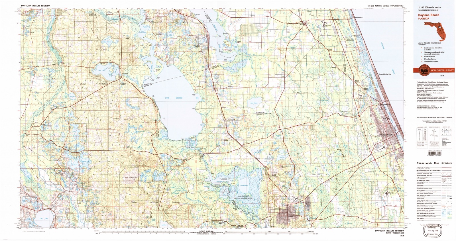
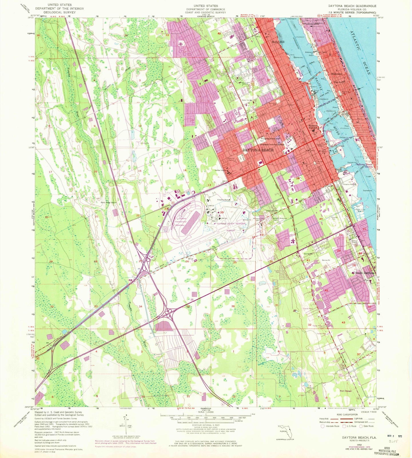
13 topographic sheets cover this place, the earliest surveyed in 1952 and the latest in 1978. It stands in the Ormond Beach census division. It lies in ZIP code area 32117. The Survey maps it on the Daytona Beach quadrangle. 12,958 people lived here at the 2020 count. It stands 13 feet above sea level.
Then and now
1952 to 1978The same ground, surveyed 26 years apart. Drag the handle to wipe between them. Both sheets are United States Geological Survey originals; neither has been altered.
Compare 1952 against another survey:
On record in Holly Hill
Buildings and businesses the archive holds for this place. Each opens its own page, with the source record it came from.
On the National Register 1 record
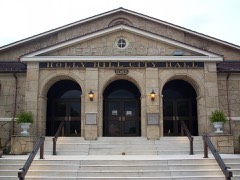 Holly Hill Municipal Buildinglisted 1993
Population over time
2 figuresHolly Hill grew from 11,659 to 12,958 between 2010 and 2020. These are the recorded population figures Wikidata holds for this place, reached through the Geographic Names Information System number this page is keyed on rather than by name, so they belong to this place and not to another of the same name. Most are census counts, but not all are: an early figure may be a founding or settlement estimate, and an estimate published within five years of a census is left out. The change column is computed, and is left blank where more than 20 years separate a figure from the one before it, because a gap that long is not a change between two counts.
| Year | People | Change |
|---|---|---|
| 2010 | 11,659 | |
| 2020 | 12,958 | +1,299 (+11%) |
Topographic sheets covering this place
5 surveys from 13 printed sheetsMatched by testing this settlement's coordinate against the published boundary of every sheet in the United States Geological Survey's historical collection. Each opens the scanned sheet at the Survey.
- 1952 USGS Daytona Beach quadrangle1:24000, 7 printings
- 1954 USGS Daytona Beach quadrangle1:250000
- 1958 USGS Daytona Beach quadrangle1:250000, 2 printings
- 1964 USGS Daytona Beach quadrangle1:250000
- 1978 USGS Daytona Beach quadrangle1:100000, 2 printings
Fires near this place
213 since 1992Regional context, not property-specific evidence. The federal wildfire occurrence database lists 213 fires within 5 miles of Holly Hill between 1992 and 2020, burning about 692 acres in total. 34 started naturally. 30 were recorded as arson. Distance is straight-line from the map coordinates, so a fire counted here may appear on a neighbouring settlement's page as well.
| Reported cause | Fires |
|---|---|
| Equipment and vehicle use | 44 |
| Missing data/not specified/undetermined | 38 |
| Natural | 34 |
| Arson/incendiarism | 30 |
| Misuse of fire by a minor | 25 |
| Recreation and ceremony | 21 |
| Railroad operations and maintenance | 15 |
| Debris and open burning | 4 |
| Smoking | 2 |
The most recent of them, most recent first, with the day each was reported and the service that recorded it.
| Date | Cause | Size | Reported by | Name on the report |
|---|---|---|---|---|
| 9 September 1999 | Natural | under an acre | Florida Forest Service | not named |
| 18 September 1992 | Railroad operations and maintenance | under an acre | Florida Forest Service | not named |
| 11 September 1992 | Railroad operations and maintenance | 2.0 acres | Florida Forest Service | not named |
| 9 August 2013 | Missing data/not specified/undetermined | 1.5 acres | Florida Forest Service | CEDAR HIGHLANDS (64) |
| 7 August 2016 | Debris and open burning | 1.0 acres | Florida Forest Service | PRIMROSE (64) |
| 30 August 2004 | Recreation and ceremony | under an acre | Florida Forest Service | HOMELESS FIRE |
| 30 August 1999 | Natural | under an acre | Florida Forest Service | not named |
| 26 August 2000 | Natural | 5.0 acres | Florida Forest Service | not named |
Settlements close enough to share some of these fires:
Mines and quarries near this place
2 within 5 milesRegional context, not property-specific evidence. The federal mineral resources record lists 2 workings within 5 miles of Holly Hill: 1 past producer, 1 producer. 1 still produces. What was taken out: Sand and Gravel, Construction, Limestone, General. Distance is straight-line from the map coordinates, so a quarry counted here may appear on a neighbouring settlement's page as well.
| Where | Site | Commodity | Status | Recorded |
|---|---|---|---|---|
| Barbour Sand and Gravel Pit | Sand and Gravel, Construction | Past Producer | ||
| Volusia Co. Rd. and Bridge - Holly Hills Pit | Limestone, General | Producer | Limestone |
Storms near this place
18 since 1993Regional context, not property-specific evidence. The National Weather Service names Holly Hill in 18 storm reports between 1993 and 2023: 8 thunderstorm wind, 5 hail, 2 flood, 1 lightning. The reports record 4 deaths and 1 injury. Each account below is quoted exactly as the forecast office filed it, from the NOAA Storm Events Database, and each date opens the federal record of that event.
| When | Event | Place named | Harm | What the report says |
|---|---|---|---|---|
| September 2022 | Flood | West Holly Hill | 4 killed, $340,000,000 | Rainfall totals averaging between 10 to 16 inches, with locally higher amounts of up to 20 inches were reported particularly in the coastal part of the county, resulting in widespread residential, street, urban, and poor drainage flooding. ||County drone and helicopter footage combined with on-site surveys captured considerable river and lakeshore flooding, with water entering numerous structures along the St. Johns River near Astor and South Moon Fish Camp, Lake Monroe in Stone Island, and Little Lake near Osteen. The St. Johns River reached record crests at both Astor (4.71 ft. on Oct. 1) and Deland (6.33 ft. on Oct. 11). See separate entry for additional details on significant (flash) flooding event in Daytona Beach, Port Orange, and New Smyrna Beach. ||A 67-year-old resident of New Smyrna Beach died due to rising flood waters in his home after he fell and rescuers were unable to reach him in time (direct). A 72-year-old Deltona man drowned after falling into a flooded canal by his home while attempting to use a hose to drain his pool (direct). A 91-year-old New Smyrna Beach man was discovered in about 6 inches of water in his home by emergency responders (direct). A 79-year-old male from Daytona Beach was found face-down in water in his home (direct).||A county damage assessment indicated 3554 structures affected, 2602 with minor damage, 645 with major damage, and 48 destroyed, mainly due to widespread and historic flooding. The combined effects of Hurricane Ian led to a total estimated damage of approximately $340M. |
| July 2009 | Lightning | Holly Hill | 1 hurt | A man was struck by lightning outside his Holly Hill home while gardening during the beginning of an approaching storm. The man was knocked unconscious for several minutes by the strike and awoke bleeding, and with a numb neck and right leg from the knee down. He also sustained burns inside his mouth and in his eyes. After gaining consciousness, he crawled into his house and his wife called 911. He was then rushed to a local hospital emergency room. |
| September 2014 | Flash Flood | Holly Hill | $3,090,000 | A persistent area of heavy rain trained across Holly Hill, Daytona Beach, and Port Orange during the early morning hours until around sunrise. Rainfall totals reached 8 to 12 inches, resulting in significant urban and roadway flooding. Retention ponds and drainage canals overflowed and rising water entered 98 single family homes, 10 multi-family homes and 6 businesses. Thirty-five of these structures experienced minor damage and the remaining 79 were affected. Estimated damage was over 3 million dollars. No injuries were reported. |
| November 2017 | Thunderstorm Wind | Holly Hill | $50,000 | Two homes sustained roof damage at the Colonial Colony North Mobile Home Park in Daytona Beach. Approximately four other nearby homes experienced minor damage. |
| July 2003 | Thunderstorm Wind | Holly Hill | $18,000 | Thunderstorm winds destroyed a large gas station roof awning in Holly Hill. |
| March 1993 | Thunderstorm Wind | Holly Hill | $5,000 | Strong winds blew several trees onto a house in Holly Hill. A gust to 64 mph was recorded at Daytona Beach at 0150 EST. |
| September 2023 | Flood | West Holly Hill | - | Volusia County Fire Rescue reported flooding of several areas in Ormond Beach due to excessive rainfall. |
| September 2023 | Heavy Rain | West Holly Hill | - | Weather Underground site KFLORMON224 measured 7.2 inches of rain for the date through the time of observation. |
| March 2021 | Hail | West Holly Hill | - | The public reported quarter sized hail near LPGA Boulevard and Azure Court. |
| March 2021 | Hail | West Holly Hill | - | Daytona International Speedway Emergency Management reported half dollar sized hail west of Interstate 95 near LPGA Boulevard. They also reported small hail had accumulated on the ground and was 4 to 5 inches deep in some spots. |
| March 2018 | Hail | Holly Hill | - | A trained spotter reported 2 inch hail in Daytona Beach. |
| June 2011 | Thunderstorm Wind | West Holly Hill | - | A trained spotter reported estimated wind gusts of around 60 mph near the intersection of Tournament Drive and LPGA Boulevard west of Daytona Beach. Spotters also reported trees down in the vicinity. |
| October 2008 | Thunderstorm Wind | Holly Hill | - | Trees were blown down on Anniston Avenue and Flomich Street. |
| June 2006 | Thunderstorm Wind | Holly Hill | - | A spotter estimated wind gusts to 52 knots in Holly Hill. |
| June 2004 | Thunderstorm Wind | Holly Hill | - | Thunderstorm winds blew down trees and power lines in Holly Hill. |
| May 2000 | Thunderstorm Wind | Holly Hill | - | Severe thunderstorm winds blew down large tree limbs in Holly Hills. |
| June 2006 | Hail | Holly Hill | - | no account filed |
| July 2003 | Hail | Holly Hill | - | no account filed |
Nearest settlements
The eight closest, with where each one stands in the county. Distances are straight-line, computed from the Geographic Names Information System coordinates.
| Map | Place | Distance | Sheets |
|---|---|---|---|
| Ortona | 0.9 miles | 13 | |
| Seabreeze | 1.5 miles | 13 | |
| Daytona Beach | 2.4 miles | 13 | |
| Ellinor Village | 2.5 miles | 13 | |
| Ormond Beach | 3.1 miles | 13 | |
| Blake | 5.0 miles | 13 | |
| Daytona Beach Shores | 5.5 miles | 14 | |
| South Daytona | 5.6 miles | 13 |
Elsewhere
Matched on this settlement's Geographic Names Information System number rather than its name, so it cannot be a different place of the same name in another state.
| Wikipedia article on Holly Hill | An encyclopaedic summary. Its text is share-alike, so it is linked here rather than copied. |
| Wikidata item Q2153091 | The structured record the population and elevation above come from. Public domain (CC0). |
Provenance
This settlement is recorded in the Geographic Names Information System as feature 284170. The sheet list is computed by point-in-boundary test against the United States Geological Survey's historical topographic inventory. Both are works of the United States government and carry no copyright under 17 U.S.C. 105.
Wildfire. Short, Karen C. 2022. Spatial wildfire occurrence data for the United States, 1992-2020 [FPA_FOD_20221014]. 6th Edition. Fort Collins, CO: Forest Service Research Data Archive. https://doi.org/10.2737/RDS-2013-0009.6 Collected with United States Government funding and usable without additional permissions or fees.
Mines and quarries. USGS Mineral Resources Data System (MRDS) https://mrdata.usgs.gov/mrds/ A work of the United States government, no copyright under 17 U.S.C. 105.
Storms. NOAA National Centers for Environmental Information, Storm Events Database https://www.ncei.noaa.gov/stormevents/ A work of the United States government, no copyright under 17 U.S.C. 105. Narratives are quoted verbatim from the National Weather Service report and are not edited or summarised.