 Block
BlockLake Jackson, Florida
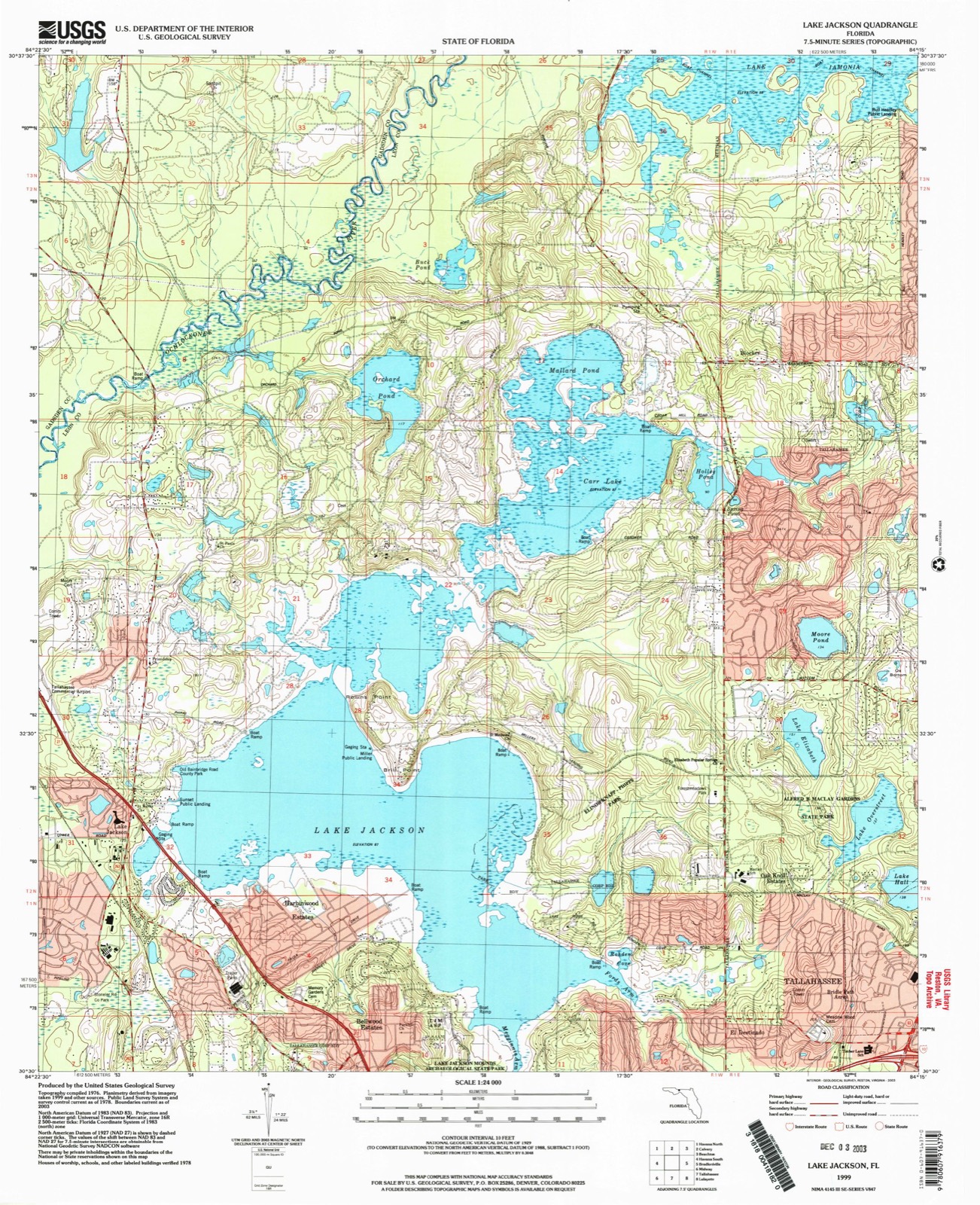
13 topographic sheets cover this place, the earliest surveyed in 1954 and the latest in 1999. It stands in the Northeast Leon census division. It lies in ZIP code area 32303. The Survey maps it on the Lake Jackson quadrangle.
Then and now
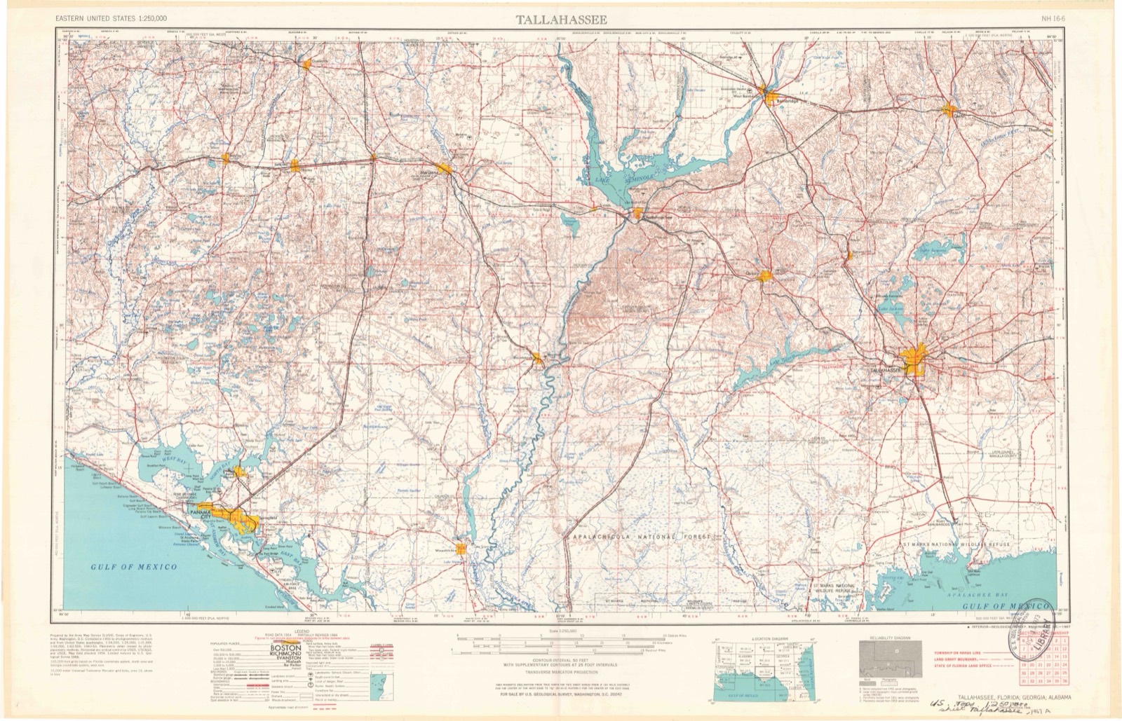
1954 to 1999The same ground, surveyed 45 years apart. Drag the handle to wipe between them. Both sheets are United States Geological Survey originals; neither has been altered.
Compare 1954 against another survey:
Topographic sheets covering this place
8 surveys from 13 printed sheetsMatched by testing this settlement's coordinate against the published boundary of every sheet in the United States Geological Survey's historical collection. Each opens the scanned sheet at the Survey.
- 1954 USGS Tallahassee quadrangle1:250000, 4 printings
- 1959 USGS Tallahassee quadrangle1:250000
- 1960 USGS Tallahassee quadrangle1:250000
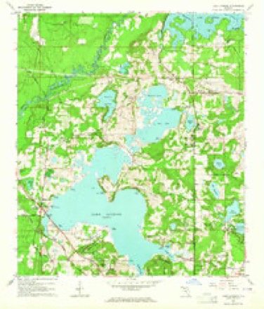
- 1963 USGS Lake Jackson quadrangle1:24000
- 1978 USGS Bainbridge quadrangle1:100000
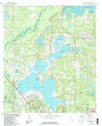
- 1982 USGS Lake Jackson quadrangle1:24000, 2 printings
- 1988 USGS Tallahassee quadrangle1:250000, 2 printings
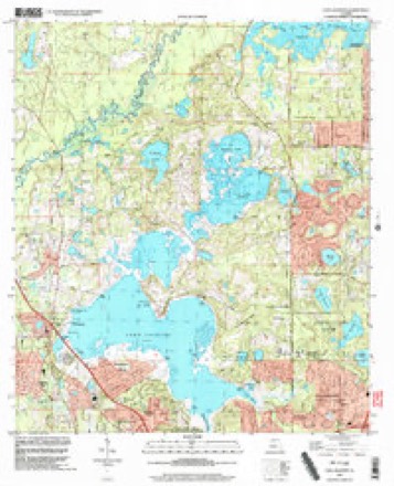
- 1999 USGS Lake Jackson quadrangle1:24000
Fires near this place
50 since 1992Regional context, not property-specific evidence. The federal wildfire occurrence database lists 50 fires within 5 miles of Lake Jackson between 1992 and 2020, burning about 665 acres in total. 2 started naturally. 1 was recorded as arson. Distance is straight-line from the map coordinates, so a fire counted here may appear on a neighbouring settlement's page as well.
| Reported cause | Fires |
|---|---|
| Debris and open burning | 19 |
| Missing data/not specified/undetermined | 10 |
| Railroad operations and maintenance | 9 |
| Equipment and vehicle use | 4 |
| Smoking | 3 |
| Natural | 2 |
| Recreation and ceremony | 1 |
| Misuse of fire by a minor | 1 |
| Arson/incendiarism | 1 |
The most recent of them, most recent first, with the day each was reported and the service that recorded it.
| Date | Cause | Size | Reported by | Name on the report |
|---|---|---|---|---|
| 30 September 1997 | Railroad operations and maintenance | 1.0 acres | Florida Forest Service | not named |
| 19 September 2011 | Debris and open burning | under an acre | Florida Forest Service | SCOTT DRIVE (20) |
| 18 September 2010 | Debris and open burning | 12 acres | Florida Forest Service | (37) OCHLOCKONEE ROBERT FIRE |
| 1 August 1993 | Natural | 160 acres | Florida Forest Service | not named |
| 7 July 2012 | Missing data/not specified/undetermined | 4.0 acres | Florida Forest Service | GARDNER LANDING (37) |
| 6 July 2006 | Natural | 8.0 acres | Florida Forest Service | (37) MILLERS LANDING FIRE |
| 21 July 2007 | Missing data/not specified/undetermined | 30 acres | Florida Forest Service | (20) GRANT RD FIRE |
| 20 July 2000 | Railroad operations and maintenance | 2.0 acres | Florida Forest Service | not named |
Settlements close enough to share some of these fires:
Mines and quarries near this place
6 within 5 milesRegional context, not property-specific evidence. The federal mineral resources record lists 6 workings within 5 miles of Lake Jackson: 4 producers, 1 unknown, 1 past producer. 4 still produce. What was taken out: Sand, Clay. Distance is straight-line from the map coordinates, so a quarry counted here may appear on a neighbouring settlement's page as well.
| Where | Site | Commodity | Status | Recorded |
|---|---|---|---|---|
| Tallahassee Brick Company Pit | Clay | Past Producer | ||
| Capital Asphalt - Davis Pit | Sand | Producer | ||
| Cumbie Constr. Co. Tower Road Pit | Sand | Producer | ||
| J. Crowder Excavation - Tower Rd | Sand | Producer | ||
| Jimmie Crowder Excava. & Land Clear - Tower Road | Sand | Producer | ||
| Leon Co. Dept. of Public Works - Wilson Sand Mine | Sand | Unknown |
Storms near this place
33 since 1999Regional context, not property-specific evidence. The National Weather Service names Lake Jackson in 33 storm reports between 1999 and 2024: 21 thunderstorm wind, 6 hail, 3 heavy rain, 2 tornado. No death or injury is recorded in these reports. Each account below is quoted exactly as the forecast office filed it, from the NOAA Storm Events Database, and each date opens the federal record of that event.
| When | Event | Place named | Harm | What the report says |
|---|---|---|---|---|
| December 2009 | Tornado (EF0) | Lake Jackson | $50,000 | A tornado touched down along the northern end of Lake Jackson east of Brill Point Road. It traveled east-northeast and produced damage just south of the 2100 block of Miller Landing Road. One home lost a sizable portion of it shingles on the southward-facing aspect of the home. Debris from the roof was carried northward between 50 and 100 feet. Three large trees were snapped in the backyard of the home and falling in a northward direction. With the damage pattern nearly perpendicular to the storm path, the damage was consistent with an F0 tornado with wind speeds up to 80 mph. |
| April 2023 | Thunderstorm Wind | Lake Jackson | $25,000 | A tree was blown down onto a home in the 2900 block of Stokley Lane. |
| June 2023 | Thunderstorm Wind | Lake Jackson | $10,000 | A tree was blown down onto a house on Caracus Ct. |
| April 2020 | Tornado (EF1) | Lake Jackson | $10,000 | A tornado touched down just south of North Monroe Street and moved east into a neighborhood where there was widespread limb and tree damage. It likely then crossed over the lake and impacted Elinor Klapp Phipps park where snapped tree trunks were|observed. It produced some of the most widespread tree damage, including snapped trucks, near Ox Bottom Road before crossing Thomasville Road. It moved northeast through Killearn Estates and Killearn Acres with additional widespread tree and limb|damage and a few spots of snapped and uprooted trees. The last significant damage was additional snapped trees on Bradfordville Road. Additional tree damage was sporadic to the east of here as is likely outflow as the tornado lifted. The highest damage was rated 95 MPH due to snapped trees but the majority of the damage|was EF0 type tree damage. |
| April 2015 | Thunderstorm Wind | Lake Jackson | $10,000 | A tree fell on a house on Castleberry Drive. Damage was estimated. |
| December 2009 | Thunderstorm Wind | Lake Jackson | $10,000 | The thunderstorm crossed Lake Jackson and produced wind damage just southwest of Brill Point Road. In this area, several large trees either uprooted or snapped along the southwest-facing aspect of the lake. All of the trees that were uprooted or snapped fell in an east-northeast direction. One home had minor wind damage to a porch with some lawn furniture from the rear to the front of the home. Additional tree damage was observed on the northeast side of Brill Point Road, oriented in an east-northeast direction. Damage was consistent with straight-line winds with speeds of 70 to 75 mph. |
| December 2012 | Thunderstorm Wind | Lake Jackson | $5,000 | Numerous power outages in the Lake Jackson and Harbinwood areas were caused by downed trees and limbs. Monetary damage was estimated. |
| May 2024 | Thunderstorm Wind | Lake Jackson | $2,000 | A tree was blown down and resulted in a power outage via the Talquin Electric outage map. |
| June 2014 | Thunderstorm Wind | Lake Jackson | $2,000 | Multiple trees were blown down on Fred George Road at Mission Road and Old Bainbridge Road. |
| January 2014 | Thunderstorm Wind | Lake Jackson | $1,000 | Trees were blown down near Miller Landing and Brillpoint Roads. |
| September 2012 | Thunderstorm Wind | Lake Jackson | $1,000 | Leon County EOC reported a large tree down across Fred George Road blocking all 4 lanes between Old Bainbridge Road and North Monroe. Monetary damage was estimated. |
| April 2024 | Flash Flood | Lake Jackson | - | Old Bainbridge Rd at Homewood Rd was flooded. |
| July 2023 | Thunderstorm Wind | Lake Jackson | - | A large oak tree blew over at the northwest corner of Highway 27 and Fred George Road. |
| June 2023 | Thunderstorm Wind | Lake Jackson | - | A tree was blown down near Swatts Road and N Monroe St. |
| June 2023 | Thunderstorm Wind | Lake Jackson | - | A tree was blown down onto Old Bainbridge Road near Westbury Dr. |
| January 2022 | Thunderstorm Wind | Lake Jackson | - | A tree was blown down on Miller Landing Road and Clippys Drive. |
| May 2022 | Thunderstorm Wind | Lake Jackson | - | A tree was blown down onto the roadway near Old Bainbridge Road and Fred George Road. |
| September 2020 | Thunderstorm Wind | Lake Jackson | - | A tree was blown down onto the roadway near N Monroe St and Home Ct. |
| April 2020 | Thunderstorm Wind | Lake Jackson | - | A tree was down across the road. |
| April 2020 | Thunderstorm Wind | Lake Jackson | - | A tree was blown down across the road. |
| July 2017 | Thunderstorm Wind | Lake Jackson | - | A tree was blown down and blocked Fred George Road near Springwood Elementary School. |
| May 2016 | Thunderstorm Wind | Lake Jackson | - | A tree blew down across Old Bainbridge Road near Swatts Road and blocked the road. |
| July 2016 | Thunderstorm Wind | Lake Jackson | - | Three trees were blown down on Miller Landing Road. |
| April 2015 | Thunderstorm Wind | Lake Jackson | - | A tree was blown down near Old Bainbridge and Sherborne Road blocking the southbound lane. |
| August 2012 | Heavy Rain | Lake Jackson | - | A 24 hour rainfall total of 5.64 inches was measured by the Northwest Florida Water Management District rain gauge located at Abundant Life Fellowship. |
| August 2012 | Heavy Rain | Lake Jackson | - | A 24 hour rainfall total of 4.33 inches was measured by the Northwest Florida Water Management District rain gauge located at Lake Jackson-Miller Landing. |
| December 2011 | Heavy Rain | Lake Jackson | - | A storm total rainfall of 4.57 inches was was measured by the capital area flood warning network rain gauge located at Christian Heritage near Lake Jackson. |
| February 2007 | Hail | Lake Jackson | - | Quarter size hail reported by the public. |
| June 1999 | Hail | Lake Jackson | - | Public reported dime size hail. |
| May 2024 | Hail | Lake Jackson | - | no account filed |
| May 2024 | Hail | Lake Jackson | - | no account filed |
| May 2015 | Hail | Lake Jackson | - | no account filed |
| June 2011 | Hail | Lake Jackson | - | no account filed |
Nearest settlements
The eight closest, with where each one stands in the county. Distances are straight-line, computed from the Geographic Names Information System coordinates.
| Map | Place | Distance | Sheets |
|---|---|---|---|
| Harbinwood Estates | 1.9 miles | 13 | |
| Bellwood Estates | 2.6 miles | 13 | |
| Zion Hill | 4.1 miles | 19 | |
| Ochlockonee | 4.8 miles | 16 | |
| El Destinado | 4.8 miles | 13 | |
| Oak Knoll Estates | 5.1 miles | 13 | |
| Macon | 5.1 miles | 19 | |
| Bridle Path Acres | 5.5 miles | 13 |
Provenance
This settlement is recorded in the Geographic Names Information System as feature 294830. The sheet list is computed by point-in-boundary test against the United States Geological Survey's historical topographic inventory. Both are works of the United States government and carry no copyright under 17 U.S.C. 105.
Wildfire. Short, Karen C. 2022. Spatial wildfire occurrence data for the United States, 1992-2020 [FPA_FOD_20221014]. 6th Edition. Fort Collins, CO: Forest Service Research Data Archive. https://doi.org/10.2737/RDS-2013-0009.6 Collected with United States Government funding and usable without additional permissions or fees.
Mines and quarries. USGS Mineral Resources Data System (MRDS) https://mrdata.usgs.gov/mrds/ A work of the United States government, no copyright under 17 U.S.C. 105.
Storms. NOAA National Centers for Environmental Information, Storm Events Database https://www.ncei.noaa.gov/stormevents/ A work of the United States government, no copyright under 17 U.S.C. 105. Narratives are quoted verbatim from the National Weather Service report and are not edited or summarised.