 Block
BlockLakeport, Florida
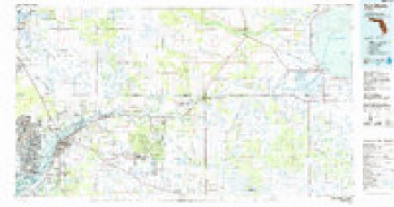
12 topographic sheets cover this place, the earliest surveyed in 1956 and the latest in 1987. It stands in the Northeast Glades census division. It lies in ZIP code area 33471. It stands on Fisheating Creek. The Survey maps it on the Lakeport quadrangle.
Research this city
Then and now
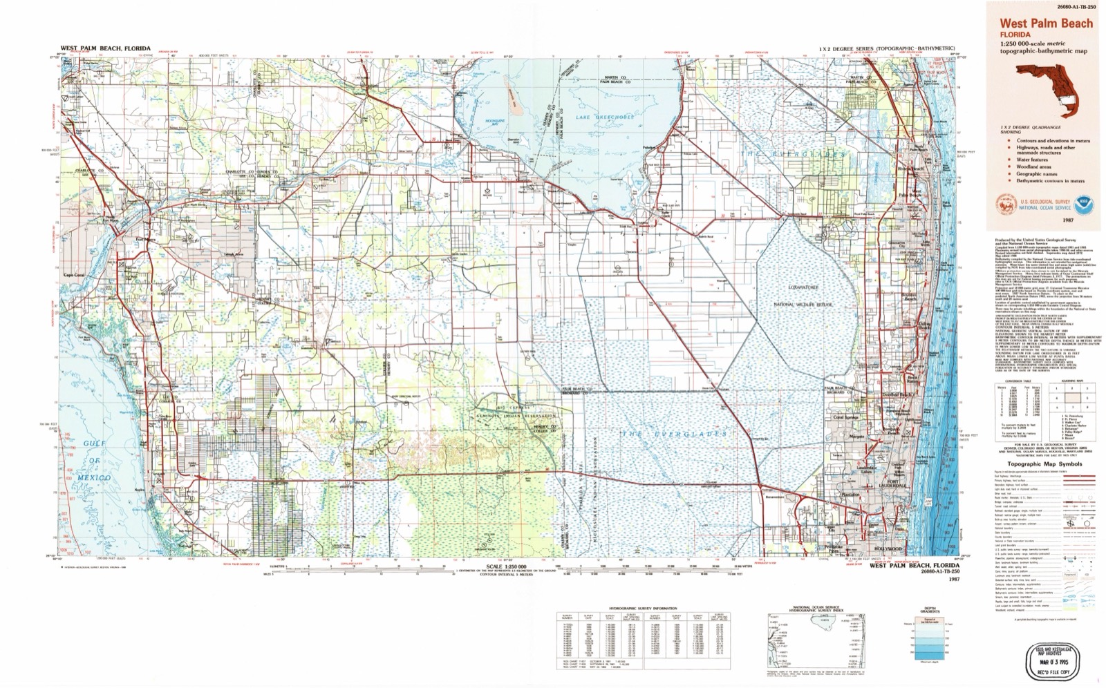
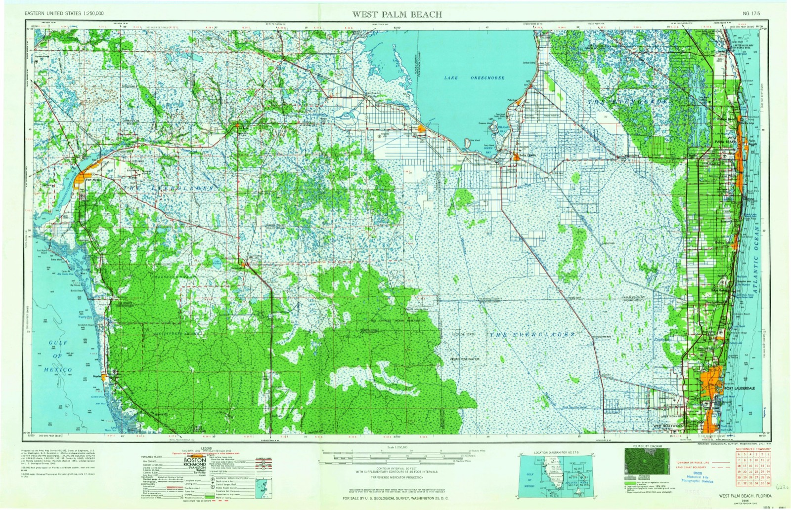
1956 to 1987The same ground, surveyed 31 years apart. Drag the handle to wipe between them. Both sheets are United States Geological Survey originals; neither has been altered.
Topographic sheets covering this place
7 surveys from 12 printed sheetsMatched by testing this settlement's coordinate against the published boundary of every sheet in the United States Geological Survey's historical collection. Each opens the scanned sheet at the Survey.
- 1956 USGS West Palm Beach quadrangle1:250000, 2 printings
- 1957 USGS West Palm Beach quadrangle1:250000
- 1958 USGS West Palm Beach quadrangle1:250000, 2 printings
- 1970 USGS Lakeport quadrangle1:24000, 3 printings
- 1981 USGS Fort Myers quadrangle1:100000
- 1985 USGS Fort Myers quadrangle1:100000
- 1987 USGS West Palm Beach quadrangle1:250000, 2 printings




Fires near this place
90 since 1993Regional context, not property-specific evidence. The federal wildfire occurrence database lists 90 fires within 5 miles of Lakeport between 1993 and 2020, burning about 60,612 acres in total. 8 started naturally. 32 were recorded as arson. Distance is straight-line from the map coordinates, so a fire counted here may appear on a neighbouring settlement's page as well.
| Reported cause | Fires |
|---|---|
| Arson/incendiarism | 32 |
| Debris and open burning | 25 |
| Equipment and vehicle use | 12 |
| Missing data/not specified/undetermined | 8 |
| Natural | 8 |
| Railroad operations and maintenance | 4 |
| Power generation/transmission/distribution | 1 |
The most recent of them, most recent first, with the day each was reported and the service that recorded it.
| Date | Cause | Size | Reported by | Name on the report |
|---|---|---|---|---|
| 24 August 2000 | Natural | 5.0 acres | Florida Forest Service | not named |
| 1 August 2020 | Debris and open burning | 3.0 acres | Florida Forest Service | BULL (22) |
| 7 July 1993 | Natural | under an acre | Florida Forest Service | not named |
| 18 July 2012 | Debris and open burning | under an acre | Florida Forest Service | BRUSH PILE (22) |
| 4 June 2007 | Natural | 200 acres | Florida Forest Service | (GL) MOONSHINE BAY II (746) |
| 22 June 1998 | Railroad operations and maintenance | under an acre | Florida Forest Service | not named |
| 18 June 2000 | Natural | 17 acres | Seminole Tribe | FREDDIE O |
| 13 June 2006 | Natural | under an acre | Seminole Tribe | STUMPFIRE |
Settlements close enough to share some of these fires:
Mines and quarries near this place
1 within 5 milesRegional context, not property-specific evidence. The federal mineral resources record lists 1 working within 5 miles of Lakeport: 1 past producer. None of them still produces. What was taken out: Sand and Gravel, Construction. Distance is straight-line from the map coordinates, so a quarry counted here may appear on a neighbouring settlement's page as well.
| Where | Site | Commodity | Status | Recorded |
|---|---|---|---|---|
| Palm Beach County Mine | Sand and Gravel, Construction | Past Producer |
Storms near this place
32 since 1998Regional context, not property-specific evidence. The National Weather Service names Lakeport in 32 storm reports between 1998 and 2025: 16 thunderstorm wind, 8 hail, 5 tornado, 1 waterspout. The reports record 1 death and 1 injury. Each account below is quoted exactly as the forecast office filed it, from the NOAA Storm Events Database, and each date opens the federal record of that event.
| When | Event | Place named | Harm | What the report says |
|---|---|---|---|---|
| June 2012 | Lightning | Lakeport | 1 killed, 1 hurt | A 51 year old male died when he was struck by lightning while boating on Lake Okeechobee during a fishing tournament. In addition, 1 other male on the boat was knocked unconscious and later was examined at a local hospital and released. |
| February 1998 | Tornado (F1) | Lakeport | $100,000 | Tornado touched down in Buckhead Ridge. Two homes had their roofs torn off. Ten homes had roof damage. Numerous trees and powerlines down. |
| June 2008 | Thunderstorm Wind | Lakeport | $75,000 | Strong Thunderstorms moved inland from Lake Okeechobee and into Buckhead Ridge producing damage to two homes, with one becoming uninhabitable. The resident of the mobile home was watching television and heard the wind pick up and noticed water coming through the ceiling and around the ceiling fan. She then ran for cover while the roof lifted off. Destruction to the mobile home was 80% with 100% destruction occurring to an addition. Amount of damage to second home was unknown. |
| October 2011 | Tornado (EF0) | Lakeport | $50,000 | A tornado rated at EF-0 moved across Lakeport in Glades County. The tornado damaged approximately 30 manufactured homes. Damage was mostly minor with siding peeled off and some roof and tree damage. Maximum winds were estimated at 85 mph. |
| June 2009 | Tornado (EF0) | Lakeport | $50,000 | Broadcast media relayed a report of damage caused by a small tornado at Lakeport RV Park in Lakeport. The person reporting the damage stated that several people saw a 8-10 foot funnel on the ground. ||A roof was lifted off of a trailer at 1256 Milum Drive, with minor porch and gutter damage to other trailers at the park. Eyewitnesses also reported hail and minor flooding. |
| April 2012 | Thunderstorm Wind | Lakeport | $20,000 | The Glades County Sheriffs Office reported a possible tornado in the Lakeport area with an estimated radar time of 250 AM EDT. Further investigation revealed that this was not a tornado but straight line thunderstorm wind gusts of 60-70 mph. A double-wide mobile home was tipped over but the unit was not tied down or secured. Another mobile home sustained roof damage but had already been weakened by previous unrepaired damage. |
| June 1999 | Thunderstorm Wind | Lakeport | $20,000 | no account filed |
| May 2025 | Thunderstorm Wind | Lakeport | $15,000 | A member of the public submitted a social media image depicting a flipped and damaged mobile home trailer associated with a strong thunderstorm downburst. |
| June 2016 | Thunderstorm Wind | Lakeport | $5,000 | A storm moving off of the northwestern end of Lake Okeechobee over Buckhead Ridge brought trees and power lines down in the community, including damaging the roof of one mobile home and wrapping the sheet metal on a power line. Lightweight signs and temporary shed structures were also blown around. Wind speeds estimated from radar indicated downburst. Information from Glades County Sheriff's Office and Glades County Emergency Management. |
| July 2025 | Thunderstorm Wind | Lakeport | $2,000 | A downed tree and power pole due to a severe thunderstorm in the area. |
| July 2024 | Funnel Cloud | Lakeport | - | Broadcast media shared photos of a funnel cloud near Lakeport as a shower moved through the area along a lake breeze boundary. |
| October 2024 | Tornado (EF1) | Lakeport | - | A tornado was spawned across the western portions of Lake Okeechobee, where it was captured by the Harney Pond WeatherSTEM camera between 10:35 AM EST and 10:44 AM EST. The tornado emerged over the Herbert Hoover Dike and entered the Miller Drive/Friendship Drive neighborhood where it damaged several manufactured homes and vegetation before crossing Florida State Road 78. The tornado advanced down Click Drive where it damaged several manufactured homes, rolled an outbuilding|off its foundation, and snapped a wooden utility pole at its base. The tornado proceeded into fields to the west of the Harney Pond Canal before entering the Brighton Seminole Indian Reservation. Residents reported seeing the tornado to the west of the Harney Pond Canal from the embankment as it crossed several cattle pastures before entering the Red Barn area to the west of Brighton Seminole Village. Several mature hardwood trees were uprooted or suffered a loss of their crowns along Red Barn Road. It likely dissipated as it crossed the canal to the north around 10:59 AM EST. The tornado was rated as an EF-1, after traveling a total 6.28 miles, with an estimated maximum winds around 110 mph. Click Drive appeared to have some of the highest damage indicators attributable to building damage with this tornado damage survey. No official damage amount was available. |
| April 2023 | Hail | Lakeport | - | Report of estimated 1.25 inch hail in Buckhead Ridge. |
| June 2020 | Hail | Lakeport | - | The Brighton Reservation Police reported Nickel size hail (0.88 inches) and wind gusts up to 50 mph with storms over the Cane Hill area of the reservation. |
| May 2016 | Hail | Lakeport | - | Seminole Police Department reported quarter size hail at Seminole casino. Seminole Police Department also reported dime and smaller size hail in surrounding areas including Brighton in Glades County. |
| March 2013 | Thunderstorm Wind | Lakeport | - | Large tree limbs downed in Buckhead Ridge. |
| May 2013 | Thunderstorm Wind | Lakeport | - | Local law enforcement reported four of five downed trees in the vicinity of Buckhead Ridge. |
| May 2012 | Hail | Lakeport | - | Nickel-size hail reported in Buckhead Ridge. |
| August 2012 | Thunderstorm Wind | Lakeport | - | Estimated winds up to 60 mph in Lakeport with some power outages. |
| April 2011 | Hail | Lakeport | - | Reported by the Sheriffs department as well as Lightsey Fish Company. Hail blew off screen porch. |
| October 2011 | Tornado (EF0) | Lakeport | - | A tornado damaged a home and barn just west of Buckhead Ridge. Damage was done to windows and roof of the home. A formal damage survey was not done due to the isolated and relatively minor nature of the damage, but the tornado is rated as an EF-0 due to the extent of the damage noted. Time and path is estimated based on emergency manager reports and analysis of radar data.||This tornado was likely spawned from the same storm that produced a tornado in Lakeport about 30 minutes earlier. |
| June 2009 | Thunderstorm Wind | Lakeport | - | Glades County Emergency Management relayed report that a transformer blew out in Buckhead Ridge. Winds of 60 mph winds were reported in the area at that time. |
| May 2009 | Hail | Lakeport | - | Glades County SO reported hail the size of nickels along with winds of around 50MPH. |
| May 2009 | Hail | Lakeport | - | Penny to quarter sized hail was reported by fire/rescue in Lakeport with a passing thunderstorm. Hail was initially penny sized, then became quarter sized as the storm intensified over the area. |
| June 2009 | Thunderstorm Wind | Lakeport | - | Public reported 60 mph wind gust at the Brighton Seminole reservation campground. |
| April 2006 | Hail | Lakeport | - | Golf ball size hail in Buckhead Ridge was reported to the Glades County Sheriff's Office. |
| June 2004 | Thunderstorm Wind | Lakeport | - | Large tree limbs were blown down in Buckhead Ridge. |
| December 2002 | Thunderstorm Wind | Lakeport | - | A coop observer reported trees blown down along Highway 78 on the Brighton Indian Reservation. |
| May 1999 | Thunderstorm Wind | Lakeport | - | Emergency Management reported tree limbs down in Lakeport and pea-size hail in Palmdale. |
| February 1998 | Thunderstorm Wind | Lakeport | - | One home lost porch roof and half of residences roof. Numerous trees and power lines down over much of eastern Glades county. |
| May 2007 | Thunderstorm Wind | Lakeport | - | no account filed |
| July 1999 | Waterspout | Lakeport | - | no account filed |
Nearest settlements
The eight closest, with where each one stands in the county. Distances are straight-line, computed from the Geographic Names Information System coordinates.
| Map | Place | Distance | Sheets |
|---|---|---|---|
| Fort Centre | 2.4 miles | 12 | |
| Sarasota Colony | 4.4 miles | 13 | |
| Monkey Box | 4.8 miles | 11 | |
| Washington Park | 9.4 miles | 11 | |
| Mayaimi (historical) | 9.7 miles | 13 | |
| Moore Haven | 10.1 miles | 11 | |
| Palmdale | 10.2 miles | 12 | |
| Harrisburg | 10.6 miles | 12 |
Provenance
This settlement is recorded in the Geographic Names Information System as feature 285298. The sheet list is computed by point-in-boundary test against the United States Geological Survey's historical topographic inventory. Both are works of the United States government and carry no copyright under 17 U.S.C. 105.
Wildfire. Short, Karen C. 2022. Spatial wildfire occurrence data for the United States, 1992-2020 [FPA_FOD_20221014]. 6th Edition. Fort Collins, CO: Forest Service Research Data Archive. https://doi.org/10.2737/RDS-2013-0009.6 Collected with United States Government funding and usable without additional permissions or fees.
Mines and quarries. USGS Mineral Resources Data System (MRDS) https://mrdata.usgs.gov/mrds/ A work of the United States government, no copyright under 17 U.S.C. 105.
Storms. NOAA National Centers for Environmental Information, Storm Events Database https://www.ncei.noaa.gov/stormevents/ A work of the United States government, no copyright under 17 U.S.C. 105. Narratives are quoted verbatim from the National Weather Service report and are not edited or summarised.