 Block
BlockLauderhill, Florida
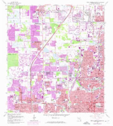
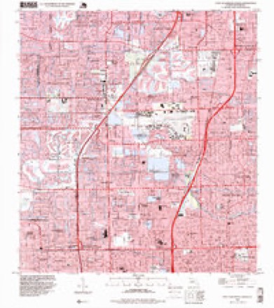
18 topographic sheets cover this place, the earliest surveyed in 1945 and the latest in 1995. It stands in the Plantation census division. It lies in ZIP code area 33313. The Survey maps it on the Fort Lauderdale North quadrangle. 74,482 people lived here at the 2020 count. It stands 10 feet above sea level.
Then and now
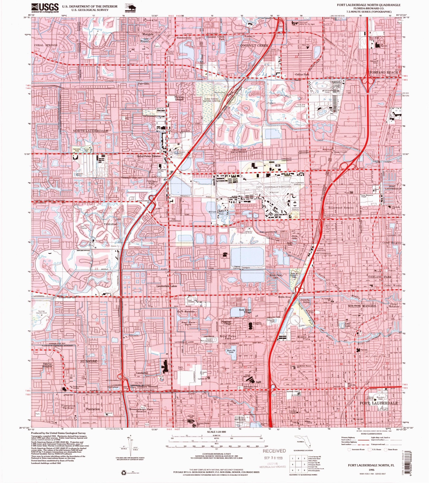
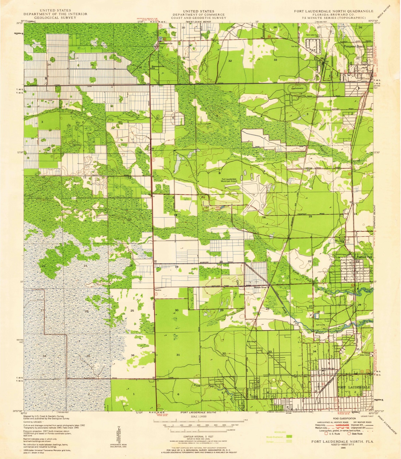
1945 to 1995The same ground, surveyed 50 years apart. Drag the handle to wipe between them. Both sheets are United States Geological Survey originals; neither has been altered.
Compare 1945 against another survey:
Population over time
2 figuresLauderhill grew from 66,887 to 74,482 between 2010 and 2020. These are the recorded population figures Wikidata holds for this place, reached through the Geographic Names Information System number this page is keyed on rather than by name, so they belong to this place and not to another of the same name. Most are census counts, but not all are: an early figure may be a founding or settlement estimate, and an estimate published within five years of a census is left out. The change column is computed, and is left blank where more than 20 years separate a figure from the one before it, because a gap that long is not a change between two counts.
| Year | People | Change |
|---|---|---|
| 2010 | 66,887 | |
| 2020 | 74,482 | +7,595 (+11%) |
Topographic sheets covering this place
10 surveys from 18 printed sheetsMatched by testing this settlement's coordinate against the published boundary of every sheet in the United States Geological Survey's historical collection. Each opens the scanned sheet at the Survey.
- 1945 USGS Fort Lauderdale North quadrangle1:24000
- 1949 USGS Fort Lauderdale North quadrangle1:24000, 2 printings
- 1956 USGS West Palm Beach quadrangle1:250000, 2 printings
- 1957 USGS West Palm Beach quadrangle1:250000
- 1958 USGS West Palm Beach quadrangle1:250000, 2 printings
- 1962 USGS Fort Lauderdale North quadrangle1:24000, 4 printings
- 1981 USGS Fort Lauderdale quadrangle1:100000
- 1985 USGS Fort Lauderdale quadrangle1:100000, 2 printings
- 1987 USGS West Palm Beach quadrangle1:250000, 2 printings
- 1995 USGS Fort Lauderdale North quadrangle1:24000




Fires near this place
1 since 2011Regional context, not property-specific evidence. The federal wildfire occurrence database lists 1 fire within 5 miles of Lauderhill in 2011, burning about 4 acres in total. None started naturally. None was recorded as arson. Distance is straight-line from the map coordinates, so a fire counted here may appear on a neighbouring settlement's page as well.
| Reported cause | Fires |
|---|---|
| Missing data/not specified/undetermined | 1 |
The most recent of them, most recent first, with the day each was reported and the service that recorded it.
| Date | Cause | Size | Reported by | Name on the report |
|---|---|---|---|---|
| 23 November 2011 | Missing data/not specified/undetermined | 4.0 acres | Florida Forest Service | DUMP ( 06) |
Settlements close enough to share some of these fires:
Mines and quarries near this place
10 of 11 shownRegional context, not property-specific evidence. The federal mineral resources record lists 11 workings within 5 miles of Lauderhill: 6 past producers, 4 producers, 1 unknown. 4 still produce. What was taken out: Stone, Crushed/Broken, Stone, Dimension, Silica, Sand and Gravel, Construction. Distance is straight-line from the map coordinates, so a quarry counted here may appear on a neighbouring settlement's page as well.
| Where | Site | Commodity | Status | Recorded |
|---|---|---|---|---|
| Powerline Pit | Silica | Past Producer | ||
| Prospect Pit | Sand and Gravel, Construction | Producer | ||
| State Road Quarry | Stone, Dimension | Unknown | ||
| 136th Street Pit | Stone, Crushed/Broken | Producer | ||
| 84 Pit | Stone, Crushed/Broken | Producer | ||
| Bates Project | Stone, Crushed/Broken | Past Producer | ||
| Decker Quarry | Stone, Crushed/Broken | Past Producer | ||
| Deem Pit | Stone, Crushed/Broken | Past Producer | ||
| Ferncrest Quarry | Stone, Crushed/Broken | Past Producer | ||
| Prospect Limestone Quarry | Stone, Crushed/Broken | Past Producer |
Storms near this place
25 since 1999Regional context, not property-specific evidence. The National Weather Service names Lauderhill in 25 storm reports between 1999 and 2024: 10 thunderstorm wind, 5 flood, 4 hail, 2 lightning. No death or injury is recorded in these reports. Each account below is quoted exactly as the forecast office filed it, from the NOAA Storm Events Database, and each date opens the federal record of that event.
| When | Event | Place named | Harm | What the report says |
|---|---|---|---|---|
| July 2004 | Heavy Rain | Lauderhill | $50,000 | The weight of two to four inches of rainfall caused a portion of an apartment roof to collapse. |
| April 1999 | Thunderstorm Wind | Lauderhill | $10,000 | no account filed |
| August 2000 | Thunderstorm Wind | Lauderhill | $5,000 | no account filed |
| April 2000 | Tornado (F0) | Lauderhill | $4,000 | A tree-top level tornado snapped a cypress tree and bent a light pole as it touched down in Veterans Park. The tornado moved north northeast for about 150 yards then damaged a screened pool enclosure before lifting. |
| June 2009 | Thunderstorm Wind | Lauderhill | $3,000 | A large tree branch broke off and pierced a three-foot hole in the ceiling of an apartment in the Sunview Park area of west Fort Lauderdale. No injuries were reported. |
| September 2006 | Lightning | Lauderhill | $3,000 | Lightning struck just outside of a home in Lauderhill during the early evening hours, causing a large hole in the driveway, knocking a garage door off its hinges and damaging the electrical panel in a car in front of the garage.The lightning was related to a band of thunderstorms loosely associated with Tropical Storm Ernesto which moved across South Florida 2 days prior. |
| June 2022 | Lightning | Lauderhill | $2,000 | Media reported a house struck by lightning at the 6200 block of SW 5 Street in Plantation. Fire officials from Plantation stated that a water heater caught fire inside the home and dealt with a gas leak. The fire department stated the time of occurrence was around 3:30 PM. |
| March 2024 | Flood | Lauderhill | - | A trained spotter reported flooding of roads and sidewalks in portions of Plantation and Lauderhill after a slow-moving thunderstorm passed over the area. A total of 2-3 inches of rain fell in this area in under an hour. No structures were reported to be impacted. |
| June 2024 | Flash Flood | Lauderhill | - | The Broward County emergency manager reported that Interstate 95 southbound traffic was being diverted onto Oakland Park Boulevard. The entrances to Interstate 95 at Sunrise Blvd, Broward Blvd, Davie Blvd, and SR-84 had been closed due to flooding and inaccessible roadways. Numerous broadcast media outlets reported that the interstate was closed for several hours. Two-day rainfall totals of 10-13 inches were registered in this area. |
| December 2024 | Flood | Lauderhill | - | The public reported street flooding near Melrose Park after slow-moving showers and embedded thunderstorms stalled over the area. Rainfall totals were estimated to be around 5 to 6 inches in less than 2 hours. |
| June 2022 | Flood | Lauderhill | - | Street flooding was reported in Plantation from slow-moving heavy showers and thunderstorms. Measured rainfall in the area was in the 2.5 to 3.5 inch range which fell in an hour or less. |
| May 2020 | Flood | Lauderhill | - | Reports of minor flooding in the Plantation area. A trained spotter in Plantation reported 6 inches of standing water on the roadside near Ridgewood Lane. The Florida Department of Transportation (FDOT) webcam indicated standing water on the roadway at the intersection of Broward Blvd and University Dr, blocking the right driving lane completely. |
| October 2020 | Flood | Lauderhill | - | Off-Duty NWS employees reported an apartment complex parking lot flooded with water half way up the tires with some cars stalled in parking lot. Along with a picture of flooded street near 3860 West Broward Blvd between 2nd Court and SW 38th Terrace. |
| September 2015 | Funnel Cloud | Lauderhill | - | A funnel cloud was reported near the intersection of I-595 and The Florida Turnpike. |
| September 2015 | Thunderstorm Wind | Lauderhill | - | A wind gust of 58 mph was measured at Broward County Emergency Operations Center. |
| April 2013 | Hail | Lauderhill | - | The skywarn spotter in Davie also reported penny sized hail with the thunderstorm. |
| April 2013 | Thunderstorm Wind | Lauderhill | - | A skywarn spotter reported a 65 mph thunderstorm wind gust near the intersection of SW 55th Ave. and SW 19th St in Davie. The spotter also reported a funnel cloud but then lost visual contact with it. Street flooding was also reported along Peters Road. |
| May 2012 | Thunderstorm Wind | Lauderhill | - | A trained spotter estimated wind gusts to 60 mph near the intersection of SW 55th Avenue and SW 19th Street in Plantation. The spotter also reported flying debris. |
| May 2012 | Thunderstorm Wind | Lauderhill | - | A member of the public reported estimated wind gusts of 60 mph near the intersection of SW 19th Street and SW 55th Avenue in Plantation. |
| May 2011 | Thunderstorm Wind | Lauderhill | - | A severe thunderstorm produced a gust of 61 MPH at the New River Middle School. |
| June 2009 | Thunderstorm Wind | Lauderhill | - | A trained spotter reported 70 mph estimated winds in Plantation. |
| July 2009 | Thunderstorm Wind | Lauderhill | - | A retired air force personnel reported wind gusts in excess of 50 knots along with power out at the intersection of University and Broward Blvd. |
| July 2007 | Hail | Lauderhill | - | Nickel size hail near the intersection of State Roads 7 and 84 in Fort Lauderdale. |
| August 2005 | Hail | Lauderhill | - | Nickel-size hail was observed. |
| June 2009 | Hail | Lauderhill | - | no account filed |
Nearest settlements
The eight closest, with where each one stands in the county. Distances are straight-line, computed from the Geographic Names Information System coordinates.
| Map | Place | Distance | Sheets |
|---|---|---|---|
| Breezeswept Park Estates | 0.8 miles | 18 | |
| Saint George | 1.2 miles | 18 | |
| Westgate Lake Manor | 1.2 miles | 16 | |
| Browardale | 1.4 miles | 18 | |
| Plantation | 1.4 miles | 18 | |
| East Gate Park | 1.4 miles | 18 | |
| Broward Estates | 1.5 miles | 18 | |
| Plantation Gardens | 1.5 miles | 18 |
Elsewhere
Matched on this settlement's Geographic Names Information System number rather than its name, so it cannot be a different place of the same name in another state.
| Wikipedia article on Lauderhill | An encyclopaedic summary. Its text is share-alike, so it is linked here rather than copied. |
| Wikidata item Q1001267 | The structured record the population and elevation above come from. Public domain (CC0). |
Provenance
This settlement is recorded in the Geographic Names Information System as feature 285368. The sheet list is computed by point-in-boundary test against the United States Geological Survey's historical topographic inventory. Both are works of the United States government and carry no copyright under 17 U.S.C. 105.
Wildfire. Short, Karen C. 2022. Spatial wildfire occurrence data for the United States, 1992-2020 [FPA_FOD_20221014]. 6th Edition. Fort Collins, CO: Forest Service Research Data Archive. https://doi.org/10.2737/RDS-2013-0009.6 Collected with United States Government funding and usable without additional permissions or fees.
Mines and quarries. USGS Mineral Resources Data System (MRDS) https://mrdata.usgs.gov/mrds/ A work of the United States government, no copyright under 17 U.S.C. 105.
Storms. NOAA National Centers for Environmental Information, Storm Events Database https://www.ncei.noaa.gov/stormevents/ A work of the United States government, no copyright under 17 U.S.C. 105. Narratives are quoted verbatim from the National Weather Service report and are not edited or summarised.