 Block
BlockPlantation, Florida
18 topographic sheets cover this place, the earliest surveyed in 1945 and the latest in 1995. It stands in the Plantation census division. It lies in ZIP code area 33317. The Survey maps it on the Fort Lauderdale North quadrangle. 91,750 people lived here at the 2020 count. It stands 9 feet above sea level.
Then and now
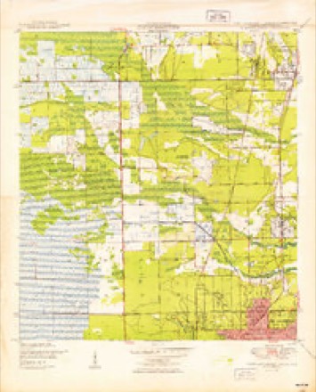
1945 to 1995The same ground, surveyed 50 years apart. Drag the handle to wipe between them. Both sheets are United States Geological Survey originals; neither has been altered.
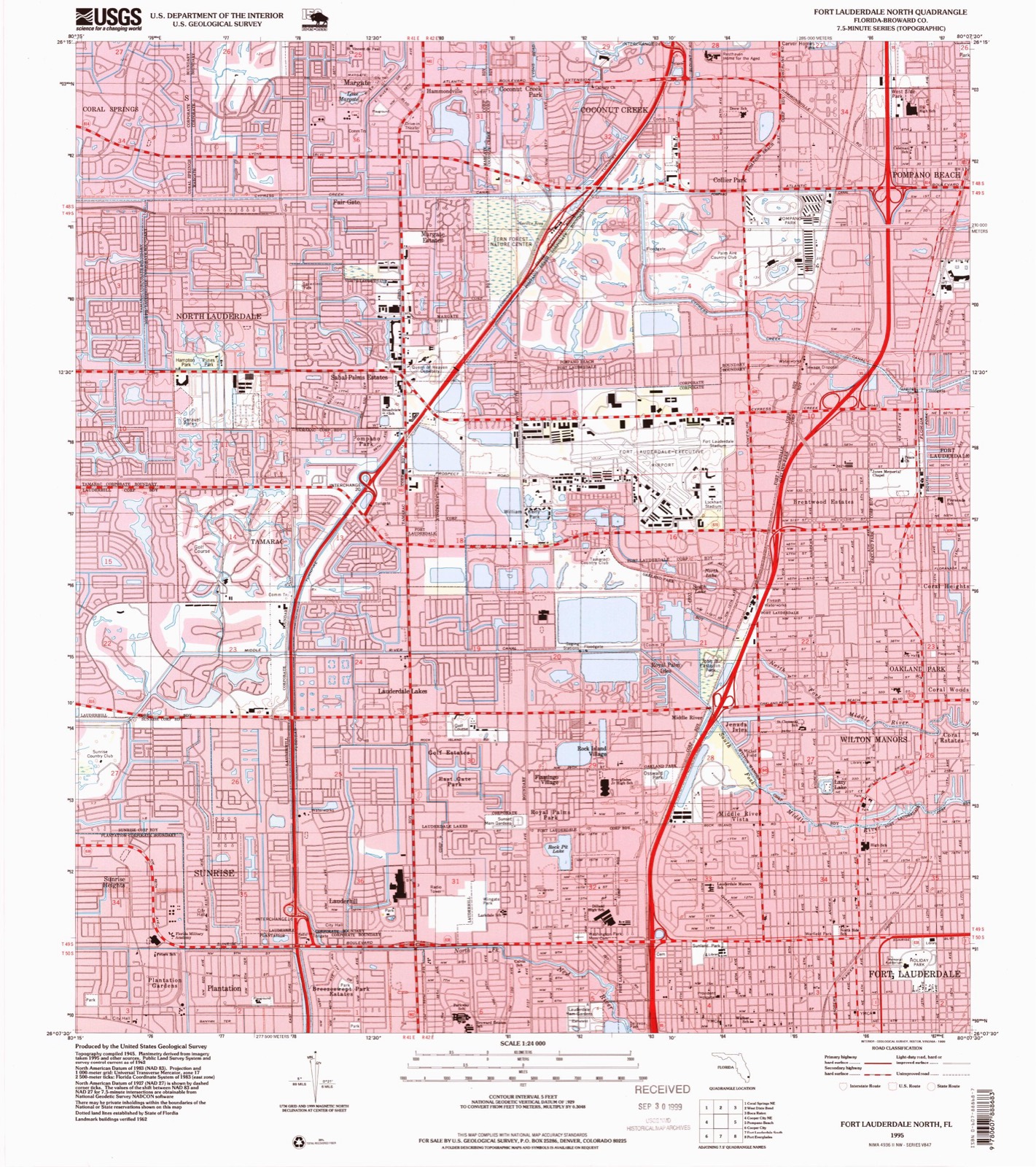
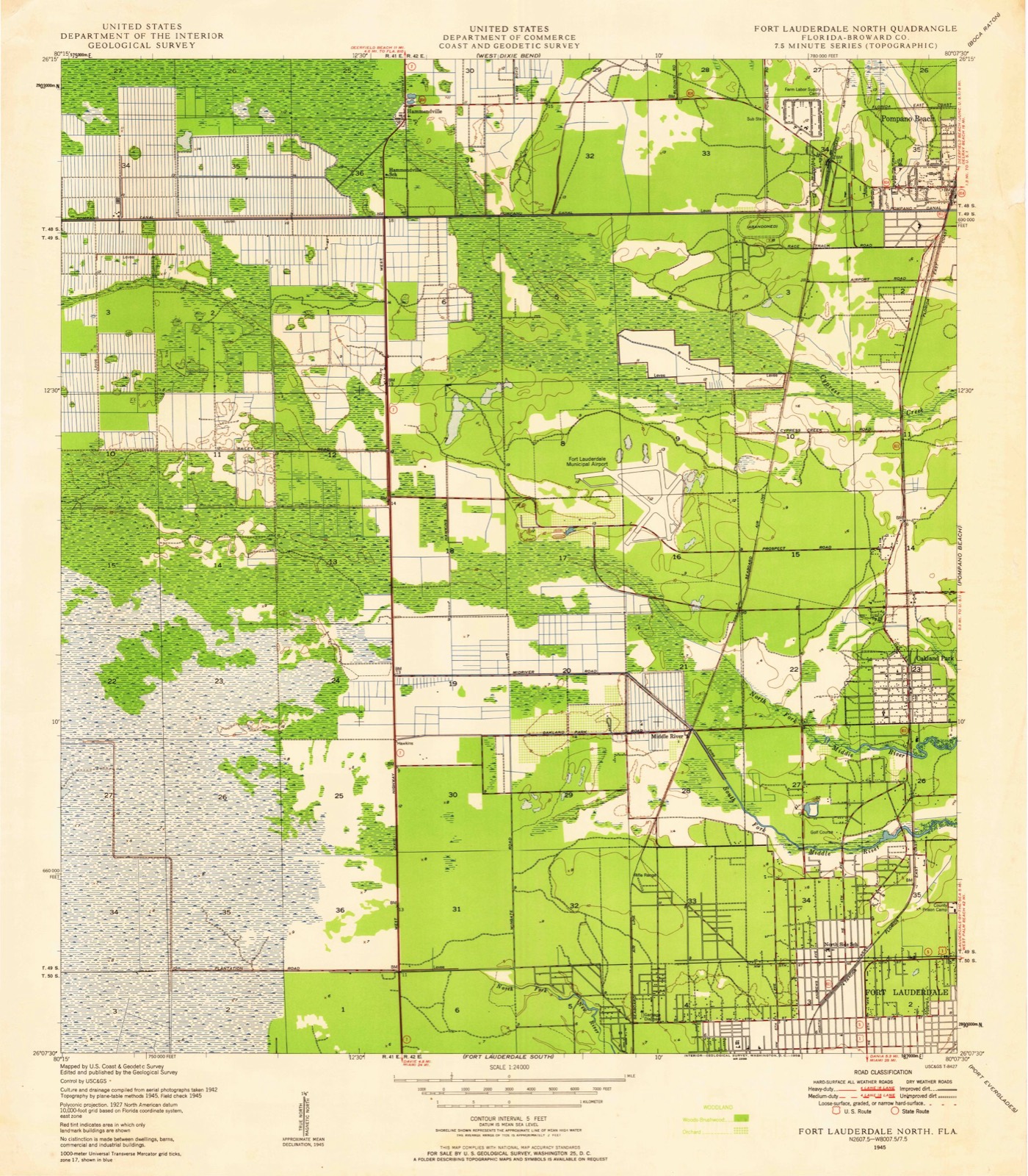
Compare 1945 against another survey:
On record in Plantation
Buildings and businesses the archive holds for this place. Each opens its own page, with the source record it came from.
On the National Register 1 record
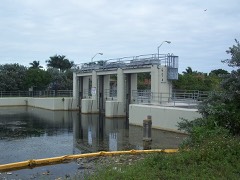 Lock No. 1, North New River Canallisted 1978
Topographic sheets covering this place
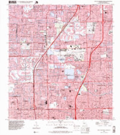
10 surveys from 18 printed sheetsMatched by testing this settlement's coordinate against the published boundary of every sheet in the United States Geological Survey's historical collection. Each opens the scanned sheet at the Survey.
- 1945 USGS Fort Lauderdale North quadrangle1:24000
- 1949 USGS Fort Lauderdale North quadrangle1:24000, 2 printings
- 1956 USGS West Palm Beach quadrangle1:250000, 2 printings
- 1957 USGS West Palm Beach quadrangle1:250000
- 1958 USGS West Palm Beach quadrangle1:250000, 2 printings
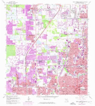
- 1962 USGS Fort Lauderdale North quadrangle1:24000, 4 printings
- 1981 USGS Fort Lauderdale quadrangle1:100000
- 1985 USGS Fort Lauderdale quadrangle1:100000, 2 printings
- 1987 USGS West Palm Beach quadrangle1:250000, 2 printings
- 1995 USGS Fort Lauderdale North quadrangle1:24000




Fires near this place
7 since 1993Regional context, not property-specific evidence. The federal wildfire occurrence database lists 7 fires within 5 miles of Plantation between 1993 and 2011, burning about 30 acres in total. None started naturally. None was recorded as arson. Distance is straight-line from the map coordinates, so a fire counted here may appear on a neighbouring settlement's page as well.
| Reported cause | Fires |
|---|---|
| Debris and open burning | 2 |
| Missing data/not specified/undetermined | 2 |
| Equipment and vehicle use | 1 |
| Misuse of fire by a minor | 1 |
| Railroad operations and maintenance | 1 |
The most recent of them, most recent first, with the day each was reported and the service that recorded it.
| Date | Cause | Size | Reported by | Name on the report |
|---|---|---|---|---|
| 13 June 2010 | Debris and open burning | under an acre | Florida Forest Service | 2 PILE FIRE |
| 11 May 1993 | Railroad operations and maintenance | under an acre | Florida Forest Service | not named |
| 26 April 1998 | Misuse of fire by a minor | 2.0 acres | Florida Forest Service | not named |
| 18 April 2006 | Equipment and vehicle use | 15 acres | Florida Forest Service | MCCALL FIRE |
| 18 December 2003 | Missing data/not specified/undetermined | 1.0 acres | Florida Forest Service | THE DAVIE PILE FIRE |
| 23 November 2011 | Missing data/not specified/undetermined | 4.0 acres | Florida Forest Service | DUMP ( 06) |
| 29 January 2001 | Debris and open burning | 8.0 acres | Florida Forest Service | not named |
Settlements close enough to share some of these fires:
Mines and quarries near this place
9 within 5 milesRegional context, not property-specific evidence. The federal mineral resources record lists 9 workings within 5 miles of Plantation: 4 past producers, 4 producers, 1 unknown. 4 still produce. What was taken out: Stone, Crushed/Broken, Stone, Dimension, Silica. Distance is straight-line from the map coordinates, so a quarry counted here may appear on a neighbouring settlement's page as well.
| Where | Site | Commodity | Status | Recorded |
|---|---|---|---|---|
| Powerline Pit | Silica | Past Producer | ||
| State Road Quarry | Stone, Dimension | Unknown | ||
| 136th Street Pit | Stone, Crushed/Broken | Producer | ||
| 84 Pit | Stone, Crushed/Broken | Producer | ||
| Arvida Lakes | Stone, Crushed/Broken | Producer | ||
| Bates Project | Stone, Crushed/Broken | Past Producer | ||
| Deem Pit | Stone, Crushed/Broken | Past Producer | ||
| Ferncrest Quarry | Stone, Crushed/Broken | Past Producer | ||
| State Road Quarry | Stone, Crushed/Broken | Producer |
Storms near this place
29 since 1997Regional context, not property-specific evidence. The National Weather Service names Plantation in 29 storm reports between 1997 and 2013: 8 thunderstorm wind, 5 hail, 5 funnel cloud, 5 lightning. The reports record 3 injuries. Each account below is quoted exactly as the forecast office filed it, from the NOAA Storm Events Database, and each date opens the federal record of that event.
| When | Event | Place named | Harm | What the report says |
|---|---|---|---|---|
| October 1999 | Tornado (F0) | Plantation | 1 hurt, $20,000 | no account filed |
| July 2005 | Lightning | Plantation | 1 hurt | A male construction worker at a golf course was injured when lightning struck a pickup truck and flashed off of it. He suffered burns and was transported to the hospital then released. It was raining at the time. |
| March 2001 | Lightning | Plantation | 1 hurt | An unknown person was struck and injured by lightning. |
| October 2011 | Flash Flood | Plantation | $2,000,000 | Torrential rainfall affected eastern sections of metro Broward County during the overnight hours of October 31st. Rainfall totals of 8 to 12 inches occurred over an area bounded by I-595 to the south and Pompano Beach to the north, from NW 31 Ave to the west all the way to the Atlantic coast. A few spots in this area likely received amounts close to 15 inches in about a 9-hour time span. These rains fell over areas already saturated from the rains of the previous two days. A total of 402 homes were affected by water damage and streets were closed due to inundation in Fort Lauderdale, Oakland Park, Wilton Manors and Pompano Beach. The area hardest-hit was between Broward and Commercial Boulevards between I-95 and Federal Highway where water covered the ground up to a few feet. ||The city of Fort Lauderdale opened a shelter for displaced residents in the hardest-hit areas. These areas qualified for federal assistance due to the magnitude and areal coverage of the flooding.||Damage amounts listed here are estimated by emergency managers taking into account total number of damaged properties and SBA loans. |
| February 2008 | Tornado (EF0) | Plantation | $350,000 | An EF0 tornado touched down just north of Interstate 595 and moved across the Riverland Village, Melrose Park and Washington Park neighborhoods of west Fort Lauderdale. The tornado moved north-northeast, roughly paralleling 31st Avenue, before lifting just south of Sunrise Boulevard. The tornado's widest point was about one-eighth of a mile between SW 4th St and SW 8th St, or between Davie and Broward Boulevards. Minor damage to roofs was noted along with fences, awnings, power lines and trees blown down. |
| May 2007 | Lightning | Plantation | $40,000 | Lightning struck the roof of The Waves apartment complex in Plantation. The strike set off flames in the attic and severely damaged four apartments.||A total of 9 people were displaced from their homes because of the fires. |
| July 2013 | Tornado (EF0) | Plantation | $10,000 | Broadcast Media and Law Enforcement reported a weak tornado touched down at Power Catamarans of South Florida damaging dinghies and watercraft. A couple of boats were overturned in the marina with one boat having a bent up shade and a catamaran was pushed into a fence. The force of the tornado also picked up three small Livingston catamarans and blew them across the yard along with a couple more on a rack. There was also one downed power line and some flashing was torn from a building. |
| July 2005 | Lightning | Plantation | $10,000 | Lightning struck and damaged the roofs of two homes in Weston. There were no fires and no one was injured. |
| August 2004 | Thunderstorm Wind | Plantation | $10,000 | The FHP reported light poles blown down. |
| July 2001 | Thunderstorm Wind | Plantation | $10,000 | A severe thunderstorm wind blew a power line onto I-75, trapping several people in their vehicles and shutting down the highway for several hours. |
| August 2004 | Lightning | Plantation | $10,000 | no account filed |
| June 2000 | Wildfire | Plantation | $10,000 | no account filed |
| July 2005 | Thunderstorm Wind | Plantation | $5,000 | Two large mahogany trees were blown down and a screened enclosure was damaged. |
| August 2006 | Hail | Plantation | - | Reported by trained spotter. |
| May 2005 | Hail | Plantation | - | Hail up to one inch in diameter was observed. |
| August 2005 | Funnel Cloud | Plantation | - | A SKYWARN spotter saw a funnel cloud near U.S 41 and Broward Boulevard. |
| April 2004 | Funnel Cloud | Plantation | - | A SKYWARN spotter reported a funnel cloud. |
| June 2004 | Thunderstorm Wind | Plantation | - | Power lines were blown down during a severe thunderstorm. |
| August 2003 | Thunderstorm Wind | Plantation | - | Power lines blew down forcing closure of the Sawgrass Expressway near Commercial Blvd. |
| August 2003 | Funnel Cloud | Plantation | - | A funnel cloud was sighted near I-595 and University Blvd. |
| September 2001 | Hail | Plantation | - | Dime-size hail was observed in Weston. |
| September 1998 | Funnel Cloud | Plantation | - | Funnel observed by sheriffs officer near I-595 and Flamingo Rd. |
| August 1998 | Funnel Cloud | Plantation | - | Several reports of funnel cloud near I-595 and Nob Hill Rd. |
| August 1998 | Thunderstorm Wind | Plantation | - | Wind gusts estimated at 61 knots. Trees down north of Weston near I-595. |
| July 1997 | Thunderstorm Wind | Plantation | - | reported by tv meteorologist. |
| July 1997 | Hail | Plantation | - | reported by storm spotter near sawgrass mills mall. increased from one quarter to three quarter inch in diameter. |
| August 1997 | Hail | Plantation | - | peters rd/university drive...street flooding also reported |
| May 2001 | Wildfire | Plantation | - | no account filed |
| August 1999 | Thunderstorm Wind | Plantation | - | no account filed |
Nearest settlements
The eight closest, with where each one stands in the county. Distances are straight-line, computed from the Geographic Names Information System coordinates.
| Map | Place | Distance | Sheets |
|---|---|---|---|
| Plantation Gardens | 0.3 miles | 18 | |
| Plantation Park | 0.7 miles | 16 | |
| Breezeswept Park Estates | 1.1 miles | 18 | |
| Sunrise Heights | 1.2 miles | 18 | |
| Lauderhill | 1.4 miles | 18 | |
| Westgate Lake Manor | 1.5 miles | 16 | |
| Plantation Isles | 1.8 miles | 16 | |
| Broward Estates | 2.1 miles | 18 |
Elsewhere
Matched on this settlement's Geographic Names Information System number rather than its name, so it cannot be a different place of the same name in another state.
| Wikipedia article on Plantation | An encyclopaedic summary. Its text is share-alike, so it is linked here rather than copied. |
| Wikidata item Q984677 | The structured record the population and elevation above come from. Public domain (CC0). |
Provenance
This settlement is recorded in the Geographic Names Information System as feature 289024. The sheet list is computed by point-in-boundary test against the United States Geological Survey's historical topographic inventory. Both are works of the United States government and carry no copyright under 17 U.S.C. 105.
Wildfire. Short, Karen C. 2022. Spatial wildfire occurrence data for the United States, 1992-2020 [FPA_FOD_20221014]. 6th Edition. Fort Collins, CO: Forest Service Research Data Archive. https://doi.org/10.2737/RDS-2013-0009.6 Collected with United States Government funding and usable without additional permissions or fees.
Mines and quarries. USGS Mineral Resources Data System (MRDS) https://mrdata.usgs.gov/mrds/ A work of the United States government, no copyright under 17 U.S.C. 105.
Storms. NOAA National Centers for Environmental Information, Storm Events Database https://www.ncei.noaa.gov/stormevents/ A work of the United States government, no copyright under 17 U.S.C. 105. Narratives are quoted verbatim from the National Weather Service report and are not edited or summarised.