 Block
BlockMarco, Florida
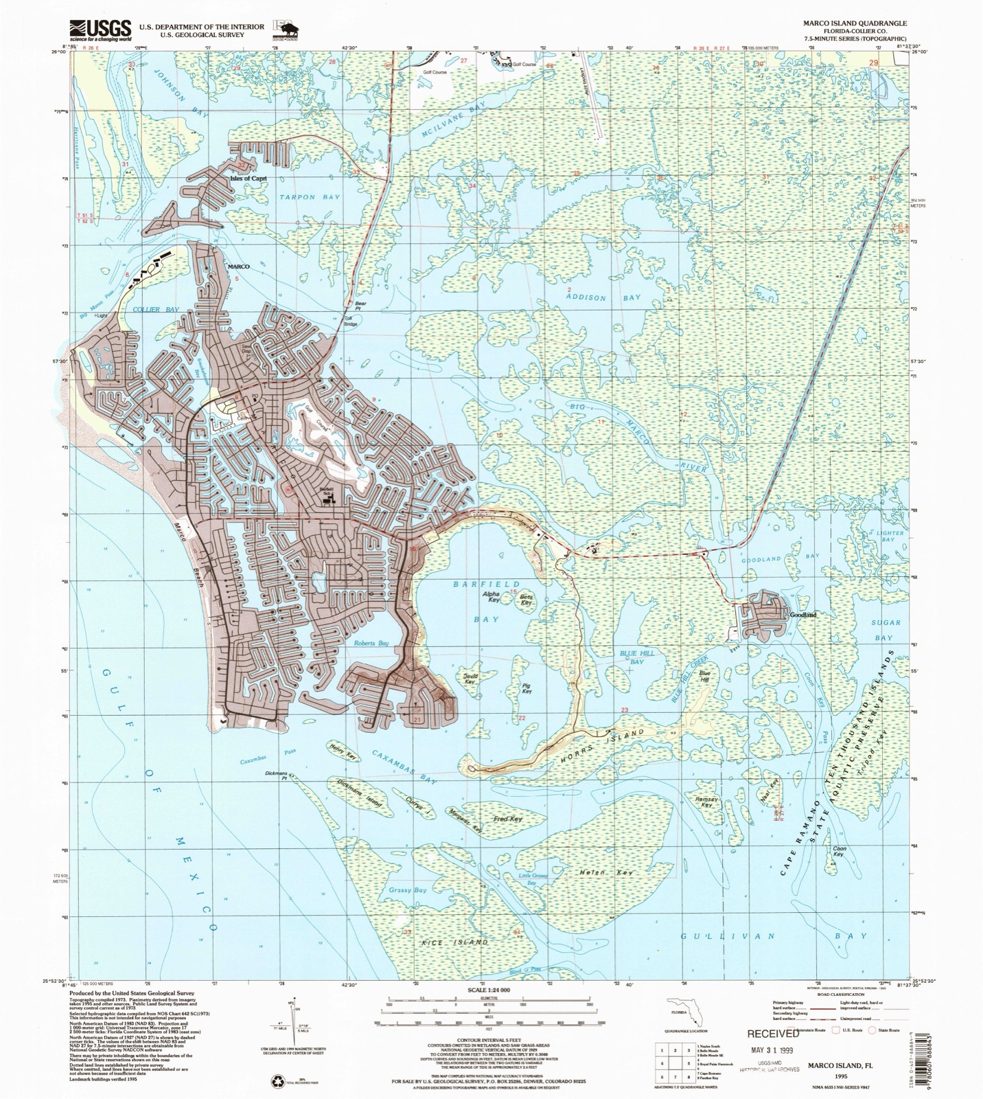
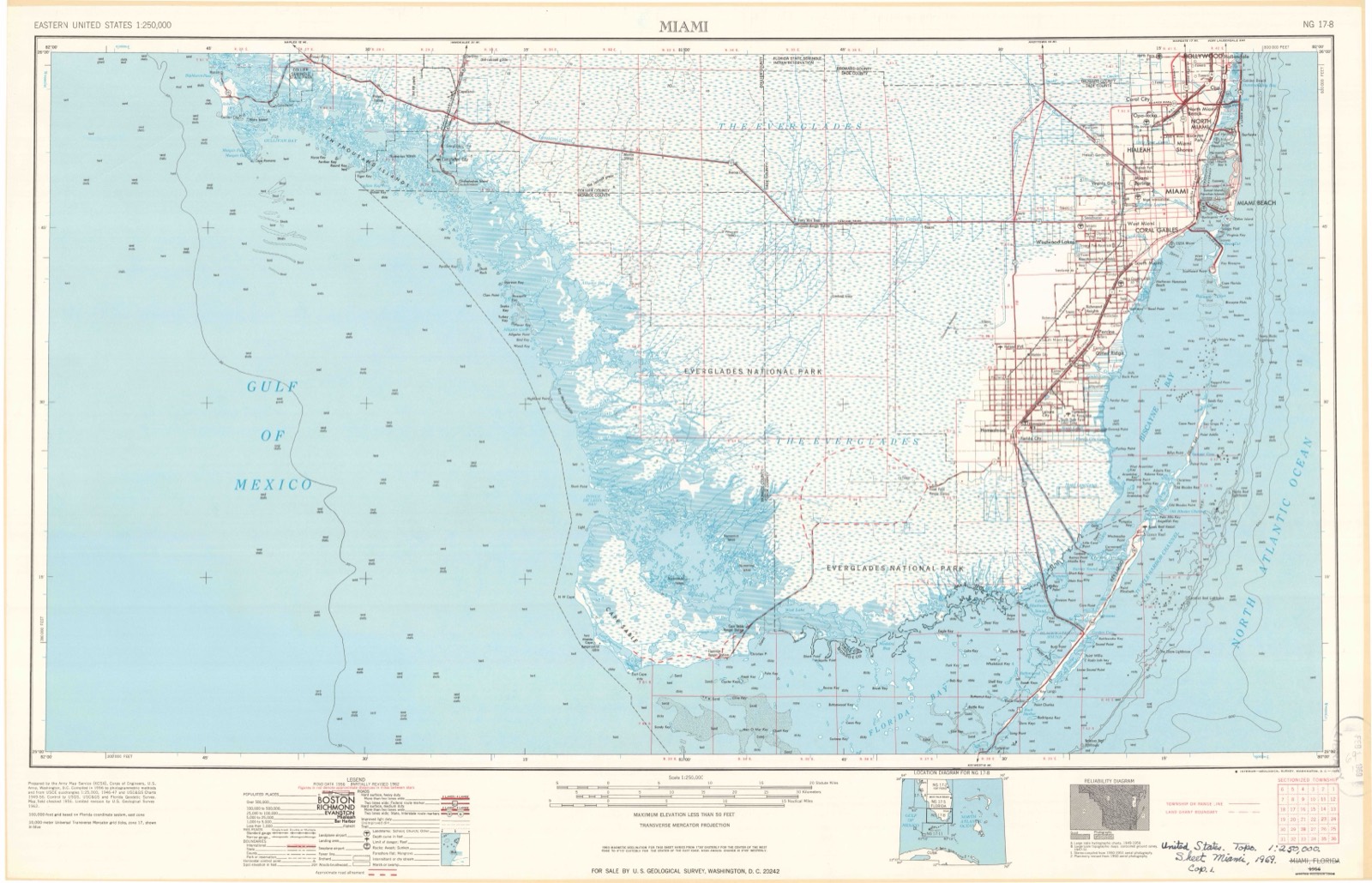
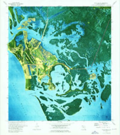
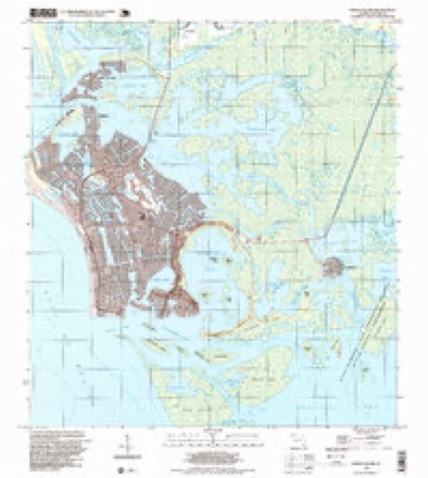
12 topographic sheets cover this place, the earliest surveyed in 1956 and the latest in 1995. It stands in the Marco Island census division. It lies in ZIP code area 34145. It lies near Stingaree Island. The Survey maps it on the Marco Island quadrangle. 15,760 people lived here at the 2020 count.
Then and now
1956 to 1995The same ground, surveyed 39 years apart. Drag the handle to wipe between them. Both sheets are United States Geological Survey originals; neither has been altered.
Compare 1956 against another survey:
Population over time
2 figuresMarco fell from 16,413 to 15,760 between 2010 and 2020. These are the recorded population figures Wikidata holds for this place, reached through the Geographic Names Information System number this page is keyed on rather than by name, so they belong to this place and not to another of the same name. Most are census counts, but not all are: an early figure may be a founding or settlement estimate, and an estimate published within five years of a census is left out. The change column is computed, and is left blank where more than 20 years separate a figure from the one before it, because a gap that long is not a change between two counts.
| Year | People | Change |
|---|---|---|
| 2010 | 16,413 | |
| 2020 | 15,760 | -653 (-4%) |
Topographic sheets covering this place
6 surveys from 12 printed sheetsMatched by testing this settlement's coordinate against the published boundary of every sheet in the United States Geological Survey's historical collection. Each opens the scanned sheet at the Survey.
- 1956 USGS Miami quadrangle1:250000, 5 printings
- 1958 USGS Miami quadrangle1:250000
- 1973 USGS Marco Island quadrangle1:24000, 3 printings
- 1982 USGS Everglades City quadrangle1:100000
- 1988 USGS Miami quadrangle1:250000
- 1995 USGS Marco Island quadrangle1:24000
Fires near this place
12 since 1992Regional context, not property-specific evidence. The federal wildfire occurrence database lists 12 fires within 5 miles of Marco between 1992 and 2004, burning about 262 acres in total. 5 started naturally. None was recorded as arson. Distance is straight-line from the map coordinates, so a fire counted here may appear on a neighbouring settlement's page as well.
| Reported cause | Fires |
|---|---|
| Natural | 5 |
| Debris and open burning | 2 |
| Misuse of fire by a minor | 2 |
| Smoking | 1 |
| Missing data/not specified/undetermined | 1 |
| Railroad operations and maintenance | 1 |
The most recent of them, most recent first, with the day each was reported and the service that recorded it.
| Date | Cause | Size | Reported by | Name on the report |
|---|---|---|---|---|
| 8 August 1993 | Natural | 10 acres | Florida Forest Service | not named |
| 25 June 1994 | Natural | 1.0 acres | Florida Forest Service | not named |
| 10 June 2002 | Natural | 5.0 acres | Florida Forest Service | not named |
| 5 April 1997 | Debris and open burning | 6.0 acres | Florida Forest Service | not named |
| 4 April 2000 | Natural | 6.0 acres | Florida Panther National Wildlife Refuge | DOF185 |
| 28 March 2000 | Natural | 25 acres | Florida Panther National Wildlife Refuge | DOF169 |
| 20 March 1993 | Misuse of fire by a minor | 2.0 acres | Florida Forest Service | not named |
| 19 March 1992 | Railroad operations and maintenance | 15 acres | Florida Forest Service | not named |
Settlements close enough to share some of these fires:
Mines and quarries near this place
2 within 5 milesRegional context, not property-specific evidence. The federal mineral resources record lists 2 workings within 5 miles of Marco: 2 unknowns. None of them still produces. What was taken out: Sand. Distance is straight-line from the map coordinates, so a quarry counted here may appear on a neighbouring settlement's page as well.
| Where | Site | Commodity | Status | Recorded |
|---|---|---|---|---|
| Collier County Board of Co Comm. - Sr 951 | Sand | Unknown | ||
| Wilson, Miller, Et. Al. - Southwood Mine | Sand | Unknown |
Storms near this place
54 since 1997Regional context, not property-specific evidence. The National Weather Service names Marco in 54 storm reports between 1997 and 2025: 15 waterspout, 11 funnel cloud, 7 thunderstorm wind, 6 lightning. The reports record 4 deaths and 7 injuries. Each account below is quoted exactly as the forecast office filed it, from the NOAA Storm Events Database, and each date opens the federal record of that event.
| When | Event | Place named | Harm | What the report says |
|---|---|---|---|---|
| September 1997 | Rip Current | Marco | 2 killed | two women swam to sand dollar island...a narrow stretch of sand about 100 feet off tigertail beach. they were overcome by waves and currents. |
| July 2021 | Lightning | Marco | 1 killed | Broadcast media relayed a report of a 17-year-old teenage boy from Georgia struck by lightning at Residents Beach on Marco Island due to a thunderstorm in the vicinity. Injuries were severe and the teen was airlifted to a hospital in Miami. Eleven (11) days later on July 28th, he unfortunately passed away due to his injuries. |
| June 1998 | Rip Current | Marco | 1 killed | 34 year old male drowned at Tigertail Beach on Marco Island. His 3 year old son was rescued between Tigertail Beach and Sand Dolllar Beach. Actual time of event unknown. |
| June 2025 | Lightning | Marco | 3 hurt | Marco Island Police Department reported three minor injuries associated with lightning striking a tiki hut along Marco Island Beach. All three individuals were transported for further assessment. |
| August 2016 | Lightning | Marco | 3 hurt | A family visiting from out of town was leaving the south beach area of Marco Island as storms approached when lightning struck near their location. A 15 year old male, as well as his brother and another female fell into the sand. All three were able to recover, but the 15 year old male reported numbness in the chest, legs, and arms. All three victims and was taken to a local hospital and later released with minor injuries. |
| January 2022 | Tornado (EF0) | Marco | 1 hurt, $20,000 | Video from the public at Isle of Capri shared via social media captured the tornado as a waterspout before it came ashore. Surveyed tornado damage was found in the Victoria Falls neighborhood west of Collier Blvd and south of Tamiami Trail. A total of 20 homes sustained at least minor damage. Several uprooted trees, broken large branches, and at least two homes with tarps on roofs indicative of roof damage were observed in this neighborhood. ||Tornado damage was also observed north of Tamiami Trail in Lely Resort. Here, the surveyed damage was mainly in the form of a few uprooted small trees, one uprooted palm tree, and broken large tree branches. The tops of a few palm trees were partially sheared off at the crown with only a few fronds remaining as well. A street sign was knocked over on Palmer Ct in Lely Resort. ||As the cell moved to the northeast, the tornado eventually crossed Interstate 75 near mile marker 96 where it blew over a semi-tractor trailer, injuring the driver, according to the Florida Highway Patrol. Estimated peak wind of 85 mph - high-end EF-0. |
| July 2001 | Flash Flood | Marco | $150,000 | At least four residences and 20 vehicles were damaged by flood waters on Marco Island and in East Naples. 48-hour rainfall amounts of 4 to 10 inches of rain were measured over southwest Florida as a trough of low pressure stalled in the eastern Gulf of Mexico. Radar estimated 8-12 inches of rain fell over a 96-hour period in Marco Island. Strong onshore winds caused some minor tidal flooding of streets. |
| February 1998 | Tornado (F0) | Marco | $50,000 | F0 touched down near 1165 Bald Eagle DR. Roof was torn off screen enclosure. Large festival tents were blown down and damaged. Several trees were downed. |
| September 2024 | Lightning | Marco | $30,000 | A member of broadcast media reported that lightning struck a home on Marco Island, damaging the attic and leading to a subsequent fire. Time is based on National Lightning Detection Network data which showed several lightning strikes in the immediate area. Damage totals are estimated. |
| June 2017 | Flood | Marco | $30,000 | Multiple streets in Marco Island were closed due to flooding, including Bald Eagle Road from Bayport to San Marco Roads and South Collier Boulevard near Winterberry Drive.|Multiple cars were stalled in the middle of the road at the time of call. Marco Island had received 6 to 8 inches of rainfall in the past 6 to 12 hours, with a storm total of up to 15 inches over a 3-day period. |
| July 2008 | Flash Flood | Marco | $10,000 | A combination of 6-8 inches of rain over a short period of time and high tide caused flooding on Marco Island. Coconuts, palm fronds, and plastic bags also clogged storm drains at some locations exacerbating the flooding. One towing company on Marco Island pulled out 35 to 40 cars alone. Water reached around 2 feet deep in some roadways and a few inches deep in some residences. Several roads were closed, including the main bridge connecting Marco Island to the mainland. |
| January 1999 | Thunderstorm Wind | Marco | $10,000 | A severe thunderstorm wind gust blew down a two story screened pool enclosure. |
| October 2019 | Thunderstorm Wind | Marco | $1,000 | Marco Island Police Department reported a powerline down near South Collier Blvd associated with a strong wind gust from a thunderstorm. |
| May 2024 | Thunderstorm Wind | Marco | $500 | Lamplighter Ct WeatherFlow station reported a 59 mph wind gust on Marco Island at 550 PM related to a severe thunderstorm in the area. Local broadcast media reported Marco Island residents received damage from strong winds. Report and pictures of flag poles snapped and laying on the ground in two yards. |
| September 2025 | Flood | Marco | - | Marco Island Police Department shared several photos of significant street flooding near the Rose Marina in north-eastern Marco Island. Water appears to be above tire level in the photographs with water over the curbs. |
| September 2025 | Flood | Marco | - | Broadcast media shared social media video of significant street flooding ongoing in Marco Island. Road still passable in the far center lane although water is approaching halfway up car tires. |
| May 2024 | Thunderstorm Wind | Marco | - | Rockport Ct WeatherFlow station reported a 67 mph wind gust on Marco Island at 525 PM|related to a severe thunderstorm in the area. |
| June 2024 | Flood | Marco | - | Reports of street flooding across much of Marco Island from broadcast media and relayed via social media. Pictures show an estimate 3 to 5 inches on streets. |
| August 2024 | Flash Flood | Marco | - | Collier County emergency management reported that in Marco Island an estimated 50 to 70 vehicles were stranded due to flooded roadways and there was flood water intrusion in some low-lying buildings and coastal structures up to 6 inches deep. NWS survey and damage assessments by local officials indicated that flood inundation was mainly 1-2 feet from a mix of rainfall and storm surge. |
| July 2020 | Flood | Marco | - | Broadcast media reported flooding across Marco Island associated with thunderstorms that slowly pushed through the area. Reports that multiple streets were under 1-2 feet of water with gauge reports across Marco Island measuring between 3 to 6 inches of rainfall in only a few hours. |
| September 2020 | Flood | Marco | - | Social media reported significant flooding on Isle of Capri and surrounding areas with water three-quarters the way up a fire hydrant and halfway up a mailbox. Personal rain gauge in Isle of Capri and Marco Island measured 3 to 4.5 inches between 11 AM and 12:30 PM EDT. |
| March 2018 | Thunderstorm Wind | Marco | - | A thunderstorm wind gust of 61 mph / 53 knots was recorded by a Weatherbug mesonet site MRCSC located at the Charter Club of Marco Beach in Marco Island. |
| March 2017 | Hail | Marco | - | Nickel size hail reported in Marco Island. |
| July 2013 | Lightning | Marco | - | Law enforcement and the Naples Daily News reported a Pennsylvania woman was injured when a lightning strike occurred near the the Marco Beach Ocean Resort at 480 S. Collier Blvd. She was taken to a local hospital and treated. |
| August 2013 | Lightning | Marco | - | A boy who was trying to seek shelter from a thunderstorm underneath a chickee hut at Marriott Beach Resort was injured when a lightning struck the hut. He was taken to a local hospital with non-life-threatening injuries. The lightning strike also set the chickee hut on fire. |
| June 2011 | Thunderstorm Wind | Marco | - | A wind gust of 50 knots was recorded at the Isle of Capri fire station. |
| June 2005 | Funnel Cloud | Marco | - | A police officer saw a funnel cloud over the Gulf of Mexico just north of Marco Island. |
| July 2004 | Funnel Cloud | Marco | - | Police saw several funnel clouds in the Gulf of Mexico. |
| July 2000 | Waterspout | Marco | - | A boat operator sighted a large waterspout in the Gulf of Mexico. |
| September 2000 | Funnel Cloud | Marco | - | Several funnel clouds were sighted south of Marco Island. |
| August 1998 | Funnel Cloud | Marco | - | A few rope-like funnel clouds were observed over the Big Marco River. |
| July 1998 | Funnel Cloud | Marco | - | Observed 1nm west southwest of Marco Island. |
| July 1998 | Heavy Rain | Marco | - | One inch of rain fell in 15 minutes. |
| July 1998 | Funnel Cloud | Marco | - | Funnel cloud observed 1nm east of Marco Island. |
| September 1998 | Funnel Cloud | Marco | - | Two funnel clouds moving southeast at north end of Marco Island. |
| February 1998 | Funnel Cloud | Marco | - | Funnel cloud spotted west of the JUDGE S.S. JOLLEY bridge. |
| June 1997 | Waterspout | Marco | - | reported by public. |
| July 1997 | Waterspout | Marco | - | waterspout observed over gulf of mexico just southwest of marco island. |
| July 1997 | Waterspout | Marco | - | waterspout sighted near marco dissipation observed. |
| July 1997 | Waterspout | Marco | - | waterspout observed 20nm sw of marco island. |
| August 1997 | Waterspout | Marco | - | several waterspouts spotted 2nm offshore capri pass near marco island. |
| August 1997 | Waterspout | Marco | - | spotted sw of cape romano moving to the northeast. |
| November 1997 | Waterspout | Marco | - | observed by towboat 2nm offshore marco island. |
| September 1997 | Waterspout | Marco | - | reported by two boats just n of marco island,. |
| August 2004 | Thunderstorm Wind | Marco | - | no account filed |
| June 2000 | Waterspout | Marco | - | no account filed |
| July 1999 | Funnel Cloud | Marco | - | no account filed |
| August 1999 | Funnel Cloud | Marco | - | no account filed |
| August 1999 | Waterspout | Marco | - | no account filed |
| August 1999 | Waterspout | Marco | - | no account filed |
| July 1999 | Waterspout | Marco | - | no account filed |
| June 1999 | Waterspout | Marco | - | no account filed |
| October 1999 | Waterspout | Marco | - | no account filed |
| September 1998 | Funnel Cloud | Marco | - | no account filed |
Nearest settlements
The eight closest, with where each one stands in the county. Distances are straight-line, computed from the Geographic Names Information System coordinates.
| Map | Place | Distance | Sheets |
|---|---|---|---|
| Isles of Capri | 0.7 miles | 12 | |
| Shell Island | 3.6 miles | 14 | |
| Old Marco Junction | 3.8 miles | 14 | |
| Caxambas | 4.6 miles | 12 | |
| Pelican Lake Motorcoach Resort | 4.6 miles | 14 | |
| Goodland | 5.5 miles | 12 | |
| Belle Meade | 5.6 miles | 14 | |
| Grocery Place | 6.2 miles | 9 |
Elsewhere
Matched on this settlement's Geographic Names Information System number rather than its name, so it cannot be a different place of the same name in another state.
| Wikipedia article on Marco | An encyclopaedic summary. Its text is share-alike, so it is linked here rather than copied. |
| Wikidata item Q35724558 | The structured record the population and elevation above come from. Public domain (CC0). |
Provenance
This settlement is recorded in the Geographic Names Information System as feature 286403. The sheet list is computed by point-in-boundary test against the United States Geological Survey's historical topographic inventory. Both are works of the United States government and carry no copyright under 17 U.S.C. 105.
Wildfire. Short, Karen C. 2022. Spatial wildfire occurrence data for the United States, 1992-2020 [FPA_FOD_20221014]. 6th Edition. Fort Collins, CO: Forest Service Research Data Archive. https://doi.org/10.2737/RDS-2013-0009.6 Collected with United States Government funding and usable without additional permissions or fees.
Mines and quarries. USGS Mineral Resources Data System (MRDS) https://mrdata.usgs.gov/mrds/ A work of the United States government, no copyright under 17 U.S.C. 105.
Storms. NOAA National Centers for Environmental Information, Storm Events Database https://www.ncei.noaa.gov/stormevents/ A work of the United States government, no copyright under 17 U.S.C. 105. Narratives are quoted verbatim from the National Weather Service report and are not edited or summarised.