 Block
BlockMelbourne, Florida
13 topographic sheets cover this place, the earliest surveyed in 1949 and the latest in 1981. It stands in the Melbourne census division. It lies in ZIP code area 32901. It stands on Crane Creek. The Survey maps it on the Melbourne East quadrangle. 84,678 people lived here at the 2020 count. It stands 13 feet above sea level.
Research this city
Then and now
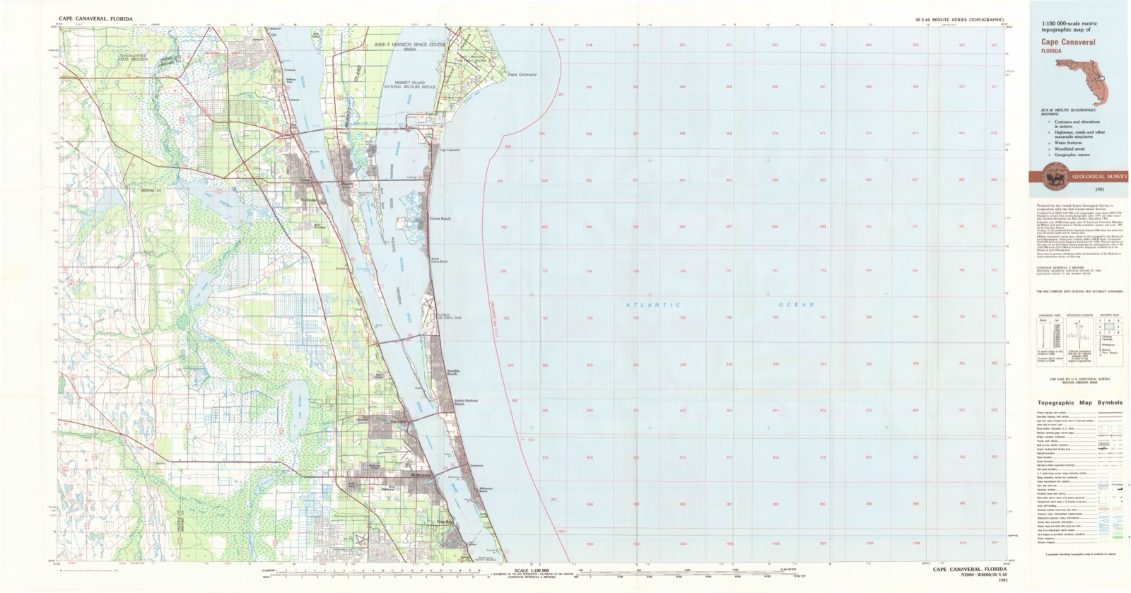
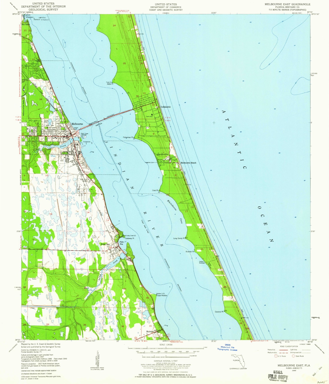
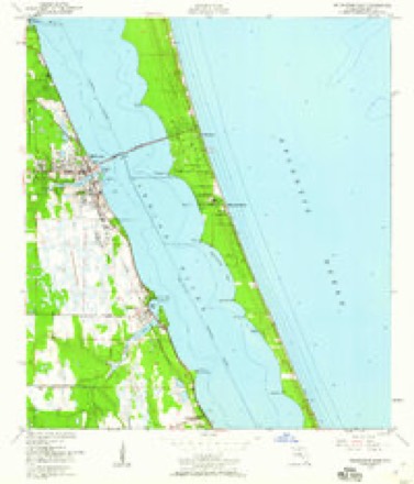
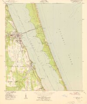
1949 to 1981The same ground, surveyed 32 years apart. Drag the handle to wipe between them. Both sheets are United States Geological Survey originals; neither has been altered.
On record in Melbourne
Buildings and businesses the archive holds for this place. Each opens its own page, with the source record it came from.
On the National Register 4 records
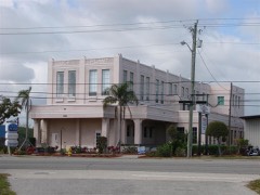 Florida Power and Light Company Ice Plantlisted 1982
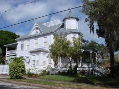 William H. Gleason Houselisted 1997
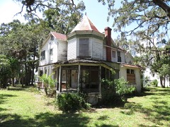 Green Gableslisted 2016
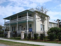 James Wadsworth Rossetter Houselisted 2005
Population over time
3 figuresMelbourne grew from 70 to 84,678 between 1885 and 2020. These are the recorded population figures Wikidata holds for this place, reached through the Geographic Names Information System number this page is keyed on rather than by name, so they belong to this place and not to another of the same name. Most are census counts, but not all are: an early figure may be a founding or settlement estimate, and an estimate published within five years of a census is left out. The change column is computed, and is left blank where more than 20 years separate a figure from the one before it, because a gap that long is not a change between two counts.
| Year | People | Change |
|---|---|---|
| 1885 | 70 | |
| 2010 | 76,068 | |
| 2020 | 84,678 | +8,610 (+11%) |
Topographic sheets covering this place
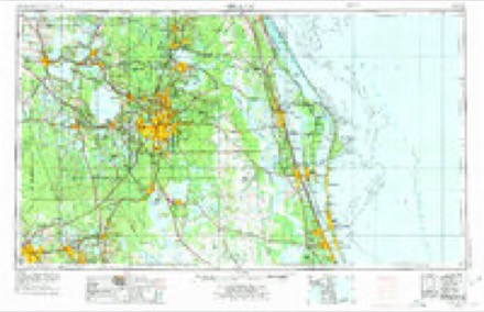
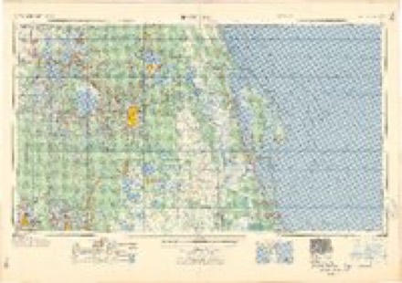
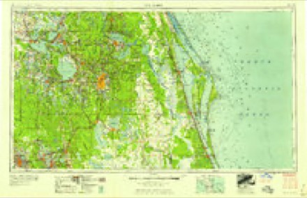
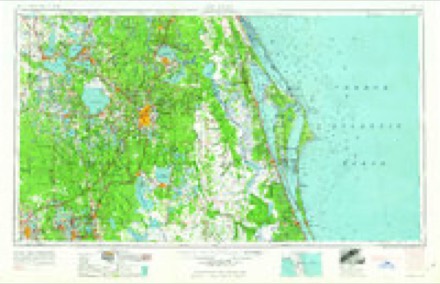
7 surveys from 13 printed sheetsMatched by testing this settlement's coordinate against the published boundary of every sheet in the United States Geological Survey's historical collection. Each opens the scanned sheet at the Survey.
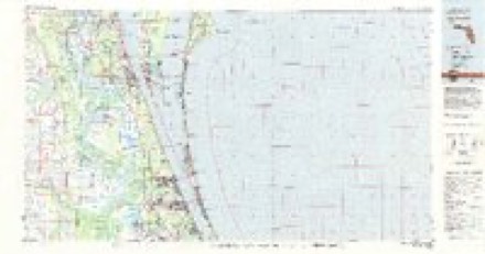
- 1949 USGS Melbourne East quadrangle1:24000, 5 printings
- 1951 USGS Melbourne East quadrangle1:24000
- 1955 USGS Orlando quadrangle1:250000, 3 printings
- 1957 USGS Orlando quadrangle1:250000
- 1958 USGS Orlando quadrangle1:250000
- 1962 USGS Orlando quadrangle1:250000
- 1981 USGS Cape Canaveral quadrangle1:100000
Fires near this place
136 since 1992Regional context, not property-specific evidence. The federal wildfire occurrence database lists 136 fires within 5 miles of Melbourne between 1992 and 2019, burning about 1,760 acres in total. 15 started naturally. 23 were recorded as arson. Distance is straight-line from the map coordinates, so a fire counted here may appear on a neighbouring settlement's page as well.
| Reported cause | Fires |
|---|---|
| Equipment and vehicle use | 43 |
| Arson/incendiarism | 23 |
| Natural | 15 |
| Misuse of fire by a minor | 13 |
| Missing data/not specified/undetermined | 12 |
| Recreation and ceremony | 10 |
| Railroad operations and maintenance | 9 |
| Smoking | 6 |
| Debris and open burning | 4 |
| Fireworks | 1 |
The most recent of them, most recent first, with the day each was reported and the service that recorded it.
| Date | Cause | Size | Reported by | Name on the report |
|---|---|---|---|---|
| 25 September 1993 | Equipment and vehicle use | 2.0 acres | Florida Forest Service | not named |
| 14 September 2011 | Missing data/not specified/undetermined | 2.0 acres | Florida Forest Service | T-BONE (05) |
| 28 August 1999 | Equipment and vehicle use | 1.5 acres | Florida Forest Service | not named |
| 16 August 2006 | Arson/incendiarism | 5.0 acres | Florida Forest Service | STACK (05) |
| 13 August 1993 | Equipment and vehicle use | 40 acres | Florida Forest Service | not named |
| 1 August 1999 | Natural | under an acre | Florida Forest Service | not named |
| 8 July 1995 | Equipment and vehicle use | 3.0 acres | Florida Forest Service | not named |
| 6 July 1995 | Equipment and vehicle use | 80 acres | Florida Forest Service | not named |
Settlements close enough to share some of these fires:
Mines and quarries near this place
1 within 5 milesRegional context, not property-specific evidence. The federal mineral resources record lists 1 working within 5 miles of Melbourne: 1 producer. All of them still produce. What was taken out: Titanium-Heavy Minerals. Distance is straight-line from the map coordinates, so a quarry counted here may appear on a neighbouring settlement's page as well.
| Where | Site | Commodity | Status | Recorded |
|---|---|---|---|---|
| Melbourne-Palm Bay Placer | Titanium-Heavy Minerals | Producer | Staurolite, Kyanite, Zircon, Rutile, Leucoxene, Ilmenite |
Storms near this place
60 of 67 shownRegional context, not property-specific evidence. The National Weather Service names Melbourne in 67 storm reports between 1993 and 2025: 28 thunderstorm wind, 20 hail, 6 tornado, 5 funnel cloud. The reports record 1 death and 2 injuries. Each account below is quoted exactly as the forecast office filed it, from the NOAA Storm Events Database, and each date opens the federal record of that event.
| When | Event | Place named | Harm | What the report says |
|---|---|---|---|---|
| August 1993 | Thunderstorm Wind | Melbourne | 1 killed | Strong thunderstorm gusts blew an elderly man off a sailboat. The man drowned. (M86O) |
| August 2002 | Lightning | Melbourne | 2 hurt | Two men working on a commercial airline baggage crew were injured when lightning struck the tail section of a jet liner. The men were on the ground under the aircraft when they were struck. They were both hospitalized briefly. |
| October 2005 | Tornado (F1) | West Melbourne | $150,000 | The third touchdown of this long track rainband cell was an F1 tornado in West Melbourne. The tornado destroyed a large section of an apartment roof, overturned a car and damaged two others. It blew down fences and trees. |
| September 2006 | Lightning | Melbourne | $100,000 | Lightning started a fire that caused $100,000 in damage to a home in Viera. |
| September 1999 | Flash Flood | Melbourne | $80,000 | Numerous thunderstorms passing over Melbourne and Brevard County produced nearly 8 inches of rain flooding numerous roadways. Forty nine homes received minor flooding. |
| July 2025 | Flash Flood | Melbourne | $50,000 | Heavy rainfall of 2 to 4 inches fell within approximately an hour and a half in Melbourne. The extreme rain rate led to a roof collapse at the Joseph N. Davis Community Center on Bruce D Buggs St. Twenty people were reportedly inside at the time but were not injured. Significant roadway flooding was also reported near the Florida Institute of Technology campus. Several vehicles were disabled in standing water near Southgate Blvd and Babcock St. A portion of Babcock St was temporarily closed due to flooding. |
| September 2001 | Tornado (F0) | Melbourne | $50,000 | A rain band associated with Tropical Storm Gabrielle moving north near the Florida coastline produced a small F0 tornado on the barrier island east of the Intracoastal Waterway. The tornado seriously damaged the roof of a boat dry storage building and overturned boats in the boatyard. A few trees were blown down and windows were blown out of automobiles. |
| January 1996 | Tornado (F0) | Melbourne | $40,000 | no account filed |
| February 2005 | Thunderstorm Wind | West Melbourne | $20,000 | Thunderstorm wind gusts blew out warehouse doors, damaged equipment, and blew out fences in West Melbourne. |
| June 2000 | Thunderstorm Wind | Melbourne | $15,000 | Thunderstorm winds blew down trees near Eau Gallie High School damaging one car. |
| July 2006 | Thunderstorm Wind | Melbourne | $10,000 | A large pole barn was blown down at a park north of Melbourne. |
| August 1996 | Tornado (F0) | West Melbourne | $10,000 | no account filed |
| November 1997 | Tornado (F0) | Melbourne | $8,000 | A fast moving F0 tornado first touched down along Interstate Highway 95 near S.R. 518. The tornado moved rapidly to the east northeast damaging road signs, snapping limbs off of trees and damaging the housing around an airconditioning system on the roof of a grocery store in Melbourne. The tornado continued east northeast and crossed the Indian River and Banana River lagoons and moved over Satellite Beach where it produced minimal damage to tree limbs. |
| January 1995 | Thunderstorm Wind | Melbourne | $8,000 | Severe thunderstorm winds blew the roof off of the Melbourne Athletic Club. |
| August 2012 | Thunderstorm Wind | Melbourne | $5,000 | A home on Duke Street in Melbourne lost its roof as a thunderstorm moved by producing severe winds. |
| November 2002 | Thunderstorm Wind | West Melbourne | $5,000 | Thunderstorm winds damaged air-conditioner units on a large warehouse store in West Melbourne. Large pallets of boxing material were moved around in the parking lot. |
| August 1999 | Thunderstorm Wind | Melbourne | $3,000 | A large service station sign was blown down and a few trees were blown down in the Melbourne area. |
| February 2005 | Thunderstorm Wind | Melbourne | $1,000 | A thunderstorm wind gust of 62 mph was recorded at the Melbourne National Weather Service office. Minor damage to fences and awnings was reported in the area. |
| June 2019 | Thunderstorm Wind | Melbourne | - | Palm Bay Police Department relayed reports of trees down and a boat blown off a trailer near the intersection of Lipscomb Street and Florida Avenue in northeast Palm Bay. |
| May 2016 | Hail | Melbourne | - | Nickel sized hail was reported by the public in the Fountainhead Subdivision in Melbourne as a strong thunderstorm affected the area. |
| March 2014 | Thunderstorm Wind | Melbourne | - | As the squall line crossed southern Brevard County, damaging winds affected portions of Melbourne and Palm Bay and produced minor wind damage. Broadcast media relayed a photo of damage to the metal roof of a mobile home in the Lakewood Village subdivision in Melbourne. Two blocks away, a small portion of a roof on a single family home was peeled back. Power lines were downed from severe thunderstorm winds on Palm Bay Road west of Interstate 95. |
| June 2013 | Funnel Cloud | Melbourne | - | A funnel cloud was sighted over the intracoastal waters near the Melbourne Causeway. |
| June 2005 | Thunderstorm Wind | Melbourne | - | A thunderstorm wind gust to 50 knots (58 mph) was recorded at Melbourne International Airport. |
| April 2003 | Hail | West Melbourne | - | Dime size hail was also reported in Palm Bay. |
| April 2003 | Hail | Melbourne | - | Golf ball size hail was also reported in Palm Bay. |
| June 2003 | Flash Flood | Melbourne | - | Heavy rain produced rapid extensive flooding of major roadways in Melbourne. |
| May 2002 | Funnel Cloud | Melbourne | - | The public reported a funnel cloud over Melbourne. |
| June 2002 | Lightning | Melbourne | - | Three men were struck by lightning on a golf course in Melbourne. None were injured. |
| June 2001 | Thunderstorm Wind | Melbourne | - | Thunderstorm winds blew down a few trees in Melbourne. |
| June 2001 | Thunderstorm Wind | Melbourne | - | Thunderstorm winds blew down a few large trees in Melbourne. |
| August 2001 | Funnel Cloud | Melbourne | - | The FAA tower at the Melbourne International Airport reported a funnel cloud in a thunderstorm west of the city. |
| March 2000 | Thunderstorm Wind | Melbourne | - | Melbourne Airport measured a gust to 59 mph during a severe thunderstorm. Power lines were blown down at Indian Harbor Beach. |
| June 2000 | Flood | Melbourne | - | Over five inches of rain fell at the Melbourne National Weather Service Office producing street flooding. |
| June 2000 | Thunderstorm Wind | Melbourne | - | Thunderstorms produced a measured 56 knots of wind at the Melbourne Airport. |
| August 1999 | Funnel Cloud | Melbourne | - | A person reported a funnel cloud in the Viera area of north Melbourne. |
| September 1999 | Flood | Melbourne | - | Heavy rains of 3 to 5 inches produces street flooding in Melbourne. |
| August 1998 | Thunderstorm Wind | Melbourne | - | Thunderstorm winds blew down trees in Melbourne. |
| August 1998 | Thunderstorm Wind | Melbourne | - | Thunderstorm winds blew down trees and large limbs damaging the roof of a house. |
| May 1998 | Hail | Melbourne | - | One inch diameter hail was also reported in Melbourne. |
| August 1998 | Thunderstorm Wind | Melbourne | - | Thunderstorm winds blew down a few trees along Highway One north of the Pineda Causeway. |
| May 1997 | Hail | Melbourne | - | Dime size hail fell in Melbourne. |
| May 1997 | Thunderstorm Wind | Melbourne | - | Thunderstorm winds blew down trees and damaged the roof of a house. |
| April 1997 | Thunderstorm Wind | Melbourne | - | Thunderstorms produced a wind gust to 66 mph at the Melbourne Regional Airport. |
| April 1997 | Thunderstorm Wind | Melbourne | - | Thunderstorms produced a wind gust to 66 mph at the Melbourne Regional Airport. |
| August 1995 | Tornado (F0) | Melbourne | - | Rain showers in a band trailing Tropical Storm Erin produced a small F0 tornado in Melbourne. It touched down briefly in Melbourne blowing down a tree and overturning a storage shed near Lake Washington and Wickham roads. |
| January 1993 | Thunderstorm Wind | Melbourne | - | A severe thunderstorm blew down power lines, numerous large branches and small trees in Melbourne. |
| August 1993 | Hail | Melbourne | - | Quarter-size hail fell. |
| August 1993 | Hail | Melbourne | - | Quarter-size hail fell. |
| July 2007 | Hail | Melbourne | - | no account filed |
| July 2007 | Hail | West Melbourne | - | no account filed |
| July 2007 | Hail | West Melbourne | - | no account filed |
| January 2004 | Hail | Melbourne | - | no account filed |
| April 2003 | Hail | West Melbourne | - | no account filed |
| June 2001 | Hail | Melbourne | - | no account filed |
| July 2001 | Hail | Melbourne | - | no account filed |
| June 2000 | Hail | Melbourne | - | no account filed |
| June 2000 | Hail | Melbourne | - | no account filed |
| May 1999 | Hail | West Melbourne | - | no account filed |
| May 1999 | Hail | Melbourne | - | no account filed |
| July 1997 | Hail | Melbourne | - | no account filed |
Nearest settlements
The eight closest, with where each one stands in the county. Distances are straight-line, computed from the Geographic Names Information System coordinates.
| Map | Place | Distance | Sheets |
|---|---|---|---|
| Indialantic | 2.3 miles | 13 | |
| West Melbourne | 2.5 miles | 16 | |
| Melbourne Beach | 2.7 miles | 13 | |
| Melbourne Village | 3.1 miles | 16 | |
| Mintons Corner | 3.3 miles | 16 | |
| Eau Gallie | 3.4 miles | 15 | |
| Palm Bay | 3.5 miles | 13 | |
| Melbourne Gardens | 3.7 miles | 16 |
Elsewhere
Matched on this settlement's Geographic Names Information System number rather than its name, so it cannot be a different place of the same name in another state.
| Wikipedia article on Melbourne | An encyclopaedic summary. Its text is share-alike, so it is linked here rather than copied. |
| Wikidata item Q949779 | The structured record the population and elevation above come from. Public domain (CC0). |
Provenance
This settlement is recorded in the Geographic Names Information System as feature 294589. The sheet list is computed by point-in-boundary test against the United States Geological Survey's historical topographic inventory. Both are works of the United States government and carry no copyright under 17 U.S.C. 105.
Wildfire. Short, Karen C. 2022. Spatial wildfire occurrence data for the United States, 1992-2020 [FPA_FOD_20221014]. 6th Edition. Fort Collins, CO: Forest Service Research Data Archive. https://doi.org/10.2737/RDS-2013-0009.6 Collected with United States Government funding and usable without additional permissions or fees.
Mines and quarries. USGS Mineral Resources Data System (MRDS) https://mrdata.usgs.gov/mrds/ A work of the United States government, no copyright under 17 U.S.C. 105.
Storms. NOAA National Centers for Environmental Information, Storm Events Database https://www.ncei.noaa.gov/stormevents/ A work of the United States government, no copyright under 17 U.S.C. 105. Narratives are quoted verbatim from the National Weather Service report and are not edited or summarised.