 Block
BlockPalm Bay, Florida
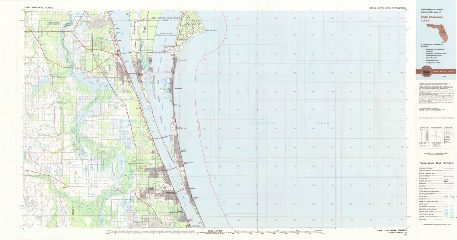
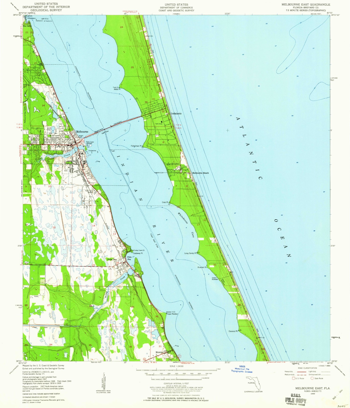
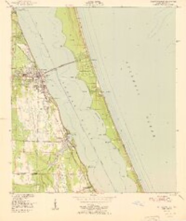
13 topographic sheets cover this place, the earliest surveyed in 1949 and the latest in 1981. It stands in the Palm Bay census division. It lies in ZIP code area 32905. The Survey maps it on the Melbourne East quadrangle. 119,760 people lived here at the 2020 count. It stands 16 feet above sea level.
Then and now
1949 to 1981The same ground, surveyed 32 years apart. Drag the handle to wipe between them. Both sheets are United States Geological Survey originals; neither has been altered.
On record in Palm Bay
Buildings and businesses the archive holds for this place. Each opens its own page, with the source record it came from.
On the National Register 1 record
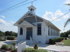 St. Joseph's Catholic Churchlisted 1987
Population over time
2 figuresPalm Bay grew from 103,190 to 119,760 between 2010 and 2020. These are the recorded population figures Wikidata holds for this place, reached through the Geographic Names Information System number this page is keyed on rather than by name, so they belong to this place and not to another of the same name. Most are census counts, but not all are: an early figure may be a founding or settlement estimate, and an estimate published within five years of a census is left out. The change column is computed, and is left blank where more than 20 years separate a figure from the one before it, because a gap that long is not a change between two counts.
| Year | People | Change |
|---|---|---|
| 2010 | 103,190 | |
| 2020 | 119,760 | +16,570 (+16%) |
Topographic sheets covering this place
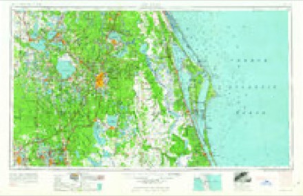
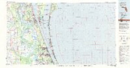
7 surveys from 13 printed sheetsMatched by testing this settlement's coordinate against the published boundary of every sheet in the United States Geological Survey's historical collection. Each opens the scanned sheet at the Survey.
- 1949 USGS Melbourne East quadrangle1:24000, 5 printings
- 1951 USGS Melbourne East quadrangle1:24000
- 1955 USGS Orlando quadrangle1:250000, 3 printings
- 1957 USGS Orlando quadrangle1:250000
- 1958 USGS Orlando quadrangle1:250000
- 1962 USGS Orlando quadrangle1:250000
- 1981 USGS Cape Canaveral quadrangle1:100000
Fires near this place
130 since 1992Regional context, not property-specific evidence. The federal wildfire occurrence database lists 130 fires within 5 miles of Palm Bay between 1992 and 2020, burning about 5,981 acres in total. 24 started naturally. 21 were recorded as arson. Distance is straight-line from the map coordinates, so a fire counted here may appear on a neighbouring settlement's page as well.
| Reported cause | Fires |
|---|---|
| Equipment and vehicle use | 37 |
| Natural | 24 |
| Arson/incendiarism | 21 |
| Missing data/not specified/undetermined | 21 |
| Misuse of fire by a minor | 8 |
| Railroad operations and maintenance | 7 |
| Smoking | 4 |
| Recreation and ceremony | 4 |
| Power generation/transmission/distribution | 3 |
| Debris and open burning | 1 |
The most recent of them, most recent first, with the day each was reported and the service that recorded it.
| Date | Cause | Size | Reported by | Name on the report |
|---|---|---|---|---|
| 30 September 1993 | Equipment and vehicle use | 8.0 acres | Florida Forest Service | not named |
| 14 September 2011 | Missing data/not specified/undetermined | 2.0 acres | Florida Forest Service | T-BONE (05) |
| 23 August 2006 | Natural | 7.0 acres | Florida Forest Service | CABBAGE PALM (5) |
| 22 August 2006 | Power generation/transmission/distribution | 10 acres | Florida Forest Service | HENDERSON (5) |
| 16 August 2006 | Arson/incendiarism | 5.0 acres | Florida Forest Service | STACK (05) |
| 11 August 2017 | Natural | 5.0 acres | Florida Forest Service | COUNTRY COVE (5) |
| 9 July 2004 | Natural | 45 acres | Florida Forest Service | COREY (O5) |
| 8 July 1995 | Equipment and vehicle use | 3.0 acres | Florida Forest Service | not named |
Settlements close enough to share some of these fires:
Mines and quarries near this place
1 within 5 milesRegional context, not property-specific evidence. The federal mineral resources record lists 1 working within 5 miles of Palm Bay: 1 producer. All of them still produce. What was taken out: Titanium-Heavy Minerals. Distance is straight-line from the map coordinates, so a quarry counted here may appear on a neighbouring settlement's page as well.
| Where | Site | Commodity | Status | Recorded |
|---|---|---|---|---|
| Melbourne-Palm Bay Placer | Titanium-Heavy Minerals | Producer | Staurolite, Kyanite, Zircon, Rutile, Leucoxene, Ilmenite |
Storms near this place
44 since 1994Regional context, not property-specific evidence. The National Weather Service names Palm Bay in 44 storm reports between 1994 and 2026: 19 hail, 11 thunderstorm wind, 6 tornado, 4 lightning. The reports record 1 death and 3 injuries. Each account below is quoted exactly as the forecast office filed it, from the NOAA Storm Events Database, and each date opens the federal record of that event.
| When | Event | Place named | Harm | What the report says |
|---|---|---|---|---|
| July 2000 | Lightning | Palm Bay | 1 killed | A 62 year old man was struck by lightning on a golf course in Palm Bay. He died of his lightning injuries on 08/01/00. |
| February 2005 | Tornado (F1) | Palm Bay | 1 hurt, $600,000 | An F1 tornado touched down in the western part of Palm Bay blowing down trees and damaging 20 homes. Four houses received major damage. A partially constructed block house was demolished. One person was injured. |
| June 2005 | Lightning | Palm Bay | 1 hurt | A Palm Bay man was struck and seriously injured by lightning while repairing roof damage from last year's hurricanes. |
| July 2003 | Lightning | Palm Bay | 1 hurt | A Palm Bay man was struck and injured by lightning while cutting his grass. |
| November 2008 | Tornado (EF0) | Palm Bay | $576,000 | Low end EF0 tornado, estimated 65 to 75 mph, touched down in southwest Palm Bay and damaged 26 structures, mainly within the Holiday Park mobile home community. Damage mostly involved roofs, fences and exterior surfaces. |
| May 1999 | Tornado (F0) | Palm Bay | $40,000 | A waterspout tornado moved west off the Indian River and came ashore along U.S. Highway 1 in Palm Bay. It damaged the roof to a restaurant and destroyed the restaurant porch. |
| February 1998 | Thunderstorm Wind | Palm Bay | $15,000 | Thunderstorm winds damaged the roof of a house in Palm Bay. |
| August 2012 | Thunderstorm Wind | Palm Bay | $10,000 | The roofs of several carports were blown down at the Malabar Lakes Apartments. |
| March 2010 | Thunderstorm Wind | Palm Bay | $10,000 | An apparent microburst associated with a fast moving strong thunderstorm produced localized wind damage to the Palm Bay Chamber of Commerce building and surrounding area. The roof of a building lost a small portion of its roof, soffits were pulled from another building and a free standing sign was ripped in half. One large tree was toppled and several small palm trees were knocked over. |
| June 2016 | Flood | Palm Bay | $5,000 | Between 4 and 6 inches of rain fell across south Brevard County during a 6-hour period from mid morning through late afternoon, leading to roadway flooding, roadway closures and stranded vehicles. High levels of standing water continued into the early evening then rapidly subsided. The areas with most significant impacts included Palm Bay and Malabar. |
| July 2007 | Lightning | Palm Bay | $5,000 | Lightning started a house fire in Palm Bay. |
| October 2005 | Tornado (F0) | Palm Bay | $5,000 | The same rainband cell that destroyed the house south of Melbourne Beach continued to move northwest and produced a brief F0 tornado that took out power lines and transformers. |
| October 1994 | Tornado (F0) | Palm Bay | $5,000 | An intense rain shower produced a small F0 tornado in Palm Bay as it moved inland from the Atlantic. The tornado remained on the ground only a few blocks. It destroyed a wooden carport, uprooted a few trees and damaged awnings, fences and outdoor furniture. |
| August 2012 | Thunderstorm Wind | Palm Bay | $3,000 | Windows were cracked and signs blown over in a muffler shop located at Babcock Street and Lake in the Woods Drive in Palm Bay. |
| March 2002 | Thunderstorm Wind | Palm Bay | $2,000 | Thunderstorm winds blew down a few large trees in Palm Bay destroying a small shed and a fence. |
| February 2014 | Thunderstorm Wind | Palm Bay | $1,000 | A Palm Bay citizen reported that strong thunderstorm winds damaged the aluminum porch of his neighbors mobile home on Tangelo Drive and peeled back part of the roof. |
| August 2012 | Thunderstorm Wind | Palm Bay | $1,000 | A large tree was knocked down into the road at the intersection of Troutman Blvd. and Port Malabar Blvd. southwest of Palm Bay. |
| March 2026 | Hail | Palm Bay | - | Public report of hail estimated to be between penny to quarter size in diameter near Malabar Rd and I-95. |
| April 2023 | Hail | Palm Bay | - | Trained spotter reports damage to cars and roofs in Palm Bay with golf ball size hail observed near Rome Ave and Nebraska Ave. |
| April 2023 | Hail | Palm Bay | - | Delayed report of hail up to quarter size near the intersection of South Babcock St and Palm Bay Rd. Time estimated via radar. |
| September 2017 | Tornado (EF1) | Palm Bay | - | Based on a NWS storm survey, a waterspout that developed on the Indian River moved onshore and damaged several residences on Worth Court in Palm Bay, including a waterfront home whose second floor was removed and carried downwind. The EF-1 tornado (estimated 100 to 110 mph) continued across US-1, causing minor roof damage to a university building. The tornado then impacted over a dozen mobile homes within Palm Bay Estates, several of which were heavily damaged or destroyed. The tornado continued west, just to the north of Turkey Creek, damaging many trees and several additional homes before moving through a school campus before dissipating near the Harris Corporation. DI2, DOD6, LB-EXP. |
| October 2011 | Heavy Rain | Palm Bay | - | Heavy rainfall associated with persistent cells produced urban, small stream, and roadway flooding in the Palm Bay area. The highest 3-day rainfall total reported within Brevard County, ending at 0600 EST October 10, was 14.82 inches, at a CoCoRaHS site located 1 mile northeast of Palm Bay (FL-BV-14). |
| September 2008 | Funnel Cloud | Palm Bay | - | Law enforcement and the public reported a funnel cloud over the Atlantic off Melbourne Beach. |
| February 2007 | Thunderstorm Wind | Palm Bay | - | A large tree took down power lines in Palm Bay. |
| June 2004 | Thunderstorm Wind | Palm Bay | - | Thunderstorm winds blew down 10 to 15 trees in Palm Bay. |
| August 2003 | Funnel Cloud | Palm Bay | - | Local fire department personnel reported two funnel clouds southwest of Palm Bay. |
| April 1997 | Thunderstorm Wind | Palm Bay | - | Thunderstorm winds blew down trees in Melbourne and Palm Bay. |
| April 1997 | Thunderstorm Wind | Palm Bay | - | Thunderstorm winds blew down trees in Melbourne and Palm Bay. |
| June 1994 | Hail | Palm Bay | - | Severe thunderstorms produced golf ball-size hail and damaged eleven mobile homes and a club house causing $75,000 damage near Palm Bay. Trees were blown down and one mobile home was damaged in South Melbourne Beach. |
| May 2007 | Hail | Palm Bay | - | no account filed |
| June 2006 | Hail | Palm Bay | - | no account filed |
| June 2004 | Hail | Palm Bay | - | no account filed |
| June 2004 | Hail | Palm Bay | - | no account filed |
| March 2003 | Hail | Palm Bay | - | no account filed |
| March 2003 | Hail | Palm Bay | - | no account filed |
| April 2003 | Hail | Palm Bay | - | no account filed |
| April 2001 | Hail | Palm Bay | - | no account filed |
| April 2001 | Hail | Palm Bay | - | no account filed |
| June 2001 | Hail | Palm Bay | - | no account filed |
| June 2001 | Hail | Palm Bay | - | no account filed |
| May 1999 | Hail | Palm Bay | - | no account filed |
| May 1998 | Hail | Palm Bay | - | no account filed |
| May 1998 | Hail | Palm Bay | - | no account filed |
| February 1998 | Hail | Palm Bay | - | no account filed |
Nearest settlements
The eight closest, with where each one stands in the county. Distances are straight-line, computed from the Geographic Names Information System coordinates.
| Map | Place | Distance | Sheets |
|---|---|---|---|
| Malabar | 2.5 miles | 13 | |
| Melbourne Beach | 2.8 miles | 13 | |
| Melbourne | 3.5 miles | 13 | |
| Indialantic | 4.0 miles | 13 | |
| West Melbourne | 4.3 miles | 16 | |
| Mintons Corner | 5.3 miles | 16 | |
| Melbourne Village | 5.4 miles | 16 | |
| Valkaria | 5.4 miles | 16 |
Elsewhere
Matched on this settlement's Geographic Names Information System number rather than its name, so it cannot be a different place of the same name in another state.
| Wikipedia article on Palm Bay | An encyclopaedic summary. Its text is share-alike, so it is linked here rather than copied. |
| Wikidata item Q816809 | The structured record the population and elevation above come from. Public domain (CC0). |
Provenance
This settlement is recorded in the Geographic Names Information System as feature 288389. The sheet list is computed by point-in-boundary test against the United States Geological Survey's historical topographic inventory. Both are works of the United States government and carry no copyright under 17 U.S.C. 105.
Wildfire. Short, Karen C. 2022. Spatial wildfire occurrence data for the United States, 1992-2020 [FPA_FOD_20221014]. 6th Edition. Fort Collins, CO: Forest Service Research Data Archive. https://doi.org/10.2737/RDS-2013-0009.6 Collected with United States Government funding and usable without additional permissions or fees.
Mines and quarries. USGS Mineral Resources Data System (MRDS) https://mrdata.usgs.gov/mrds/ A work of the United States government, no copyright under 17 U.S.C. 105.
Storms. NOAA National Centers for Environmental Information, Storm Events Database https://www.ncei.noaa.gov/stormevents/ A work of the United States government, no copyright under 17 U.S.C. 105. Narratives are quoted verbatim from the National Weather Service report and are not edited or summarised.