 Block
BlockMiramar, Florida
15 topographic sheets cover this place, the earliest surveyed in 1947 and the latest in 1994. It stands in the Miramar-Pembroke Pines census division. It lies in ZIP code area 33023. The Survey maps it on the North Miami quadrangle. 134,721 people lived here at the 2020 count. It stands 7 feet above sea level.
Then and now
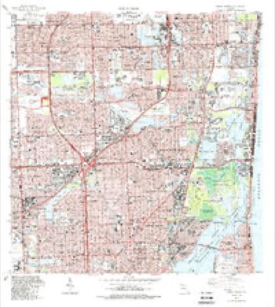
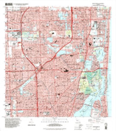
1947 to 1994The same ground, surveyed 47 years apart. Drag the handle to wipe between them. Both sheets are United States Geological Survey originals; neither has been altered.
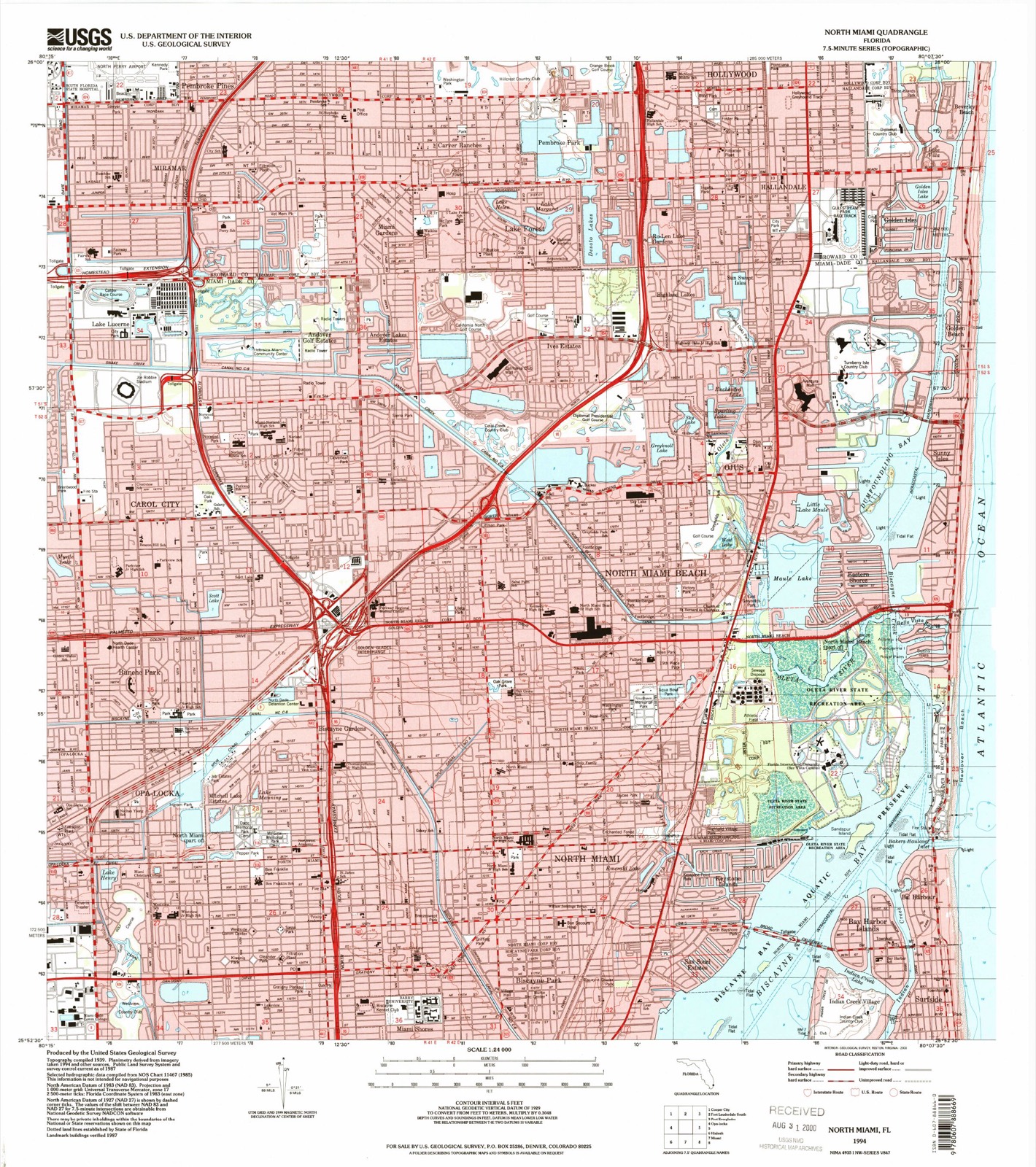
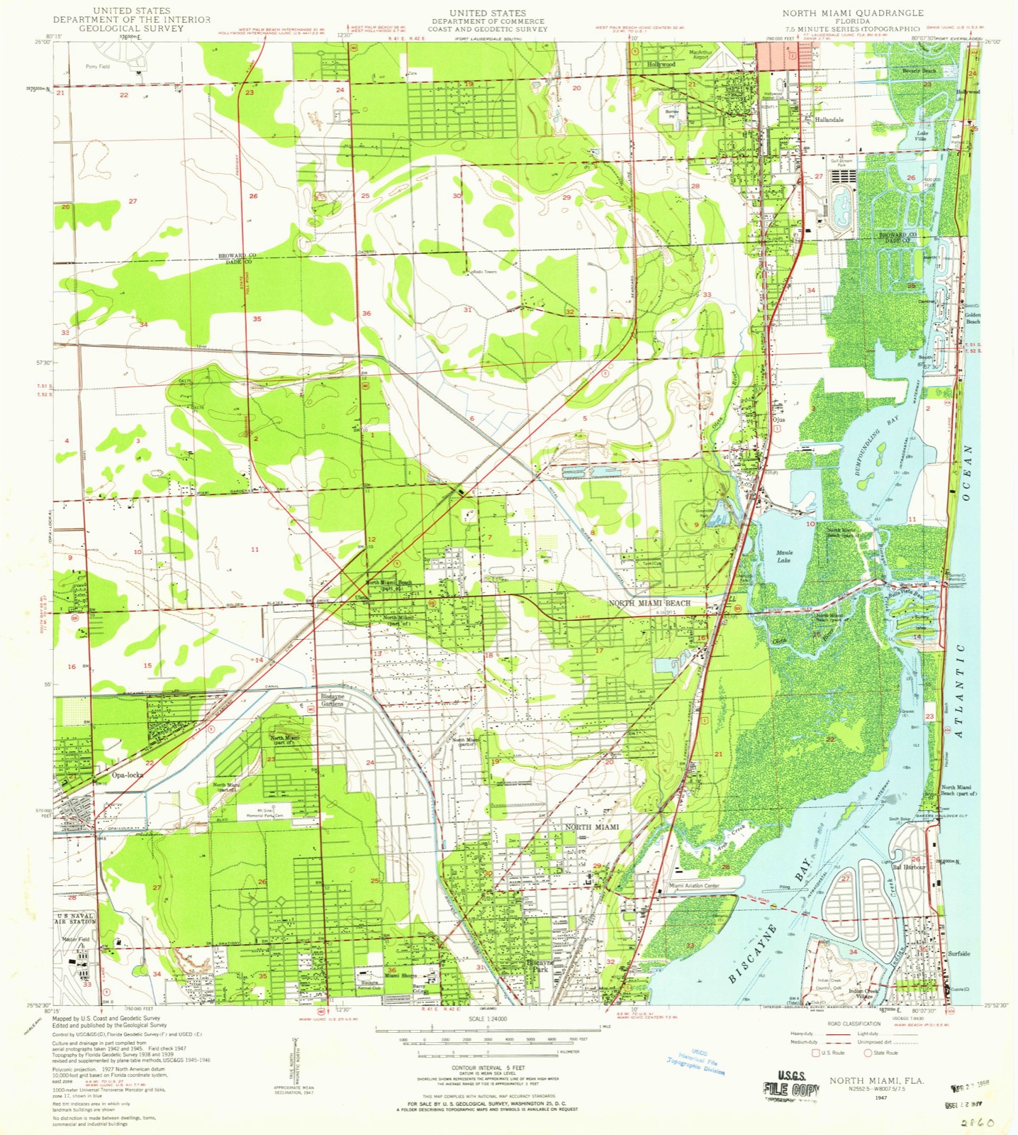
Compare 1947 against another survey:
Population over time
2 figuresMiramar grew from 122,041 to 134,721 between 2010 and 2020. These are the recorded population figures Wikidata holds for this place, reached through the Geographic Names Information System number this page is keyed on rather than by name, so they belong to this place and not to another of the same name. Most are census counts, but not all are: an early figure may be a founding or settlement estimate, and an estimate published within five years of a census is left out. The change column is computed, and is left blank where more than 20 years separate a figure from the one before it, because a gap that long is not a change between two counts.
| Year | People | Change |
|---|---|---|
| 2010 | 122,041 | |
| 2020 | 134,721 | +12,680 (+10%) |
Topographic sheets covering this place
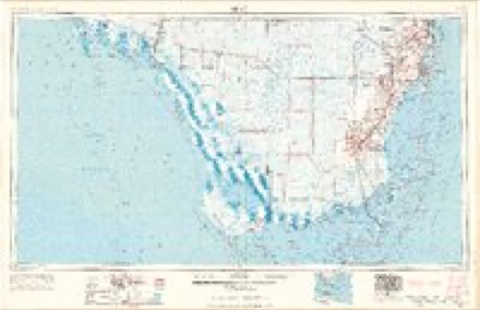
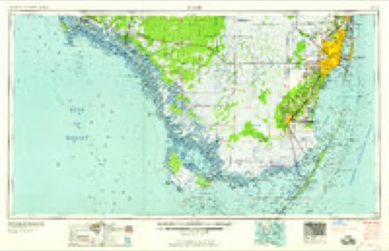
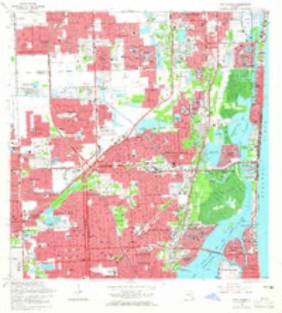
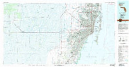
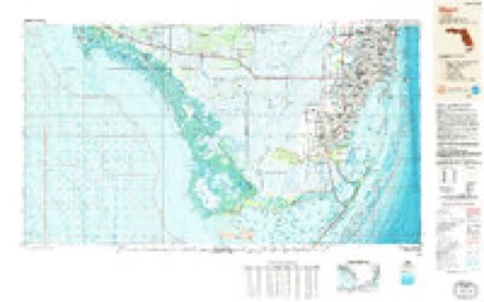
9 surveys from 15 printed sheetsMatched by testing this settlement's coordinate against the published boundary of every sheet in the United States Geological Survey's historical collection. Each opens the scanned sheet at the Survey.
- 1947 USGS North Miami quadrangle1:24000
- 1950 USGS North Miami quadrangle1:24000
- 1956 USGS Miami quadrangle1:250000, 5 printings
- 1958 USGS Miami quadrangle1:250000
- 1962 USGS North Miami quadrangle1:24000, 3 printings
- 1981 USGS Miami quadrangle1:100000
- 1988 USGS Miami quadrangle1:250000
- 1988 USGS North Miami quadrangle1:24000
- 1994 USGS North Miami quadrangle1:24000
Fires near this place
32 since 1993Regional context, not property-specific evidence. The federal wildfire occurrence database lists 32 fires within 5 miles of Miramar between 1993 and 2018, burning about 277 acres in total. None started naturally. 7 were recorded as arson. Distance is straight-line from the map coordinates, so a fire counted here may appear on a neighbouring settlement's page as well.
| Reported cause | Fires |
|---|---|
| Railroad operations and maintenance | 10 |
| Arson/incendiarism | 7 |
| Misuse of fire by a minor | 6 |
| Equipment and vehicle use | 4 |
| Missing data/not specified/undetermined | 2 |
| Debris and open burning | 2 |
| Recreation and ceremony | 1 |
The most recent of them, most recent first, with the day each was reported and the service that recorded it.
| Date | Cause | Size | Reported by | Name on the report |
|---|---|---|---|---|
| 4 July 2017 | Arson/incendiarism | under an acre | Florida Forest Service | FIREWORKS (6) |
| 13 June 2010 | Debris and open burning | under an acre | Florida Forest Service | 2 PILE FIRE |
| 6 May 1994 | Railroad operations and maintenance | 15 acres | Florida Forest Service | not named |
| 5 May 2003 | Arson/incendiarism | 4.0 acres | Florida Forest Service | not named |
| 3 May 2006 | Missing data/not specified/undetermined | 2.0 acres | Florida Forest Service | THE SILO FIRE |
| 26 May 1993 | Railroad operations and maintenance | 3.0 acres | Florida Forest Service | not named |
| 18 May 2006 | Missing data/not specified/undetermined | under an acre | Florida Forest Service | ENGINE 89 FIRE |
| 18 May 1994 | Railroad operations and maintenance | 2.0 acres | Florida Forest Service | not named |
Settlements close enough to share some of these fires:
Mines and quarries near this place
4 within 5 milesRegional context, not property-specific evidence. The federal mineral resources record lists 4 workings within 5 miles of Miramar: 4 producers. All of them still produce. What was taken out: Sand and Gravel, Construction, Stone, Crushed/Broken, Limestone, General. Distance is straight-line from the map coordinates, so a quarry counted here may appear on a neighbouring settlement's page as well.
| Where | Site | Commodity | Status | Recorded |
|---|---|---|---|---|
| A.J. Capeletti - No. 3 Pit | Limestone, General | Producer | Limestone | |
| Broward Pit No. 1 | Stone, Crushed/Broken | Producer | ||
| Hollywood Pit No. 1 | Sand and Gravel, Construction | Producer | ||
| Pit No. 6 | Sand and Gravel, Construction | Producer |
Storms near this place
60 of 130 shownRegional context, not property-specific evidence. The National Weather Service names Miramar in 130 storm reports between 1996 and 2025: 46 thunderstorm wind, 37 hail, 15 lightning, 12 funnel cloud. The reports record 3 deaths and 4 injuries. Each account below is quoted exactly as the forecast office filed it, from the NOAA Storm Events Database, and each date opens the federal record of that event.
| When | Event | Place named | Harm | What the report says |
|---|---|---|---|---|
| June 2024 | Lightning | Miramar | 1 killed | Broadcast media reported that a 19-year-old male was killed by lightning strike as he was jogging at Vista View Park in Davie during a thunderstorm. |
| May 2007 | Lightning | Miramar | 1 killed | Lightning struck and killed a 24-year old man who was laying tile on the roof of a home in western sections of Miramar. The force of the lightning knocked out a second worker, but he regained consciousness and did not require further medical attention. |
| June 1998 | Lightning | Miramar | 1 killed | A 38-year-old woman was struck by lightning in her backyard under a avacado tree. It was not raining at the time. The bolt struck her in the belt buckle. At the 3700 block of SW 1232nd Ave. |
| June 2004 | Lightning | Miramar | 2 hurt | Two construction workers were injured when lightning struck a nearby crane. The thunderstorm was approaching from about four miles away and it was not raining at the time the lightning struck. |
| November 2006 | Heavy Rain | Miramar | 1 hurt, $5,000 | Heavy rains swept across South Florida during the very early morning hours and caused the ceiling of an apartment to collapse in eastern sections of Miramar. A seven-year-old boy received minor injured when the ceiling collapsed on him. The rest of his family, three adults and another child, were not injured. |
| June 1999 | Lightning | Miramar | 1 hurt | no account filed |
| February 1998 | Tornado (F1) | Miramar | $30,000,000 | At 2034 est the f1 tornadoes crossed the dade-broward counties line and damaged a strip shopping center in miramar. The multiple tornadoes moved across north perry airport at 2036 est where 40 aircraft were destroyed and 40 aircraft were damaged. The tornadoes weakened to f0-f1 intensity as they continued north-northeast damaging a shopping center in davie near orange rd/hiatus rd. |
| November 1998 | Tornado (F1) | Miramar | $100,000 | A tornado touched down just north of the Miramar Florida Turnpike toll plaza and moved to the north northeast. The roofs of 12 houses were damaged as well as foliage, power lines and vehicles. |
| August 2004 | Lightning | Miramar | $20,000 | A lightning-initiated fire damaged the attic of a house. |
| February 2024 | Tornado (EF0) | Miramar | $10,000 | A tornado was observed in the cities of Miramar and Pembroke Pines as showers passed in the mid-afternoon. Most damage observed along the path was minor and mainly to vegetation and fencing. The tornado was rated as an EF-0 with an estimated maximum winds near 75 mph. The tornado had a non-continuous damage path length of 3.6 miles with a maximum width of 100 yards. Damage amount is estimated. |
| June 2023 | Thunderstorm Wind | Miramar | $10,000 | A member of the public reported multiple trees down at Country Isles Park in Weston. Additionally, multiple trees were reported down near the intersection of Creekford Drive and Pine Branch in Weston. The time of events were estimated based on radar signature of the passing severe storm. |
| June 2021 | Lightning | Miramar | $5,000 | A Florida Highway Patrol trooper reported a vehicle struck by lightning traveling westbound on Alligator Alley near Mile Marker 31. Lightning struck the rear antenna of a vehicle where it then discharged through the ground. The road received damage, with a reported 7 ft x 4 ft x 2 in deep hole in the road. No injuries reported. |
| February 2010 | Flash Flood | Miramar | $5,000 | Extremely heavy rains caused severe flooding of streets in Weston and Southwest Ranches. Flooding was also noted in Cooper City and Pembroke Pines, but not deep enough to cause any significant impacts. ||Rainfall totals of 7 to 8 inches were observed in Cooper City and Pembroke Pines mainly east of I-75, with an area of 4 to 6 inches west of I-75 from Weston to Pembroke Pines. |
| May 2024 | Thunderstorm Wind | Miramar | $2,000 | Broadcast media reported downed trees and powerlines near SW 202 Avenue and Pines Boulevard after a severe thunderstorm moved through the area. |
| June 2022 | Thunderstorm Wind | Miramar | $2,000 | A member of the public sent a video showing wind damage from a thunderstorm in the Century Village community in Pembroke Pines. Downed branches and a downed light pole were seen with various plant debris in the parking lot. Pea to dime size hail was also reported in the area. |
| March 2011 | Thunderstorm Wind | Miramar | $2,000 | Retired NWS employee reported an uprooted ficus tree of approximately 3 feet in diameter at the Flamingo Lakes Golf Course. Estimated winds were near 60 mph. |
| April 2023 | Thunderstorm Wind | Miramar | $1,000 | A trained spotter reported a measured wind gust of 56 mph in Weston. A member of the media shared an image of several large tree branches downed by winds in the same area. Hail up to a half-inch in diameter was also reported with this storm. |
| May 2020 | Thunderstorm Wind | Miramar | $1,000 | An off-duty NWS Employee reported downed tree limbs (green palm fronds and oak limbs of 1-2 inches in diameter with a few 3 inches in diameter) in Weston, near Savanna Trail and Saddle Club Rd. Cypress Bay High School (closest Mesonet) measured a wind gust of 47 mph (41 kt). |
| September 2010 | Lightning | Miramar | $1,000 | Lightning struck a house during Labor Day festivities in Southwest Ranches. Tiles were blown from the roof and a fire was started on the roof as well. The fire was extinguished and no other damages were known. |
| September 2010 | Lightning | Miramar | $1,000 | Lightning struck a home in Pembroke Pines blowing a small hole in the roof and roofing tiles onto a parked car. The tiles caused minor damage to the car. No fire was started by the strike, however power was knocked out. |
| June 2009 | Lightning | Miramar | $1,000 | A two-story home was struck by lightning in Weston, causing a fire inside the home. Firefighters were able to put out the blaze with only minor damage. All occupants of the home were able to evacuate safely. ||Time is approximate based on radar and lightning data. |
| July 2009 | Lightning | Miramar | $1,000 | Lightning hit a gas station in Miramar blowing a hole in the roof and knocking out power. The gas station attendant saw the flash and heard the thunder, but was not injured. |
| August 2008 | Lightning | Miramar | $1,000 | Lightning struck a home just after 2 PM in Southwest Ranches. The strike ignited an air conditioning duct, but when the fire department arrived all they saw was smoke. The house was vented and no significant damage was reported. |
| August 2020 | Thunderstorm Wind | Miramar | $500 | An off duty NWS employee reported several large tree branches down in the vicinity of SW 178th Ave and SW 61st Ct in Southwest Ranches. A wind gust of 59 mph was measured by the Earth Networks site at Cypress Bay High School, about 1.5 miles to the NNW. |
| August 2018 | Lightning | Miramar | $500 | A lightning strike destroyed a tree at a residence on the corner of SW 36th Court and SW 165th Avenue in Miramar. There was no other damage reported from the strike. No injuries reported. |
| June 2009 | Lightning | Miramar | $500 | Lightning struck a tree and caused it fall and light on fire. |
| August 2025 | Flood | Miramar | - | Broadcast Media relayed a report of minor street flooding in Davie, which occurred due to a heavy thunderstorm slowly moving southward over the area. |
| May 2025 | Thunderstorm Wind | Miramar | - | Mesonet station 1529W at the City of Sunrise Fire Station 83 reported a 58 mph wind gust with a severe thunderstorm. |
| March 2024 | Hail | Miramar | - | The public reported up to nickel-sized hail as a strong thunderstorm moved through the area. |
| June 2024 | Hail | Miramar | - | Penny sized hail was reported at the Snake Road exit, north of Interstate 75, on the Miccosukee Reservation. |
| October 2024 | Tornado (EFU) | Miramar | - | A brief tornado was observed on traffic cameras and a via a storm chaser crossing Interstate 75/Alligator Alley in western Broward County. This tornado was also sighted from far western metro Broward County near US 27. There was no visible damage since the area where the tornado was on the ground was inaccessible and unpopulated. Maximum wind speed and EF rating are unknown with path width estimated from observations. |
| April 2023 | Funnel Cloud | Miramar | - | Several trained spotters reported a funnel cloud, west of Sunrise, associated with a gusty shower over the Everglades. |
| April 2023 | Thunderstorm Wind | Miramar | - | Wind instrument captured a peak wind gust of 70 mph and a 1-minute sustained wind of 42 mph from a thunderstorm in Weston. |
| April 2023 | Hail | Miramar | - | An off-duty NWS employee reported quarter sized hail in Miramar. Numerous public reports of hail up to the size of 1.25 in the western Miramar area. |
| June 2023 | Flood | Miramar | - | Several streets impassable in Weston from very heavy rain with some cars stalled. Rainfall of 4-5 inches fell in the area. |
| June 2023 | Thunderstorm Wind | Miramar | - | A thunderstorm wind gust of 58 mph/50 knots was measured at WeatherSTEM station 1529W City Of Sunrise Fire as a severe thunderstorm moved through the area. |
| May 2022 | Hail | Miramar | - | Several reports received of hail ranging from pea to nickel size in Weston. Winds also estimated in the 40-50 mph range. |
| September 2022 | Tornado (EFU) | Miramar | - | Tornado over the Everglades of NW Broward County was confirmed by doppler radar tornado debris signature. |
| June 2021 | Thunderstorm Wind | Miramar | - | Broadcast media relayed reports of small branches and palm fronds down from a strong thunderstorm in Weston. Radar estimated wind in the area was 50-60 mph, and a wind gust of 52 mph was measured near Weston Regional Park. |
| May 2020 | Hail | Miramar | - | Members of the public reported nickel size hail with a thunderstorm in Weston near Saddle Club Road. |
| July 2020 | Thunderstorm Wind | Miramar | - | EarthNetworks sensor site WSTNN at Cypress Bay High School reported a 66 mph thunderstorm wind gust. |
| November 2020 | Flash Flood | Miramar | - | Multiple reports of significant flooding received from the broadcast media, trained spotters, law enforcement, and NWS employees were received over the course of a day. Reports of significant street flooding and major, damaging rainfall in many neighborhoods in the following cities: Miramar, Pembroke Pines, Southwest Ranches, Weston, Davie, Fort Lauderdale, and Lauderhill. Standing water remained for several days, blocking off some neighborhoods. Water entered above grade structures in Fort Lauderdale and Lauderhill, as well as many near or at grade structures in Davie. At least minor flooding was noted across the remainder of the county. Rainfall amounts of 8 to almost 21 inches were measured across most of Broward County, with almost 21 inches in Pembroke Pines, and 12 to 18 inches in southwest Broward metro communities from Weston to Miramar. |
| November 2020 | Flood | Miramar | - | Flooding lingered over many parts of Broward County for up to 4 days after the causative event related to Tropical Storm Eta. Streets remained flooded over SW metro Broward County where the most rain fell, with some neighborhoods blocked off, as well as in the Broadview Park area of Fort Lauderdale. |
| June 2020 | Hail | Miramar | - | Spotter reported hail between dime and nickel size from a strong thunderstorm about 1 mile NW from the intersection of Weston Road and Griffin Road. Pea size hailed was also reported by the public via social media near Emerald Estates. |
| May 2019 | Hail | Miramar | - | A member of the public reported dime/ penny size hail in Pembroke Pines near I-75 and Pines Blvd. |
| May 2019 | Hail | Miramar | - | A member of the public reported 1 inch hail at a restaurant on Pines Blvd west of I-75. |
| June 2019 | Thunderstorm Wind | Miramar | - | Strong line of thunderstorms produced a 58 mph wind gust measured by the WeatherBug station HLLBS located at BSO Alligator Alley west of Weston. |
| June 2018 | Funnel Cloud | Miramar | - | Report received via social media of a funnel cloud, looking west from the intersection of Interstate 75 and Griffin Road in Weston. |
| June 2018 | Funnel Cloud | Miramar | - | A photo of a funnel cloud was reported via Twitter from a member of the public. |
| July 2018 | Tornado (EF0) | Miramar | - | Multiple photos shared from broadcast media showed a tornado in western Broward County. The tornado occurred west of Griffin Road over the Everglades lasting a few minutes. There was no damage reported as it stayed over the open Everglades. |
| July 2018 | Funnel Cloud | Miramar | - | Multiple spotters and an off-duty NWS employee reported a funnel cloud halfway down to the ground. Photos from the off-duty NWS employee indicate funnel was roughly halfway down to the ground. The funnel cloud was in Pembroke Pines just to the west of I-75. |
| May 2017 | Funnel Cloud | Miramar | - | A member of forest service reported a brief funnel cloud just south of I-75 in Broward County. The funnel never extended to the ground. |
| May 2017 | Thunderstorm Wind | Miramar | - | A thunderstorm produced a 61 mph / 53 knot wind gust at the WeatherBug mesonet site located at Cypress Bay High School in Weston. |
| May 2017 | Thunderstorm Wind | Miramar | - | An off duty NWS employee reported multiple medium sized trees down on 196 Ave between Griffin Road and Sheridan Street due to thunderstorms. |
| October 2017 | Tornado (EF0) | Miramar | - | Multiple photos and videos received via social media show a brief tornado touchdown just south of I-75 and west of US-27 west of the city of Weston. The tornado remained over an open field before lifting. Time estimated by radar. |
| September 2017 | Tornado (EF1) | Miramar | - | NWS storm survey determined an area of enhanced tree damage along SW 172 Avenue between Memorial Hospital and Miramar Regional Park was the result of a tornado. Sections of trees were completely ripped apart. |
| September 2017 | Tornado (EF1) | Miramar | - | NWS storm survey determined a tornado in the Chapel Trail neighborhood near NW 196 Avenue north of Pines Boulevard. Several trees ripped apart with roof tile damage. Damage pattern suggested rotation. Time estimated via radar. |
| September 2016 | Hail | Miramar | - | A member of the media reported quarter size hail on I-75 in Miramar. There were also multiple reports of pea size hail in surrounding areas. |
| February 2016 | Thunderstorm Wind | Miramar | - | Strong winds lead to damage across West Pembroke Pines and Miramar. In the Estates of Pembroke Shores area, several trees were blown down, crushing a pool cage. A six foot polymer fence was also blown out in the community. Nearby, surveillance video shows strong winds downed numerous trees and damaged the entrance gates at Estates at Tequesta Cove. Radar winds estimated at 60 to 70 mph at the time of the damage. |
| February 2016 | Tornado (EF0) | Miramar | - | The tornado touched down just to the south of the intersection of South Post and Weston Roads at 705 am, knocking over a large tree and spreading significant tree limb debris into nearby car dealerships on the east side of the roadway. The tornado then crossed I-75 just south of SW 36th Street, knocking over trees in the field on the east side of the highway. Additional trees were uprooted and snapped as the track continued northeast near the intersection of SW 37th Street and SW 150th Avenue. More tree damaged occurred further east in the Davie/Fort Lauderdale KOA near the intersection of SW 37th Court and Boyscout Road. A row of power lines was knocked down along 130th Avenue just to the north of SW 36th Court, before the tornado crossed Flamingo Road, tearing a large limb off of a massive tree in Flamingo Gardens. Continuing further northeast, the tornado downed additional trees and power lines down along Canyon Maple Boulevard with shingle damage to roofs to home in the vicinity. Several large trees were then downed along West Lake Villa Circle before the tornado crossed Nob Hill Road. Additional trees were uprooted near Tree Tops and Westridge Parks on the east side of the roadway. Eyewitness reports in the vicinity also report airborne debris. The damage path ended around 718 AM with several large trees snapped and soffit damage to homes in the Escape At Arrowhead neighborhood along SW 24th Court and SW 81st Avenue. |
Nearest settlements
The eight closest, with where each one stands in the county. Distances are straight-line, computed from the Geographic Names Information System coordinates.
| Map | Place | Distance | Sheets |
|---|---|---|---|
| Pembroke Pines | 1.2 miles | 16 | |
| Utopia | 1.6 miles | 15 | |
| Miami Gardens | 1.7 miles | 15 | |
| West Park | 1.8 miles | 15 | |
| Carver Ranches | 2.1 miles | 15 | |
| Fleetwood Manor | 2.1 miles | 16 | |
| Hollywood Ridge Farms | 2.2 miles | 15 | |
| Hollywood Beach Gardens | 2.4 miles | 16 |
Elsewhere
Matched on this settlement's Geographic Names Information System number rather than its name, so it cannot be a different place of the same name in another state.
| Wikipedia article on Miramar | An encyclopaedic summary. Its text is share-alike, so it is linked here rather than copied. |
| Wikidata item Q745168 | The structured record the population and elevation above come from. Public domain (CC0). |
Provenance
This settlement is recorded in the Geographic Names Information System as feature 286974. The sheet list is computed by point-in-boundary test against the United States Geological Survey's historical topographic inventory. Both are works of the United States government and carry no copyright under 17 U.S.C. 105.
Wildfire. Short, Karen C. 2022. Spatial wildfire occurrence data for the United States, 1992-2020 [FPA_FOD_20221014]. 6th Edition. Fort Collins, CO: Forest Service Research Data Archive. https://doi.org/10.2737/RDS-2013-0009.6 Collected with United States Government funding and usable without additional permissions or fees.
Mines and quarries. USGS Mineral Resources Data System (MRDS) https://mrdata.usgs.gov/mrds/ A work of the United States government, no copyright under 17 U.S.C. 105.
Storms. NOAA National Centers for Environmental Information, Storm Events Database https://www.ncei.noaa.gov/stormevents/ A work of the United States government, no copyright under 17 U.S.C. 105. Narratives are quoted verbatim from the National Weather Service report and are not edited or summarised.