 Block
BlockPembroke Pines, Florida
16 topographic sheets cover this place, the earliest surveyed in 1949 and the latest in 1994. It stands in the Miramar-Pembroke Pines census division. It lies in ZIP code area 33023. The Survey maps it on the Fort Lauderdale South quadrangle. 171,178 people lived here at the 2020 count. It stands 7 feet above sea level.
Then and now
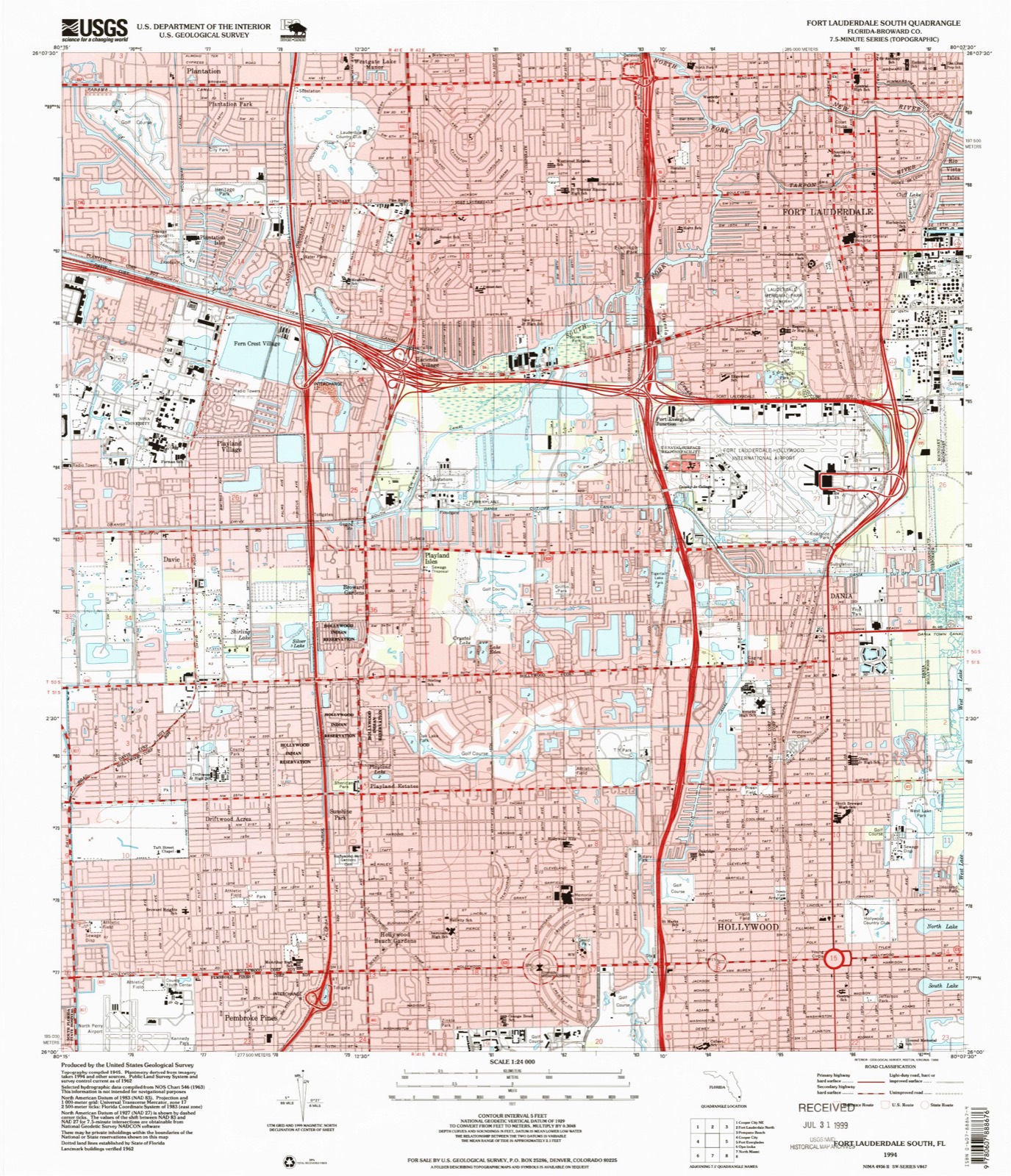
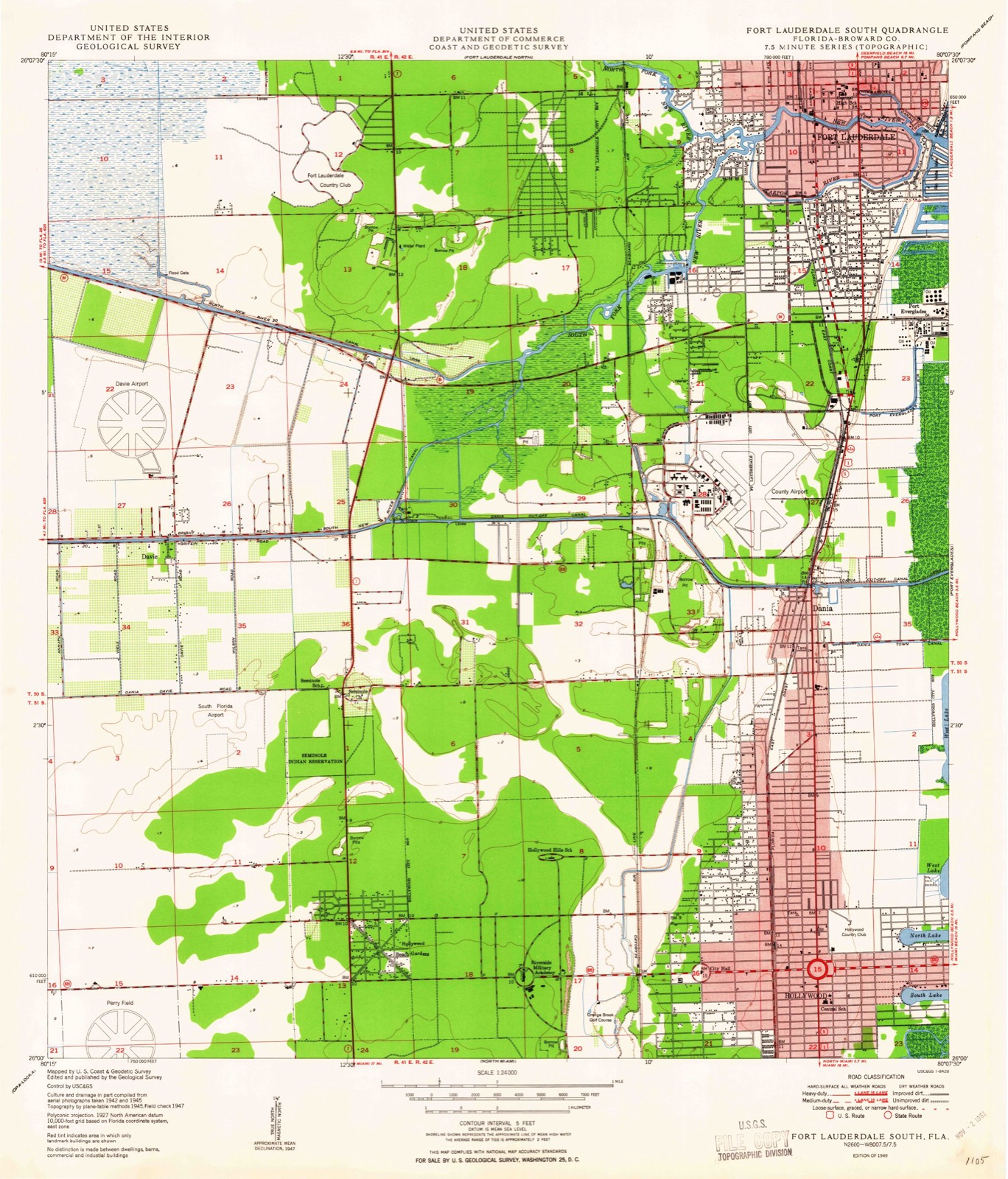
1949 to 1994The same ground, surveyed 45 years apart. Drag the handle to wipe between them. Both sheets are United States Geological Survey originals; neither has been altered.
Compare 1949 against another survey:
Population over time
2 figuresPembroke Pines grew from 154,750 to 171,178 between 2010 and 2020. These are the recorded population figures Wikidata holds for this place, reached through the Geographic Names Information System number this page is keyed on rather than by name, so they belong to this place and not to another of the same name. Most are census counts, but not all are: an early figure may be a founding or settlement estimate, and an estimate published within five years of a census is left out. The change column is computed, and is left blank where more than 20 years separate a figure from the one before it, because a gap that long is not a change between two counts.
| Year | People | Change |
|---|---|---|
| 2010 | 154,750 | |
| 2020 | 171,178 | +16,428 (+11%) |
Topographic sheets covering this place
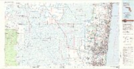
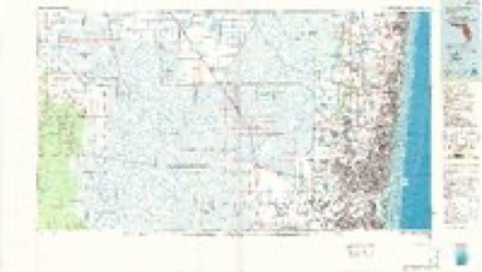
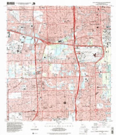
9 surveys from 16 printed sheetsMatched by testing this settlement's coordinate against the published boundary of every sheet in the United States Geological Survey's historical collection. Each opens the scanned sheet at the Survey.
- 1949 USGS Fort Lauderdale South quadrangle1:24000, 2 printings
- 1956 USGS West Palm Beach quadrangle1:250000, 2 printings
- 1957 USGS West Palm Beach quadrangle1:250000
- 1958 USGS West Palm Beach quadrangle1:250000, 2 printings
- 1962 USGS Fort Lauderdale South quadrangle1:24000, 3 printings
- 1981 USGS Fort Lauderdale quadrangle1:100000
- 1985 USGS Fort Lauderdale quadrangle1:100000, 2 printings
- 1987 USGS West Palm Beach quadrangle1:250000, 2 printings
- 1994 USGS Fort Lauderdale South quadrangle1:24000




Fires near this place
30 since 1993Regional context, not property-specific evidence. The federal wildfire occurrence database lists 30 fires within 5 miles of Pembroke Pines between 1993 and 2018, burning about 279 acres in total. None started naturally. 6 were recorded as arson. Distance is straight-line from the map coordinates, so a fire counted here may appear on a neighbouring settlement's page as well.
| Reported cause | Fires |
|---|---|
| Railroad operations and maintenance | 10 |
| Arson/incendiarism | 6 |
| Misuse of fire by a minor | 6 |
| Equipment and vehicle use | 4 |
| Debris and open burning | 2 |
| Missing data/not specified/undetermined | 2 |
The most recent of them, most recent first, with the day each was reported and the service that recorded it.
| Date | Cause | Size | Reported by | Name on the report |
|---|---|---|---|---|
| 13 June 2010 | Debris and open burning | under an acre | Florida Forest Service | 2 PILE FIRE |
| 6 May 1994 | Railroad operations and maintenance | 15 acres | Florida Forest Service | not named |
| 5 May 2003 | Arson/incendiarism | 4.0 acres | Florida Forest Service | not named |
| 26 May 1993 | Railroad operations and maintenance | 3.0 acres | Florida Forest Service | not named |
| 18 May 2006 | Missing data/not specified/undetermined | under an acre | Florida Forest Service | ENGINE 89 FIRE |
| 18 May 1994 | Railroad operations and maintenance | 2.0 acres | Florida Forest Service | not named |
| 11 May 2006 | Arson/incendiarism | under an acre | Florida Forest Service | PINES CHURCH FIRE |
| 27 April 2002 | Railroad operations and maintenance | 1.0 acres | Florida Forest Service | not named |
Settlements close enough to share some of these fires:
Mines and quarries near this place
6 within 5 milesRegional context, not property-specific evidence. The federal mineral resources record lists 6 workings within 5 miles of Pembroke Pines: 5 producers, 1 past producer. 5 still produce. What was taken out: Stone, Crushed/Broken, Sand and Gravel, Construction, Limestone, General. Distance is straight-line from the map coordinates, so a quarry counted here may appear on a neighbouring settlement's page as well.
| Where | Site | Commodity | Status | Recorded |
|---|---|---|---|---|
| A.J. Capeletti - No. 3 Pit | Limestone, General | Producer | Limestone | |
| Hollywood Pit No. 1 | Sand and Gravel, Construction | Producer | ||
| Sterling Road Pit | Sand and Gravel, Construction | Past Producer | ||
| Arvida Lakes | Stone, Crushed/Broken | Producer | ||
| Broward Pit No. 1 | Stone, Crushed/Broken | Producer | ||
| Rhodes Pit | Stone, Crushed/Broken | Producer |
Storms near this place
44 since 1995Regional context, not property-specific evidence. The National Weather Service names Pembroke Pines in 44 storm reports between 1995 and 2025: 13 thunderstorm wind, 11 lightning, 8 funnel cloud, 5 hail. The reports record 16 injuries. Each account below is quoted exactly as the forecast office filed it, from the NOAA Storm Events Database, and each date opens the federal record of that event.
| When | Event | Place named | Harm | What the report says |
|---|---|---|---|---|
| May 1996 | Lightning | Pembroke Pines | 11 hurt | no account filed |
| August 2000 | Lightning | Pembroke Pines | 1 hurt, $2,000 | A woman was slightly injured by lightning. The strike tore a two-foot hole in the roof of a house then went through the ceiling and a wall and struck the victim as she sat in a chair. |
| June 2001 | Lightning | Pembroke Pines | 1 hurt | A 39-year old male was injured while fishing on an airboat in the everglades, 20 miles west of Everglades Holiday Park. It was raining heavily with frequent lightning at the time that the lightning struck the man's fishing rod. Another man in the boat contacted emergency officials, but help was delayed arriving due to the ferocity of the thunderstorm. |
| July 2001 | Lightning | Pembroke Pines | 1 hurt | A firefighter was injured while closing the bay doors of Fire Station 99. The lightning struck a nearby light pole and travelled to the door. The 34-year old man was treated and released at a hospital. |
| September 1997 | Lightning | Pembroke Pines | 1 hurt | male struck by lightning while working on air conditioning unit at 420 sw 83rd way. |
| April 1999 | Wildfire | Pembroke Pines | 1 hurt | no account filed |
| July 2004 | Lightning | Pembroke Pines | $300,000 | A lightning strike on the roof of a house caused a fire in the attic. |
| August 2003 | Lightning | Pembroke Pines | $250,000 | A lightning-initiated fire destroyed a house in Southwest Ranches. Ammunition in the house exploded. |
| June 2001 | Tornado (F1) | Pembroke Pines | $150,000 | no account filed |
| May 2000 | Lightning | Pembroke Pines | $100,000 | no account filed |
| May 2020 | Flood | Pembroke Pines | $10,000 | Various reports of flooding received from Broadcast media and members of the public. The public reported water over a curb and halfway up tires of vehicles near the intersection of North Park Road and Johnson Street. Broadcast media reported flooding in the Hollywood area including water on neighborhood streets making travel difficult with cars stalling along with significant flooding near the Hollywood Beach Golf Club with impassable streets. In Hallandale Beach, one family told local media that they woke up to find their ceiling crumbling in a bedroom when the roof collapsed after heavy rain overnight. Another partial roof collapse was reported just a half-mile away in Hollywood. No one was seriously injured. Torrential rainfall produced flooding of poor drainage areas in urban locations as well as near canals and small lakes. A resident in Hollywood told the local news that there was flooding inside and outside their cottage where they noticed water pouring in from the cracks in the floor. The entire floor is concrete and they also saw 3 to 5 inches of water flooding out from underneath the counter and the cabinets in the kitchen. No injuries reported. |
| August 2004 | Lightning | Pembroke Pines | $10,000 | no account filed |
| August 1999 | Thunderstorm Wind | Pembroke Pines | $10,000 | no account filed |
| September 2015 | Lightning | Pembroke Pines | $5,000 | SUV traveling along I-95 near Griffin Road exit was disabled by lightning strike on rear of vehicle. A hole the size of a quarter was found in the rear of the vehicle beneath the back windshield and the electrical system in the car was destroyed. No injuries were reported and vehicle was towed from scene. |
| July 2007 | Lightning | Pembroke Pines | $5,000 | Lightning struck a home in the 1500 block of NW 167th Avenue in Pembroke Pines. The attic was filled with smoke and a vent on the home was charred. |
| September 2025 | Thunderstorm Wind | Pembroke Pines | $2,000 | Broward County Sheriffs Office reports all lanes of SR-848 at SW 35th Ave are closed due to downed powerline in Hollywood in relation to a strong thunderstorm that moved over the area. |
| June 2023 | Thunderstorm Wind | Pembroke Pines | $1,000 | A public report of a large tree down after strong thunderstorm passes with gusty winds. Numerous reports of winds reaching 45 to 60 mph across areas impacted by the same thunderstorms in Broward County. |
| June 2004 | Hail | Pembroke Pines | $1,000 | no account filed |
| August 2025 | Flood | Pembroke Pines | - | Trained spotter reports heavy street flooding with video evidence near Stirling Road between Dixie Highway and US-1. |
| September 2025 | Flood | Pembroke Pines | - | Social media video of significant street flooding occurring on Stirling Road in between US-1 and Dixie Highway. Water visible covering much of the roadway aside from the far center lane. |
| August 2019 | Flood | Pembroke Pines | - | Emergency Managers reported partial road closures with several lanes impassible near Stirling Rd and N 56th ave where heavy rain had fallen. |
| September 2012 | Thunderstorm Wind | Pembroke Pines | - | An off duty NWS employee estimated a wind gust of 60 mph in Pembroke Pines. |
| July 2007 | Hail | Pembroke Pines | - | Dime to nickel size hail. |
| May 2006 | Hail | Pembroke Pines | - | Reported east of I-75. |
| August 2005 | Thunderstorm Wind | Pembroke Pines | - | A tree was blown down along Taft Street between Palm Avenue and Hiatus Avenue. |
| August 2003 | Hail | Pembroke Pines | - | The public reported 3/4 inch hail. |
| October 2003 | Funnel Cloud | Pembroke Pines | - | An off duty NWS employee saw a funnel cloud about two miles west of U.S. 27 and Pines Boulevard. |
| November 2002 | Thunderstorm Wind | Pembroke Pines | - | A cluster of severe thunderstorms brought down trees in Pembroke Pines and Pompano Beach. |
| August 2002 | Thunderstorm Wind | Pembroke Pines | - | Thunderstorm wind gusts near 60 mph knocked down large tree limbs. |
| March 1998 | Thunderstorm Wind | Pembroke Pines | - | Automobiles were tossed and large trees were downed. |
| June 1998 | Funnel Cloud | Pembroke Pines | - | Several funnel clouds reported by residents near I-75 and Pines Blvd. |
| August 1998 | Funnel Cloud | Pembroke Pines | - | Funnel sighted at Chapel Trail east of US-27 on Pines Blvd. Winds estimated to be 52 knots. |
| July 1997 | Funnel Cloud | Pembroke Pines | - | sighted west of florida turnpike and north of pines blvd. |
| June 1997 | Tornado (F0) | Pembroke Pines | - | several reports of tornado. no damage or injuries reported. movement was to south at 15 mph. |
| February 1995 | Thunderstorm Wind | Pembroke Pines | - | Thunderstorm winds gusts of 60 mph were reported in Pembroke Pines. |
| December 1995 | Thunderstorm Wind | Pembroke Pines | - | Squall line moving east at 30 mph produced gust around 58 mph in the west portion of Pembroke Pines. |
| June 2006 | Hail | Pembroke Pines | - | no account filed |
| June 2004 | Funnel Cloud | Pembroke Pines | - | no account filed |
| June 2004 | Thunderstorm Wind | Pembroke Pines | - | no account filed |
| March 2003 | Thunderstorm Wind | Pembroke Pines | - | no account filed |
| July 1999 | Funnel Cloud | Pembroke Pines | - | no account filed |
| July 1998 | Funnel Cloud | Pembroke Pines | - | no account filed |
| July 1997 | Thunderstorm Wind | Pembroke Pines | - | no account filed |
| August 1996 | Funnel Cloud | Pembroke Pines | - | no account filed |
Nearest settlements
The eight closest, with where each one stands in the county. Distances are straight-line, computed from the Geographic Names Information System coordinates.
| Map | Place | Distance | Sheets |
|---|---|---|---|
| Fleetwood Manor | 1.0 miles | 16 | |
| Miramar | 1.2 miles | 15 | |
| Hollywood Beach Gardens | 1.3 miles | 16 | |
| Utopia | 1.5 miles | 15 | |
| Driftwood Acres | 1.7 miles | 16 | |
| West Park | 1.8 miles | 15 | |
| Sunshine Park | 1.9 miles | 16 | |
| Carver Ranches | 2.0 miles | 15 |
Elsewhere
Matched on this settlement's Geographic Names Information System number rather than its name, so it cannot be a different place of the same name in another state.
| Wikipedia article on Pembroke Pines | An encyclopaedic summary. Its text is share-alike, so it is linked here rather than copied. |
| Wikidata item Q370972 | The structured record the population and elevation above come from. Public domain (CC0). |
Provenance
This settlement is recorded in the Geographic Names Information System as feature 288686. The sheet list is computed by point-in-boundary test against the United States Geological Survey's historical topographic inventory. Both are works of the United States government and carry no copyright under 17 U.S.C. 105.
Wildfire. Short, Karen C. 2022. Spatial wildfire occurrence data for the United States, 1992-2020 [FPA_FOD_20221014]. 6th Edition. Fort Collins, CO: Forest Service Research Data Archive. https://doi.org/10.2737/RDS-2013-0009.6 Collected with United States Government funding and usable without additional permissions or fees.
Mines and quarries. USGS Mineral Resources Data System (MRDS) https://mrdata.usgs.gov/mrds/ A work of the United States government, no copyright under 17 U.S.C. 105.
Storms. NOAA National Centers for Environmental Information, Storm Events Database https://www.ncei.noaa.gov/stormevents/ A work of the United States government, no copyright under 17 U.S.C. 105. Narratives are quoted verbatim from the National Weather Service report and are not edited or summarised.