 Block
BlockNavarre, Florida
18 topographic sheets cover this place, the earliest surveyed in 1921 and the latest in 1994. It stands in the Holley-Navarre census division. It lies in ZIP code area 32566. It lies near Santa Rosa Island. The Survey maps it on the Navarre quadrangle. 40,817 people lived here at the 2020 count. It stands 10 feet above sea level.
Then and now
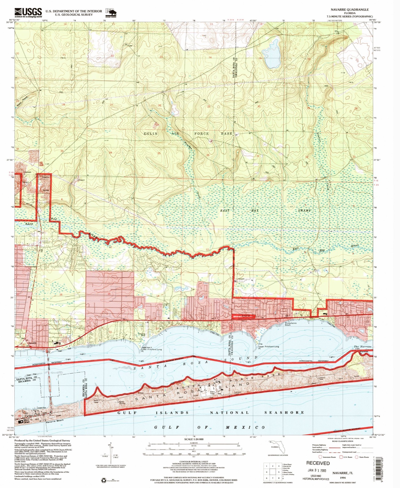
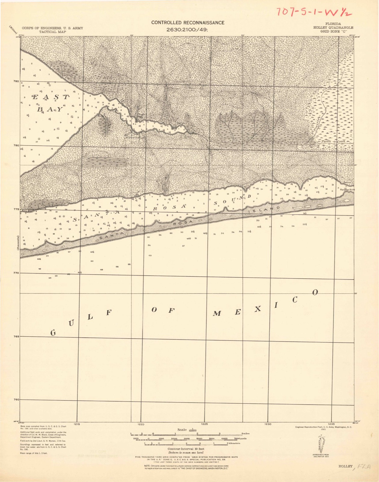
1921 to 1994The same ground, surveyed 73 years apart. Drag the handle to wipe between them. Both sheets are United States Geological Survey originals; neither has been altered.
Population over time
2 figuresNavarre grew from 31,378 to 40,817 between 2010 and 2020. These are the recorded population figures Wikidata holds for this place, reached through the Geographic Names Information System number this page is keyed on rather than by name, so they belong to this place and not to another of the same name. Most are census counts, but not all are: an early figure may be a founding or settlement estimate, and an estimate published within five years of a census is left out. The change column is computed, and is left blank where more than 20 years separate a figure from the one before it, because a gap that long is not a change between two counts.
| Year | People | Change |
|---|---|---|
| 2010 | 31,378 | |
| 2020 | 40,817 | +9,439 (+30%) |
Topographic sheets covering this place
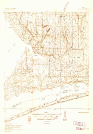
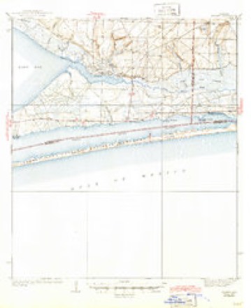
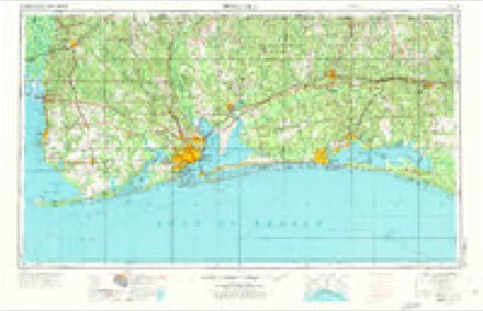
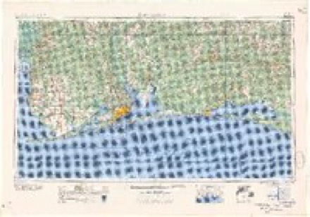
10 surveys from 18 printed sheetsMatched by testing this settlement's coordinate against the published boundary of every sheet in the United States Geological Survey's historical collection. Each opens the scanned sheet at the Survey.
- 1921 USGS Holley quadrangle1:62500
- 1936 USGS Holley quadrangle1:62500, 2 printings
- 1936 USGS Holley quadrangle1:48000
- 1938 USGS Holley quadrangle1:62500, 3 printings
- 1957 USGS Pensacola quadrangle1:250000, 3 printings
- 1959 USGS Pensacola quadrangle1:250000
- 1960 USGS Pensacola quadrangle1:250000
- 1970 USGS Navarre quadrangle1:24000, 3 printings
- 1978 USGS Fort Walton Beach quadrangle1:100000, 2 printings
- 1994 USGS Navarre quadrangle1:24000
Fires near this place
219 since 1992Regional context, not property-specific evidence. The federal wildfire occurrence database lists 219 fires within 5 miles of Navarre between 1992 and 2019, burning about 5,820 acres in total. 5 started naturally. 10 were recorded as arson. Distance is straight-line from the map coordinates, so a fire counted here may appear on a neighbouring settlement's page as well.
| Reported cause | Fires |
|---|---|
| Railroad operations and maintenance | 59 |
| Missing data/not specified/undetermined | 38 |
| Debris and open burning | 36 |
| Misuse of fire by a minor | 32 |
| Equipment and vehicle use | 21 |
| Arson/incendiarism | 10 |
| Smoking | 9 |
| Fireworks | 5 |
| Natural | 5 |
| Recreation and ceremony | 3 |
| Other causes | 1 |
The most recent of them, most recent first, with the day each was reported and the service that recorded it.
| Date | Cause | Size | Reported by | Name on the report |
|---|---|---|---|---|
| 8 September 1997 | Equipment and vehicle use | 1.0 acres | Florida Forest Service | not named |
| 6 September 2002 | Railroad operations and maintenance | 1.6 acres | Florida Forest Service | not named |
| 30 September 2003 | Debris and open burning | under an acre | Florida Forest Service | MENORCA FIRE - 1181 |
| 30 September 1999 | Railroad operations and maintenance | under an acre | Florida Forest Service | not named |
| 3 September 2017 | Missing data/not specified/undetermined | under an acre | Florida Forest Service | KIT LANE (57) |
| 3 September 2007 | Natural | under an acre | Florida Forest Service | 57-SUNNYBROOK FIRE-1462 |
| 24 September 2006 | Debris and open burning | under an acre | Florida Forest Service | EL PASEO FIRE-1661 |
| 22 September 1997 | Missing data/not specified/undetermined | 2.0 acres | Florida Forest Service | not named |
Settlements close enough to share some of these fires:
Mines and quarries near this place
3 within 5 milesRegional context, not property-specific evidence. The federal mineral resources record lists 3 workings within 5 miles of Navarre: 2 producers, 1 unknown. 2 still produce. What was taken out: Sand. Distance is straight-line from the map coordinates, so a quarry counted here may appear on a neighbouring settlement's page as well.
| Where | Site | Commodity | Status | Recorded |
|---|---|---|---|---|
| Edward M. Chadburn, Inc. -Holly Mine | Sand | Unknown | ||
| M and L Sand Co. - Navarre Mine | Sand | Producer | ||
| O.C. Mills Sand Co. - Mills Mine | Sand | Producer |
Storms near this place
60 of 70 shownRegional context, not property-specific evidence. The National Weather Service names Navarre in 70 storm reports between 1995 and 2025: 20 thunderstorm wind, 19 lightning, 8 rip current, 7 waterspout. The reports record 8 deaths and 7 injuries. Each account below is quoted exactly as the forecast office filed it, from the NOAA Storm Events Database, and each date opens the federal record of that event.
| When | Event | Place named | Harm | What the report says |
|---|---|---|---|---|
| June 2005 | Lightning | Navarre | 1 killed, 1 hurt | A tourist from Louisiana was killed while walking on Navarre Beach. An eleven year old daughter of a friend was walking with him when the strike occurred. The girl was treated for minor injuries at the scene. The man was found in the surf and was pronounced dead at the scene. They were walking along the beach in between a thunderstorm to the west of them and one approaching from the east when the strike occurred. |
| May 2003 | Rip Current | Navarre | 1 killed | A 34 year old male and a younger boy were swimming near Navarre Beach. The rough water kept taking the two farther offshore and they began to struggle. A surfer was able to paddle to them and brought the younger boy to shore. By the time the rescuer got to the second individual he had already gone under. The surfer was able to locate the individual and bring him ashore. The individual was taken to a local hospital where he died. |
| April 2001 | Rip Current | Navarre | 1 killed | A 66 year old male drowned in rough surf near Navarre Beach. The man had gone into the rough surf to rescue his granddaughter. He got caught in a strong rip current and drowned. His granddaughter safely made it to shore. The man lived in Okaloosa county. The time of the drowning was estimated to be around noon. |
| April 2001 | Rip Current | Navarre | 1 killed | A 45 year old male drowned while swimming in rough water with his family near Navarre Beach. The family was vacationing at the beach and were from Maryland. The family got caught in a strong rip current and lifeguards were able to save the man's wife and son. By the time they got back to him he had drowned. Red flags were flying along the beaches warning people of dangerous surf. The family was swimming at an area that was near, but not patrolled by life guards. |
| April 2001 | Rip Current | Navarre | 1 killed | A 52 year old Walton county man drowned while swimming in rough surf near Navarre Beach. The man was swimming just offshore when he got caught in a strong rip current and drowned. The time of the downing was estimated to be around noon CST. This was the fourth person to die in strong rip currents in the area this month. |
| November 2001 | Rip Current | Navarre | 1 killed | For the second day in a row, a swimmer drowned in strong rip currents off the beaches at Navarre. The unusually warm weather for late November persuaded beachgoers to venture into the waters, but an increasingly strong onshore wind flow had developed dangerous rip currents along some beaches. A man visiting the area from Citrus County Florida was overcome by the rough waters, and drowned. |
| November 2001 | Rip Current | Navarre | 1 killed | An increasing onshore wind flow in advance of an approaching cold front resulted in the development of strong rip currents along some Florida panhandle beaches. Unusually warm temperatures prior to frontal passage persuaded more beachgoers to venture into the waters than would normally do so in late November. The combination of the warm temperatures and the developing rip currents proved deadly to one beachgoer, drowning a man visiting from Missouri. |
| March 2000 | Rip Current | Navarre | 1 killed | A 42 year old male, from Decatur AL, drowned after being caught in a rip current in the surf at Navarre. |
| April 2017 | Lightning | Navarre | 3 hurt | Three injuries were reported in Navarre due to lightning strikes. One individual was seated in a metal chair when lightning struck his home. Two other individuals were transported to the hospital after lightning struck their facility while they were using the phone lines. |
| June 2025 | Lightning | Navarre | 1 hurt | Lightning strike to an individual. |
| August 2012 | Lightning | Navarre | 1 hurt | A 54 year old Male was stuck by lightning and suffered minor injuries. |
| June 2001 | Rip Current | Navarre | 1 hurt | A local thirty-nine year old female was taken to a hospital after being rescued at Navarre Beach from rough waters. She and three friends were swimming in the rough surf when they were caught in a rip current. Rescuers were able to rescue the three, with the one woman being taken to the hospital, and later released. |
| January 2002 | Thunderstorm Wind | Navarre | $720,000 | A thunderstorm moved in from the Gulf of Mexico just before midnight. The storm moved from the Gulf of Mexico across Jessica Way then across U. S. Highway 98, where a strip mall was damaged, then down Whispering Pines Blvd. The winds from the storm damaged 29 homes on Jessica Way and Whispering Pines Blvd. as it moved to the northeast. Most of the damage to the homes were shingles blown from roofs and fences blown down. Several trees were also blown onto vehicles and flying debris broke several windshields. The most significant damage occurred to the strip mall along U. S. Highway 98. The winds from the storm hit the mall broadside and shifted several columns holding the front of the mall up. This allowed part of the center of the mall to collapse. Flying debris also knocked out several windows at the mall. There were occupants in part of the mall, but no one was injured as most of the damage occurred in the unoccupied portion of the mall. |
| July 2015 | Lightning | Navarre | $100,000 | Lightning induced structure fire at 7231 Manatee St. The home was 50 percent damaged by fire, 100 percent by smoke, and 75 percent by water. |
| January 1997 | Lightning | Navarre | $75,000 | no account filed |
| August 2016 | Lightning | Navarre | $50,000 | A lightning strike resulted in 40K-50K in damages to a home. |
| July 2015 | Lightning | Navarre | $50,000 | Lightning struck a house and caused a fire in the attic. |
| December 2007 | Thunderstorm Wind | Navarre | $40,000 | no account filed |
| March 2014 | Thunderstorm Wind | Navarre | $25,000 | Winds estimated at 80 mph blew a roof off a building at a strip mall. Numerous cars damaged and power lines down. Hwy 98 closed due to downed power lines. |
| July 2013 | Flash Flood | Navarre | $25,000 | Flood water at least 2 foot deep reported in a house on Aurora Drive in Holley By The Sea Community. |
| July 2013 | Flash Flood | Navarre | $25,000 | Flood water at least 2 foot deep reported in a house on Aurora Drive in Holley By The Sea Community. |
| January 2017 | Lightning | Navarre | $20,000 | Lightning caused a house fire on Surfside Cove. |
| February 1996 | Thunderstorm Wind | Navarre | $20,000 | no account filed |
| February 2016 | Thunderstorm Wind | Navarre | $15,000 | Severe thunderstorm wind gusts near 70 mph produced minor roof damage to residences at James Harvell Road and Highway 87. |
| February 2016 | Thunderstorm Wind | Navarre | $15,000 | Severe thunderstorm winds near 70 mph produced roof damage to residences on Cosica Boulevard. |
| July 2007 | Lightning | Navarre | $15,000 | Lightning struck a house near Navarre causing a fire which resulted in significant damage to the home. |
| July 2000 | Thunderstorm Wind | Navarre | $15,000 | High winds caused roof damage to a couple of duplexes and damaged a couple of metal sheds in the Navarre area. Some tree limbs were also blown down. No injuries were reported. |
| August 1998 | Lightning | Navarre | $15,000 | Lightning struck a tree near a home and ran into the house through the tree root system. The lightning blew out the breaker box in the home and damaged some electrical appliances. |
| August 2022 | Lightning | Navarre | $10,000 | Lightning struck a home causing a fire. |
| February 2017 | Thunderstorm Wind | Navarre | $10,000 | Winds estimated at 70 mph downed several trees in the road with one falling on a home. A fence was also damaged. |
| March 2014 | Thunderstorm Wind | Navarre | $10,000 | Winds estimated at 70 mph blew a roof off a building on Navarre Beach. |
| March 2014 | Thunderstorm Wind | Navarre | $10,000 | Winds estimated at 80 mph blew windows out near Belle Mer Condo. |
| February 2013 | Lightning | Navarre | $10,000 | A lightning strike resulted in a house fire in the town of Midway. |
| July 2013 | Flash Flood | Navarre | $10,000 | Automobiles were stalled due to flood waters on U.S. Highway 98 where water was at least one foot deep in places. Water was also reported at least 6 inches over the roadway on Mercado Street and Avenida Del Sol in Navarre. |
| August 1998 | Lightning | Navarre | $10,000 | A crane being used for construction on Navarre Beach was caught in winds and was also struck by lightning from a storm that moved in from the east. The workers saw the storm coming and were trying to get the crane lowered when winds bent the crane and lightning struck the tall crane. No one was injured. |
| June 2008 | Lightning | Navarre | $10,000 | no account filed |
| March 2005 | Thunderstorm Wind | Navarre | $10,000 | no account filed |
| September 2018 | Lightning | Navarre | $5,000 | Thunderstorms produced lightning which struck two structures. |
| July 2012 | Lightning | Navarre | $5,000 | no account filed |
| January 1998 | Thunderstorm Wind | Navarre | $3,500 | Trees and power lines were blown down in Navarre. |
| June 2005 | Tornado (F0) | Navarre | $3,000 | As Tropical Storm Arlene moved ashore, a weak tornado briefly touched down near Navarre. The weak tornado was on the ground briefly and only caused minor damage. A fire department near the touchdown measured 60 mph wind gusts. |
| October 1995 | Tornado (F0) | Navarre | $3,000 | A tornado briefly touched down in Navarre blowing some trees down. |
| February 2018 | Lightning | Navarre | $2,000 | Lightning struck a residential building. |
| November 2018 | Thunderstorm Wind | Navarre | $2,000 | High winds downed trees on Turkey Creek Drive. |
| April 1995 | Thunderstorm Wind | Navarre | $2,000 | An awning was blown off a convenience store and several trees were also blown down in the Navarre area. |
| March 1999 | Coastal Flood | Navarre | $2,000 | no account filed |
| April 1997 | Lightning | Navarre | $1,000 | Lightning struck two different homes in the Navarre area. Both homes suffered minimal damage . |
| January 2024 | Thunderstorm Wind | Navarre | - | Measured by Weatherstem station at Navarre Beach Marine Science Station. |
| January 2024 | Thunderstorm Wind | Navarre | - | Thunderstorm wind damage to the Navarre Beach Lifeguard Headquarters. Pictures and videos via social media. |
| April 2021 | Thunderstorm Wind | Navarre | - | Measured by weather stem site in Navarre. |
| September 2021 | Flash Flood | Navarre | - | Ortega St and Onich Dr in Navarre was closed to due to flooding. Other roads in Navarre were flooded as well, including Avenida De Sol north of Torres St and along High School Blvd. |
| April 2020 | Thunderstorm Wind | Navarre | - | High winds downed a tree on a house. |
| July 2013 | Flash Flood | Navarre | - | Santa Rosa Emergency Services reported they had closed portions of Onich Driver, Shipton Street and Ortega Street due to at least 6 inches of water covering the roadways. |
| July 2013 | Flash Flood | Navarre | - | Avenida Del Sol was flooded with water at least 6 inches deep in Navarre. |
| September 2008 | Tornado (EF0) | Navarre | - | An outer rainband from Hurricane Gustav produced a weak EF0 tornado in Navarre that caused no damage. |
| July 2000 | Hail | Navarre | - | Dime sized hail was reported as a thunderstorm moved across the southern portion of the county. |
| August 2000 | Waterspout | Navarre | - | Two waterspouts were reported over the water just offshore of Navarre. The waterspouts dissipated without moving ashore. |
| July 2000 | Funnel Cloud | Navarre | - | A funnel cloud was observed near Navarre Beach. The funnel never touched down and dissipated into the cloud. |
| July 2000 | Waterspout | Navarre | - | A waterspout was observed just offshore, south of Navarre Beach. The waterspout dissipated over water. |
| July 2000 | Waterspout | Navarre | - | A waterspout was observed just east of Navarre Beach. The waterspout dissipated over the water. |
Nearest settlements
The eight closest, with where each one stands in the county. Distances are straight-line, computed from the Geographic Names Information System coordinates.
| Map | Place | Distance | Sheets |
|---|---|---|---|
| Harper | 3.1 miles | 20 | |
| Holley | 3.9 miles | 20 | |
| Muddy Ford | 4.3 miles | 20 | |
| Woodlawn Beach | 6.8 miles | 20 | |
| Tiger Point | 10.3 miles | 18 | |
| Dickerson City | 11.8 miles | 18 | |
| Broxson | 11.9 miles | 20 | |
| Oriole Beach | 12.2 miles | 17 |
Elsewhere
Matched on this settlement's Geographic Names Information System number rather than its name, so it cannot be a different place of the same name in another state.
| Wikipedia article on Navarre | An encyclopaedic summary. Its text is share-alike, so it is linked here rather than copied. |
| Wikidata item Q3470764 | The structured record the population and elevation above come from. Public domain (CC0). |
Provenance
This settlement is recorded in the Geographic Names Information System as feature 287558. The sheet list is computed by point-in-boundary test against the United States Geological Survey's historical topographic inventory. Both are works of the United States government and carry no copyright under 17 U.S.C. 105.
Wildfire. Short, Karen C. 2022. Spatial wildfire occurrence data for the United States, 1992-2020 [FPA_FOD_20221014]. 6th Edition. Fort Collins, CO: Forest Service Research Data Archive. https://doi.org/10.2737/RDS-2013-0009.6 Collected with United States Government funding and usable without additional permissions or fees.
Mines and quarries. USGS Mineral Resources Data System (MRDS) https://mrdata.usgs.gov/mrds/ A work of the United States government, no copyright under 17 U.S.C. 105.
Storms. NOAA National Centers for Environmental Information, Storm Events Database https://www.ncei.noaa.gov/stormevents/ A work of the United States government, no copyright under 17 U.S.C. 105. Narratives are quoted verbatim from the National Weather Service report and are not edited or summarised.