 Block
BlockOcean Ridge, Florida
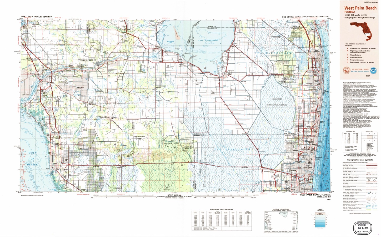
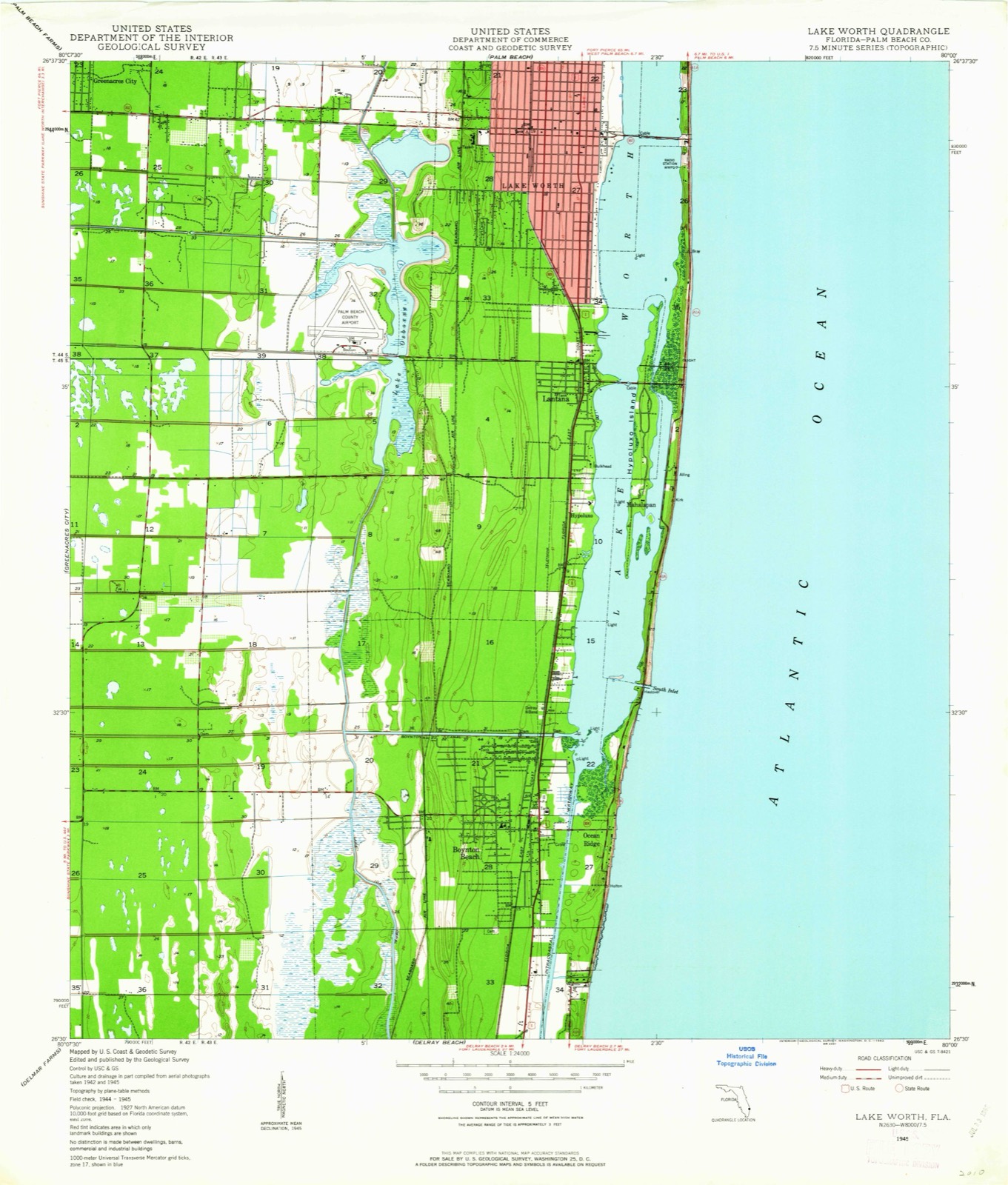
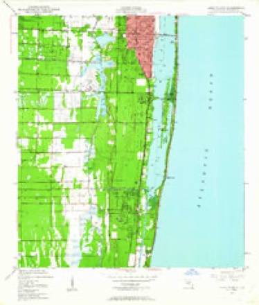
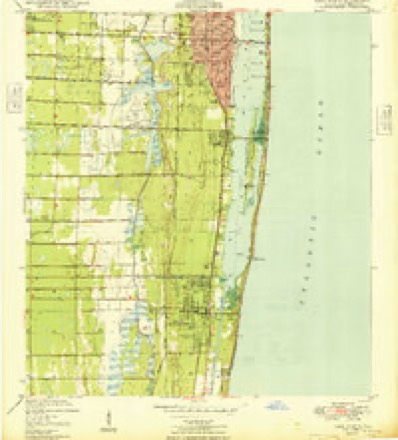
14 topographic sheets cover this place, the earliest surveyed in 1945 and the latest in 1987. It stands in the Boynton Beach-Delray Beach census division. It lies in ZIP code area 33435. The Survey maps it on the Lake Worth quadrangle. 1,830 people lived here at the 2020 count. It stands 7 feet above sea level.
Then and now
1945 to 1987The same ground, surveyed 42 years apart. Drag the handle to wipe between them. Both sheets are United States Geological Survey originals; neither has been altered.
Compare 1945 against another survey:
On record in Ocean Ridge
Buildings and businesses the archive holds for this place. Each opens its own page, with the source record it came from.
On the National Register within a mile 2 records
The National Register names another town for these. They stand within one mile of this settlement's coordinate.
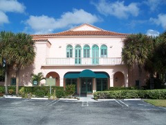 Boynton Woman's Clublisted 1979 · 0.8 miles away
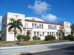 Boynton Schoollisted 1994 · 0.9 miles away
Population over time
3 figuresOcean Ridge grew from 1,636 to 1,830 between 2000 and 2020. These are the recorded population figures Wikidata holds for this place, reached through the Geographic Names Information System number this page is keyed on rather than by name, so they belong to this place and not to another of the same name. Most are census counts, but not all are: an early figure may be a founding or settlement estimate, and an estimate published within five years of a census is left out. The change column is computed, and is left blank where more than 20 years separate a figure from the one before it, because a gap that long is not a change between two counts.
| Year | People | Change |
|---|---|---|
| 2000 | 1,636 | |
| 2010 | 1,786 | +150 (+9%) |
| 2020 | 1,830 | +44 (+2%) |
Topographic sheets covering this place
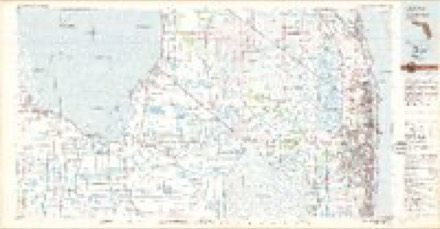
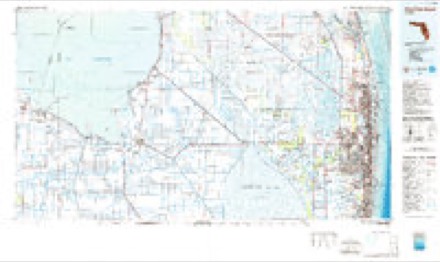
8 surveys from 14 printed sheetsMatched by testing this settlement's coordinate against the published boundary of every sheet in the United States Geological Survey's historical collection. Each opens the scanned sheet at the Survey.
- 1945 USGS Lake Worth quadrangle1:24000, 4 printings
- 1949 USGS Lake Worth quadrangle1:24000
- 1956 USGS West Palm Beach quadrangle1:250000, 2 printings
- 1957 USGS West Palm Beach quadrangle1:250000
- 1958 USGS West Palm Beach quadrangle1:250000, 2 printings
- 1981 USGS West Palm Beach quadrangle1:100000
- 1985 USGS West Palm Beach quadrangle1:100000
- 1987 USGS West Palm Beach quadrangle1:250000, 2 printings




Fires near this place
4 since 2000Regional context, not property-specific evidence. The federal wildfire occurrence database lists 4 fires within 5 miles of Ocean Ridge between 2000 and 2017, burning about 14 acres in total. None started naturally. 1 was recorded as arson. Distance is straight-line from the map coordinates, so a fire counted here may appear on a neighbouring settlement's page as well.
| Reported cause | Fires |
|---|---|
| Missing data/not specified/undetermined | 2 |
| Misuse of fire by a minor | 1 |
| Arson/incendiarism | 1 |
The most recent of them, most recent first, with the day each was reported and the service that recorded it.
| Date | Cause | Size | Reported by | Name on the report |
|---|---|---|---|---|
| 3 June 2008 | Missing data/not specified/undetermined | 4.0 acres | Florida Forest Service | MINOR ROAD FIRE |
| 26 May 2000 | Arson/incendiarism | 2.0 acres | Florida Forest Service | not named |
| 19 April 2002 | Missing data/not specified/undetermined | 7.2 acres | Florida Forest Service | not named |
| 19 February 2017 | Misuse of fire by a minor | 1.0 acres | Florida Forest Service | NICKELS (50) |
Settlements close enough to share some of these fires:
Mines and quarries near this place
1 within 5 milesRegional context, not property-specific evidence. The federal mineral resources record lists 1 working within 5 miles of Ocean Ridge: 1 past producer. None of them still produces. What was taken out: Stone, Crushed/Broken. Distance is straight-line from the map coordinates, so a quarry counted here may appear on a neighbouring settlement's page as well.
| Where | Site | Commodity | Status | Recorded |
|---|---|---|---|---|
| Peanut Island Limestone Quarry | Stone, Crushed/Broken | Past Producer |
Storms near this place
27 since 1997Regional context, not property-specific evidence. The National Weather Service names Ocean Ridge in 27 storm reports between 1997 and 2026: 9 hail, 5 tornado, 5 thunderstorm wind, 3 flash flood. The reports record 1 death and 3 injuries. Each account below is quoted exactly as the forecast office filed it, from the NOAA Storm Events Database, and each date opens the federal record of that event.
| When | Event | Place named | Harm | What the report says |
|---|---|---|---|---|
| February 1997 | Rip Current | Ocean Ridge | 1 killed | no account filed |
| August 2008 | Lightning | Ocean Ridge | 3 hurt | Around 5:30 PM a trooper from the Florida Highway Patrol was investigating a crash on interstate 95 in Palm Beach County when he was struck by lightning. The trooper was able to radio for help and was taken to Bethesda Memorial Hospital along with two other people who were involved in the crash. All three people injured by the strike were later released by the hospital. |
| April 2023 | Tornado (EF0) | Ocean Ridge | $50,000 | A tornado affected southern portions of Boynton Beach on the evening of April 28th. The first visible signs of tornadic damage were just west of I-95 and south of SW 23rd Ave in the form of several broken large tree branches and a royal palm tree partially stripped of its fronds. The tornado moved ENE continuing it's path as it crossed I-95, with reports of traffic stopping or slowing down as the circulation crossed the interstate. The tornado then moved through portions of the High Point community where about a half-dozen homes sustained minor roof uplift near the corners of the structures, awnings twisted or completely torn off and landing several houses away, and several large tree branches and trunks broken. The final indication of tornadic damage was a downed small palm tree at Main Blvd, east of SW 3rd St, just south of the Boynton Beach Little League Park. The damage path was sporadic in spots, with large tree branches or trunks snapped right next to other trees and buildings with no visible signs of damage. Therefore, the tornado is rated as an EF-0 with estimated maximum winds near 80 mph. Most of the winds along the damage path were estimated in the 65-75 mph range. Damage amounts are estimated. |
| January 2008 | Flash Flood | Ocean Ridge | $10,000 | Intense rains affected Boynton Beach and the northwest section of Delray Beach during the late afternoon and evening hours of January 22nd. Maximum observed rainfall amounts were between 4 and 6 inches in Boynton Beach, although Doppler radar estimated as much as 10 inches of rain fell in just over 3 hours.||Numerous reports of flooding were reported. A trained spotter reported water getting into houses in the corridor west of Federal Highway and east of Congress Avenue between Boynton Beach Boulevard and Woolbright Road. Water rose to as high as 2 feet along sections of Congress Avenue. Significant flooding was reported at the parking lot of Boynton Beach mall. The I-95 on-ramp at Gateway Boulevard was closed due to the water depth, as was sections of Boynton Beach Boulevard. ||Dozens of vehicles stalled and 40 traffic accidents were reported due to the rain and standing water. |
| April 2007 | Tornado (EF0) | Ocean Ridge | $10,000 | Tornado touched down in Boynton Beach near Congress Avenue and Military Trail, causing damage to trailers and satellite dishes at the School Board's ITV building. The tornado moved east and flipped over a tractor trailer at the I-95 off ramp to Boynton Beach Boulevard before lifting. |
| September 2022 | Tornado (EF0) | Ocean Ridge | $2,000 | Brief tornado occurred in Boynton Beach near I-95 and Boynton Beach Boulevard. Damage was minor and confined to trees and a fence. There was an unconfirmed report of damage to the city hall building in the town of Gulf Stream which may be from this parent storm. |
| May 2019 | Thunderstorm Wind | Ocean Ridge | $2,000 | A trained spotter reported wind damage to manufactured homes in the Jamaica Bay neighborhood including downed flag poles, broken windows, and torn awnings. Radar estimated time of 438 PM EDT. Wind speed was estimated to be at least 50 mph. |
| May 2024 | Thunderstorm Wind | Ocean Ridge | $1,000 | Several pictures and videos from social media showed downed large trees branches and snapped trees after a severe thunderstorm moved through Ocean Ridge. Time estimated via radar. A nearby weather station recorded a 55 mph wind gust. |
| February 2013 | Tornado (EF0) | Ocean Ridge | $1,000 | The Store Manager of Lowe's Home Improvement Center witnessed a tornado in the storm parking lot. Trees were downed, cars moved and a stop sign was broken. No other damage or injuries were reported. |
| February 2026 | Hail | Ocean Ridge | - | A trained spotter reported and sent images of estimated quarter-size hail in Boynton Beach. |
| February 2026 | Hail | Ocean Ridge | - | A member of the public sent photos of quarter-size estimated hail in Boynton Beach. |
| May 2025 | Hail | Ocean Ridge | - | A trained spotter reported hail between the size of a quarter dollar and ping pong balls falling during a severe thunderstorm in west Boynton Beach. |
| June 2023 | Hail | Ocean Ridge | - | Quarter sized hail was reported at the intersection of Congress Blvd and Woolbright |Rd, along with widespread street flooding in the area. |
| June 2023 | Flood | Ocean Ridge | - | TV meteorologist shared video of a flooded street with water halfway up car tires in the Boynton Beach area. A stalled car was also captured on the video as well. Time estimation based off radar was around 3pm. |
| April 2021 | Hail | Ocean Ridge | - | Social media reports of nickel-sized hail in Boynton Beach. Palm fronds were also seen down around the area. |
| May 2020 | Flash Flood | Ocean Ridge | - | Several inches of rain, with measured amounts ranging from 3 to 6 inches, and locally higher amounts, caused flooding in portions of Boynton Beach and Ocean Ridge. Law enforcement reported Woolbright Road was closed from Federal Highway to the intracoastal waterway bridge due to heavy rainfall. The Weather Underground station KFLBOYNT1 near Bethesda Hospital East in Boynton Beach measured 5.43 inches of rain. |
| October 2020 | Flood | Ocean Ridge | - | WPEC-TV reported street flooding on the 3500 block of ruskin avenue in Boynton Beach after heavy rainfall moved across the area. |
| October 2020 | Flash Flood | Ocean Ridge | - | Significant flooding occurred in the Lake Boynton Estates area of Boynton Beach, resulting from a combination of heavy rainfall of the previous days plus 4-5 inches of rain on the night and early morning of October 24th and 25th. Two to three homes had water intrusion, and water was about 2 feet deep on streets. Four families in the area requested to be evacuated. Flood waters lingered for over 24 hours (this is detailed in a separate storm entry under Flood). |
| October 2020 | Flood | Ocean Ridge | - | Flooding lingered in the Lake Boynton Estates neighborhood for over 24 hours following the heavy rainfall of October 24th and 25th (see Flash Flood entry in this episode for more information on the causative event). Streets were impassable in the area, along with 2-3 homes with water intrusion which required evacuations. |
| October 2017 | Tornado (EF0) | Ocean Ridge | - | Tornado initially touched down started in the community in Boynton Beach at the intersection of Oak Street and Shady Lane where minor roof damage occurred. The tornado then continued north toward the Place where part of a roof lifted off a vacant mobile home and was carried several hundred yards away. The tornado continued north to Royal Manor Boulevard where a light pole was broken and more minor roof damage reported in the community. The tornado crossed NW 22nd Avenue before lifting near Sausalito Circle where some minor roof damage was found. |
| July 2015 | Hail | Ocean Ridge | - | Quarter sized hail was reported on Boynton Beach Blvd. between Military Trail and Jog Rd. Relayed by local media. |
| July 2015 | Thunderstorm Wind | Ocean Ridge | - | Several trees were blown down at Boynton Beach Mall. |
| June 2014 | Hail | Ocean Ridge | - | A member of the public reported hail larger than dime sized in Boynton Beach. |
| April 2013 | Thunderstorm Wind | Ocean Ridge | - | Estimated wind gust of 60-70 mph was reported by a spotter near Federal Highway and SE 23rd Ave. |
| June 2011 | Thunderstorm Wind | Ocean Ridge | - | The Law Real Estate sign was blown down onto Federal highway in Boynton Beach. |
| May 2009 | Hail | Ocean Ridge | - | The Boynton Beach PD reported nickel sized hail and wind gusts to around 40MPH. |
| April 2007 | Hail | Ocean Ridge | - | Nickel size hail at 1045 NW 10th Street, near Boynton Beach Boulevard and Congress Avenue. |
Nearest settlements
The eight closest, with where each one stands in the county. Distances are straight-line, computed from the Geographic Names Information System coordinates.
| Map | Place | Distance | Sheets |
|---|---|---|---|
| Boynton Beach | 1.0 miles | 14 | |
| Briny Breezes | 1.3 miles | 14 | |
| Gulf Stream | 2.3 miles | 17 | |
| Chapel Hill | 2.4 miles | 17 | |
| Hypoluxo | 2.7 miles | 14 | |
| Manalapan | 2.9 miles | 14 | |
| Golf | 3.7 miles | 17 | |
| Country Club Trail | 3.8 miles | 14 |
Elsewhere
Matched on this settlement's Geographic Names Information System number rather than its name, so it cannot be a different place of the same name in another state.
| Wikipedia article on Ocean Ridge | An encyclopaedic summary. Its text is share-alike, so it is linked here rather than copied. |
| Wikidata item Q2036889 | The structured record the population and elevation above come from. Public domain (CC0). |
Provenance
This settlement is recorded in the Geographic Names Information System as feature 288040. The sheet list is computed by point-in-boundary test against the United States Geological Survey's historical topographic inventory. Both are works of the United States government and carry no copyright under 17 U.S.C. 105.
Wildfire. Short, Karen C. 2022. Spatial wildfire occurrence data for the United States, 1992-2020 [FPA_FOD_20221014]. 6th Edition. Fort Collins, CO: Forest Service Research Data Archive. https://doi.org/10.2737/RDS-2013-0009.6 Collected with United States Government funding and usable without additional permissions or fees.
Mines and quarries. USGS Mineral Resources Data System (MRDS) https://mrdata.usgs.gov/mrds/ A work of the United States government, no copyright under 17 U.S.C. 105.
Storms. NOAA National Centers for Environmental Information, Storm Events Database https://www.ncei.noaa.gov/stormevents/ A work of the United States government, no copyright under 17 U.S.C. 105. Narratives are quoted verbatim from the National Weather Service report and are not edited or summarised.