 Block
BlockOlustee, Florida
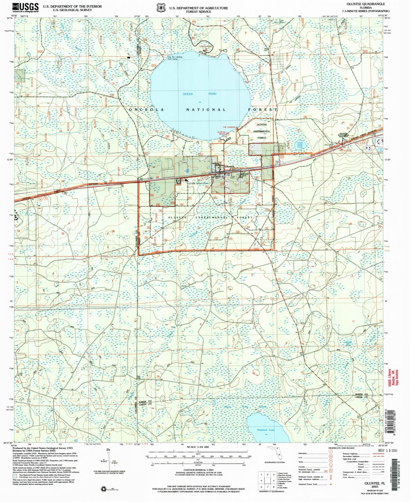
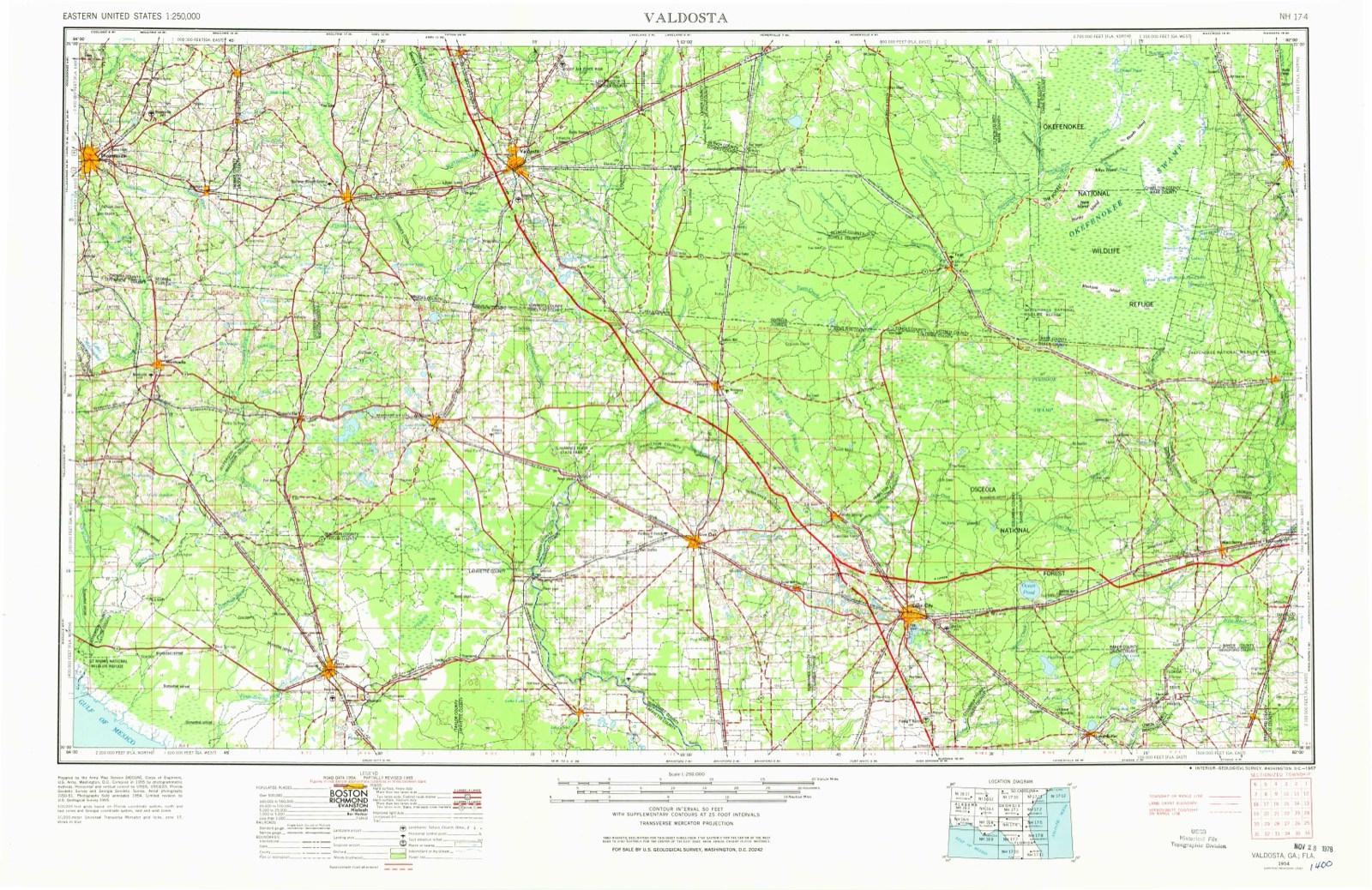
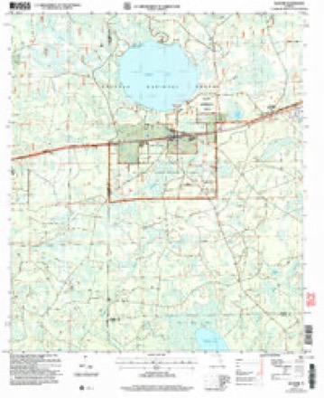
10 topographic sheets cover this place, the earliest surveyed in 1954 and the latest in 2005. It stands in the Sanderson census division. It lies in ZIP code area 32087. The Survey maps it on the Olustee quadrangle. It stands 161 feet above sea level.
Then and now
1954 to 2005The same ground, surveyed 51 years apart. Drag the handle to wipe between them. Both sheets are United States Geological Survey originals; neither has been altered.
Compare 1954 against another survey:
On record in Olustee
Buildings and businesses the archive holds for this place. Each opens its own page, with the source record it came from.
On the National Register 1 record
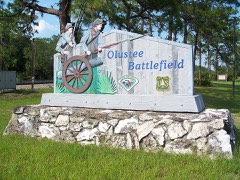 Olustee Battlefieldlisted 1970
Topographic sheets covering this place
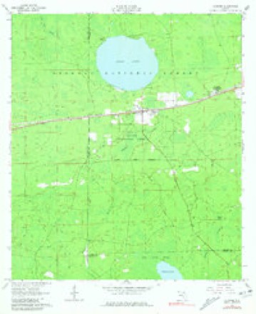
6 surveys from 10 printed sheetsMatched by testing this settlement's coordinate against the published boundary of every sheet in the United States Geological Survey's historical collection. Each opens the scanned sheet at the Survey.
- 1954 USGS Valdosta quadrangle1:250000, 2 printings
- 1958 USGS Valdosta quadrangle1:250000
- 1959 USGS Valdosta quadrangle1:250000
- 1963 USGS Olustee quadrangle1:24000, 3 printings
- 1981 USGS Lake City quadrangle1:100000, 2 printings
- 2005 USGS Olustee quadrangle1:24000
Fires near this place
179 since 1992Regional context, not property-specific evidence. The federal wildfire occurrence database lists 179 fires within 5 miles of Olustee between 1992 and 2020, burning about 1,482 acres in total. 100 started naturally. 20 were recorded as arson. Distance is straight-line from the map coordinates, so a fire counted here may appear on a neighbouring settlement's page as well.
| Reported cause | Fires |
|---|---|
| Natural | 100 |
| Arson/incendiarism | 20 |
| Debris and open burning | 12 |
| Equipment and vehicle use | 12 |
| Power generation/transmission/distribution | 11 |
| Railroad operations and maintenance | 8 |
| Recreation and ceremony | 8 |
| Missing data/not specified/undetermined | 5 |
| Smoking | 3 |
The most recent of them, most recent first, with the day each was reported and the service that recorded it.
| Date | Cause | Size | Reported by | Name on the report |
|---|---|---|---|---|
| 7 September 2011 | Natural | under an acre | National Forests in Florida | VENT |
| 6 September 2013 | Natural | 16 acres | National Forests in Florida | MIDNIGHT |
| 3 September 2012 | Arson/incendiarism | under an acre | National Forests in Florida | HOG PIN |
| 16 September 1997 | Natural | 50 acres | National Forests in Florida | LIGHTS OUT |
| 12 September 1995 | Natural | under an acre | National Forests in Florida | HOLMES |
| 6 August 1997 | Arson/incendiarism | under an acre | National Forests in Florida | BOAT RAMP |
| 3 August 1999 | Natural | 2.0 acres | National Forests in Florida | BASHFUL |
| 26 August 2011 | Natural | under an acre | National Forests in Florida | HOPEWELL CHURCH |
Settlements close enough to share some of these fires:
Specimens collected near this place
12 of 195 shownRegional context, not property-specific evidence. Museums hold 195 specimens collected within 10 miles of Olustee between 1861 and 1975: 74 Animalia, 61 Plantae, 56 Fungi, 3 Unrecorded, 1 Protozoa. 12 distinct Species records are shown. Collected by A. & H. Dietrich, A. H. Antonie, A.E. Daugherty and others. Each is a physical object with a catalogue number, and each entry opens the museum's record. This is what was collected and kept, not a survey of what lives here - nothing can be concluded from a species being absent.
| Image | Species | Year | Collected by | Where, as recorded |
|---|---|---|---|---|
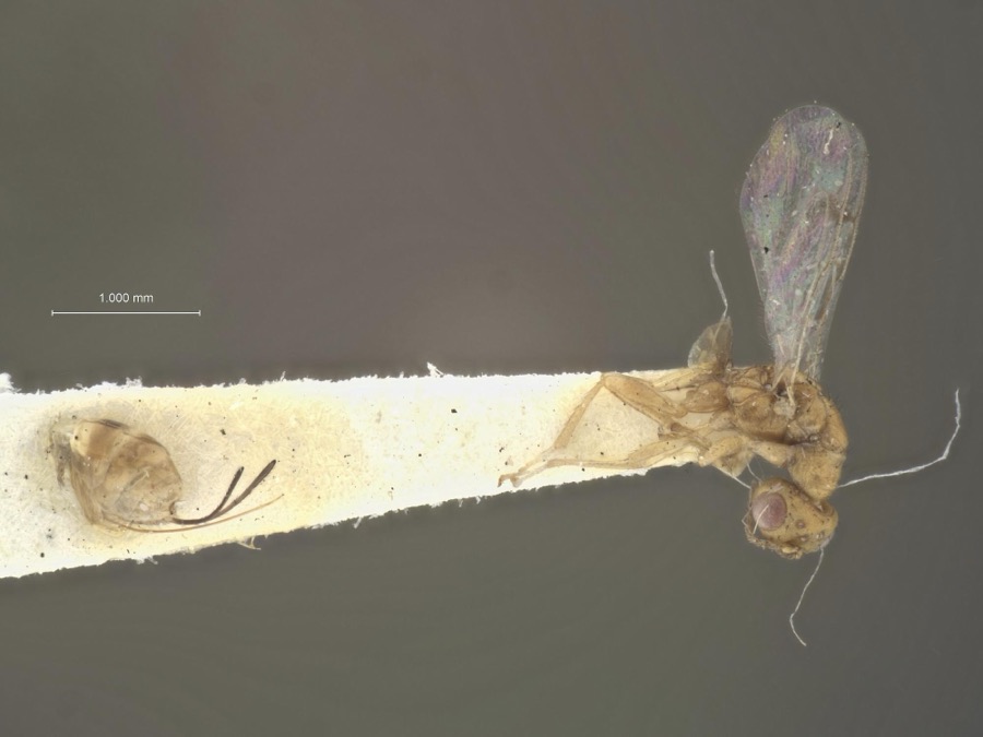 | Megastigmus floridanus Milliron, 1949 | 1929 | J. Kirkland | Osceola |
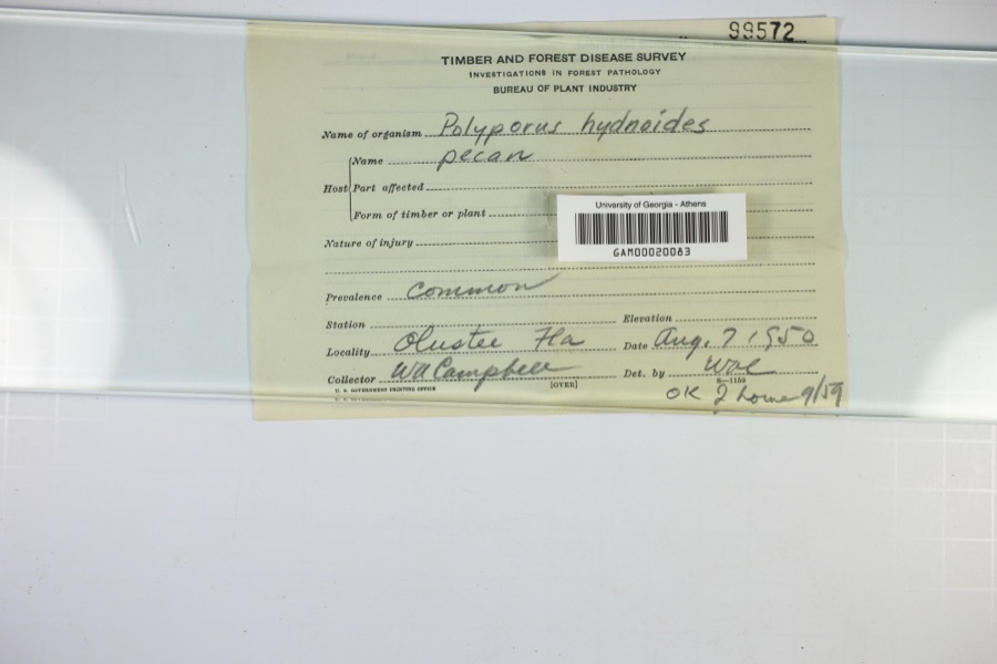 | Polyporus hydnoides (Sw.) Fr. | 1950 | W.A. Campbell | |
| Libellula axilena Westwood, 1837 | 1861 | A. & H. Dietrich | Osceola National Forest, Ocean Pond Camp | |
| Gaylussacia nana (A.Gray) Small | 1934 | L. J. Pessin | Olustee Forest. Plot 58. | |
| Limodorum parviflorum Nash | 1934 | L. Pessin | Olustee National Forest. | |
| Vaccinium arboreum Marshall | 1934 | L. J. Pessin | Olustee Forest. Sect 18, T3S, R20E. | |
| Vaccinium stamineum L. | 1934 | L. Pessin | Olustee Forest. Sect 18, T3S, R20E. | |
| Calopogon pulchellus (Salisb.) R.Br. | 1936 | Allan G. Watkins | Olustee Expt'l Compt. A-1,2; Plot 0-65. | |
| Lyonia fruticosa (Michx.) G.S.Torr. | 1936 | Allan G. Watkins | Olustee Expt'l. Comp't A-1,2; Plot 0-65. | |
.jpg) | Asca von Heyden, 1826 | 1937 | Liefeld, T. A. | Osceola National Forest, Baker Co., FL, U.S.A. |
| Pinus elliottii var. elliottii | 1937 | A. H. Antonie | Olustee | |
| Pinus palustris Mill. | 1937 | A. H. Antonie | Olustee |
All 195 specimens within 10 miles, at the Global Biodiversity Information Facility.
Storms near this place
10 since 2002Regional context, not property-specific evidence. The National Weather Service names Olustee in 10 storm reports between 2002 and 2025: 4 thunderstorm wind, 4 heavy rain, 1 hail, 1 tornado. No death or injury is recorded in these reports. Each account below is quoted exactly as the forecast office filed it, from the NOAA Storm Events Database, and each date opens the federal record of that event.
| When | Event | Place named | Harm | What the report says |
|---|---|---|---|---|
| July 2002 | Thunderstorm Wind | Olustee | $2,000 | Large trees down near Interstate 10. |
| March 2025 | Tornado (EF1) | Olustee | - | At approximately 11:38 AM EDT, a tornado with estimated peak winds|of 90 mph touched down over the Osceola National Forest near NE|Olino Rd, just north of Interstate 10 in Olustee, FL. The tornado|broke off many small branches, snapped tree trunks of many small |pines trees, and ripped the bark off of a medium sized pine tree |at NE Olino Rd near NE Gum Swamp Rd before quickly progressing |northeastward into a heavily forested area. The tornado then |proceeded to snap the trunks of many small pine trees on County |Road 250A as well as a service road just off of CR 250A before |continuing into more dense forest to its northeast. The width of |the tornado's track became much more narrow as it crossed into |far western Baker County and ended near Forest Road 211, where |several more small tree trunks were snapped. |
| January 2025 | Heavy Rain | Olustee | - | Mesonet station OLSF1 Olustee measured 12 hr rainfall as of 6:31 am 1/19/2025 of 5.12 inches. |
| December 2023 | Heavy Rain | Olustee | - | A station in the Olustee Forest measured storm total rainfall of 3.20 inches. |
| November 2023 | Heavy Rain | Olustee | - | A mesonet site near Olustee measured a 24 hour rainfall total of 3.02 inches. |
| April 2019 | Thunderstorm Wind | Olustee | - | Florida State Warning Point reported Interstate 10 East Bound through the Osceola National Forest had to be closed at mile marker 317 due to a downed tree. No injuries or fatalities. |
| November 2019 | Heavy Rain | Olustee | - | Storm total rainfall from a mesonet site at Olustee. |
| July 2016 | Thunderstorm Wind | Olustee | - | Power lines were blown down in Olustee. |
| May 2010 | Thunderstorm Wind | Olustee | - | Five trees were blown down along County Road 250 between the Columbia county line and County Road 229. The time of the event was based on radar imagery. |
| April 2003 | Hail | Olustee | - | no account filed |
Nearest settlements
The eight closest, with where each one stands in the county. Distances are straight-line, computed from the Geographic Names Information System coordinates.
| Map | Place | Distance | Sheets |
|---|---|---|---|
| Okeafenoke Swamp (historical) | 2.6 miles | 10 | |
| Manns Spur | 6.2 miles | 9 | |
| Sanderson | 8.9 miles | 9 | |
| Margaretta | 11.8 miles | 14 | |
| Sapp | 13.5 miles | 12 | |
| Manning | 13.6 miles | 12 | |
| Pine Top | 14.0 miles | 14 | |
| Kenny | 14.4 miles | 14 |
Elsewhere
Matched on this settlement's Geographic Names Information System number rather than its name, so it cannot be a different place of the same name in another state.
| Wikipedia article on Olustee | An encyclopaedic summary. Its text is share-alike, so it is linked here rather than copied. |
| Wikidata item Q7088867 | The structured record the population and elevation above come from. Public domain (CC0). |
Provenance
This settlement is recorded in the Geographic Names Information System as feature 306156. The sheet list is computed by point-in-boundary test against the United States Geological Survey's historical topographic inventory. Both are works of the United States government and carry no copyright under 17 U.S.C. 105.
Wildfire. Short, Karen C. 2022. Spatial wildfire occurrence data for the United States, 1992-2020 [FPA_FOD_20221014]. 6th Edition. Fort Collins, CO: Forest Service Research Data Archive. https://doi.org/10.2737/RDS-2013-0009.6 Collected with United States Government funding and usable without additional permissions or fees.
Specimens. Global Biodiversity Information Facility (GBIF), https://www.gbif.org/. Only records licensed CC0 or CC BY are used. Records licensed CC BY-NC are excluded because this site carries advertising. Images are checked individually and any whose licence is non-commercial, no-derivatives or unreadable is refused.
Storms. NOAA National Centers for Environmental Information, Storm Events Database https://www.ncei.noaa.gov/stormevents/ A work of the United States government, no copyright under 17 U.S.C. 105. Narratives are quoted verbatim from the National Weather Service report and are not edited or summarised.