 Block
BlockPalm Beach Gardens, Florida
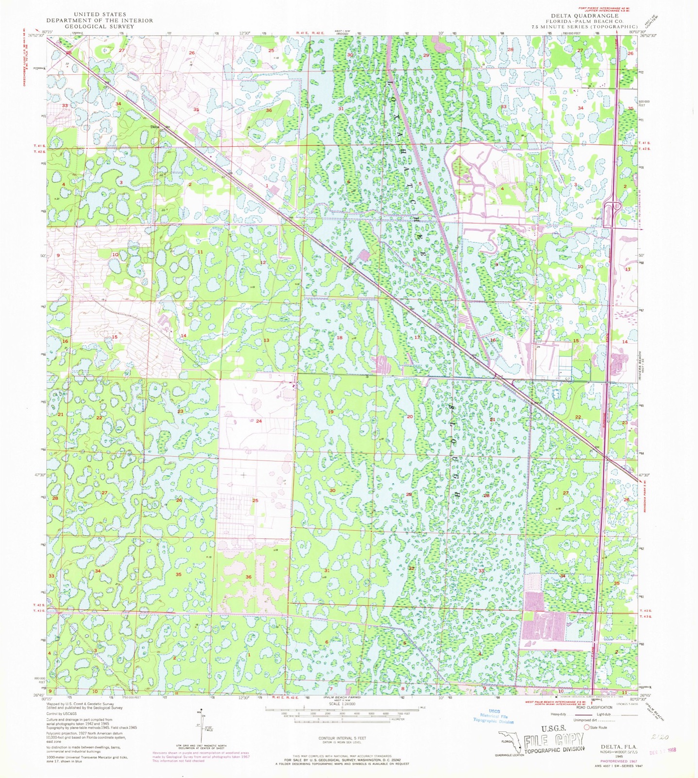
16 topographic sheets cover this place, the earliest surveyed in 1945 and the latest in 1987. It stands in the Royal Palm Beach-West Jupiter census division. It lies in ZIP code area 33418. The Survey maps it on the Delta quadrangle. 59,182 people lived here at the 2020 count. It stands 16 feet above sea level.
Then and now
1945 to 1987The same ground, surveyed 42 years apart. Drag the handle to wipe between them. Both sheets are United States Geological Survey originals; neither has been altered.
Compare 1945 against another survey:
Population over time
2 figuresPalm Beach Gardens grew from 48,452 to 59,182 between 2010 and 2020. These are the recorded population figures Wikidata holds for this place, reached through the Geographic Names Information System number this page is keyed on rather than by name, so they belong to this place and not to another of the same name. Most are census counts, but not all are: an early figure may be a founding or settlement estimate, and an estimate published within five years of a census is left out. The change column is computed, and is left blank where more than 20 years separate a figure from the one before it, because a gap that long is not a change between two counts.
| Year | People | Change |
|---|---|---|
| 2010 | 48,452 | |
| 2020 | 59,182 | +10,730 (+22%) |
Topographic sheets covering this place
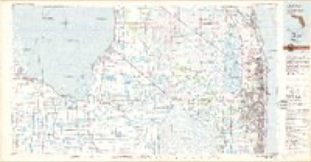
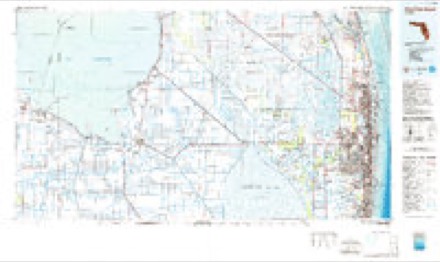
8 surveys from 16 printed sheetsMatched by testing this settlement's coordinate against the published boundary of every sheet in the United States Geological Survey's historical collection. Each opens the scanned sheet at the Survey.
- 1945 USGS Delta quadrangle1:24000, 6 printings
- 1950 USGS Delta quadrangle1:24000
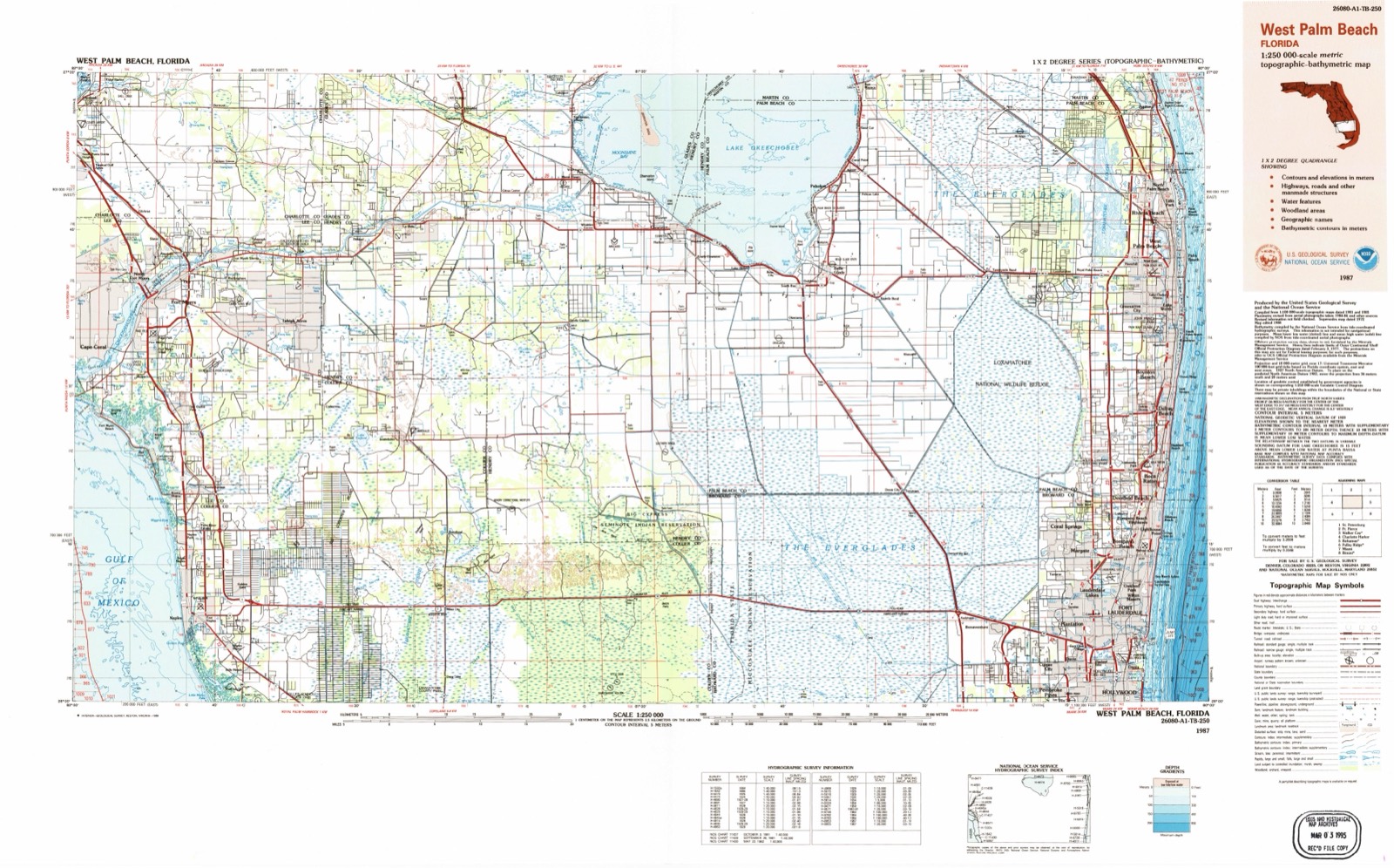
- 1956 USGS West Palm Beach quadrangle1:250000, 2 printings
- 1957 USGS West Palm Beach quadrangle1:250000
- 1958 USGS West Palm Beach quadrangle1:250000, 2 printings
- 1981 USGS West Palm Beach quadrangle1:100000
- 1985 USGS West Palm Beach quadrangle1:100000
- 1987 USGS West Palm Beach quadrangle1:250000, 2 printings




Fires near this place
83 since 1992Regional context, not property-specific evidence. The federal wildfire occurrence database lists 83 fires within 5 miles of Palm Beach Gardens between 1992 and 2017, burning about 1,467 acres in total. 55 started naturally. 4 were recorded as arson. Distance is straight-line from the map coordinates, so a fire counted here may appear on a neighbouring settlement's page as well.
| Reported cause | Fires |
|---|---|
| Natural | 55 |
| Railroad operations and maintenance | 12 |
| Missing data/not specified/undetermined | 4 |
| Arson/incendiarism | 4 |
| Misuse of fire by a minor | 4 |
| Equipment and vehicle use | 3 |
| Smoking | 1 |
The most recent of them, most recent first, with the day each was reported and the service that recorded it.
| Date | Cause | Size | Reported by | Name on the report |
|---|---|---|---|---|
| 7 September 1993 | Railroad operations and maintenance | 1.5 acres | Florida Forest Service | not named |
| 3 September 1998 | Equipment and vehicle use | 6.0 acres | Florida Forest Service | not named |
| 2 September 2004 | Natural | 10 acres | Florida Forest Service | 218 |
| 9 August 1993 | Railroad operations and maintenance | 40 acres | Florida Forest Service | not named |
| 7 August 2009 | Natural | 2.0 acres | Florida Forest Service | HOOD ROAD |
| 7 August 2005 | Natural | 15 acres | Florida Forest Service | SCHOOL CMND |
| 3 August 2006 | Natural | under an acre | Florida Forest Service | SLOUGH COMMD. |
| 21 August 2011 | Natural | 6.0 acres | Florida Forest Service | WATSON (50) |
Settlements close enough to share some of these fires:
Storms near this place
51 since 1994Regional context, not property-specific evidence. The National Weather Service names Palm Beach Gardens in 51 storm reports between 1994 and 2023: 14 thunderstorm wind, 10 hail, 9 funnel cloud, 7 tornado. The reports record 31 injuries. Each account below is quoted exactly as the forecast office filed it, from the NOAA Storm Events Database, and each date opens the federal record of that event.
| When | Event | Place named | Harm | What the report says |
|---|---|---|---|---|
| August 2003 | Tornado (F1) | Palm Beach Gardens | 28 hurt, $80,000,000 | A SKYWARN spotter sighted a funnel cloud that touched down near North Lake Boulevard and North Military Trail. The tornado moved south through the Garden Walk Mobile Home Park then turned southeast and crossed I-95, overturning a semi-tractor trailer. The tornado proceeded east through Riviera Beach damaging the roofs of many houses and businesses. Twenty-eight persons suffered minor injuries, 58 homes were destroyed, 21 homes suffered major damage and 150 homes had minor damage. Several cars and trucks were overturned and damage was estimated at $70-80 million. |
| August 2019 | Lightning | Palm Beach Gardens | 1 hurt | Broadcast media reports a man was critically injured due to a lightning strike. He was injured while walking his dog in Lake Park. The man was transported to a local hospital. |
| August 2005 | Lightning | Palm Beach Gardens | 1 hurt | A 15-year-old boy riding a bicycle in Abacoa was injured by a lightning strike. He was transported to a hospital, treated and released. It was raining heavily at the time. |
| June 1996 | Lightning | Palm Beach Gardens | 1 hurt | no account filed |
| January 1999 | Flash Flood | Palm Beach Gardens | $1,900,000 | Torrential rainfall from a nearly stationary line of thunderstorms dropped an estimated 10 to 15 inches of rain, most of it falling within a two hour period, in the Highland Pines Subdivision in Palm Beach Gardens. Initially, a South Florida Water Management gage measured 31 inches of rain, but subsequent reanalysis indicated the gage reading was about 50% too high. A total of 136 buildings suffered flood damage as well as numerous vehicles. Streets were closed and I-95 was partially closed by a large sinkhole. |
| April 2023 | Tornado (EF2) | Palm Beach Gardens | $250,000 | The tornado began in eastern Palm Beach Gardens, just east of Interstate 95, and moved northeast across A1A, passing just south of the Palm Beach Gardens Medical Center. As it moved through the Sanctuary Cove community, it crossed State Road 786 (PGA Boulevard) near the intersection with US-1. After a short trek up US-1, the tornado dissipated before reaching Juno Beach. Light tree damage consistent with an EF-0 was noted near the determined starting point of the tornado. The tornado strengthened quickly to an EF1 as it moved through the Gardens East apartment complex. Significant tree damage ranging from uprooted trees to snapped trunks were noted in this community. The tornado then moved through the Sandalwood Estates |community off of Burns road. Quite a bit of tree debris was scattered throughout this community, with several large trees completely uprooted. One notable damage indicator was a greater than 3 inch diameter branch that pierced the metal roof of a |residence. A countless number of large branches were stripped from trees throughout the community with a few snapped trunks near the worst of the damage in this area. The tornado then moved through the Rainwood community where a home suffered broken windows and had many shingles removed. Similar tree damage continued into this neighborhood.||When the tornado crossed Prosperity Farms Road and entered the Sanctuary Cove community, this was where it strengthened to EF-2 intensity reaching an estimated peak wind of 130 mph. Some of the most substantial structural damage was noted here with collapsed roofs, broken windows, removed roofing material, and debarking of trees. The EF2 tornado then cross the North Palm Beach Waterway where it completely destroyed a manufactured home along the canal bank. As the tornado moved NNE it crossed into the Point at Palm Beach Gardens community where it created minor structural damage to the complex, but had some of its most photographed moments as |cars were displaced, flipped, and stacked on each other. The tornado then moved through the City Centre where considerable tree, light post, and street sign damage was noted. As it crossed PGA Blvd the tornado destroyed a dry cleaners business, collapsed large light poles, and even caused a concrete electrical pole to lean. The last notable damage was still at EF2 strength when the tornado crossed US 1 and caused two cars to be flipped and displaced on the opposite side of US 1. Several videos of the |incident were witnessed, as well as one from inside the vehicle, and the survey crew was able to interview one of the drivers. The tornado quickly lifted after crossing US 1 where it caused minor tree damage in a shopping center. Damage value is estimated based on the number of structures, vehicles, and trees damaged. |
| April 2022 | Tornado (EF0) | Palm Beach Gardens | $153,000 | A tornado developed from a south-moving thunderstorm over northern Palm Beach County. The tornado touched down in the area of Burns Road in Palm Beach Gardens, producing roof, awning, and fence damage to an apartment complex and adjacent community center. There was substantial damage at the community center to light poles, fences, bleachers, pool equipment, and playground equipment. The tornado then passed over the property of Palm Beach Gardens High School where a wind gust of 78 mph was recorded. Damage at the school was primarily to trees and fences. The tornado continued to produce tree damage along Military Trail until lifting near the St. Ignatius Loyola Cathedral south of Holly Drive.||It was determined to be a high-end EF-0 with maximum winds estimated around 85 mph. Damage amounts were provided by Palm Beach Gardens PD and emergency management officials. |
| March 2009 | Tornado (EF0) | Palm Beach Gardens | $75,000 | A tornado touched down in Palm Beach Gardens in the Ballenisles Golf Country Club near Holly and Seagrape Drives. The tornado moved southeast, moving across Military Trail and Lilac Street, and lifted near Palm Beach Gardens High School. Minor roof damage was noted to a few residential buildings, as well as trees uprooted and a fence blown over near Palm Beach Gardens High School. Final tornado rating was EF0 based on Emergency Manager survey and analysis of damage photos. |
| July 2014 | Lightning | Palm Beach Gardens | $20,000 | Two cars were set on fire after lightning hit a power pole, dropping power lines on top of the vehicles. |
| October 2014 | Flash Flood | Palm Beach Gardens | $5,000 | Torrential rainfall during the afternoon hours led to flash flooding in and near downtown West Palm Beach and as far north as Riviera Beach. Palm Beach County Sheriff's Office closed several roads in the area, including the area of Australian Avenue and 45th Street in West Palm Beach. Main impact was from impassable streets with no reports of significant structural flooding. Measured rainfall amounts were in the 5 to 8 inch range in less than 6 hours, with rainfall rates of 4-5 inches per hour during the height of the event. Maximum measured rainfall total was 8.78 inches in the northern West Palm Beach area near the Intracoastal Waterway.||Damage total is estimated and based primarily on reports of impassable streets and stalled vehicles. |
| June 1994 | Hail | Palm Beach Gardens | $5,000 | Nickel-size hail reported in Palm Beach Gardens. |
| July 2021 | Thunderstorm Wind | Palm Beach Gardens | $2,000 | A thunderstorm wind gust of 58 mph (50 kt) was measured by the Mesonet station WPSHS at Suncoast Community High School. |
| July 2021 | Thunderstorm Wind | Palm Beach Gardens | $2,000 | A thunderstorm wind gust of 61 mph (53 kt) was measured by the Mesonet station PLMGR at Palm Beach Gardens High School. |
| September 2012 | Thunderstorm Wind | Palm Beach Gardens | $500 | Two palm trees were downed by strong thunderstorm wind gusts in the western suburbs of Palm Beach County near the intersection of Northlake Boulevard and Ibis Boulevard. |
| April 2023 | Hail | Palm Beach Gardens | - | Dime to nickel sized hail was observed at Watkins Middle School in Palm Beach Gardens. |
| April 2023 | Hail | Palm Beach Gardens | - | Palm Beach SKYWARN spotter reported up to quarter sized hail at Prosperity Farms Road and Northlake Boulevard. |
| April 2023 | Thunderstorm Wind | Palm Beach Gardens | - | The Palm Beach Emergency Operations Center reported trees and powerlines down, which were blocking westbound lanes of Alternate A1A in Palm Beach Gardens. |
| April 2023 | Hail | Palm Beach Gardens | - | Penny to golf ball sized hail was reported by the public in Palm Beach Gardens. |
| April 2022 | Thunderstorm Wind | Palm Beach Gardens | - | A wind gust of 78 mph was recorded by the Earth Networks site PLMGR at Palm Beach Gardens High School in association with the tornado which moved through the area. |
| July 2022 | Thunderstorm Wind | Palm Beach Gardens | - | A member of the public reported healthy tree limbs broken from strong thunderstorm winds in the Palm Beach Gardens area. |
| April 2020 | Hail | Palm Beach Gardens | - | Reports and photos received from broadcast media of quarter size hail in Palm Beach Gardens. |
| April 2020 | Hail | Palm Beach Gardens | - | Reports received from the public of quarter size hail in Lake Park and at the FITTEAM Ballpark of the Palm Beaches. |
| April 2020 | Thunderstorm Wind | Palm Beach Gardens | - | A ham radio operator relayed a report of tree damage at the intersection of Northlake Blvd and Ibis Blvd. |
| April 2020 | Thunderstorm Wind | Palm Beach Gardens | - | A thunderstorm wind gust of 62 mph/ 54 knots was recorded by the Weatherbug site RVRPB, located at the Riviera Beach Emergency Operations Center. |
| December 2019 | Flood | Palm Beach Gardens | - | Heavy rainfall in northeastern Palm Beach County led to 4 to 6 inches of rain in approximately 6 hours. This rainfall led to street flooding and standing water over much of this area, including water flowing over curbs near the corner of West Indiantown Road and Maplewood Drive in Jupiter, street flooding at the corner of Ardley Road and Tudor Road in Juno Beach, at least one foot of moving water on roads near the intersection of Frederick Small Road and Military Trail, and water close to encroaching on structures in Riviera Beach. |
| February 2015 | Thunderstorm Wind | Palm Beach Gardens | - | Social media reports estimated winds at the PGA National Golf Course reached 60 mph during the third round of the PGA Tour's Honda Classic. At least one large tree was uprooted on the course, with minor damage to tents and other outdoor items. |
| August 2015 | Funnel Cloud | Palm Beach Gardens | - | Photos received via social media of small funnel clouds near Riviera Beach. |
| August 2015 | Funnel Cloud | Palm Beach Gardens | - | Photos received via broadcast and social media show funnel cloud in Riviera Beach. |
| August 2015 | Tornado (EF0) | Palm Beach Gardens | - | Video and eyewitness reports show brief tornado touchdown over landfill west of Florida Turnpike near Dyer Park. No reported damage. Duration and location estimated from video and reports. |
| November 2015 | Heavy Rain | Palm Beach Gardens | - | Broadcast media relayed public report and picture of road flooding at the intersection of Prosperity Farms Road and 10th Ave in Lake Park around 5pm. Picture showed several inches of water covering the intersection which appeared to be barely passable at the time. |
| September 2014 | Funnel Cloud | Palm Beach Gardens | - | Broadcast media relayed video and picture of a funnel cloud in the area of Northlake Blvd and I-95. |
| August 2014 | Funnel Cloud | Palm Beach Gardens | - | A member of the public relayed a report of a brief funnel cloud via social media in Palm Beach Gardens. |
| June 2012 | Thunderstorm Wind | Palm Beach Gardens | - | A severe thunderstorm produced a wind gust estimated at 60 mph. A railroad crossing arm was snapped along State Road 710 6 miles west northwest of Riviera Beach. |
| June 2012 | Thunderstorm Wind | Palm Beach Gardens | - | A severe thunderstorm produced an estimated wind gust of 60 mph. A large tree was uprooted at the PGA National Golf Club in Palm Beach Gardens. |
| March 2009 | Thunderstorm Wind | Palm Beach Gardens | - | Power lines were downed along Military Trail between Blue Heron and 45th Streets. |
| March 2009 | Flash Flood | Palm Beach Gardens | - | Significant flooding was reported in the Palm Beach Gardens and North Palm Beach areas. Flooding was most severe in the area of Pearl Street and Riverside Drive, and along US 1 near PGA Boulevard. Water reached the windows of cars in some cases. The flooding along US 1 was exacerbated by construction on the highway. |
| June 2009 | Thunderstorm Wind | Palm Beach Gardens | - | Power lines were reported down in Palm Beach Gardens. Time estimate based on radar data. |
| January 2005 | Funnel Cloud | Palm Beach Gardens | - | The public reported several funnel clouds. |
| August 2004 | Tornado (F0) | Palm Beach Gardens | - | A brief tornado touchdown was observed near the intersection of Seminole-Pratt Road and Northlake Boulevard. |
| August 2003 | Funnel Cloud | Palm Beach Gardens | - | The Office of Emergency Management reported several funnel clouds. |
| March 2003 | Funnel Cloud | Palm Beach Gardens | - | Funnel clouds were reported in Palm Beach Gardens and Wellington. |
| March 2003 | Hail | Palm Beach Gardens | - | A SKYWARN spotter saw quarter-size hail. |
| July 2003 | Hail | Palm Beach Gardens | - | Quarter-size hail fell near the intersection of the Beeline Expressway and SR 786. |
| May 2000 | Tornado (F0) | Palm Beach Gardens | - | Emergency Management Official and newspaper reporter sighted a brief tornado touch down. |
| February 1998 | Funnel Cloud | Palm Beach Gardens | - | Three funnel clouds were spotted by teacher at H.L. WATKINS Middle School 9480 Macarther BLVD. |
| March 1995 | Hail | Palm Beach Gardens | - | Nickel-size hail reported near junction of Donald Ross Road and Interstate 95. |
| March 2005 | Thunderstorm Wind | Palm Beach Gardens | - | no account filed |
| March 2005 | Hail | Palm Beach Gardens | - | no account filed |
| June 2000 | Wildfire | Palm Beach Gardens | - | no account filed |
| October 1999 | Flash Flood | Palm Beach Gardens | - | no account filed |
| July 1999 | Funnel Cloud | Palm Beach Gardens | - | no account filed |
Nearest settlements
The eight closest, with where each one stands in the county. Distances are straight-line, computed from the Geographic Names Information System coordinates.
| Map | Place | Distance | Sheets |
|---|---|---|---|
| Monet | 2.6 miles | 14 | |
| North Palm Beach | 3.0 miles | 14 | |
| Palm Lake Estates South | 3.6 miles | 14 | |
| Lake Park | 4.1 miles | 14 | |
| Gramercy Park | 4.3 miles | 14 | |
| Juno Ridge | 4.4 miles | 14 | |
| North Palm Beach Heights | 4.6 miles | 16 | |
| Juno Isles | 5.0 miles | 14 |
Elsewhere
Matched on this settlement's Geographic Names Information System number rather than its name, so it cannot be a different place of the same name in another state.
| Wikipedia article on Palm Beach Gardens | An encyclopaedic summary. Its text is share-alike, so it is linked here rather than copied. |
| Wikidata item Q994159 | The structured record the population and elevation above come from. Public domain (CC0). |
Provenance
This settlement is recorded in the Geographic Names Information System as feature 302681. The sheet list is computed by point-in-boundary test against the United States Geological Survey's historical topographic inventory. Both are works of the United States government and carry no copyright under 17 U.S.C. 105.
Wildfire. Short, Karen C. 2022. Spatial wildfire occurrence data for the United States, 1992-2020 [FPA_FOD_20221014]. 6th Edition. Fort Collins, CO: Forest Service Research Data Archive. https://doi.org/10.2737/RDS-2013-0009.6 Collected with United States Government funding and usable without additional permissions or fees.
Storms. NOAA National Centers for Environmental Information, Storm Events Database https://www.ncei.noaa.gov/stormevents/ A work of the United States government, no copyright under 17 U.S.C. 105. Narratives are quoted verbatim from the National Weather Service report and are not edited or summarised.