BlockBefore
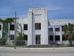
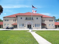
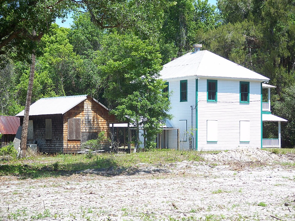
Photograph of Sanchez Homestead
Photograph by Ebyabe, CC BY 2.5. Via Wikimedia Commons.

Sanchez Homestead

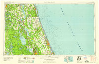
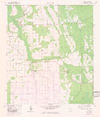
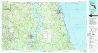
Listed on the National Register of Historic Places in 2001. 8 historic topographic surveys show this location, the earliest from 1937.

From the record

“The Sanchez Homestead is a historic site in Elkton, Florida, United States. It is located at 7270 Old State Road 207.”

Wikipedia article Sanchez Homestead, CC BY-SA 4.0.

One of 51 National Register listings published here for St. Johns County · listed in 2001 · category: Building.

Sources: the Wikipedia article · the case file at the National Archives · the National Register database, National Park Service


The listing

  • What is counted as historic. The nomination lists 5 buildingss, 3 structuress, 1 site as contributing to the listing.
  • Address. 7270 Old State Rd. 207, Elkton, 32033
  • When was it listed? October 2001
  • Category. building
  • Census division. Hastings
  • Architectural style. vernacular architecture
  • National Register reference number. 01001083 - the number the National Park Service assigned this property when it was listed, and the key its nomination file is catalogued under at the National Archives.

Fires near this property

103 since 1992

Regional context, not property-specific evidence. The federal wildfire occurrence database lists 103 fires within 5 miles of Sanchez Homestead between 1992 and 2020, burning about 1,723 acres in total. 36 started naturally. 6 were recorded as arson. Distance is straight-line from the map coordinates, so a fire counted here may appear on a neighbouring settlement's page as well.

Reported cause Fires
Natural36
Railroad operations and maintenance15
Equipment and vehicle use15
Debris and open burning13
Missing data/not specified/undetermined11
Power generation/transmission/distribution6
Arson/incendiarism6
Misuse of fire by a minor1

The most recent of them, most recent first, with the day each was reported and the service that recorded it.

DateCause SizeReported by Name on the report
4 September 1993Natural2.0 acresFlorida Forest Servicenot named
26 September 2009Equipment and vehicle useunder an acreFlorida Forest Service821
17 September 2008Natural4.0 acresFlorida Forest ServiceWF HUTCHSON
3 August 2014Power generation/transmission/distributionunder an acreFlorida Forest Service305 FIRE 2 (55)
3 August 2014Power generation/transmission/distribution3.0 acresFlorida Forest Service305 FIRE 1 (55)
23 August 1993Natural6.0 acresFlorida Forest Servicenot named
23 August 1993Natural15 acresFlorida Forest Servicenot named
20 August 1999Naturalunder an acreFlorida Forest Servicenot named

Every fire recorded in St. Johns County

Storms near this property

22 since 1998

Regional context, not property-specific evidence. The National Weather Service names Elkton, the town this property stands in, in 22 storm reports between 1998 and 2025: 14 thunderstorm wind, 3 hail, 3 tornado, 2 funnel cloud. No death or injury is recorded in these reports. Each account below is quoted exactly as the forecast office filed it, from the NOAA Storm Events Database, and each date opens the federal record of that event.

WhenEvent Place namedHarm What the report says
May 2013Tornado (EF0)Elkton$500,000A barn was severely damaged at Jen-Sar Farms and Produce store. A large barn was destroyed with noticeable debris lofted into nearby structures. A large tree was snapped at its base and fell on a mobile home causing significant damage by splitting the unit in two. Multiple trees were uprooted and fell on a boat near Elkton. The cost of damage was estimated, and is likely underestimated.
June 1998Thunderstorm WindElkton$4,000Shed destroyed.
June 1998Thunderstorm WindElkton$500Large trees were blown down along CR 13.
August 2020Thunderstorm WindElkton$10Tree limbs were blown down along County Road 305. The cost of damage was unknown but estimated for inclusion in Storm Data.
June 2025Thunderstorm WindElkton-Several trees were blown down near County Rd 13A and County Rd 305. The time of damage was based on radar.
May 2024Thunderstorm WindElkton-Trees and power lines were blown down near County Road 305 in Elkton.
April 2023HailElkton-The public submitted a social media image of hail on the ground.
July 2022Funnel CloudElkton-A narrow funnel cloud was reported with a thunderstorm west of St. Augustine. Radar estimated location.
December 2019Tornado (EF0)Elkton-The tornado appeared to have touched down shortly after 5 am and tracked ENE from near the SW corner of Saint Ambrose Church Road and County Road 305 and ended just east of County Road 207. A trained storm spotter reported a tornado on the ground near State Road 207 and County Road 305 in Elkton around 5:05 am. Tree debris, shingles and part of a tin roof were reported in trees and across the ground. A kitchen and bath store in Elkton sustained major roof damage as well as damage to their supplies stored outdoors including solid surface countertops. The official NWS Storm Survey estimated peak winds around 85 mph (EF0) and reported road signs that were bent and/or twisted in Elkton. Metal roof panels were stripped off of a building and thrown over a fence. A door was also extracted from a building.
July 2017Thunderstorm WindElkton-A power company truck was damaged by a tree limb that was blown down.
May 2016Thunderstorm WindElkton-Several trees were blown down in Elkton. Two were blown down near Saint Ambrose Church Road and one was blown down near County Road 13 South.
June 2015Tornado (EF0)Elkton-A brief tornado was reported near Meadowbrook Road and State Road 207. A packing shed was destroyed, a potato field was damaged, and the tornado also destroyed a shed and damaged a metal constructed structure near 6106 County Road 305. Estimated winds were near 80 mph. The cost of damage was unknown.
June 2015Thunderstorm WindElkton-Strong rear flank downdraft winds blew down trees following a brief tornado touchdown.
July 2014Thunderstorm WindElkton-A storm survey determined that a microburst produced straight line winds estimated at 70-80 mph. Damage included tow barns partially collapsed, one downed tree, and bent power lines. Damage was not noted upstream nor downstream of this location. Damage occurred along County Road 305 south of State Road 207. The cost of damage was unknown.
May 2013Thunderstorm WindElkton-Trees and power lines were blown down along State Route 207. The time is estimated from radar imagery.
May 2013Thunderstorm WindElkton-Over 60 reports of power lines damaged from fallen trees and strong winds were reported over the southwest portion of St. Johns county. The time of damage was based on radar.
June 2011Thunderstorm WindElkton-Trees and a power line were blown down near State Road 206.
June 2009HailElkton-Quarter size hail was reported in Elkton near State Road 207.
July 2007Thunderstorm WindElkton-Numerous trees were blown down in Elkton. Power lines were blown down near Hastings.
May 2007HailElkton-Duval county Emergency Management witnessed penny size while traveling north on Interstate 95 near the State Road 16 exit in front of the St. Augustine Outlet Mall complex.
July 2006Thunderstorm WindElkton-no account filed
April 2005Funnel CloudElkton-no account filed

Every storm recorded in St. Johns County

Maps showing this location

8 surveys

United States Geological Survey topographic sheets whose coverage includes this point. Matched by taking the coordinate the National Park Service records for this property, then testing that coordinate against the published boundary of every sheet.

Listed places nearby

2 within 8 miles

Other National Register properties close enough to walk or drive between, ordered by distance from this one. Both positions come from the same geocoding pass that matched these properties to their map sheets.

Photograph PropertyDistance Listed
Hastings Community Center2.3 miles2007
Hastings High School2.4 miles2006

Sources for this property

National Archives recordThe nomination case file for reference 01001083 in Record Group 79.
Wikipedia articleCommunity-written account of this property, licensed CC BY-SA.
St. Johns CountyAll 51 listed properties in this county.

Provenance

  • Listing record. National Park Service National Register of Historic Places, listed-properties dataset, current to 2026-05-22.
  • Map join. Address geocoded through the United States Census geocoder, then tested against the published boundary of every sheet in the USGS Historical Topographic Map Collection.
  • How this page is made. Listing fields come from federal records; map-sheet coverage is a labelled coordinate-to-boundary calculation, not a source-field claim.
  • Wildfire. Short, Karen C. 2022. Spatial wildfire occurrence data for the United States, 1992-2020 [FPA_FOD_20221014]. 6th Edition. Fort Collins, CO: Forest Service Research Data Archive. https://doi.org/10.2737/RDS-2013-0009.6 Collected with United States Government funding and usable without additional permissions or fees.
  • Storms. NOAA National Centers for Environmental Information, Storm Events Database https://www.ncei.noaa.gov/stormevents/ A work of the United States government, no copyright under 17 U.S.C. 105. Narratives are quoted verbatim from the National Weather Service report and are not edited or summarised.