BlockBefore
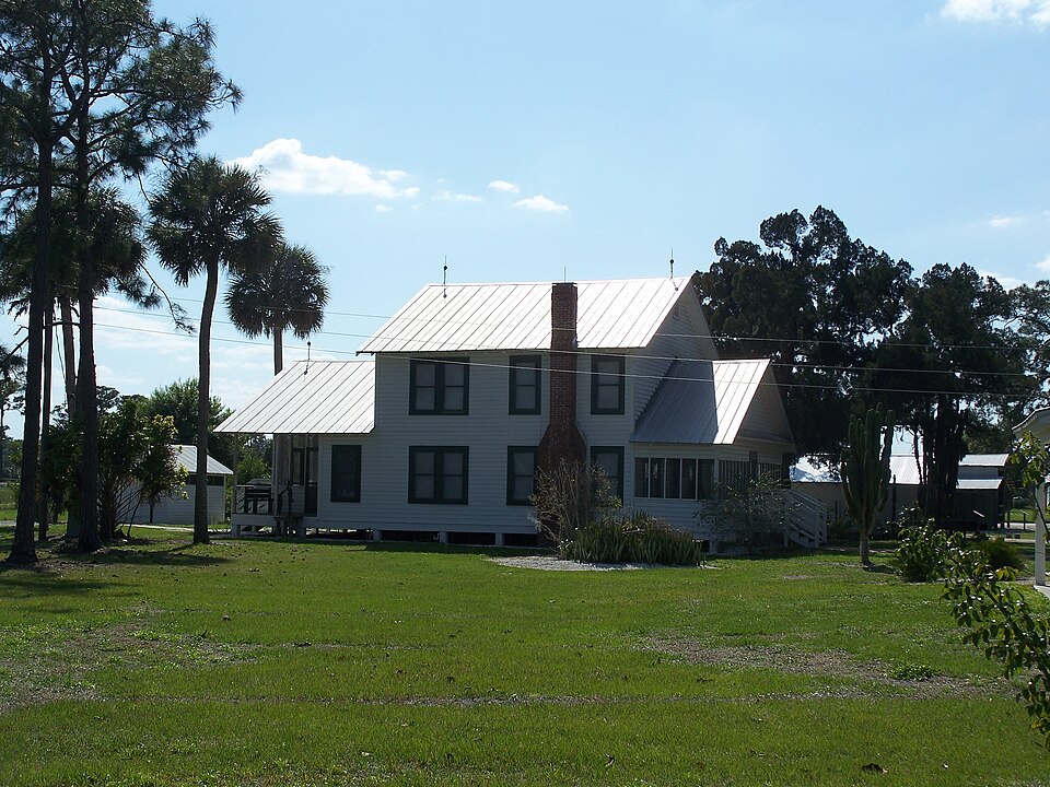
Photograph of Roberts Ranch
Photograph by Ebyabe, CC BY-SA 3.0. Via Wikimedia Commons.

Roberts Family Home/Main House

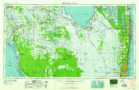
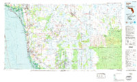
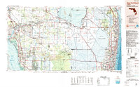
Listed on the National Register of Historic Places in 2003. 6 historic topographic surveys show this location, the earliest from 1956.

From the record

One of 12 National Register listings published here for Collier County · listed in 2003 · category: Building.

Sources: the case file at the National Archives · the National Register database, National Park Service · the Wikipedia article

The listing

  • What is counted as historic. The nomination lists 9 buildingss, 3 structuress as contributing to the listing.
  • Still standing. The Park Service records this property as extant.
  • Address. 1215 Roberts Ave., Immokalee, 34142
  • When was it listed? October 2003
  • Category. building
  • Census division. Immokalee
  • National Register reference number. 03000990 - the number the National Park Service assigned this property when it was listed, and the key its nomination file is catalogued under at the National Archives.

Fires near this property

147 since 1992

Regional context, not property-specific evidence. The federal wildfire occurrence database lists 147 fires within 5 miles of Roberts Family Home/Main House between 1992 and 2020, burning about 2,237 acres in total. 21 started naturally. 22 were recorded as arson. Distance is straight-line from the map coordinates, so a fire counted here may appear on a neighbouring settlement's page as well.

Reported cause Fires
Railroad operations and maintenance47
Arson/incendiarism22
Missing data/not specified/undetermined21
Natural21
Equipment and vehicle use18
Debris and open burning7
Misuse of fire by a minor7
Recreation and ceremony4

The most recent of them, most recent first, with the day each was reported and the service that recorded it.

DateCause SizeReported by Name on the report
16 September 1996Railroad operations and maintenanceunder an acreFlorida Forest Servicenot named
15 September 1996Railroad operations and maintenanceunder an acreFlorida Forest Servicenot named
12 September 1992Natural5.0 acresFlorida Forest Servicenot named
11 September 2005Recreation and ceremony5.0 acresFlorida Forest Service11/15TH ST FIRE/ CUMMINGS
8 August 2018Natural10 acresFlorida Forest ServiceCOGAN (11)
7 August 1998Equipment and vehicle useunder an acreFlorida Forest Servicenot named
13 August 1998Naturalunder an acreFlorida Forest Servicenot named

Every fire recorded in Collier County

Storms near this property

30 since 1993

Regional context, not property-specific evidence. The National Weather Service names Immokalee, the town this property stands in, in 30 storm reports between 1993 and 2024: 12 thunderstorm wind, 9 funnel cloud, 4 hail, 2 flash flood. The reports record 1 death and 2 injuries. Each account below is quoted exactly as the forecast office filed it, from the NOAA Storm Events Database, and each date opens the federal record of that event.

WhenEvent Place namedHarm What the report says
April 2003LightningImmokalee1 killed, 2 hurtA 52-year old Mexican national was killed while working near a ditch at a farm two miles from Oil Well Road. Two other men standing about 10 feet away were injured by the same lightning strike. It was raining heavily at the time. It was raining heavily at the time.
March 1998Thunderstorm WindImmokalee$100,000At Immokalee Regional Airport one aircraft destroyed and 3 aircraft damaged. A metal building was also damaged. One quarter mile away a feed and supply store reported roof damage.
May 1993Thunderstorm WindImmokalee$50,000Strong thunderstorm winds stripped insulation from the roof of a house and uprooted several trees, one of which fell on a car.
June 2011Thunderstorm WindImmokalee$38,000Numerous reports of tree branches and trees were blown down across the Naples, Golden Gate Estates, and Immokalee areas. Power lines reported down throughout Naples metro. Rainfall amounts between 2.5 and 4 inches have also been reported.
May 2007Thunderstorm WindImmokalee$10,000A roof was blown off a business building.
May 1996Thunderstorm WindImmokalee$10,000no account filed
May 2024Thunderstorm WindImmokalee$3,000A survey crew found wind damage consistent with a downburst of up to 70 mph / 61 knots after a severe thunderstorm went through Immokalee. The straight-line wind damage started just west of 9th Street and went between Main and Colorado until about 4th St. Several medium to large tree limbs were broken, with power lines and poles knocked down, and tents blown over.
May 2024FloodImmokalee-Several pictures and videos on social media of flooded streets and parking lots after a strong thunderstorm slowly moved through the area.
May 2024Funnel CloudImmokalee-A video on social media showed a funnel cloud over Ave Maria as a thunderstorm moved through the area.
June 2023HailImmokalee-Report relayed from broadcast media of hail up to 1 inch in diameter in Immokalee.
January 2016Thunderstorm WindImmokalee-Gust to 79 mph (69kts) was recorded at the Seminole Tribe Reservation in Immokalee.
March 2014Thunderstorm WindImmokalee-A thunderstorm wind gust of 58 mph was reported at the weatherbug station in Immokalee.
May 2013Thunderstorm WindImmokalee-Twitter report received of strong winds causing tree damage in Ave Maria. A 20-foot tree was split in half and a few smaller trees were uprooted.
June 2011Thunderstorm WindImmokalee-One and a half to two feet in diameter pines trees were reported down in the Immokalee area. Trees were also blown down and onto trailers and a car causing damage.
May 2005Funnel CloudImmokalee-A funnel cloud was sighted near the intersection of County Roads 846 and 858.
June 2004Funnel CloudImmokalee-A funnel cloud was seen.
June 2004Thunderstorm WindImmokalee-A severe thunderstorm wind gust was measured by a FAWN station in Immokalee.
November 2003Funnel CloudImmokalee-Emergency Manager reported a funnel cloud near Immokalee.
July 2002Funnel CloudImmokalee-The Florida Highway Patrol reported a funnel cloud.
September 2000Funnel CloudImmokalee-A funnel cloud was sighted.
June 1998Thunderstorm WindImmokalee-Numerous trees and powerlines were downed over western Collier County.
July 1998Funnel CloudImmokalee-Funnel cloud observed south of Immokalee.
August 1998WaterspoutImmokalee-Waterspout observed touching down briefly on Lake Trafford.
October 1997Funnel CloudImmokalee-observed by collier county emergency management near lake trafford.
September 1997Funnel CloudImmokalee-reported by storm spotter.
June 2009HailImmokalee-no account filed
July 2009HailImmokalee-no account filed
August 2006Flash FloodImmokalee-no account filed
July 2000Flash FloodImmokalee-no account filed
July 1997HailImmokalee-no account filed

Every storm recorded in Collier County

Maps showing this location

6 surveys

United States Geological Survey topographic sheets whose coverage includes this point. Matched by taking the coordinate the National Park Service records for this property, then testing that coordinate against the published boundary of every sheet.

Sources for this property

National Archives recordThe nomination case file for reference 03000990 in Record Group 79.
Wikipedia articleCommunity-written account of this property, licensed CC BY-SA.
Collier CountyAll 12 listed properties in this county.

Provenance

  • Listing record. National Park Service National Register of Historic Places, listed-properties dataset, current to 2026-05-22.
  • Map join. Address geocoded through the United States Census geocoder, then tested against the published boundary of every sheet in the USGS Historical Topographic Map Collection.
  • How this page is made. Listing fields come from federal records; map-sheet coverage is a labelled coordinate-to-boundary calculation, not a source-field claim.
  • Wildfire. Short, Karen C. 2022. Spatial wildfire occurrence data for the United States, 1992-2020 [FPA_FOD_20221014]. 6th Edition. Fort Collins, CO: Forest Service Research Data Archive. https://doi.org/10.2737/RDS-2013-0009.6 Collected with United States Government funding and usable without additional permissions or fees.
  • Storms. NOAA National Centers for Environmental Information, Storm Events Database https://www.ncei.noaa.gov/stormevents/ A work of the United States government, no copyright under 17 U.S.C. 105. Narratives are quoted verbatim from the National Weather Service report and are not edited or summarised.