Block
BlockFrom the record
One of 50 National Register listings published here for Monroe County · listed in 2004 · category: District.
Sources: the case file at the National Archives · the National Register database, National Park Service
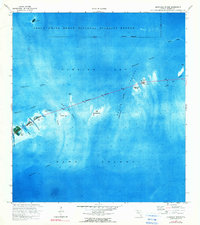
Listed on the National Register of Historic Places in 2004. 3 historic topographic surveys show this location, the earliest from 1972.
One of 50 National Register listings published here for Monroe County · listed in 2004 · category: District.
Sources: the case file at the National Archives · the National Register database, National Park Service
Regional context, not property-specific evidence. The federal wildfire occurrence database lists 2 fires within 5 miles of Overseas Highway and Railway Bridges (Boundary Increase) between 2001 and 2014, burning under an acre in total. None started naturally. None was recorded as arson. Distance is straight-line from the map coordinates, so a fire counted here may appear on a neighbouring settlement's page as well.
| Reported cause | Fires |
|---|---|
| Debris and open burning | 1 |
| Fireworks | 1 |
The most recent of them, most recent first, with the day each was reported and the service that recorded it.
| Date | Cause | Size | Reported by | Name on the report |
|---|---|---|---|---|
| 4 July 2014 | Fireworks | under an acre | Florida Forest Service | OHIO KEY (44) |
| 1 March 2001 | Debris and open burning | under an acre | Florida Forest Service | not named |
Regional context, not property-specific evidence. The National Weather Service names Key Largo, the town this property stands in, in 24 storm reports between 1994 and 2022: 9 waterspout, 7 thunderstorm wind, 3 tornado, 2 hail. The reports record 20 injuries. Each account below is quoted exactly as the forecast office filed it, from the NOAA Storm Events Database, and each date opens the federal record of that event.
| When | Event | Place named | Harm | What the report says |
|---|---|---|---|---|
| November 1998 | Tornado (F2) | Key Largo | 20 hurt, $25,000,000 | A multivortex tornado touched down just west of U.S. 1 near mile marker 100. The tornado moved north northeast at 30 mph passing across ten housing subdivision, mostly mobile home parks. It damaged about 600 structures, tore down utility lines, damaged vessels and destroyed a great deal of foliage. The tornado crossed to the east of U.S. 1 near the intersection of Highway 905, overturning a semi tractor trailer, and continue north northeast for about six miles damaging house roofs and foliage. |
| September 2008 | Tornado (EF0) | Upper Key Largo | $25,000 | Tornado touched down on Atlantic side of U.S. Highway One and moved toward the northwest. The tornado caused minor damage to facia on a business on the bayside of U.S. Highway One, then moved into a residential area. One residence with two broken windows, and another residence had an exterior wall penetrated with a 2x4 carried from over 250 yards away from a home under construction. Several trees and large limbs downed. Estimated maximum wind speed 60 to 70 mph. |
| June 2022 | Flood | Upper Key Largo | $20,000 | Localized street flooding was observed in several neighborhoods in the Key Largo through Tavernier areas of the upper Florida Keys. In addition, a few boats on lifts with drain plugs left in were damaged or dropped into local canals due to the weight of accumulated rainfall onboard. |
| April 2010 | Thunderstorm Wind | Upper Key Largo | $1,500 | Multiple spotters reported several downed tree limbs ranging from 8 to 12 inches in diameter at the intersection of Dolphin and Biscayne Roads in Key Largo. |
| June 2007 | Thunderstorm Wind | Key Largo | $1,000 | A car dealership assistant manager reported strong winds blew open double glass doors and caused 30 feet of suspended ceiling to collapse. A flag pole with two flags suspended was bent 30 degrees at a bank across the street. |
| June 2007 | Thunderstorm Wind | Key Largo | $500 | A landscaper reported medium sized tree limbs were blown down in Rock Harbor. |
| April 2010 | Thunderstorm Wind | Upper Key Largo | $200 | Estimated southwest wind gusts to 45 mph shifted to northwest, gusting to about 60 mph as a line of thunderstorms moved through the Jewfish Creek area of North Key Largo. Filled trash cans were blown across a property with a mailbox destroyed. |
| June 2007 | Hail | Key Largo | - | A landscaper reported 3/4 inch hail in Rock Harbor. |
| October 2007 | Heavy Rain | Upper Key Largo | - | Approximately 10 inches of rain was measured at the Pennekamp State Park rangers quarters ending 09:00 EST on October 1, 2007. Street flooding was observed in the vicinity of the cooperative station. |
| July 2001 | Waterspout | Key Largo | - | Waterspout reported 1 mile E of Key Largo. |
| August 2001 | Waterspout | Upper Key Largo | - | Two large waterspouts observed 1/2 mile southeast of of Upper Key Largo. |
| March 2000 | Waterspout | Key Largo | - | Waterspout was reported 1 mile south of Key Largo |
| June 2000 | Waterspout | Upper Key Largo | - | Waterspout observed 1 mile east of upper Key Largo near Garden Cove area. |
| August 2000 | Thunderstorm Wind | Key Largo | - | Gust reported by Molasses Reef C-Man station. |
| September 1999 | Waterspout | Key Largo | - | Waterspout 1 mile north of Key Largo |
| September 1999 | Waterspout | Upper Key Largo | - | Waterspout observed 1 mile east of Card Sound Road. |
| June 1998 | Funnel Cloud | Key Largo | - | Funnel cloud observed 2nm south of Mile Marker 100. |
| July 1998 | Thunderstorm Wind | Key Largo | - | Wind sustained 42 gusting to 52 knots at Molasses Reef C-MAN. |
| February 1998 | Thunderstorm Wind | Key Largo | - | Recorded at C-MAN MLRF. |
| February 1994 | Hail | Upper Key Largo | - | Three-quarter inch hail was reported. |
| May 1996 | Tornado (F0) | Key Largo | - | no account filed |
| September 1996 | Waterspout | Key Largo | - | no account filed |
| August 1996 | Waterspout | Key Largo | - | no account filed |
| September 1996 | Waterspout | Key Largo | - | no account filed |
United States Geological Survey topographic sheets whose coverage includes this point. Matched by taking the middle of the area the National Park Service maps for this listing, then testing that coordinate against the published boundary of every sheet.
Other National Register properties close enough to walk or drive between, ordered by distance from this one. Both positions come from the same geocoding pass that matched these properties to their map sheets.
| Photograph | Property | Distance | Listed |
|---|---|---|---|
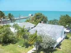 | Pigeon Key Historic District | 3.5 miles | 1990 |
| National Archives record | The nomination case file for reference 04000788 in Record Group 79. |
| Monroe County | All 50 listed properties in this county. |