Block
BlockFrom the record
One of 17 National Register listings published here for Highlands County · listed in 2020 · category: Site.
Sources: the National Register database, National Park Service
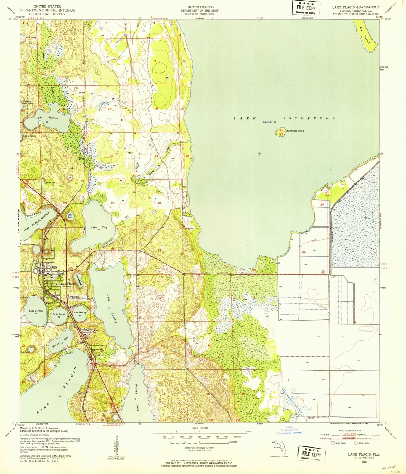
Listed on the National Register of Historic Places in 2020. 6 historic topographic surveys show this location, the earliest from 1952.
One of 17 National Register listings published here for Highlands County · listed in 2020 · category: Site.
Sources: the National Register database, National Park Service
The ground this property stands on, surveyed 36 years apart. Drag the handle to wipe between them. Both sheets are United States Geological Survey originals; neither has been altered.
Regional context, not property-specific evidence. The federal wildfire occurrence database lists 496 fires within 5 miles of Highway Park Cemetery between 1992 and 2020, burning about 3,439 acres in total. 44 started naturally. 82 were recorded as arson. Distance is straight-line from the map coordinates, so a fire counted here may appear on a neighbouring settlement's page as well.
| Reported cause | Fires |
|---|---|
| Railroad operations and maintenance | 120 |
| Arson/incendiarism | 82 |
| Debris and open burning | 67 |
| Equipment and vehicle use | 50 |
| Natural | 44 |
| Missing data/not specified/undetermined | 34 |
| Misuse of fire by a minor | 31 |
| Recreation and ceremony | 27 |
| Power generation/transmission/distribution | 22 |
| Smoking | 17 |
| Fireworks | 2 |
The most recent of them, most recent first, with the day each was reported and the service that recorded it.
| Date | Cause | Size | Reported by | Name on the report |
|---|---|---|---|---|
| 7 September 1996 | Misuse of fire by a minor | under an acre | Florida Forest Service | not named |
| 26 September 1993 | Natural | 2.8 acres | Florida Forest Service | not named |
| 21 September 2011 | Debris and open burning | 2.0 acres | Florida Forest Service | DASHER (28) |
| 21 September 2010 | Arson/incendiarism | 4.0 acres | Florida Forest Service | (HI) HARVEY (499) |
| 21 September 1996 | Natural | under an acre | Florida Forest Service | not named |
| 20 September 2006 | Debris and open burning | under an acre | Florida Forest Service | 956 |
| 20 September 2003 | Natural | under an acre | Florida Forest Service | 1285-HI CO-FIRE-HWY 70W |
| 19 September 2017 | Power generation/transmission/distribution | 4.0 acres | Florida Forest Service | MYER ROAD (28) |
Regional context, not property-specific evidence. The National Weather Service names Lake Placid, the town this property stands in, in 32 storm reports between 1993 and 2024: 14 thunderstorm wind, 13 hail, 3 tornado, 1 wildfire. The reports record 1 injury. Each account below is quoted exactly as the forecast office filed it, from the NOAA Storm Events Database, and each date opens the federal record of that event.
| When | Event | Place named | Harm | What the report says |
|---|---|---|---|---|
| October 2024 | Tornado (EF2) | Lake Placid | 1 hurt, $500,000 | Tornado estimated to have begun near the southeastern shore of|Lake Clay before moving north-northwest across the lake and|entering the Tropical Harbor Mobile Home community situated along|the northern shore of the lake. Approximately 20 to 30 units|suffered damage, primarily consisting of carports being peeled|off or removed, along with various degrees of roof, carport and|patio damage. A few units suffered partial wall collapses as a|result of the roof being compromised, with 1 injury as a result|when a woman sheltering inside her bedroom was injured by a|collapsing exterior wall. One unit was found to have been|displaced approximately one foot off its supports, along with its|roof mostly removed and a few walls collapsed. A number of large|limbs were felled in the community as well. The tornado continued|to track north-northwest across unpopulated areas beyond the|mobile home park, then across a solar farm, before likely|dissipating near the southern shore of Lake Apthorpe. Maximum estimated winds were 130 mph. |
| May 2009 | Lightning | Lake Placid | $187,000 | A restaurant was completely destroyed by a lightning induced fire. The market value of the building was $132,000 while the contents were estimated at $65,000. |
| July 2000 | Thunderstorm Wind | Lake Placid | $100,000 | Thunderstorm winds ripped off large segments of a dairy farm roof and damaged several smaller out buildings on Southwest Ruck's Dairy Road near State Road 70, six miles southeast of Lake Placid. |
| June 1999 | Thunderstorm Wind | Lake Placid | $50,000 | The Highlands County Sheriffs Department reported that thunderstorm winds downed several large trees in and around Lake Placid. |
| September 2000 | Tornado (F0) | Lake Placid | $25,000 | A fast moving tornado, associated with an outer rainband of Hurricane Gordon, was observed to sporadically touch down by a Skywarn Spotter in Lake Placid. The tornado downed a few trees, toppled power lines and snapped several branches in Lake Placid before it continued to move north northwest over rural semi-wooded western Highlands county. The tornado was last observed at Highlands Hammock State Park where it touched down and destroyed a ranger outhouse before it receded and dissipated. |
| January 2016 | Thunderstorm Wind | Lake Placid | $20,000 | A local newspaper reported damage to a few homes near H.L Bishop Park. One home had their lanai ripped off the home. Another resident had a few magnolia trees down in the yard while another had a tree fall through her bedroom window. |
| June 1999 | Thunderstorm Wind | Lake Placid | $10,000 | The Highlands County Emergency Management reported that thunderstorm winds downed several large trees and damaged a fence near the intersection of Lake June Road and Grace Avenue near the south shore of Lake June. |
| April 2019 | Thunderstorm Wind | Lake Placid | $5,000 | A large tree was uprooted in the Leisure Lake subdivision of Placid Lakes. |
| April 2015 | Thunderstorm Wind | Lake Placid | $5,000 | The Highlands County Sheriffs office reported numerous downed power lines in Lake Placid. |
| April 1999 | Thunderstorm Wind | Lake Placid | $5,000 | Thunderstorm winds downed several large trees and toppled a few sheds one quarter mile west of U.S. Highway 27 near the north shore of Lake June. |
| August 1998 | Thunderstorm Wind | Lake Placid | $5,000 | Thunderstorm winds downed several large trees and branches in Sebring. |
| April 2011 | Thunderstorm Wind | Lake Placid | $2,000 | A few trees and street signs were blown down along Lake June Road in Lake Placid. |
| June 1999 | Thunderstorm Wind | Lake Placid | $2,000 | The Highlands County Emergency Management reported that thunderstorm winds uprooted a large tree onto a house which damaged a corner of its roof in Lake Placid. |
| July 1995 | Tornado (F0) | Lake Placid | $2,000 | A short-lived tornado caused minor damage to two homes in the Placid Lakes subdivision. Also, fences were blown down, shingles and screens were blown away, a storage shed was destroyed, and a mailbox was blown over by the tornadic winds. |
| May 1995 | Thunderstorm Wind | Lake Placid | $2,000 | Thunderstorm winds damaged several pool and porch screen enclosures, at the Placid Lakes subdivision five miles southwest of Lake Placid. Also, solar panels were blown off a roof in the subdivision. In Lake Placid, two large trees at least two-feet in diameter were downed by thunderstorm winds. |
| September 2013 | Thunderstorm Wind | Lake Placid | $1,000 | Highlands County 911 Call Center reported railroad crossing gates knocked down onto a road due to strong thunderstorm wind gusts. |
| April 2010 | Thunderstorm Wind | Lake Placid | $1,000 | A large tree branch broke off and fell onto a mobile home near the intersection of Lagrow Road and Lake Clay Drive. |
| April 2015 | Hail | Lake Placid | - | Pictures and video were received via social media of quarter to golf ball size hail falling in Lake Placid. |
| April 2015 | Hail | Lake Placid | - | The Highlands County Emergency Manager relayed numerous reports of quarter size hail in downtown Lake Placid. |
| May 2009 | Hail | Lake Placid | - | Penny size hail was reported in Lake Placid. |
| June 2008 | Hail | Lake Placid | - | Penny to nickel size hail was reported near US Highway 27 in Placid Lakes. |
| June 2001 | Hail | Lake Placid | - | Dime sized hail was reported by a Skywarn Spotter in the Leisure Lakes subdivision five miles northwest of Lake Placid. |
| April 2000 | Wildfire | Lake Placid | - | Wildfires burned nearly 160 acres of brush and scrub trees in Lake Placid. |
| May 1999 | Hail | Lake Placid | - | Dime sized hail was reported by the Florida highway patrol between U.S. Highway 27 and Lake June. |
| May 1999 | Hail | Lake Placid | - | Nickel sized hail was reported by the Fire Department in Leisure Lakes along County Road 621. |
| August 1999 | Hail | Lake Placid | - | Quarter to dime sized hail was reported near Lake Placid by the Highlands County Emergency Management and at the Archbald Biological Station along U.S. Highway 27 south of State Road 70. |
| April 1999 | Hail | Lake Placid | - | Quarter sized hail fell in the Lake Blue Estates along U.S. Highway 27 in Lake Placid. |
| August 1998 | Hail | Lake Placid | - | Golfball sized hail was reported in Lake Placid by the Highlands County Sheriffs Department. |
| February 1993 | Thunderstorm Wind | Lake Placid | - | Dime-size hail fell. Thunderstorm winds gusted to 70 mph. |
| February 1993 | Hail | Lake Placid | - | Dime-size hail fell. Thunderstorm winds gusted to 70 mph. |
| May 2005 | Hail | Lake Placid | - | no account filed |
| May 1998 | Hail | Lake Placid | - | no account filed |
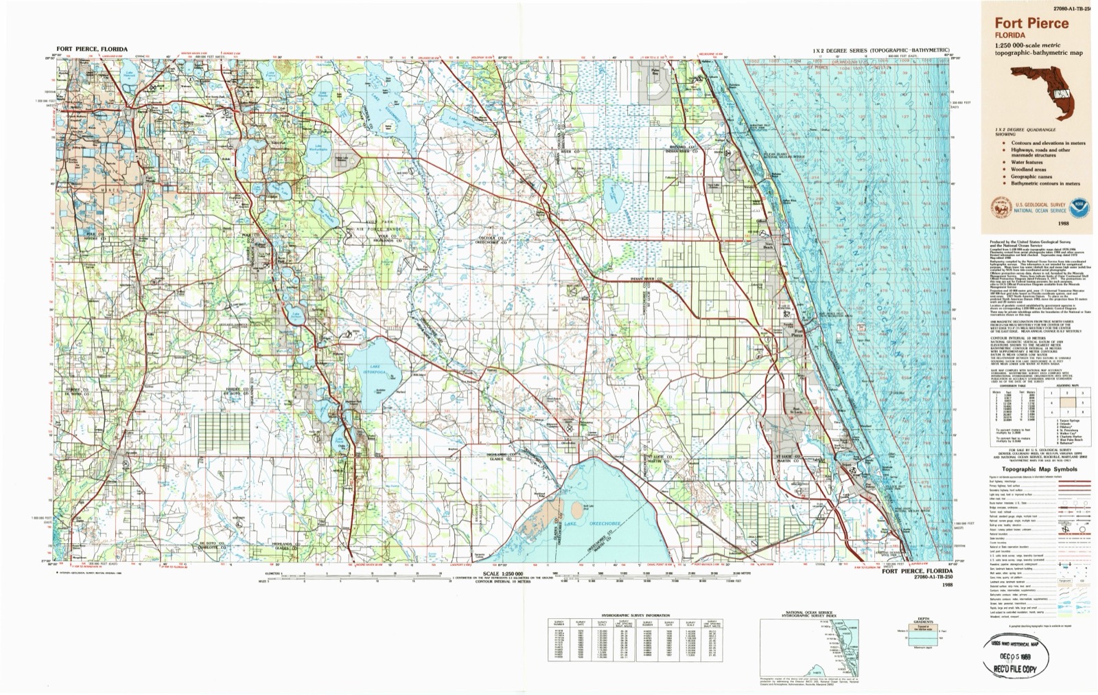
United States Geological Survey topographic sheets whose coverage includes this point. Matched by taking the coordinate the National Park Service records for this property, then testing that coordinate against the published boundary of every sheet.
Other National Register properties close enough to walk or drive between, ordered by distance from this one. Both positions come from the same geocoding pass that matched these properties to their map sheets.
| Photograph | Property | Distance | Listed |
|---|---|---|---|
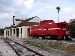 | Lake Placid A. C. L. Railroad Depot, Old | 2.1 miles | 1993 |
| National Archives record | The nomination case file for reference 100005241 in Record Group 79. |
| Highlands County | All 17 listed properties in this county. |