| July 1998 | Thunderstorm Wind | Marathon | 1 killed | ASOS at Marathon Airport recorded 50 knots at 1620 EDT. The C-MAN at Sombrero Key recorded 59 knots. A storm spotter estimated wind gusts of 65 knots. Signs and trees were downed throughout the Marathon area. Several boats were swamped. Five people were knocked overboard from their sailboat. Four were rescued by the USCG. A 34 year old man was found drowned two days later. |
| February 1998 | Tornado (F1) | Marathon | $20,000,000 | Tornado moved from south across Grassy Key near MM 56.5. |
| August 2005 | Tornado (F2) | Marathon | $5,000,000 | Tornado damage path began oceanfront at 73rd Street Ocean (F1) in Marathon and moved northeast, crossing U.S. Highway 1 near 76th Street Ocean, passing through Marathon Airport before entering Florida Bay near the Sea Air Estates Subdivision. Most signficant damage (F2) included concrete block residential structure shifted on foundation...a frame residence shifted on pilings, and bent large steel I-Beams on recently constructed hangars at Marathon Airport. One boat sunk in canal. Extensive damage to porches and trees along narrow path. |
| June 2005 | Thunderstorm Wind | Marathon | $60,000 | Thunderstorm winds estimated at 60 to 70 mph blew down a large billboard on top of permanent shelter canopies at the Marathon Municipal Skate Park. Large tree blown down at Monroe County Sheriffs Office, an 80-foot guy-wired communications antenna snapped at a level 20 feet above the ground, and a 30-foot-tall 4-foot diameter rubber tree was uprooted and damaged the corner section of a roof of a day care center. |
| November 2009 | Thunderstorm Wind | Marathon | $30,000 | Severe wind gusts out of the north northeast spread out of the east end of Boot Key Harbor. Three small vessels, including one trimaran, were overturned. A vessel docked at Dockside Marina measured a wind gust in excess of 100 mph at mast level. An outdoor canopy secured by heavy tube steel framing was destroyed at a restaurant. A tent was also carried into power lines, causing a power outage to most of the Sombrero Country Club and Sombrero Beach area. |
| November 2009 | Thunderstorm Wind | Marathon | $20,000 | Significant damage to trees was noted along the back nine of the Sombrero Country Club, with lose objects and lawn furniture tossed from under stilted homes into Boot Key Harbor. No damage was observed to roofing materials, doors or windows. |
| June 1995 | Tornado | Marathon | $15,000 | A waterspout, travelling toward the west southwest, moved ashore near Marathon Airport. The tornado jumped highway U.S. 1 then descended on Sombrero Boulevard. The tornado moved offshore into Boot Key Harbor before dissipating. Fences and small trees were blown down and several vehicles suffered minor damage at Sombrero Key Resort and Country Club. A dinghy was destroyed when it was lifted into the air, over telephone lines, then dropped to the ground. |
| June 2005 | Tornado (F0) | Marathon | $5,000 | Tornado touched down at F0 intensity along 52nd Street Gulf and had a skipping, curved path generally toward the east-southeast. The tornado continued through the Garden Club and across U.S. Highway 1. Numerous large limbs up to 12 inches in diameter and a few trees were downed in a narrow convergent path across the parking lots of a vacant establishment and a supermarket. Limbs were deposited along curving cyclonic paths from 50 to 150 yards from the original source trees. Numerous parking and stop signs were damaged and destroyed along the path. The damage path ended approximately 150 yards south of U.S. Highway 1 near Sombrero Beach Road. Estimated maximum winds of 65 mph on a narrow, intermittent path. |
| June 2007 | Tornado (EF0) | Marathon | $2,500 | A large nonsupercell waterspout made landfall as a tornado on Palm Island, a private resort community. Trees were damaged, along with air conditioning units torn off a commercial structure, and outdoor furniture tossed throughout the resort and into the water. The tornado crossed back into the water, and made a second landfall just west of the Seven Mile Grille Restaurant on the Florida Bay side of Vaca Key. There, only medium sized tree limbs were damaged. Peak damage rating was confirmed as EF0. The tornado dissipated as a weakening swirl across US Highway 1. |
| February 2008 | Tornado (EF0) | Marathon | $2,000 | A weak tornado, possibly a landfalling waterspout, produced EF0 damage along an intermittent path from Saguro Lane through Ocatillo Lane in the Flamingo Island subdivision of Marathon. The longest continuous damage path was approximately 100 yards long with a width of 25 yards. Damage was limited to live palm fronds and small broken branches, several found hanging in utility wires. Three homes were reported with minor roof damage, mainly to soffets blown upward into the roof cavity and a few shingles torn off. A second damage path, in-line with the path in Flamingo Island, was noted at the Marathon High School. One small tree was broken at the base, with an unsecured soccer goal overturned. A wooden canopy used as a sunscreen for the high school athletic field's press box was blown down. |
| November 2023 | Flood | Marathon | - | Heavy rainfall estimated by radar of 5 to 8 inches produced extensive poor drainage area flooding across Marathon and Key Colony Beach, with some streets with one to two feet depth of water. Several motor vehicles stalled due to flooding. |
| March 2001 | Waterspout | Marathon | - | Waterspout observed 1 miles south of 7 mile bridge. |
| July 2001 | Thunderstorm Wind | Marathon | - | Two boats capsized; four fisherman and two had to be rescued. No injuries reported. |
| September 2001 | Waterspout | Marathon | - | Waterspout observed 2 miles north of Marathon. |
| March 2000 | Waterspout | Marathon | - | Waterspout reported 12 miles north of Marathon. |
| March 2000 | Waterspout | Marathon | - | Waterspout reported 5 miles north of Marathon. |
| March 2000 | Waterspout | Marathon | - | Waterspout reported 4 miles north of Marathon. |
| March 2000 | Waterspout | Marathon | - | Waterspout reported 4 miles north of Marathon. |
| January 2000 | Funnel Cloud | Marathon | - | Funnel cloud was sighted about 5 miles southwest of the 7 mile bridge. |
| May 2000 | Waterspout | Marathon | - | Waterspout observed 3 miles southeast of Marathon. |
| May 2000 | Waterspout | Marathon | - | Waterspout observed 3 miles north of Marathon. |
| July 2000 | Waterspout | Marathon | - | Waterspout observed 4 miles west of Marathon. |
| July 2000 | Waterspout | Marathon | - | Waterspout observed 3 miles north-northwest of Marathon. |
| July 2000 | Waterspout | Marathon | - | Waterspout observed 2 miles north of Marathon |
| July 2000 | Waterspout | Marathon | - | Waterspout observed 3 miles north of Key Colony Beach |
| October 2000 | Waterspout | Marathon | - | Waterspout observed 2 miles south of the 7 mile bridge. |
| September 2000 | Waterspout | Marathon | - | Waterspout observed 30 miles southeast of Marathon. |
| September 2000 | Waterspout | Marathon | - | 2 waterspouts observed 2 miles south of Pigeon Key. |
| September 2000 | Waterspout | Marathon | - | Waterspout observed 1 mile south of Marathon. |
| August 2000 | Thunderstorm Wind | Marathon | - | Wind gust occurred 5 miles east of Marathon. |
| August 2000 | Waterspout | Marathon | - | Waterspout observed 1 mile south of Key Colony Beach. |
| September 2000 | Lightning | Marathon | - | Lightning struck a residence causing structural and electrical damage. Damage amount is not known. |
| October 1999 | Waterspout | Marathon | - | Numerous waterspouts were reported by storm spotters from 1 to 4 miles south and southeast of Marathon |
| May 1999 | Waterspout | Marathon | - | 1 mile south of Marathon, did not affect land |
| May 1999 | Funnel Cloud | Marathon | - | 1 mile south of Marathon |
| June 1999 | Waterspout | Marathon | - | 20 miles southeast of Key Colony Beach |
| September 1999 | Waterspout | Marathon | - | Waterspout was 3 miles south of Key Colony Beach |
| June 1999 | Waterspout | Marathon | - | waterspout 1/2 mile north of Marathon |
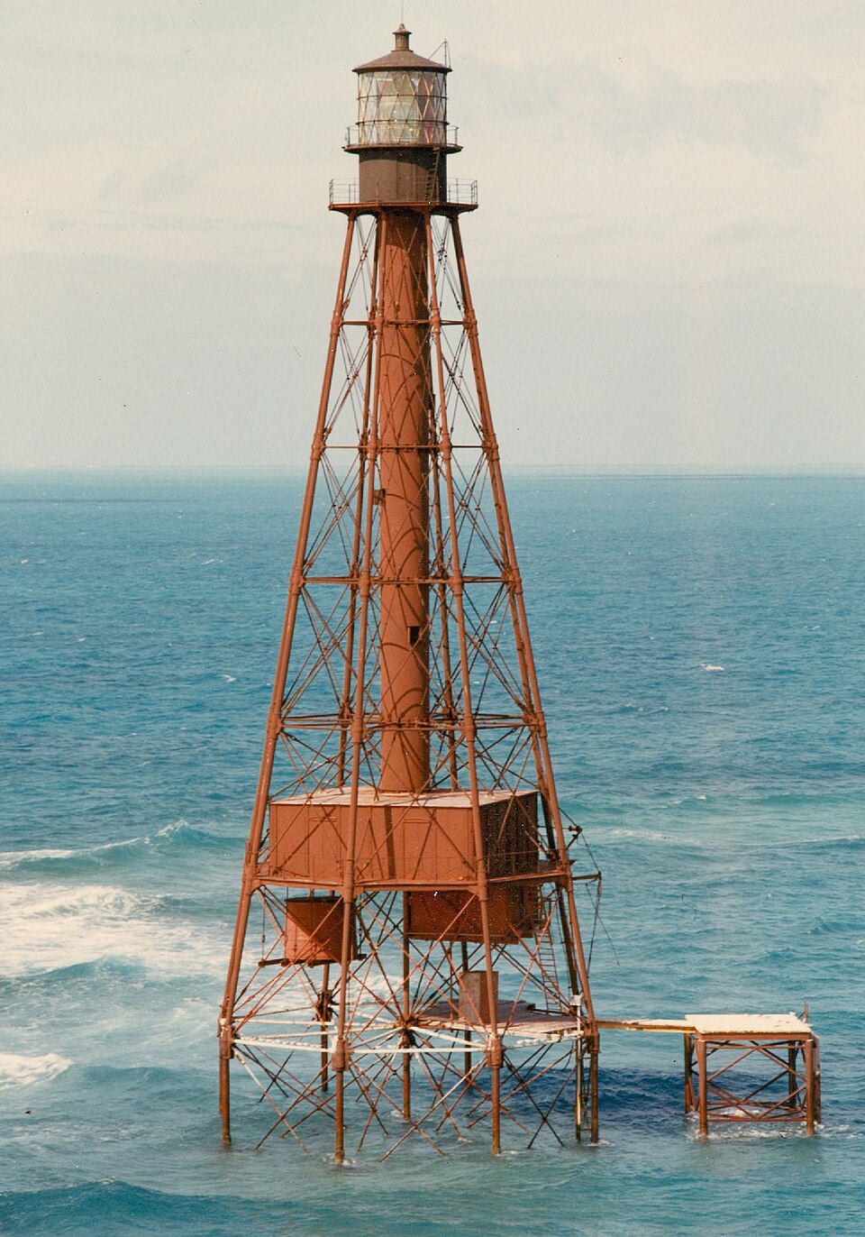
| December 1999 | Waterspout | Marathon | - | Waterspout observed 1 mile southeast of Sombrero Key lighthouse |
| May 1999 | Funnel Cloud | Marathon | - | Funnel cloud 1 mile South of MTH dissipated before reaching land. |
| September 1999 | Waterspout | Marathon | - | Waterspout observed 1 mile north of Conch Key. |
| September 1999 | Waterspout | Marathon | - | Waterspout observed 2 miles north of Grassy Key. |
| May 1999 | Waterspout | Marathon | - | 1 miles south of MTH |
| August 1999 | Waterspout | Marathon | - | just north of Fiesta Key about 17 miles northeast of Marathon |
| August 1999 | Waterspout | Marathon | - | 1 mile north of long key |
| August 1999 | Waterspout | Marathon | - | Large waterspout observed 4 miles southeast |
| August 1999 | Waterspout | Marathon | - | 4 miles west of Marathon |
| August 1999 | Waterspout | Marathon | - | 3 miles southeast of Marathon |
| May 1998 | Thunderstorm Wind | Marathon | - | Reported by yacht in Looe Key harbor that 6 occupied boats were capsized with 2 boats being over 20 feet. |
| May 1998 | Thunderstorm Wind | Marathon | - | Radioed in by vessel off Sombrero Key. |
| April 1998 | Waterspout | Marathon | - | Reports of numerous waterspouts sighted along the lower and middle keys between mile markers 47 and 58. |
| November 1998 | Thunderstorm Wind | Marathon | - | A severe thunderstorm wind gust reported in Marathon but doing no known damage. |
| February 1998 | Thunderstorm Wind | Marathon | - | Recorded at C-MAN SMKF. |
| February 1998 | Hail | Marathon | - | Golf ball size hail. Several trees blown down. |
| July 1997 | Waterspout | Marathon | - | several waterspouts were observed in the vicinity of marathon. |
| July 1997 | Funnel Cloud | Marathon | - | monroe county e.m. reported several funnel clouds just north of marathon. |
| June 1997 | Waterspout | Marathon | - | pilot reported |
| August 1997 | Waterspout | Marathon | - | large waterspout reported oceanside of grassy key near mm56. |
| August 1997 | Waterspout | Marathon | - | observed 3nm n of seven mile bridge by marathon sheriffs office. |
| August 1997 | Waterspout | Marathon | - | reported near marathon. |
 Block
Block