Block
BlockFrom the record
One of 74 National Register listings published here for Palm Beach County · listed in 2014 · category: Building.
Sources: the National Register database, National Park Service
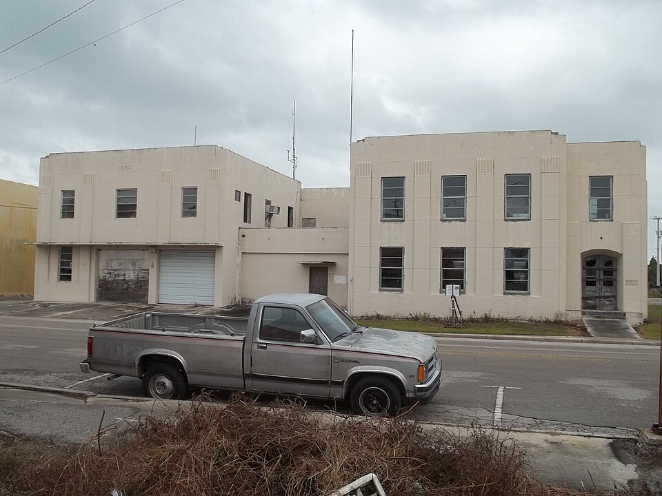
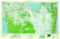
Listed on the National Register of Historic Places in 2014. 7 historic topographic surveys show this location, the earliest from 1956.
One of 74 National Register listings published here for Palm Beach County · listed in 2014 · category: Building.
Sources: the National Register database, National Park Service
Regional context, not property-specific evidence. The federal wildfire occurrence database lists 90 fires within 5 miles of Old Belle Glade Town Hall between 1992 and 2020, burning about 219 acres in total. 4 started naturally. 8 were recorded as arson. Distance is straight-line from the map coordinates, so a fire counted here may appear on a neighbouring settlement's page as well.
| Reported cause | Fires |
|---|---|
| Railroad operations and maintenance | 43 |
| Misuse of fire by a minor | 12 |
| Missing data/not specified/undetermined | 9 |
| Arson/incendiarism | 8 |
| Debris and open burning | 5 |
| Smoking | 5 |
| Natural | 4 |
| Equipment and vehicle use | 3 |
| Recreation and ceremony | 1 |
The most recent of them, most recent first, with the day each was reported and the service that recorded it.
| Date | Cause | Size | Reported by | Name on the report |
|---|---|---|---|---|
| 30 July 1998 | Railroad operations and maintenance | under an acre | Florida Forest Service | not named |
| 18 July 1996 | Smoking | under an acre | Florida Forest Service | not named |
| 1 July 2019 | Arson/incendiarism | under an acre | Florida Forest Service | PAWN LAKE FIRE |
| 4 June 2004 | Debris and open burning | under an acre | Florida Forest Service | THE 4 O'CLOCK FIRE |
| 4 June 1999 | Natural | under an acre | Florida Forest Service | not named |
| 15 June 1997 | Railroad operations and maintenance | under an acre | Florida Forest Service | not named |
| 10 June 2000 | Misuse of fire by a minor | 5.0 acres | Florida Forest Service | not named |
| 1 June 2019 | Misuse of fire by a minor | under an acre | Florida Forest Service | SLIDE ( 50 ) |
Regional context, not property-specific evidence. The federal mineral resources record lists 2 workings within 5 miles of Old Belle Glade Town Hall: 1 past producer, 1 producer. 1 still produces. What was taken out: Stone, Crushed/Broken. Distance is straight-line from the map coordinates, so a quarry counted here may appear on a neighbouring settlement's page as well.
| Where | Site | Commodity | Status | Recorded |
|---|---|---|---|---|
| Rabbit Island Rock Division | Stone, Crushed/Broken | Producer | ||
| South Bay Limestone Quarry | Stone, Crushed/Broken | Past Producer |
Regional context, not property-specific evidence. The National Weather Service names Belle Glade, the town this property stands in, in 40 storm reports between 1994 and 2023: 12 thunderstorm wind, 12 funnel cloud, 9 tornado, 4 hail. The reports record 1 injury. Each account below is quoted exactly as the forecast office filed it, from the NOAA Storm Events Database, and each date opens the federal record of that event.
| When | Event | Place named | Harm | What the report says |
|---|---|---|---|---|
| June 1996 | Lightning | Belle Glade | 1 hurt, $50,000 | no account filed |
| November 2001 | Tornado (F1) | Belle Glade | $8,000 | A tornado, associated with an outer rain band of hurricane Michelle, touched down about one mile north of Belle Glade and moved south at 30 mph through a portion of downtown Belle Glade. Windows were blown out of vehicles and buildings near the Palm Beach Government complex. Trees and signs were blown over and a swath of sugar cane was flattened. |
| May 2009 | Thunderstorm Wind | Belle Glade | $3,000 | A passing thunderstorm produced a wind gust of 58 mph at a mesonet site in Belle Glade. Power lines were also blown down with this storm along with a tree. |
| June 2008 | Thunderstorm Wind | Belle Glade | $2,000 | The Palm Beach County Sherrif's Office reported power lines down in Belle Glade. |
| June 2008 | Thunderstorm Wind | Belle Glade | $2,000 | A severe thunderstorm moved across the Belle Glade area blowing down power lines and a street sign. |
| May 2009 | Thunderstorm Wind | Belle Glade | $1,000 | A severe thunderstorm in western Palm Beach County blew down a high tension power line at NW 12th and NW Main Streets. |
| July 2009 | Lightning | Belle Glade | $1,000 | Lightning hit a transformer at a sugar mill in the Belle Glade area. |
| June 1994 | Thunderstorm Wind | Belle Glade | $500 | Florida Highway Patrol reported an uprooted tree fell onto a mobile home in Belle Glade. Wind gust of 51 knots observed at Palm Beach International Airport. Large trees were blown down damaging a mobile home and a carport just south of Lake Worth. A waterspout was sighted offshore Delray Beach. A large billboard was blown down and power poles were bent in Hypoluxo. |
| April 2023 | Thunderstorm Wind | Belle Glade | - | A thunderstorm wind gust of 60 mph/52 knots was measured at the Belle Glade FAWN mesonet station. |
| May 2023 | Thunderstorm Wind | Belle Glade | - | The Glades Central High School Earth Networks station measured a wind gust to 62 mph as a severe thunderstorm moved through the area. |
| September 2023 | Funnel Cloud | Belle Glade | - | Broadcast media reported a funnel cloud near Belle Glade as a shower passed over the area. |
| May 2020 | Tornado (EF0) | Belle Glade | - | The Palm Beach Sheriffs Office and multiple trained spotters reported that a landspout tornado occurred in an open field near 800 S. Main Street in Belle Glade. No damage was noted. |
| May 2020 | Thunderstorm Wind | Belle Glade | - | An off-duty NWS employee reported a large tree down in Belle Glade associated with a thunderstorm that moved through the area. Estimated wind gust from closest weather observation site, US Sugar 04. |
| June 2020 | Funnel Cloud | Belle Glade | - | Spotter reported a funnel cloud extending 80 percent of the way to the ground from cloud base in the Belle Glade area. Spotter noted that the funnel did not extend to the ground. This was associated with generating convection that interacted with a lake-breeze boundary peripheral to Lake Okeechobee. |
| June 2020 | Flood | Belle Glade | - | Snap map image of poor-drainage-related flooding of residential property in the Belle Glade area, enhanced by runoff from earlier heavy rains. |
| August 2015 | Funnel Cloud | Belle Glade | - | Report of funnel cloud received via social media. Time and location approximate. |
| August 2013 | Funnel Cloud | Belle Glade | - | A spotter reported two successive funnel clouds extending nearly halfway to the ground just east of Belle Glade. |
| June 2013 | Tornado (EF0) | Belle Glade | - | An EF0 tornado moved across Belle Glade with reports of trees down and damage to an awning near 1000 S. Main St. and several power lines down near 400 Martin Luther King Blvd. |
| April 2011 | Thunderstorm Wind | Belle Glade | - | Recorded by personal weather station in Belle Glade. |
| April 2010 | Tornado (EF0) | Belle Glade | - | The Palm Beach County Sherriffs office reported a tornado 2 miles northeast of the Palm Beach County Sherriff's office substation along state road 80; however no damages or injuries occurred. |
| June 2009 | Thunderstorm Wind | Belle Glade | - | Reported at Belle Glade Public Library. |
| June 2008 | Thunderstorm Wind | Belle Glade | - | A severe thunderstorm moved across the Belle Glade area producing damage, and the storm then continued east bound producing a wind gust of 68 MPH at a mesonet site in the Loxahatchee Wildlife Refuge. |
| May 2007 | Hail | Belle Glade | - | Large hail damaged crops in a field east of Belle Glade. |
| May 2007 | Hail | Belle Glade | - | Hail damaged crops at two fields east of Belle Glade. Thousands of ears of corn suffered damage in 160 acres at Hundley Farms, and a 30 acre field of lettuce and other greens were damaged at Growers Management. Losses were estimated at about $750,000. |
| June 2006 | Funnel Cloud | Belle Glade | - | Spotters and amateur radio operators reported a funnel cloud between Belle Glade and Pahokee. |
| September 2004 | Funnel Cloud | Belle Glade | - | A funnel cloud was seen by Police. |
| August 2003 | Funnel Cloud | Belle Glade | - | A funnel cloud was sighted over Lake Okeechobee. |
| March 2003 | Tornado (F0) | Belle Glade | - | Sugar cane workers sighted a tornado. No casualties or damage were reported. |
| March 2003 | Thunderstorm Wind | Belle Glade | - | A tree was blown down. |
| May 2003 | Funnel Cloud | Belle Glade | - | A funnel cloud was sighted southwest of Belle Glade. |
| August 2001 | Tornado (F0) | Belle Glade | - | A tornado was photographed by workers in an open field. No damage was reported. |
| March 2000 | Tornado (F0) | Belle Glade | - | A brief tornado touchdown in a sugar cane field was witnessed by a T.V. news crew. |
| June 2000 | Tornado (F0) | Belle Glade | - | The Sheriff's Office reported a brief tornado touchdown in a corn field near Belle Glade. |
| July 2000 | Tornado (F0) | Belle Glade | - | A Sheriff's Deputy reported a brief tornado touchdown three miles south of SR 80 just southwest of Hatter Highway. No damage was sustained. |
| July 2000 | Funnel Cloud | Belle Glade | - | A funnel cloud was reported. |
| May 1998 | Hail | Belle Glade | - | Reported by Palm Beach County sheriff deputy. |
| August 1997 | Funnel Cloud | Belle Glade | - | reported by kpbi tower about 30nm w. |
| August 1997 | Funnel Cloud | Belle Glade | - | sighted under developing thunderstorm just south of belle glade. |
| May 1999 | Hail | Belle Glade | - | no account filed |
| May 1999 | Funnel Cloud | Belle Glade | - | no account filed |
United States Geological Survey topographic sheets whose coverage includes this point. Matched by taking the coordinate the National Park Service records for this property, then testing that coordinate against the published boundary of every sheet.
| National Archives record | The nomination case file for reference 14000827 in Record Group 79. |
| Palm Beach County | All 74 listed properties in this county. |