Block
BlockFrom the record
One of 4 National Register listings published here for Taylor County · listed in 2015 · category: Building.
Sources: the National Register database, National Park Service
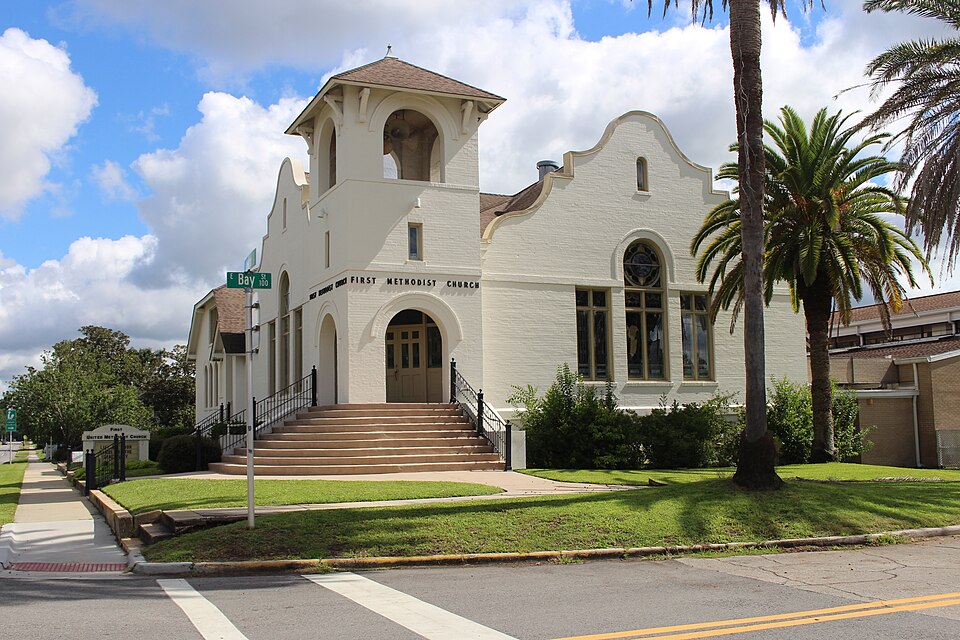
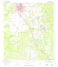
Listed on the National Register of Historic Places in 2015. 5 historic topographic surveys show this location, the earliest from 1954.
One of 4 National Register listings published here for Taylor County · listed in 2015 · category: Building.
Sources: the National Register database, National Park Service
Regional context, not property-specific evidence. The federal wildfire occurrence database lists 508 fires within 5 miles of First Methodist Episcopal Church, South between 1992 and 2020, burning about 1,270 acres in total. 30 started naturally. 29 were recorded as arson. Distance is straight-line from the map coordinates, so a fire counted here may appear on a neighbouring settlement's page as well.
| Reported cause | Fires |
|---|---|
| Debris and open burning | 148 |
| Railroad operations and maintenance | 79 |
| Equipment and vehicle use | 75 |
| Misuse of fire by a minor | 52 |
| Missing data/not specified/undetermined | 46 |
| Natural | 30 |
| Arson/incendiarism | 29 |
| Power generation/transmission/distribution | 20 |
| Smoking | 16 |
| Recreation and ceremony | 9 |
| Other causes | 3 |
| Fireworks | 1 |
The most recent of them, most recent first, with the day each was reported and the service that recorded it.
| Date | Cause | Size | Reported by | Name on the report |
|---|---|---|---|---|
| 9 September 2003 | Arson/incendiarism | 5.0 acres | Florida Forest Service | PARKER FIRE #2 (OF2) |
| 9 September 2003 | Arson/incendiarism | under an acre | Florida Forest Service | PARKER FIRE #1 (OF 2) |
| 6 September 2019 | Equipment and vehicle use | under an acre | Florida Forest Service | WOODS CREEK PP (62) |
| 24 September 2016 | Equipment and vehicle use | 1.0 acres | Florida Forest Service | HWY 98 FIRE (62) |
| 23 September 2019 | Arson/incendiarism | under an acre | Florida Forest Service | HOMER J. SMITH(62) |
| 23 September 2018 | Debris and open burning | under an acre | Florida Forest Service | JACKSON ROAD (62) |
| 22 September 1999 | Railroad operations and maintenance | under an acre | Florida Forest Service | not named |
| 20 September 2014 | Debris and open burning | under an acre | Florida Forest Service | KINSEY ROAD (62) |
Regional context, not property-specific evidence. The federal mineral resources record lists 1 working within 5 miles of First Methodist Episcopal Church, South: 1 plant. All of them still produce. What was taken out: Stone, Crushed/Broken. Distance is straight-line from the map coordinates, so a quarry counted here may appear on a neighbouring settlement's page as well.
| Where | Site | Commodity | Status | Recorded |
|---|---|---|---|---|
| Perry Mill | Stone, Crushed/Broken | Plant |
Regional context, not property-specific evidence. The National Weather Service names Perry, the town this property stands in, in 71 storm reports between 1995 and 2024: 49 thunderstorm wind, 9 hail, 4 flash flood, 3 tornado. The reports record 5 injuries. Each account below is quoted exactly as the forecast office filed it, from the NOAA Storm Events Database, and each date opens the federal record of that event.
| When | Event | Place named | Harm | What the report says |
|---|---|---|---|---|
| August 1998 | Lightning | Perry | 5 hurt, $750,000 | Lightning ignited a natural gas pipeline at the Florida Gas Transmission Company, about three miles northeast of Perry. A pair of explosions sent a 600-foot fireball skyward forcing the evacuation of about 100 residents. Five homes were incinerated and natural gas supplies were shut off to Perry and surrounding communities. Four firefighters and a gas plant employee suffered burns. The American Red Cross set up a temporary shelter at the Taylor County High School for displaced families. Units from Leon, Dixie, Jefferson, and Wakulla County joined the Taylor County and Perry firefighting efforts. |
| October 2003 | Tornado (F1) | Perry | $100,000 | A weak tornado touched down near Carlton Cemetery Road, just south of the Perry-Foley Airport where a barn was heavily damaged. Intermittent damage occurred throughout neighborhoods along Foley Cut-Off Road which were littered by uprooted trees and downed power lines. Several homes sustained minor damage. One mobile was damaged by a fallen live oak tree. The tornado dissipated just northeast of County Road 356 and Faulkner Road. Reported by the Taylor County EMA. |
| September 2002 | Flash Flood | Perry | $100,000 | Torrential rain from slow-moving thunderstorms flooded several homes. Reported by the Taylor County Sheriff. |
| May 2022 | Tornado (EF0) | Perry | $75,000 | A tornado touched down briefly in downtown Perry, FL and was on the ground for about a minute. The tornado touched down west of South Quincy St. near W. Homer J. Smith Ave. It blew over a fence and pealed back a tin roof at a tavern. It continued east northeast along E. Hampton Springs Rd pulling up a carport cover that was anchored to the ground. The tornado bent over a stop sign and snapped large branches off a tree near the intersection of S. Jefferson St. and W. Hampton Springs Rd. One of these was hurled across the intersection, breaking a window of a home. The tornado then broke or bent several large tree limbs before damaging a fence east of Orange St. The tornado lifted just east of S. Center St. This tornado was rated EF0 with max winds around 75 mph. |
| December 1996 | Thunderstorm Wind | Perry | $50,000 | no account filed |
| January 1997 | Thunderstorm Wind | Perry | $20,000 | no account filed |
| May 2022 | Thunderstorm Wind | Perry | $10,000 | Trees were blown down in Perry near the Highway 221 and 27 intersection with some structural damage reported. |
| February 2017 | Thunderstorm Wind | Perry | $10,000 | Trees were blown down along Jefferson Street in Perry. One tree fell on a car. Damage was estimated. |
| February 2015 | Thunderstorm Wind | Perry | $10,000 | Multiple trees and power lines were blown down causing numerous power outages. |
| July 2023 | Thunderstorm Wind | Perry | $5,000 | A shed roof was torn off by strong winds along Highway 98. |
| July 2016 | Lightning | Perry | $5,000 | A combination of numerous cloud to ground lightning strikes and some wind caused several power outages across the Perry area. |
| February 2007 | Thunderstorm Wind | Perry | $5,000 | A Taylor County 911 dispatcher reported numerous downed trees and power lines between Perry and Shady Grove. |
| February 2005 | Thunderstorm Wind | Perry | $5,000 | Roof damage to a mobile home. Reported by the Taylor County EMA. |
| June 2004 | Thunderstorm Wind | Perry | $5,000 | A roof ripped off a mobile home and several downed trees reported by the Taylor County EMA. |
| February 1998 | Thunderstorm Wind | Perry | $5,000 | Quarter size hail near Salem and dime size hail two miles west of Rocky Creek road. Trees down just north of Perry on Woods Creek Road. Power lines down near the Florida Highway Patrol Headquarters Post one mile north of Perry. |
| January 2024 | Thunderstorm Wind | Perry | $3,000 | At least two trees and a power line were blown down in the Perry area. |
| September 2019 | Thunderstorm Wind | Perry | $3,000 | Fallen trees or limbs resulted in a power outage to 39 customers along County Road 255A. |
| April 2018 | Thunderstorm Wind | Perry | $3,000 | Fallen trees or limbs resulted in a power outage to 81 customers. |
| August 2014 | Thunderstorm Wind | Perry | $3,000 | Trees and power lines were blown down throughout Perry. |
| July 2012 | Thunderstorm Wind | Perry | $3,000 | The Taylor county 911 dispatch reported power lines blown down around Perry, focused on Main Street and Highway 19. Monetary damage was estimated. |
| June 2011 | Thunderstorm Wind | Perry | $3,000 | Several trees were blown down on the north side of Perry. The spotter estimated a wind gust of 65 mph. |
| April 2024 | Thunderstorm Wind | Perry | $2,000 | Power lines were blown down at Veterans and Orange St. |
| April 2023 | Thunderstorm Wind | Perry | $2,000 | Power lines were blown down near Perry. |
| July 2023 | Thunderstorm Wind | Perry | $2,000 | A power line was blown down on Martin Luther King Ave in Perry. |
| May 2022 | Thunderstorm Wind | Perry | $2,000 | Fallen trees and limbs resulted in a power outage along E Ash St. |
| July 2022 | Thunderstorm Wind | Perry | $2,000 | A few trees and at least one power line were blown down in the Perry area. |
| June 2018 | Thunderstorm Wind | Perry | $2,000 | A tree and power line were reported down near Highway 27 and San Pedro. |
| May 2016 | Thunderstorm Wind | Perry | $2,000 | Fallen tree or large limbs resulted in power outages near Helen Street on the northeast side of Perry as reported on the Duke Energy outage website. |
| August 2009 | Thunderstorm Wind | Perry | $2,000 | Some power lines were down in Perry. |
| October 2006 | Thunderstorm Wind | Perry | $2,000 | Some trees and power lines down northwest of Perry. Reported by the Florida DOT. |
| July 2000 | Thunderstorm Wind | Perry | $2,000 | Downed trees on power lines. Reported by the Taylor County Sheriff. |
| June 1997 | Thunderstorm Wind | Perry | $2,000 | no account filed |
| March 2022 | Thunderstorm Wind | Perry | $1,000 | A power line was blown down near the Dollar General. |
| May 2014 | Thunderstorm Wind | Perry | $1,000 | Two trees were blown down in the city of Perry. |
| June 2010 | Thunderstorm Wind | Perry | $1,000 | A couple of trees were blown down along Highway 19 near Perry. The monetary damage figure provided is a rough estimate. |
| April 2009 | Thunderstorm Wind | Perry | $1,000 | Several trees and power lines were down with power outages reported just west of Perry. |
| March 2002 | Thunderstorm Wind | Perry | $1,000 | Windows blown out of a house on Holt Road. Reported by the Taylor County EMA. |
| May 2006 | Thunderstorm Wind | Perry | $500 | The Taylor County Sheriff reported a few trees down. |
| July 2006 | Thunderstorm Wind | Perry | $500 | Several downed trees reported by the Taylor County Sheriff. |
| May 2024 | Thunderstorm Wind | Perry | - | Several trees were blown down in Perry. |
| April 2024 | Thunderstorm Wind | Perry | - | A tree was blown down across Park St. |
| August 2024 | Flash Flood | Perry | - | Media showed video of a flooded property in Perry with water near a structure. |
| August 2023 | Thunderstorm Wind | Perry | - | Multiple trees were blown down across northern Taylor county. |
| June 2023 | Thunderstorm Wind | Perry | - | A tree was blown down onto N Reddick Road. |
| March 2022 | Flash Flood | Perry | - | A bridge was flooded on West Julia Street. |
| August 2022 | Thunderstorm Wind | Perry | - | Fallen trees or limbs resulted in a power outage. |
| August 2022 | Thunderstorm Wind | Perry | - | Fallen trees or limbs resulted in a power outage. |
| June 2021 | Thunderstorm Wind | Perry | - | Large tree limbs were blown down along Puckett Road. |
| July 2020 | Thunderstorm Wind | Perry | - | Numerous trees were blown down. |
| July 2020 | Thunderstorm Wind | Perry | - | A spotter estimated wind gusts of 60 mph. |
| July 2020 | Thunderstorm Wind | Perry | - | Two trees were blown down on county roads. |
| July 2018 | Thunderstorm Wind | Perry | - | A tree was blown down near the intersection of Highway 27 and Walter Schmidt Lane. |
| June 2018 | Flood | Perry | - | Minor flooding occurred along a creek on Julia Street in Perry. Radar estimated around 3 inches of rain during the day. |
| May 2016 | Thunderstorm Wind | Perry | - | A tree was blown down onto Ash Street. |
| August 2016 | Flash Flood | Perry | - | The Perry dispatch reported numerous reports of flooding and road closures in and around the Perry area. |
| August 2016 | Flood | Perry | - | Video on social media showed Pine Crest Street in Perry flooded with significant standing water and barricades in place. |
| June 2015 | Thunderstorm Wind | Perry | - | Numerous trees were blown down. |
| August 2012 | Heavy Rain | Perry | - | The Perry co-op observer reported a 24 hour rainfall total of 3.32 inches ending at 2 pm EDT. |
| August 2012 | Heavy Rain | Perry | - | The broadcast media relayed a viewer report of 4 inches of rain about 10 miles WSW of Perry. |
| December 2012 | Tornado (EF0) | Perry | - | The Perry police reported a brief tornado touchdown near the police station. No damage occurred. |
United States Geological Survey topographic sheets whose coverage includes this point. Matched by taking the coordinate the National Park Service records for this property, then testing that coordinate against the published boundary of every sheet.
Other National Register properties close enough to walk or drive between, ordered by distance from this one. Both positions come from the same geocoding pass that matched these properties to their map sheets.
| Photograph | Property | Distance | Listed |
|---|---|---|---|
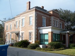 | Taylor County Jail, Old | under 500 feet | 1989 |
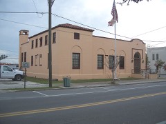 | Perry Post Office, Old | 0.2 miles | 1989 |
| National Archives record | The nomination case file for reference 15000210 in Record Group 79. |
| Taylor County | All 4 listed properties in this county. |