| April 2006 | Lightning | West Palm Beach | 1 killed | A 65-year-old man was killed when he was struck by lightning while standing in his front yard talking to his neighbor. |
| July 1997 | Lightning | West Palm Beach | 1 killed | 34 year old male struck by lightning shortly after getting out of his car at his residence on stoneway lane. |
| March 2004 | Rip Current | Palm Beach | 6 hurt | A dozen people were caught in a rip current at Sunset Avenue Beach. The people were rescued but eight of them were transported to the hospital. |
| September 1999 | Lightning | West Palm Beach | 1 hurt, $50,000 | no account filed |
| January 2005 | Lightning | West Palm Beach | 1 hurt | A 44-year-old male construction worker in the median of I-95 near Forest Hill Boulevard was injured when lightning struck a nearby crane. He was transported to the hospital then released. |
| April 2004 | Lightning | West Palm Beach | 1 hurt | A 43-year-old male walking to his vehicle was injured when lightning struck a nearby tree. It was raining steadily at the time. The man was treated and released from a hospital. |
| August 2004 | Lightning | West Palm Beach | 1 hurt | A 33-year-old soccer coach was talking on the telephone when he received a shock from a lightning strike knocking him from his chair. |
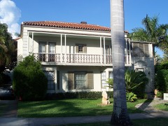
| July 2007 | Lightning | Palm Beach | $15,000,000 | The landmark Casa Amado mansion at 455 North County Road which was undergoing renovations was severely damaged by an apparent lightning strike. The mansion was totaled, with damage estimated at $15 million or more. ||The fire department was called in at 1135 PM after calls reporting smoke were received. Storms affected the area sometime around 230 PM, which is the time the lightning strike was believed to have occurred. |
| July 2000 | Lightning | North Palm Beach | $2,500,000 | no account filed |
| June 1994 | Thunderstorm Wind | West Palm Beach | $50,000 | Florida Highway Patrol reported an uprooted tree fell onto a mobile home in Belle Glade. Wind gust of 51 knots observed at Palm Beach International Airport. Large trees were blown down damaging a mobile home and a carport just south of Lake Worth. A waterspout was sighted offshore Delray Beach. A large billboard was blown down and power poles were bent in Hypoluxo. |
| April 1999 | Thunderstorm Wind | West Palm Beach | $50,000 | no account filed |
| May 1999 | Wildfire | West Palm Beach | $30,000 | no account filed |
| June 1995 | Thunderstorm Wind | West Palm Beach | $25,000 | Severe thunderstorm winds damaged screened porches and awnings on a few homes and downed tree limbs. |
| January 2000 | Wildfire | West Palm Beach | $20,000 | no account filed |
| April 1999 | Thunderstorm Wind | North Palm Beach | $20,000 | no account filed |
| August 2023 | Thunderstorm Wind | West Palm Beach | $10,000 | Broadcast media reported that a large tree fell on a school bus as a severe thunderstorm moved through the area. There were no injuries at the time of the report. The speed of the wind gust was estimated based on close proximity to where a 74 mph gust was recorded. |
| December 2006 | Flash Flood | West Palm Beach | $5,000 | A slow-moving low pressure trough caused very heavy rains and significant flooding over parts of Palm Beach County. West Palm Beach International Airport received a total of 8.21 inches of rain ending at 7 PM on the 15th. Other locations in Central and Southern Palm Beach County received between 6 and 8 inches of rain. Northern Broward County received lesser amounts in the 2 to 3 inch range.|Several streets and roads were closed in the city of West Palm Beach, with water reaching up to 3 feet deep in some areas. Hardest hit was the neighborhood of Pineapple Park. Many vehicles were stranded in the deep water, with local police receiving about 120 calls for assistance. No significant damage was reported to property despite water entering homes and businesses. |Florida Power and Light reported 20,000 customers without power during the afternoon and early evening hours. Shelters were opened for people left homeless by the floods, but only 5 people had arrived as of 8:30 PM. |
| April 2004 | Thunderstorm Wind | North Palm Beach | $5,000 | A T.V. station reported thunderstorm wind gusts uprooted trees and damaged house awnings. |
| July 2001 | Thunderstorm Wind | West Palm Beach | $5,000 | Power lines were blown down. |
| April 2021 | Thunderstorm Wind | North Palm Beach | $2,000 | Social media report of large hardwood tree branch downed and wooden fence knocked down off Burns Rd near Palm Beach Gardens Medical Center. Time estimated. |
| March 1999 | Tornado (F0) | West Palm Beach | $2,000 | no account filed |
| March 2024 | Flash Flood | West Palm Beach | - | Law enforcement reported flash flooding with several stalled-out cars and standing water on Southern Boulevard in West Palm Beach, as well as US-1 in Lake Worth, after rounds of showers and thunderstorms moved through the area. 3 to 5 inches of rain was estimated to have fallen in a less than 3-hour period across this area, with 12-hour rainfall amounts of 6 to 7 inches. |
| March 2022 | Funnel Cloud | North Palm Beach | - | A trained spotter reported a funnel cloud near I-95 and Blue Heron Blvd associated with a strong thunderstorm moving east. Dime size hail was also observed near this location. |
| July 2020 | Hail | West Palm Beach | - | Broadcast media reported nickel size hail on Southern Boulevard in eastern parts of West Palm Beach. |
| August 2020 | Flood | West Palm Beach | - | Video on social media shows roads partially submerged in the Prospect Park neighborhood of West Palm Beach from heavy rainfall. Rainfall amounts in the surrounding area were in the 3 to 5 inch range. |
| April 2019 | Thunderstorm Wind | North Palm Beach | - | Palm Beach Gardens PD reported multiple power lines down along PGA Boulevard and Military Trail. Hail up to 0.50 was also reported in the vicinity. Time based on radar wind signature of over 60 mph about 300 feet above the surface. |
| April 2019 | Thunderstorm Wind | North Palm Beach | - | Picture received via social media showed large tree down on cars in a parking lot at Palm Beach State College in Palm Beach Gardens. Other pictures received of broken large tree branches in nearby North Palm Beach. Time estimated and based on radar wind signature of at least 60 mph at about 300 feet above the ground. |
| August 2019 | Flash Flood | West Palm Beach | - | Several reports and videos from WPTV of flooding due to heavy rainfall of 2 to 3 inches falling within 30 minutes across portions of West Palm Beach. This heavy rainfall caused streets to become impassable with some cars stuck in deep water, which reached up to the headlights. Streets which had significant flooding include: Flagler Drive, Parker Avenue, and Banyan Street east of Tamarind Avenue. |
| March 2014 | Thunderstorm Wind | West Palm Beach | - | A weatherbug mesonet site reported a thunderstorm wind gust 59 mph. |
| April 2013 | Tornado (EF0) | South Palm Beach | - | A waterspout moved onshore and was caught on video with minor roof damage and broken windows reported in the vicinity of La Coquille Villas along with downed trees on both sides of Highway A1A. |
| April 2013 | Thunderstorm Wind | North Palm Beach | - | Florida Power and Light reported to the Palm Beach Post that a tree fell on powerlines in North Palm Beach...near 1660 12 Oaks Way. It was also reported that there was tree damage at a condominium development in the same area. |
| March 2008 | Hail | West Palm Beach | - | A severe thunderstorm continued northward after producing wind damage in the Lake Clarke Shores area and produced quarter sized hail in West Palm Beach along Southern Boulevard between the Intracoastal Waterway and Dixie Highway. |
| February 2007 | Hail | West Palm Beach | - | Hail reported at 330 Sea Spray Avenue in West Palm Beach by trained spotter. |
| April 2005 | Thunderstorm Wind | West Palm Beach | - | A thunderstorm wind gust of 58 mph was estimated by the public. |
| June 2005 | Funnel Cloud | North Palm Beach | - | Tower personnel saw three funnel clouds near North Palm Beach Municipal Airport. |
| August 2004 | Hail | West Palm Beach | - | Hail three quarters of an inch in diameter was reported near 45th Street and Broadway. |
| August 2004 | Tornado (F0) | West Palm Beach | - | A tornado was seen over a small lake. |
| August 2003 | Funnel Cloud | West Palm Beach | - | A funnel cloud was seen over the Palm Beach Zoo at Dreher Park. |
| August 2003 | Tornado (F0) | West Palm Beach | - | A waterspout moved ashore from the Atlantic near the Town of Palm Beach and continued west. The tornado did very minor damage to a construction site. |
| February 2002 | Heavy Rain | West Palm Beach | - | Three to five inches of rain fell between 10 am and 2 pm with nine inches measured at Lake Worth ina 38-hour period. A woman drove her vehicle into a canal and drowned when her car was swept away. |
| September 2002 | Funnel Cloud | West Palm Beach | - | Emergency Management Officials reported a funnel cloud. |
| March 2001 | Funnel Cloud | West Palm Beach | - | A SKYWARN spotter sighted a funnel cloud forming near Climatis and Quadrille Roads. |
| May 2001 | Funnel Cloud | West Palm Beach | - | The Highway Patrol reported a funnel cloud near SR 80 at 20-mile bend. |
| March 2001 | Hail | West Palm Beach | - | A spotter reported dime-size hail between Indiantown and West Palm Beach. |
| June 2001 | Waterspout | West Palm Beach | - | Two waterspouts were sighted in the Atlantic about one mile offshore Southern Boulevard. |
| July 2001 | Funnel Cloud | West Palm Beach | - | A SKYWARN spotter sighted a funnel cloud over Wellington. |
| July 2001 | Flash Flood | West Palm Beach | - | Street flooding in Wellington was caused by four inches of rain in a two hour period. |
| November 1998 | Waterspout | West Palm Beach | - | A pilot sighted two waterspouts west of Grand Bahama Island in the Bahamas. |
| June 1998 | Funnel Cloud | Palm Beach | - | Funnel cloud spottered by trained weather spotter. The funnel cloud was located 1nm northeast of the Breakers Hotel. The shower producing the funnel was moving to the east at 8 knots. |
| August 1998 | Waterspout | Palm Beach | - | Waterspout observed near the coast. |
| July 1997 | Thunderstorm Wind | West Palm Beach | - | large tree fell on cars along 45 st. |
| October 1997 | Rip Current | Palm Beach | - | swimmer rescued at midtown beach by surfer. |
| August 1997 | Funnel Cloud | West Palm Beach | - | reported by public. |
| June 1994 | Thunderstorm Wind | West Palm Beach | - | Nickel and dime-size hail was reported around West Palm Beach. Thunderstorm winds uprooted trees and blew tree limbs off. |
| April 1993 | Thunderstorm Wind | Palm Beach | - | International AirportHigh winds moved a USAir B-737 that was parked at the boarding gate at Palm Beach International Airport. A 55 mph gust was measured at 0425 EST at the airport. |
| November 2003 | Heavy Rain | West Palm Beach | - | no account filed |
| June 2001 | Thunderstorm Wind | West Palm Beach | - | no account filed |
| June 2001 | Hail | West Palm Beach | - | no account filed |
| May 2000 | Funnel Cloud | West Palm Beach | - | no account filed |
| September 2000 | Funnel Cloud | West Palm Beach | - | no account filed |
 Block
Block