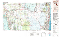
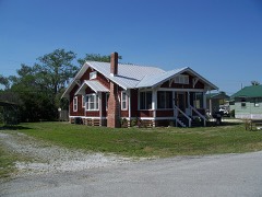
Listed on the National Register of Historic Places in 1995. 7 historic topographic surveys show this location, the earliest from 1956.
From the record
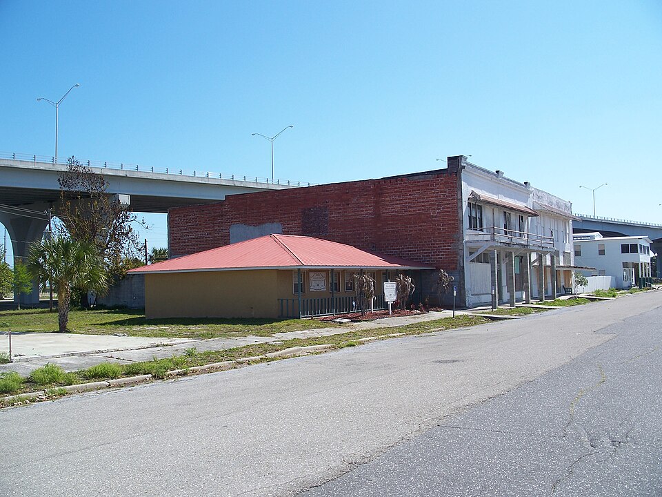
“The Moore Haven Downtown Historic District is a U.S. historic district located in Moore Haven, Florida. The district runs from 3 through 99 Avenue J., 100 1st Street and Lone Cypress Park, a park which houses the only cypress tree in the district.”
Wikipedia article Moore Haven Downtown Historic District, CC BY-SA 4.0.
One of 3 National Register listings published here for Glades County · listed in 1995 · category: District.
National Register reference number.95001166- the number the National Park Service assigned this property when it was listed, and the key its nomination file is catalogued under at the National Archives.
Fires near this property
45 since 1992
Regional context, not property-specific
evidence. The
federal wildfire occurrence database
lists 45 fires within 5 miles of Moore Haven Downtown Historic District
between 1992 and 2018, burning about 582 acres in total. 3 started naturally. 12 were recorded as arson.
Distance is straight-line from the map coordinates, so a fire counted
here may appear on a neighbouring settlement's page as well.
Reported cause
Fires
Arson/incendiarism
12
Debris and open burning
8
Equipment and vehicle use
6
Railroad operations and maintenance
4
Recreation and ceremony
4
Missing data/not specified/undetermined
4
Natural
3
Power generation/transmission/distribution
2
Smoking
1
Misuse of fire by a minor
1
The most recent of
them, most recent first, with the day each was reported and the service
that recorded it.
Regional context, not property-specific
evidence. The National Weather Service names
Moore Haven, the town this property stands in, in 27 storm reports between 1994 and 2024: 8 tornado, 6 thunderstorm wind, 6 hail, 5 funnel cloud.
The reports record 3 injuries. Each account below is quoted exactly as the forecast office
filed it, from the NOAA Storm Events Database, and each date
opens the federal record of that event.
A severe tornado was initially observed in images captured over the western Lake|Okeechobee littoral shelf from the Harney Pond WeatherSTEM camera around 1:30 PM|EST in Glades County. The debris from the littoral shelf and associated vegetation was lofted in the air producing a tornadic debris signature detectable by the distant Miami|radar by 1:35 PM EST. The first observed property damage attributable to this tornado was in the Sarasota Colony neighborhood of Lakeport where the tornado demolished the second story dwellings of three well-built homes and then proceeded to cross Florida State Road 78 into the Fishermans Lane neighborhood where it destroyed the roofs and broke windows of 1920s-era Florida homes, lofted and tossed several manufactured homes and travel trailers, flipped a Ford Focus station wagon, and deposited debris over two blocks from their original location into the bottom of a retention pond behind the neighborhood. One manufactured home chassis was observed wrapped 15 to 20 feet above the ground around a hardwood tree located across the street from its original location with the contents of the home located in the pond almost 200 yards downstream. Damage from multiple vortices was observed at this location including one swath that reached EF-1 intensity to the east of the main EF-3 damage path. The tornado proceeded north-northwest to the east of the Harney Pond Canal into the Brighton Seminole Indian Reservation. A tornadic debris signature was detectable on the Miami radar at 1:48 PM EST as the tornado entered the southern|limits of the reservation. As the tornado continued north-northwest, it damaged trees and pulled metal panels from roofing of assorted outbuildings from different|homesteads on the south side of the reservation. The tornado entered the Brighton Seminole Village causing tree and chickee hut roof damage in the Knotts Landing neighborhood before moving into the Sports Complex where it demolished the spectator and dugout areas of some of the baseball fields. The tornado likely lifted behind one of the baseball fields around 1:49 PM EST. The Miami radar continue to detect a tornadic debris signature through 1:50 PM EST as the storm moved north along Reservation Road. The tornado was rated as a violent EF-3 that at peak produced an estimated 140 mph wind in the Sarasota Colony neighborhood of Glades County. In total, 54 structures were damaged, with 27 uninhabitable and considered destroyed. There were three people injured and no fatalities. Damage dollar amount is estimated.
A tornado moved NW over portions of Moore Haven early Wednesday morning, September 28th. First signs of damage was tree damage near Park Avenue and Yaun Road, with siding and panel damage to a home on Park Avenue, as well as two storage trailers tipped near the Sportsman Village on Daniels Road next to the US 27 bridge. The damage path ended near the Moore Haven Yacht Club where siding damage to homes were observed. Damage is consistent with the higher end of the EF-0 scale.|Damage totals are estimated.
Strong winds caused some damage to mobile home carports and roofs along Azalea Avenue at Bowden's sub-division just south of Moore Haven. Several power lines were also downed near a sugarcane field. Area affected was roughly a half mile wide.||Damage survey done by Glades County Emergency Management after initial report by law enforcement.
A tornado formed along the southeast shore of Lake Okeechobee and moved west northwest. Sporadic damage along the track consisted of a pool enclosure blown into a canal and the roof of a Catholic Church being partially blown off.
A video on social media showed a funnel cloud looking west from State Road 78 near Moore Haven, associated with a thunderstorm moving over the area. Time is estimated.
The tornado initially touched down near the intersection of West Avenue and North Avenue, creating partial roof damage to a home along North Avenue as well as destroying a back porch and piercing side of nearby shed with debris. The tornado then traveled to the northeast, downing powerlines along the northeast side of the intersection of North Avenue and Riverside Drive SW as well as partially destroying a fence and uprooting trees. The tornado then moved northeast across the Caloosahatchee River. Additional roof debris was found in open fields on the east side of the river near River Road and Azalea Avenue. The tornado then tracked across open fields, before crossing Old US 27 and US 27 near Yaun Road. The most signficant damage occurred along the north side of Yaun Road where two mobile homes were destroyed. One mobile home was flipped and totaled, with debris scattered in a nearby field. The second mobile home remained standing, but most of the walls were removed. In addition to the mobile homes, a nearby fence was knocked down along with the destruction of a greenhouse, and dog and chicken pens. The porch roof of another mobile home was also destroyed. The tornado then lifted shortly thereafter just before crossing the railroad tracks near Park Avenue East.
The Glades County Emergency Manager reported a tornado touched down in open country near the intersection of U.S. 27 and State Road 78. There were no reports of injuries, fatalities or damage.
Tornado was reported by a sheriff's deputy. F0 tornado touched down in a sugar cane field near the intersection of US27 and CR710. Minor damage to powerlines.
Male was swept overboard from 30 foot sailboat. He was rescued as he clung to a buoy and his mate and sailboat drifted about one half mile away on Lake Okeechobee.
United States Geological Survey topographic
sheets whose coverage includes this point. Matched by taking the coordinate the National Park Service records for this property, then
testing that coordinate against the published boundary of every sheet.
Other National Register properties close
enough to walk or drive between, ordered by distance from this one. Both
positions come from the same geocoding pass that matched these properties
to their map sheets.
Listing record. National Park Service National Register of Historic Places, listed-properties dataset, current to 2026-05-22.
Map join. Address geocoded through the United States Census geocoder, then tested against the published boundary of every sheet in the USGS Historical Topographic Map Collection.
How this page is made. Listing fields come from federal records; map-sheet coverage is a labelled coordinate-to-boundary calculation, not a source-field claim.
Wildfire. Short, Karen C. 2022. Spatial wildfire occurrence data for the United States, 1992-2020 [FPA_FOD_20221014]. 6th Edition. Fort Collins, CO: Forest Service Research Data Archive. https://doi.org/10.2737/RDS-2013-0009.6 Collected with United States Government funding and usable without additional permissions or fees.
Storms. NOAA National Centers for Environmental Information, Storm Events Database https://www.ncei.noaa.gov/stormevents/ A work of the United States government, no copyright under 17 U.S.C. 105. Narratives are quoted verbatim from the National Weather Service report and are not edited or summarised.
 Block
Block