BlockBefore
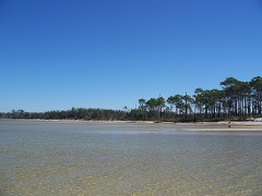
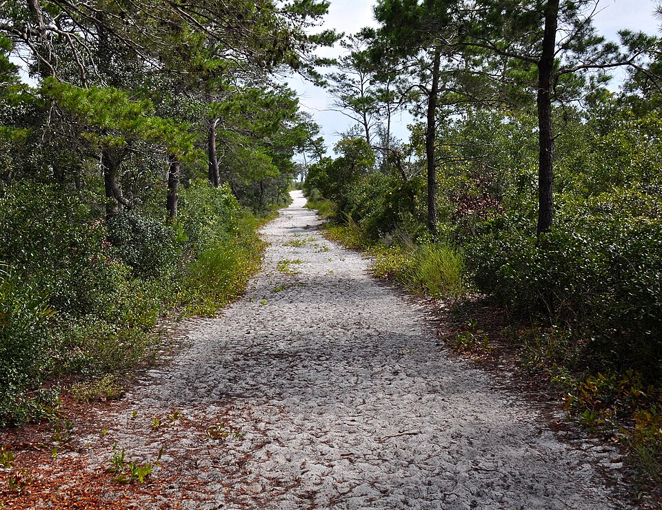
Photograph of First American Road in Florida
Photograph by Skye Marthaler, CC BY-SA 3.0. Via Wikimedia Commons.

First American Road in Florida

Built in 1824. Listed on the National Register of Historic Places in 1998. 9 historic topographic surveys show this location, the earliest from 1921.

From the record

“The First American Road in Florida is a historic road near Gulf Breeze, Florida. It is located in the Naval Live Oaks Area of the Gulf Islands National Seashore.”

Wikipedia article First American Road in Florida, CC BY-SA 4.0.

One of 11 National Register listings published here for Santa Rosa County · listed in 1998 · category: Site · built in 1824.

Sources: the Wikipedia article · the case file at the National Archives · the National Register database, National Park Service


The listing

  • Address. Gulf Islands National Seashore-Naval Live Oaks Area, Gulf Breeze, 32561
  • When was it listed? September 1998
  • Category. site
  • Also known as. Archeological Properties of the Naval Live Oaks Reservation MPS
  • Census division. Gulf Breeze
  • When was it built? 1824
  • National Register reference number. 98001168 - the number the National Park Service assigned this property when it was listed, and the key its nomination file is catalogued under at the National Archives.

Fires near this property

67 since 1992

Regional context, not property-specific evidence. The federal wildfire occurrence database lists 67 fires within 5 miles of First American Road in Florida between 1992 and 2020, burning about 728 acres in total. 1 started naturally. 1 was recorded as arson. Distance is straight-line from the map coordinates, so a fire counted here may appear on a neighbouring settlement's page as well.

Reported cause Fires
Missing data/not specified/undetermined14
Equipment and vehicle use13
Misuse of fire by a minor12
Recreation and ceremony11
Railroad operations and maintenance6
Smoking4
Debris and open burning4
Natural1
Other causes1
Arson/incendiarism1

The most recent of them, most recent first, with the day each was reported and the service that recorded it.

DateCause SizeReported by Name on the report
19 September 1999Railroad operations and maintenanceunder an acreFlorida Forest Servicenot named
18 September 2019Recreation and ceremonyunder an acreGulf Island National SeashoreNLO PICNIC
8 August 2011Missing data/not specified/undeterminedunder an acreGulf Island National SeashoreNLO HQ PARKING LOT
8 August 2011Missing data/not specified/undeterminedunder an acreGulf Island National SeashoreGROUP CAMP ROAD
8 August 2011Missing data/not specified/undeterminedunder an acreGulf Island National SeashoreVILLA TRAIL
29 August 1993Equipment and vehicle use40 acresFlorida Forest Servicenot named
2 August 2001Railroad operations and maintenance1.0 acresFlorida Forest Servicenot named
31 July 2014Missing data/not specified/undeterminedunder an acreGulf Island National SeashoreBAYSHORE

Every fire recorded in Santa Rosa County

Mines and quarries near this property

2 within 5 miles

Regional context, not property-specific evidence. The federal mineral resources record lists 2 workings within 5 miles of First American Road in Florida: 1 occurrence, 1 producer. 1 still produces. What was taken out: Sand and Gravel, Construction. Distance is straight-line from the map coordinates, so a quarry counted here may appear on a neighbouring settlement's page as well.

Where SiteCommodity StatusRecorded
Bellview PitSand and Gravel, ConstructionProducer
Unnamed Sand and Gravel PitSand and Gravel, ConstructionOccurrence

Every working recorded in Santa Rosa County

Storms near this property

32 since 1995

Regional context, not property-specific evidence. The National Weather Service names Gulf Breeze, the town this property stands in, in 32 storm reports between 1995 and 2023: 10 thunderstorm wind, 8 lightning, 4 flash flood, 3 tornado. The reports record 1 injury. Each account below is quoted exactly as the forecast office filed it, from the NOAA Storm Events Database, and each date opens the federal record of that event.

WhenEvent Place namedHarm What the report says
July 2011LightningGulf Breeze1 hurtA 40 year old male was struck by lightning at the intersection of Avalon blvd and Tuscarora trail. After the strike the man noticed his pants were burned...the hairs on his arm singed...and he complained of a severe headache. He was transported to a local hospital.
October 2001Thunderstorm WindGulf Breeze$50,000High thunderstorm winds blew down a large scoreboard at Gulf Breeze High School. Several trees were also blown down, and a few light weight structures were also damaged.
July 1998LightningGulf Breeze$40,000Lightning started a fire in a wooded area around Gulf Breeze. The fire burned for about five hours and destroyed 150 acres of land. No one was injured and no homes were damaged.
January 1995Thunderstorm WindGulf Breeze$40,000Four homes in the Sterling Point subdivision suffered roof and siding damage from severe thunderstorm winds. Fences were torn down and garage doors and windows were also broken.
January 2017LightningGulf Breeze$20,000Lightning strike caused a house fire on Autumn Breeze Circle.
September 2008Tornado (EF0)Gulf Breeze$12,000An outer rainband from Hurricane Gustav produced a weak EF0 tornado in Gulf Breeze that caused tree damage.
August 2022LightningGulf Breeze$10,000Lightning struck a home near Gulf Breeze causing a fire.
February 2017LightningGulf Breeze$10,000Lightning strike resulted in smoke damage.
September 2014LightningGulf Breeze$10,000A lightning strike caused damage to a house and car.
July 1999Tornado (F0)Gulf Breeze$10,000Storm damage occurred near Garcon Point, northeast of Gulf Breeze. A 12X24 section of tin roof on a home was damaged along with power lines down. The damage was caused by a possible waterspout moving inland off of Pensacola Bay.
July 2002Thunderstorm WindGulf Breeze$8,000Several trees were blown down near Gulf Breeze by high winds from a thunderstorm.
August 2016LightningGulf Breeze$5,000Lightning struck a water main near a house causing water to flow into the house.
April 2015LightningGulf Breeze$5,000A lightning strike resulted in a house fire.
September 2004Tornado (F0)Gulf Breeze$3,000A fast moving tornado moved into Santa Rosa county from Escambia county. The weak tornado entered the county southeast of Gulf Breeze and moved rapidly west northwest before dissipating just west of Gulf Breeze. The tornado caused minor damage. The area had been evacuated due to Hurricane Ivan.
July 1997Thunderstorm WindGulf Breeze$3,000Several trees were blown down in Gulf Breeze. This was the second thunderstorm to move through the city during the morning hours that caused wind damage.
July 1997Thunderstorm WindGulf Breeze$3,000Several trees were blown down in Gulf Breeze.
July 1995Thunderstorm WindGulf Breeze$1,500Several trees and power lines were blown down in Gulf Breeze.
June 2023Heavy RainGulf Breeze-Mesonet site recorded 9.04 inches of rain.
June 2023Flash FloodGulf Breeze-Heavy rain caused flooding and closed Gulf Breeze Parkway.
June 2023Heavy RainGulf Breeze-Mesonet site at Gulf Breeze recorded 14.08 inches of rain.
April 2021Thunderstorm WindGulf Breeze-Measured by weather flow site XGBZ.
April 2021Flash FloodGulf Breeze-Video of flooding in Gulf Breeze with water nearly 3 feet deep along Maplewood Drive.
May 2019Thunderstorm WindGulf Breeze-The Weatherflow mesonet site in Gulf Breeze measured a thunderstorm wind gust of 68 mph.
August 2016Flash FloodGulf Breeze-Heavy rain caused flooding along Highway 98 throughout Gulf Breeze.
June 2012Flash FloodGulf Breeze-Heavy rain caused several roads to be closed in southern Santa Rosa County due to water over the road.
August 2001WaterspoutGulf Breeze-A large waterspout was observed by several people over Pensacola Bay. The waterspout was moving north across the bay and dissipated just before the storm moved ashore. The large spout was visible for several minutes.
July 2001Thunderstorm WindGulf Breeze-A wind gust of near 60 mph was estimated at a local market during a thunderstorm in Gulf Breeze. No damage was reported from the high winds.
March 2000HailGulf Breeze-Nickle size hail was reported in the community.
June 2000WaterspoutGulf Breeze-A waterspout was observed over Santa Rosa Sound near Gulf Breeze. The waterspout remained over water for several minutes before dissipating over the Sound.
April 2023Thunderstorm WindGulf Breeze-no account filed
April 2010HailGulf Breeze-no account filed
March 2003HailGulf Breeze-no account filed

Every storm recorded in Santa Rosa County

Maps showing this location

9 surveys

United States Geological Survey topographic sheets whose coverage includes this point. Matched by taking the middle of the area the National Park Service maps for this listing, then testing that coordinate against the published boundary of every sheet.

Listed places nearby

1 within 8 miles

Other National Register properties close enough to walk or drive between, ordered by distance from this one. Both positions come from the same geocoding pass that matched these properties to their map sheets.

Photograph PropertyDistance Listed
Naval Live Oaks Reservation0.2 miles1998

Sources for this property

National Archives recordThe nomination case file for reference 98001168 in Record Group 79.
Wikipedia articleCommunity-written account of this property, licensed CC BY-SA.
Santa Rosa CountyAll 11 listed properties in this county.

Provenance

  • Listing record. National Park Service National Register of Historic Places, listed-properties dataset, current to 2026-05-22.
  • Map join. Address geocoded through the United States Census geocoder, then tested against the published boundary of every sheet in the USGS Historical Topographic Map Collection.
  • How this page is made. Listing fields come from federal records; map-sheet coverage is a labelled coordinate-to-boundary calculation, not a source-field claim.
  • Wildfire. Short, Karen C. 2022. Spatial wildfire occurrence data for the United States, 1992-2020 [FPA_FOD_20221014]. 6th Edition. Fort Collins, CO: Forest Service Research Data Archive. https://doi.org/10.2737/RDS-2013-0009.6 Collected with United States Government funding and usable without additional permissions or fees.
  • Mines and quarries. USGS Mineral Resources Data System (MRDS) https://mrdata.usgs.gov/mrds/ A work of the United States government, no copyright under 17 U.S.C. 105.
  • Storms. NOAA National Centers for Environmental Information, Storm Events Database https://www.ncei.noaa.gov/stormevents/ A work of the United States government, no copyright under 17 U.S.C. 105. Narratives are quoted verbatim from the National Weather Service report and are not edited or summarised.