BlockBefore
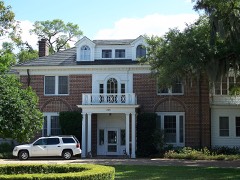
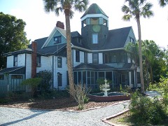
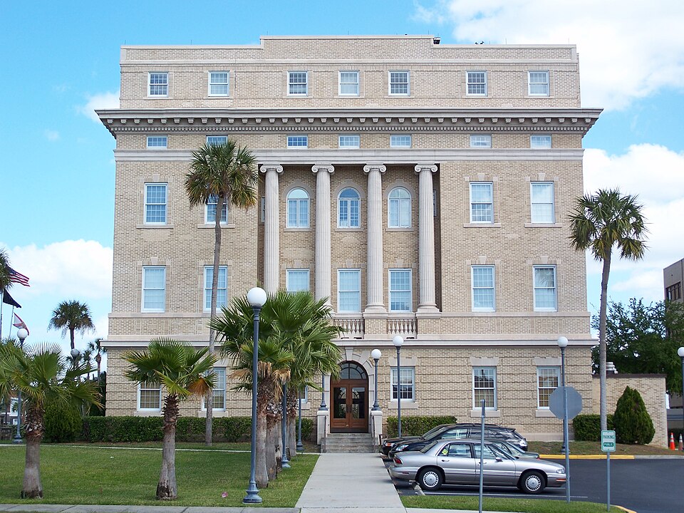
Photograph of Old Lake County Courthouse
Photograph by Ebyabe, CC BY 2.5. Via Wikimedia Commons.

Lake County Courthouse

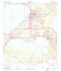
Listed on the National Register of Historic Places in 1998. 6 historic topographic surveys show this location, the earliest from 1955.

From the record

“The Old Lake County Courthouse is a historic courthouse in Tavares, Florida, located at 315 West Main Street. On September 25, 1998, it was added to the U.S.”

Wikipedia article Old Lake County Courthouse (Florida), CC BY-SA 4.0.

One of 31 National Register listings published here for Lake County · listed in 1998 · category: Building.

Sources: the Wikipedia article · the case file at the National Archives · the National Register database, National Park Service

The listing

  • What is counted as historic. The nomination lists 1 building, 1 object as contributing to the listing.
  • Address. 315 W. Main St., Tavares, 32778
  • When was it listed? September 1998
  • Category. building
  • Census division. Tavares
  • Architectural style. Neoclassical architecture
  • National Register reference number. 98001199 - the number the National Park Service assigned this property when it was listed, and the key its nomination file is catalogued under at the National Archives.

Fires near this property

102 since 1992

Regional context, not property-specific evidence. The federal wildfire occurrence database lists 102 fires within 5 miles of Lake County Courthouse between 1992 and 2020, burning about 1,120 acres in total. 23 started naturally. 12 were recorded as arson. Distance is straight-line from the map coordinates, so a fire counted here may appear on a neighbouring settlement's page as well.

Reported cause Fires
Railroad operations and maintenance25
Natural23
Debris and open burning15
Arson/incendiarism12
Equipment and vehicle use10
Misuse of fire by a minor7
Missing data/not specified/undetermined6
Recreation and ceremony3
Power generation/transmission/distribution1

The most recent of them, most recent first, with the day each was reported and the service that recorded it.

DateCause SizeReported by Name on the report
3 September 2001Natural5.0 acresFlorida Forest Servicenot named
28 September 2018Arson/incendiarismunder an acreFlorida Forest ServiceHURRICANE (35)
19 September 2019Debris and open burning1.0 acresFlorida Forest ServiceGRAND ISLAND SHORES (35)
18 September 2000Railroad operations and maintenanceunder an acreFlorida Forest Servicenot named
7 August 2006Naturalunder an acreFlorida Forest Service35/LAST RANCH FIRE/0865
21 August 2007Arson/incendiarism2.1 acresFlorida Forest Service35/LAKE PINES FIRE/0996
20 August 2000Natural3.0 acresFlorida Forest Servicenot named
19 August 1997Misuse of fire by a minorunder an acreFlorida Forest Servicenot named

Every fire recorded in Lake County

Mines and quarries near this property

3 within 5 miles

Regional context, not property-specific evidence. The federal mineral resources record lists 3 workings within 5 miles of Lake County Courthouse: 1 producer, 1 unknown, 1 prospect. 1 still produces. What was taken out: Sand and Gravel, Construction, Sand, Diatomite. Distance is straight-line from the map coordinates, so a quarry counted here may appear on a neighbouring settlement's page as well.

Where SiteCommodity StatusRecorded
Astatula Sand MineSand and Gravel, ConstructionProducer
Florida Rock Industries, Inc - Astatula MineSandUnknown
Unnamed Diatomite DepositDiatomiteProspect

Every working recorded in Lake County

Storms near this property

20 since 1997

Regional context, not property-specific evidence. The National Weather Service names Tavares, the town this property stands in, in 20 storm reports between 1997 and 2024: 8 hail, 7 thunderstorm wind, 4 tornado, 1 lightning. The reports record 1 injury. Each account below is quoted exactly as the forecast office filed it, from the NOAA Storm Events Database, and each date opens the federal record of that event.

WhenEvent Place namedHarm What the report says
July 2002LightningTavares1 hurtA 19 year old man was struck and seriously injured by lightning while riding on a personal water craft.
June 1998Thunderstorm WindTavares$150,000Thunderstorm winds blew the bay doors out at a car dealership. Winds blew down a church steeple, damaged two mobile homes.
April 1997Tornado (F0)Tavares$150,000A small tornado touched down briefly in the town of Tavares blowing down trees and power lines and damaging 25 homes and mobile homes.
July 2015Thunderstorm WindTavares$50,000A thunderstorm produced a locally damaging microburst which downed one large and partially rotten oak tree in Tavares. The tree toppled onto a playground and damaged a fence and shed. Other small branches and twigs were downed in the immediate vicinity. Winds were estimated at 50 to 55 mph.
July 2000Thunderstorm WindTavares$50,000Strong downburst winds blew down trees and damaged a river cruise boat near Tavares.
May 2022Thunderstorm WindTavares$25,000Lake County Emergency Management reported numerous trees were knocked down and several homes sustained wind damage in the city of Tavares due to straight-line winds. Two apartment complexes along East Alfred Street suffered roof damage. There were several trees knocked down on Anderson Road and near the intersection of Druid Place and Laurel Way, with some power lines being knocked down. A home in the Lake Dora Manor subdivision sustained minor roof damage.
June 2014Thunderstorm WindTavares$1,000A thunderstorm with estimated wind gusts up to 55 mph produced minor damage in Tavares. Soffits damaged on two adjacent homes and metal porch roof blown in on another home.
February 2024HailTavares-Quarter sized hail reported at the seaplane base in Tavares.
April 2023Thunderstorm WindTavares-Emergency manager reports trees down or uprooted, some landing on roofs, causing structural damage to homes near Tavares and Oakland Park.
May 2022HailTavares-Amateur radio operator relayed report of quarter-sized hail near the intersection of U.S. Highway 441 and Banning Beach Road in Tavares.
June 2022HailTavares-Lake County Emergency Management reported penny sized hail near the intersection of West Alfred Street and West Maud Street in Tavares.
June 2020Tornado (EF0)Tavares-Based on numerous videos, pictures, and reports received from Lake County Emergency Management, Lake County Sheriff's Office, local broadcast media, trained spotters and the public, a waterspout on Lake Dora came onshore in Tavares as a brief tornado before quickly dissipating. The waterspout formed on Lake Dora at approximately 1741 LST. The waterspout came onshore on the north side of the lake near the 32900th block of Lakeshore Drive in Tavares at approximately 1742 LST, as a weakening tornado. The tornado knocked down a power pole and transformer on Lakeshore Drive before dissipating north of the road. Peak winds are estimated between 60-65 mph. No other damages or injuries occurred.
July 2018Tornado (EF0)Tavares-Based on photographs and videos received from the public, local media, and emergency management, the NWS Melbourne determined a high-end EF-0 tornado, with winds of 80-85 mph, occurred in Tavares. The damage showed a discontinuous tornado track moving to the southwest along a nearly one mile path near U.S. Highway 441. The tornado lasted approximately 5 minutes. The most significant damage occurred to a warehouse/mobile unit located behind a Winn Dixie near the 450th block of East Burleigh Boulevard in Tavares. This structure was destroyed, and a piece of sheet metal was lofted onto a nearby power pole. Also, the Fish Camp Lake Restaurant located at the intersection of U.S. Highway 441 and North Lakeshore Boulevard sustained moderate roof damage. The exterior kitchen exhaust fan was ripped off the roof and thrown onto a nearby street. Adjacent to the restaurant at the Lake Tire & Auto Store, several wood fences were knocked over and a small tree was uprooted, falling onto a trailer. Additional reports of very minor damage occurred along US Highway 441, such as small tree limbs and branches knocked off trees, and small fences knocked over. A member of the public relayed a video from a boat on Lake Eustis showing the tornado as it was impacting the area near the Fish Camp Lake Restaurant. DI8, DOD2, EXP-LB; DI3, DOD4, EXP-LB.
January 2017HailTavares-A photo re-tweeted via Twitter by broadcast media showed dime to quarter size hail fell in Tavares during passage of an isolated severe thunderstorm ahead of a strong squall line.
March 2011Thunderstorm WindTavares-Multiple trees down on Acorn Court.
May 2009HailTavares-A public report of half dollar size hail falling in Tavares was relayed by NWS Tampa Bay.
May 2005HailTavares-no account filed
May 2000HailTavares-no account filed
June 1998HailTavares-no account filed

Every storm recorded in Lake County

Maps showing this location

6 surveys

United States Geological Survey topographic sheets whose coverage includes this point. Matched by taking the coordinate the National Park Service records for this property, then testing that coordinate against the published boundary of every sheet.

Listed places nearby

6 within 8 miles

Other National Register properties close enough to walk or drive between, ordered by distance from this one. Both positions come from the same geocoding pass that matched these properties to their map sheets.

Photograph PropertyDistance Listed
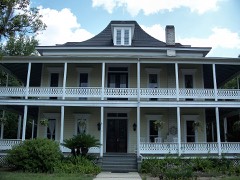
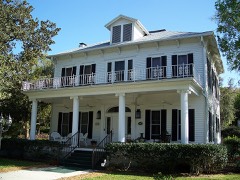
Harry C. Duncan House0.5 miles1997
Purdy Villa3.8 miles2004
William Kimbrough Pendleton House4.3 miles1983
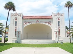
Ferran Park and the Alice McClelland Memorial Bandshell4.5 miles1994
Gould Hyde Norton House4.5 miles1997
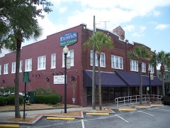
Eustis Commercial Historic District4.6 miles2005

Sources for this property

National Archives recordThe nomination case file for reference 98001199 in Record Group 79.
Wikipedia articleCommunity-written account of this property, licensed CC BY-SA.
Lake CountyAll 31 listed properties in this county.

Provenance

  • Listing record. National Park Service National Register of Historic Places, listed-properties dataset, current to 2026-05-22.
  • Map join. Address geocoded through the United States Census geocoder, then tested against the published boundary of every sheet in the USGS Historical Topographic Map Collection.
  • How this page is made. Listing fields come from federal records; map-sheet coverage is a labelled coordinate-to-boundary calculation, not a source-field claim.
  • Wildfire. Short, Karen C. 2022. Spatial wildfire occurrence data for the United States, 1992-2020 [FPA_FOD_20221014]. 6th Edition. Fort Collins, CO: Forest Service Research Data Archive. https://doi.org/10.2737/RDS-2013-0009.6 Collected with United States Government funding and usable without additional permissions or fees.
  • Mines and quarries. USGS Mineral Resources Data System (MRDS) https://mrdata.usgs.gov/mrds/ A work of the United States government, no copyright under 17 U.S.C. 105.
  • Storms. NOAA National Centers for Environmental Information, Storm Events Database https://www.ncei.noaa.gov/stormevents/ A work of the United States government, no copyright under 17 U.S.C. 105. Narratives are quoted verbatim from the National Weather Service report and are not edited or summarised.