BlockBefore
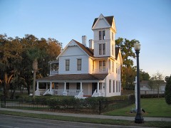
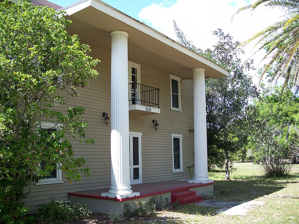
Photograph of Campbell House
Photograph by Ebyabe, CC BY 2.5. Via Wikimedia Commons.

Campbell House

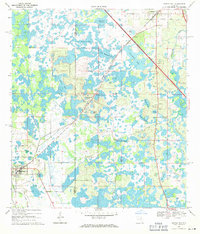
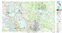
Listed on the National Register of Historic Places in 1999. 6 historic topographic surveys show this location, the earliest from 1955.

From the record

“The Campbell House, also known as the Valentine House), is a historic house at 3147 County Road 470 in Okahumpka, Florida. It is locally significant as an excellent example of a frame vernacular house, and one of the few houses built in the 19th century Okahumpka.”

Wikipedia article Campbell House (Okahumpka, Florida), CC BY-SA 4.0.

One of 31 National Register listings published here for Lake County · listed in 1999 · category: Building.

Sources: the Wikipedia article · the case file at the National Archives · the National Register database, National Park Service · the Wikipedia article

The listing

  • What is counted as historic. The nomination lists 2 buildingss as contributing to the listing.
  • Address. 3147 Co. Rd. 470, Okahumpka, 34762
  • When was it listed? November 1999
  • Category. building
  • Census division. Howey-in-the-Hills-Okahumpka
  • National Register reference number. 99001298 - the number the National Park Service assigned this property when it was listed, and the key its nomination file is catalogued under at the National Archives.

Fires near this property

113 since 1992

Regional context, not property-specific evidence. The federal wildfire occurrence database lists 113 fires within 5 miles of Campbell House between 1992 and 2020, burning about 1,043 acres in total. 16 started naturally. 8 were recorded as arson. Distance is straight-line from the map coordinates, so a fire counted here may appear on a neighbouring settlement's page as well.

Reported cause Fires
Railroad operations and maintenance31
Debris and open burning17
Natural16
Equipment and vehicle use16
Missing data/not specified/undetermined14
Arson/incendiarism8
Smoking5
Misuse of fire by a minor4
Power generation/transmission/distribution1
Other causes1

The most recent of them, most recent first, with the day each was reported and the service that recorded it.

DateCause SizeReported by Name on the report
7 September 1994Equipment and vehicle use1.0 acresFlorida Forest Servicenot named
8 August 2020Debris and open burning5.0 acresFlorida Forest ServiceCLEARWATER (35)
3 August 2016Debris and open burning2.0 acresFlorida Forest ServiceBLUFF (35)
27 August 1999Naturalunder an acreFlorida Forest Servicenot named
9 July 2000Natural2.5 acresFlorida Forest Servicenot named
8 July 1999Natural3.5 acresFlorida Forest Servicenot named
25 July 1999Natural1.0 acresFlorida Forest Servicenot named
23 July 1999Natural2.0 acresFlorida Forest Servicenot named

Every fire recorded in Lake County

Mines and quarries near this property

2 within 5 miles

Regional context, not property-specific evidence. The federal mineral resources record lists 2 workings within 5 miles of Campbell House: 1 unknown, 1 past producer. None of them still produces. What was taken out: Sand, Kaolin. Distance is straight-line from the map coordinates, so a quarry counted here may appear on a neighbouring settlement's page as well.

Where SiteCommodity StatusRecorded
Florida China Clay Company PitKaolinPast Producer
Florida Rock Industries, Inc. - Turnpike Sand MineSandUnknown

Every working recorded in Lake County

Storms near this property

10 since 1998

Regional context, not property-specific evidence. The National Weather Service names Okahumpka, the town this property stands in, in 10 storm reports between 1998 and 2021: 5 thunderstorm wind, 3 hail, 1 lightning, 1 tornado. The reports record 1 injury. Each account below is quoted exactly as the forecast office filed it, from the NOAA Storm Events Database, and each date opens the federal record of that event.

WhenEvent Place namedHarm What the report says
January 2020Tornado (EF0)Okahumpka1 hurtNational Weather Service staff conducted a damage survey and confirmed an EF-0 tornado occurred in Okahumpka on January 4, 2020. Peak winds were estimated between 65 and 75 mph, along a discontinuous path of 2.38 miles, with a maximum width of 175 yards. The tornado generally moved northeast beginning just west of the Florida Turnpike near mile marker 295, crossing mostly wooded areas, Debbie Road, and the western side of the Holiday RV Village before dissipating. Damage estimates indicate significant roof damage to 3 to 5 mobile homes, one large oak tree was toppled, and numerous large branches of weak/old trees were downed. One resident received minor injuries when a tree branch came through the roof of his manufactured home at the RV Village. The individual self-transported to the hospital for treatment of a minor cut to his head.
June 1998Thunderstorm WindOkahumpka$14,000Thunderstorm winds blew down trees and billboards and overturned a tractor trailer on the Florida Turnpike.
June 2017LightningOkahumpka$5,000Lake County Emergency Services reported that several large branches fell onto a mobile home in Leesburg after lightning from a nearby thunderstorm struck a tree next to the mobile home. A 68-year-old woman was injured when the branches fell on her as she was sleeping in her bedroom. The woman managed to get outside of her mobile home where neighbors called 911. The woman was transported to a local hospital with minor injuries and later released.
August 2008Thunderstorm WindOkahumpka$1,000Local law enforcement reported a tree blown down on Highway 33.
August 2008Thunderstorm WindOkahumpka$1,000Trees were blown down across US Highway 33.
March 2021HailOkahumpka-A trained spotter reported hail up to quarter size.
March 2021Thunderstorm WindOkahumpka-A trained spotter reported numerous 1 inch and larger tree branches downed throughout The Plantation at Leesburg community.
March 2019HailOkahumpka-A trained weather spotter observed quarter sized hail at the Hawthorne community in Leesburg.
May 2019Thunderstorm WindOkahumpka-The Florida Division of Emergency Management relayed reports of 10 homes on Great Egret Drive in Okahumpka that received damage to shingles, siding, and fences.
July 2017HailOkahumpka-A trained spotter reported was driving along US Highway 27 just south of Leesburg when he reported nickel sized hail. The spotter also reported that hail was becoming larger than nickel sized when he decided to turn around.

Every storm recorded in Lake County

Maps showing this location

6 surveys

United States Geological Survey topographic sheets whose coverage includes this point. Matched by taking the coordinate the National Park Service records for this property, then testing that coordinate against the published boundary of every sheet.

Listed places nearby

6 within 8 miles

Other National Register properties close enough to walk or drive between, ordered by distance from this one. Both positions come from the same geocoding pass that matched these properties to their map sheets.

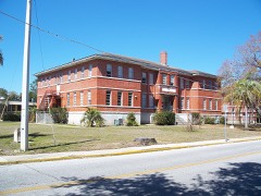
Photograph PropertyDistance Listed
Okahumpka Rosenwald School0.4 miles2022
Mote-Morris House4.5 miles1974
Lee School4.7 miles1995
Hill Crest7.1 miles2015
Fruitland Park Community Center7.7 miles2015
Howey House7.8 miles1983

Sources for this property

National Archives recordThe nomination case file for reference 99001298 in Record Group 79.
Wikipedia articleCommunity-written account of this property, licensed CC BY-SA.
Lake CountyAll 31 listed properties in this county.

Provenance

  • Listing record. National Park Service National Register of Historic Places, listed-properties dataset, current to 2026-05-22.
  • Map join. Address geocoded through the United States Census geocoder, then tested against the published boundary of every sheet in the USGS Historical Topographic Map Collection.
  • How this page is made. Listing fields come from federal records; map-sheet coverage is a labelled coordinate-to-boundary calculation, not a source-field claim.
  • Wildfire. Short, Karen C. 2022. Spatial wildfire occurrence data for the United States, 1992-2020 [FPA_FOD_20221014]. 6th Edition. Fort Collins, CO: Forest Service Research Data Archive. https://doi.org/10.2737/RDS-2013-0009.6 Collected with United States Government funding and usable without additional permissions or fees.
  • Mines and quarries. USGS Mineral Resources Data System (MRDS) https://mrdata.usgs.gov/mrds/ A work of the United States government, no copyright under 17 U.S.C. 105.
  • Storms. NOAA National Centers for Environmental Information, Storm Events Database https://www.ncei.noaa.gov/stormevents/ A work of the United States government, no copyright under 17 U.S.C. 105. Narratives are quoted verbatim from the National Weather Service report and are not edited or summarised.