 Block
From the record
2 National Register listings published here.
Sources: the National Register database, National Park Service
18 topographic sheets and 2 fire insurance atlases across 1 place.
2 National Register listings published here.
Sources: the National Register database, National Park Service
Every property in this county listed on the National Register of Historic Places, with the year it was listed and the federal nomination document.
| Photograph | Property | Type | Listed | Reference |
|---|---|---|---|---|
 | Arlington Methodist Episcopal Church, South | building | 1990 | 90000572 |
 | Edison Commercial Historic District | district | 2000 | 00000528 |
Flown by the U.S. Geological Survey between 1937 and 1989, the Aerial Photo Single Frames collection is the definitive mid-century view of the land: fields, roads and rivers as the camera saw them. The Survey holds 334 frames inside the rectangle that bounds this county; the 12 frames below were taken over the county itself, chosen across the decades of flights (at most four a year from that rectangle), so one flight cannot crowd out the rest. The full set is free to browse and download at EarthExplorer under the dataset Aerial Photo Single Frames.

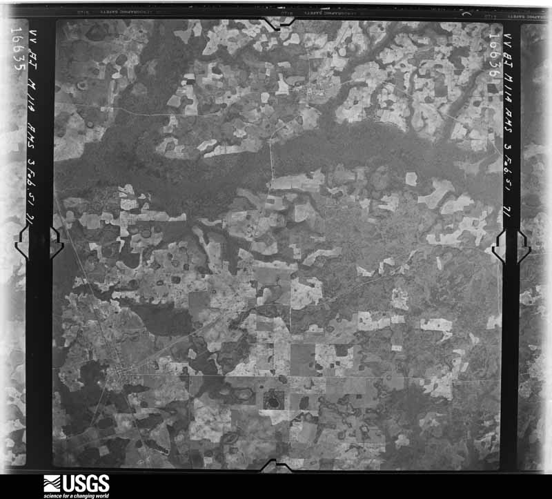
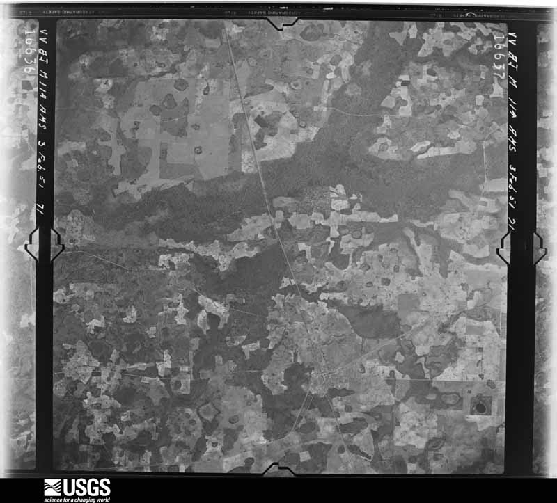

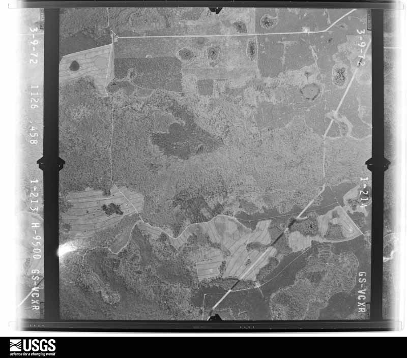
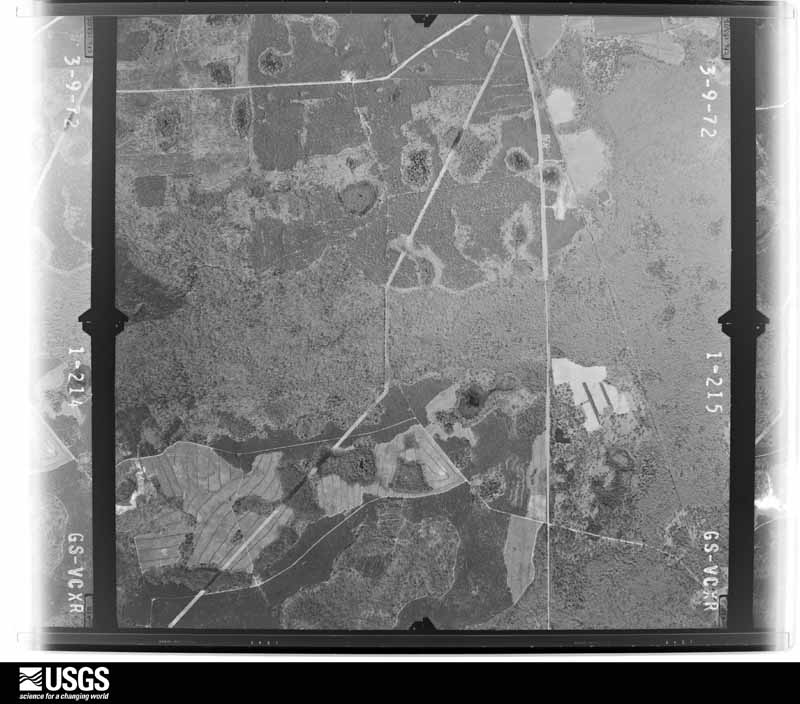

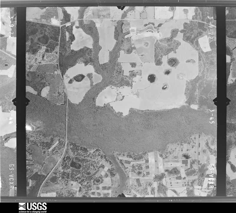
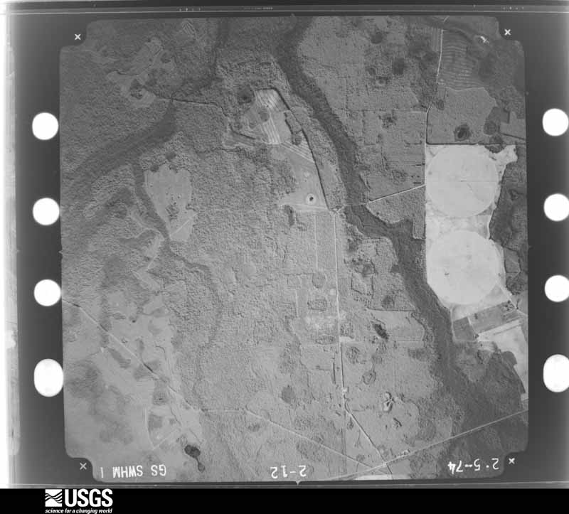

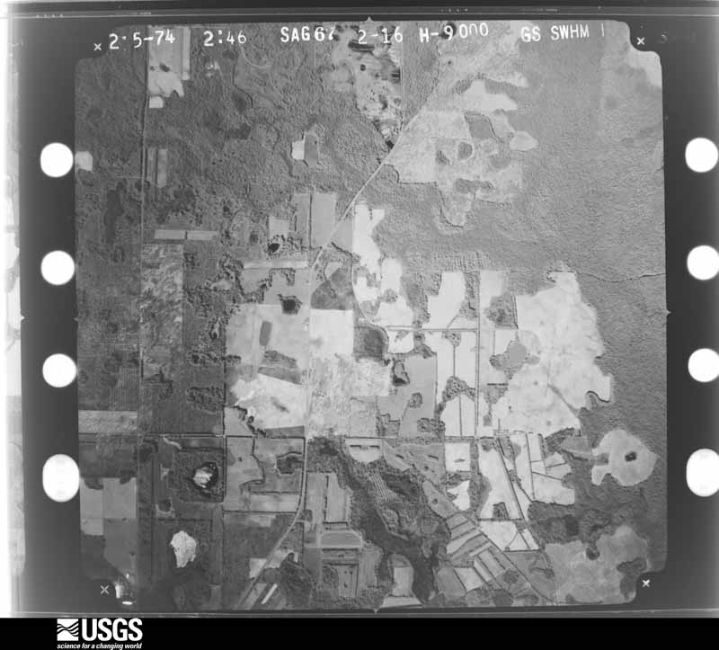

The thermometers that kept this county's weather, and the gages that measured the flow of its streams, as the federal records hold them. The extremes below are measured values from those records, not estimates.
Who lived here in 1950, one enumeration district at a time, as the Census Bureau described each district. Each row opens its official National Archives result, with Population Schedules and ED Maps available there.
Every wildfire the federal occurrence database records inside this county: 474 of them, burning about 1,554 acres. 9 started naturally and 27 were recorded as arson. Each settlement page carries the fires within five miles of it.
| Reported cause | Fires |
|---|---|
| Debris and open burning | 329 |
| Equipment and vehicle use | 57 |
| Arson/incendiarism | 27 |
| Missing data/not specified/undetermined | 21 |
| Smoking | 12 |
| Natural | 9 |
| Railroad operations and maintenance | 8 |
| Recreation and ceremony | 6 |
| Misuse of fire by a minor | 5 |
The five largest, by the area the report gives. Two of them were set deliberately.
| Date | Cause | Size | Reported by | Name on the report |
|---|---|---|---|---|
| 22 June 2011 | Debris and open burning | 164 acres | Georgia Forestry Commission | FY2011-CALHOUN-043 |
| 9 November 2004 | Arson/incendiarism | 62 acres | Georgia Forestry Commission | not named |
| 17 June 2008 | Equipment and vehicle use | 50 acres | Georgia Forestry Commission | not named |
| 5 April 2006 | Debris and open burning | 49 acres | Georgia Forestry Commission | not named |
| 31 May 2008 | Equipment and vehicle use | 42 acres | Georgia Forestry Commission | not named |
| 4 March 1996 | Debris and open burning | 41 acres | Georgia Forestry Commission | not named |
| 13 February 2012 | Arson/incendiarism | 38 acres | Georgia Forestry Commission | FY2012-CALHOUN-007 |
| 2 June 2019 | Debris and open burning | 37 acres | Georgia Forestry Commission | FY2019CALHOUN004 |
Every settlement page carries the fires within five miles of it - see the settlement index below.
The NOAA Storm Events Database holds 86 reports for this county, causing no deaths, 10 injuries and about $4,726,000 in recorded property damage. Each settlement page carries the reports that name it.
| Kind of event | Reports |
|---|---|
| Thunderstorm Wind | 55 |
| Tornado | 14 |
| Hail | 7 |
| Flash Flood | 3 |
| Flood | 2 |
| Winter Storm | 2 |
| Funnel Cloud | 1 |
| Lightning | 1 |
| Heavy Rain | 1 |
The most serious of them, by death, then injury, then recorded damage. The accounts are quoted exactly as the forecast office filed them.
| When | Event | Place named | Harm | What the report says |
|---|---|---|---|---|
| April 2016 | Tornado (EF2) | Moye | 5 hurt, $150,000 | The combination of dual-polarization radar data and the damage survey show that the tornado initially touched down very close to the Clay/Randolph County line west of US Highway 27. The tornado then continued on a continuous path for nearly 16 miles across much of northwestern Calhoun County. Initial damage northwest of Edison, GA in northwestern Calhoun County was largely limited to downed or snapped trees. As the tornado neared Georgia Highway 216, there was an area of more concentrated damage along Magnolia Road. Two single wide mobile homes were destroyed at this location along with numerous snapped pine trees. Damage in this area was consistent with EF-1 damage or a maximum wind of around 100-105 mph. For the following four miles of the track, damage was once again limited to mostly downed or snapped trees. More significant damage occurred east of the Ichawaynochaway Creek north of Georgia Highway 37 near Dickey, GA. On Country Club Road, a single family residence was damaged, with a portion of the exterior brick wall collapsed, large sections of the roof removed, and debris blown 100-200 yards from the structure. Large trees near the residence were uprooted or snapped. Across the road, a double wide mobile home had some sections of walls and roof removed, and it was blown off its foundation by a couple feet. Additional large, healthy trees were snapped and uprooted at that location. Damage in this area was consistent with high end EF-1 to low end EF-2 damage, with a maximum wind of 110-120 mph. Even more significant damage occurred further east along the Dickey Bypass. Numerous trees in this area were snapped and uprooted. Along the south side of the road, a double-wide mobile home was completely obliterated with debris blown across the road about 50 yards or more into a tree line. This mobile home was strapped and anchored to the ground in several locations, with the anchors sticking into the ground approximately a foot. The mobile home frame separated completely and wrapped around a nearby tree. Numerous hardwood trees near the home were snapped. Damage at this location was the most intense along the track of this tornado and was consistent with strong EF-2 damage, with a maximum wind of 125 to 130 mph. Analysis of the damage patterns suggests that this mobile home may have been hit by a subvortex in the tornado, as debris was blown across the path of the tornado to the north. Most of the debris along the rest of the path tended to be blown in a more easterly direction. Just to the east of that residence, another house was damaged, with a small portion of the roof removed. The residents stated that the roof had separated from the walls, but set down again in a slightly different location. Almost all the pine trees near this house were snapped. The tree damage continued to the east for about another mile, with a medium sized shed or outbuilding also destroyed near the end of the tornado path. Total damage cost was estimated. |
| March 1958 | Tornado (F1) | not stated | 2 hurt, $2,500 | no account filed |
| February 1974 | Tornado (F1) | not stated | 1 hurt, $2,500,000 | no account filed |
| January 1974 | Tornado (F1) | not stated | 1 hurt, $25,000 | no account filed |
| December 1985 | Thunderstorm Wind | not stated | 1 hurt | no account filed |
| July 2005 | Flash Flood | Countywide | $500,000 | Torrential rainfall of two to four inches in a three-hour period associated with Tropical Storm Dennis' feeder band washed out some county roads. The Calhoun County EMA reported flood water in several homes. |
| December 2002 | Thunderstorm Wind | Countywide | $500,000 | Straight-line winds destroyed an irrigation system and severely damaged a few homes in Arlington, caused roof and carport damage in Morgan, and downed numerous trees and power lines in Edison and other areas in the northwest portion of the county. Reported by GEMA. |
| July 2018 | Thunderstorm Wind | Arlington | $250,000 | Numerous trees were blown down on homes in Arlington. Damage was consistent with winds around 75 mph. Damage cost was estimated. |
| January 2017 | Tornado (EF0) | Leary | $250,000 | An EF0 tornado with max winds near 85 mph touched down along Mercer Ave and lifted near Bray St in the town of Leary. Damage consisted of numerous uprooted trees and minor damage to several roofs. Several outbuildings were also damaged, and numerous power lines and power poles were blown down. Damage cost was estimated. |
| January 2017 | Tornado (EF2) | Moye | $200,000 | The tornado touched down in Clay County and moved northeast through the northwest corner of Calhoun County and into southern Randolph County. It caused extensive tree damage with nearly every tree in its path snapped through the Clay and Calhoun portions of the track. In addition, it flipped a mobile home in Clay County, injuring one person who was inside. The tornado caused major roof damage in Clay and Calhoun counties removing the roofing structure from two homes. It also caused minor roofing damage to several homes in all three counties. Damage cost was estimated. |
| November 2000 | Thunderstorm Wind | Leary | $100,000 | Thunderstorm winds ripped the porch off a farmhouse, toppled several trees and power lines, and damaged a pump house, two tractors and an irrigation system. Reported by the Albany News Herald. |
| August 2006 | Lightning | Edison | $75,000 | Lightning struck an unoccupied home and destroyed it. Reported by the Citizen News-Edison. |
| January 2024 | Tornado (EF1) | Arlington | $50,000 | This is a continuation of the EF2 tornado from Early county. The Calhoun county portion of the track is rated as EF1. The tornado touched down in a heavily wooded area along Daniels road in Early County causing minor damage to trees. The tornado travelled north and intensified as it crossed agricultural fields and Clower Road where it toppled several center pivot irrigation systems. An unreinforced concrete block home was also destroyed along this road in Early county, consistent with an EF-2 rating. EF-2 damage was also noted just to the northeast along Highway 45 where two homes were badly damaged. An older two story home was shifted off its foundation several feet. Another newer brick home suffered significant roof damage. The intensity peaked at this location with an estimated maximum wind speed of 120 mph. Tree damage continued along the track to the northeast across Highway 216 and Nantze Spring Road before the tornado moved into Calhoun County. The tornado continued through wooded portions of Calhoun County, causing EF-1 consistent damage to trees. Damage was also noted to a railroad crossing gate along State Road 82. The tornado continued northeast through Calhoun County across Boggy Creek Road and Highway 37. The tornado crossed Highway 234 causing roof damage to a home before damaging a double-wide manufactured home on County Road 120. The tornado dissipated in a rural area just northeast of Highway 55. Thanks to Early and Calhoun County Emergency Management for assistance with this survey. |
| April 1971 | Tornado (F2) | not stated | $25,000 | no account filed |
| November 1957 | Tornado (F1) | not stated | $25,000 | no account filed |
| April 2007 | Tornado (EF0) | Morgan | $10,000 | A weak tornado briefly touched down just north of Morgan. It damaged a structure and felled numerous trees. |
| August 2006 | Thunderstorm Wind | Countywide | $10,000 | Several downed trees and power lines throughout the county reported by the Citizen News-Edison. |
| January 2005 | Tornado (F1) | Arlington | $5,000 | After crossing the Early-Calhoun County line, the tornado weakened slightly as it plowed through a pine forest. It blew several large trees across a railroad track before dissipating over an open field west of Arlington. The ground assessment was conducted by a SKYWARN storm spotter. The aerial assessment was conducted by the Georgia State Patrol. |
| September 2004 | Tornado (F0) | Arlington | $5,000 | Brief touchdown of a tornado downed trees and power lines. Reported by the Calhoun EMA. |
| May 1999 | Thunderstorm Wind | Arlington | $5,000 | Calhoun County EMA reported several large trees and high tension power lines down. |
| March 2026 | Thunderstorm Wind | Morgan | $3,000 | Numerous trees and power lines were blown down across the county. |
| August 2018 | Thunderstorm Wind | Moye | $3,000 | Widespread power outages occurred in western Calhoun county due to power lines down. |
| December 2018 | Thunderstorm Wind | Edison | $3,000 | Sporadic power outages occurred from just east of Edison to near Dickey as gusty winds from a line of storms moved through the area. |
| January 2013 | Thunderstorm Wind | Parksville | $3,000 | A few trees and power lines were blown down across the county. Monetary damage was estimated. |
| July 2002 | Thunderstorm Wind | Turman | $3,000 | Several downed trees and power lines reported by the Calhoun County Sheriff. |
| December 1973 | Tornado (F1) | not stated | $2,500 | no account filed |
| June 2024 | Thunderstorm Wind | Edison | $2,000 | The City of Edison Facebook page reported a tree down on a power line on Manry Street. |
| June 2020 | Thunderstorm Wind | Leary | $2,000 | Power lines were blown down near Leary. |
| December 2018 | Thunderstorm Wind | Arlington | $2,000 | Sporadic power outages occurred in Arlington as gusty winds from a line of storms moved through the area. |
| June 2014 | Thunderstorm Wind | Morgan | $2,000 | A few trees and power lines were blown down. |
| September 2012 | Thunderstorm Wind | Leary | $2,000 | A few trees were blown down across eastern Calhoun county. Monetary damage was estimated. |
| January 2002 | Thunderstorm Wind | Countywide | $2,000 | Some downed trees on Highway 37. Reported by the Calhoun County Sheriff. |
| May 2011 | Thunderstorm Wind | Edison | $1,500 | A few trees were reported down along with dime sized hail. The monetary damage figure provided is a rough estimate. |
| March 2011 | Thunderstorm Wind | Edison | $1,500 | Trees were blown down in Edison. The monetary damage figure provided is a rough estimate. |
| May 2006 | Thunderstorm Wind | Morgan | $1,000 | The Calhoun County Sheriff reported some trees down around State Highway 234. |
| July 2004 | Thunderstorm Wind | Arlington | $1,000 | Downed trees blocked several roads. Reported by the Calhoun County EMA. |
| December 1996 | Thunderstorm Wind | Countywide | $1,000 | no account filed |
| August 2014 | Thunderstorm Wind | Dickey | $500 | A large tree was blown down on Highway 151 north of Morgan. |
| August 1999 | Thunderstorm Wind | Morgan | $500 | Calhoun County S.O. reported several downed trees and dime size hail. |
| July 1995 | Thunderstorm Wind | Leary | $500 | Thunderstorm winds knocked several trees down along County Road 148. |
| July 1994 | Thunderstorm Wind | Arlington | $500 | Thunderstorm winds knocked several large tree limbs down on Georgia State Road 45. |
| July 1994 | Thunderstorm Wind | Morgan | $500 | Thunderstorm winds downed several large trees and power lines along Georgia Highway 37. |
| August 1994 | Thunderstorm Wind | Leary | $500 | Pataula Electric reported a large tree had fallen across a power line which resulted in numerous outages across the county. |
| March 2026 | Thunderstorm Wind | Edison | - | Multiple trees were down near Edison. |
| March 2026 | Thunderstorm Wind | Arlington | - | A tree was down on Hwy 216 at mile marker 3. |
| March 2026 | Thunderstorm Wind | Turman | - | A tree was down at Hwy 216 and Turman Rd. |
| January 2025 | Winter Storm | not stated | - | An estimated 2-3 inches of snow have blanketed Oconee County. Snow changed over to a mix of sleet and freezing rain by early afternoon, with an additional 1/10 to 1/4 inch of ice accumulation on top of the snow. All precipitation ended late in the day. All roads were covered with snow and/or ice. Vehicles are sliding out everywhere (morning report). |
| January 2025 | Winter Storm | not stated | - | Widespread 0.5 to 1.5 inches of snow fell across Oconee County. Due to very cold temperatures well below freezing, roads quickly became snow covered and very slick, which led to numerous accidents just before sunset. |
| February 2024 | Flash Flood | Leary | - | Several roads were flooded across Calhoun county. |
| February 2024 | Flash Flood | Morgan | - | A drainage pond overflowed its embankment, and six to eight inches of water covered a portion of Georgia Highway 45. |
| February 2020 | Flood | Arlington | - | A picture of flooding was posted on social media on John McMurria Road near Arlington. |
| April 2020 | Thunderstorm Wind | Morgan | - | Trees were blown down along Highway 37 between Leary and Morgan. |
| March 2019 | Thunderstorm Wind | Leary | - | Two trees were blown down in Leary. |
| April 2019 | Thunderstorm Wind | Morgan | - | Two trees were blown down on Williamsburg Road. |
| May 2019 | Thunderstorm Wind | Commissary Hill | - | A tree was blown down along Highway 45. |
| June 2019 | Thunderstorm Wind | Edison | - | Two trees were blown down at Bluffton Road. |
| July 2018 | Thunderstorm Wind | Leary | - | Several trees were blown down. |
| July 2018 | Thunderstorm Wind | Edison | - | Several trees were blown down. |
| July 2018 | Thunderstorm Wind | Morgan | - | Several trees were blown down. |
| August 2018 | Thunderstorm Wind | Moye | - | A tree was blown down onto Wayback Road. |
The Survey's mineral resources record lists 1 working inside this county. It is closed or unrecorded. Each settlement page carries the workings within five miles of it.
| Commodity | Workings |
|---|---|
| Kaolin, Aluminum | 1 |
The least common of them first, because a county's hundredth gravel pit says nothing its first ten did not.
| Where | Site | Commodity | Status | Recorded |
|---|---|---|---|---|
| Springvale Bauxite District | Kaolin, Aluminum | Past Producer | 1916 |
Named settlements recorded in the Geographic Names Information System, each with the topographic sheets covering it. Villages, hamlets and abandoned places alike. Each is shown with the nearest named watercourse or landform and the survey quadrangle it falls on. The 1 place that was also surveyed for fire insurance comes first, with the number of atlases and photographs held for them.
Edison census division · 39846 · Edison quadrangle
7 sheets, 1953 to 1981
Fire insurance: 2 atlases
Leary census division · 39866 · On Falling Creek · Morgan quadrangle
7 sheets, 1953 to 1981
Morgan census division · 39866 · On Little Pachitla Creek · Edison quadrangle
7 sheets, 1953 to 1981
Morgan census division · 39866 · Morgan quadrangle
7 sheets, 1953 to 1981
No longer a settlement
Edison census division · 39846 · On McKinnon Branch · Bluffton quadrangle
7 sheets, 1953 to 1981
The vanished settlements of Calhoun County: the places named above that are no longer on the map.