 Block
From the record
11 National Register listings published here.
Sources: the National Register database, National Park Service
34 topographic sheets and 8 fire insurance atlases across 1 place.
11 National Register listings published here.
Sources: the National Register database, National Park Service
Taken for the Office of War Information and the Farm Security Administration, who photographed the country between 1935 and 1944. Works of United States government photographers, with no known restriction on use. Each opens its catalogue record.










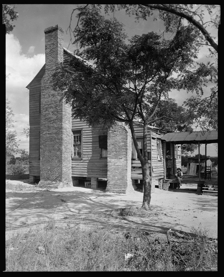

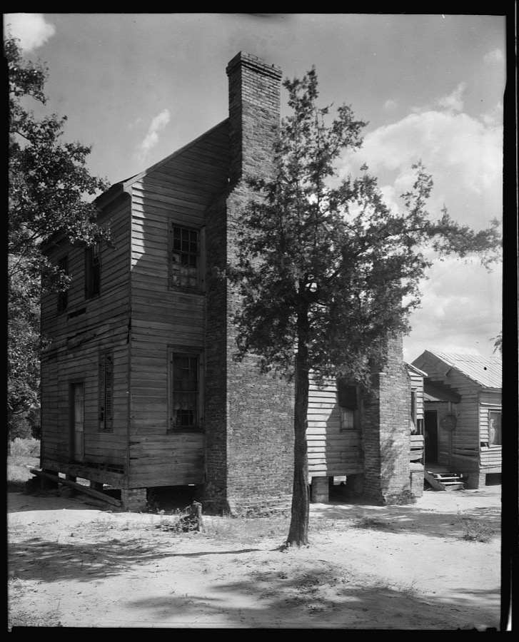
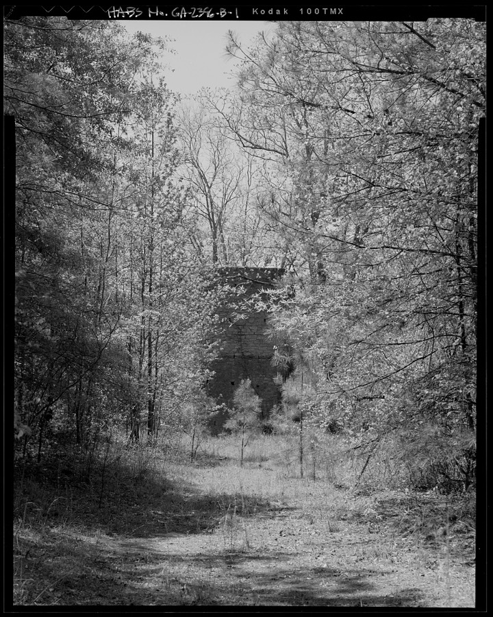







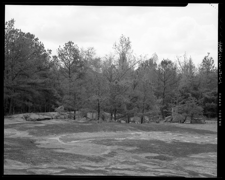
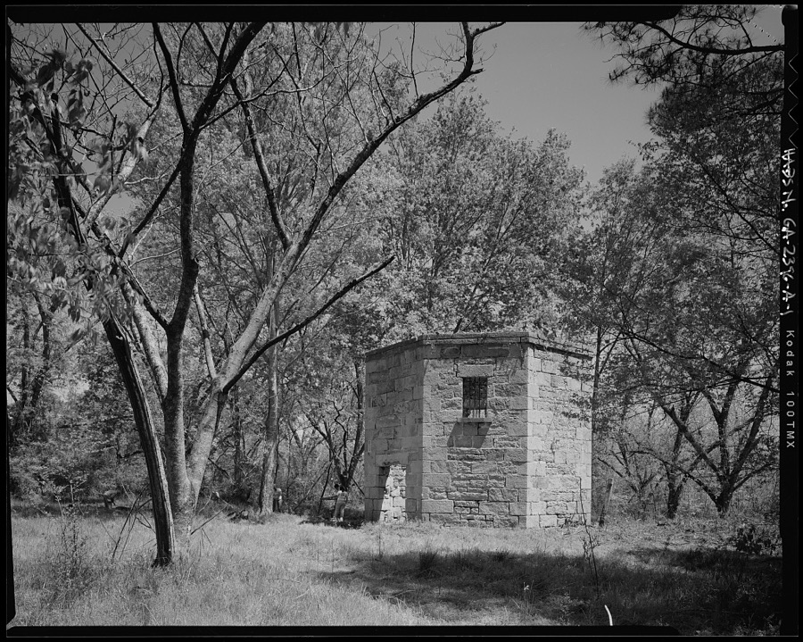

Every property in this county listed on the National Register of Historic Places, with the year it was listed and the federal nomination document.
| Photograph | Property | Type | Listed | Reference |
|---|---|---|---|---|
| Camilla-Zack Community Center District | district | 1974 | 74000685 | |
| Cheely-Coleman House | building | 1976 | 76000638 | |
| Glen Mary | building | 1974 | 74000687 | |
| John S. Jackson Plantation House and Outbuildings | building | 1984 | 84001116 | |
 | Jewell Historic District | district | 1979 | 79003106 |
| Linton Historic District | district | 1975 | 75000597 | |
| Pearson-Boyer Plantation | district | 1993 | 93000236 | |
| Rockby | building | 1978 | 78000988 | |
| Shivers-Simpson House | building | 1970 | 70000207 | |
 | Sparta Cemetery | site | 2001 | 01000647 |
 | Sparta Historic District | district | 1974 | 74000686 |
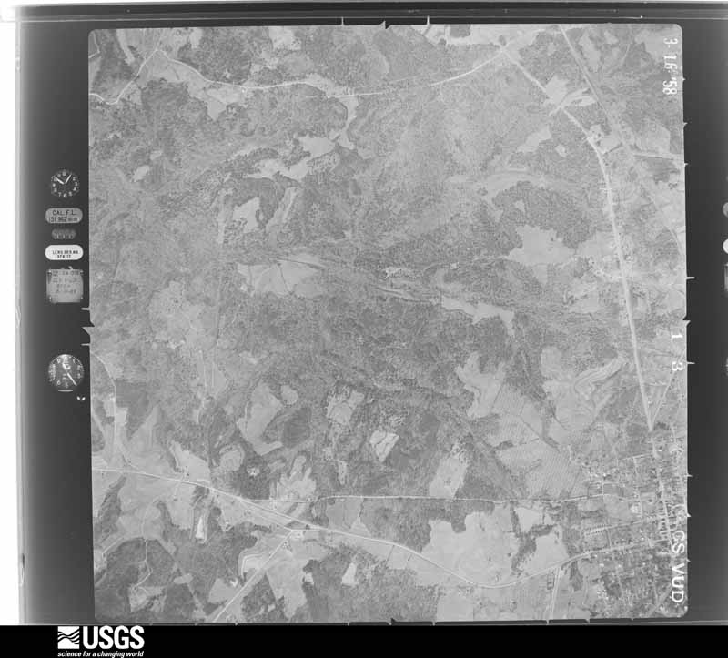
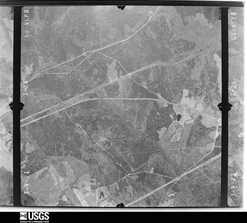
Flown by the U.S. Geological Survey between 1937 and 1989, the Aerial Photo Single Frames collection is the definitive mid-century view of the land: fields, roads and rivers as the camera saw them. The Survey holds 831 frames inside the rectangle that bounds this county; the 20 frames below were taken over the county itself, chosen across the decades of flights (at most four a year from that rectangle), so one flight cannot crowd out the rest. The full set is free to browse and download at EarthExplorer under the dataset Aerial Photo Single Frames.


















The thermometers that kept this county's weather, and the gages that measured the flow of its streams, as the federal records hold them. The extremes below are measured values from those records, not estimates.
Who lived here in 1950, one enumeration district at a time, as the Census Bureau described each district. Each row opens its official National Archives result, with Population Schedules and ED Maps available there.
Every wildfire the federal occurrence database records inside this county: 1,064 of them, burning about 6,477 acres. 92 started naturally and 85 were recorded as arson. Each settlement page carries the fires within five miles of it.
| Reported cause | Fires |
|---|---|
| Debris and open burning | 582 |
| Missing data/not specified/undetermined | 108 |
| Equipment and vehicle use | 104 |
| Natural | 92 |
| Arson/incendiarism | 85 |
| Smoking | 44 |
| Recreation and ceremony | 22 |
| Misuse of fire by a minor | 18 |
| Railroad operations and maintenance | 9 |
The five largest, by the area the report gives. One of them was set deliberately.
| Date | Cause | Size | Reported by | Name on the report |
|---|---|---|---|---|
| 19 May 1995 | Natural | 253 acres | Georgia Forestry Commission | not named |
| 23 July 1993 | Natural | 185 acres | Georgia Forestry Commission | not named |
| 31 January 1992 | Equipment and vehicle use | 142 acres | Georgia Forestry Commission | not named |
| 9 August 2002 | Natural | 120 acres | Georgia Forestry Commission | FY2003-HANCOCK-008 |
| 2 April 2014 | Debris and open burning | 109 acres | Georgia Forestry Commission | FY2014-HANCOCK-020 |
| 17 March 1992 | Debris and open burning | 106 acres | Georgia Forestry Commission | not named |
| 17 September 1999 | Arson/incendiarism | 100 acres | Georgia Forestry Commission | not named |
| 6 March 2005 | Debris and open burning | 84 acres | Georgia Forestry Commission | not named |
Every settlement page carries the fires within five miles of it - see the settlement index below.
The NOAA Storm Events Database holds 88 reports for this county, causing 1 death, 4 injuries and about $1,888,500 in recorded property damage. Each settlement page carries the reports that name it.
| Kind of event | Reports |
|---|---|
| Thunderstorm Wind | 56 |
| Hail | 19 |
| Tornado | 9 |
| Flood | 2 |
| Flash Flood | 2 |
The most serious of them, by death, then injury, then recorded damage. The accounts are quoted exactly as the forecast office filed them.
| When | Event | Place named | Harm | What the report says |
|---|---|---|---|---|
| February 2009 | Tornado (EF3) | Culverton | 1 killed, 3 hurt, $500,000 | A storm survey conducted by the National Weather Service Forecast Office in Peachtree City, Georgia confirmed that an EF3 tornado touched down approximately five miles east-southeast of Sparta, or about three miles east of the intersection of Georgia Highway 15 and 16. The tornado then moved along a nearly eight-mile long path across far southeast Hancock county and continued into extreme southern Warren county and then into extreme northwest Glascock county. The total tornado path length was nearly 11 miles long. The maximum path width was estimated to be 500 yards with maximum winds of 140 mph. A church, two site-built homes, and four mobile homes were completely destroyed in the Hickory Grove Community. One fatality and three injuries occurred where the mobile homes were destroyed. Hundreds of trees were either uprooted or snapped along the path of the tornado. |
| April 2009 | Tornado (EF3) | Sunshine | 1 hurt, $500,000 | A damage survey conducted by the National Weather Service Forecast Office in Peachtree City, Georgia confirmed that yet a third tornado touched down in Hancock county within a 15 minute period of time. However, this tornado was determined to be an EF3 tornado. This tornado touched down about halfway between Sparta and Culverton in east central Hancock county. The tornado was determined to have a maximum path width of 1/2 mile with maximum winds of 160 mph. Much of the damage occurred along Dunn and Hickory Grove Roads. Along the path of the tornado, one 4000 square foot site-built home was completely destroyed. The debris from the home was scattered across an area up to 400 feet downstream. A resident of this home suffered serious injuries. Another nearby double-wide mobile home was also completely destroyed. Two other nearby homes on Dunn suffered minor damage and two additional homes on Youngblood Road toward Jewell suffered extensive roof damage. A swath of 116 mature pecan trees at a pecan orchard on Hickory Grove road were flattened. These were owned by a resident adjacent to one of the damaged homes on Hickory Grove Road. One of the homeowners also lost a Shetland pony during the tornado. |
| March 2007 | Flood | Devereux | $300,000 | The Hancock County Emergency Management Director reported that repeated heavy rain fell across much of the county from mid morning until shortly after midnight. Rainfall of six to eight inches fell across much of the county. Georgia Highway 22 and 16 were both closed. In addition, several wooden bridges were washed out. Disaster funding was provided for road and bridge repair from the Federal Emergency Management Agency to the county. Estimated repair costs were in the $300,000 to $400,000 range. |
| April 2011 | Thunderstorm Wind | Devereux | $100,000 | The Hancock County Emergency Management Director reported that dozens of trees were down across the county, including several on homes. Several people were trapped in homes from downed trees, but no injuries were reported. |
| March 2007 | Thunderstorm Wind | Devereux | $100,000 | The Hancock County Emergency Management Director reported that numerous trees and power lines were down along or near Georgia Highways 22 and 16 from Devereux, to Sparta, to Culverton, to Mayfield. Fifteen homes were damaged from downed trees. |
| January 2017 | Thunderstorm Wind | Glenford | $75,000 | The Hancock County Emergency Manager reported numerous trees and power lines blown down on the west side of Sparta. One tree fell on and destroyed a home. |
| June 2001 | Flood | Countywide | $75,000 | The Hancock county Emergency Management Director and WAGA Television, FOX 5 of Atlanta, reported that a few roads in the county were washed out because of high water. Damage was less extensive than counties immediately adjacent to the west. |
| March 2017 | Thunderstorm Wind | Gum Hill | $20,000 | The Washington EMC reported numerous power poles blown down and snapped across the county. |
| April 2017 | Tornado (EF0) | Shoulderbone | $20,000 | A National Weather Service survey team found that an EF0 tornado with maximum wind speeds of 80 MPH and a maximum path width of 200 yards moved across the western portion of Hancock County. Numerous trees were uprooted and snapped west of Sparta near the intersection of Rivers Road and Fort Creek Road where the tornado touched down. The tornado tracked east for several miles snapping several trees. A small shed was demolished along Hunts Chapel Church Road near the intersection with Pumping Station Road where the tornado ended. [04/03/17: Tornado #22, County #1/1, EF-0, Hancock, 2017:054]. |
| December 2019 | Flash Flood | Carrs Station | $15,000 | The county Emergency Manager reported Island Creek Drive was washed out by a creek near the intersection with Fox Glove Drive near Lake Sinclair. Radar estimates indicate that 3 to 4 inches of rain occurred over the area, with the resulting high runoff causing the small creek to rise quickly. |
| April 2011 | Tornado (EF0) | Sandy Run | $15,000 | A damage survey conducted by the National Weather Service Forecast Office in Peachtree City, Georgia confirmed that the EF1 tornado that first touched down in southeast Putnam county tracked into western Hancock county before lifting. As it moved into Hancock county, it weakened to an EF0 strength. The total tornado path length was about seven miles, of which approximately three miles fell within Hancock county. The maximum path width was 200 yards with maximum winds estimated to be 90 mph. Much of the tornado path was across Lake Sinclair, and as such damage was minimal. Damage within Hancock county was mostly confined to dozens of snapped or uprooted trees and several downed power lines. Some minor structural damage was reported to homes along the lake. There were no fatalities or injuries reported anywhere with this tornado.||[04/27-04/28/11: Tornado #14, County #2-2, EF1, Putnam-Hancock, 2011:023]. |
| April 2017 | Thunderstorm Wind | Shoulderbone | $12,000 | The Hancock County Emergency Manager reported trees blown down from around the intersection of Hunts Chapel Road and Highway 16 into downtown Sparta. |
| April 2009 | Tornado (EF0) | Sparta | $10,000 | A damage survey conducted by the National Weather Service in Peachtree City, Georgia confirmed that a brief EF1 tornado touched down approximately two miles northwest of Sparta and traveled only 1.5 miles before lifting. This was the first of three tornadoes to touch down in Hancock county between 1019 pm EDT and 1028 pm EDT, each near Sparta. This tornado was determined to have a maximum path width of 100 feet with maximum winds estimated at 80 mph. This first tornado tracked through a quite rural area. However, one mobile home suffered moderate damage to its roof, siding, and windows. |
| August 2002 | Thunderstorm Wind | Sparta | $10,000 | The Sparta Ishmaelite newspaper reported that thunderstorm winds ripped off a newly installed metal roof at the Sparta High School. This portion of the building housed the Board of Education's central office. The wind also damaged much of the wooden frame constructed above the old roof which was designed to support the new roof. Many trees and power lines were also downed in the Sparta area causing many of the city's residents to be without power for three hours. |
| November 2016 | Thunderstorm Wind | Sandy Run | $7,000 | The Hancock County 911 center reported several trees blown down in the Holiday Shores area. |
| April 2009 | Tornado (EF0) | Granite Hill | $7,000 | A damage survey conducted by the National Weather Service Forecast Office in Peachtree City, Georgia confirmed that yet a second tornado touched down in Hancock county. This was also a brief EF0 tornado and touched down just north-northeast of downtown Sparta. The path width of this tornado was determined to also be 100 feet with maximum winds estimated to also be 80 mph. Numerous large trees were down along the path of the tornado in a primarily rural area. No structural damage was noted in association with this tornado. |
| June 2001 | Thunderstorm Wind | Countywide | $7,000 | The Hancock County Sheriff's Office reported that trees and power lines were down all across the county. |
| March 2018 | Thunderstorm Wind | Granite Hill | $6,000 | The Hancock County 911 center reported trees and a power line blown down on Springfield Road near Highway 15. |
| April 2017 | Thunderstorm Wind | Sparta | $6,000 | The broadcast media reported trees blown down on Highway 15 between the Dollar General and On-the-Way Motors. |
| June 2015 | Thunderstorm Wind | Sparta | $6,000 | The Hancock County Emergency Manager reported a couple of large pecan trees blown down in Sparta. |
| May 2019 | Thunderstorm Wind | Granite Hill | $5,000 | Dispatch reported at least 2 trees down on Hwy 15 between Clay Street and Burnett Street. |
| January 2017 | Tornado (EF1) | Friendship | $5,000 | A National Weather Service survey team found that an EF1 tornado with maximum winds of 95 MPH and a maximum path width of 70 yards began in Hancock County just northeast of Deepstep Road, which is the Hancock/Baldwin County line. The tornado moved northeast parallel to Deepstep Road for less than a quarter of a mile before it turned east and crossed the road into Baldwin County. Several trees were blown down along this portion of the path. The total path length in both counties was around a half mile. [01/21/17: Tornado #18, County #1/2, EF1, Hancock-Baldwin, 2017:019]. |
| March 2013 | Thunderstorm Wind | Shoulderbone | $5,000 | The Hancock County 911 Center reported numerous trees down across the county. |
| April 2009 | Hail | Shoulderbone | $5,000 | The Hancock County Emergency Management Director relayed a report from a weather spotter of golf ball-sized hail in the Shoulderbone area. |
| May 2008 | Thunderstorm Wind | Shoulderbone | $5,000 | The Hancock County 911 Center reported that several trees and power lines were down throughout the county. Radar data supports that a bow echo moved through the northern and eastern part of the county from Shoulderbone, to Sparts, Culverton, and Mayfield, and points southeast toward the Washington county line. |
| May 1994 | Thunderstorm Wind | Sparta | $5,000 | Thunderstorm winds downed several large trees along Georgia Highway 16. |
| May 1994 | Thunderstorm Wind | Linton | $5,000 | Thunderstorm winds toppled several large pecan and hickory trees 2W of Linton. Between 30 and 40 homes were without power for at least three hours due to power lines downed by thunderstorm winds. |
| February 1993 | Thunderstorm Wind | Sparta | $5,000 | Several large tree limbs were downed. |
| April 1997 | Thunderstorm Wind | Sparta | $4,500 | no account filed |
| July 2016 | Thunderstorm Wind | Shoulderbone | $4,000 | The Georgia Department of Transportation reported trees blown down and blocking the road along Highway 16 near Green Springs Road and along Highway 22 near mile post 12. |
| June 2016 | Thunderstorm Wind | Mount Zion | $4,000 | The Hancock County 911 center reported 6 trees blown down near Highways 16 and 22. |
| February 2025 | Thunderstorm Wind | Carrs Station | $3,000 | Em reports several trees down east of lake sinclair between hwy 22 and hwy 441. |
| June 2023 | Thunderstorm Wind | Sandy Run | $3,000 | Report of 3 large trees downed by strong winds at Big Water E Rd and Sheffield Dr. |
| January 2020 | Thunderstorm Wind | Powelton | $3,000 | The Hancock County Emergency Manager reported trees blown down near the intersection of Highway 22 East and Old Crawfordville Highway. |
| June 2019 | Thunderstorm Wind | Granite Hill | $3,000 | The Hancock County Emergency Manager reported trees blown down on Highway 16 at Old Augusta Road and on Highway 15 at Cody Johnson Road. |
| February 2003 | Thunderstorm Wind | Sparta | $3,000 | The Hancock county 911 center reported that several trees and some power lines were blown down. |
| January 2001 | Thunderstorm Wind | Sparta | $3,000 | The Hancock county 911 center reported that trees were blown down 5 miles east of Sparta and also on the west side of the county. |
| August 1956 | Tornado (F1) | not stated | $2,500 | no account filed |
| July 2020 | Thunderstorm Wind | Granite Hill | $2,000 | The Hancock County 911 center reported power lines blown down along the Sandersville Highway. |
| March 2010 | Hail | Devereux | $2,000 | The Hancock County Emergency Management Director relayed a report of golf ball-sized hail from the western part of the county, northwest of Sparta. The public observed golf ball-sized hail just north of Devereux, also in western Hancock county. |
| July 2010 | Thunderstorm Wind | Shoulderbone | $2,000 | The Hancock County Emergency Management Director reported that several trees were down near Shoulderbone. |
| July 2008 | Thunderstorm Wind | Sparta | $2,000 | The Hancock County 911 Center reported that up to four trees were down, a couple on power lines. |
| July 1999 | Thunderstorm Wind | Sparta | $2,000 | Hancock county 911 reported several trees were down on power lines. |
| July 1997 | Thunderstorm Wind | Sparta | $2,000 | Several trees and limbs were knocked down by thunderstorm winds in Mayfield. |
| June 1996 | Thunderstorm Wind | Devereux | $2,000 | no account filed |
| May 2006 | Thunderstorm Wind | Linton | $1,500 | The Washington County Membership Cooperative reported that two large oak trees were down on power lines on Linton Road along the Hancock/Glascock county line east of Linton. |
| February 2025 | Thunderstorm Wind | Carrs Station | $1,000 | A tree was reported down in the 2000 block of carrs station road. |
| February 2025 | Thunderstorm Wind | Sparta | $1,000 | A tree was downed in the 3000 block of linton road. |
| August 2023 | Thunderstorm Wind | Shoulderbone | $1,000 | Tree down at SR 16 and Glen Spring Rd . |
| June 2022 | Thunderstorm Wind | Sandy Run | $1,000 | Tree reported down on the 200 block of River Ridge Trail. |
| September 2018 | Thunderstorm Wind | Sparta | $1,000 | The Hancock County 911 center reported a tree blown down on Gilbert Circle. |
| August 2015 | Thunderstorm Wind | Shoulderbone | $1,000 | The Hancock County 911 Center reported a tree blown down on Highway 16 near Shoulderbone. |
| November 2010 | Thunderstorm Wind | Devereux | $1,000 | The Hancock County Emergency Management Director reported that two trees and one power line were down near Lake Sinclair. |
| July 2002 | Thunderstorm Wind | Sparta | $1,000 | The Hancock county 911 center reported that several trees were down along Georgia Highway 77 northwest of Sparta. |
| May 2008 | Tornado (EF0) | Eureka | $500 | A damage survey conducted by the National Weather Service Forecast Office in Peachtree City, Georgia concluded that an EF0 tornado touched down in extreme eastern Hancock county before crossing into Washington county and briefly strengthening to an EF1 as it made an approximately four-mile-long track, ending approximately 3 miles north of Warthen in Washington county. Within Hancock county, the tornado was only rated an EF0 as it tracked across a totally rural area of less than 1/4 mile just south of Barnes Road and west of Georgia Highway 15. Damage within Hancock county was confined to minor tree damage. |
| July 1995 | Thunderstorm Wind | Sparta | $500 | Thunderstorm winds knocked trees down on power lines in White Plains and Sparta. |
| June 2022 | Thunderstorm Wind | Carrs Station | - | Report of tree down on Ogletree Rd. |
| June 2022 | Thunderstorm Wind | Sandy Run | - | Report of a tree down on Captains Ct. |
| November 2020 | Flash Flood | Carrs Station | - | The Emergency Manager reported flooding on Cut Thru Road due to high water conditions in Little Rocky Creek. Radar estimates indicate that 4 to 6 inches of rain occurred over the area, producing excessive runoff and resulting in the flash flooding. |
| August 2014 | Hail | Shoulderbone | - | The public reported Penny-sized hail. |
The Survey's mineral resources record lists 4 workings inside this county. 1 still produces and 3 are closed or unrecorded. Each settlement page carries the workings within five miles of it.
| Commodity | Workings |
|---|---|
| Sand and Gravel, Construction | 3 |
| Clay, Fire Clay (Refractory), Kyanite | 1 |
The least common of them first, because a county's hundredth gravel pit says nothing its first ten did not.
| Where | Site | Commodity | Status | Recorded |
|---|---|---|---|---|
| Carrs Station Mine | Clay, Fire Clay (Refractory), Kyanite | Producer | ||
| Unnamed Sand Deposit | Sand and Gravel, Construction | Occurrence | Alluvium | |
| Unnamed Sand Deposit | Sand and Gravel, Construction | Past Producer | Alluvium | |
| Unnamed Sand Deposit | Sand and Gravel, Construction | Prospect | Alluvium |
Named settlements recorded in the Geographic Names Information System, each with the topographic sheets covering it. Villages, hamlets and abandoned places alike. Each is shown with the nearest named watercourse or landform and the survey quadrangle it falls on. The 1 place that was also surveyed for fire insurance comes first, with the number of atlases and photographs held for them.
Sparta census division · 31087 · Sparta quadrangle
10 sheets, 1953 to 1988
Fire insurance: 8 atlases
Devereux census division · 31087 · On Little Island Creek · Lake Sinclair East quadrangle
14 sheets, 1912 to 1988
No longer a settlement
Sparta census division · 31087 · Warthen NE quadrangle
10 sheets, 1953 to 1988
No longer a settlement
Linton census division · 31087 · On Long Branch · Friendship quadrangle
14 sheets, 1912 to 1988
Devereux census division · 31087 · Shoulderbone quadrangle
10 sheets, 1953 to 1988
No longer a settlement
Linton census division · 31087 · On Drawhorn Creek · Devereux quadrangle
13 sheets, 1912 to 1988
No longer a settlement
Sparta census division · 31087 · On Sikes Creek · Shoulderbone quadrangle
10 sheets, 1953 to 1988
Linton census division · 31087 · On Little Tiger Creek · Deepstep quadrangle
11 sheets, 1953 to 1988
Mayfield census division · 31087 · On Battle Branch · Sparta NW quadrangle
10 sheets, 1953 to 1988
No longer a settlement
Sparta census division · 31087 · On Lundy Creek · Shoulderbone quadrangle
10 sheets, 1953 to 1988
Mayfield census division · 31087 · Sparta quadrangle
10 sheets, 1953 to 1988
No longer a settlement
Linton census division · 31087 · On Sheep Creek · Devereux quadrangle
13 sheets, 1912 to 1988
The vanished settlements of Hancock County: the places named above that are no longer on the map.
10 topographic sheets and 8 fire insurance atlases, 1884 to 1945
The complete index, with nothing left out. Each of these is a separate record with its own page: a federal survey report, or the case file that argued a property on to the National Register. Both are public domain and reproduced word for word.
The vanished settlements of Hancock County, the places these records name that are no longer on the map.